
Scan the QR code and open PeakVisor on your phone
Situated in nearly the exact center of British Columbia, Canada, Carp Lake Provincial Park has long been famous for its rainbow trout, as it offers some of the best fishing in central British Columbia. The park encompasses Carp Lake, War Lake, several smaller lakes and streams, sandy beaches, and dense forests. Ant Hill (1,249 m/4,098 ft) and Carp Hill (1,126 m/ 3,694 ft) stand as sentinels along the east side of the park and overlook the lakes.
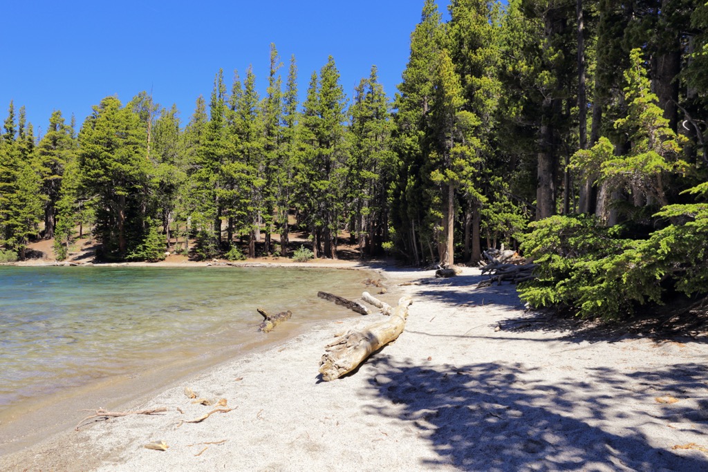
Carp Lake Provincial Park is located at nearly the geographical center of British Columbia, Canada. The 38,149 ha (94,268 acre) park sits upon the Nechako Plateau and encompasses Carp Lake, War Lake, the beginning of the McLeod River, and many smaller lakes and streams that provide opportunities for angling, including fly-fishing.
There are two hills which overlook the lake, of which Ant Hill (1,249 m/4,098 ft) is the tallest and most prominent. Ant Hill sits along the southeast border of the park while Carp Hill (1,126 m/ 3,694 ft) stands sentinel in the northeast corner of the park and overlooks War Lake and Carp Lake.
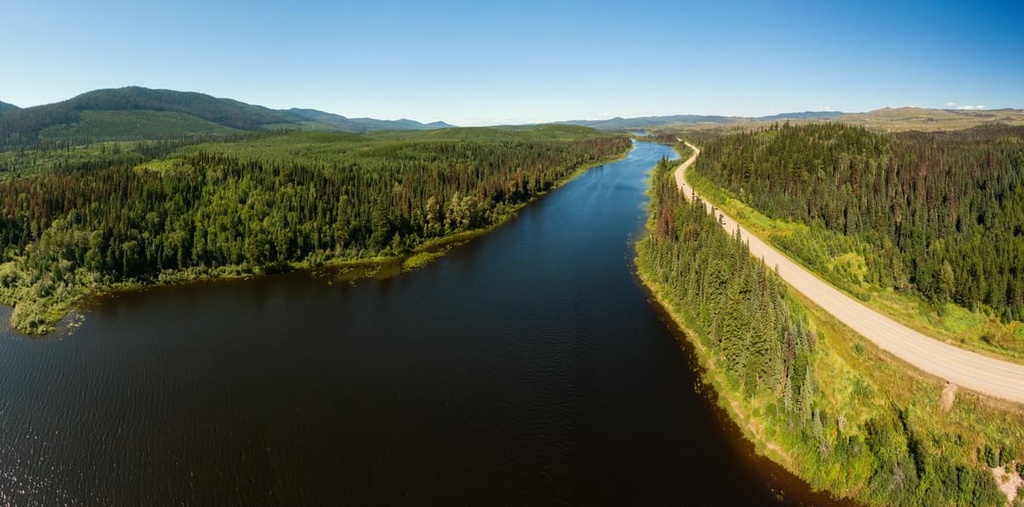
The park is vehicle accessible and there are over 100 vehicle accessible campsites as well as many backcountry campsites available. Visitors can drive to the park by following Highway 97, the John Hart Highway, to McLeod Lake and then taking Carp Lake Road west. This is a 32 km (19 mi) gravel road to the park, which is occasionally only a single lane, and as such, caution must be taken when driving this road.
Visitors could also access the southern side of the park by following the Davie Muskeg Road, especially if they want to visit the Gates Lake Recreation Site, the Muskeg River Falls Recreation Site or hike the Muskeg Falls Trail along this road. There is also access from the west, along the McLeod Tsiloch Road which passes by the Turner Lake Recreation Sir and the McKinnon Esker Ecological Reserve.
Located upon the Nechako Plateau and just west of the Far Northern Rockies, Carp Lake Provincial Park is one of the many wilderness parks in the region. The following are other nearby parks:
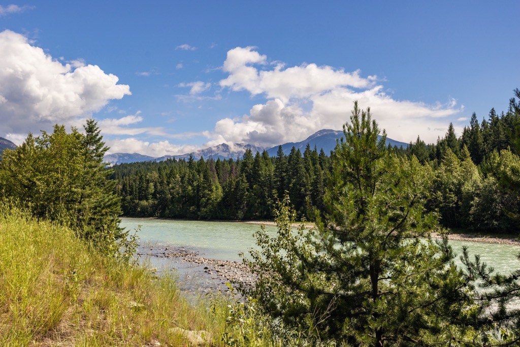
Carp Lake Provincial Park sits upon the Nechako Plateau and is west of the Far Northern Rockies. Most of the plateau consists of Cenozoic lava flows that covered older sedimentary and volcanic layers of rock as well as Jurassic and Cretaceous granitic intrusions.
The bedrock of the plateau and Carp Lake Provincial Park formed as microcontinents and island arcs out in the Pacific Ocean. As their tectonic plate subducted beneath the west coast of North America, these microcontinents and island arcs accreted to the western continental margin of North America.
As oceanic tectonic plates subducted beneath the continent, the subduction zone tends to be volcanically active. As such, while the tectonic processes were also creating the Canadian Cordillera, which consist of the Coast, Columbia, and Rocky Mountains, lava was flowing upon the interior of British Columbia, creating the vast Nechako, Fraser, and Thompson plateaus.
It was about 60 million years ago, at the same time as the formation of the Canadian Rockies, when lava flowed upon north-central British Columbia to create the Nechako Plateau. For millions of years erosive forces acted upon the landscape to create the topography of the nearby mountains and dissected the plateaus with great rivers.
The topography of Carp Lake Provincial Park and even the shape of Carp Lake was heavily influenced by the glaciers and ices sheets that covered the region during the Pleistocene. Significant ice coverage over the Nechako Plateau ground away the softer rocks and created a generally flat topography.
As the ice was melting after the Pleistocene, glaciers deposited many piles of glacial till that are too insubstantial to show on a topographical map. However, the till is certainly noticeable at a local level in the form of kames, drumlins, eskers, and moraines.
Carp Lake lies upon a plain of glacial till which consists of thousands of grooves that the ices sheets and glaciers carved, as well as eskers and drumlin-like ridges. Drumlins are elongated hills of glacial drift, and it is these debris piles that created the lake’s many islands, and its countless coves and bays.
Carp Lake is at an elevation of 841 m (2,760 ft) upon the Nechako Plateau, where the ecological classification of the region is typically described as part of the Sub-Boreal Spruce Ecosystem. The climate of the park is characterized by warm summers and cold winters with deep snow cover.
The forests around Carp Lake are typically sub-boreal and consist of hybrid white spruce, subalpine fir, black spruce, aspen, and lodgepole pine. Along the rivers and shores of the lakes there are abundant willows and alders.
The lakes and streams of the park make it an attractive habitat for wildlife, as such there is abundant wildlife in the park. Visitors are likely to see members of the deer family while visiting the park and they may also see black bears or moose as well. Moose frequent the marshy areas around the lakes and streams to forage for food and they may also be spotted swimming to or from one of the lake’s many islands.
During their nesting season and migratory periods, the lakes and wetlands are filled with waterfowl, and the loon’s call can be heard echoing over the lake at the end of the day. Gray jays are especially prevalent and are often seen thieving from the campsites.
Other animals that may be spotted in the park are snowshoe hares, wolves, fisher, ermine, and marten. Grizzly bears may occasionally come through the park; however, they are not as common as the regional black bears. Some of the regional birds include the pine grosbeak, red crossbill, great gray owl, and great horned owl which remain even through the winter.
Carp Lake entered written history in 1806 when the explorer Simon Fraser was introduced to the lake’s abundant fish. In 1806, while encamped at Lake McLeod, Fraser wrote about a lake from which the local Carrier people “catch immense numbers of fish of the carp kind,” which led to naming the lake as Carp Lake.
In 1805, Simon Fraser established Trout Lake Fort for the North West Company and McLeod Lake, about 32 km (19 mi) east of Carp Lake. Trout Lake Fort, later renamed Fort McLeod, was the first permanent non-indigenous settlement west of the Rocky Mountains, in British Columbia.
During 1806, while Fraser and his followers were encamped at Trout Lake Fort and preparing for their journey to establish Fort St. James at Stuart Lake, they were dismayed that the water levels of their local lake appeared to hinder their success at catching sufficient fish to sustain themselves. As such, they were fortunate to find that the nearby Carp Lake had more than enough fish.
Fraser and his followers followed an established indigenous trade route between McLeod Lake and Stuart Lake, which ran alongside Carp Lake. There are remnants of the historical trail along the north and west shores of Carp Lake, part of which was incorporated into the interpretive loop trail near Carp Lake Campground.
Through Simon Fraser, the North West Company established a lucrative fur trade with the local Carrier people. Also known as the Dakelh, the Carrier people are the indigenous people of a large portion of the central interior of British Columbia.
The “Carrier” name comes from the anglicized name that the Sekani gave them, which means “people of the rocks or mountains”. They call themselves the Dakelh, which means “people who travel upon water”. The significance of the Dakelh name is obvious when visiting their traditional territory, which includes Carp Lake Provincial Park, and many other lakes and rivers upon which these people traditionally traveled.
Over 100 archeological sites have been discovered around Carp Lake. The sites include the remnants of the trail between Stuart Lake and McLeod Lake, as well as many cache pits. The cache pits are often found in locations that we would choose as suitable camp sites, which shows that we are using the lake in much the same way as it has been used for hundreds of years.
Carp Lake Provincial Park was established in 1973 to preserve a representation of the Nechako Lowlands Ecosection and its glacial features. Furthermore, the park was also created to provide quality fishing, boating, and camping opportunities in a rustic, secluded wilderness setting.
First to the local indigenous and then to Simon Fraser, Carp Lake was always known as a prime fishing lake; however, there are many other activities that visitors can enjoy. The following are the major trails and activities to enjoy in Carp Lake Provincial Park.
Since the lake was named for its historical usage as a location where the local Carrier people went to “catch immense numbers of fish of the carp kind,” it makes sense that the park draws anglers from across the region and province. Rainbow trout are found in Carp Lake and most visitors who come to the park are anglers.
Carp Lake and War Lake both feature boat launches and power boats are a common occurrence upon the lake; however, canoeing and kayaking are also a wonderful way to explore the park. There are many islands that have backcountry campsites upon them and there are many coves and bays that visitors can explore.
Boating is the best way to explore the park; however, there are several hiking trails that are worth visiting. One of the most scenic attractions is near the eastern border of the park, where a short hike takes visitors to view War Falls, which is a series of two significant falls with a short distance of rapids in between.
There are other hikes from the main campground, such as the loop trail that leads to McLeod River and Rainbow Lake and gives access to some great fly-fishing sites. This loop trail includes interpretive signs and is part of the original indigenous trail between McLeod Lake and Carp Lake.
The historical trail was first used by indigenous travelers and later used by Simon Fraser and fur traders to travel between McLeod Lake and Stuart Lake. Remnants of the historical trail can be found along the north and west sides of Carp Lake.
There are additional trails from the campground leading down to the sandy beaches of the northern shore of Carp Lake which make for a wonderful place to spend the day. The sand extends up to 300 m (1,000 ft) offshore, which is in strong contrast to the rocky beaches along the southern shore of Carp Lake.
The final official trail in the park is only accessible by boat and is found at the end of Drumlin Bay which is at the west end of Carp Lake. The trail from Drumlin Bay is a portage trail to Dace Lake, from which canoes and kayaks can traverse Dace Lake, Sucker Lake, and LHO Lake.
The gates to the park are left open in the winter and while it is difficult to get to, there are many activities to enjoy during the winter. While ice fishing is an obvious activity for Carp Lake, there are local groups that gather at the park to ride snowmobiles. Finally, visitors can snowshoe across or around the lake and test their winter camping skills.
Carp Lake Provincial Park is a rustic and remote wilderness park. For generations, the park has been popular with boaters and anglers looking to enjoy a secluded wilderness experience. The following are the major cities near the park and the closest communities.
Prince George is about 170 km (102 mi) south of Carp Lake Provincial Park. The park is a popular destination for locals for boating, fly fishing, and family camping.
Like many of the communities in the region, Prince George was founded as a trading fort by Simon Fraser in the early nineteenth century. The has grown substantially since its establishment as Fort George in 1807 to now be considered the capital of northern British Columbia.
Despite the relatively metropolitan amenities in the city, wilderness and outdoor activities are still among the most popular pastimes for Prince George locals. Furthermore, visitors tend to come to Prince George as a starting point for wilderness adventures in northern British Columbia.
Popular activities include fishing, hunting, riding OHVs, backpacking, camping, hiking, snowmobiling, wildlife and bird watching, and mountain biking. There are some great local trails for riding or hiking, such as Cottonwoods Island Loop, Greenway Trail, Shane Lake Loop, McMillan Creek Loop, Troll Lake, Kakwa Lake Trail, and Forests for the World Lookout.
However, there are also many fantastic wilderness parks within striking distance from Prince George, such as Carp Lake Provincial Park, Pine Le Moray Provincial Park, Monkman Provincial Park, and Sugarbowl-Grizzly Den Provincial Park. There is also Fraser River Provincial Park, Stuart River Provincial Park, and Bowron Lake Provincial Park.
McLeod Lake is 32 km (19 mi) east of Carp Lake Provincial Park and is the closest community to the park. The community was originally named Trout Lake Fort and was established in 1805 by Simon Fraser as the first non-indigenous permanent settlement west of the Canadian Rockies.
The community is unincorporated and has only the basic services that visitors might require. Despite the proximity of McLeod Lake to Carp Lake Provincial Park, it is suggested that visitors to the park be self-sufficient, bringing everything they might need.

Fort St. James is located along the shore of Stuart Lake, 65 km (40 mi) straight southwest of Carp Lake Provincial Park or about 90 km (56 mi) by road. Like the other communities in the region, Fort St. James was established as a North West Company trading post in the early nineteenth century by Simon Fraser.
While it took some time to establish an efficient fur trade among the local Dakelh people, the post at Fort St. James became the head of the New Caledonia District and was in operation until 1952.
During the winter, locals and visitors may find themselves enjoying skiing or snowboarding at the nearby Murray Ridge Ski Area, ice fishing, snowmobiling, or even dog sledding. Golfing, sailing, camping, wildlife viewing, fishing, and paddling are popular summer activities.
Some of the nearby parks and wilderness areas include Nation Lake Provincial Park and Omineca Provincial Park which have fantastic paddling routes. Mount Pope Provincial Park has some great hiking trails, and there are many great local trails, such as the Duz Cho and Nyan Wheti which follow ancient indigenous trade routes.


