
Scan the QR code and open PeakVisor on your phone
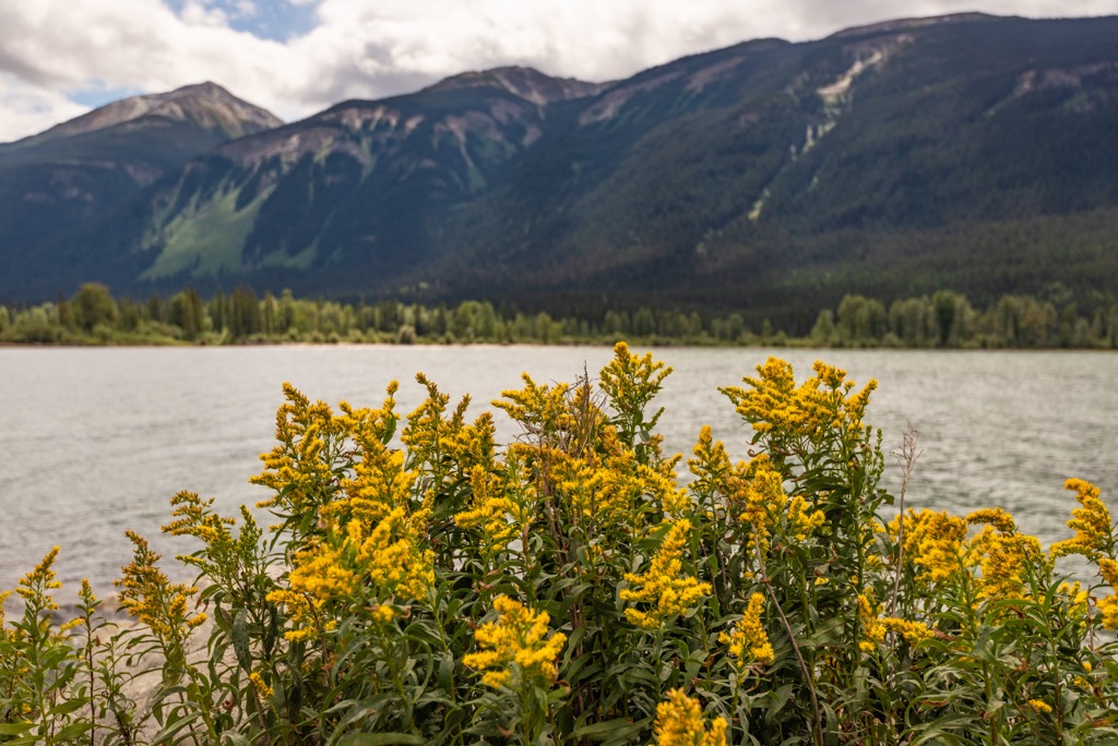
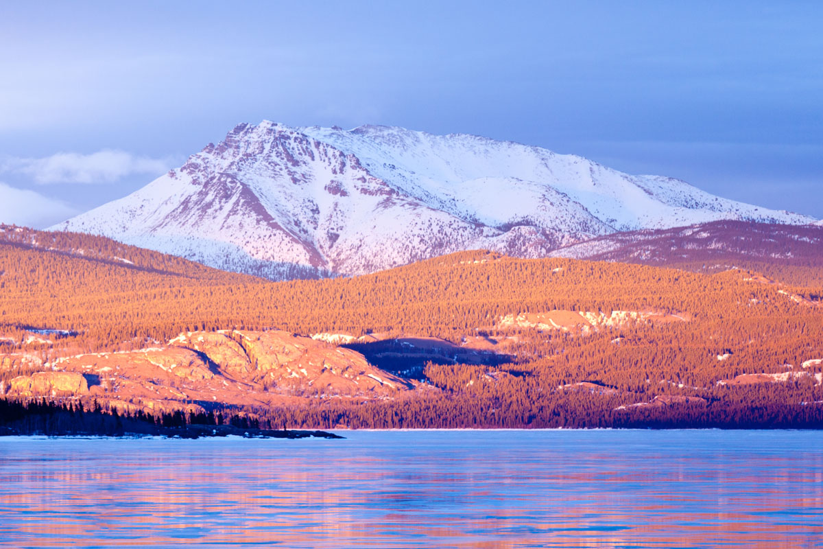
Sugarbowl-Grizzly Den Provincial Park is situated along the Fraser River at the north end of the Columbia Mountains in British Columbia, Canada. With a forest filled with old growth western red cedar, western hemlock, and Engelmann spruce, the park includes the Grand Canyon of the Fraser and rises to the summit of Raven Peak (1,838 m/6,030 ft).
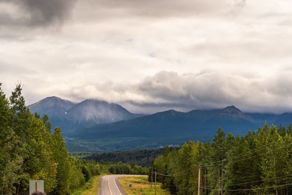
Located along the Fraser River, Sugarbowl-Grizzly Den Provincial Park is in eastern-central British Columbia, Canada. The park is located about 90 km (54 mi) east of the city of Prince George along Highway 16.
Sugarbowl-Grizzly Den Provincial Park rises from the Fraser River to the summits of Sugarbowl Mountain (1,838 m/6,030 ft), Viking Peak (1,883 m/6,178 ft) and Raven Peak (1,890 m/6,200 ft). Covering 24,756 hectares (61, 173 acres), the park is filled with old growth forests of western red cedar, western hemlock, and Engelmann Spruce, as well as the Grand Canyon of the Fraser.
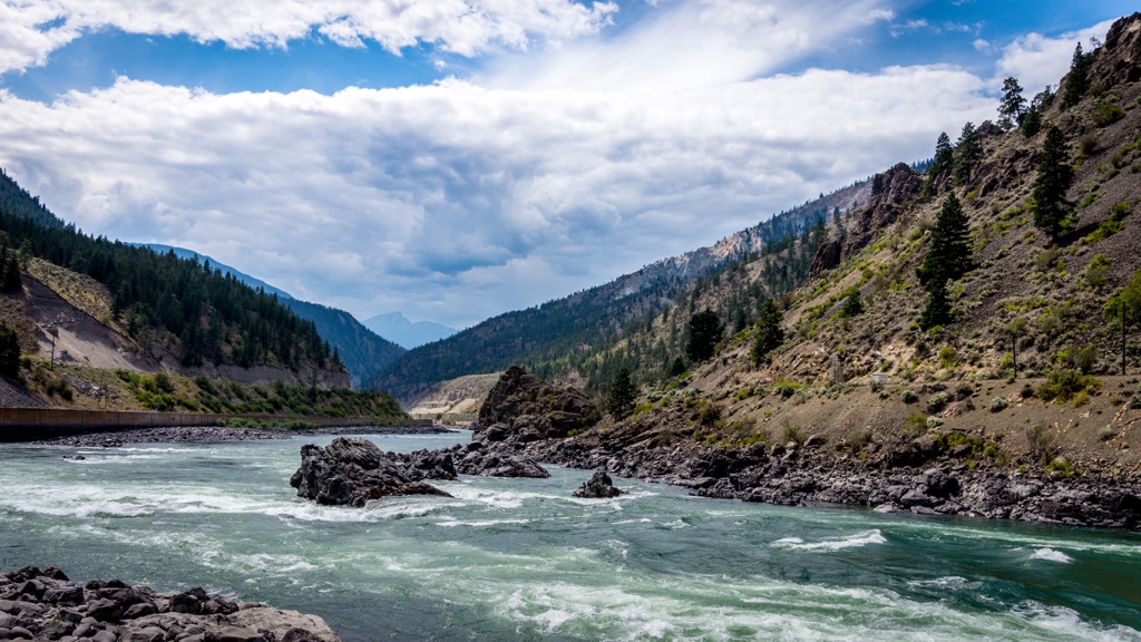
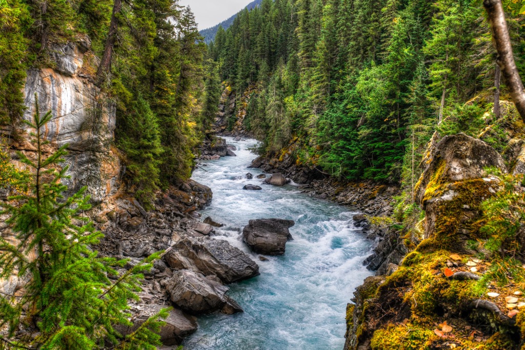
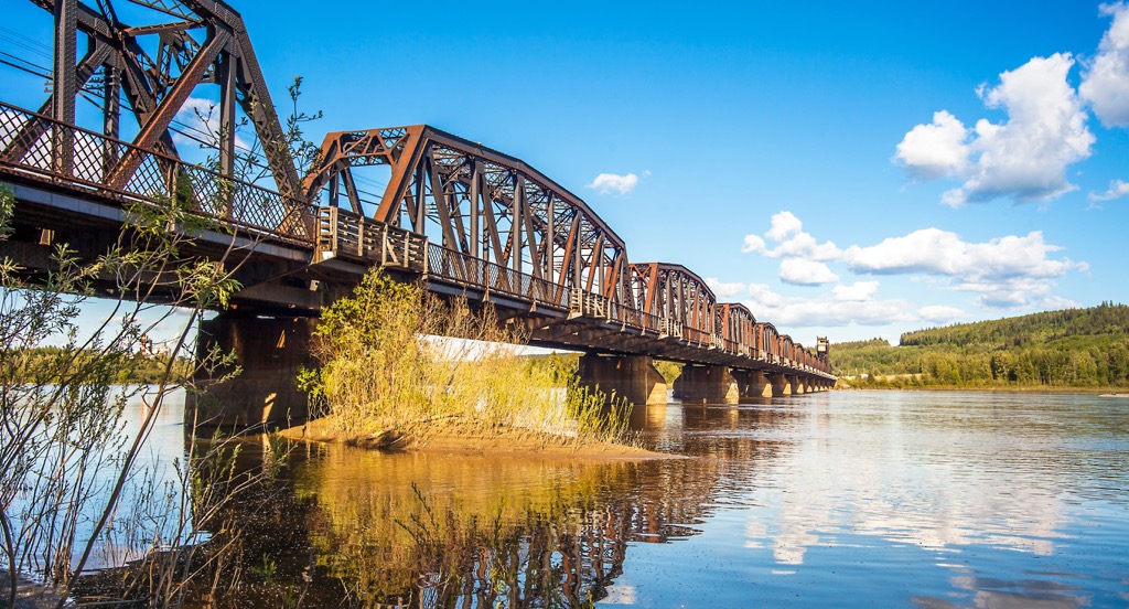
The Grand Canyon of the Fraser is near the confluence of Kenneth Creek and has historical significance pertaining to the Overlander’s journey to the Cariboo gold fields in the 1860s.
The park is the closest alpine recreation area to Prince George and it has been a popular destination for locals since 1976. Most visitors to the park arrive by car along Highway 16 which runs through the park; however, there are some trails accessible from the Hungary Creek Forest Road, which is no longer cleared during the winter.
The primary role of the park is to protect critical mountain caribou habitat, to protect the historically significant Grand Canyon of the Fraser, and to provide wilderness recreational opportunities near Prince George. The following are some of the other parks that are nearby:
The park is at the tip of the Cariboo Mountains which are one of the major subranges of the Columbia Mountains. The Selkirk, Monashee, and Purcell Mountains are the southern divisions of the Columbia Mountains.
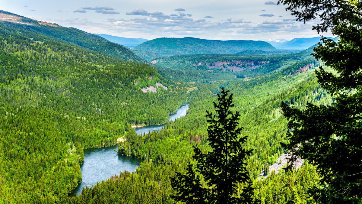
The Fraser River runs along the east side of the park through the Rocky Mountain Trench. Locally, the Fraser River and the Rocky Mountain Trench divide the Cariboo Mountains from the Hart Ranges of the Far Northern Rockies.
The Rocky Mountain Trench is a 1,600 km (1,000 mi) long valley that is 3-16 km (2-10 mi) wide that runs from the Liard River, just south of the BC-Yukon border to Flathead Lake, Montana, USA.
Sugarbowl-Grizzly Den Provincial Park is at the northern tip of the Cariboo Mountains, which are the northern subrange of the Columbia Mountains. The Purcell, Monashee, and Selkirk Mountains are the other subranges of the Columbia Mountains.
A variety of rock compose the Columbia Mountains and among the oldest are Precambrian metamorphic rocks which were mostly sedimentary to begin with. There are also sedimentary and volcanic formations from the Paleozoic and Mesozoic.
Throughout their formation, the Columbia Mountains were intruded by magma which created a considerable number of granitic stocks and batholiths of varying size.
The topographical differences between the ranges is due to altitude and the differences in erosion in each subrange’s rock layers. The Cariboo Mountains are mainly composed of sedimentary rocks and metamorphosed sedimentary rocks of Proterozoic and Lower Cambrian age.
There is some limestone in the range; however, quartzite is the principal rock and is present in thick layers. The durable quartzites have influenced the topography of the range and their peaks tend to be sharp and have continuous ridges. Peaks underlain by granite tend to be more rounded, larger, and ridges radiate irregularly from a central mass.
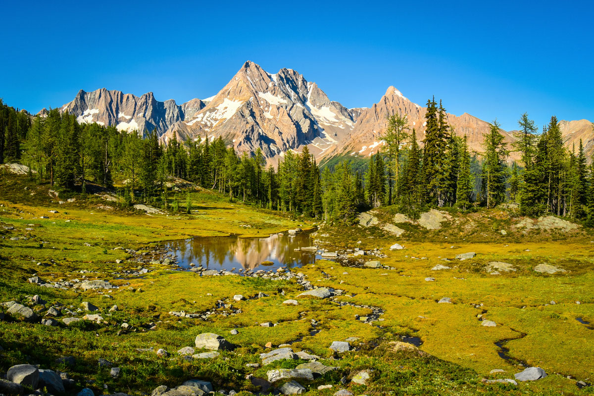
In general, the Cariboo Mountains rise to high, serrate peaks that were glacially sculpted and are separated by steep-walled glaciated valleys. During the Pleistocene, the mountains were heavily glaciated.
The mountains were intensely glaciated, and peaks higher than 2,400 m (8,000 ft) projected through the Pleistocene ice-cap as nunataks. The nunataks were subjected to alpine glaciation which created Matterhorn-like peaks.
Being located at the north end of the range and having relatively low-elevation peaks, Sugarbowl-Grizzly Den Provincial Park was overridden by the ice sheet and the effects are the rounded peaks and ridges. The glaciers also created the U-shaped valleys throughout the park.
Sugarbowl-Grizzly Den Provincial Park has two major ecological areas, one being the relatively flat terrain north of Highway 16 which is part of the Rocky Mountain Trench, and the mountainous terrain south of the highway.
The mountainous terrain is part of the Northern Columbia Mountains Ecoregion and the terrain along the river is part of the Upper Fraser Trench Ecosection. These distinctions delineate differences in habitat for plants and wildlife.
The forests are primarily western red cedar, western hemlock, and Engelmann spruce. While there are still areas of old growth, there are large tracts that have been logged within the past 50 years. The forests transition to alpine meadows and up steep, rocky inclines towards the summits of the park’s three major peaks.

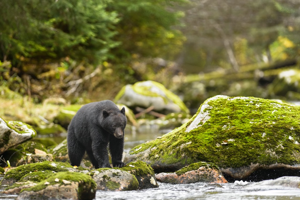
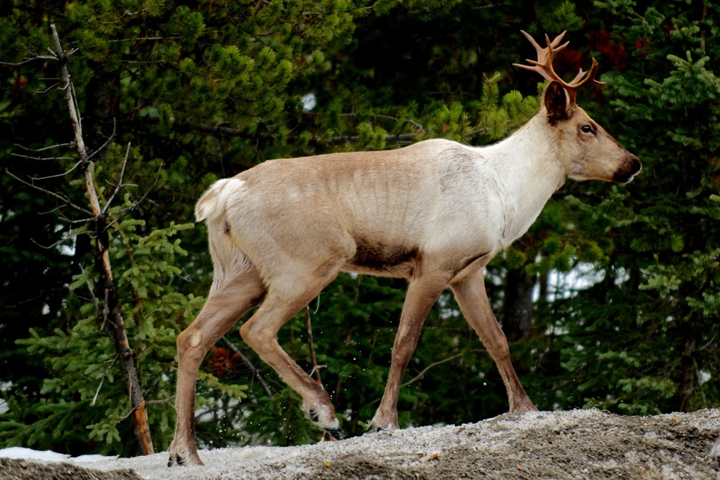
The park provides habitat for many animals typical of the region; however, it is particularly important habitat for grizzly bears and especially mountain caribou.
The south side of Viking Ridge is an especially popular place for caribou; however, all of the terrain above 1,380 m (4,500 ft) is excellent caribou habitat.
Caribou utilize the lower areas in the early winter and tend to migrate to the higher elevation parkland later in the winter. Caribou typically survive the winter by eating lichen from the rocks and trees. The park also has an important migration corridor that allows movement between the park and adjacent caribou habitat.
The park and protected area is part of the traditional territory of the Lheidli T’enneh. “Lheidi” means “the people from the confluence of the river” in their Carrier language and refers to their traditional territory around prince George, which surrounds the confluence of the Nechako River and Fraser River.
Archaeological evidence supports indigenous occupation of the region for the past 9,000 years. The Lheidli T’enneh are the most recent indigenous inhabitants of the region. The Lheidli T’enneh didn’t have any permanent settlements in modern Prince George until the arrival of the Hudson’s Bay Company and their trading post at Fort George in the 1820s.
The Lheidli T’enneh did have temporary and seasonal settlements across their territory and many fishing camps have been discovered along the Nechako River, Fraser River, and the Beaverly area.
Alexander Mackenzie encountered the Lheidli T’enneh in 1793 as he traveled an ancient Grease Trail to Nuxalk territory. It was later in 1808, when Simon Fraser established his advanced camp in the area to explore the Fraser River to the Pacific that the fur trade began to affect the local indigenous. For hundreds of years the fur trade and settlement of the region would affect the indigenous people and their culture.
While the fur trade in the region waned, logging became a major industry across British Columbia. Pulp and timber companies came to the slopes of Sugarbowl Mountain, Viking Peak, and Raven Peak. As the logging companies built their roads through the valleys, the area became more accessible to the public and has steadily increased in popularity for cross-country skiers and hikers since the 1970s.
It was Northwood Pulp and Timber Ltd. that built the original trails and cabins in the 1970s. The Sons of Norway built an additional cabin on the lower part of Grizzly Den Trail in 1977. The Ministry of Forests maintained the trails and cabins until 2000 at which time the area was declared a Provincial Park and BC Parks now manages.
It should be mentioned that the Grand Canyon of the Fraser is also in the Park, which is historically a very dangerous spot for the river men that ran barges up and down the river. Over the years, many people lost their lives in the canyon.
The Grand Canyon of the Fraser is near the confluence with Kenneth Creek and is about 4 km (2.5 mi) long. This feature was difficult to traverse, even for the Lheidli T’enneh who would portage contents and sometimes even the canoes around the canyon during high water.
The first recorded drowning death related to the canyon occurred in 1862 when the Overlanders made their passage down the river. The Overlanders lost ten scouting canoes at this spot and portaged their supplies around the first two sections of wild water.
For the final stretch of rough water, crews navigated the river, and while not unscathed, they made it through; however, upriver, seven stragglers fell overboard and one of them drowned. During the construction of the Grand Trunk Pacific Railway, the treacherous waters also took the lives of many scow operators.
While efforts were made to remove some of the largest rocks and barriers, this allowed the water to flow even faster through the canyon. From the first recorded drowning of the Overlander in 1862, it is estimated that the canyon has been the site of 200 drowning deaths.
Since 1976, Sugarbowl-Grizzly Den has been a very popular alpine recreation area for the residents of Prince George. The following are the major trails and attractions in the incredible wilderness area around Sugarbowl Mountain and the Fraser River.
The Sugarbowl Mountain Trail starts from a trail head along Highway 16 about 80 km (64 mi) from Prince George. There is a parking lot off the south side of the highway and the trail starts from the southeast side of the parking.
From the parking lot a narrow path rises through a forest of cedar and western hemlock up the north slope of Sugarbowl Mountain and onto a lightly wooded subalpine ridge. The ridge is about 5 km (3 mi) from the trailhead with an elevation gain of 900 m (3000 ft). The peak is about 4 km (2.4 mi) further with an additional 150 m (500 ft) of elevation gain.
Hikers can continue to make a loop by connecting to the Viking Ridge Trail or return back the way they came. The ridges can be quite treacherous when visibility is low and hikers should be on the lookout for markers and rock cairns to help guide them.
About 5 km (3 mi) past the Sugarbowl Mountain trailhead is the parking lot for the Viking Ridge trailhead. The trail officially starts from a sign along the highway cutbank and then travels up the northwest slope of Viking Peak.
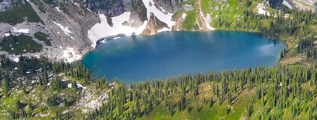
The trail follows through a meadow, passes a small lake, and finally reaches the summit. There are excellent viewpoints along the ridge to see the incredible Rocky Mountain Trench. From the trailhead to the summit is about 6.5 km (4 mi) with 1021 m (3350 ft) of elevation gain. The meadows are about 3 km (1.8 mi) and the lake is about 5.5 km (3.3 mi) from the trailhead.
Access to Grizzly Den is off Hungary Creek Forestry Service Road which is about 88 km (53 mi) southeast along Highway 16. The trailhead is a parking lot about 13 km (8 mi) up Hungary Creek Forestry Service Road.
From the parking lot the trail winds through a forest of spruce and balsam spruce balsam forest. The trail passes 8 Mile log cabin, through wet meadows, and across several creeks until it finally ascends to the timber A-frame cabin.
It is 6 km (3.6 mi) to the cabin with about 600 m (2,000 ft) of elevation gain. The trail continues for another 3 km to reach the summit of a small peak with an additional 450 m (1,500 ft) of elevation gain. During inclement weather, the cabin blends in with the forest and can be difficult to see. This can be part of a larger loop that passes Raven Peak and Raven Lake.
A couple kilometers past the Grizzly Den trailhead is the trailhead and parking lot for the Raven Lake Trail. The trail is about 5 km (3 mi) long and ascends steeply through the spruce forests to arrive at Raven Lake and its associated cabin. The elevation gain to the lake is about 450 m (1500 ft). The Raven Lake trail is often very wet and slippery, especially in winter.
There is a trail around the lake as well as the opportunity to follow a trail to Grizzly Den. The Raven Lake to Grizzly Den Cabin trail heads east of Raven Lake around the ridge and follows the east side of Raven Mountain. The trail then descends below the ridge locals call Jacqueline Rose Ridge and heads through Pat’s Pass to the Grizzly Den cabin.
Located in the Cariboo Mountains of central British Columbia, Sugarbowl-Grizzly Den Provincial Park is a beautiful alpine wilderness area. The park is especially popular for the residents of Prince George. The following are brief descriptions of the nearby community of Prince George and park accommodations.
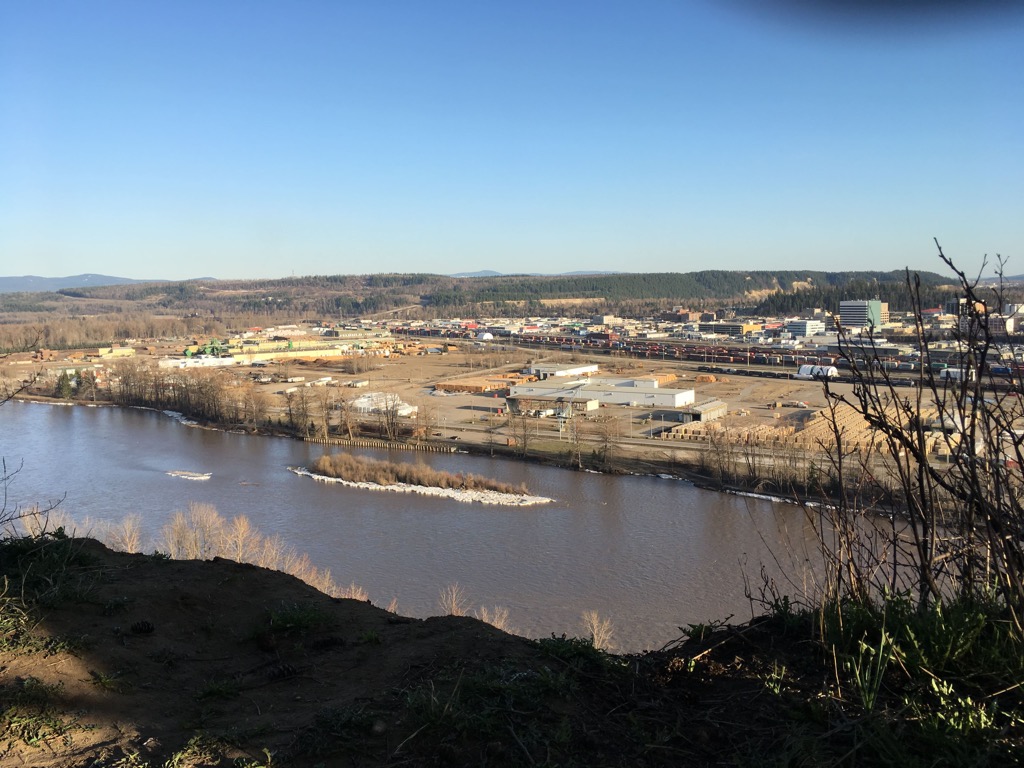
Known as the capital of northern British Columbia, Prince George is located at the confluence of the Fraser River and the Nechako River. It is on the western side of the Regional District of Fraser-Fort George at the junction of Highways 16 and 97.
The original settlement was Fort George, which was established by Simon Fraser in the early nineteenth century. Prince George has since grown into an important transportation and service hub for the north of British Columbia.
While in the middle of the wilderness, Prince George features the amenities of any modern city, including fine dining restaurants, cinemas, museums, a range of accommodations and an international airport.
There are some popular hikes around the city, such as the Cottonwoods Island Loop, the Greenway Trail to Shane Lake Loop, McMillan Creek Loop, Troll Lake, Kakwa Lake Trail, and Forests for the World Lookout. Sugarbowl-Grizzly Den is the closest alpine wilderness park and is about 80 km southeast of the city, along Highway 16.
There are three cabins available in Sugarbowl-Grizzly Den Provincial Park for the public to use for overnight visits. Available year-round, the cabins are known as 8 Mile Cabin, Raven Lake Cabin, and Grizzly Den Cabin.
Grizzly Den and Raven Lake were built in the 1970 by Northwood Pulp and Timber Ltd 8 Mile cabin, which was originally built in 1977 by the Sons of Norway to facilitate winter access along the unplowed Hungary Creek Forest Service Road.
Cabins are available for reservation through the Prince George Backcountry Recreation Society which supports trail and park maintenance in the parks and wilderness areas of Prince George. The cabins are user maintained and visitors are asked to keep the cabins clean and restock the wood bin for the next group.
Grizzly Den and 8 Mile Cabin are in their original state; however, Raven Lake Cabin was completely rebuilt in 2019 and has space for up to ten visitors per night in the new two-story cabin. While the cabins have some amenities, visitors are encouraged to be self-reliant in case the cabin is full.


