Scan the QR code and open PeakVisor on your phone
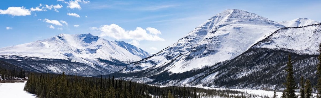
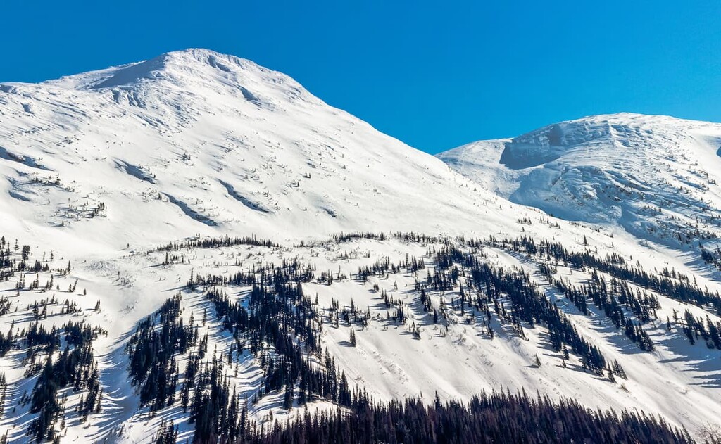
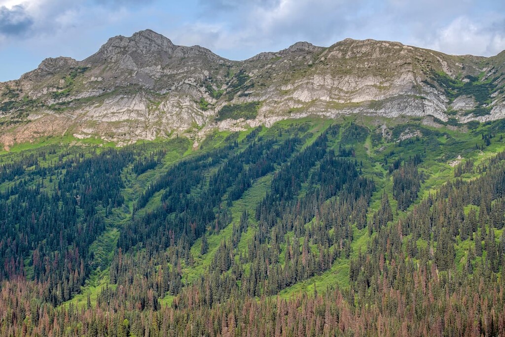
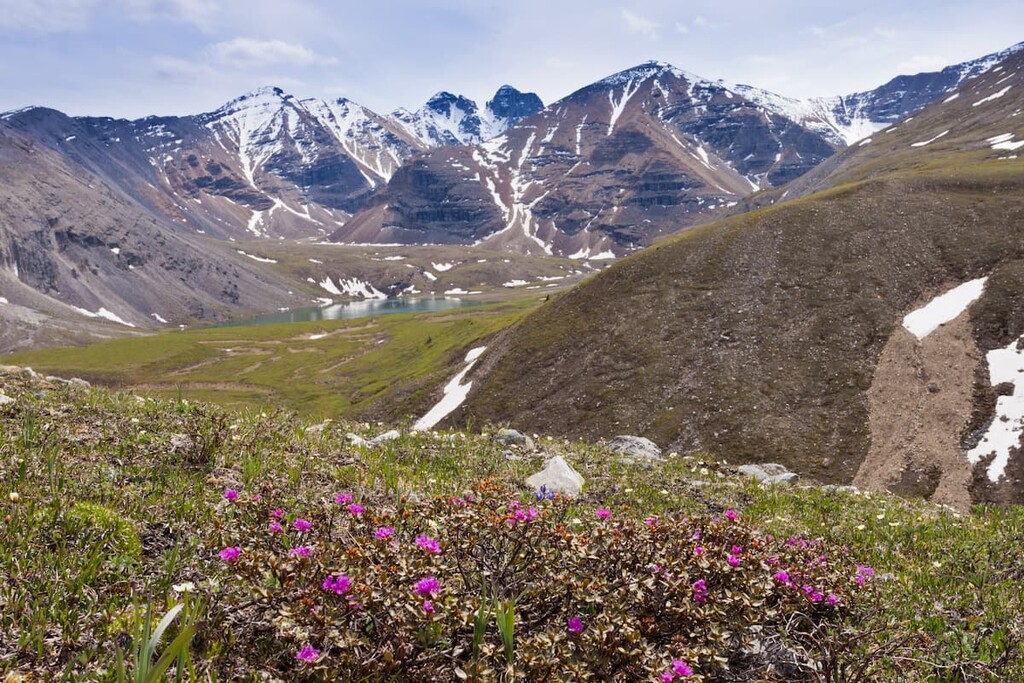
The Far Northern Rockies are the northernmost extent of the Rocky Mountains. The range is located in northeastern British Columbia, Canada. There are 519 named peaks in the range, the tallest and most prominent of which is Ulysses Mountain (3,024 m/9,921 ft). Additionally, the range contains 4 ultra-prominent peaks: Ulysses Mountain, Mount Ovington, Mount Sylvia, and Mount Crysdale.
Located in northeastern British Columbia, Canada, the Far Northern Rockies are the northernmost part of the greater Rocky Mountains, which begin in the US state of New Mexico.
The peaks run in a southeast to northwest direction along the Continental Divide, with the foothills to the east and the Rocky Mountain Trench to the west. Additionally, the Far Northern Rockies contain a number of subranges, including the Muskwa Range and the Hart Range.
They are also bordered by many other mountain systems within British Columbia, Alberta, and Yukon. In particular, the Far Northern Rockies are bordered to the east by the Cassiar Mountains, the Omineca Mountains, and the Nechako Plateau.
Meanwhile, the Liard River is the northern terminus of the Far Northern Rocky Mountains. To the north of this is the Yukon Intermountain Ranges and the Mackenzie Mountains. Additionally, Jarvis Creek is the border between the northern Rockies and the Park Ranges to the southeast.
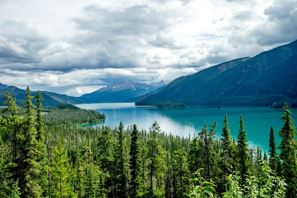
While the Far Northern Rockies are remote, there are many provincial parks and other protected areas found in the range. The following are some of the parks and protected areas in the northern Rockies which have hiking trails, unique natural features, beautiful lakes and rivers for paddling, and wildlife for viewing:
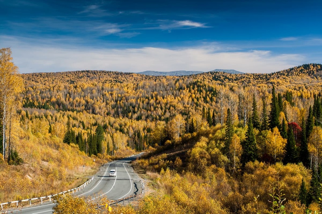
The main communities and cities near the northern Rockies are Prince George, Dawson Creek, and Fort Nelson in British Columbia, and Grande Prairie in Alberta. Highway 97 is the prominent highway that accesses most of the northern Rockies, while the Yellowhead Highway, and Highway 52 provide additional road connections into the Hart Ranges.
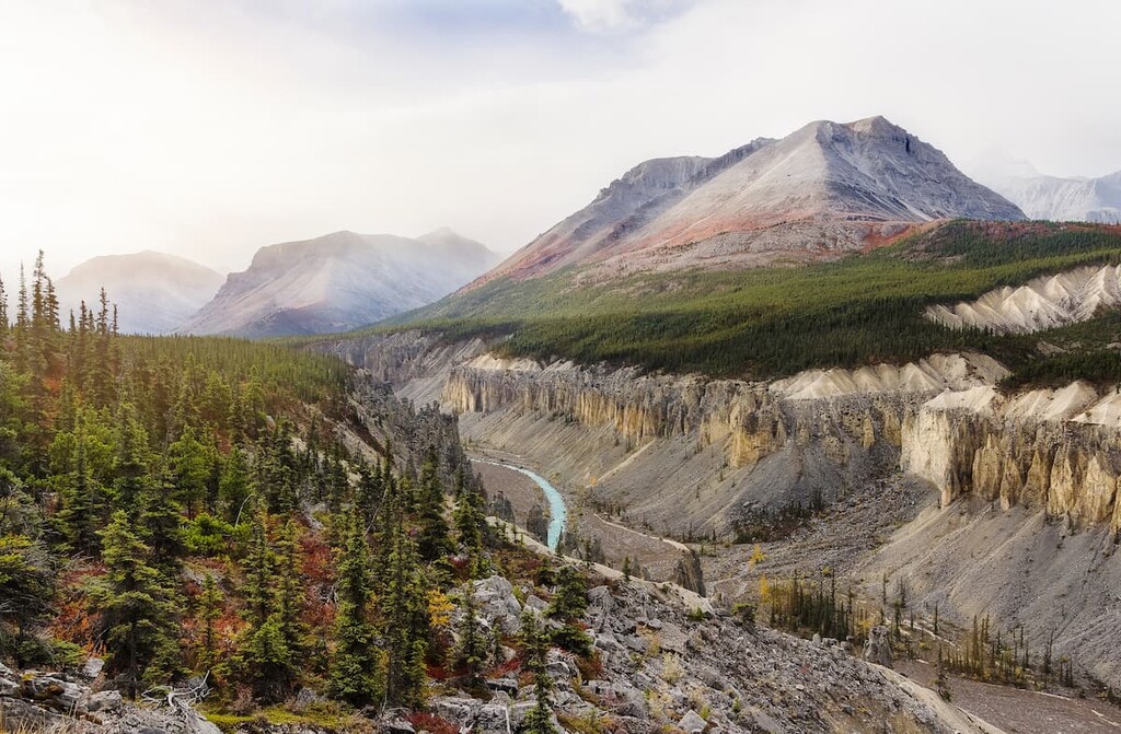
Some of the rocks of the northern Rockies are over 500 million years old, while most of the rocks are about 380 million years old.
The primary layers of rock in the range were created as a result of the compaction of marine sediment into limestone. Furthermore, layers of mud and silt flowed from the continent to create additional layers of rock on top of the layers of limestone.
About 75 million years ago, the tectonic plates under the Pacific Ocean collided with the North American plate. Because the continental plates are more buoyant than their oceanic counterparts, the oceanic plate began to subduct beneath the continent.
The oceanic plates subducted steeply beneath the western coast of Canada, whereas the subduction was much shallower in the United States. The angle at which the plates subducted accounts for some of the physiological differences between the Canadian Rockies and the Rocky Mountains through the United States.
During the collision and subduction of the tectonic plates, pressure built in the layers of rock. These layers would then crack and be displaced in a process called thrust faulting. During this time, Paleozoic limestone was thrust northeast and on top of younger layers of Cretaceous sandstone and shale.
However, the Misinchinka Range, which is a subrange of the Hart Ranges, and a part of Muskwa Ranges are composed of schist. Schist is the result of metamorphosed mudstone or shale. The tallest mountain in the band of schist found in the Far Northern Rockies is Deserters Peak, which has an elevation of 2,265 m (7,430 ft).
The schist mountains in the range are softer than their limestone counterparts. As such, the schist mountains in the Far Northern Rockies are more heavily eroded than their neighboring limestone peaks. Indeed, most of the Misinchinka Range and the schist band of the Muskwa Range are both lower than 2,100 m (7,000 ft) in elevation and have rounded tops.
During the Pleistocene, ice sheets covered most of the northern Rockies. There was also significant accumulations and movement of cirque and alpine glaciers across the range. While evidence of the continental ice sheet and glaciers is widespread across the Hart Ranges, the Muskwa Ranges show localized, rather than regional, topographical differences.
In the Muskwa Ranges, most of the glaciers formed among the tallest grouping of mountains, which includes Mount Churchill, Mount Roosevelt, Mount Stalin, and a number of other peaks as far south as Mount Lloyd George. Significant valley glaciers crept from these mountains and created the Gataga, Racing, Muskwa, and Kwadacha River valleys.
While most of the northern Rockies show evidence of glaciation, part of the Muskwa Ranges shows little to no evidence of glacial erosion from a continental ice sheet or glaciers. However, despite the lack of regular signs of glacial erosion, there is a near-continuous veneer of glacial drift that suggests that an ice sheet covered the region at one point in time.
In addition to the Misinchinka schist band, the northern Rockies have several other geological anomalies. The Hart Ranges are lower in elevation and more subdued topographically than the surrounding ranges because of a different stratigraphy and rock structure.
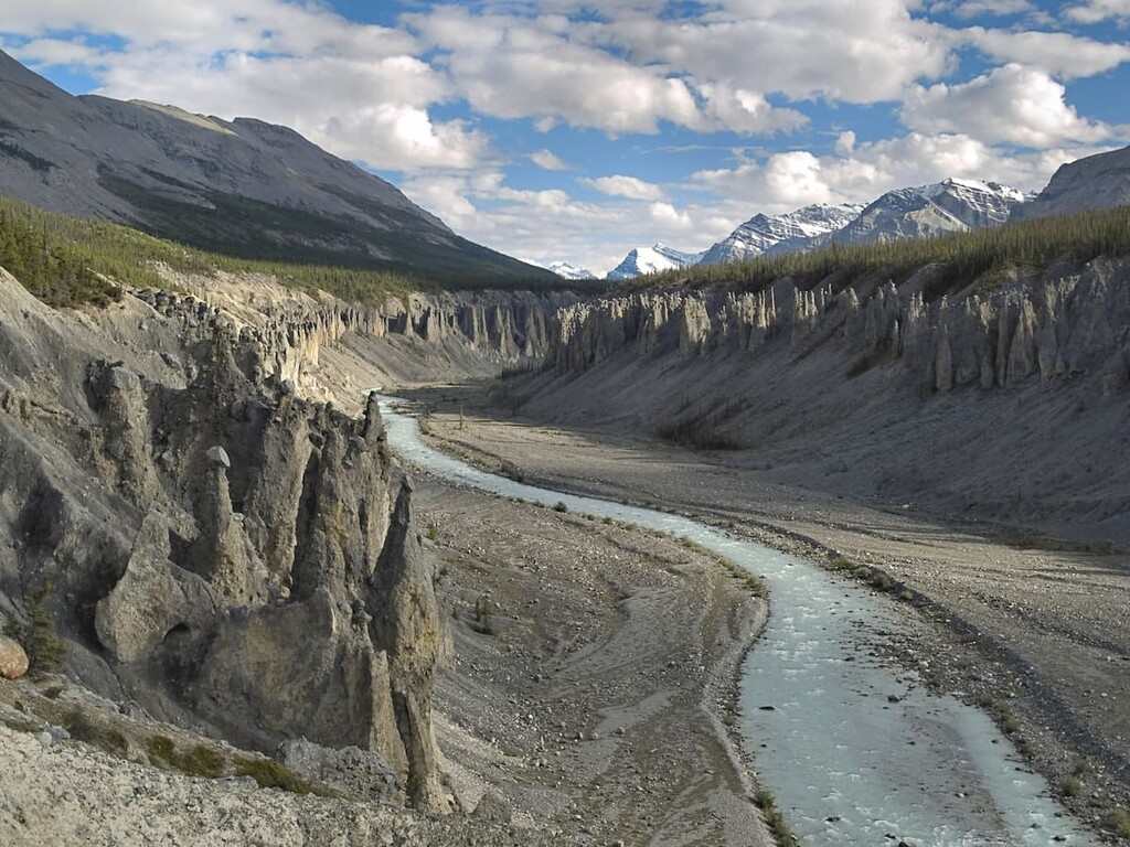
Additionally, the Muskwa Ranges have areas with significant karst formations, such as the limestone caves found in Bocock Peak Provincial Park. The northern Rockies also have mineral springs, such as those in the Ospika Cones Ecological Reserve, which have created an other-worldly landscape of mineral deposits and tufa.
There are three distinct ecologies represented in the northern Rockies: Alpine Tundra Zone, Spruce-Willow-Birch Zone, and Engelmann Spruce – Subalpine Fir Zone.
While the alpine is all representative of the Boreal Altai Fescue Alpine, there is a difference between the subalpine in the north and south of the northern Rockies. The northern subalpine is representative of the Spruce-Willow-Birch Zone while the south is part of the Engelmann Spruce-Subalpine Fir Zone and the Sub-Boreal Spruce Zone.
The mountain peaks of the northern Rockies are rocky and barren where they are not covered by glaciers or a thin, windblown snowpack. Below the region’s rocky peaks, grasses, such as Altai fescue and small-awned sedge grow in scattered clumps among the rocks and form alpine meadows. Here, dwarf shrubs and krummholz grow in protected areas and very few animals inhabit the alpine.
Mountain goats and stone sheep are the only large animals that may inhabit the alpine year-round. However, hoary marmots and Columbian ground squirrels burrow under the alpine rocks along the tree line and there are several birds that nest in the alpine, such as the white-tailed ptarmigan and the American pipit.
Covering the northern third of British Columbia, the ecology of the Spruce-Willow-Birch Zone is the harshest in the province with the coldest, longest winters and the shortest and coolest summers. The climate and terrain in this zone are typically unsuitable for human habitation; however, the beautiful wilderness and abundant wildlife in the region make it ideal for many recreational activities.
The mountains in the area are steep and below the tree line, the forests are typically subalpine fir and spruce, with lodgepole pine growing at lower elevations. The southern slopes and valley bottoms may have stands of trembling aspen. Scrub birch and several species of willow commonly grow in the area, as do grasses like Altai fescue.
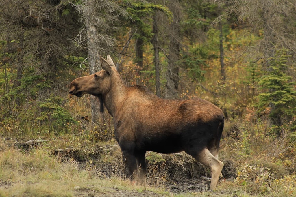
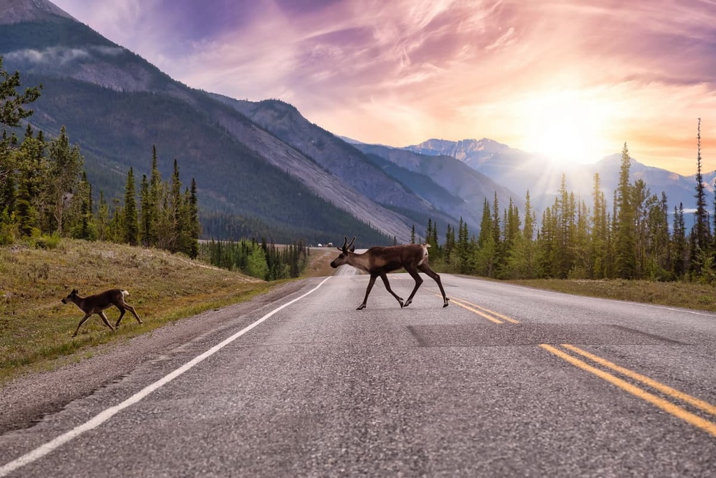
Most mammals that don’t hibernate only inhabit this area of the mountains during the summer. Rocky Mountain elk and mule deer tend to stay toward the east side of the mountains in the foothills where the snowfall tends to be less frequent than the rest of the range. Moose and caribou are widespread in the range, too; however, even they may leave the region by mid-winter in search of better grazing.
The birds that inhabit the region are robust and hardy so that they can survive the long and cold winters. The common raven, gray jay, and the boreal chickadee survive the harsh winters in the region by foraging for seeds or carrion.
There are no reptiles in the zone; however, there are several amphibians, such as the western toad, wood frog, and spotted frog, which burrow underground and hibernate during the winter.
The southern two-thirds of the northern Rockies subalpine is characteristic of the ecology of the Engelmann Spruce-Subalpine Fir Zone. The forests here are dominated by subalpine fir and Engelmann spruce. Meanwhile, the significant annual snowfall feeds the creeks and rivers throughout the year.
The open alpine areas in the region are dominated by mountain heather. Here, krummholz growth is dependent upon the prevailing winds, which sculpt the trees during fierce winter storms. There are limited grasslands in the zone, too, which tend to grow on the southern aspects of the slopes in the drier regions of the northern Rockies.
The eastern slopes of the northern Rockies were the first part of the range to be free of ice during the Pleistocene. As the ice melted, plants began to colonize the region and animals began to inhabit the northern Rockies. Around 8,000 years ago, peoples from the south and from the north began to inhabit the northern Rockies.
The northern Rockies are the traditional territory of people from the Dene First Nations and the Métis Nation British Colubia. Before contact with Europeans, the Métis and First Nations thrived by hunting and gathering in the region.
Europeans reached the Rocky Mountains by the eighteenth century and colonization of the northern Rockies has been documented as early as 1805 when the North West Company established a trading post to the east of the ranges at Fort Nelson. With the arrival of the fur trade, trapping became the main livelihood of the people in the north, a practice that continues in some capacity to this day.
There is also evidence of the attempts of prospectors attempting to find a short passage through northeastern British Columbia during the 1898 Yukon gold rush. Significant survey expeditions of the northern Rockies began in 1893 when R.G. McConnell worked for the Geological Survey of Canada. McConnell was responsible for naming Mount Lloyd George after the British prime minister.
In 1931, Mary Henry began her first expedition into the northern Rockies to document plants. She was searching for the “tropical valley” that she had heard about from trappers of the area. Mount Mary Henry was named for her to honour her part in the recent history of the region.
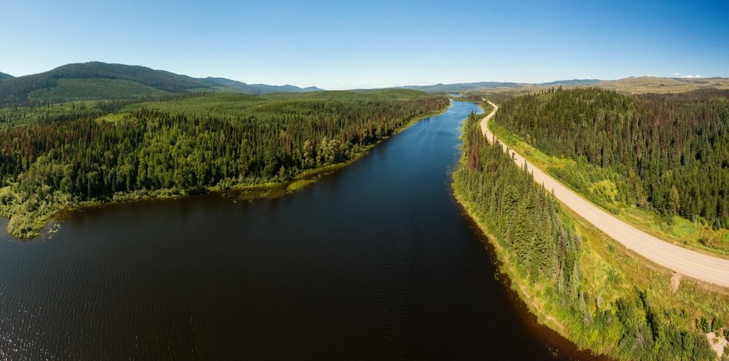
Prior to 1942, there were no significant roads into or through the northern Rockies. However, during the 1940s, construction began on the Alaska Highway. Before this time, the area was difficult to access and the residents of the region and those that decided to travel into the area had to travel by foot, horse, boat, or plane. The rivers were part of the traditional transportation routes in the region, as was the Davie Trail, which traveled along the Rocky Mountain Trench.
The construction of the Alaska Highway spurred the development of the region to its current level. Trapping provides the livelihood for many residents of the area, as does forestry and mining.
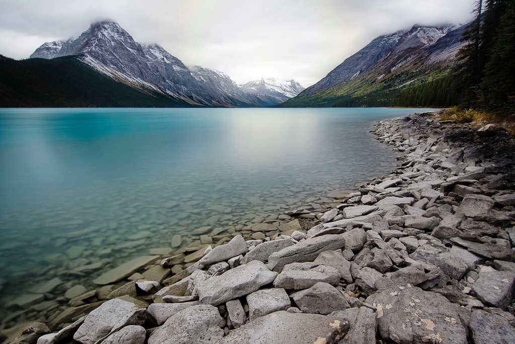
The vast wilderness of the northern Rockies has an endless quantity of scenic landscapes and recreational opportunities among the rugged peaks, alpine lakes, cascading rivers, and dense forests. The following are some of the incredible areas for backcountry adventures and hiking in the range:
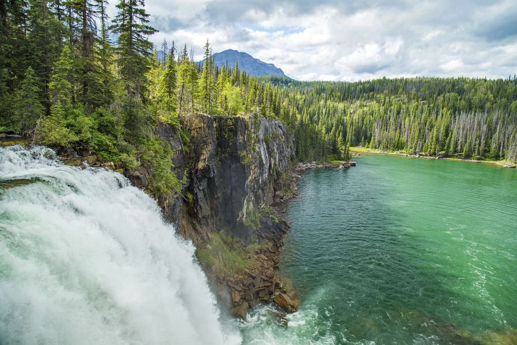
Tucked into the Hart Ranges of the northern Rockies, Monkman Provincial Park is notable for several unique features that make the park a worthwhile backcountry destination. Some of the incredible features found in the park include Kinuseo Falls, the Monkman Cascades, and the Stone Corral.
There are several trails leading to the 60 m (197 ft) tall Kinuseo Falls. In fact, the falls are taller than Niagara Falls in eastern Canada. These hiking trails lead to several incredible vistas of the falls.
Meanwhile, a short 4 km (2.4 mi) trail leads to the Stone Corral, which is a fascinating lake surrounded by massive, sheer limestone cliffs. The lake is a cenote, which is to say that it was created by water dissolving the limestone to create the feature. In addition to the cenote, flowing water created several caves nearby that are home to many fascinating limestone features.
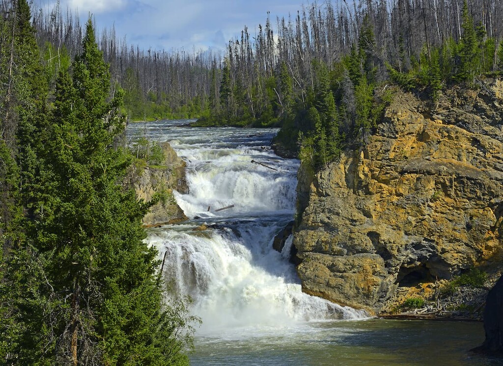
Additionally, the main Monkman Lake hiking trail passes near a series of 10 waterfalls that are known as the Monkman Cascades. The falls are known for their heights, water volume, and scenic backdrops.
Beyond Monkman Lake, the historic Monkman Pass Memorial Hiking Trail follows parts of the historic route established by Alex Monkman when he started building a highway to connect northern Alberta to the Pacific ports.
Bocock Peak Provincial Park is situated alongside 11 Mile Creek at the north end of the Hart Ranges. It is a small park of only 11 square kilometers (4 square miles) in area; however, it is host to several unique natural cave systems.
While there are no official trails or facilities in the park, backcountry camping is allowed as you explore the region. At the headwaters of the Peace River, along the Continental Divide, the park has three significant limestone cave systems. The deepest of the park’s cave systems is 253 m (830 ft) deep, making it the ninth deepest cave system in Canada.
While exploring such fragile destinations as the karst caves and the region’s alpine ecology, care must be taken to preserve the natural environment. It is as important to leave the cave features undisturbed as it is to practice Leave No Trace while hiking and camping.
Located at the south end of the Muskwa Ranges on the north of Williston Lake’s Peace Reach, Butler Ridge Provincial Park offers boating, fishing, hiking, and wildlife viewing opportunities. The park provides boat access to British Columbia’s largest man-made lake; however, the jewel of the park is the hiking trail that runs along the 15 km (9 mi) Butler Ridge.
With a distance over 13 km (8 mi), the trail along Butler Ridge presents amazing views of the Rocky Mountains, the Peace River, and Williston Lake. The trail climbs 753 m (2,470 ft); however, the views from the ridge are worth the effort of the steep hike.
Kwadacha Wilderness Provincial Park is a remote wilderness park on the western side of the Muskwa Ranges. It borders Northern Rocky Mountains Provincial Park. The park is only accessible via two hiking trails or by plane. The primary trail is a 150 km (90 mi) trek from the Alaska Highway into the park where you are free to explore the wilderness along unmaintained paths.
The trail into the park is believed to be one of the migration routes of the first peoples who inhabited the Muskwa Ranges and Rocky Mountain Trench after the last glacial maximum. Additionally, the park is home to over 70 distinct bird species, including eagles, warblers, Lapland Longspurs, grebes, teals, hawks, falcons, and kestrels.
The remote wilderness of Graham-Laurier Provincial Park covers nearly 1,000 square kilometers (386 square miles) of land. It contains attractions such as Christina Falls. It also boasts trails that travel along Emmerslund Creek, Needham Creek, Horn Creek, and the Graham River.
Christina Falls is accessible by a 22 km trail that is open to OHV and non-motorized users. The rest of the trails in the park are only for non-motorized users only. Backcountry camping is permitted across the park; however, there are no facilities and the subalpine ecosystem is fragile, so take care when traveling in the region.
Encompassing 6,657 square kilometers (2,570 square miles) of mountainous terrain, Northern Rockies Provincial Park is the largest of the parks in the region. The park borders Stone Mountain Provincial Park and Kwadacha Wilderness Provincial Park.
The park has many primitive campsites along the region’s major rivers and there are also many trails along the creeks and rivers that were created by local outfitting companies; however, none of these are well maintained. Primary access to the park is by hiking, horse, plane, or boat.
Some of the main activities of the park are hiking, backpacking, trail riding, mountaineering, and canoeing. Some of the popular canoe trips in the park follow the Tuchodi River and the Muskwa River.
Located toward the north end of the Muskwa Ranges in the northern Rockies, Stone Mountain Provincial Park offers opportunities for canoeing, hiking, angling, horseback riding, and camping.
Some of the natural features to discover in the park are the beautiful alpine meadows, waterfalls, alpine lakes, and hoodoos. Popular day hikes in the park include Summit Peak Trail, Erosion Pillars Trail, and Flower Springs Trail. Popular backpacking trails include MacDonald Creek Valley Trail and the Wokkpash Valley-MacDonald Creek Loop Trail.
The mountainous regions of the northern Rockies are relatively sparsely populated except by small municipalities that were typically built around the forestry or mining industries. The following are some major towns and cities in the region, many of which are located around the edges of the northern Rockies.
Located at the junction of Highways 16 and 97 to the southwest of the northern Rockies, Prince George is considered the capital of northern British Columbia. It was originally founded as Fort George, a North West Company trading post established by Simon Fraser in 1807.
Prince George has grown into an important transportation and service hub for the north of British Columbia with all the amenities of a modern city. It features fine dining restaurants, cinemas, museums, a range of accommodations and an international airport.
Off-roading is a popular pastime of locals in the region and there are well established clubs and areas to practice motocross and drive OHVs. The area also has vast wilderness areas that local hiking groups flock to as well as opportunities for fishing and other outdoor recreation activities.
Some of the most popular hikes around the city are the Cottonwoods Island Loop, the Greenway Trail to Shane Lake Loop, McMillan Creek Loop, Troll Lake, Kakwa Lake Trail, and Forests for the World Lookout.
Located to the east of the northern Rockies, Dawson Creek saw its most significant population growth when it became Mile 0 for the Alaska Highway in 1942.
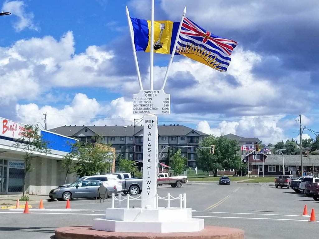
Dawson Creek is considered to be a gateway city to Alaska and the northwest of Canada. The area surrounding Dawson Creek has beautiful wilderness areas that are great for hiking, skiing, and OHV use. In addition to wilderness access, the city has an art gallery, a historical village, a museum, as well as annual fall fairs and a rodeo.
Fort Nelson was established as a trading post for the North West Company in the early nineteenth century. The community is surrounded by dense boreal forests and is near several world-renowned attractions in the northeastern part of the Rockies.
Some of the attractions near Fort Nelson are found in the Liard River Hot Springs Provincial Park and Muncho Lake Provincial Park. Popular activities include hunting, fishing, snowmobiling, dog sledding, bird watching, and hiking.