Scan the QR code and open PeakVisor on your phone
Redfern-Keily Provincial Park is located in the Far Northern Rockies of British Columbia, Canada. The park is one of the most accessible wilderness parks in northern British Columbia. There are 13 named mountains in the park, the highest and most prominent of which is Mount Ulysses with 3,024 m (9,921 ft) of elevation and an astounding 2,285 m (7,497 ft) of prominence.
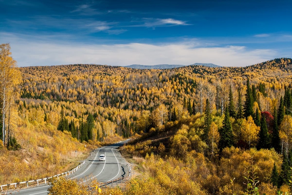
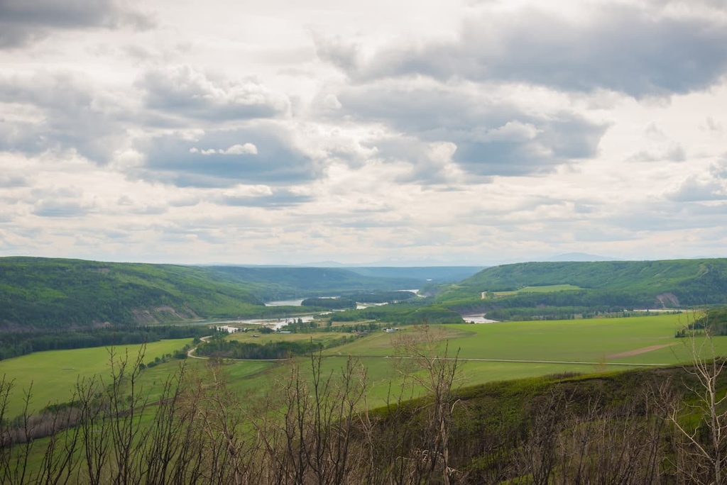
Redfern-Keily Provincial Park is a protected area situated in the Muskwa Ranges of the Far Northern Rockies of British Columbia, Canada. The Alaska Highway (Highway 97) runs north-south along the eastern slopes of the Far Northern Rockies, connecting northern British Columbia to the rest of the province and country.
Like most of the parks in northern British Columbia and northern Canada, there is no road access into the park; however, there are two major trails that have been historically used to access the park and the wilderness of the surrounding region.
Redfern-Keily is one of many provincial parks and protected areas in the Muskwa Ranges. Some of the other nearby parks include:
The Rocky Mountains and the Far Northern Rockies started forming about 75 million years ago, during a mountain formation event called the Laramide orogeny. The Laramide orogeny began when tectonic plates under the Pacific Ocean collided with and slid under the western edge of North America.
As the Farallon Plate, which was located under the Pacific Ocean, subducted beneath the continent, the force of the collision compressed the ancient continental margin, which was located approximately along the current border between Alberta and British Columbia. The compression caused the layers of rocks to heat, and they then started to fold.
As the collision continued, the layers of rocks folded and eventually cracked and buckled, creating the fault lines that are still present today. However, the mountain building process was not smooth, as the pressure would build up in the layers of rocks and then they would suddenly thrust forward. The Rockies were created as thrust faults stacked up and pushed northeast.
At the start of the Laramide orogeny, the Columbia Mountains and most of the western cordillera had already lifted well above sea level. To the west of the Columbia Mountains, a large inland sea covered the ancient continental margin, with layers of Paleozoic limestone and dolomite covered with Cretaceous aged sandstone, mudstone, and slate.
Over the following 45 million years, the 400 km (240 mi) wide continental margin folded, buckled, and was raised upwards of 5 kilometers (3.6 mi) above sea level. Additionally, the width of the Rockies was compressed so that it was only 200 km (120 mi) wide.
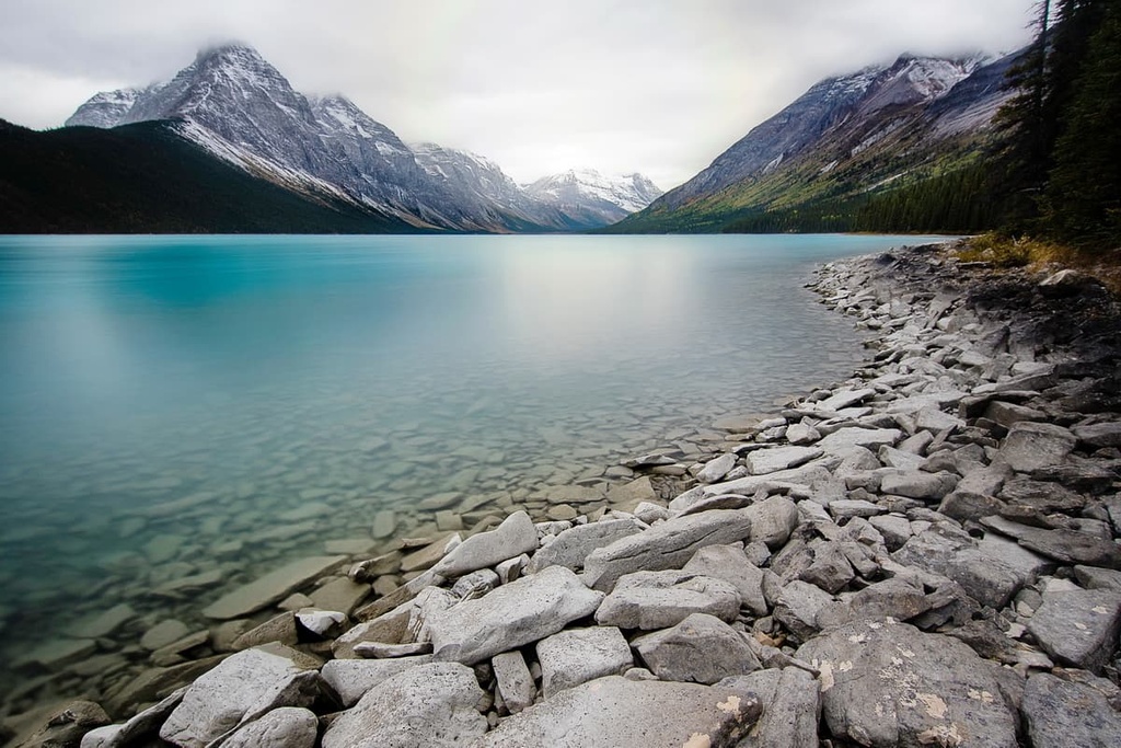
Redfern-Keily Provincial Park has a visible thrust fault, rugged castellated peaks, glacial U-shaped valleys, hanging valleys, natural arches, cirques, and horns. The mountains of the park are formed from the Paleozoic limestone and dolomite, like most of the Rockies, while the foothills are formed of Triassic rock.
The thrust fault emerges to the south of Trimble Lake and is evidence of how the Muskwa Ranges were created. Additional geological features are evident throughout the park; however, most of the topography of the mountains were created during the last glacial maximum of the Pleistocene.
Glaciers covered the park and only finally receded about 12,000 years ago. During the successive glacial maximums, alpine glaciers created the cirques, horns, U-shaped valley, and the hanging valleys. Further erosion from run-off, wind, and rain created the natural arches in the park and the hoodoos which are located along Besa River, below Mount Dopp.
At the end of the Pleistocene, the remaining glaciers in the mountains and the continental ice sheet, which was located to the east, created a massive ice dam. Until the ice dam melted, a glacial lake resided in the valleys between the Muskwa River, Prophet River, and the Lower Sikanni Chief Rivers. The retreating glaciers covered the valley bottoms with a thin, but universal veneer of glacial till.
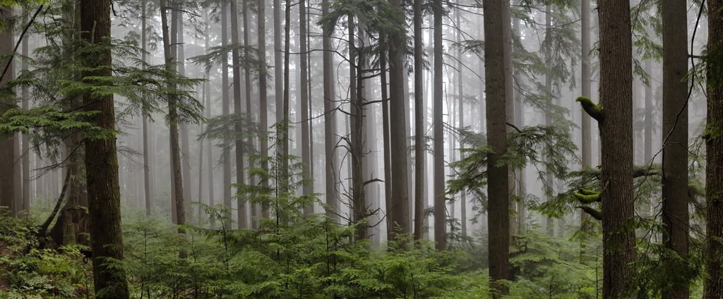
The slopes and valleys of Redfern-Keily Provincial Park are filled with forests of white spruce, subalpine fir, lodgepole pine, black spruce, and trembling aspen. The ecology is characteristic of the Spruce-Willow-Birch ecosystem. However, the park is also home to scrub birch and willow in its riparian areas.
Above 1,800 m (5,900 ft) in elevation, the Boreal Altai Fescue Alpine is the dominant ecosystem. Shrubs, heathers, mosses, lichens, and krummholz full of white spruce, Engelmann spruce, and subalpine fir grow from the tree line to the rocky peaks in the park.
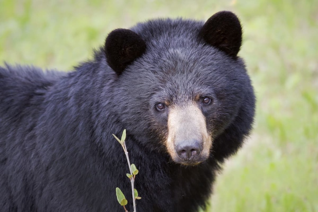
The park is ecologically important, as it is large enough to support large mammal predator/prey systems. Many large ungulates roam the park, including caribou, elk, moose, mountain goat, mule deer, Stone’s sheep, and white-tailed deer. The major predators are black bears, gray wolves, and grizzly bears.
The park also contains many of the fur-bearing animals that were historically important to the region’s fur trade throughout the nineteenth century, such as the fisher, marten, and the wolverine. A reintroduced herd of plains bison roam near Trimble Lake, which was part of their historic range. Finally, the park also contains a regionally significant population of Pacific loons.
Redfern-Keily Provincial Park and the surrounding region are located on the traditional territory of the Denédeh and Beaver First Nations. The valleys and rivers of the park have been historically and presently used by First Nations for hunting, fishing, plant collection, and seasonal food preparation.
There are several historic sites located around Trimble and Redfern Lakes, which include a cabin site, cache, camp trails, refuse, and lithics. Additionally, the confluence of Besa River and Keily Creek has been used as a camping area for many distinct groups. Furthermore, Keily Creek contains a burial site and is considered sacred by the local First Nations.
After making contact with the trappers and traders from Hudson’s Bay Company, many members of local First Nations became prolific trappers for the company. They often traded furs at Fort St. John and Hudson’s Hope.
Other historical events that happened in and around the park include the 1932 survey of the glaciers and snowfields around Mount Ulysses and a 1934 expedition that camped along the shores of Redfern Lake.
The northbound trail from the 1934 expedition is still visible and is part of a rough patchwork of trails in the park. Redfern-Keily Provincial Park has two major trails running into and through the park which have been used historically and are still used today to access the hunting, fishing, and resources of the park.
There are a handful of major trails into the remote wilderness of Redfern-Keily Provincial Park, which make it one of the most accessible wilderness parks in the Muskwa Ranges.
The Redfern Lake Trail follows Nevis Creek and the Besa River to Redfern Lake, while a second trail follows the Sikanni Chief River to Trible Lake. A third trail links Trimble Lake to Besa River, completing the loop.
These trails are open to hikers, mountain bikes, horses, dog sleds, and snowmobiles. There are also primitive campsites along the trails which visitors are encouraged to use in order to minimize impact on the environment. Motorized OHVs can only access the park via the Redfern Lake Trail as motorized access along the Sikanni Chief River does not extend into the park.
These historical trails lead into the incredible wilderness of the Muskwa Ranges. Most of the visitors to the area are there on hunting and fishing expeditions; however, the park has incredible sights for backcountry hikers who wish to explore the region.
The Muskwa Ranges are remote mountains in the north of British Columbia. It wasn’t until the 1940s, with the completion of the Alaska Highway, that road travel into northern British Columbia was common or even possible.
The northern stretches of British Columbia are sparsely inhabited; however, the following are a few of the major communities located near and on the way to Redfern-Keily Provincial Park.
The area surrounding Dawson Creek contains beautiful wilderness that is perfect for hiking, skiing, and OHV use. Dawson Creek is located about 255 km (153 mi) from the trailheads that lead into Redfern-Keily Provincial Park.
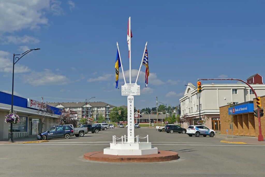
A major event in the history of Dawson Creek occurred when, during World War II, the United States used the city as a terminus for the Alaska Highway. The highway was constructed through northern British Columbia to be used to help supply defenses to the looming threat to Alaska.
Wilderness activities are popular in Dawson Creek, including fishing, hunting, and OHV use; however, in addition to wilderness access, the city has an art gallery, a historical village, a museum, as well as annual fall fairs and a rodeo.
Some of the popular hikes around the city of Dawson Creek include the casual 1.8 km (1 mi) Leoppky Park Trail and the 9.7 km (5.8 mi) Dawson Creek Trail. There is also a moderate 7.4 km (4.4 mi) hike along the Rim Rocks Trail.
Fort St. John is situated about 190 km (114 mi) to the south of the trailheads which lead to Redfern-Keily Provincial Park. It is the largest city in the Peace River Regional District, and it is located at Mile 47 of the Alaska Highway.
The community was originally established as a trading post for the fur trade in 1794, a year after Alexander Mackenzie traveled to the region. The community and region are still considered part of the vast wilderness. The mountains that surround Fort St. John are home to an abundance of wildlife, scenic landscapes, wild rivers and creeks, and plenty of trails to explore.
Some of the many attractions and trails around the city include the Charlie Lake Caves (have evidence of human inhabitants from 10,500 years ago), the Willow Loop, Cactus Trails, and the Cecil Lake Highway Trail Loop. From these trails, there is a vast northern wilderness to explore by foot, horse, snowmobile, dogsled, or OHV.
Fort Nelson is a town surrounded by the dense boreal forests of northern Canada. It is located in the middle of a beautiful wilderness area and about 200 km (120 mi) to the north of the trailheads into Redfern-Keily Provincial Park.
Originally established as a trading post for the North West Company in the early nineteenth century, Fort Nelson is now a great starting point for trips to several world-renowned attractions in the northeastern part of the Rockies. Popular activities in and around Fort Nelson include hunting, fishing, snowmobiling, dog sledding, bird watching, and hiking.
Some of the main attractions near Fort Nelson are found in the welcoming hot springs at Liard River Hot Springs Provincial Park. Other popular destinations include the remote wilderness at Stone Mountain, Northern Rocky Mountains, and Kwadacha Wilderness Provincial Parks.