
Scan the QR code and open PeakVisor on your phone
Kwadacha Wilderness Provincial Park is a protected area located in northern British Columbia, Canada. This remote wilderness park encompasses 25 named peaks of the Muskwa Ranges of the far northern Rockies. The tallest and most prominent peak in Kwadacha Wilderness Provincial Park is Mount Lloyd George, which is 2,921 m (9,583 ft) tall with 1,187 m (3,894 ft) of prominence.
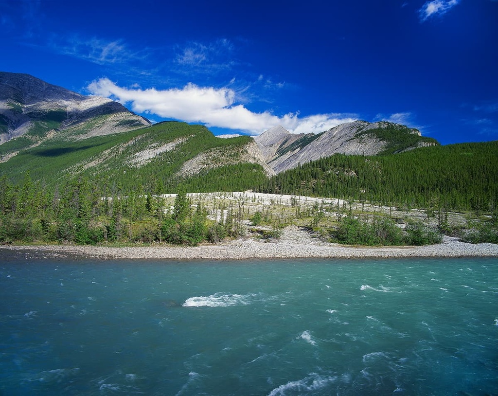
Kwadacha Wilderness Provincial Park is an outdoor recreation destination located on the north side of the Peace River Regional District in northern British Columbia, Canada. The park encompasses 1,300 square kilometers (500 square miles) of remote wilderness in the mountains of the Muskwa Ranges.
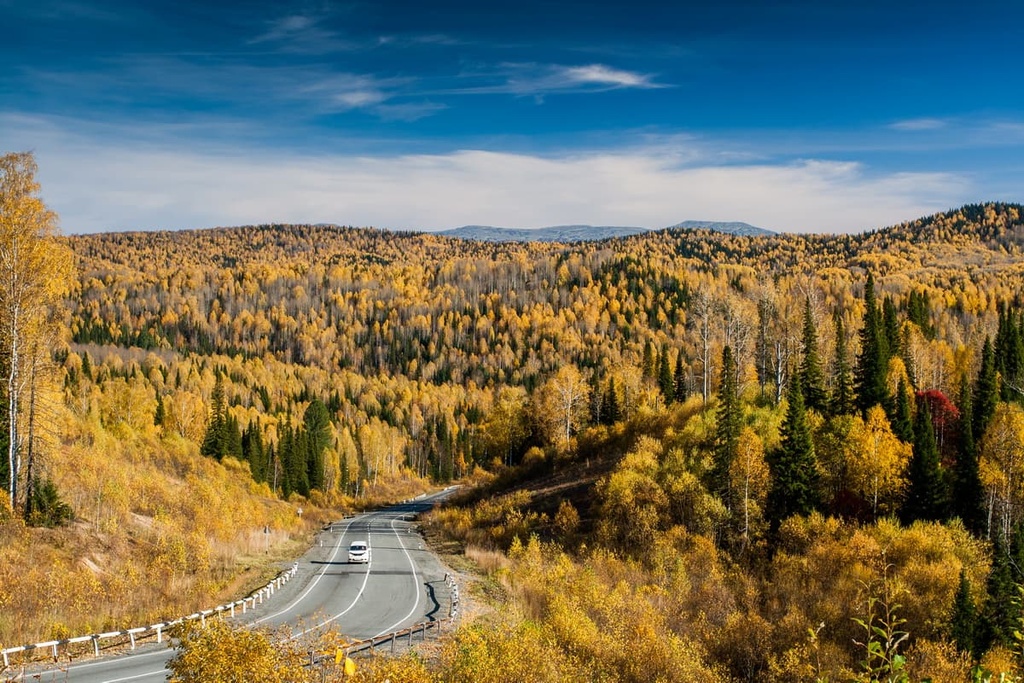
The far northern Rockies are relatively inaccessible as there are very few highways and roads through the area. It was only in the 1940s, with the construction of the Alaska Highway that much of northern British Columbia became accessible to cars and buses.
However, despite the Alaska Highway, Kwadacha Wilderness Park is still only accessible via a 150 km (90 mi) hiking and horse trail or by plane.
The park was established in 1973 to protect the Eastern and Western Muskwa Ranges in the British Columbia Parks system. The park is in the Muskwa-Kechika Management Area, which is one of North America’s last true wilderness areas to the south of the 60th parallel. The pristine beauty, natural resources, and the diverse and plentiful wildlife of the region makes this area well worth protecting.
In addition to Kwadacha Wilderness Provincial Park, the following nearby parks were established in northern British Columbia to preserve and protect the delicate northern wilderness:
Hundreds of millions of years ago, marine sediments accumulated along the coastal margin of North America, roughly starting where the western Alberta border is today.
Over hundreds of millions of years, these sediments were compressed into layers of limestone. These layers were subsequently covered by more sediment from the Canadian Shield that was washed into the sea that was covering western Canada.
About 75 million years ago, the Farallon tectonic plate collided with the west coast of North America, creating mountains in the process. The Columbia and Coast Mountains were already in the process of forming and now the Rocky Mountains started to rise above sea level.
This tectonic collision compressed the ancient continental margin, creating enough heat and pressure to deform and fold the layers of rock. Eventually fault lines formed and pressure continued to build up until the layers of rock were displaced. The lateral pressure squeezed the rock layers until they moved upward in a process called thrust faulting.
The mountains were formed by a series of thrust faults that broke and stacked layers of rock from the east to the west. The older Paleozoic limestone layer was stacked onto the younger Cretaceous layer of sandstone and shale.
The rocks of the Kwadacha Wilderness Provincial Park consist of a unit of quartzites, conglomerated slates, and limestone that extends from Mount Churchill to Mount Lloyd George. During the Pleistocene, glaciers formed among the tall peaks of Mount Churchill, Mount Roosevelt, and Mount Lloyd George.
From the peaks, the glaciers carved the Gataga, Racing, Muskwa, and Kwadacha River valleys. Additionally, cirque and alpine glaciers carved the high relief of the region, which is similar to the topography of the southern Rocky Mountains in Jasper and Banff National Park.
Kwadacha Wilderness Provincial Park has two different ecological zones: the Boreal Altai Fescue Alpine Zone and the Spruce-Willow Birch Zone. Elevation is the key factor differentiating these ecologies; however, there is a transitional band along the tree line, where the ecology resembles parkland, with stands of trees interspersed throughout alpine meadows.
The Boreal Altai Fescue Alpine Zone covers a large portion of Kwadacha Wilderness Provincial Park. It encompasses the 25 peaks and the elevations above 1,400 m (4,592 ft). The Alpine Zone extends from the mountain tops and has colder temperatures and shorter growing seasons than the valleys below.
The vegetation in the region is mainly heath with some herbaceous plants, heather, grasses, mosses, and lichens. In early summer, the wildflowers such as mountain avens, buttercups, lilies, and paintbrushes are in bloom.
During the summer caribou, Stone's sheep, mountain goats, snowshoe hares, and ground squirrels may inhabit and pass through the alpine zone. During the winter, the snowpack is deep and vegetation is scarce, so most animals shelter in the forests at lower elevations.
The Spruce-Willow-Birch Zone is the subalpine, which is typically located between 900 and 1,500 m (2,950 and 4,920 ft) in the park. White spruce and subalpine fir are the typical trees found in this zone, though the forests grow denser at lower elevations.
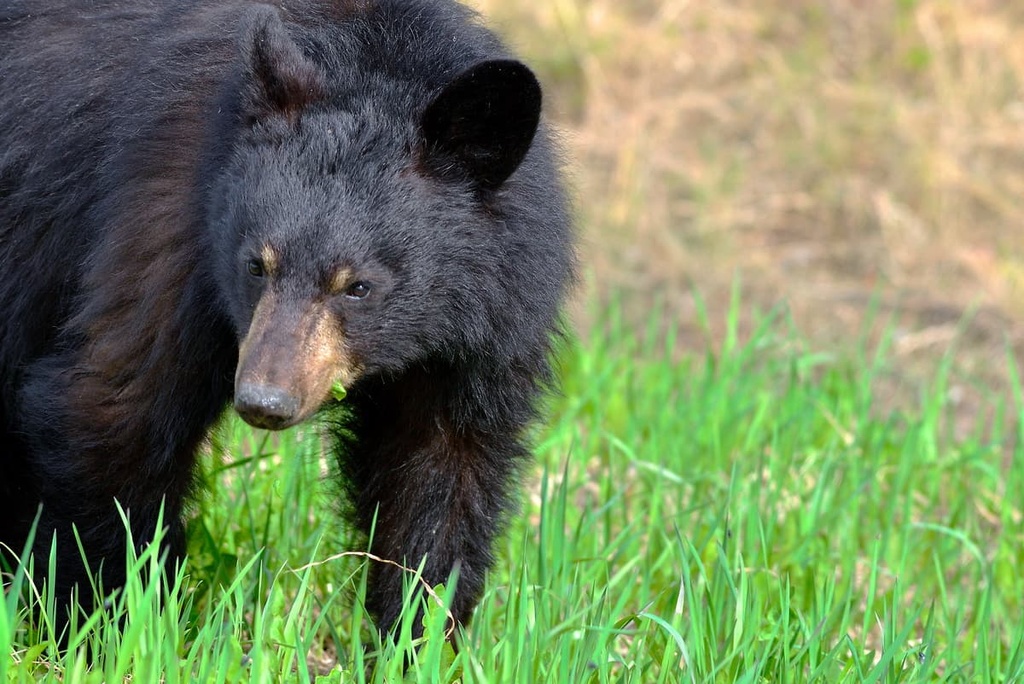
Moose, caribou, mountain goat, Stone's sheep, wolves, and both black and grizzly bears are the large mammals that can be found in the subalpine of the wilderness park. Some of the smaller animals that you may find are wood frogs, western toads, spruce grouse, ravens, squirrels, wolverines, and marten.
Two of the large lakes in the region support rainbow trout, bull trout, and whitefish, with rare occurrences of the pygmy whitefish. Additionally, over 70 bird species have been recorded in the park, including hawks, falcons, eagles, warblers, kestrels, grebes, teals, and Lapland longspurs.
At the end of the Pleistocene, the ice sheets and glaciers melted from the eastern slopes of the Rocky Mountains and, by about 8,000 years ago, the northern Rockies became habitable for humans. Prehistoric megafauna, such as mastodons and giant bison once roamed what is now Canada and bands of hunters followed their food to the north.
Kwadacha Wilderness Provincial Park is located on the traditional territory of the Dene First Nation and the Métis Nation. Before contact with Europeans, the Dene and Métis thrived on their ancestral homelands by hunting and gathering in the region.
Settlement of the northern Rockies by people of European descent has been documented as early as 1805 when the North West Company established a trading post to the east of the Kwadacha Wilderness Provincial Park at Fort Nelson. Trapping became the main livelihood of the people in the north, a practice that continues in some capacity to this day.
In 1893, R.G. McConnell led survey expeditions of the northern Rockies when he worked for the Geological Survey of Canada. McConnell was responsible for giving the English language name to Mount Lloyd George, the tallest mountain in Kwadacha Wilderness Provincial Park. He named the peak after the Welshman David Lloyd George, the former prime minister of the United Kingdom.
Prior to 1942, there were no significant roads leading into or through the northern Rockies; however, in 1934, Charles Bedaux attempted to lead an expedition across the northern parts of Alberta and the northern Rockies of British Columbia. The expedition was to end at the Pacific; however, shortly after crossing Bedaux Pass, which was named for him, the party turned back due to the impending winter.
Before the construction of the Alaska Highway, the area was difficult to access. Residents and visitors to the region typically travelled by foot, horse, boat, or plane. The rivers were part of the traditional transportation routes in the region, as was the Davie Trail, which traveled along the Rocky Mountain Trench, west of Kwadacha Wilderness Provincial Park.
The 1,300 square kilometers (500 square miles) of pristine wilderness surrounding the Muskwa River is the main attraction in Kwadacha Wilderness Provincial Park.
There is no road access into the park, so most anglers and hunters are flown into the park. However, there is a trail into the park that enters from the east side of the Rocky Mountains.
The most common trail into Kwadacha Wilderness Provincial Park is a 150 km (90 mi) long path that starts just north of the community of Trutch on the Alaska Highway. The trail follows the Prophet River until it meets up with a valley that crosses into the wilderness park.
There is another trailhead that starts near Sikanni Chief and joins with the previously mentioned trail. The Bedaux expedition followed the Muskwa River to its headwaters at Fern Lake, in Kwadacha Wilderness Provincial Park, and the pass adjacent to Fern Lake was named for Bedaux.
Kwadacha Wilderness Provincial Park is located in the remote Muskwa Ranges of the far northern Rocky Mountains. When visiting the northern Rockies, you will find that there are many small communities, but not all of them will have services for visitors and tourists. The following places have services and accommodations for visitors to the north:
Located southeast of Kwadacha Wilderness Provincial Park, Dawson Creek is situated at Mile 0 of the Alaska Highway. It is considered to be a gateway to northern British Columbia. Before the construction of the Alaska Highway, northern British Columbia was difficult to access and there were no paved roads into the area.
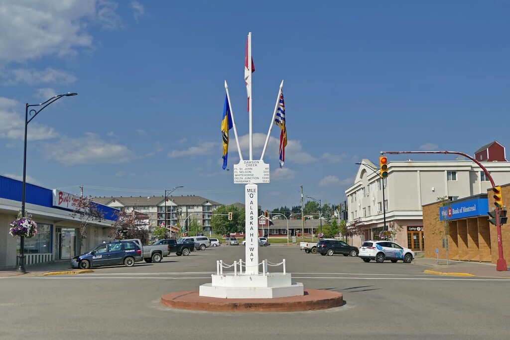
The Alaska Highway has allowed industry and visitors to access the beautiful northern Rockies. The area surrounding Dawson Creek has beautiful wilderness areas that are great for hiking, skiing, and OHV use. In addition to wilderness access, the city has an art gallery, a historical village, a museum, as well as annual fall fairs and a rodeo.
Some of the popular hikes around the city of Dawson Creek are the moderate 7.4 km (4.4 mi) hike along the Rim Rocks Trail and the 9.7 km (5.8 mi) Dawson Creek Trail. There is also the easy 1.8 km (1 mi) Loeppky Park Trail to help get you outside and moving around.
Fort Nelson is surrounded by the dense boreal forests of northern Canada. It is located in the middle of a beautiful wilderness area. Originally established as a trading post for the North West Company in the early nineteenth century, Fort Nelson is now a great starting point for trips to several world-renowned attractions in the northeastern part of the Rockies.
Some of the main attractions near Fort Nelson are found in the welcoming hot springs at Liard River Hot Springs Provincial Park. Other popular destinations include the remote wilderness at Stone Mountain, Northern Rocky Mountains, and Kwadacha Wilderness Provincial Parks.
Popular activities in and around Fort Nelson include hunting, fishing, snowmobiling, dog sledding, bird watching, and hiking.
Tumbler Ridge was built as a mining community to provide homes and services to the workers of the local mines; however, commodity prices decreased, and the town’s population decreased too.
However, the town got a new claim to fame in the year 2000 thanks to a happenstance discovery by two young boys.
In 2000, two young boys discovered dinosaur tracks along the town’s river, which led to further major fossil and bone discoveries from the Cretaceous around the community and region. The fossil discovery helped Tumbler Ridge receive funding for a museum and the Peace Region Paleontology Research Centre.
The area around Tumbler Ridge was listed as a UNESCO Global Geopark, which helps to promote the significance of the region and bring in geological and paleontological tourists. The region contains an impressive variety of geological features, in addition to the dinosaur trackways and fossils.
The geopark includes many fascinating natural areas and wilderness areas to explore that surround the town of Tumbler Ridge.
Monkman Provincial Park, Wapiti Lake Provincial Park, Bearhole Lake Provincial Park, Gwillim Lake Provincial Park, Hole in the Wall Provincial Park, and Sukunka Falls Provincial Park lay entirely or partially in the geopark. They all offer amazing hikes for visitors to enjoy.


