
Scan the QR code and open PeakVisor on your phone
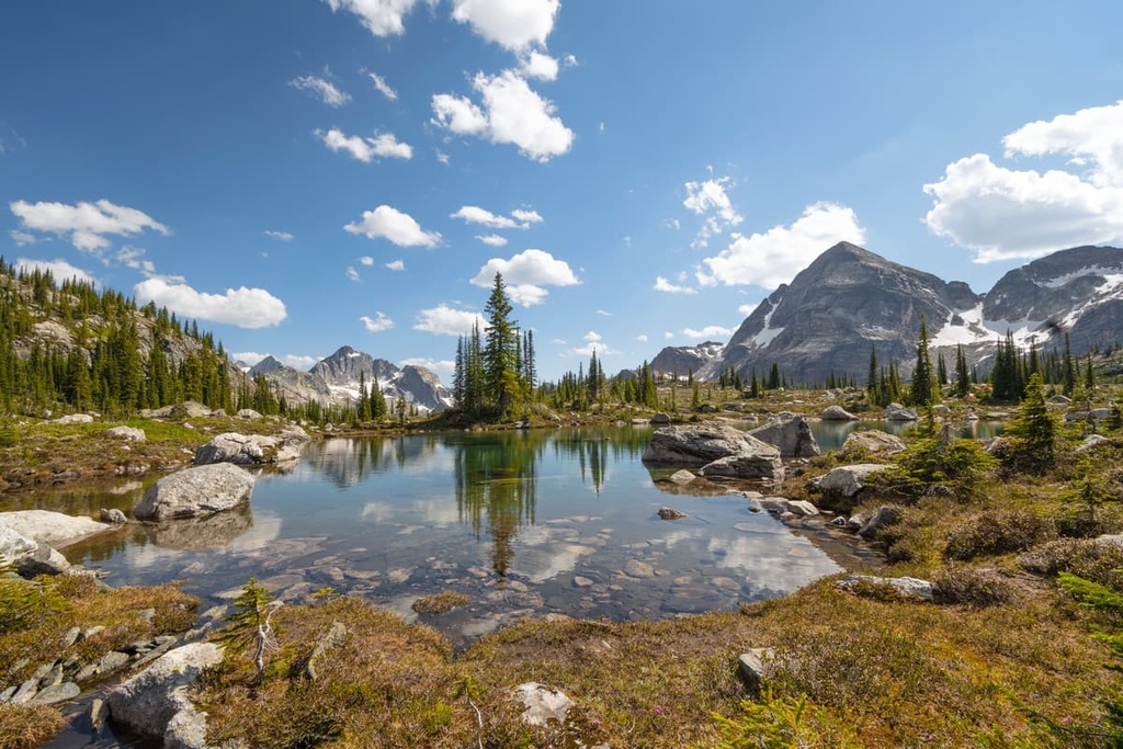
Gwillim Lake Provincial Park is a protected area located on the eastern slopes of the Hart Ranges in the far northern Rockies of British Columbia, Canada. The 1,100 ha (2,700 acre) Gwillim Lake is bordered by 8 named peaks, the tallest and most prominent of which is Mount Niles at 1,625 m (5,331 ft) in elevation and with 485 m (1,591 ft) of prominence.
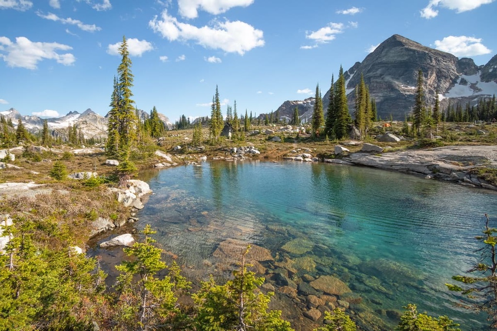
Gwillim Lake Provincial Park is located in the Peace River Regional District of British Columbia, Canada. The deep, clear waters of Gwillim Lake are surrounded by the Hart Ranges of the far northern Rockies to the west and the gentle ridges of the Rocky Mountain Foothills to the east.
There are seven named peaks that surround Gwillim Lake, of which Mount Niles is the tallest and the most prominent mountain. Mount Niles is 1,625 m (5,331 ft) tall and has 485 m (1,591 ft) of prominence. Meanwhile, Mount Meikle has 428 m (1,404 ft) of prominence and Trapper Mountain has 269 m (888 ft) of prominence.
The park and lake are both accessible via Highway 29, which runs along the eastern slopes of the northern Rockies. Additionally, the park is one of over 800 protected areas in British Columbia. Some of the other parks in the region are:
As part of the Hart Ranges of the Rocky Mountains, the rocks of Gwillim Lake Provincial Park started forming about 380 million years ago as cyanobacteria died and accumulated in a shallow sea off the west coast of ancient North America. As the cyanobacteria, which are also called blue-green algae, died, they deposited a calcite particle on the seafloor.
Throughout the Pleistocene, the accumulation of these dead cyanobacteria built up layers of marine sediment that were sometimes several kilometers thick. Under the weight of the layers above, the marine sediment compacted and became the limestone that would become the Rocky Mountains.
During the Cretaceous, the Farallon tectonic plate, which was located under the Pacific Ocean, collided with and subducted beneath North America. During this tectonic collision, exotic terranes were being added to the west coast, which was located along the Alberta-British Columbia border.
Contemporary British Columbia is made almost entirely of exotic and volcanic terranes that were skimmed off the tectonic plates that were once located under the Pacific Ocean. The subduction of these tectonic plates formed the Columbia, Interior, and Coast Mountains.
Additionally, as the mountains of what is now British Columbia rose in the west, they left behind a large inland sea that covered significant areas of present-day Alberta. As the cordillera was lifted, continental silt and sand were washed into the sea.
These sediments covered the marine sediment that was now at the bottom of the large inland sea. Eventually, these layers of mud and sand became the layers of shale and sandstone that we see in the region today.
About 75 million years ago, the Farallon plate was still pushing up against the west coast of North America. This force began to compress and deform the layers of rock that were once located along the ancient coastal margin that is now situated along Alberta’s western border. Starting from the southwest, the Canadian Rockies started to lift upward above the sea.
The Rocky Mountains rose into the sky above for about 40 million years, as layers of limestone were thrust up and onto layers of sandstone and shale. During their formation, the mountains were subjected to erosional forces, such as wind, rain, and snow. In a process called differential erosion, the layers of sandstone and shale eroded faster than the layers of limestone.
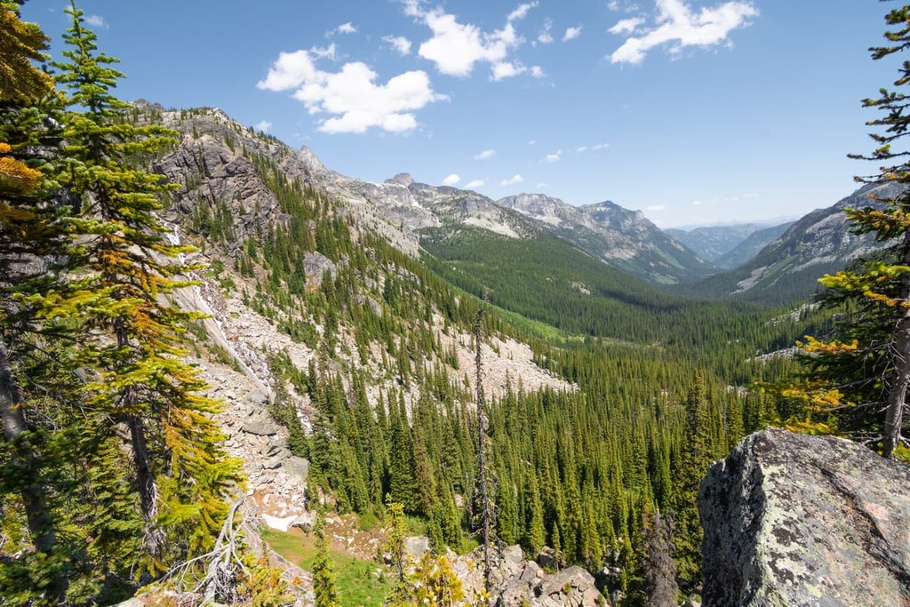
The softer Cretaceous rocks were eroded, too, a process that created the valleys between the region’s limestone peaks. Further erosion occurred during the Pleistocene when what is now Canada was covered by ice sheets that were often several kilometers thick. Several glacial maximums scoured the Rocky Mountains during the Pleistocene into the range we see today.
The ice sheets rounded off many of the lower-lying peaks while also scouring the softer rock from the valleys. Additionally, alpine and cirque glaciers formed in the peaks above the ice sheet and cut into the slopes of mountains, carving out cirques.
The current topography of Gwillim Provincial Park is mainly due to the most recent glacial maximum of the Pleistocene, which ended about 12,000 years ago.
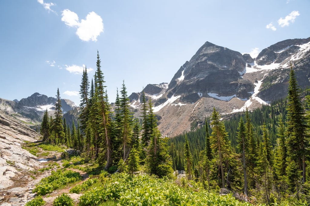
Gwillim Lake Provincial Park is generally considered to be part of the Boreal White and Black Spruce zone with the higher elevations supporting species of the subboreal Engelmann Spruce-Subalpine Fir zone.
Lodgepole pine, aspen, birch and cottonwood stands are characteristic of lower elevations in the park. Meanwhile, south-facing slopes feature a heavy deciduous composition that creates a colourful autumn display.

On north-facing slopes, lodgepole pine and black spruce dominate in the colder climate, with little or no deciduous trees present. Low lying, wet localities, such as throughout the park are vegetated by willow and alder.
A variety of wildlife typical to north-eastern British Columbia inhabits the park and the surrounding areas. Large ungulates, such as deer and moose, are seen regularly in the park, while elk and caribou are rarely spotted.
Grizzly and black bears live in and around Gwillim Lake, as do wolves, mountain goats, beavers, and coyotes. Several species of small mammals inhabit the park, too, such as fisher, fox, lynx, marten, squirrel, and muskrat.
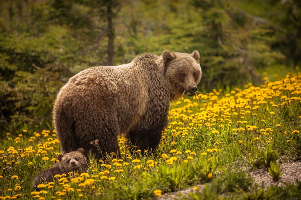
Gwillim Lake contains a large variety of fish for recreational anglers, such as lake char, dolly varden, whitefish, grayling, pike, and burbot. The gravel beds of the inflowing creeks provide spawning grounds for trout, whitefish, and grayling.
Located along the eastern slopes of the Rocky Mountains, the land in and around Gwillim Lake Provincial Park was likely part of the ancient ice-free corridor that was created during the Pleistocene glacial maximums. The ice-free corridor was also the first area to melt at the end of the Pleistocene.
This ice-free corridor stretched from what is now Alaska and Yukon, along the eastern slopes of the Rocky Mountains through British Columbia and Alberta. It connected these northerly regions to the southern half of North America. It is believed that this ice-free corridor played a role in the human migration over land to North America.
However, during the final opening of the corridor, which started about 15,000 years ago, archaeological evidence suggests western Canada was initially inhabited by people travelling from the south to the north, following the migration of ancient megafauna.
There are six areas of archaeological importance in Gwillim Lake Provincial Park, half of which are located on the east end of the lake and the other half are situated on the western point of the lake. On the west end of the lake, there is a site with basalt and chert flakes, which indicates the presence of seasonal hunting camps that were once used by local First Nations.
Thanks to the abundant fur-bearing animals in the park and surrounding area, trappers have worked in the boundaries of the park since Alexander Mackenzie traveled through the region. In fact, there are still several recorded trap lines in the park; however, they are not all being used.
The first recorded photograph of Gwillim Lake was taken by Samuel Prescot as he traveled from Jasper to the Peace River area. There is an old trail that travels along the south shore of the lake as well as the remains of cabins that had been built before the park was established in 1981.
Gwillim Lake Provincial Park is a popular destination for those living in northern British Columbia as it offers many different opportunities for recreation, such as canoeing, climbing, cycling, hiking, fishing, horseback riding, scuba diving, waterskiing and powerboating, swimming, and windsurfing. There are also snowshoeing and backcountry skiing opportunities during the winter.
There is a vehicle-accessible campground in the park with toilets, drinking water, and a playground for the children. Walk-in and backcountry camping is permitted within the park; however, there are no facilities, which allows for free-range exploration in the wilderness park.
There are a couple of designated trails that travel along the lake shore that are relatively short, as well as the Beaver Pond Trail. However, there are few other maintained hiking trails and most adventuring in the park is off-trail.
Additionally, while powerboats and vehicles are allowed, my preferred way to experience this park is paddling the open waters to explore the lake’s shoreline. Most visitors to the region also enjoy hiking into the backcountry for a day or two to find some summits and remote lakes.
Gwillim Lake Provincial Park was built to facilitate wilderness and lake activities to the surrounding communities in the northern Rockies of British Columbia. Locals visit the park for boating, fishing, and many other activities.
The following are some of the major cities and towns near Gwillim Lake:
Tumbler Ridge is a planned community that was built in the 1980s to provide housing and services to the mines in the region. While initially there was optimism for the community, declining commodity prices prevented the expected growth of Tumbler Ridge.
Years of fluctuating coal prices, challenging conditions for the mines, and a lack of investments prevented the economy from diversifying; however, in 2000, the town’s future changed in an instant.
In 2000, two young boys discovered dinosaur tracks along the river, a discovery that led to further major fossil and bone discoveries in the region that date back to the Cretaceous period.
This fossil discovery helped Tumbler Ridge receive funding for a museum and the Peace Region Paleontology Research Centre. Furthermore, the area around Tumbler Ridge was listed as North America’s second UNESCO Global Geopark in order to promote the significance of the region and bring in geological and paleontological tourists to the area.
The geopark includes many fascinating natural areas and wilderness areas to check out. Some of the best hiking and adventuring destinations in the geopark include Monkman Provincial Park, Wapiti Lake Provincial Park, Bearhole Lake Provincial Park, Gwillim Lake Provincial Park, Hole in the Wall Provincial Park, and Sukunka Falls Provincial Park.
Gwillim Lake Provincial Park is located about 150 km (90 mi) to the west of Dawson Creek which is the gateway to Alaska and the northern wilderness of Canada.
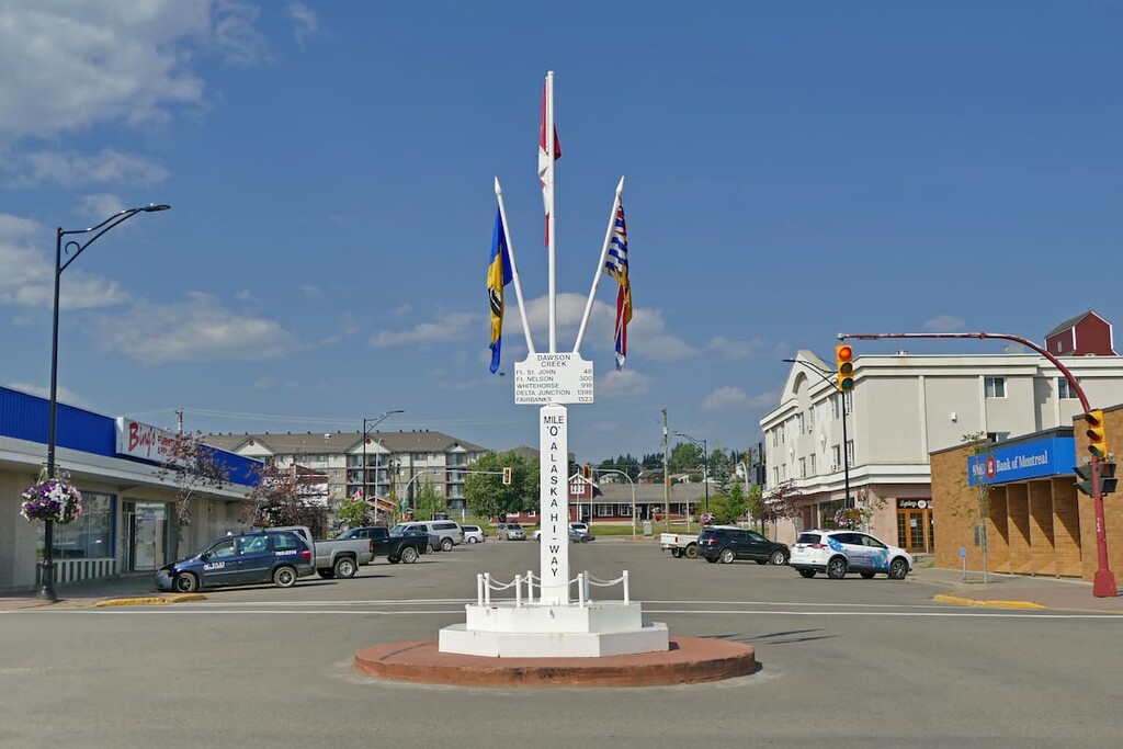
The area surrounding Dawson Creek contains beautiful wilderness that is perfect for hiking, skiing, and OHV use. Originally, settlers of European descent came to the region for the homestead grants that were being offered by the government of Canada.
Railways were later built through the town, which helped it grow by attracting more businesses and settlers. Dawson Creek saw some excitement during World War II when the United States used the city as a terminus for the Alaska Highway, which was built to help supply defenses to the looming threat to Alaska.
Wilderness activities are popular in Dawson Creek, such as fishing, hunting, and OHV use; however, in addition to wilderness access, the city has an art gallery, a historical village, a museum, as well as annual fall fairs and a rodeo.
Some of the popular hikes around the city of Dawson Creek include the casual 1.8 km (1 mi) Leoppky Park Trail and the 9.7 km (5.8 mi) Dawson Creek Trail. There is also a moderate 7.4 km (4.4 mi) hike along the Rim Rocks Trail.
Situated about 230 km (138 mi) to the northwest of Gwillim Lake Provincial Park, Mackenzie is located on the west side of the Hart Ranges off Highway 39, along the shore of Williston Lake. The community maintains 32 km (19 mi) of groomed cross country ski trail throughout the winter.
The municipality of Mackenzie is a great place for winter-loving outdoor enthusiasts, as the community hosts annual dog sledding, cross country skiing, and snowmobiling competitions. Additionally, there are many trails nearby that are worth hiking if you’re in the area. Some of the recommended trails are the Morfee Lake Trail, Cut Thumb Falls Trail, and Kimta Creek Trail.


