
Scan the QR code and open PeakVisor on your phone
Wapiti Lake Provincial Park is a protected area located in the eastern Hart Ranges of the Far Northern Rockies in British Columbia, Canada. Bertram Peak (2,202 m/ 7,224 ft) overlooks the park’s namesake, Wapiti Lake, and is the sole named peak that stands alongside the lowlands of Wapiti Lake Provincial Park. The backcountry park is praised for its scenic views, rushing rivers, and crystal clear lakes.
Encompassing 168 square kilometers (64 square miles) of the Far Northern Rockies in British Columbia, Canada, Wapiti Lake Provincial Park is a backcountry haven with ample opportunities for wilderness recreation and adventure.
The park sits along the edge of the eastern Hart Ranges. It encompasses Wapiti Lake, Bertram Peak (2,202 m/ 7,224 ft), and a swath of pristine wilderness.
Wapiti Lake Provincial Park is one of the many parks in the Hart Ranges. Some of the other parks that are located nearby include:
As they are part of the Hart Ranges of the Rocky Mountains, the rocks of Bertram Peak and Wapiti Lake Provincial Park started forming about 380 million years ago. The limestone that dominates the park and this part of the Rockies was created from the accumulation of sediment in a shallow sea that was once located off the coast of ancient North America.
As cyanobacteria, which are also called blue-green algae, died in this shallow sea, they deposited calcite particles on the seafloor. Over the course of millions of years, these particles accumulated and built up layers of marine sediment that were sometimes several kilometers thick.
Eventually, this marine sediment compacted and became the limestone that would later form the basis of the Rocky Mountains. The Rockies were primarily formed as a result of a mountain-building event called the Laramide orogeny.
During the Laramide orogeny, the Farallon tectonic plate, which was located under the Pacific Ocean, collided with and subducted beneath North America. During this tectonic collision, exotic terranes were added to the west coast of the continent, which was located along the modern-day Alberta-British Columbia border at the time.
While contemporary British Columbia is made almost entirely of exotic and volcanic terranes that were skimmed off the tectonic plates that were once located under the Pacific Ocean, the Rockies were created from the thick layers of limestone that had formed off the coast.
The Rocky Mountains rose into the sky above for about 40 million years as layers of limestone were thrust up and onto layers of sandstone and shale. In a process called differential erosion, the layers of sandstone and shale eroded faster than the layers of limestone, as the forming peaks were subjected to the erosive power of rain, wind, and glaciers.
Significant erosion occurred during the Pleistocene when what is now Canada was covered by ice sheets that were often several kilometers thick. Several glacial maximums scoured the Rocky Mountains during the Pleistocene to create the range we see today.
Of special note are the Triassic-aged fossils that have been found in the park, such as the ichthyosaurs. Other examples of ichthyosaurs have been found in locations in China and Japan, among other places.
Wapiti Lake Provincial Park is also located within the boundaries of the Tumbler Ridge Global Geopark. The geopark is a UNESCO site that features a number of unique geological, paleontological, and archeological sites in a relatively small area. Among the other features of the geopark are the fossilized remains of a dinosaur trackway.
Wapiti Lake Provincial Park is located in the Far Northern Rockies, and its ecology is characterized as part of the Engelmann Spruce-Subalpine Fir zone. This subalpine zone of the park is commonly found across the higher elevation areas of British Columbia, and it has what many would consider to be a severe climate.
As it is characterized by a short, cool growing season and long, cold winters, the flora and fauna of Wapiti Lake Provincial Park are quite hardy. Engelmann spruce, subalpine fir, white spruce, and lodgepole pine are the dominant tree species in the park’s forests. Close to the summit of Bertram Peak, the forests begin to thin and they eventually become stands of trees that are interspersed with meadow and heath.
Lodgepole pine, aspen, birch, and cottonwood stands are characteristic of the lower elevations in the park. Adjacent to the region’s rivers, vegetation may include willow and alder. Some noteworthy plants to look out for in the park include Labrador tea and nodding onion.
Labrador tea is mostly found in spongy bogs and it grows to 50 cm (20 inches) in height. This evergreen shrub has lance-shaped leaves with curled edges and dense rusty hairs on the underside. Meanwhile, nodding onion grows to about 30 cm (12 inches) and has a bent flower head with up to a dozen pink blooms. It is found along lakeshores, and its leaves have a strong onion smell.
A variety of wildlife typical to north-eastern British Columbia inhabits the park and the surrounding areas. Large ungulates, such as deer and moose, are seen regularly in the park, while elk and caribou are rarely spotted.
Grizzly and black bears live in and around Wapiti Lake, as do wolves, mountain goats, beavers, and coyotes. Several species of small mammals inhabit the park, too, such as fishers, foxes, lynx, martens, squirrels, and muskrats. Bull trout and mountain whitefish are present in Wapiti Lake, too.
The traditional territory of many Indigenous people, including the Carrier First Nations (Dakelh), Dene First Nations, Cree First Nations, Sekani First Nations (Tse’khene), and Métis Nation, among others, includes land that is now located within Wapiti Lake Provincial Park. Indigenous people have hunted, fished, trapped, and gathered sustenance and other resources in what is now the park for countless generations.
Prescott Faye and his expedition party made what was likely the first recorded visit to the area by people of European descent in 1914. In the years that followed this expedition, it’s likely that other people of European descent made their way to the lake, but their travels aren’t well-known.
However, in 1962, Maynard Bergh, a local helicopter pilot, built the original cabin on the shores of Wapiti Lake. This paved the way for the establishment of other buildings in the region.
During the late 1960s Father Mariman, a Catholic priest, built a grotto and several buildings in the area for a spiritual retreat. Visitors today seem to understand the general reverence that the pristine lake and wilderness deserve and why the area was once used as a spiritual retreat.
In the early 1980s, the BC Forest Service and a Katimavik crew set about repairing and restoring the Wapiti Onion Trail to Wapiti Lake. In 1995, the current cabin was constructed by the BC Forest Services, and in 2000, the area was designated as Wapiti Lake Provincial Park.
Wapiti Lake has been an important place for First Nations and Métis people since time immemorial. In recent decades, it also became a popular destination for spiritual retreats among non-Indigenous residents in the region.
Nowadays, the area of Wapiti Lake Provincial Park is also a relatively popular destination for outdoor recreation. Here’s a look at some of the major trails and attractions that are located in and near Wapiti Lake Provincial Park.
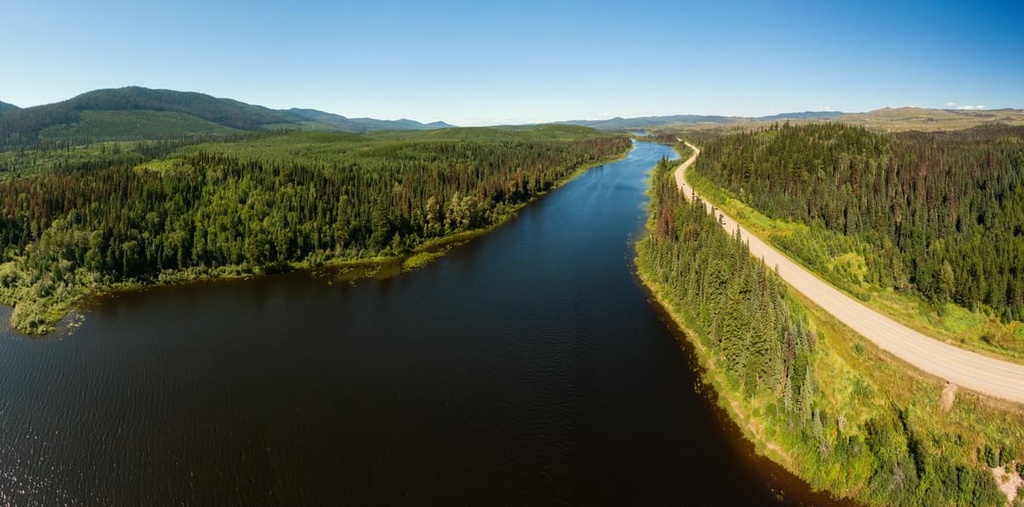
The Wapiti Onion Trail is a 30 km (18 mi) trek from the trailhead at the recreation site to Onion Lake, which is located just north of Wapiti Lake Provincial Park. There are many detailed descriptions of the trail available online, which include information about ideal campsites and viewpoints along the route.
The trail includes many creek crossings and 1,000 m (3,280 ft) of elevation gain over a very short distance. Some of the attractions that are found along the trail include Wapiti Falls, the Catholic grotto and shrine, the cabin along the shores of Wapiti Lake, and the nodding onion that can be found along the shores of Onion Lake.
The trek to and from Onion Lake is usually accomplished over several days and is only recommended for experienced hikers.
The falls along the Wapiti River are situated only a short detour from the main Wapiti Onion Trail, and they are worth checking out if you are in the region.
There are several areas near the falls that are suitable for a picnic or an overnight campsite. Many visitors to the area will take some time to fish near the falls while they take in the views.
Fossil Lake is located about 14 km (8.6 mi) away from the cabin at Wapiti Lake along a trail that is generally overgrown and often difficult to follow.
Effort has been made over the past decades to flag part of the trail; however, the limited use of the trail has allowed the wilderness to take its natural course and consume the trails that have been made. While it is a difficult trek, people who are able to make it to Fossil Lake are typically impressed by the many fossils that can be found in the area.
As it is located at the southern end of the park, Tuck Lake is a rather obscure destination. Very few people make the trek to this lake; however, some have in years past and were rewarded with incredible views of the surrounding mountains and glaciers.
There isn’t a well-maintained trail to Tuck Lake, though, so anyone making the journey should be experienced with off-trail navigation and route finding in the wilderness.
Wapiti Lake is the main attraction at Wapiti Lake Provincial Park. A cabin that was built at the lake in 1995 has two sets of bunks, a fire pit, benches, and basic amenities for visitors to enjoy. The lake is also a popular wilderness swimming destination for people staying in the cabin.
The park itself sees relatively few visitors each year, so it’s possible that campers will get the cabin to themselves during their stay. However, there’s always a chance that the cabin will be occupied before you arrive, so hikers should always bring a tent or some other form of shelter for the night.
Wapiti Lake is located in the front ranges of the Far Northern Rockies in British Columbia. The area is world-renowned for its unique geological and paleontological features. The following are some of the major cities and towns that are located near this gem of a park.
Tumbler Ridge is situated about 40 km (24 mi) to the north of Wapiti Lake Provincial Park. The town was built in the 1980s to provide housing and services to the mines in the region, which were opened to exploit the newly found coal deposits in the area.
While initially there was optimism for the community, declining commodity prices prevented the growth of Tumbler Ridge into a major settlement. Fluctuating coal prices, challenging conditions for the mines, and a lack of investments prevented the town’s economy from diversifying for decades; however, in 2000, the town’s fortune and direction changed thanks to a discovery made by two local boys.
In 2000, two young boys discovered dinosaur tracks along the river near the townsite. This discovery led to a number of other major fossil and bone discoveries in the region. Ultimately, all of these discoveries helped Tumbler Ridge receive funding for a museum and the Peace Region Paleontology Research Centre.
Continued interest and promotion of the area around Tumbler Ridge allowed for the creation of the Tumbler Ridge Geopark. The geopark is now home to many incredible features that include the dinosaur trackway and an incredible deposit of ichthyosaurus fossils.
The geopark includes many fascinating natural areas and wilderness areas for visitors to check out, too. Some of the best hiking and adventuring destinations in the geopark include Monkman Provincial Park, Wapiti Lake Provincial Park, Bearhole Lake Provincial Park, Gwillim Lake Provincial Park, Hole in the Wall Provincial Park, and Sukunka Falls Provincial Park.
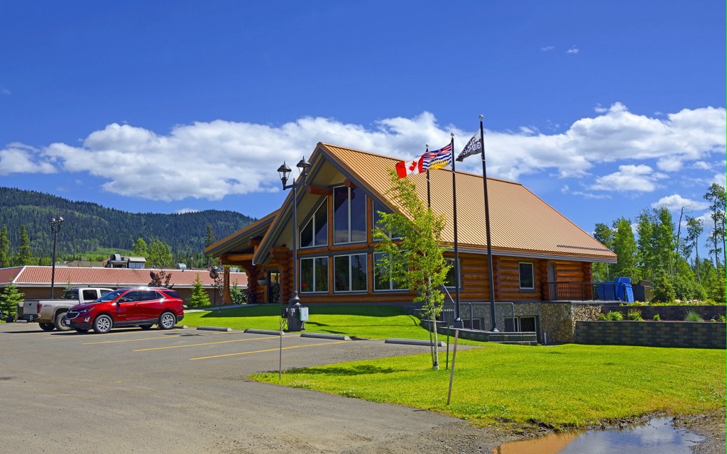
Prince George is a city located at the junction of Highways 16 and 97. Due to its strategic location, most visitors to northern British Columbia pass through the city during their drive. The city is also located about 150 km (93 mi) to the southwest of Wapiti Lake Provincial Park on the western side of the Rocky Mountains.
Prince George is a major transportation hub in northern British Columbia, and it is considered the capital of the north end of the province. While it is located among the dense and expansive forests of the northern part of the province, the city features fine dining restaurants, cinemas, museums, a range of accommodation options, and an international airport.
Fishing, canoeing, hunting, snowmobiling, snowshoeing, and backcountry skiing are also popular regional activities in Prince George. Some of the most popular hikes around the city include the Cottonwoods Island Loop, the Greenway Trail to Shane Lake Loop, McMillan Creek Loop, Troll Lake, Kakwa Lake Trail, and Forests for the World Lookout.


