
Scan the QR code and open PeakVisor on your phone
The Misinchinka Ranges include 38 named peaks. The highest is Sentinel Peak at 2,513 m. Other notable peaks include Mount Vreeland, Mount Crysdale and Mount Barton.
The Misinchinka Ranges are a major subrange of the Hart Ranges, which are a system of peaks located in the northern Canadian Rockies of British Columbia, Canada. There are 38 named peaks in the Misinchinka Ranges of which the tallest is Sentinel Peak with an elevation of 2,513 m (8,245 ft) and the most prominent is Mount Crysdale with an elevation of 2,427m (7,963 ft) and a prominences of 1,594 m (5,230 ft).
As part of the Hart Ranges of the Canadian Rockies, The Misinchinka Ranges are located near the Continental Divide in northern British Columbia, Canada.
The ranges are the western portion of the Hart Ranges and are bordered by the Rocky Mountain Trench to the west. They are situated mostly in the Regional District of Fraser-Fort George, though the northern part of the range extends into the Peace River Regional District.
Highway 97 runs near the west side of the Misinchinka Ranges and Highway 16 runs near the south end of the ranges. The major parks and recreation areas in the Misinchinka Ranges are Arctic Pacific Lakes Provincial Park, Monkman Provincial Park, and Pine Le Moray Provincial Park.
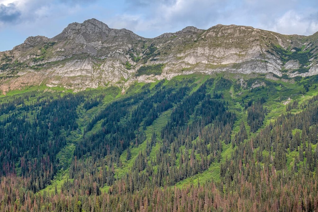
The major difference between the Misinchinka Ranges and the rest of the Hart Ranges is their rock composition. The Hart Ranges characteristically have thick quartzite and limestone formations that allow for precipitous slopes and castellated forms while the Misinchinka Ranges are made of a softer schist.
Due to the schistose rock of the Misinchinka Group, the mountains of the Misinchinka Ranges typically have rounded, wooded summits that are typically only up to 2,000 m (6,500 ft) tall. The Pleistocene ice sheets reached up to 2,130 m (7,000 ft) in elevation and scoured the soft schist peaks of the range.
Furthermore, many of the peaks of the Misinchinka Ranges were not affected by valley and alpine glaciers, leading to a unique topography within the Rocky Mountains. The Misinchinka Ranges are significantly subdued and less rugged than the stereotypically craggy Rocky Mountains, which are found to the south.
The Misinchinka Ranges contain three main ecological zones: the alpine, the subalpine forest of Engelmann spruce and subalpine fir, and finally the low-lying sub-boreal forests.
The alpine tundra in the ranges is generally barren with only meadows of sedges and heath. This is because of the tundra’s cold winters and short growing season, both of which make it difficult for any woody plants to grow, except in dwarf form. Due to the topography of the region, only the mountains north of Highway 97 have significant alpine tundra.
A parkland mosaic of small stands of trees and alpine meadows transition to the dense subalpine forests. Engelmann spruce and subalpine fir dominate the subalpine of the Misinchinka Ranges. Lodgepole pine is also common in the subalpine areas, especially in areas recently affected by forest fires.
The sub-boreal forests form a very insignificant portion of the Misinchinka Ranges ecology and are only found at the bottoms of the valleys. Since the growing season of the sub-boreal forests in the valley bottoms is slightly longer than the subalpine areas, hybrid Engelmann-white spruce can grow, in addition to subalpine fir and lodgepole pine.
The Misinchinka Ranges are home to many of the typical Canadian mammals. Elk and deer forage in the alpine meadows during the summer while bighorn sheep remain in the alpine during the winter, moving to steep slopes that resist the accumulation of snow. Caribou, mountain goats, grizzly bears, and moose also inhabit the Misinchinka Ranges.
White-tailed ptarmigan may be spotted among the rocky peaks during nesting season and golden eagles can be seen soaring over the mountains. Gray jays, ravens, and other robust birds are found throughout the range.
There are many migratory birds that come to the range during their season, while only a few, such as the pine grosbeak, red crossbill, great gray owl, and great horned owl remain all year. The seeds of the mature coniferous forests provide food for pine siskins, pine grosbeaks, and golden-crowned kinglets.
Human habitation and use of the Misinchinka Ranges likely began about 9,000 years ago after the glaciers had receded and plants and animals began to thrive in the region. The ranges are the traditional territory of the Tse’khene and the Denéndeh people.
During the eighteenth and nineteenth centuries, fur traders came west to expand the fur trade for the Hudson’s Bay Company and the North West Company. Alexander Mackenzie was exploring the region in 1793 and Simon Fraser established a camp near the ranges in 1808, from which he set off on his expedition to the Pacific Ocean.
While Highway 97 runs through the ranges, there has been very little development in the region. Forestry is currently the primary industry within the Misinchinka Ranges. Meanwhile there are mines in the Hart Ranges to the east and oil and gas development further east, in the Alberta prairies.
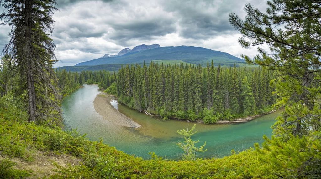
The wilderness of the Misinchinka Range is remote and rugged. The following are some beautiful parks to experience if you’re willing to get off the beaten path.
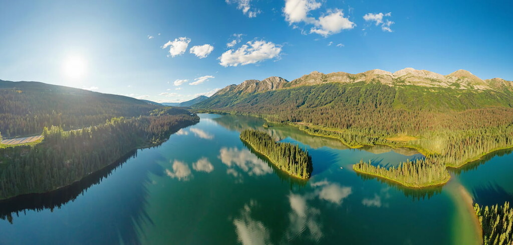
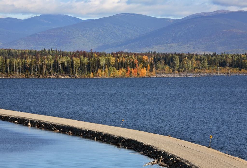
Arctic Pacific Lakes Provincial Park has a chain of lakes along the Continental Divide where water from the lakes flows west to the Pacific or north to the Arctic Ocean. The lakes are a stunning turquoise, and they are surrounded by steep cliffs with alpine peaks and ridges as a backdrop.
The lakes have a variety of fish species including lake trout, bull trout, rainbow trout, kokanee, dolly varden, mountain whitefish, redside shiner, lake char, and chinook salmon, as well as arctic grayling in Arctic Lake. The lakes provide excellent opportunities for anglers.
The easiest way to access the park is by canoeing from Arctic Lake through to Portage and finally Pacific Lake. The only trail in the park is the portage trail between Arctic and Pacific Lakes. The other secluded areas of the park are best accessed from the water.
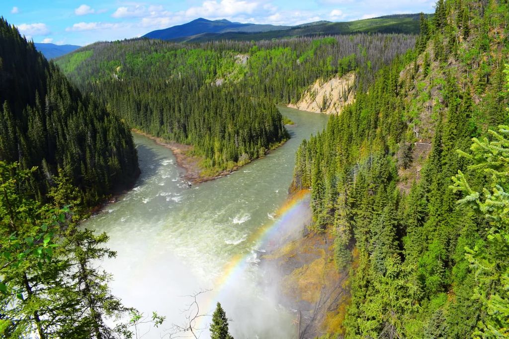
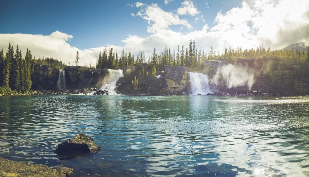
Located on the west side of the Misinchinka Ranges, Monkman Provincial Park is surrounded by rugged alpine peaks. It contains clear alpine lakes, thundering waterfalls, alpine meadows, scenic rapids, and forested valleys.
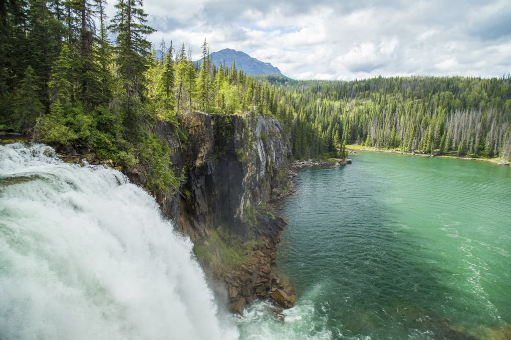
Day hikes to include in your next visit to the park are the short trails to Jade Falls, the Stone Corral Caves, and the mighty Kinuseo Falls. The 47 km (28 mi) Monkman Lake Trail is a fantastic way to explore the park and see the many waterfalls that are found throughout the region.
Pine Le Moray Provincial Park is located on the west side of the Hart Ranges where Highway 97 turns from a north-south highway to an east-west highway. While there are no official hiking trails in the park, there is a vehicle-access campground as well as two unofficial peak trails.
With regards to trails that start from Highway 97 on the west side of the park, one option is an 8.4 km (5 mi) out and back to the top of Mount Murray via Pine Pass. The other popular hike is to the ridge of the Murray Range. While it is not even 2.5 km (1.5) mi to the summit, it is a grueling and steep hike; however, the views of the Murray Range and the surrounding Hart Ranges, make it worthwhile.
A lodge was built at Pine Pass in 1945 to accommodate travelers and highway workers who were upgrading Highway 97. With the paved road, skiing and backcountry travel became popular activities in the pine pass area. There is currently a campground at Hart Lake that also offers access to the lake for swimming, boating, or fishing.
The Misinchinka is part of the Hart Ranges of the northern Rockies in northern British Columbia. The following are several towns and cities where you can find supplies and accommodations for your wilderness adventures.
The city of Prince George is considered the capital of northern British Columbia and its recent history can be traced back to the founding of Fort George, a North West Company trading post established by Simon Fraser in 1807. The city is located to the southwest of the Misinchinka Ranges at the junction of Highways 16 and 97.
Situated at the confluence of the Nechako and Fraser Rivers, with all the amenities of a modern city, including fine dining restaurants, cinemas, museums, a range of accommodations, and an international airport, the city has grown to become an important transportation and service hub to the north of British Columbia.
Off-roading is a popular pastime of locals in the region and there are well established clubs and areas to practice motocross and drive OHVs. The area also has vast wilderness areas that local hiking groups flock to as well as incredible opportunities for fish and other outdoor recreation.
Some of the most popular hikes around the city are the Cottonwoods Island Loop, the Greenway Trail to Shane Lake Loop, McMillan Creek Loop, Troll Lake, Kakwa Lake Trail, and Forests for the World Lookout.
Located on the west side of the Misinchinka Ranges off Highway 39, Mackenzie is a community nestled along the shore of Williston Lake. The municipality of Mackenzie is a great place for winter-loving outdoor enthusiasts, where they host dog sledding, cross country skiing, and snowmobiling competitions.
The community maintains 32 km (19 mi) of groomed cross country ski trail throughout the winter. Additionally, there are many trails nearby that are worth hiking if you’re in the area. Some of the recommended trails are the Morfee Lake Trails, Cut Thumb Falls, and the Kimta Creek Trail.
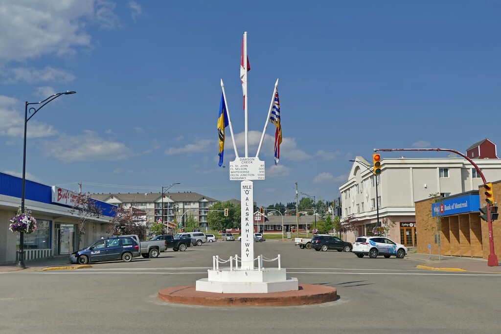
Dawson Creek is located northeast of the Misinchinka Ranges at the junction of Highway 2 and Highway 97. The area surrounding Dawson Creek has beautiful wilderness areas that are great for hiking, skiing, and OHV use. In addition to wilderness access, the city has an art gallery, a historical village, a museum, as well as annual fall fairs and a rodeo.
Some of the popular hikes around the city of Dawson Creek are the easy 1.8 km (1 mi) Leoppky Park Trail and the 9.7 km (5.8 mi) Dawson Creek Trail. There is also a moderate 7.4 km (4.4 mi) hike along the Rim Rocks Trail.


The highest peak in the Misinchinka Ranges is Sentinel Peak, at 2,513 m.
The Misinchinka Ranges have 38 named peaks.


