
Scan the QR code and open PeakVisor on your phone
Liard River Corridor Provincial Park has 1 named peak. The highest is Rocky Mountain Foothills at 864 m.
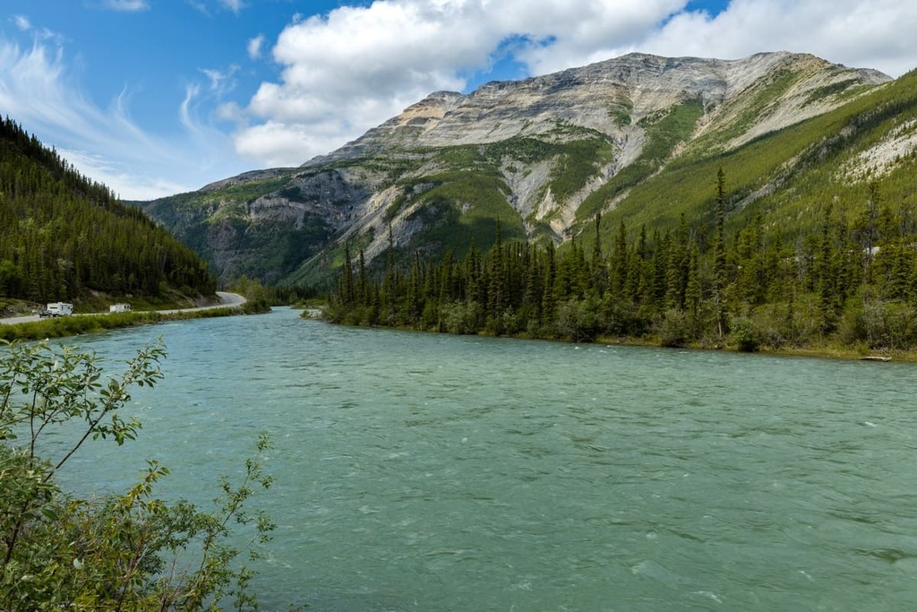
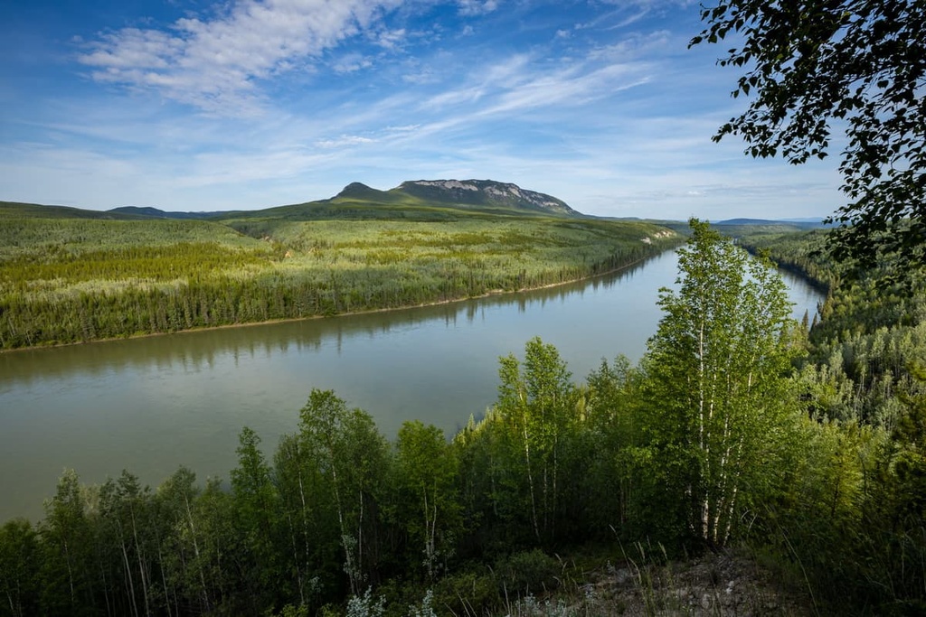
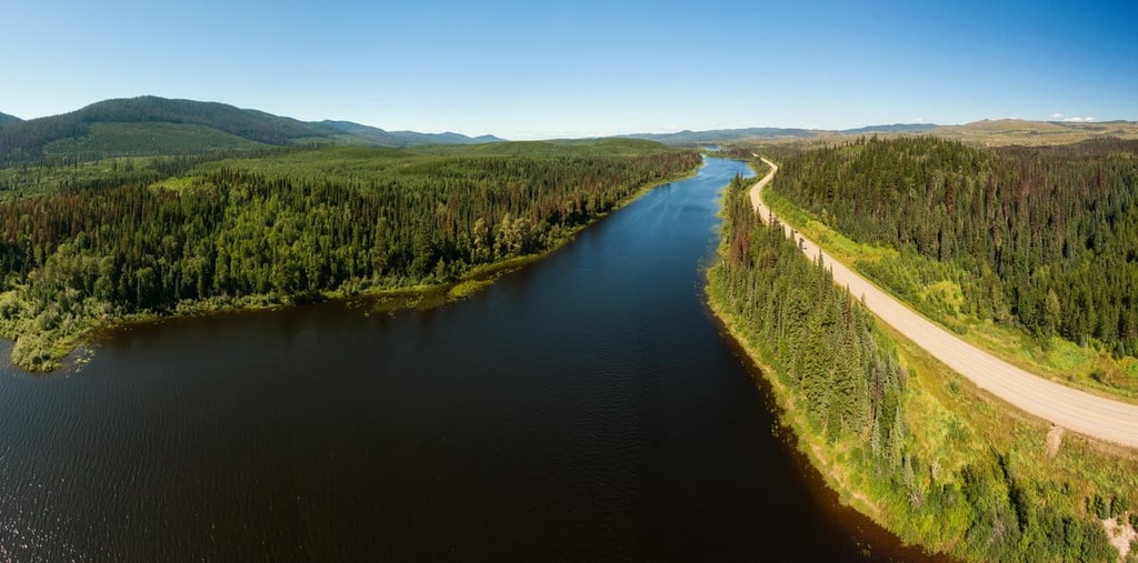
Located along the banks of the Liard River in northern British Columbia, Canada, Liard River Corridor Provincial Park is a protected area set along the boundary between the Muskwa Ranges of the Far Northern Rockies and the Liard Plain. The park encompasses over 83,000 hectares (320 square miles) of the northern wilderness of the Rocky Mountain Foothills.
Liard River Corridor Provincial Park is a protected area located in the Northern Rockies Regional Municipality of British Columbia, Canada. The park is situated in the foothills of the Muskwa Ranges of the Far Northern Rockies next to the banks of the Liard River.
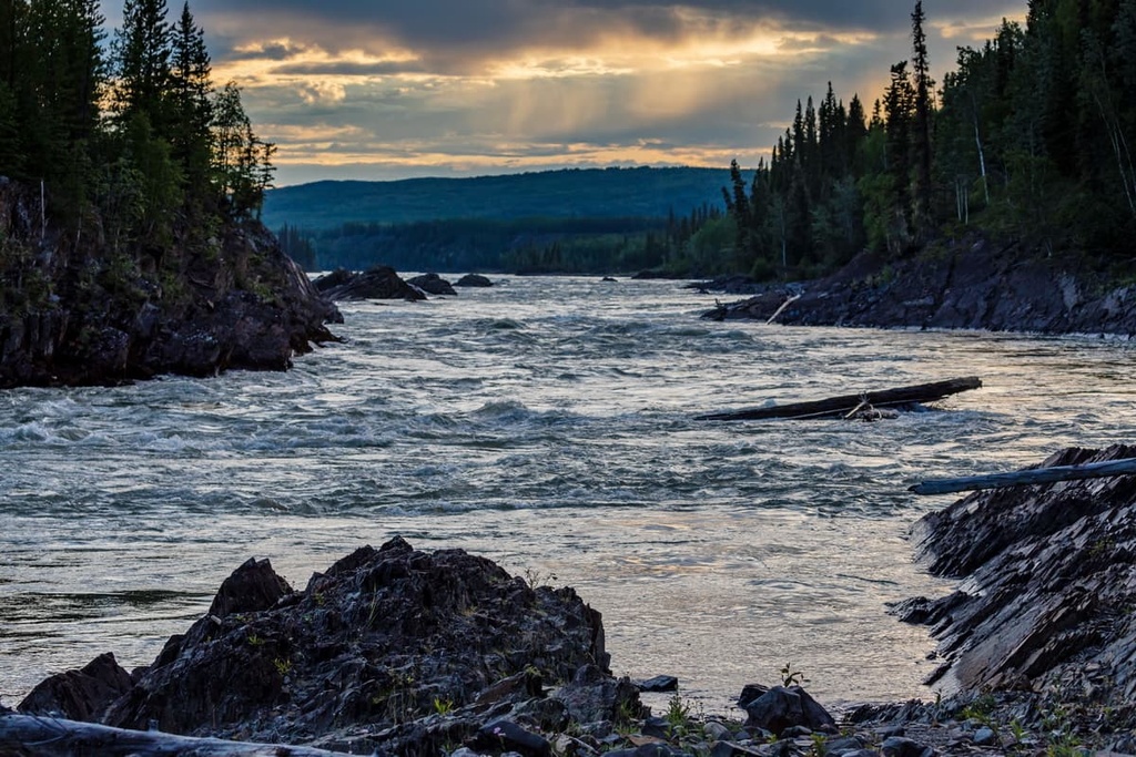
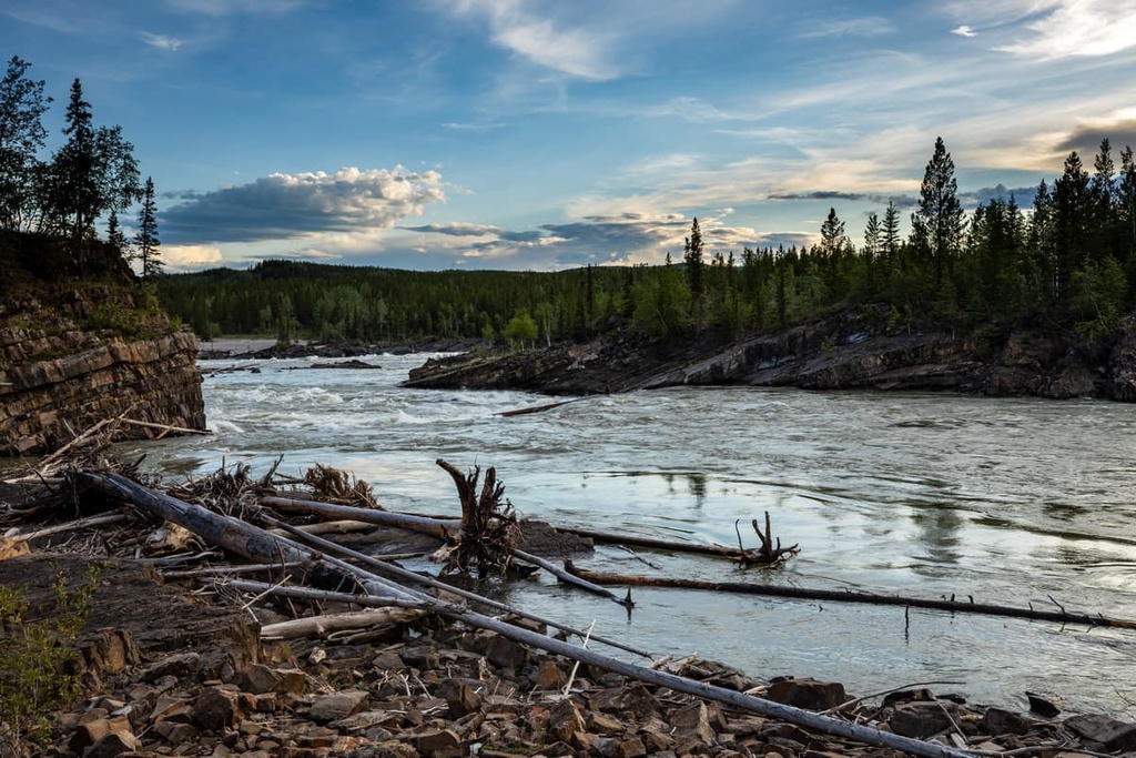
The Liard River forms the border between the Liard Plain and the northern end of the Canadian Rockies. The park encompasses a diversity of landscapes that range from old-growth spruce forests and upland plateaus to muskeg and the incredible rapids of the Liard River Grand Canyon.
Encompassing over 831 square kilometers (320 square miles) of terrain, Liard River Corridor Provincial Park is part of a series of connected protected areas that also includes Liard River West Corridor Park and Liard River Corridor Protected Area. In total, the protected areas along the Liard River encompass nearly 900 square kilometers (343 square miles) of pristine wilderness in northern British Columbia.
Some of the other parks that are located near Liard River Corridor Provincial Park include:
Liard River Corridor Provincial Park lies along the boundary between the Muskwa Ranges of Far Northern Rockies and the Liard Plain. The Rockies extend southward through British Columbia and Alberta and into the US. The Liard Plains extend northward into Yukon and the Northwest Territories of Canada.
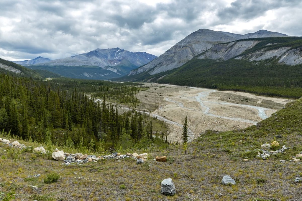
The park is located at the north end of the Sentinel Range, which is a subrange of the Muskwa Ranges. While the mountains that are situated to the south of the park and the plains that are located to the north of the park have different topographical features, their underlying geology is very similar.
The Liard River cuts through sedimentary deposits that formed along the ancient coastal margin of North America about 380 million years ago. This rock formed over the course of millions of years during the Paleozoic when sediment accumulated into thick layers of limestone. This limestone was later covered with sediments that eventually formed shale and mudstone during the Cretaceous.
The northern end of the Rockies and their foothills, where the Liard River is located, was one of the final mountain ranges created during the 40 million year-long Laramide orogeny, which was the mountain-building event that was primarily responsible for creating the Rocky Mountains.
During this orogeny, exotic terranes collided with North America and their underlying tectonic plates subducted. As a result, the Canadian Rockies began to form, primarily in the southeastern corner of what is now British Columbia near the province’s modern-day border with Alberta.
The subduction of the Farallon plate continued in a northerly trend along the west coast of Canada, compressing the ancient coastal plain that was found along the modern border of British Columbia and Alberta. The compression of the continent heated, folded, buckled, and ultimately broke and thrust up the layers of sedimentary rocks to create the Rocky Mountains.
As the Laramide orogeny ended, the Farallon plate shifted direction and stopped subducting beneath the west coast of Canada. This caused the end of the compression and uplift of the Rockies. The final dissipation of force from this tectonic collision created the foothills of northern British Columbia, through which the Liard River flows, though it left the northern and eastern plains relatively undisturbed.
However, while the Laramide orogeny left the plains intact, as the mountains uplifted in the cordillera, water began to flow eastward in massive rivers with strong, erosive currents. The flowing water eroded away the less erosion-resistant rocks in the region. It also carved out a series of isolated uplands, canyons, and plateaus, including the incredible Grand Canyon of the Liard River.
During the Pleistocene, glaciers converged in the Muskwa Ranges. These glaciers became part of the massive cordilleran ice sheet and they flowed eastward and northward from the range. The ice sheet scoured the mountains, rounded over lower peaks, and exited through the valleys. Above the ice sheet, cirque and alpine glaciers eroded away at the mountain peaks, carving out cirques and alpine valleys.
The cordilleran and continental ice sheets converged to the east Liard River Corridor Provincial Park in the eastern foothills along their border with the great plains. Glacial lakes then filled the lowlands with lake deposits and till plains while the plateaus were covered with a mantle of clay and sand.
There are two distinct ecological zones present in Liard River Corridor Provincial Park. The highest elevations in the park feature terrain that is consistent with the ecology of the subalpine Spruce-Willow-Birch zone because they are not high enough to be defined as part of the Boreal Altai Fescue Alpine Zone. At the same time, the park’s lowlands and plains are representative of the Boreal White and Black Spruce ecology.
Dwarf spruce, willow, and birch, as well as shrubs, heath, herbs, mosses, and lichens, grow on the tops of the foothills in the park. At lower elevations, the park’s forests are dense and full of taller trees; however, the high, wide valleys that are located along the river corridor collect the cold air, resulting in a mosaic of grasslands, scrub, and wetlands.
The lowest elevations of the Liard River corridor are filled with open forests of white spruce and subalpine fir. These forests eventually transition into the boreal forests of the Liard Plains and the Great Plains as you move toward the north and the east. The park’s boreal forests are a mix of black spruce bogs with stands of white spruce and trembling aspen.
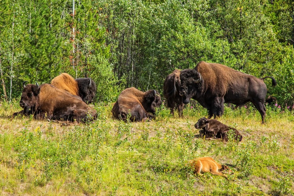
The park is also home to many rare and important animal species, such as free-ranging wood bison, moose, grizzly bear, Rocky Mountain elk, and many other animal species. The limited area of the park does not envelope the complete range of many of the above-mentioned animals, and therefore most species in the region migrate along the Liard River corridor a couple of times each year.
The land that’s located in and around Liard River Corridor Provincial Park is the traditional territory of the Métis Nation and the Dene First Nations. The Dene and the Métis have inhabited the region for countless generations.
Before European contact, the Métis and the First Nations of the region lived a traditional lifestyle that included seasonal rounds where people would move to different areas during the summer for hunting and harvesting so they could prepare themselves for the winter. Hunting big game, fishing, and harvesting tubers and berries were the major sources of sustenance for the early residents of this northern region.
The nomadic lifestyle of the Indigenous peoples of the region continued uninterrupted until the late eighteenth and early nineteenth centuries when European fur traders arrived in the area. The introduction of the fur trade to the Métis Nation and the Dene First Nations changed life in the region as we know it.
Many Métis and Dene began hunting and trapping fur-bearing animals to trade for goods with European traders. Indeed, trapping became a significant source of income for most people in the region for many decades. Only since the late twentieth century has the regional economy shifted away from the fur trade.
During the twentieth century, forestry, oil, and gas became major regional industries; however, due to falling prices of these resources and major economic downturns, the logging, oil, and gas companies across the region shut down and tourism became a major regional industry.
Northern British Columbia includes many remote natural treasures that are worth the effort to visit. One such natural gem is Liard River Corridor Provincial Park, which was established in 2001 to preserve the incredible Grand Canyon of the north.
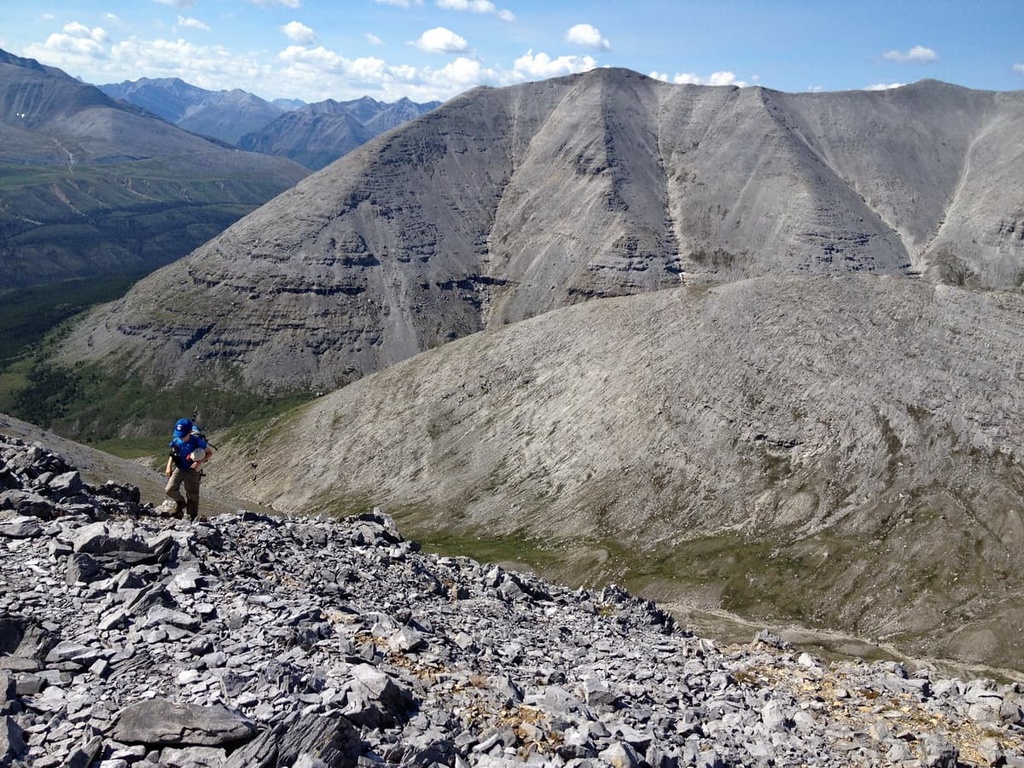
Northern British Columbia is a vast wilderness with endless forests, rugged mountains, stunning lakes, and raging rivers for residents and visitors to enjoy. While there are no official trails in Liard River Corridor Provincial Park, there are many different ways to travel in and through the park during your next trip to the region.
Even though there are no official trails in Liard River Corridor Provincial Park, the river corridor has been used by humans for generations, so there are several unofficial hiking routes that travel along the river and to nearby locations. There are also a number of routes that start from the highway and lead toward viewpoints of the Grand Canyon.
Additionally, there is a popular overland route that starts just east of the hot springs. This overland route first leaves the hot springs and leads along the north shore of the river around the base of Mount Ole. It then heads toward the Grand Canyon of the Liard.
There is a side trail along this route that takes you to an overlook with fantastic river views while the main trail leads to an outfitter’s lodge. The trail then leaves the Liard River, crossing the Deer River and ending several kilometers past Nordquist Lake. This overland trail is 57 km (34 mi) long one way.
The Grand Canyon of the Liard is a 30 km (19 mi) stretch of the Liard River that begins to the east of Liard River Hot Springs. The canyon contains many class IV and higher rapids, so it is recommended that only experienced paddlers attempt the canyon.
There are several hiking trails that start at the Alaska Highway and lead to views of the incredible canyon. One such hiking trail to the Grand Canyon follows an old BC Hydro road. The trail then crosses the Trout River and continues to the Grand Canyon. While the Trout River crossing can be hazardous, this trail provides foot and horseback access to the canyon.
The Liard River is an incredible destination for both fishing and boating. The river before the canyon is a wonderful place to boat and fish.
Additionally, there is a wonderful canoe trip that you can take down the Smith River to the Liard, which makes a great day trip. There are also many side drainages to explore from the river, and travelers can fish for Arctic grayling and bull trout while on the Liard.
Here are some of the major communities that are located in the vast wilderness that surrounds Liard River Corridor Provincial Park in northern British Columbia.
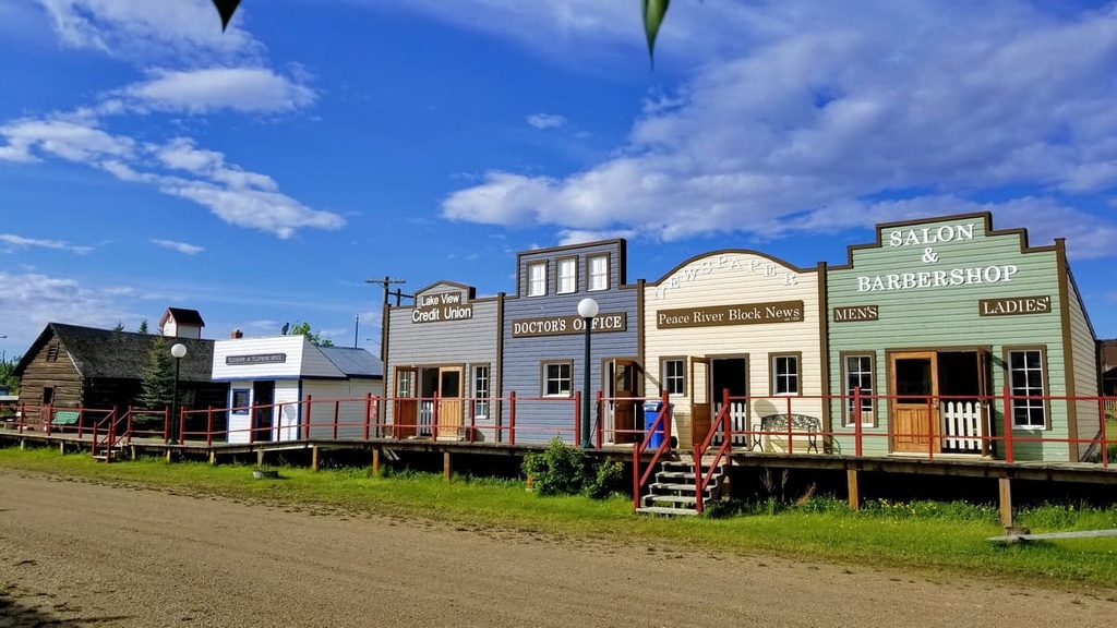
Originally established as a trading post for the North West Company in 1805, Fort Nelson is the largest community in the area around Liard River Corridor Provincial Park. Fort Nelson is located about 300 km (180 mi) to the southeast of the park, and the community officially became a municipality in 2006 after it amalgamated with the Northern Rockies Regional Municipality.
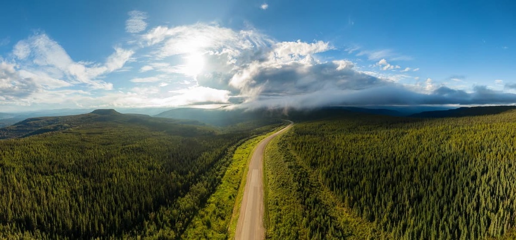
Fort Nelson is home to the region’s government and was the original “Mile 0” for the Alaska Highway before the road was extended to Dawson Creek. The Alaska Highway gives travelers access to some of the most rugged wilderness areas of northern British Columbia. It also provides easy access to the area around Fort Nelson, which is now located at Mile 300 (Kilometer 483) of the Alaska Highway.
As it is surrounded by dense boreal forests and pristine wilderness, Fort Nelson is located near several world-renowned attractions in the northeastern Rockies. Some of the major destinations that are situated near Fort Nelson include the hot springs in the Liard River Hot Springs Provincial Park and the Grand Canyon of the North in Liard River Corridor Provincial Park.
Initially established by Simon Fraser in 1807 as Fort George, Prince George was originally a North West Company trading post. Located some 1,100 km (660 mi) to the south of Liard River Corridor Provincial Park, Prince George is the transportation hub for northern British Columbia and a likely stop on your way to visit the northern reaches of the province.
The city features fine dining, cinemas, museums, a range of accommodations, and an international airport; however, the rugged northern wilderness is the main attraction of Prince George.
Some of the most popular hikes that are located in the areas around the city are the Cottonwoods Island Loop, the Greenway Trail to Shane Lake Loop, McMillan Creek Loop, Troll Lake, Kakwa Lake Trail, and Forests for the World Lookout.
Located to the east of the Northern Rockies, Dawson Creek is a community that’s situated some 760 km (456 mi) from Liard River Corridor Provincial Park. Dawson Creek also serves as Mile 0 for the famous Alaska Highway, which leads through northern British Columbia to the US state of Alaska.
The region surrounding Dawson Creek is home to beautiful wilderness areas that are great for hiking, skiing, and OHV-based adventure. In addition to its convenient access to the surrounding wilderness, the city of Dawson Creek boasts an art gallery, a historical village, and a museum, as well as annual fall fairs and a rodeo.
Some of the popular hikes that are located around the city of Dawson Creek are the casual 1.8 km (1 mi) Loeppky Park Trail and the 9.7 km (5.8 mi) Dawson Creek Trail. There is also a moderate 7.4 km (4.4 mi) hike along the Rim Rocks Trail that’s popular among residents and visitors. Dawson Creek is also a great rest stop for travels to any one of a number of incredible northern parks, such as Redfern-Keily Provincial Park, Northern Rocky Mountains Provincial Park, and Stone Mountain Provincial Park.


The highest peak in Liard River Corridor Provincial Park is Rocky Mountain Foothills, at 864 m.
Notable peaks in Liard River Corridor Provincial Park include Rocky Mountain Foothills.


