
Scan the QR code and open PeakVisor on your phone
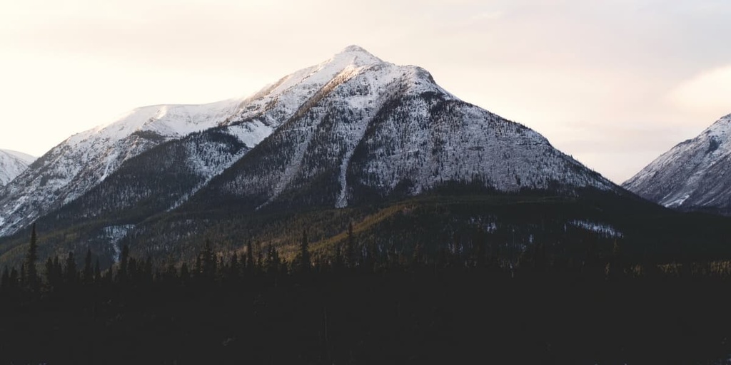
The Northern Rockies Regional Municipality is a unique municipality located in the northeastern part of the province of British Columbia in Canada. It is centered around the major population center of Fort Nelson and has 189 named peaks in its 85,014 sq. km (32,824 sq. mi) territory. The tallest and most prominent peak in the regional municipality is Mount Sylvia (2,926 m/9,633 ft).
The Northern Rockies Regional Municipality is located in the northeast corner of British Columbia, Canada. It shares its eastern border with the province of Alberta and its northern border with both Yukon and the Northwest Territories.
The regional municipality was previously part of the Fort Nelson–Liard Regional District, which later became the Northern Rockies Regional District. It is now known as the Northern Rockies Regional Municipality.
In 2009, Fort Nelson, the only incorporated town in the Northern Rockies Regional District, amalgamated with the district to become the Northern Rockies Regional Municipality. Nowadays, the entire 85,014 sq. km (32,824 sq. mi) area is run as a municipal government, with a mayor and councilors.
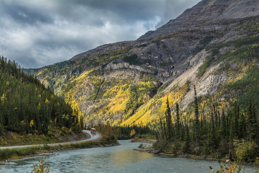
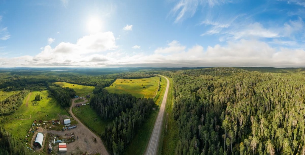
Highway 97 is the primary route through this mountainous and densely forested region. It runs from the Peace River Regional District in the south to Yukon in the north. Highway 77 branches off north of Fort Nelson and heads towards the Northwest Territories and Nahanni National Park Reserve. The Stikine Region is also situated to the west of the Northern Rockies Regional Municipality.
Fort Nelson is the major community in the region and it is home to the offices of the regional municipality. Most communities in the region are found along Highway 97, such as Prophet River, Toad Lake, and Muncho Lake.
There are 189 named peaks in the Northern Rockies Regional Municipality, of which Mount Sylvia is the tallest. Mount Sylvia has an elevation of 2,936 m (9,633 ft). It is also an ultra-prominent mountain with 1,553 m (5,095 ft) of prominence. There are nine additional mountains over 2,800 m (9,184 ft) in the regional district, including Arnhem Mountain, Dieppe Mountain, and Normandy Mountain.
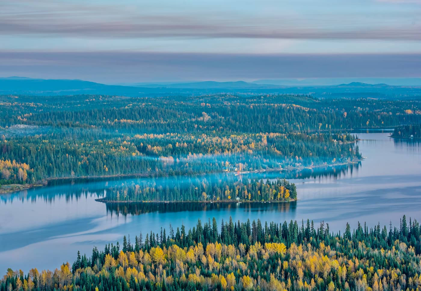
The densely forested and mountainous terrain of the regional municipality has many beautiful and noteworthy natural areas. The following are some of the protected areas in the Northern Rockies Regional Municipality:
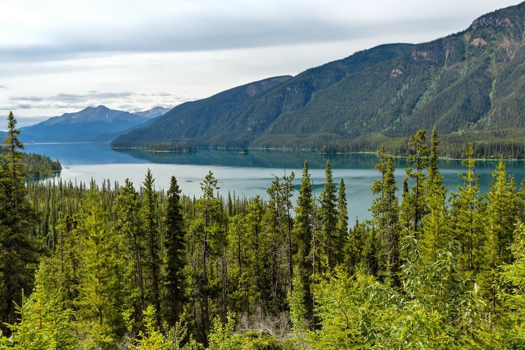
Physiographically, the Northern Rockies Regional Municipality stands in stark contrast to the mountains in the west of the region and the plains in the east; however, the geology and rocks that underlie the whole area are quite similar in nature and origin.
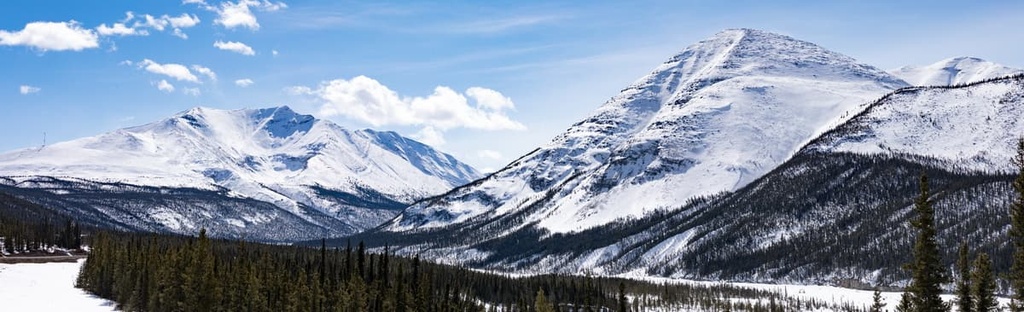
The mountains in the west of the regional municipality are part of the Muskwa Ranges of Far Northern Rockies. Some of the sub ranges include the Stone Range, Sentinel Range, and the Barricade Range.
The Rabbit Plateau, Etsho Plateau, and the Poplar Hills are transitional areas between the mountains and the plains in the regional district. Additionally, the Liard Plains cover the rest of the regional municipality to the east of the Rocky Mountains.
While the mountains and plains in the regional municipality have very different topographical features, their underlying geology is very similar. Most of the rocks in the Northern Rockies Regional Municipality formed as sedimentary deposits along the ancient coastal margin of North America about 380 million years ago.
Over the course of millions of years, during the Paleozoic, sediment accumulated into thick layers of limestone, which was later covered with silts of shale and mudstone during the Cretaceous. The Far Northern Rockies formed during the Laramide orogeny, which was a 40 million year-long mountain building event that started about 75 million years ago.
During the Laramide orogeny, the western coast of North America, including the broad coastal plain, was compressed, heated, folded, buckled, and ultimately broken and thrust up to create the Rocky Mountains.
However, the force of the orogeny dissipated with the formation of the foothills along the eastern slopes. This left the plains relatively flat and undisturbed by the massive tectonic events that created the western cordillera.
However, as the mountains uplifted in the cordillera, water began to flow eastward in massive rivers with strong, erosive currents. The flowing water eroded the less resistant rocks to carve the region into a series of isolated uplands and plateaus.
During the Pleistocene, glaciers converged in the Muskwa Ranges to become part of the massive cordilleran ice sheet. The cordilleran ice sheet scoured the mountains, rounding over lower peaks and scouring the valley, while cirque and alpine glaciers serrated the mountain peaks, as well as carving cirques and alpine valleys.
The ice sheets in the great plains extended from the east and from the north to the south and the west. They often converged with the cordilleran ice sheet during the Pleistocene. Glacial lakes then filled the lowlands with lake deposits and till plains, while the plateaus were covered with a mantle of clay and sand.
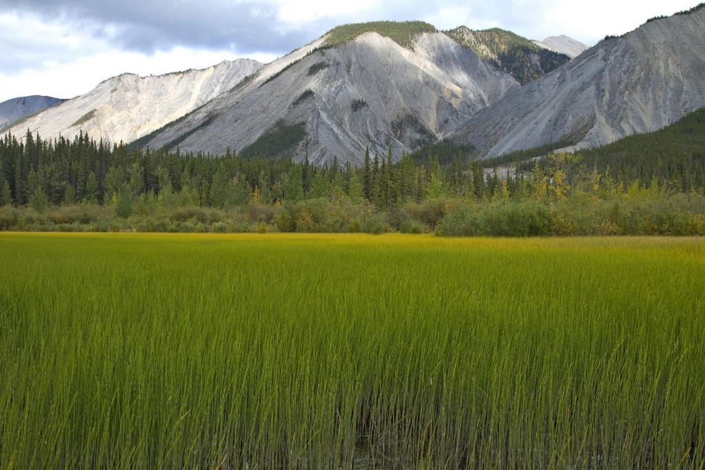
The Northern Rockies Regional Municipality has three different ecologies. At the highest elevations, the Boreal Altai Fescue Alpine Zone dominates. Meanwhile, the subalpine is consistent with the ecology of the Spruce-Willow-Birch zone and the lowlands and plains are representative of the Boreal White and Black Spruce ecology.
The alpine zones in the regional municipality are typically considered to be barren, rocky, tundra; however, there are areas of alpine parkland that have stands of trees interspersed with alpine meadows.
The trees in these areas are typically dwarf fir and spruce. But some deciduous willow and scrub birch may also grow in the near-alpine. The trees in the alpine are stunted and the highest elevation trees in the area are usually thickets of gnarled and windblown krummholz.
Dwarf shrubs, heath, herbs, mosses, and lichens grow in the alpine; however, these trees are more abundant in the subalpine where they can grow to taller heights. The subalpine of the Northern Rockies Municipal District often has high, wide valleys that collect the cold air, which results in a mosaic of grasslands, scrub, and wetlands in the subalpine.
The lowest elevations in the regional municipality are full of open forests of white spruce and subalpine fir, which transition to the boreal forests of the Liard Plains and the Great Plains that extend north and east, across northern Canada.
The boreal forests are a mix of black spruce bogs with stands of white spruce and trembling aspen. Numerous forest fires over the millennia have created successional forests of lodgepole pine and aspen.
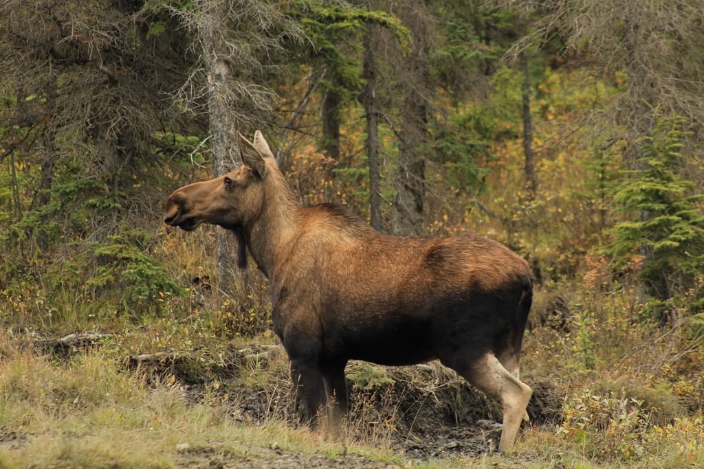
The rich ecology and the diverse topography of the region have created the habitats for many unusual and important species. The area is home to free-ranging woods bison, moose, grizzly bear, Rocky Mountain elk, and many other animal species.
During the Pleistocene, glaciers and ice sheets covered most of North America; however, there were periods when the cordilleran and continental ice sheets receded sufficiently to allow an ice-free corridor along the eastern slopes of the Rocky Mountains. The Pleistocene ice-free corridor is a potential way that ancient peoples may have migrated into North America.
The Northern Rockies Regional Municipality is the traditional territory of the Métis Nation and the Dene First Nations. The Dene and the Métis have inhabited the region for countless generations.
Before European contact, the Métis and the First Nations of the region lived a traditional lifestyle that included seasonal rounds, moving to different areas during the summer for hunting and harvesting to prepare themselves for the winter.
The nomadic lifestyle of the Indigenous peoples of what is now the Northern Rockies Regional Municipality continued uninterrupted until the late eighteenth and early nineteenth centuries when European fur traders arrived in the region.
The introduction of the fur trade to the Métis and the Dene First Nations changed life in the region as we know it. Many Métis and Dene began hunting and trapping the fur-bearing animals to trade for goods with European traders. Fort Nelson was constructed in 1805 as an outpost for the fur trade. It remains the only community with more than 1,000 residents in the entire regional municipality.
Indeed, trapping became a significant source of income for most people in the region for many decades. Only during the late twentieth century has the regional economy shifted away from the fur trade.
During the twentieth and the beginning of the twenty-first centuries, forestry, oil, and gas became major regional industries; however, due to falling resource prices and major economic downturns, the logging, and oil, and gas companies across the region shut down.
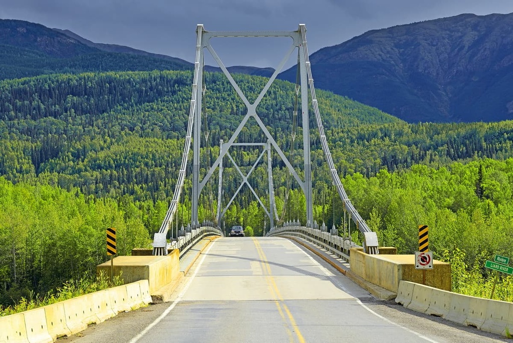
Currently tourism is the major industry in the Northern Rockies Regional Municipalities. Most of the tourism industry in the region caters to travelers of the Alaska Highway (Highway 97).
Many people traveling the Alaska Highway stop at Fort Nelson to refuel and stock up on provisions before heading into the most remote stretch of the highway. The smaller communities of Toad River and Muncho Lake also have gas stations, campgrounds, restaurants, and, in some cases, backcountry lodges and airports, all of which offer services to tourists on the highway.
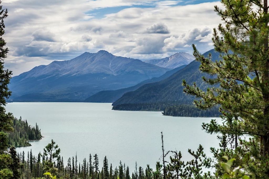
The Northern Rockies Regional Municipality is a vast wilderness with endless forests, rugged mountains, stunning lakes, and raging rivers.
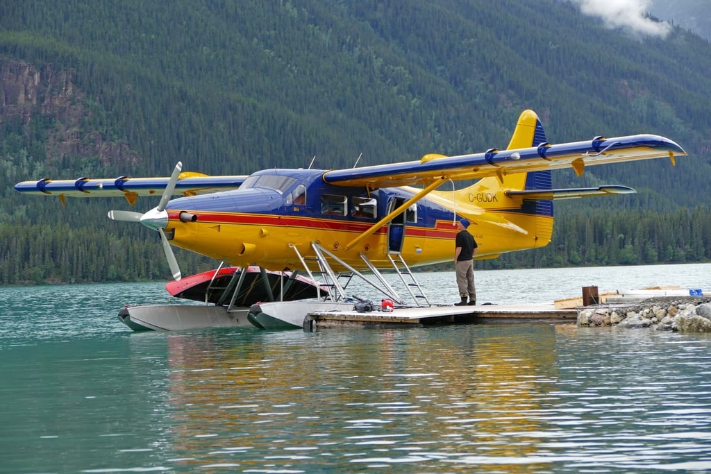
Before 1948, the only way to travel the region was by boat, horse, foot, or float plane. The Alaska Highway was constructed during World War II, and we now have relatively easier access to some of the majestic wilderness of northern British Columbia.
The following are some of the popular hiking areas and attractions of Northern Rockies Regional Municipality:
The Liard River Hot Springs are the largest natural hot springs in Canada. They are found in Liard River Hot Springs Provincial Park, in the Northern Rockies Regional Municipality. The hot springs are a river of hot water as opposed to a spring-fed pool, and, as such, there is a diverse ecosystem surrounding the warm waters.
Many bird and mammal species take advantage of the warm waters in the hot springs. For example, bears and moose are known to frequent the region’s warm swamps. The park also has unique flora, including 14 species of orchids. All of this unique flora and fauna inspired early travelers to originally call the area the “Tropical Valley.”
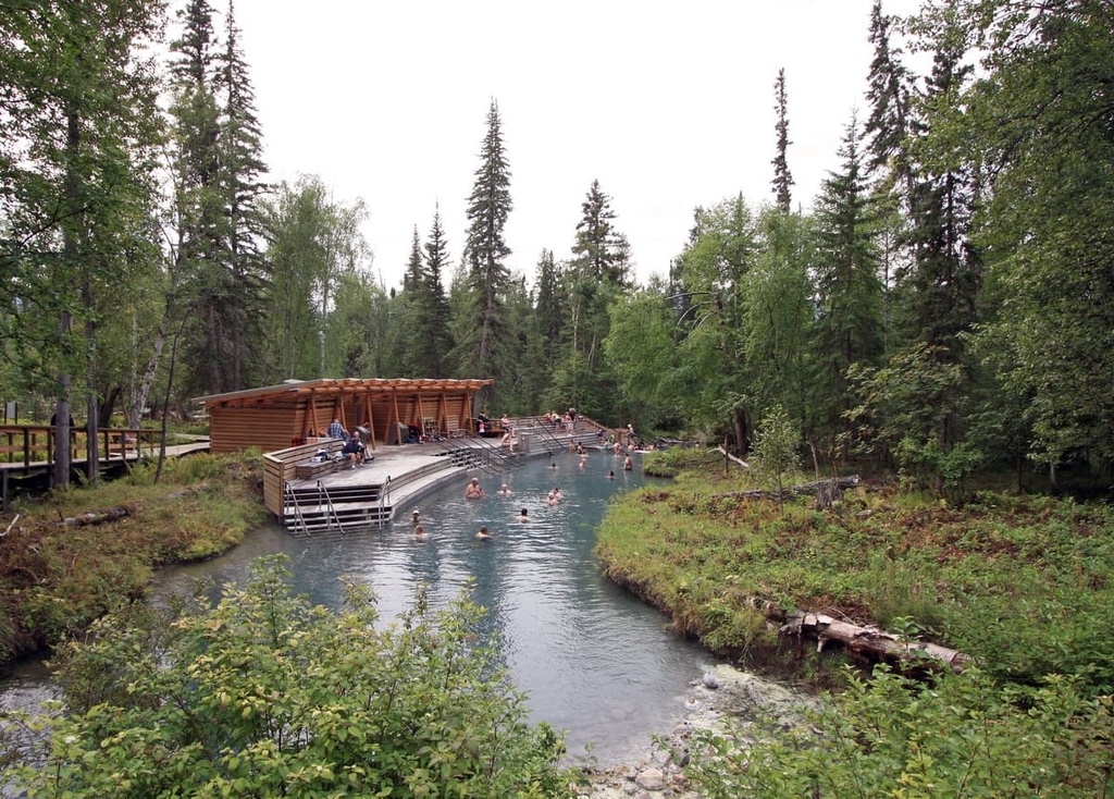
The park features a boardwalk from the parking lot that travels over the delicate muskeg to the bathing areas. There is a vehicle-accessible campground, change houses, and a playground in the park, too.
Stone Mountain Provincial Park is an outdoor recreation area found along the Alaska Highway in the Northern Rockies Municipal District at the north end of the Muskwa Ranges. The provincial park offers opportunities for canoeing, hiking, angling, horseback riding, and camping.
Stunning alpine meadows, waterfalls, hoodoos, and alpine lakes are some of the many attractions of the park. Popular day hikes in the park include the Summit Peak Trail, Erosion Pillars Trail, and Flower Springs Trail. Popular backpacking trails include MacDonald Creek Valley Trail and the Wokkpash Valley-MacDonald Creek Loop Trail.
Northern Rockies Provincial Park is located along the southern border of the Northern Rockies Regional Municipality. It is partly located within the Peace River Regional District. The park borders Stone Mountain Provincial Park and Kwadacha Wilderness Provincial Park.
Along the region’s major rivers, there are primitive campsites and many trails. Most of the trails along the creeks and rivers were created by local outfitting companies; however, none of these are well maintained. Canoeing and kayaking are the main transportation throughout the park, with hiking excursions going out from the rivers.
Some of the main activities of the park are hiking, backpacking, trail riding, mountaineering, and canoeing. Some of the popular canoe trips in the park follow the Tuchodi River and the Muskwa River.
The Northern Rockies Regional Municipality is a vast wilderness in northeastern British Columbia. The following are some of the major communities in and around the region:
Fort Nelson is the only large community in the Northern Rockies Regional Municipality. It was technically a town before it was amalgamated with the Northern Rockies Regional Municipality in 2006.
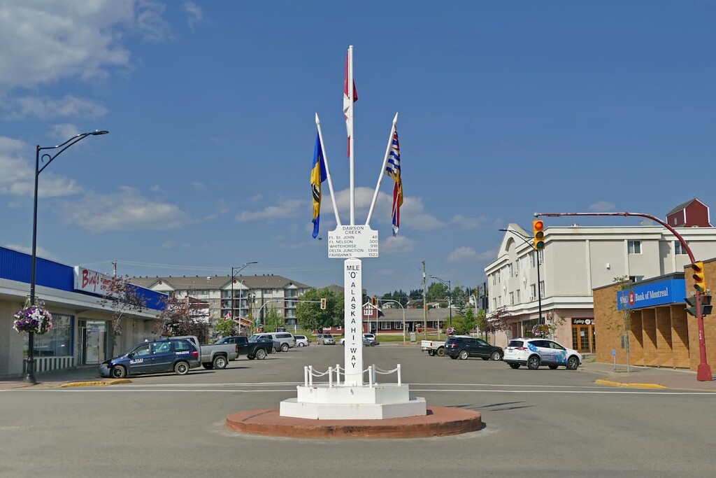
The community was initially established as a trading post for the North West Company in 1805, and it is the current home of the region’s government.The community was the original “Mile 0” for the Alaska Highway before the road was built through to Dawson Creek.
The Alaska Highway gives access to some of the rugged wilderness in northern British Columbia and around Fort Nelson, which is now located at Mile 300 of the Alaska Highway.
Fort Nelson is surrounded by dense boreal forests and is near several world-renowned attractions in the northeastern part of the Rockies. Some of the attractions near Fort Nelson are found in the Liard River Hot Springs Provincial Park and Muncho Lake Provincial Park. Popular activities include hunting, fishing, snowmobiling, dog sledding, bird watching, and hiking.
Prince George was originally founded as Fort George, a North West Company trading post established by Simon Fraser in 1807. The city is located 800 km (480 mi) to the south of Fort Nelson and is the transportation hub for northern British Columbia.
While the city features fine dining, cinemas, museums, a range of accommodations and an international airport, the rugged northern wilderness is the main attraction for the city. Off-roading is a popular pastime of locals in the region and there are well-established clubs and areas to practice motocross and drive OHVs.
The area also has vast wilderness areas that local hiking groups flock to as well as opportunities for fishing and other outdoor recreation activities. Some of the most popular hikes around the city are the Cottonwoods Island Loop, the Greenway Trail to Shane Lake Loop, McMillan Creek Loop, Troll Lake, Kakwa Lake Trail, and Forests for the World Lookout.
Located to the east of the Northern Rockies, Dawson Creek is located some 480 km (300 mi) from Fort Nelson. The community saw its most significant population growth when it became Mile 0 for the Alaska Highway in 1942.
Dawson Creek is a gateway city to Alaska and the wilderness and communities of northwestern Canada. The area surrounding Dawson Creek has beautiful wilderness areas that are great for hiking, skiing, and OHV use. In addition to wilderness access, the city has an art gallery, a historical village, a museum, as well as annual fall fairs and a rodeo.
Some of the popular hikes around the city of Dawson Creek are the casual 1.8 km (1 mi) Loeppky Park Trail and the 9.7 km (5.8 mi) Dawson Creek Trail. There is also a moderate 7.4 km (4.4 mi) hike along the Rim Rocks Trail.


