Scan the QR code and open PeakVisor on your phone
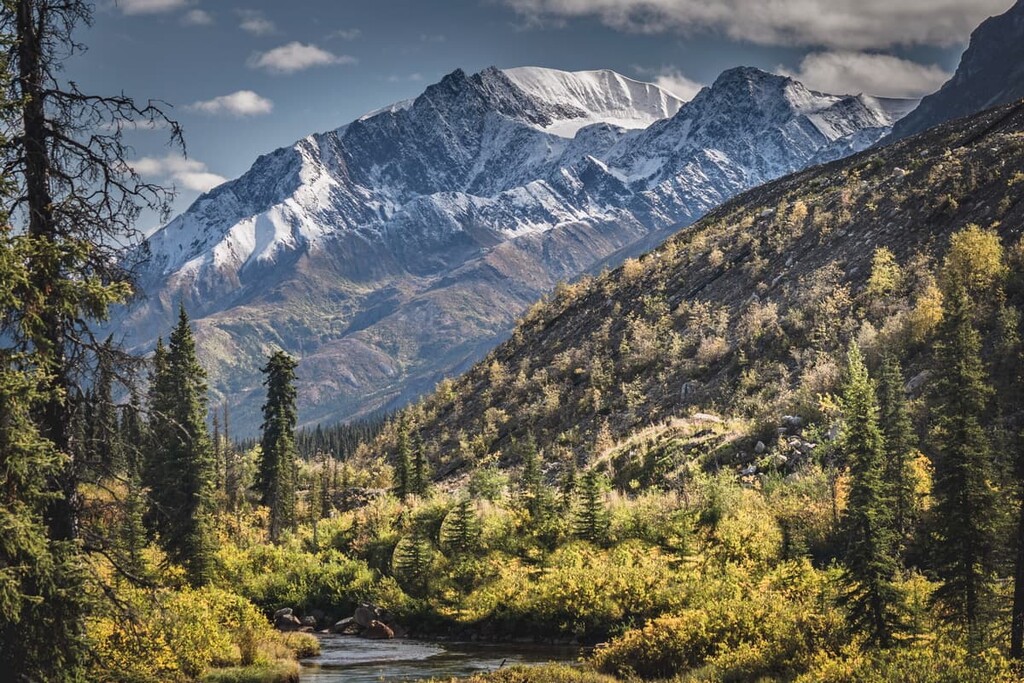
Nahanni National Park Reserve is 30,050 sq. km (11,602 sq. mi) of spectacular landscape that’s located in the southwest corner of Northwest Territories, Canada. The South Nahanni River is a highlight of the park as it features canyons that reach 1,000 m (3,300 ft) in depth. The park contains 94 named peaks, the highest and most prominent of which is Mount Nirvana with an elevation of 2,773 m (9,098 ft) and a prominence of 1,661 m (5,449 ft).
Located in the Dehcho Region in southwest Northwest Territories, Nahanni National Reserve is 30,050 sq. km (11,602 sq. mi) of protected wilderness. The spectacular landscape of Nahanni was recognized in 1978, the inaugural year of UNESCO World Heritage Sites.
Nahanni National Park was one of the first four Natural World Heritage Sites to be recognized, alongside Simien National Park in Ethiopia, the Galapagos Islands of Ecuador, and Yellowstone National Park in the United States.
The name Nahanni comes from the Dene language, which is traditionally spoken by the Indigenous residents of this part of what is now the Northwest Territories. The name for the area is Nahʔa Dehé, which means "river of the land of the Nahʔa people". The name references the South Nahanni River, which has been flowing through the park for millions years.
Access to the park is through the community of Nahanni Butte of the Nahɂą Dehé Dene Band of the Dehcho First Nations. The community is located along Highway 7 ( Liard Highway), which is a gravel highway that connects most of this remote territory. Nahanni National Park Reserve is about 500 km (311 mi) west of Yellowknife.
Fort Simpson is located to the east of the park and Fort Liard is located to the southwest of the park. All these communities have airports, which provides a vital link to the rest of the country as well as air transport into and through Nahanni National Park Reserve.
With sheer granite spires, vast alpine plateaus, 1,000 m (3,300 ft) deep canyons, mineral springs, tufa mounds, and incredible karst formations, Nahanni National Park Reserve holds incredible geological wonders that were recognized in 1978 as a UNESCO World Heritage Site.
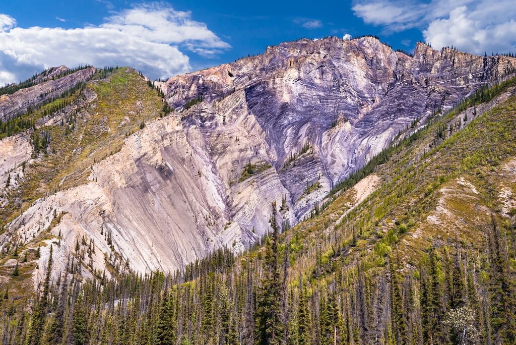
The landscape of Nahanni National Park Reserve started forming 500 million years ago as sediment accumulated on the seafloor. For 300 million years, sediment accumulated into layers of limestone and dolomite from marine life as well as layers of sandstone and shale that was deposited into the sea by continental rivers. The sediments accumulated to a depth of over 6,000 m (19,680 ft).
As North America began colliding with the tectonic plates under the Pacific Ocean, the Mackenzie Mountains started to rise and magma was forced near the surface. The magma didn’t erupt as volcanoes, instead, massive igneous intrusions into the sedimentary rock, called batholiths, formed. As the sedimentary rock eroded, the granite towers that make up the Cirque of the Unclimbables and Vampire Peaks in the Ragged Range were left behind.
The South Nahanni River had been flowing along its course before the Mackenzie Mountains began to form. The South Nahanni is a rare example of an antecedent river which means that the river was strong enough and the mountains rose slowly enough that the river maintained its course over history.
Nahanni National Park Reserve was named as a UNESCO World Heritage Site for the spectacular geological formations and landscapes within the park. The following are the geologic wonders in Nahanni National Park Reserve.
The Ragged Range is located along the northwest boundary of the park, near the border with Yukon. The name comes from the spectacular formations of granite peaks. The granite peaks were created from igneous intrusions into the sedimentary layers at the beginning of the formation of the Mackenzie Mountains over 100 million years ago.
The magma pushed up on the sedimentary layers and cooled into formations called batholiths. The sedimentary layers subsequently eroded, leaving the durable granite peaks which were further shaped by the Pleistocene glaciers. The Ragged Range and Nahanni National Park Reserve are a mountaineer’s playground as they feature spectacular climbs in the Cirque of the Unclimbables and Vampire Peaks.
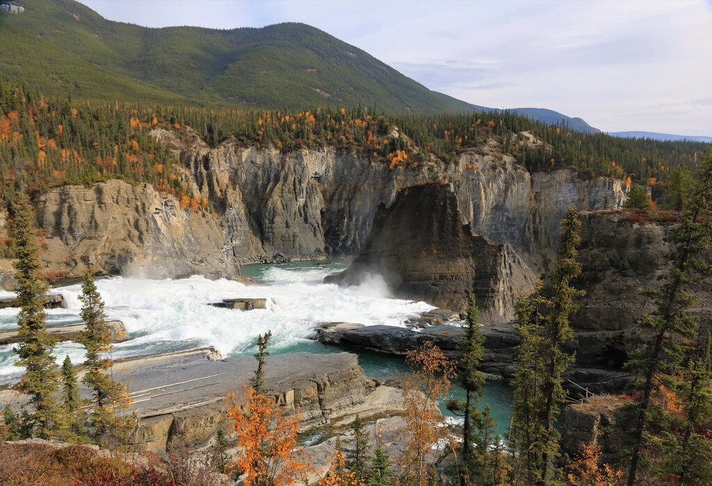
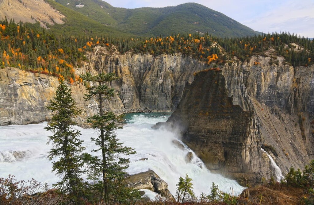
Virginia Falls is where the placid South Nahanni River comes together and starts to pick up speed before it funnels together and plunges over a fall of 92 m (301 ft). The falls are divided by a central rock that has resisted erosion as the falls have migrated upstream. The falls have gradually migrated upstream creating Fourth Canyon. It was the final canyon to be named by prospectors as they travelled upstream.
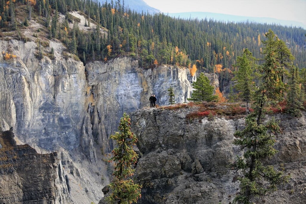
For over 100 million years, the South Nahanni has been flowing and eroding away at the landscape as the mountains were being uplifted. The four main canyons of the river were carved over millions of years to be upward of 1,000 m (3,300 ft) deep.
Downriver from Fourth Canyon is the 40 km (24 mi) stretch of Third Canyon hats through the mountains of the Funeral Range. The walls of Third Canyon are typically long slopes that were created as the river cut through layers of sandstone, shale, and limestone.
A feature of Third Canyon that emphasizes that the South Nahanni was flowing before the mountains were formed is The Gate, where the river makes a sharp turn and continues through a narrow gap that is flanked by a 460m (1,508 ft) limestone wall.
Second Canyon flows through the Headless Range and leads into Deadman Valley where Tlogosho Plateau backdrops a massive alluvial fan that dominates the valley. Many shorebirds inhabit the fan, such as sandpipers, for which the fan is an important nesting area. The valley and fan are also a popular stop for paddlers making their way down the South Nahanni.

Beginning after Deadman Valley, the river flows through the 30 km (18 mi) long First Canyon. First Canyon has the highest and steepest walls of all the canyons as the South Nahanni cut through the resistant limestone for millions of years. The river eroded the resistant limestone as it was raised up 1,000 m (3,300 ft) creating one of the most dramatic landscapes in the park.
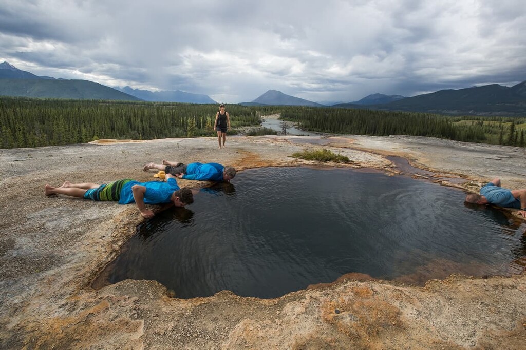
At over 30 m (98 ft) tall and 60 m (196 ft) wide, the tufa mound that is referred to as the North Mound is believed to be over 10,000 years old. These magnificent tufa mounds formed thanks to the Rabbit kettle Hot Springs and other hot springs around the park.
The hot springs are created from rain and melt water that percolated deep into the earth where it was heated by geothermal energy. The hot water is then forced up along the faults which were created as the mountains formed, and the water comes out as a hot spring.
The deeper the water travels and the longer it stays underground, the hotter the water gets and more minerals dissolve into the water. Once the water springs from the earth and starts to cool, the minerals precipitate and build up as the tufa mounds.
The Rabbitkettle Hot Springs and other places in the park have special meaning in the culture of the Dene and Métis. Gifts of tobacco are often left at the springs and if the springs are overflowing, it is seen as a sign of good luck.
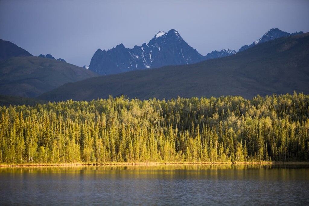
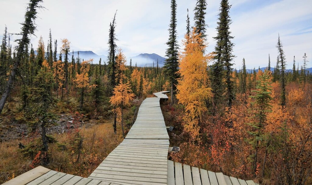
There are two main ecozones in Nahanni National Park Reserve: the Taiga Plains and the Cordillera. The Taiga Plains are found in the east of the park while the cordillera dominates the western reaches of the region.
The Taiga Plains of Nahanni National Park Reserve are part of the vast tracts of relatively flat land that spread across northern Canada. The land is characterized by peat plateaus, thermokarst lakes, and permafrost.
The typical vegetation in this ecozone resed canopy boreal forests that are dominated by white spruce, black spruce, and deciduous paper birch. Scattered stands of aspen and jack pine may also be found in this area.
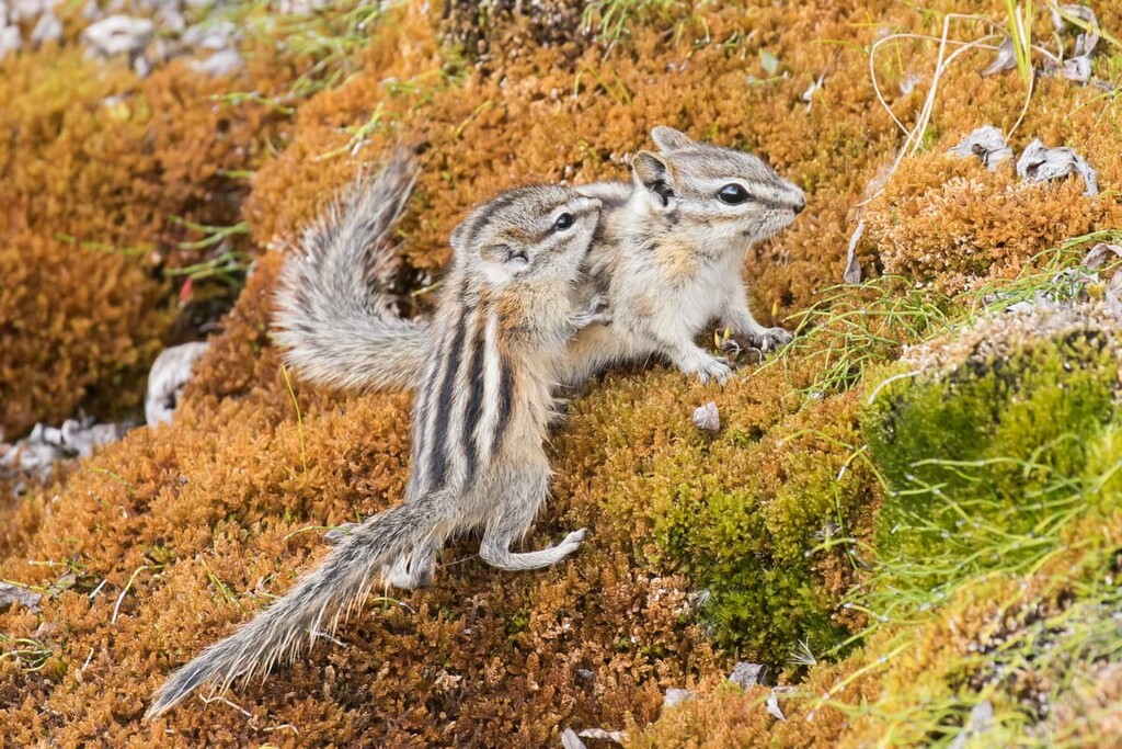
The Taiga Shield has the greatest representation of animals of all the ecozones of the Northwest Territories. There are 50 mammal species and over 250 bird species that may be found in the eastern edges of Nahanni National Park Reserve.
Major bird species in the region include bald eagles, osprey, falcons, hawks, owls, and ducks. The Taiga Shield has important northern breeding grounds for many duck species.
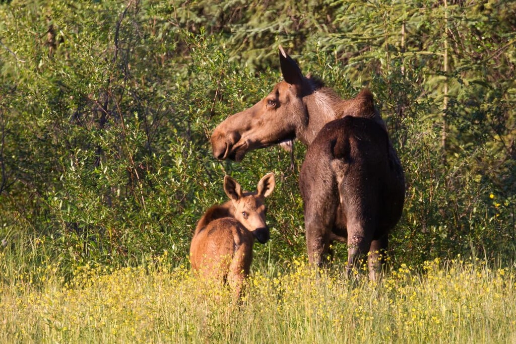
The large mammals include many ungulates (hooved animals) species, such as several caribou species, muskoxen, moose, white-tail and mule deer, elk, and wood bison. There are also many carnivores, including grizzly bears, black bears, lynx, wolves, red foxes.
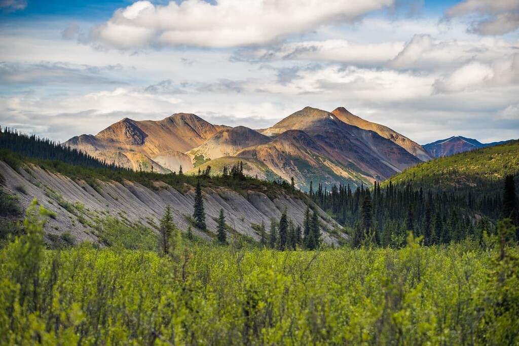
The Cordillera is a landscape that rises from the plains, first as rolling hills that soon transition to rocky ridges, eroded plateaus and finally to the rugged granite peaks of the Ragged Range at the western edge of the park. The mountains are cut by U-shaped glacial valleys and the deep V-shaped canyons that rivers formed over thousands of years.
Most of the species of birds and mammals are the same as the Taiga Shield and the Taiga Plains; however, there are several species that are unique to the mountain ecology. Trumpeter swans, dusky grouse, and white-tailed ptarmigan live in the cordillera. Dall sheep and mountain goats are mammals that are unique to the mountainous areas of the park and aren’t found on the plains.
Nahanni National Park Reserve is in Dehcho Region, which is the least populated area of the Northwest Territories. Fort Simpson is the only village-sized municipality, with 1,200 inhabitants. There are fewer than 1,000 people living in the other five communities.
The first human occupation of the area is estimated to have occurred 9,000 to 10,000 years ago. The Dene people have been living on the lands around Nahanni National Park Reserve for thousands of years. Evidence of human occupation has been found at Yohin Lake, which is at the eastern border of the park along the South Nahanni River near the modern community of Nahanni Butte.
Local oral histories often refer to a mountain-dwelling people called the Naha. The Naha were said to have come down from the mountains to raid the lowland settlements; however, these people are said to have quickly and mysteriously disappeared.
Fur traders expanded into the region by the eighteenth century and more people came to the region with Alexander Mackenzie’s exploration of the Mackenzie River and the construction of trading posts at Fort Simpson and Fort Liard. By the nineteenth century most Dene families left their nomadic lifestyles and moved to permanent communities close to the trading posts and worked in the fur trade.
Many local First Nations traveled down the Nahanni River each spring in 20 m (66 ft) long canoes, loaded with their winter fur harvest. The canoes, which were constructed from six to ten moose hides that were stretched over a spruce frame, were then disassembled and traded along with the other furs. The families would hike home, carrying their supplies on their backs and their pack dogs.
At the close of the nineteenth century, the north was overtaken by the Klondike Gold Rush. While the gold was found in Yukon, there were many that attempted to travel via the South Nahanni River to reach the Klondike. Many others tried to find their fortune on the banks of the Flat and South Nahanni Rivers.
No significant gold was found along the South Nahanni; however, there are several grisly tales that came from that time. The legendary lost mine of the McLeod brothers is supposed to have been where the brothers found their gold; nevertheless, they and many prospectors who came after did not make it out alive. The park features of Deadmen Valley, Headless Creek, Headless Range, and the Funeral Range bear testimony to the fate of many that came searching for gold.
The untimely demise of people continued well into the twentieth century with the disappearance of Jack Patterson, a geologist who disappeared in 1946. Patterson’s partner was reported as saying, “There is absolutely no denying the sinister atmosphere of that whole valley. The weird, continual wailing of the wind is something I won’t, soon forget.”
In 1964, there was a turning point for the region when Jean Poirel, a traveler from Montreal visited the South Nahanni River and surrounding region. During his expeditions, Poirel documented more than 250 caverns, one of which contained 116 Dall’s sheep skeletons embedded into the permafrost walls that dated back to 2,500 BCE.
Poirel escorted Prime Minister Pierre Trudeau in the park in 1972, after which Trudeau established the original Nahanni National Park. Further agreements made with First Nations, land claims were settled, and by 2009, 30,050 square kilometers (11,602 square miles) were designated as part of the Nahanni National Park Reserve which is to be co-managed between the Dehcho First Nations and Parks Canada.
The Nahanni National Park Reserve has some of the most spectacular landscapes in the world. It would likely take a lifetime to fully explore the vast wilderness and destinations in the park. The following are some of the incredible attractions and activities in the park.
Near the downriver end of First Canyon two thermal sources create the Kraus Hot Springs. The springs are named for Mary and Gus Kraus who lived at the springs from 1940 to 1971. The water springs from the earth at 32°C (91°F) creating a soothing environment for relaxation. The warm springs created an exotic ecosystem in the northern reaches of Canada and this location is likely the source of many legends and myths of tropical forests in the north.
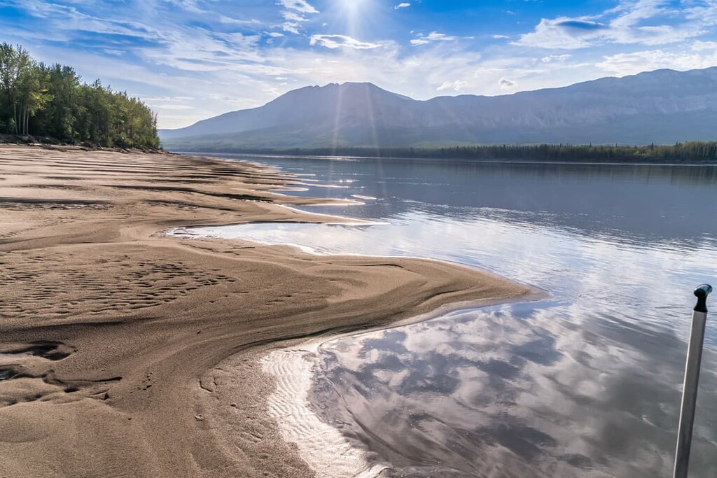
Outcrops of white sandstone have been eroded by the wind into softly rounded domes, pedestals, and arches at the Sand Blowouts. Sandstone spheres from marble to tennis ball size are found across the fine sand that is more evocative of a beach or desert than the high mountain forest in which it is found.
The Virginia falls are found at the top of the Fourth Canyon along the South Nahanni River. The South Nahanni funnels together at this point to pour over a 92 m (301 ft) drop. The current falls are split by Mason’s Rock, which was named after the famous Canadian canoeist, author, and filmmaker. The rock has resisted the incredibly erosive force of the river.
With the inclusion of the Sluice Box Rapids above the falls, the Virginia Falls are twice as high as Niagara Falls. The falls were originally located at the east end of Fourth Canyon; however, over the centuries, erosion has shifted the falls upriver, creating the 8 km (5 mi) canyon. The mist from the falls has created an environment where several rare orchid species can grow.
The Kraus Hot Springs which are found in the park contain high levels of sulfur that prevents the tufa mounds from forming as they have at Rabbitkettle Hot Springs. The Rabbitkettle Hot Springs are home to the largest tufa mounds in Canada. The largest, called the North Mound, is 30 m (98 ft) tall and 60 m (196 ft) wide.
The water comes from deep in the Earth’s crust near the base of the granite batholiths that make up the Ragged Range. As the water cools and the calcium carbonate particles precipitate, rims form around the pools of water.
The mounds themselves are believed to be over 10,000 years old. Visitors to the area must be accompanied by Parks Canada staff and observe special restrictions to protect these fragile features.
The Nahanni Karst is considered among the most spectacular examples of this landform known to humankind. The limestone landscape was molded by rainwater over millennia to create caves, towers, and arches of a quality rarely seen outside the tropics. There are incredible labyrinths of corridors formed from hundreds of meters of caves, sinkholes, and shafts.
There are over 250 caves in the region documented by Jean Poirel, including the cave where the remains of Dall’s sheep are found embedded in the permafrost. There are also karst canyons where the water disappears underground to reappear from the karst springs that feed the South Nahanni and Ram Rivers.
The Nahanni National Park Reserve is a mountaineering playground that relatively few get to visit. The Ragged Range has two areas with incredible granite routes that are famous in the climbing community. The Cirque of the Unclimbables is as daunting as the name implies and the Vampire Peaks are an imposing set of peaks in the park. Mountaineers visit the area from across the world to experience these incredible routes and to reflect upon the solitude of this isolated wilderness.
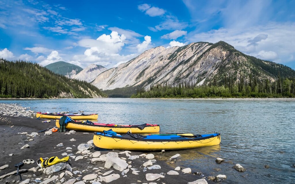
River trips along the South Nahanni can start as far north as Nááts’įhch’oh National Park Reserve at the headwaters of the river. The river trips are famous for combining a cultural experience with challenging white water. The river is 147 km (88 mi) from Virginia Fall to Kraus Hot Springs, with an additional 35 km (21 mi) to the park boundary.
With names such as Canyon Rapids, Figure Eight Rapids at Hell’s Gate, and Wrigley’s Whirlpool, the Class II and III rapids of the river are sure to challenge and excite travelers. However, while the rapids are exciting, travelling by river also gives visitors the opportunity to take day hikes and treks from the river into the surrounding mountains. The river experience is sure to saturate your senses and immerse your spirit in the wild Nahanni.
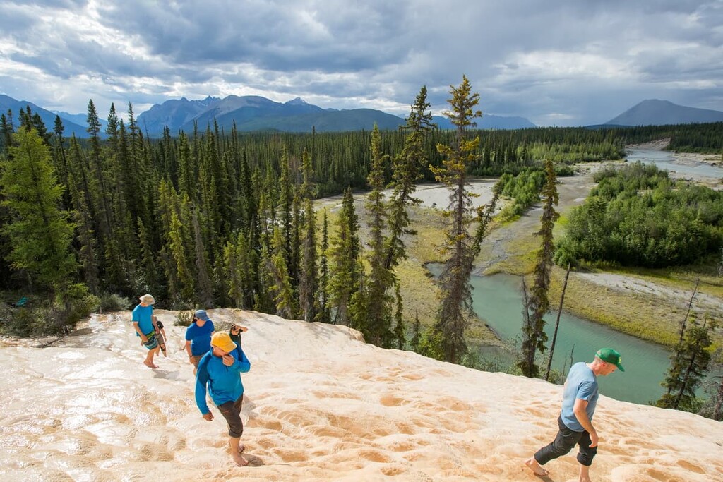
There are spectacular opportunities for hiking in Nahanni National Park Reserve. With the vast size of the park and the complete lack of roads, the main access to hiking is either by boat from the river or by plane or helicopter. Additionally, there are no official trails in the park; however, many of the popular trails are becoming more defined as visitors continue to visit the region.
Some of the popular hikes are Glacier Lake, which is the gateway to the Ragged Range and the Cirque of the Unclimbables. The Secret Lakes are a series of small, deep lakes that are nestled in a steep- sided mountain valley. Other destinations are Sunblood Mountain and Marengo Falls which are accessible from the Virginia Falls campground.
While paddling down the river there are also Scow Creek, Prairie Creek, Sheaf Creek, Dry Canyon Creek, Ram Creek, and Lafferty Creek to explore.
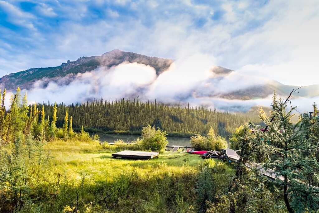
There are no public roads in Nahanni National Park Reserve, so visitors typically access the park through a chartered plane or ambitious overland routes. The park office for Nahanni National Park Reserve is found in Fort Simpson, Northwest Territories. Overnight visitors must register before they enter the park and deregister upon their safe return. The following are ways to access the park.
Most visitors travel to the park via a chartered floatplane. Many of the regional communities, including Fort Simpson and Yellowknife in the Northwest Territories, Muncho Lake in British Columbia, and Watson Lake in Yukon have charters available. Travelers should ensure that the carrier has the proper permits to land in the national park and that the pilot is familiar with the region.

While most people visit the park to travel the South Nahanni River, there are day trip services available from Fort Simpson. Planes can land at Virginia Falls and Glacier Lake for day trips. The only other landing sites in the park are at Bunny Bar, Island Lake, Honeymoon Lake, Seaplane Lake, and Rabbitkettle Lake.
While there are no public roads in Nahanni National Park Reserve, there are several overland routes. It is possible to reach the headwaters of the South Nahanni at the Mooseponds by travelling one of several ambitious and demanding routes east across the continental divide from Yukon.
Other visitors choose to access the park through the former mining town of Tungsten. The road to Tungsten is not maintained and is impassable at times and requires a four-wheel drive vehicle. Access to the park from Tungsten requires paddling either the Little Nahanni River or Flat River to descend to the South Nahanni. Both rivers from Tungsten contain Class IV and V rapids that require expert paddling skill.