
Scan the QR code and open PeakVisor on your phone
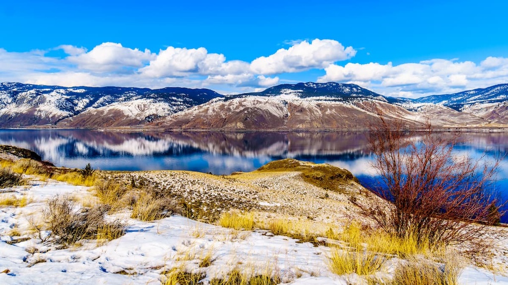
The Thompson-Nicola Regional District is an administrative region located in the interior of the province of British Columbia in Canada. Located on the between the Thompson and Fraser Rivers on the Thompson Plateau, the Thompson-Nicola Regional District has 376 named peaks, the tallest of which is Mount Monashee with 3,275 m (10,745 ft) of elevation.
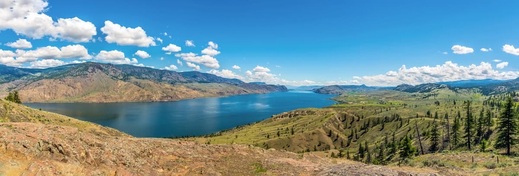
Situated in the interior of British Columbia, Canada, the Thompson-Nicola Regional District is named for David Thompson and Chief Nicola, two influential people in the history of the region. The regional district covers parts of the Fraser Plateau, the Thompson Plateau, and the Columbia Mountains.
There are 382 named peaks in the Thompson-Nicola Regional District, of which Mount Monashee is the tallest with 3,275 m (10,745 ft) of elevation and 2,402 m (7,881 ft) of prominence. Skihist Mountain is the seventh tallest mountain in the district; however, it is the most prominent with 2,968 m (9738 ft) of elevation and 2,467 m (8,094 ft) of prominence.
The Thompson-Nicola Regional District is situated to the south of the Cariboo Regional District, and to the west of both the Regional District of North Okanagan and Central Okanagan. The Regional District of Okanagan-Similkameen is also located to the south of the Thompson-Nicola Regional District.
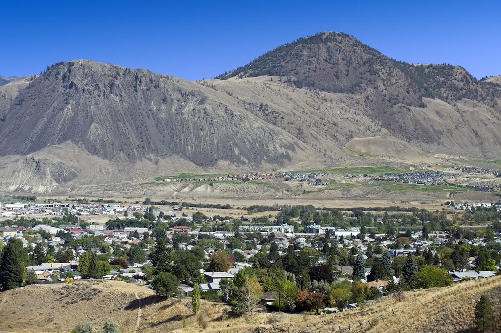
The Trans-Canada Highway (Highway 1) and Highway 5 are the major transportation routes through the district. They lead to the regional capital of Kamloops and to the only other city in the region, the city of Merritt.
Enveloping the spectacular wilderness and landscapes of the interior plateaus, Thompson-Nicola Regional District has dozens of provincial parks and protected areas. The following is a list of some of the many parks in the region.
The Thompson-Nicola Regional District encompasses three major geological zones. The first geologic zone is the Interior Plateau, which includes the Fraser Plateau, the Thompson Plateau, and the Shuswap and Quesnel Highlands. The other zones are Monashee Mountains of the Columbia Mountains and the Chilcotin Ranges of the Coast Mountains.
The mountains and plateaus of British Columbia were created during several different events that started over 500 million years ago as sediment accumulated on the seafloor off the western coast of North America. As the North American plate began to collide with tectonic plates under the Pacific Ocean, the Columbia Mountains began to form.
During the formation of the Monashee Mountains and the rest of the Columbia Mountains, additional land was added to the west coast of the continent. This happened as island arcs and micro continents accreted to the western edge as their tectonic plate subducted beneath the continent.
The accretion of these terrains and the subsequent tectonic collision helped to form the Coast Mountains. Following the formation of the western cordillera, lava erupted over the interior of British Columbia, creating the vast plateaus that are present today.
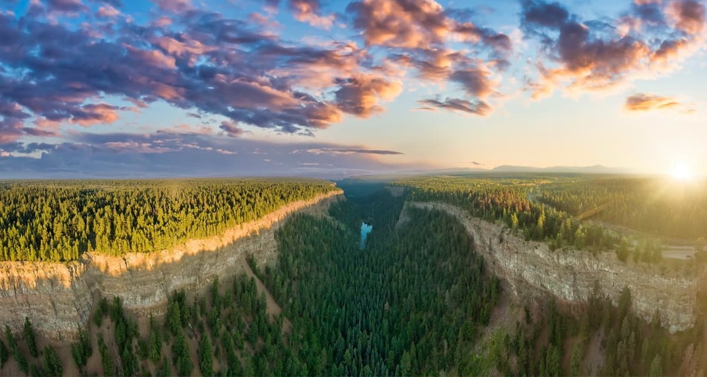
The Fraser Plateau is the northern end of the Thompson-Nicola Regional District. It is home to the youngest rocks in the region. In fact, about 5 million years ago, volcanic eruptions covered the plateau in a thick layer of basalt.
The Thompson Plateau has a great diversity of rocks, including basaltic lava, Paleozoic sedimentary rocks, and granitic intrusions. The major lava flows over the Thompson Plateau started about 60 million years ago and were likely the result of crustal thinning.
The Quesnel and Shuswap Highland are situated between the plateaus and the Columbia Mountains. These highlands are heavily dissected remnants of the previous terranes. As the region contains a substantial amount of schist, the highland was easily eroded during the Pleistocene to create the current topography. The mountains across the plateaus and highlands are the remnants of Paleozoic limestone and quartzite.
The plateau was covered with glaciers during the Pleistocene. These glaciers scoured the plateau, leaving behind only the most durable rocks. Many of the mountains in the region have a granitic core that resisted the massive glacial erosion of the Pleistocene.
The plateaus are also covered with a thick layer of glacial till. As such, there are many drumlins and eskers found in the region. The highlands were heavily eroded from the glacial run-off, and many of the large lakes, such as Shuswap Lake, are kettle lakes that formed in the faults of the region.
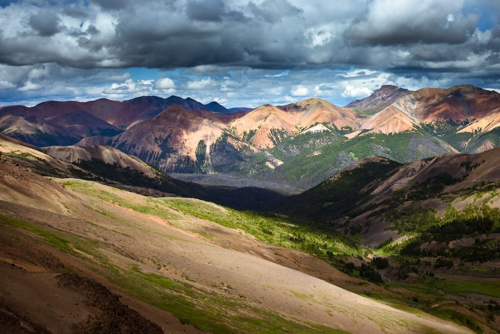
The Monashee Mountains are a subrange of the Columbia Mountains. They are located on the west side of the Thompson-Nicola Regional District. The Monashee Mountains are composed of Paleozoic and Mesozoic sedimentary and metamorphic rocks as well as batholiths that date back as far as the Cretaceous.
The northernmost peaks of the range above 2,440 m / 8,000 ft in elevation were tall enough to sit above the Pleistocene ice sheet; however, they underwent significant erosion from alpine and cirque glaciers. The lower elevation peaks in the range underwent significant glaciation, a process that eventually created sawtooth ridges and Matterhorn-like peaks.
The western side of the Thompson-Nicola Regional District includes the Camelsfoot Range of the Chilcotin Mountains. The Chilcotin Mountains form the east side of the Pacific Ranges, which are part of the Coast Mountains.
The Chilcotin Mountains are primarily composed of Mesozoic volcanic and sedimentary rock, with small granitic intrusions. The mountains rise up from the plateaus in the east to the taller, granite core mountains of the rest of the Pacific Ranges. During the Pleistocene, alpine and cirque glaciers scalloped the northern slopes and eroded the valleys, altering the region’s topography in the process.
There are many factors that affect the ecology of the Thompson-Nicola Regional District, such as latitude, elevation, proximity to the ocean, as well as the topography of the Coast Mountains. Precipitation is the main factor that differentiates the two major ecologies in the region: the rain shadow-induced dry zone and the wet belt.
The eastern slopes of the Chilcotin Mountains, as well as the Thompson and Fraser Plateaus, are generally located in the rain shadow of the Pacific Ranges. As such, they experience less than average rainfall. The rain shadow is a result of the prominence of the Pacific Ranges and the effect that these mountains have on local weather patterns.
As the warm, moisture laden air blows east from the Pacific, the air cools and condenses as it gains elevation over the mountains, forcing it to drop its moisture as rain or snow in the Pacific Ranges. This creates a rain shadow across the plateaus. The dry plateaus are typically covered with forests of Douglas fir and lodgepole pine.
The river and lake valleys are even drier and hotter than the plateaus. Indeed, they have parkland-like forests of ponderosa pine and Douglas fir. The understory and meadows are dominated by drought-resistant grasses. Along the lower terraces of the river valleys, the heat is the most intense, and the rainfall is the least. As such, only drought resistant grasses and sagebrush tend to grow in these areas.
While the rain shadow plateaus are arid, there is still an abundance of wildlife, especially in the winter. This is because most species in the region that don’t hibernate will migrate to the plateaus, which are warmer and have less snow. Moose, elk, mountain goats, coyotes, grizzly bears, and black bears are all common mammals across the plateaus.
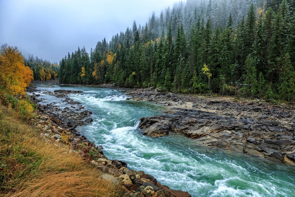
The interior wet belt includes the western side of the Chilcotin Ranges as well as the Monashee Mountains on the east side of the Thompson-Nicola Regional District. The valleys are filled with the temperate rainforests of western hemlock and western red cedar.
Douglas fir and lodgepole pine are transitional tree species that extend upward from the dry plateaus. Meanwhile, hybrid spruce and subalpine fir start growing at higher elevations along the mountain slopes. Moving up from the valleys, the hemlock and cedar are replaced by Engelmann spruce and subalpine fir.
Since Engelmann spruce tend to live longer than subalpine fir, the canopy at lower elevations is usually dominated by Engelmann spruce; however, the subalpine fir is cold-tolerant and thrives along the tree line, where spruce doesn’t grow well.
In the Columbia Mountains, the forests thin towards the peaks, leaving the alpine to be covered with alpine meadows of heather, herbs, and grasses. The tops of the mountains tend to be barren and rocky, except where sedges grow along the edges of the enduring spring and summer snowpack.
The Thompson-Nicola Regional District has been inhabited by humans for the last 10,000 years. There is mixed opinion on who the first inhabitants of the region were; however, it is known that the ancestors of many of the modern First Nations of the region arrived about 4,000 years ago, except for the Ktunaxa.
The Nlaka’pamux, Syilx, Secwepemc, and the Ktunaxa have called the region home for thousands of years. The Nlaka’pamux (Thompson), Syilx (Okanagan), and Secwepemc (Shuswap) First Nations are all part of the Interior Salish culture, which moved inland from the west coast about 4,000 years ago.
It is speculated that the Salish’s skill in fishing helped them thrive in the region. The Interior Salish traditionally migrated to camping sites in the summer to gather resources before returning to live in a community of pit houses for the winter.
However, the Ktunaxa (Kootenay) are distinct from the Interior Salish culture and are not closely related to other First Nations in the region. The Ktunaxa lived primarily in the Columbia and Kootenay River Valley, on the west side of the Rocky Mountains; however, they would hunt, trade, and travel from the eastern slopes of the Rockies to the western slopes of the Columbia Mountains.
Fur traders of European descent first reached the Thompson Plateau in 1811. By 1862, smallpox had reached the interior of British Columbia, killing at least two-thirds of the Indigenous peoples in the region. Accounts of the time tell of entire villages dying, with bodies scattered around the village, as there was nobody left to bury the dead.
After the smallpox epidemic, settlers of European descent began to arrive in full force and claim the land for industry and agriculture. As a result, ranching and forestry are the major industries that developed in the Thompson-Nicola Regional District.
Many families came to the region to work the land and make a living. The Ray and Majeur families were homesteaders in what is now Wells Gray Provincial Park, where their homes and outbuildings remain. Tourism has now become a primary industry as Kamloops has worked to build the infrastructure to become the Tournament Capital of Canada, hosting over 100 sports tournaments each year.
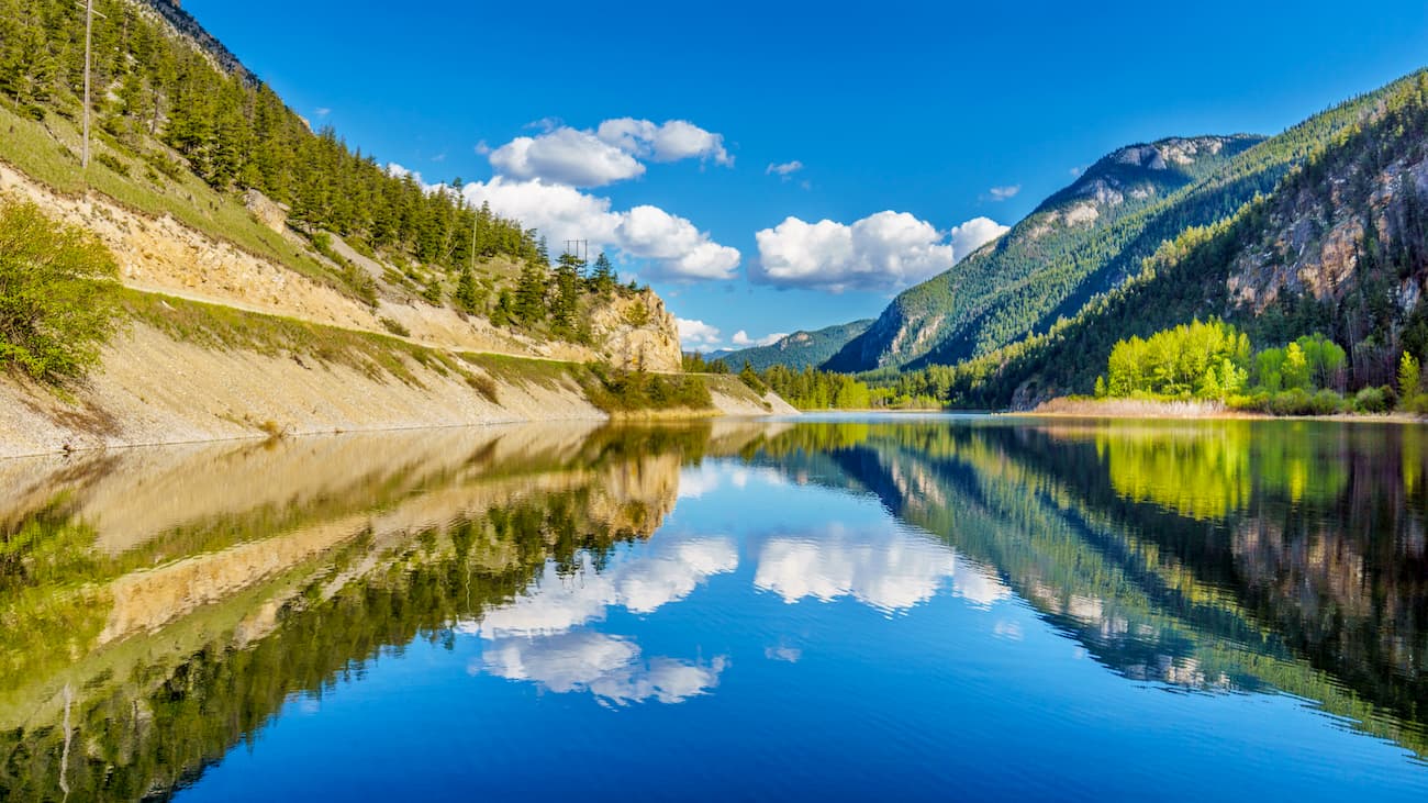
The Thompson-Nicola Regional District has a large and varied wilderness area that includes stunning grasslands, scenic mountains, and clear lakes. The following are some of the popular hiking areas in the region.
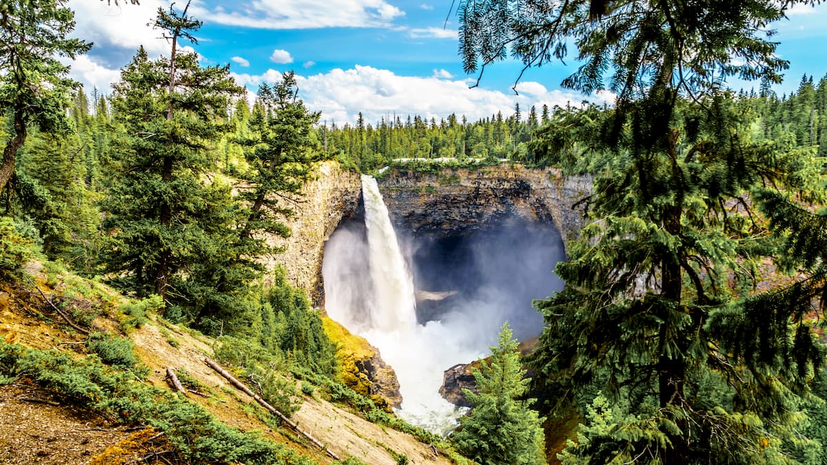
Located in the Monashee Mountains on the east side of the Fraser Plateau, Wells Gray Provincial Park is filled with incredible trails, cultural sites, and scenic landscapes. In addition to the Murtle and Clearwater Rivers that run through the park, there are 39 named waterfalls in the park to find and enjoy.
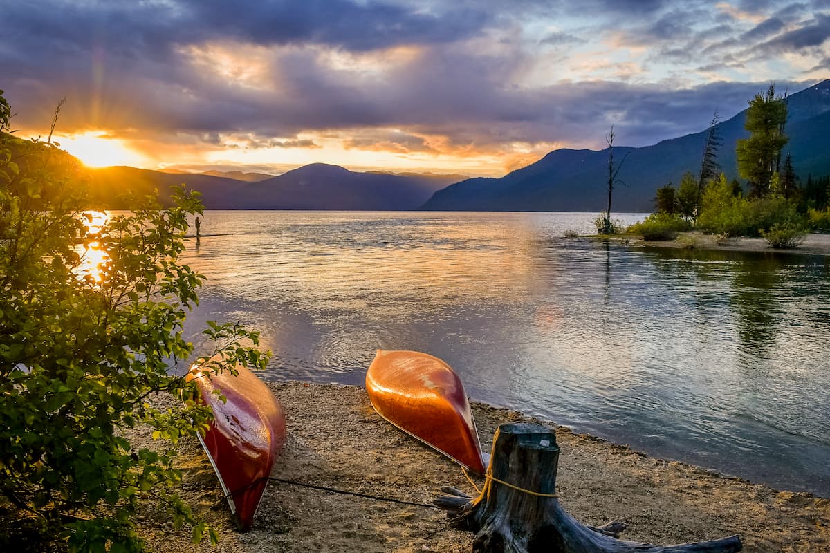
The alpine wilderness in the area was created by volcanic activity and carved by glaciers. Here, old-growth interior rainforests surround beautiful lakes where you can hike or paddle to experience the tranquility of nature.
Some of the cultural sites in the park include the remains of pit houses and underground food caches, as well as the unique pictographs at Mahood Lake.
Some of the best hikes to waterfalls are the Moul Falls Trail, Helmcken Falls Rim Trail, Dawson Falls, Spahat Falls, Canim Falls, and Mahood Falls. Many of the falls are less than 2 km (1.2 mi) from a trailhead and are easy enough to visit that you can see many of the falls in a single day of casual walking.
Some longer trails to enjoy are the 10 km (6 mi) trail to Trophy Meadows or the Discovery Cabin and Table Mountain Trail, which is a 25 km (15 mi) roundtrip with backcountry campsites available. Additional full-day and multi-day hikes include the trail between Trophy Chalet and Discovery Chalet, the Whitehorse Bluff Trail, and the Fighting Meadows Trail.
The Lac du Bois Grasslands Protected Area is located to the west of the regional capital of Kamloops. The park features beautiful lakes as well as three distinct grassland ecosystems.
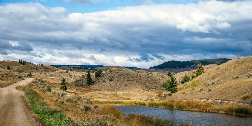
The main trail through the area is the Grasslands Community Trail which leads through all three grassland types. Other trails are the Dewdrop Trail, Cinnamon Ridge Trail, and the Mara Trail interpretive loop.
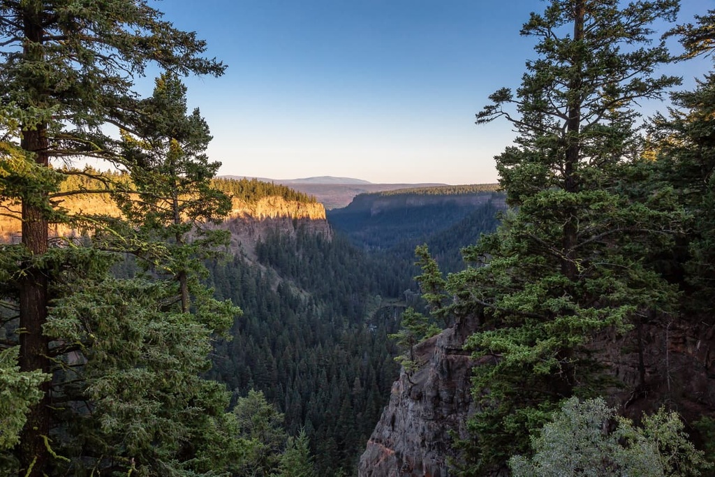
Chasm Provincial Park features an 8 km (4.8 mi) long, 600 m (1,968 ft) wide, and 300 m (984 ft) deep chasm that gives the park its name. Carved from sediment-rich glacial runoff 10,000 years ago, the massive chasm also has a 40 km (24 mi) long esker that stretches upstream from the chasm.
Even though the park was established in 1940, and only encompasses 31 square kilometers (12 square miles) of land, there are no official hiking trails. However, there are many informal trails, many of which follow old roads. One of the old roads leads along the southern edge of the chasm, offering spectacular views along the way.
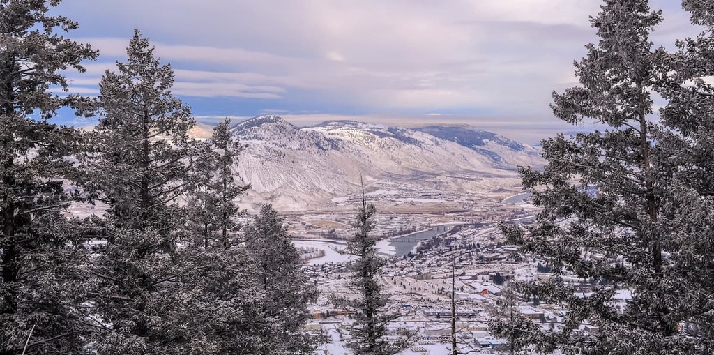
With over 40 km (24 mi) of trails packed into 8 square kilometers (3 square miles) of land, the Kenna Cartwright Nature Park is both the largest municipal park in the province and one of the best for outdoor recreation.
Found on the slopes of Mount Dufferin, the park has a seemingly endless collection of wilderness views and viewpoints that overlook the convergence of the North and South Thompson Rivers.
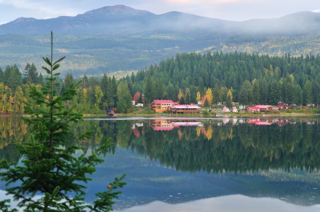
Located north of Kamloops, near Wells Gray Provincial Park, the community of Clearwater is situated at the center of several beautiful hiking areas. To the east of the community is the Clearwater River Trail Recreation site, which has a wilderness full of great hikes and mountain bike trails.
North Thompson River Provincial Park and Dunn Peak Protected Area are located to the south of Clearwater. Meanwhile, Wells Gray Provincial Park is situated to the north of the community. In addition to the parks, there are many unprotected wilderness areas around the community with trails to beautiful little lakes and backcountry campsites.
The Thompson-Nicola Regional District has incredible wilderness trails, beautiful mountain peaks, fascinating cultural sites, and stunning rivers and creeks. The following are the major towns and cities of the region, where you’ll find accommodation and all that you’ll need for any adventure.
Kamloops is known as the Tournament Capital of Canada, as it hosts over 100 sports tournaments annually. As such, tourism is a major industry in the city. In addition to hosting tournaments, the city is also host to film and wine festivals, mountain bike festivals, car shows, art shows, comedy fests, as well as a rib fest and other conventions and festivals.
While there is a lot happening in the city, there are also some great natural and wilderness areas near the Kamloops, where you can go for a weekend or an afternoon. Some of the best hiking areas near Kamloops are the Kenna Cartwright Nature Park, Lac du Bois Grasslands Protected Area, Greenstone Mountain Provincial Park, and Mount Savona Provincial Park.
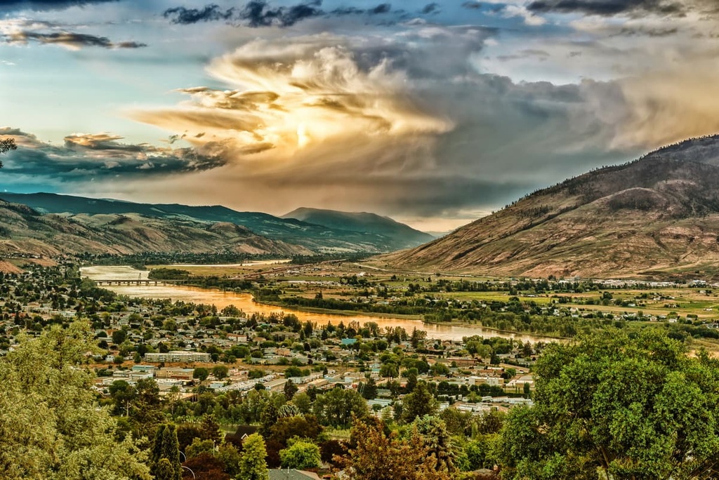
Located centrally on the Thompson Plateau, Merritt is situated at the confluence of the Nicola and Clearwater Rivers. The townsite and surrounding grasslands have been a meeting place for settlers and First Nations for hundreds of years. As traders and settlers started visiting the region, the Merritt area became a junction for many major trails.
By the middle of the eighteenth century, the grasslands around Merritt drew the attention of settlers who were interested in ranching. Large ranching operations were set up around the area.

The town of Merritt was established in the 1880s, but at the time it was known as “The Forks,” a reference to it being at the junction of several trails. Even today, Merritt is situated at the junction of the modern highways that cross British Columbia.
There are some incredible wilderness areas accessible from Merritt, too. Some hikes to look for while passing through or staying in Merritt are the Coldwater River Trail, Iron Mountain Loop, Tom Lacey Trail, Godey Creek Trail, and Lone Pine Loop.


