Scan the QR code and open PeakVisor on your phone
With rolling hills, dense forests, open parkland, alpine peaks, and large lakes, the Regional District of North Okanagan is a decidedly beautiful section of south central British Columbia, Canada. There are 71 named peaks within the district, the tallest of which is Cranberry Mountain with 2867 m (9,404 ft) of elevation. Mara Mountain is the most prominent peak in the regional district with 2250 (7,380 ft) of elevation and 1693 m (5,553 ft) of prominence.
Located northeast of Kelowna, British Columbia, the Regional District of North Okanagan covers 7,512 square kilometers (2,900 square miles) of land and has a population estimated at 85,000 people.
The major road into and through the region is Highway 97, which is roughly the western border of the district from Kelowna to Revelstoke. Also, Highway 6 traverses the district from east to west. The regional district’s head office is in Coldstream and the largest city in the district is Vernon.
The Regional District of North Okanagan includes some popular lake country, such as Okanagan Lake, Kalamalka Lake, and Mara Lake. Meanwhile, the Shuswap Lakes and the towns of Salmon Arm and Sicamous are located along the northwest boundary of the district. The town of Revelstoke and the Arrow Lakes are also along the eastern boundary of North Okanagan.
There are many provincial parks, ecological reserves, protected areas, and recreation sites that the provincial government has designated within North Okanagan. The designated conservation areas are as follows:
The climate varies across the Regional District of North Okanagan; however, there are many opportunities for adventure and tourism. The Silver Star Mountain Resort is located in the heart of the district. Additionally, the district has plenty of other areas with hiking, fishing, kayaking, mountain biking, and more.
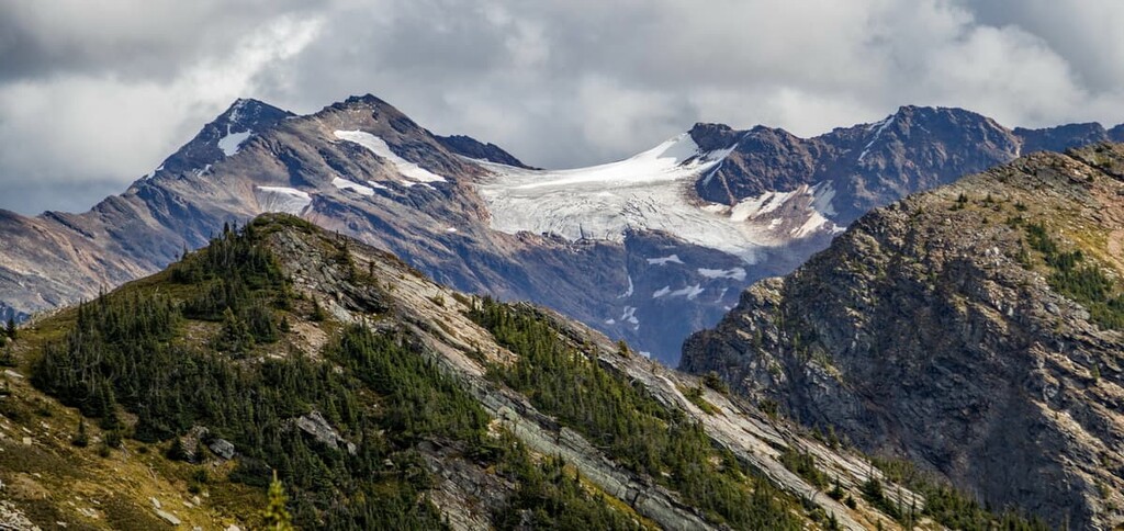
The Regional District of North Okanagan has a fascinating geological history, with rocks that are over two billion years old in the north to newer rocks that are only 700,000 years old in the south.
In the north of the region are the oldest rocks, over two billion years old, which are found within a section of a Precambrian craton called the Shuswap terrane. The rocks in this area are metamorphic and include argillite, gneiss, phyllite, and schists formed igneous and sedimentary rock by heat and pressure.
About 800 million years ago, significant layers of rock that make up the mountains and highlands of the Regional District of North Okanagan started to form. As the ancient supercontinent of Rodinia started to separate, the western edge of the ancient North American continent began to pull away from the other land masses.
The ancient coastal margin of North America is found roughly along the border of Alberta and British Columbia. As ancient North America separated, massive amounts of eroded gritstone, sandstone, and shale started filling the rift. The rift was located where the Columbia Mountains would form 600 million years later.
The creation of the Columbia Mountains continues with the subduction of the Insular and Kula tectonic plates, which were under the Pacific Ocean. As North America moved west, the Insular and then Kula plate collided with North America and began to subduct, which is when one tectonic plate descends beneath another.
As the Insular and Kula plates subducted, ancient volcanic islands and mini continents from the Pacific were accreted (stuck to) the coastal margin of North America. Most of British Columbia is made from accreted land from the subducted plates as well as new volcanoes that formed during the subduction.
About 185 million years ago, as the tectonic plates were colliding, the layers of rock began to deform and rise up. The Columbia Mountains were formed first, followed by the Coast Mountains. These mountains were formed during a process called the Sevier orogeny.
Towards the end of the Sevier orogeny, about 75 million years ago, another mountain formation event started. This new event was the Laramide orogeny, which was responsible for the formation of much of the Rocky Mountains.
The Regional District of North Okanagan covers several subranges of the Columbia Mountains. The north of the district are the Silver Hills, Park Range, Mabel Range, and Hunters Range of the Shuswap HIghlands. The southwest corner of the district is part of the Okanagan Highlands, and the east mountains are the Gold Range and Whatshan Range of the Monashee Mountains.
About 45 million years ago, the ancient Shuswap terrane surfaced during a time of increased volcanism in the region. Lava erupted along fissures from Yukon to Yellowstone National Park in the United States. The Monashee Mountains prevented the flows from travelling east, and the youngest lava flow in the region is near Kelowna and is about 700,000 years old.
Most of the lava was removed from the region from erosion; however, there are a few places where the lava is still present. Mount Ida is formed of volcanic rock covering older igneous rock, and in Dennison-Bonneau Provincial Park there are ancient hoodoos that populate the forest.
When the Columbia Mountains originally formed, they were actually a series of plateaus that were much taller than the peaks are today. The mountains were then covered by thick glaciers during the Pleistocene.
The ice sheets and glaciers that covered western Canada were between 1 km (0.6 mi) and 3 km (1.8 mi) thick, and as they melted, they moved massive amounts of rock and sediment. This process covered many areas in hundreds of meters of glacial till and debris.
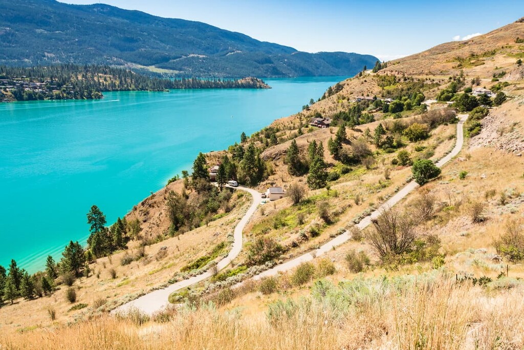
The large lakes of the Regional District of North Okanagan are found along ancient faults that were filled with ice, preventing them from filling up with glacial till. As the ice finally melted, massive kettle lakes were formed, some of which include Okanagan Lake, Shuswap Lake, Mara Lake, and the Arrow Lakes.
There are five ecological zones in the Regional District of North Okanagan. These regions range from the alpine tundra peaks to the ancient forest full of cedar and hemlock giants. The following are the regions and their general characteristics.
Cold winters, combined with a short, cool growing season create conditions that are unfavorable to most trees and many plants. Most of the Alpine Tundra Zone of the district is found in the peaks of the Monashee Mountains.
The alpine is dominated by dwarf shrubs, heaths, herbs, mosses, and lichen. The subalpine forest gives way to parkland, then to alpine meadows, and finally barren rock graces the highest elevations. The climate of the Alpine Tundra Zone is harsh and sparsely vegetated and, as such, it is generally unattractive to wildlife.
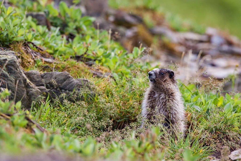
While nearly all wildlife will evacuate the alpine regions during the winter, the summer sees a lot of animal activity among the mountain peaks. Golden eagles will hunt Columbian ground squirrels and hoary marmots, while mountain goats and bighorn sheep wander the ridges. Meadows of heath and sedge, as well as krummholz are the primary vegetation in this area.
Below the tree line, dense forests of Engelmann spruce and subalpine fir dominate the landscape. There are various stands of whitebark pine, limber pine, and alpine larch found throughout this ecological zone.
Thick tangles of white-flowered rhododendron is a characteristic shrub throughout the zone, alongside other shrubs, such as black huckleberry, grouseberry, and false azalea. Subalpine meadows are filled with a variety of flowering herbs, including Indian hellebore, paintbrush, foam flower, and Sitka valerian.
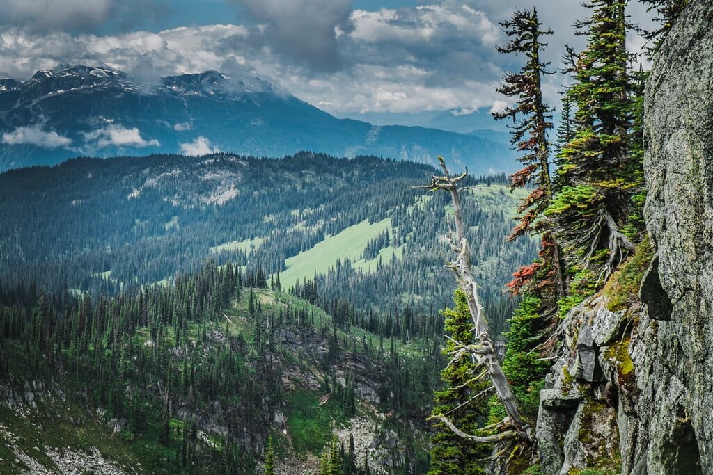
The high snowfall of the Engelmann Spruce-Subalpine Fir Zone deters most animals from wintering in the zone, except for caribou, which feed on lichen, and mountain goats. The summer sees a variety of large mammals, including grizzly and black bears, deer, and elk.
The Montane Spruce Zone of the Regional District of North Okanagan is only found within a small area south of Coldstream and north of Kelowna. It is the transition area between the lower elevation forests that are filled with Douglas fir, cedar, and hemlock; and the forests of Engelmann spruce and subalpine fir at higher elevations.
As a transition area, the montane forests contain species from the neighboring ecologies such as the subalpine fir, grouseberry, and black huckleberry typical of higher elevations. As well as Douglas-fir, lodgepole pine, white spruce, western larch, western red cedar, trembling aspen, and black cottonwood.
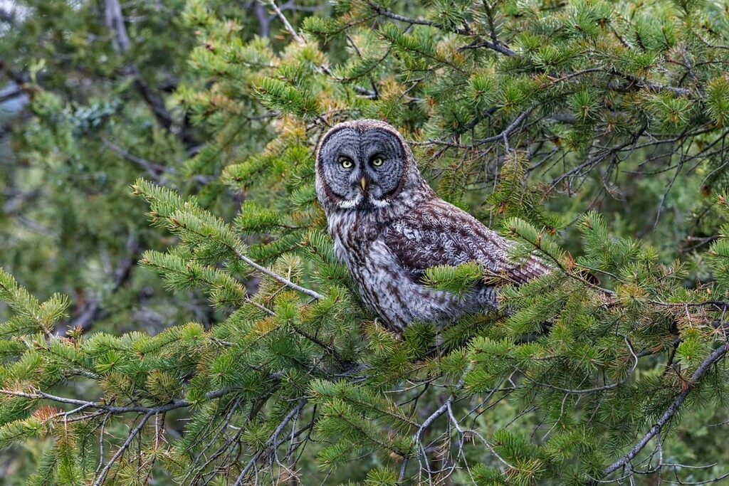
The old growth forest in this zone also provides a preferred habitat for many animals including the fisher, marten, red crossbill, southern red-backed vole, porcupine, and the great grey owl. Bighorn sheep, mountain goats, golden eagles, mule deer, and the golden mantled ground squirrel prefer dry grassland areas.
The Interior Cedar – Hemlock Zone is found in the middle to lower elevations of the interior regions of North Okanagan. While the winters here are cool and wet, the summers are dry and warm. This allows for the widest variety of coniferous tree species of any zone in the province.
Western redcedar and western hemlock are the characteristic trees of this zone. White-Engelmann spruce hybrids and subalpine fir are common to the area while lodgepole pine and Douglas fir can be found in dry areas of the zone.
With a matrix of old and young forests, there is a diverse variety of wildlife in the region, with some species that prefer the old growth forests and others that prefer the more open spaces of the young forests. Woodpeckers and owls prefer the mature forests, while ruffed grouse, American robins, and golden eagles prefer the open forests and parkland.
The animals in this zone are the typical animals of the region. These include species such as grizzly bear, elk, white-tail deer, wolverine, and many smaller mammals, including ground squirrels, martens, and fishers.
The Interior Douglas Fir Zone is found in the dry southern interior of British Columbia, and it occurs in the rain shadow of the Coast Mountains. This zone is found within the lowest valleys of the Okanagan Highlands in the North Okanagan.
Douglas Fir is the dominant tree with lodgepole pine and Ponderosa pine as the seral trees after forest fires. Along the drier limits of the zone, the landscape often becomes savannah-like, supporting meadows of rough fescue and bluebunch wheatgrass.
This zone is prime winter habitat for ungulates, with its low snowpack, abundant shrubs, and old Douglas fir forests. Mule deer, white-tailed deer, elk, and bighorn sheep all have a preferred habitat within the Interior Douglas Fir Zone.
The land that is now part of the Regional District of North Okanagan has been inhabited since the glaciers started to retreat about 11,000 years ago. Part of the traditional territory of the Ktunaxa (Kootenay) is in the North Okanagan, as are the territories of the Syilx (Okanagan), Sinixt (Arrow Lakes Band), and the Secwepemcul’ecw (Shuswap).
The Ktunaxa traditionally inhabit from the western slopes of the southern Canadian Rockies, through the Purcell Mountains to the Monashee Mountains. It’s possible that the modern nation are descendants of the people that arrived in the Kootenay Valley 11,000 years ago. The Ktunaxa have a language that is different from all of the other surrounding First Nations, which suggests ancient and unique origins.
The Syilx, Sinixt, and the Secwepemcul’ecw are all part of the Interior Salish culture. The Salish culture originated on the Pacific coast where it evolved from the proto-Salish culture between 3,000 and 6,000 years ago. The Salish culture is believed to have moved inland to the Okanagan, where it displaced other cultures that inhabited the region.
Fur traders with the Northwest Company and Hudson’s Bay Company were the first Europeans to encounter the First Nations of this region. The disastrous effects of smallpox on First Nations communities were evident by the time David Thompson came to the region in the early nineteenth century.
Before the fur trade, the First Nations of the region lived a subsistence lifestyle of hunting, fishing, and gathering. Many First Nations would use summer camps that were near important resources and, in the winter, would return to their community and live in pit houses.
Settlers of European descent started arriving for mining, logging, and agriculture in the late nineteenth and early twentieth century. After the arrival of these settlers, many of First Nations transitioned to an agriculture and ranching-based way of life.
Logging, mining, and agriculture were the primary industries in the region for the past two centuries; however, the warm and dry climate that is characteristic of much of the region has now made it a popular tourist destination.
The North Okanagan has mild winters with abundant snowfall in the mountains, with warm and dry summers. This ideal climate has made the North Okanagan a year-round destination for outdoor enthusiasts. The following are several of the best hiking and outdoor recreation destinations to check out for your next adventure.
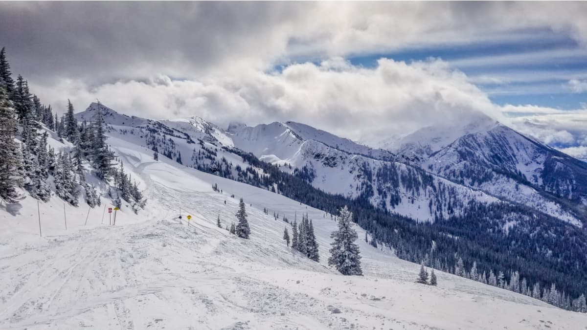
A moderate climate and abundant snowfall make Silver Star Provincial Park an incredible winter adventure destination. There are snowmobile trails as well as hiking trails in the park during the winter. The trails lead up to several peaks and some lookouts that give a panoramic view of the Monashee Mountains and the Okanagan Valley.
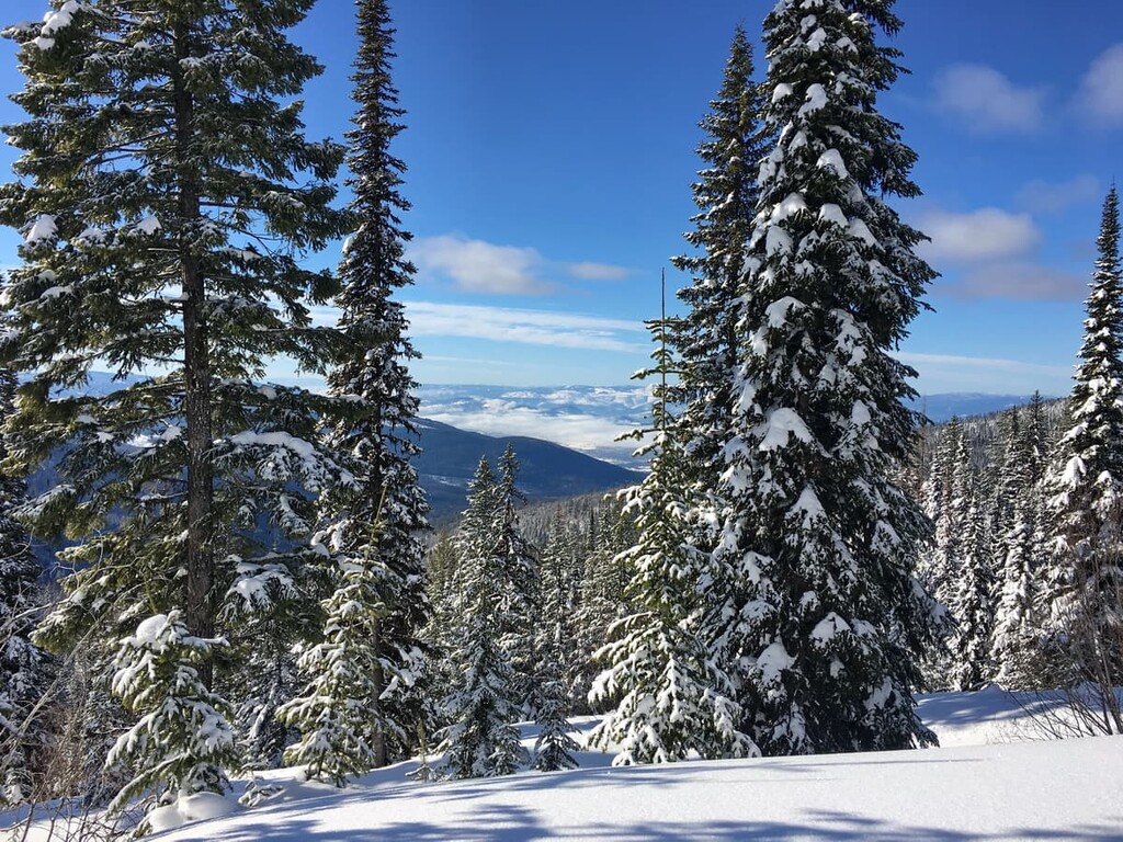
The park is designed for maximum winter enjoyment with wide trails that make it easy for snowshoes as well as warming huts at several locations in the park. The mild winter weather makes this an ideal winter adventure location.
Vernon is a small city on the north end of Okanagan Lake and Kalamalka Lake. There are dozens of trails that include lakeside strolls, ridge walks, and mountains to summit. Many of the trails start in Vernon, while others are in the nearby Kalamalka Lake Provincial Park and Ellison Provincial Park.
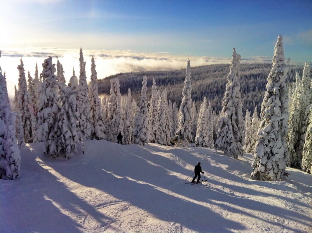
With phenomenal snow and mild winters, it’s no wonder that the Regional District of North Okanagan doesn’t have more ski resorts. Silver Star Mountain Resort is found on the eastern slopes of Silver Star Mountain and it has many lift assisted ski runs as well as a resort village.
The resort is also open in the summer for mountain bikes. Offering downhill, cross country, and enduro tracks, Silver Star Mountain Resort is a popular destination during both the summer and winter months.
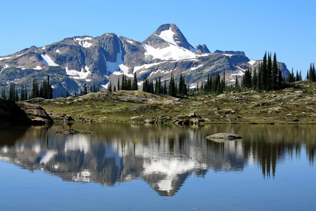
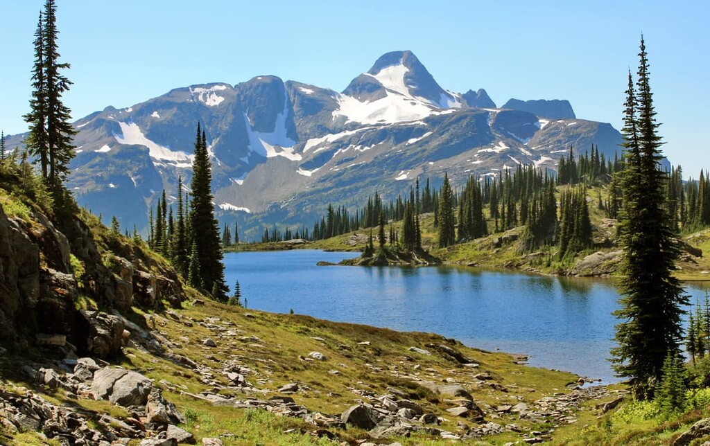
Lush forests of old growth cedar, spruce, and hemlock grace the slopes and valleys of Monashee Provincial Park while alpine meadows burst with wildflowers in the spring. Indeed, Monashee Provincial Park has many beautiful areas to explore.
Peters and Margie Lakes are found beneath Mount Fosthall, the highest peak in the park. There are rugged peaks to scramble and wildlife to view, which, if you’re lucky, may include the rare mountain caribou or wolverine among the more common mule deer, pikas, and ground squirrels.
Monashee Provincial Park is a fantastic destination for backcountry adventurers. There are four backcountry campgrounds which allow you to easily spend days exploring the rivers, lakes, trails, and peaks. There are fish in the lakes and streams as well as plenty of wildlife to view in the park, too.
There are many hiking trails as well as several peaks in the park for climbing. While some peaks are best left to those with mountaineering experience, Mount Fosthall and Slate Mountain offer climbing and scrambling opportunities.
There are many cities and towns in and around the Regional District of North Okanagan. Most have a fairly laid back atmosphere and they are small communities that often cater to agriculture, mining, and forestry. The following are several of the major cities and towns in the area to visit.
The city of Kelowna, British Columbia spans across Okanagan Lake and it is located just south of Vernon in the Regional District of Central Okanagan. Although Kelowna is located just outside of North Okanagan, it is one of the province’s major metropolitan areas and it offers good access to the North Okanagan region.
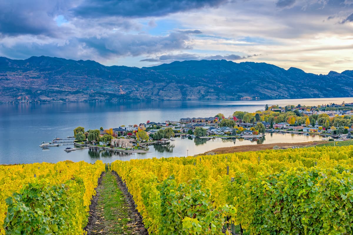
There are many lakeside accommodations in the city, as well as campgrounds, and hotels. Kelowna has golf courses, fantastic restaurants, orchards, farmers markets, and many more activities. There are innumerable hiking opportunities around the city, too, many of which lead along the lake, a ridge, or up a stream to a waterfall.
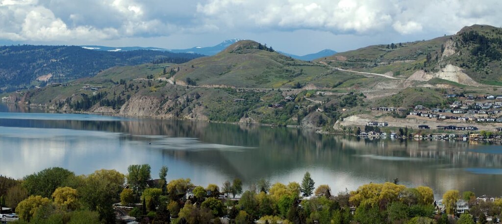
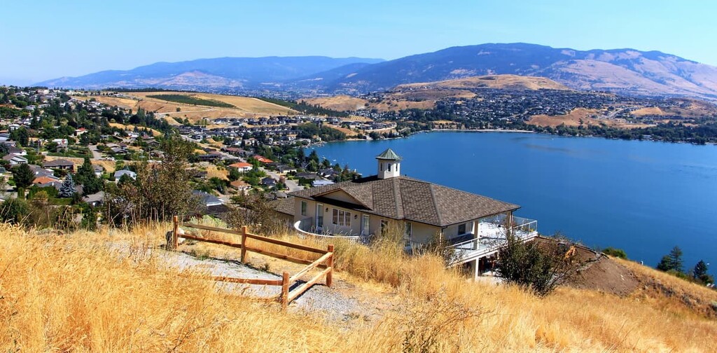
The city of Vernon is located at the north end of Okanagan Lake and Kalamalka Lake. It is the largest city on the North Okanagan. The Greater Vernon Area includes the district capital of Coldwater.
Vernon is a little smaller and a little more relaxed than the nearby city of Kelowna. However, it has all the amenities to make your stay enjoyable without the crowds that sometimes exist at popular locations in Kelowna.
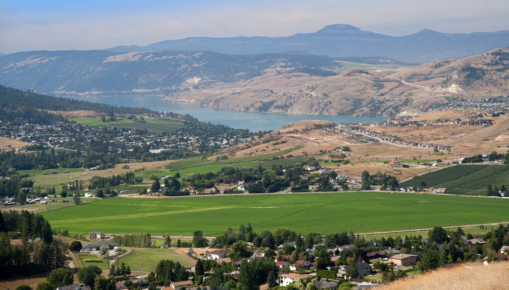
The city is located along the lakes and surrounded by rolling hills that have ranching, farmland, vineyards, and orchards. There are guided and self-guided tours of the region’s vineyards, as well as farmer’s markets to stroll through on the weekends when you’re not on the water or in the hills.
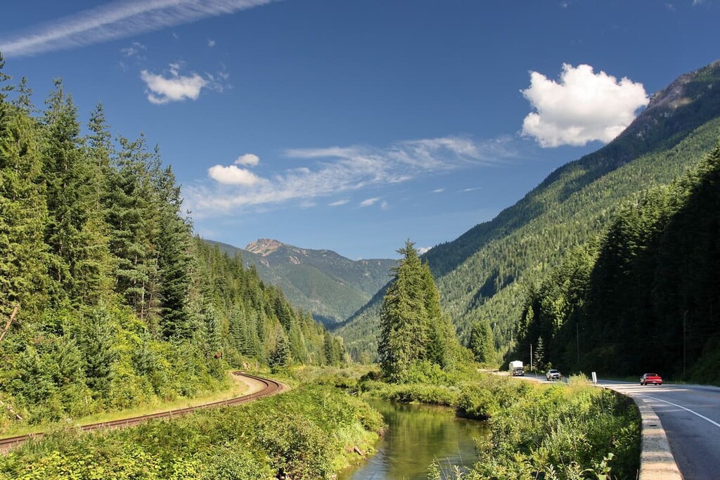
Located at the southern edge of the Columbia-Shuswap Regional District, Revelstoke is not technically in North Okanagan; however, visitors from the east will drive through it to get to North Okanagan and there are a lot of activities that make it a worthwhile rest stop.
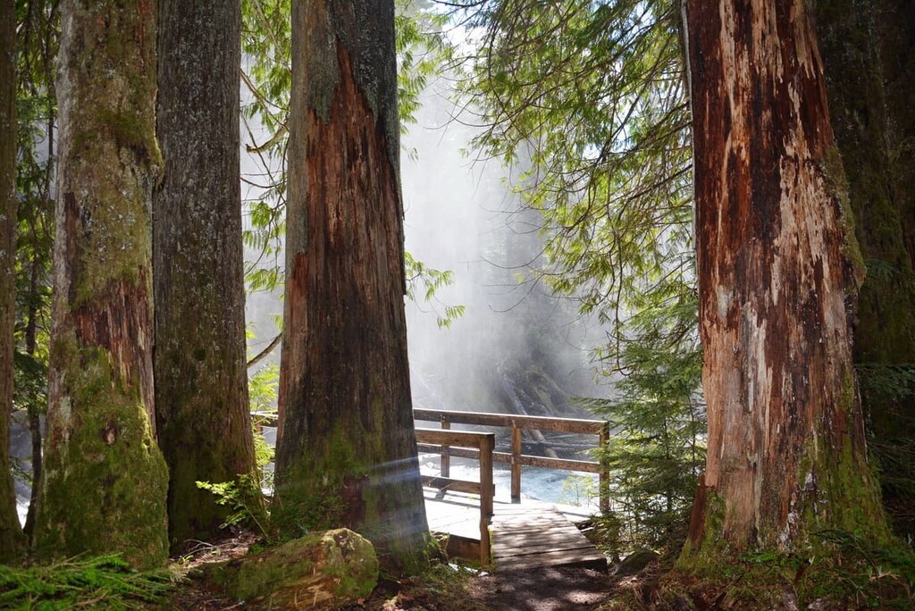
Revelstoke is popular for its downhill skiing opportunities at Revelstoke Mountain Resort as well as cat-skiing and heli-skiing opportunities. There are many trails to hike near the city, such as the Giant Cedars Boardwalk or the trail in Mount Revelstoke National Park. The Enchanted Forest and neighboring adventure park are located close to the town, as is the 3 Valley Gap Ghost Town.
The roads leading to Revelstoke often follow the railway tracks and are surrounded by lush forests and steep mountains. There are many waterfalls to spot as well as wildlife to look out for when you’re in the town, too.