Scan the QR code and open PeakVisor on your phone
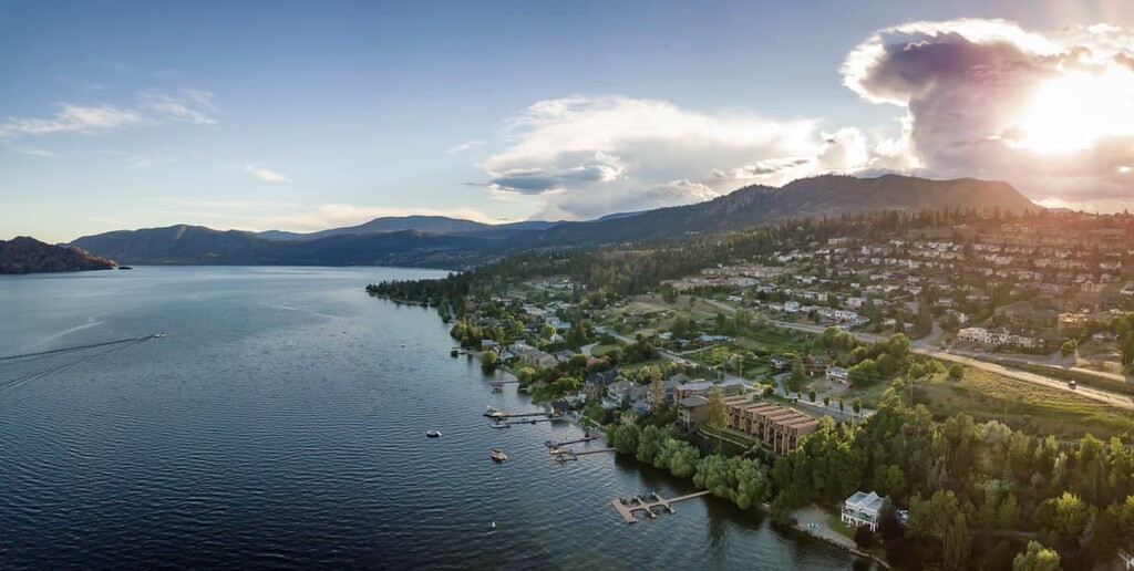
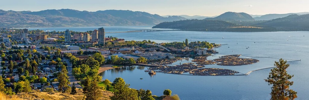
The Regional District of Central Okanagan is located around Okanagan Lake and the city of Kelowna, in the southern interior of British Columbia, Canada. The district covers 2,905 square kilometers (1,122 square miles) of land and has 39 named peaks, the tallest of which is Little White Mountain with 2,171 m (7,121 ft) of elevation and 794 m (2,604 ft) of prominence.
Straddling Okanagan Lake, the Regional District of Central Okanagan contains 2,905 square kilometers (1,122 square miles) of land and has a population that is just under 200,000 people. It borders the regional districts of North Okanagan, Central Kootenay, Kootenay Boundary, Okanagan-Similkameen, and Thompson-Nicola in the province of British Columbia.
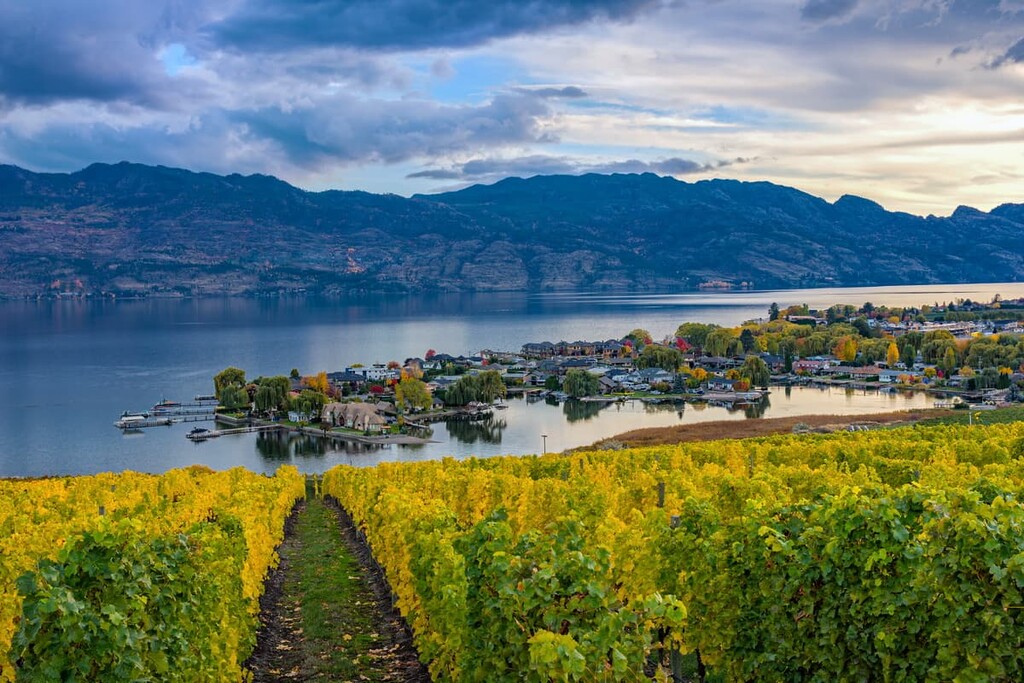
The primary industries in the regional district are retirement- and recreation-based, with outdoor activities such as boating, watersports, skiing, and hiking being among the most popular in the area. Orchards and vineyards are the primary agricultural industries in the region, alongside a small amount of ranching.
The major cities in Central Okanagan are Kelowna and West Kelowna, and the district municipalities of Peachland and Lake Country. The primary road through the district is Highway 97 (Okanagan Highway), which travels along Okanagan Lake.
There are many areas available for wilderness exploration and outdoor recreation in Central Okanagan. The district is home to many regional parks, recreation sites, and provincially designated parks and protected areas. The district contains the following provincial parks and protected areas:

The layers of rock that form the bedrock and surface geology of Central Okanagan, British Columbia came from three primary sources: erosion, marine sedimentation, and volcanic activity.
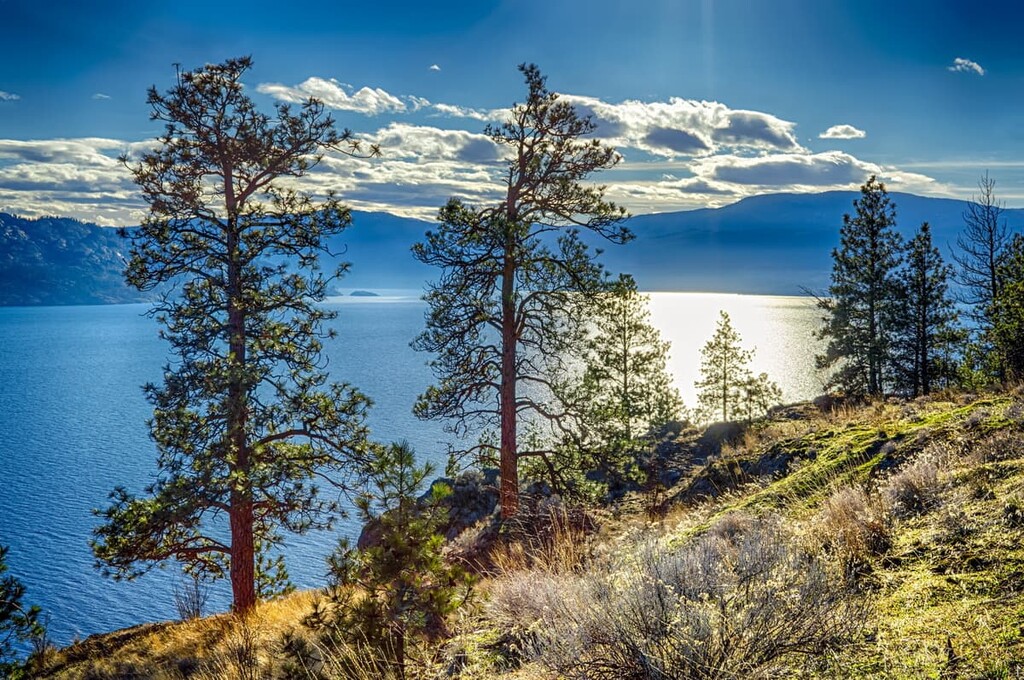
Central Okanagan is within the Columbia and Coast Mountains of British Columbia. Specifically, the part of the district east of Okanagan Lake is part of the Okanagan Highland and west of the lake is the Thompson Plateau. The Okanagan fault runs north to south along the center of the Okanagan Valley, and is the reason the lake is so long and deep.
The rocks that form a layer of the Columbia Mountains first came into place as the ancient supercontinent of Rodinia began pulling apart about 800 million years ago. As the ancient North American continent drifted apart from the Rodinian land mass, gritstone, sandstone, and shale settled into the forming rift along the continental margin creating a clastic rock layer. Over the next 600 million years, layers of sediment formed on the continental margin, covering the ancient clastic layer.
In the meantime, two further supercontinents formed which were Pannotia and then Pangaea; however, the west coast of ancient North America remained as a coastal margin during this time. As Pangaea broke apart about 180 million years ago, ancient North America drifted west and collided with the oceanic plates of the Pacific.
Over the next 120 million years, during the Jurassic, terranes were accreted onto the coastal margin of North America, forming much of modern British Columbia. The accreted land came from buoyant micro-continents and island arcs that were crushed onto the continent, instead of sinking with their original tectonic plate. The collision and subduction of the plates also caused layers of rock to deform and stack creating the Western Cordillera.
The Columbia Mountains of the Western Cordillera formed first, followed by the Coast Mountains. Finally the Rocky Mountains started forming about 75 million years ago. The accretion of terranes onto the western coast of what is now British Columbia is the primary reason there are so many different types of rocks in the Columbia and Coast Mountains.
The Eocene epoch, about 55 million years ago, was a time of great change in the Okanagan area with significant volcanic action and the beginning of the formation of the Okanagan fault. Magma flowed close to the surface, creating granite intrusions in the region. Crustal relaxation and thinning are the cause of the volcanic conditions that created Giant’s Head, Mount Boucherie, and Mount Knox.
Before the Eocene, North America was generally being compressed by its collision with nearby oceanic plates. As a result, massive layers of rock were being uplifted, forming the Western Cordillera. During the Eocene, the continental crust began relaxing and during the Oligocene, between 36 and 24 million years ago, massive backsliding began to occur.
The Okanagan fault opened during the Oligocene, as the top layers of rock separated from the layers below and slid up to 100 kilometers (60 miles) to the west. Further west, the Rocky Mountain Trench was also in the process of opening up between the Rocky Mountains and the Columbia Mountains.
The Okanagan fault is the reason that there are different rock types on either side of the Okanagan Valley. There are metamorphic and plutonic rocks in the east that were exposed as layers of sedimentary, volcanic, and plutonic rocks slipped west.

While there were some volcanic eruptions that occurred in the Okanagan during the Pleistocene, the most recent of which occurred 700,000 years ago to the south of Kelowna, the major mountains of the Okanagan had already formed by this time. Heavy glaciation during several glacial and interglacial periods dramatically changed the landscape of Central Okanagan into what we see today.
Large areas of Kelowna are built on the alluvial fans and deltas that glaciers laid down over 10,000 years ago. The silt and clay cliffs along Highway 97 are the result of vast glacial deposits. Terraces of well-draining sand and gravel, which are important to the thriving orchards in the region, were also built up during the glacial periods of the Pleistocene.
Furthermore, Okanagan Lake remains in its current shape and depth because of the glaciers that once covered this area. As the glaciers melted away some 15,000 years ago, relatively small amounts of ice remained at the bottom of the faults in the regions. The ice in the faults was covered by glacial lakes and hundreds of meters of sediment and till. When the ice in the depths of the faults finally melted, it created massive kettle lakes along these faults.
When glacial remnants are covered and surrounded by debris, as was the case with the ice in the Okanagan fault and other fault lines, kettle lakes can form. This is because the ice that was left behind will eventually melt and create a depression that fills with water. Okanagan Lake, Mara Lake, the Shuswap Lakes, and the Arrow Lakes all formed as kettle lakes when faults filled with ice that later melted during the interglacial period.
There are five main ecological zones in the Regional District of Central Okanagan, all of which are generally classified by the dominant tree species of the zone. Starting from the highest elevations on the mountains of Central Okanagan there is the Engelmann Spruce – Subalpine Fir Zone, followed by the Montane Spruce Zone, and the Interior Cedar – Hemlock Zone in the mountain valleys.
As the elevation decreases through the center of the Okanagan Valley towards the lake, the ecology of the region is more clearly defined as being part of the Interior Douglas Fir Zone. Furthermore, the Ponderosa Pine Zone can be found along the shores of the lake.
There are a variety of animals that inhabit Central Okanagan, none of which are unique to the area as most have a wide range through the Columbia, Coast, and Rocky Mountains. Ungulates of the regions include mule and white-tail deer, elk, caribou, mountain goats, and bighorn sheep.
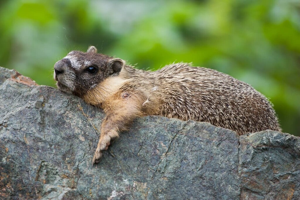
Large predators that inhabit Central Okanagan include grizzly bears, black bears, cougars, and wolves. Foxes and coyotes are common, as well as many small mammals such as pika, Columbian ground squirrels, hoary marmots, fishers, and wolverines.
The Okanagan Valley is located in the rain shadow of the Coast Mountains and as such, the precipitation is significantly lower than in adjacent regions. The Okanagan Valley is very dry, and many animal species, such as elk, bighorn sheep, and deer, migrate long distances to spend winter in the relatively snow-free areas of the Ponderosa Pine and Interior Douglas Fir Zones that are adjacent to Okanagan Lake.
The earliest human habitation of the Okanagan Valley dates back about 8,000 years. The Regional District of Central Okanagan is the traditional territory of the Syilx and Nlaka’pamux nations, both of which are Interior Salish cultures.
The Salish culture originated on the Pacific coast an estimated 6,000 years ago from a proto-Salish culture. People from the coastal Salish culture moved inland to become the Interior Salish culture, who are the ancestors of the modern First Nations of the Okanagan. At the height of Okanagan dominance of the region, about 3,000 years ago, it’s estimated that 12,000 people inhabited the Okanagan Valley and surrounding areas.
Europeans first came to the Okanagan in 1811 as part of a fur trading expedition. Traders from the Pacific Fur Company were the first people of European descent to visit the region. Within 15 years, a trail had been established to ship furs from the Okanagan to the Pacific coast.
Father Charles Pandosy created the first European settlement when he established the Okanagan Mission in 1859. The following decades saw a gold rush, which brought some settlers to the Okanagan; however, most of the settlement occurred in the late nineteenth century as military land grants were handed out.
Many of the original ranches that were established during this time are still in operation. Others formed the basis of further community developments, such as Coldstream Ranch, Ellis Ranch, and Richter Ranch.
The commercial orchards in the region started to see success by the 1920s. Nowadays, the Okanagan is known for the many varieties of fruit that are grown there. Steamboats started shipping goods along Okanagan Lake and were required for shipping fruit until the 1930s. Since then, forestry and mining have played an important role in the growing economy.
The current economy in the region is boosted by tourism and retirement services. Favored by its lakes, sunny climate, wilderness areas, orchards, and wineries, the Okanagan Valley has become a popular destination for tourists and retirees.
The Regional District of Central Okanagan has a beautiful portion of Okanagan Lake as well as spectacular wilderness areas. The following are a few amazing places to explore and things to do while you’re in the region.
Representing ecosystems of the Okanagan Highlands and the Okanagan Basin, Myra-Bellevue Provincial Park covers nearly 77 square kilometers (30 square miles) of mountains and wilderness. It features the dramatic cliffs of Little White Mountain and trails that follow the historic Kettle Valley Railway.
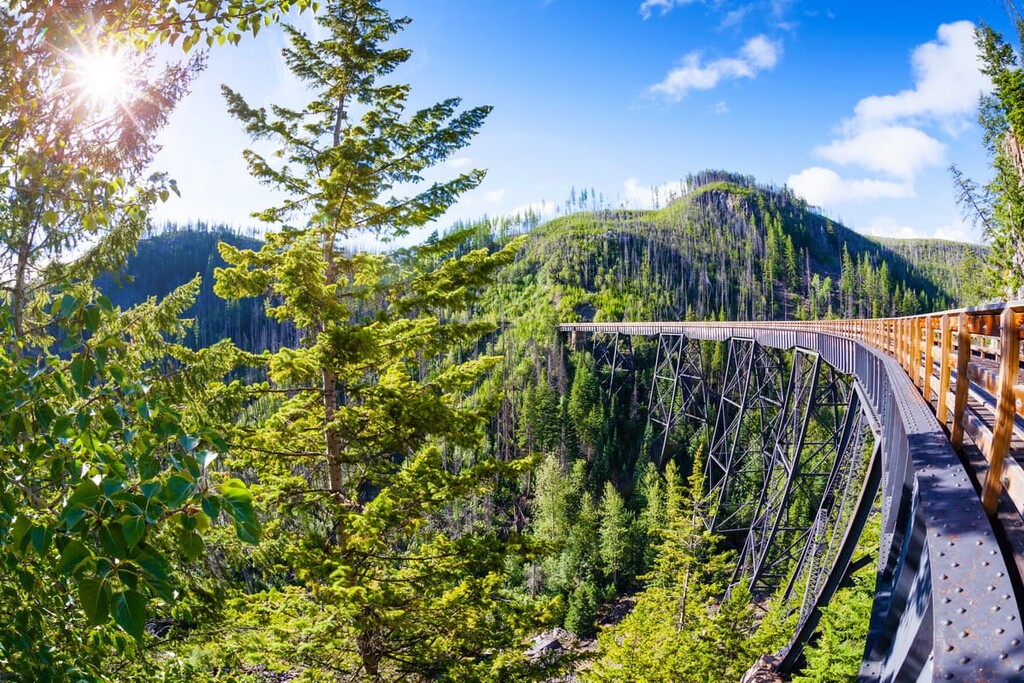
The featured hike is 12 km (7.5 mi) long and it follows the path of the Kettle Valley Railway. First opened in 1915 with trains running through the Okanagan until 1989, the Kettle Valley Railway features spectacular scenery along the route as it clings to the steep cliffs. The highlights of the trail are the 18 hand-built trestle bridges along the trail and two tunnels.
As a wide flat trail with minimal incline, the Kettle Valley Railway Trail is especially popular with cyclists. If you wish to adventure further into the history of the Kettle Valley Railway, located above the track line are remnants of the worker’s camps including “rock ovens” that were built and used by the Italian stone masons who were constructing the railway.
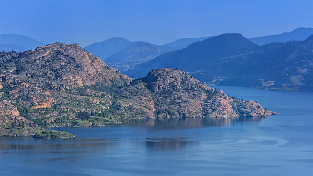
Okanagan Mountain rises from the western shore of Okanagan Lake as the highpoint of Okanagan Mountain Provincial Park. The park covers 110 square kilometers (42 square miles) of rugged landscape, spruce forests, mountain lakes, canyons, and creeks. The view from the top of Okanagan Mountain lets you see a great distance up and down the Okanagan Valley.
There are rugged wilderness trails, creeks, canyons, and beaches. The park is accessible by car and by boat, and it includes beachside campgrounds that are only accessible by boat. While other wild places in the park are only accessible by foot, bicycle, or horse.
The park contains numerous historical sites to discover and explore. Provincially significant pictographs are to be found on rock outcrops and canyon walls. Commando Bay was used during World War II, in 1944, to secretly train Chinese-Canadian soldiers in guerilla warfare. Further trekking can take you off trail to find the remnants of the DC3 passenger plane that crashed in 1950. Unfortunately the flight’s crew perished; however, all 16 passengers survived and were later rescued.
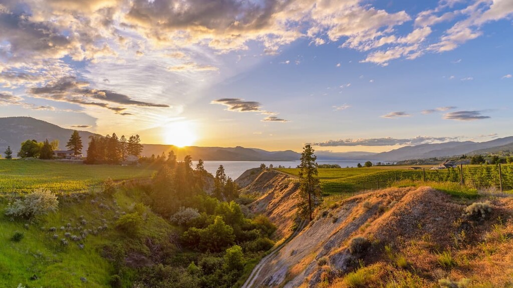
With its bright sunshine, sparkling lakes, and abundant beaches, the Okanagan Valley is a seductive and magical place. Furthermore, some of the most delicious fruits are grown in the valley, thanks to the terraces that the glaciers formed 12,000 years ago.
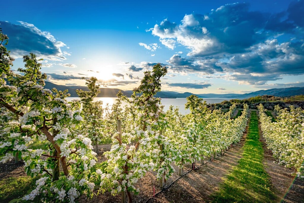
The valley grows a variety of fruit which includes apples, peaches, pears, nectarines, plums, and cherries. There are countless orchards that are open to the public so you can pick your own fruit from the tree, or you can purchase it from one of the many famer’s markets or roadside stands throughout the Valley.

Furthermore, the well-draining soil and dry, sunny weather is the perfect combination for growing grapes for the more than 200 wineries in the Okanagan. There are many tours that are guided or self-guided through which you can experience a sample of the Valley’s wine. Some of the more unique vineyards have opted to use their grapes to make delicious balsamic and infused vinegars instead of wine.
The cities and towns of the Central Okanagan are located along Highway 97. The following are two popular destinations in the region:
Kelowna is considered the capital of the Okanagan and it is the largest city in the region. It is located on the eastern shore of Okanagan Lake, and it has a wide range of accommodations and attractions.
Tourism is a major economic driver in the city, especially in the summertime. The city fills in the summer months with people from across British Columbia and Canada, who flock to the region to enjoy the warm and dry weather that is common.
Beach and lake life are the main reason that people come to the Okanagan. However, there are some great hiking areas nearby, such as Okanagan Mountain Provincial Park and Myra-Bellevue Provincial Park. Additionally, the valley has over 200 wineries and countless orchards to visit.
The municipality of Peachland is a really laid-back town that is filled with tourists and seniors during the summer. There is a lovely path through town that follows the shore with stops along the way, including a marina, playgrounds, and beaches.
The historical features of the town include a quaint museum that features exhibits on local history and the old school, which has since become a visitor center. Aside from the incredible climate, beautiful lake, and endless beaches, one of the best features of Peachland is that it is usually nearly 100% mosquito-free.
After years of educating Peachland’s youth, the municipality’s Historic School closed in 2002. In 2011 a bat colony, which had been there for decades, was discovered in the attic of Peachland’s Historic School. It’s these bats that keep Peachland and the surrounding area mosquito-free. During the summer you can visit the schoolhouse at dusk to watch the bats emerge from the attic vents.