
Scan the QR code and open PeakVisor on your phone
Myra-Bellevue Provincial Park is located on the Okanagan Highlands of southern British Columbia, Canada. The park contains many beautiful settings upon the slopes of Little White Mountain (2,171 m/ 7,123 ft), which is the only peak in the park, and in and around Myra Canyon.
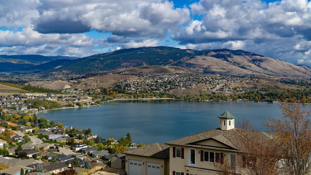
Located on the slopes south of the Okanagan city of Kelowna, in British Columbia, Canada, Myra-Bellevue Provincial Park includes the beautiful historic trestles and tunnels of the Kettle Valley Railway, the dramatic escarpment of Little White Mountain, the Angel Springs in Myra Canyon, and many more picturesque settings.
Myra-Bellevue Provincial Park is located so close to Kelowna that one of the access points to the park is on Stewart Road East, which is essentially one of the city streets. Other access points to the park include the parking lot and trailhead off of Myra Forest Service Road or the trailhead on Little White Forest Service Road.
Myra-Bellevue is one of many provincial parks in the Okanagan. The following are some of the other parks that are nearby:
Like most of British Columbia, the Okanagan was accreted to the west coast along with many other exotic terranes between 160 and 60 million years ago. The accretion of land and subsequent mountain formation events were fueled by the energy of shifting tectonic plates.
Volcanic rifts in the Atlantic were pushing ancient North America west, while rifting in the Pacific pushed the oceanic pacific plates east. The consequences were the subduction of Pacific tectonic plates beneath North America; however, the microcontinents and islands arcs were skimmed from their original Pacific plate and stuck to the west coast of Canada, to create most of British Columbia’s land mass.
During the Eocene, between 55 and 34 million years ago, the Okanagan geology was very active. The Laramide orogeny was ending around this time, which was the formation event for the Canadian Rockies. Near the end of the Laramide orogeny, the Earth’s crust relaxed after the compressional forces of the tectonic collision subsided.
The relaxation of the Earth’s crust in the Okanagan area created areas of thin crust where magma could intrude into the sedimentary bedrock or outright erupt as a volcano. Magma intrusion during this time created the granite rocks in the eastern Okanagan, as well as several volcanoes, such as Giant’s Head, Munson Mountain, Mount Boucherie, and Knox Mountain.
Furthermore, the uplift of metamorphic and plutonic rocks caused the development of the Okanagan fault around 36 million years ago. The Okanagan fault runs the length of the Okanagan Valley and into northern Washington and is the major topographical feature of the region.
The Okanagan fault represents an area where the upper layers of rock were sheared free of the lower layers and slid about 100 km (60 mi) west. The younger sedimentary, volcanic, and plutonic rocks are exposed west of the fault while the older metamorphic and plutonic rocks are exposed east of the fault.
During the Pleistocene, which was between 2.5 million and 10,000 years ago, the Okanagan was subjected to several glacial and interglacial periods. The most recent glacial period in the region is referred to as the Fraser glaciation and it occurred between 25,000 and 10,000 years ago.
Aside from evidence of erosion and layers of glacial deposits across the Okanagan Valley, the major results of the glacial events were the creation of the Okanagan and adjacent lakes. The Okanagan Lake is a kettle lake, which are lakes that are created in the depression of persistent glacial ice.
While most of the glaciers had melted, glacial ice persisted in the seam of the Okanagan fault. Over thousands of years the valley was shaped by glacial meltwater and glacial deposits which covered the Okanagan fault in a thick layer of sand, silt, and rocks.
The landscape finally warmed sufficiently for the trapped ice to melt which created long depressions along the floor of the Okanagan valley. In time, as water drained through the valley, the lakes filled and are as we see them today.
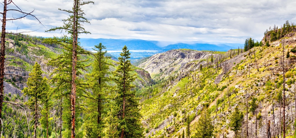
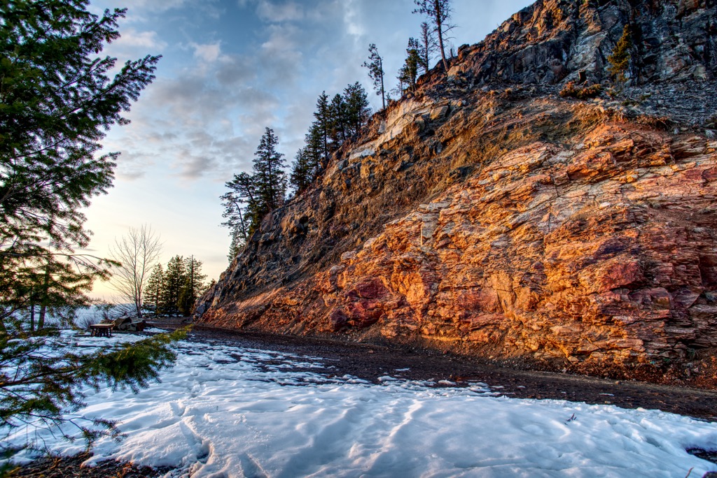
Situated upon the Okanagan Highlands, Myra-Bellevue Provincial Park rises up the northern slope of Little White Mountain and encompasses several distinct ecologies. The lowest elevations of the park are part of the Interior Douglas-fir ecozone, while the top of Little White Mountain is high enough to create an Alpine Tundra ecosystem
Myra-Bellevue Provincial Park is home to small stands of old growth Douglas fir and ponderosa pine, as well as larch, subalpine fir, and Engelmann spruce. These old growth forests are protected alongside some of the most southerly stands of cedar forests in the Okanagan Valley.
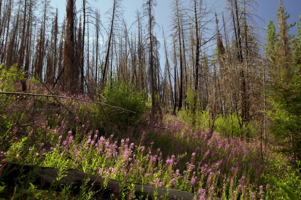
The lower elevation forests are dominated by Douglas fir; however, forest fires are common in the region and create stands of even-aged lodgepole pine. The marvelous ponderosa pine, with their long needles and massive pine cones, grows at the lowest elevations of the park, where it is hottest and driest.
As the elevation of the park increases, there is a thin band of cedar-hemlock forests. Western red cedar and western hemlock are the most common trees; however, this is a transitionary forest between the lower and upper elevations and it contains the widest variety of coniferous tree species of any zone in British Columbia.
Douglas fir and lodgepole pine are found on the drier sites of the cedar-hemlock forests and white-Engelmann spruce hybrids begin to thrive at this elevation. As the elevation increases, the cedar-hemlock forests give way to the hardier spruce hybrids and subalpine fir. Douglas fir and lodgepole pine still persist in stands, especially where wildfires have occurred.
Below the shrub and heath covered alpine of Little White Mountain, subalpine fir and Engelmann spruce dominate the subalpine. These are the hardiest of the region’s trees and are the ones that can withstand the long, cold temperatures that persist among the region’s mountain peaks during the winter.
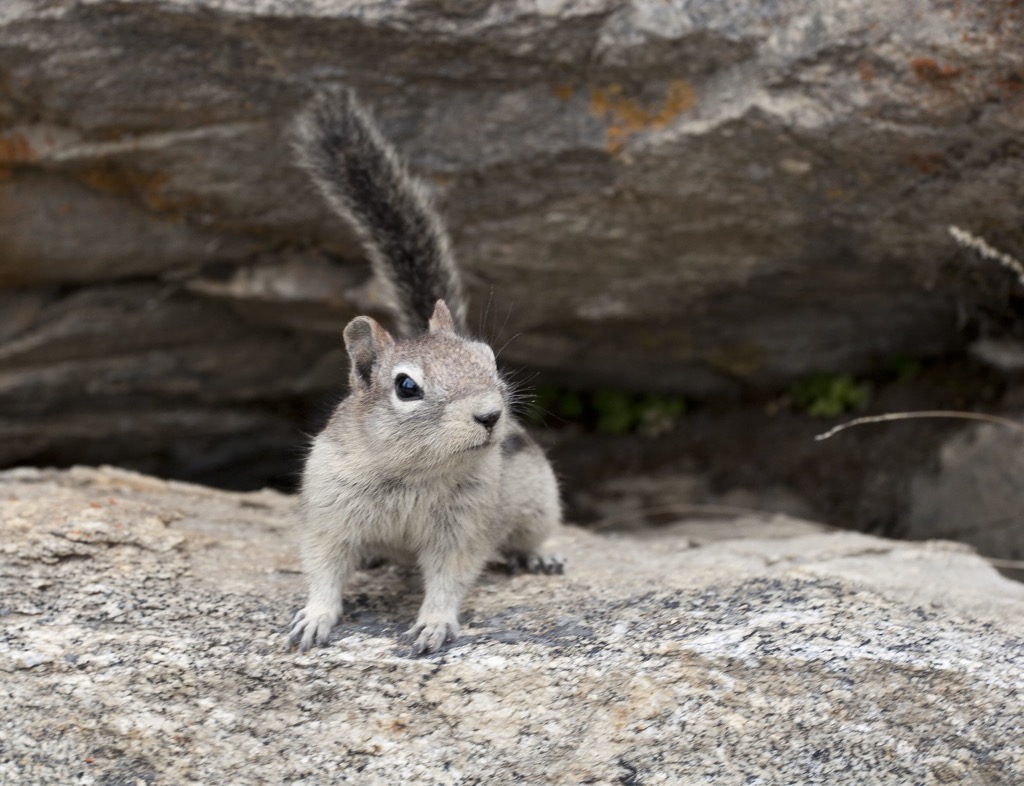
Elk inhabit the subalpine meadows and rock escarpment of Little White Mountain, while grizzly bears, deer, moose, cougar, and mountain goats also inhabit the park. White-throated swifts, Lewis’s woodpecker, flammulated owls, and western screech owls are some of the birds that may be seen while in the park.
Habitation of the Okanagan Valley is believed to have begun about 8,000 years ago. Myra-Bellevue Provincial Park is part of the traditional territory of the Syilx (Okanagan) First Nation, who are part of the Interior Salish culture.
The Interior Salish culture is the inland extension of the Salish culture that emerged from a proto-Salish culture on the Pacific coast about 6,000 years ago. About 4,000 years ago members of the Salish culture migrated and settled in the interior of British Columbia, to become the dominant culture upon the Thompson and Fraser Plateaus.
At the height of the Syilx culture, about 3,000 years ago, upwards of 12,000 people inhabited the Okanagan Valley and surrounding regions. The Syilx followed a traditional seasonal round in which they moved within traditional areas throughout the year to fish, hunt, or collect food. During the winter, the Syilx inhabited semi-permanent villages, where they lived in kekulis, which is a type of pit house.
The first recorded instance of non-indigenous people in the Okanagan valley occurred in 1811, in the form of a fur trading expedition. The fur trade expanded relatively quickly across the Okanagan and Brigade Trail was established to connect the region to the outposts in the north and those at Fort Vancouver.
The trade route lasted until 1846, when the Oregon Treaty established the border between the United States and British North America, which bisected the trail. To avoid tariffs, British and French traders established a new, northern route, which bypassed Fort Okanagan. The valley received few outside visitors for the following decade, until Father Pandosy established the first non-indigenous settlement in 1859.
The Fraser Canyon gold rush of 1858 encouraged settlement of the valley as some miners decided to stake claims around the South Okanagan and Similkameen Valleys. Further settlement occurred at the end of the nineteenth century when farms and ranches were established on military land grants.
The region was initially supported by mining and ranching; however, agriculture soon became a dominant industry. The region is home to British Columbia's first locally created wine and the orchards supply produce for much of Canada.
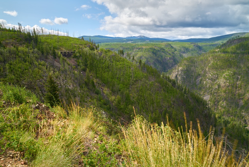
Additionally, the logging industry grew around the valley, and the unique “donut shape” of Myra-Bellevue Provincial Park is related to existing forestry tenures on the slopes of Little White Mountain.
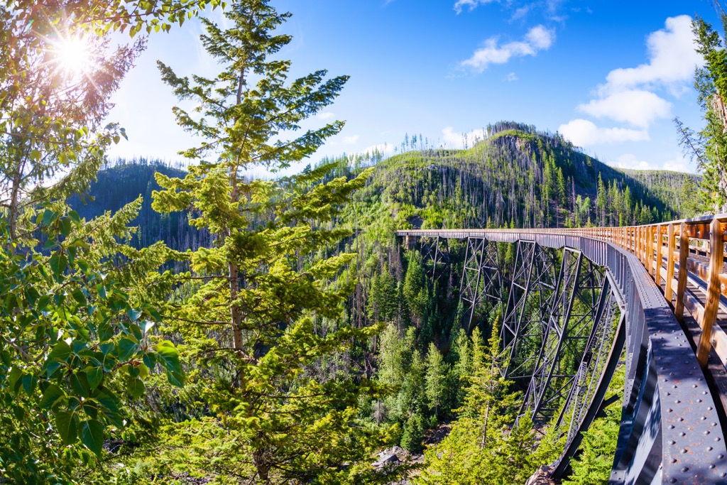
One of the major attractions and human achievements in Myra-Bellevue Provincial Park was the construction of the Kettle Valley Railway through Myra Canyon. The rail line started construction in 1911 to connect the communities of Hope and Midway.
This railway line was created to connect the isolated southeast area of the province to maintain Canadian sovereignty and prevent silver from the Kootenay, Boundary, and Similkameen areas from being shipped to the United States.
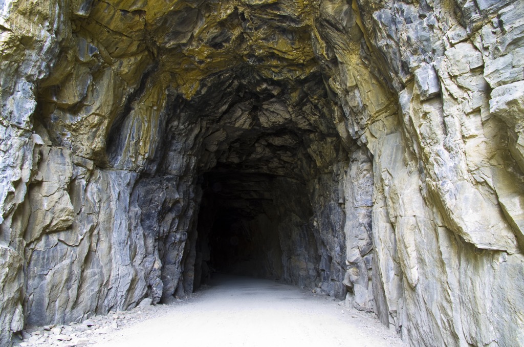
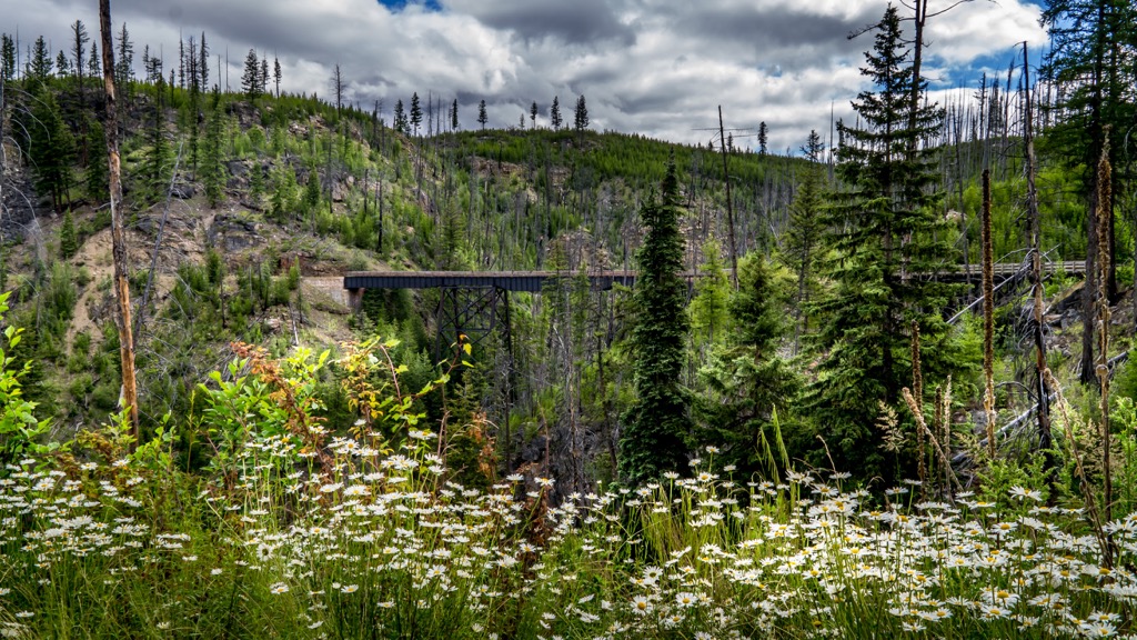
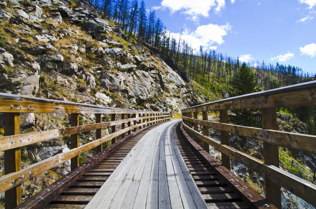
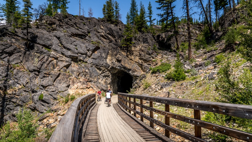
The construction of the railway through the Coquihalla Canyon features five Othello tunnels and two bridges; however, Myra Canyon required significantly more resources to connect the rail line. Traversing the Myra Canyon required the construction of two tunnels and 18 wooden trestles, all of which are now designated as a National Historic Site of Canada.
The 2003 wildfires destroyed a dozen of the wooden trestle bridges; however, those have since been rebuilt. The Myra Canyon portion of the Kettle Valley Railway is part of the Trans-Canada trails and is a popular tourist destination, where hikers and cyclists can follow the historic route over the bridges and through the tunnels.
Encompassing the northern slope of Little White Mountain and Myra Canyon, Myra-Bellevue Provincial Park has several incredible attractions and trails that are worth visiting.
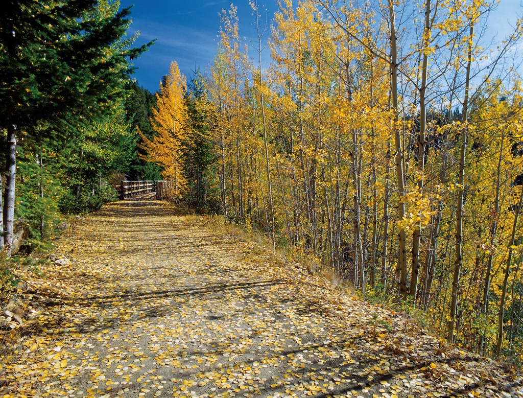
The Kettle Valley Railway right of way is encompassed within Myra-Bellevue Provincial Park and is open to the public as part of the Trans-Canada Trail. The east side of the park is home to Myra Canyon and contains a popular 12 km (7.2 mi) stretch of the trail that features the tunnels and passes over many of the trestle bridges of the Kettle Valley Railway.
Furthermore, the trail along the railway right of way continues for about 18 km (11 mi) through the park and continues along the Trans-Canada Trail, outside of the park. The trail is a popular attraction for cyclists because the views are incredible, and the trail is relatively flat.
Adjacent to the railway are several sites associated with the original construction of the railway. Local organizations lead tours to the remains of construction camps that were discovered by firefighters after the 2003 wildfires. The camps give a glimpse into history and the conditions of the many migrant workers that constructed the magnificent trestle bridges and tunnels.
Angel Springs is in Myra Canyon and is about a 7 km (5 mi) hike to the springs and back to the trailhead. The trail is mostly in the forest and is a great trail to get out of the sun on the hot summer days. Angel Springs features tufa mineral deposits, natural pools, steps, sinkholes, and small caves.
Aside from the Trans-Canada Trail which follows the railway right of way, there are two other major trails that traverse part of Myra-Bellevue Provincial Park. The Crawford Trail and The Okanagan Highland Trail pass through the park, and both trails lead to the summit of Little White Mountain.
Little White Mountain is one of the rare mountains over 2,000 m that are relatively easy to access via the forest service roads. The trails lead to the picturesque alpine meadows and the views from the summit stretch across the Okanagan Highlands. Crawford Lake is near the summit and is also a popular destination when hiking to the top of Little White Mountain.
Myra-Bellevue Provincial Park serves the relatively large regional population of the Okanagan. The following are some of the major cities and nearby towns.
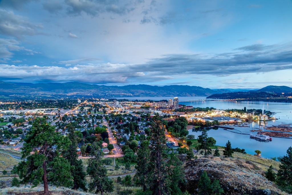
Kelowna is considered the capital of the Okanagan and it is the largest city in the region. It is located on the eastern shore of Okanagan Lake and is adjacent to the north side of Myra-Bellevue Provincial Park.
The warm weather brings tourists from across the region and Canada to enjoy the large lakes and beaches in the Okanagan Valley. Beach and lake life are the main reason that people come to the Okanagan. However, there are some great hiking areas nearby, such as Okanagan Mountain Provincial Park and Myra-Bellevue Provincial Park.
Kelowna is also home to British Columbia’s first winery, and since the nineteenth century, over 200 wineries and vineyards have been opened in the region. The Okanagan is also home to countless orchards that sell their produce at roadside and farm stands. Some of the orchards allow visitors to come and pick produce for themselves, such as apples, cherries, and blueberries.
The city of Vernon is situated at the north end of Okanagan Lake and Kalamalka Lake, about 50 km (30 mi) north of Myra-Bellevue Provincial Park. Set among rolling hills that are home to ranches, farmland, vineyards, and orchards, the city of Vernon is a true oasis on the shores of Okanagan Lake.
Vernon is a little smaller and a little more relaxed than the nearby city of Kelowna; however, it has all the amenities you need for an enjoyable trip. Some of the things around town to do are vineyard tours, farmer’s markets, and enjoy nature upon the water or in the wilderness.
Some of the closest hiking areas are Silver Star Provincial Park, Graystokes Provincial Park, and Wrinkly Face Provincial Park. Some of the lakeside parks are Kekuli Bay Provincial Park, Ellison Provincial Park, and Fintry Provincial Park. Fintry Provincial Park is the location of an historic homestead and there is a beautiful waterfall that visitors can hike to.


