
Scan the QR code and open PeakVisor on your phone
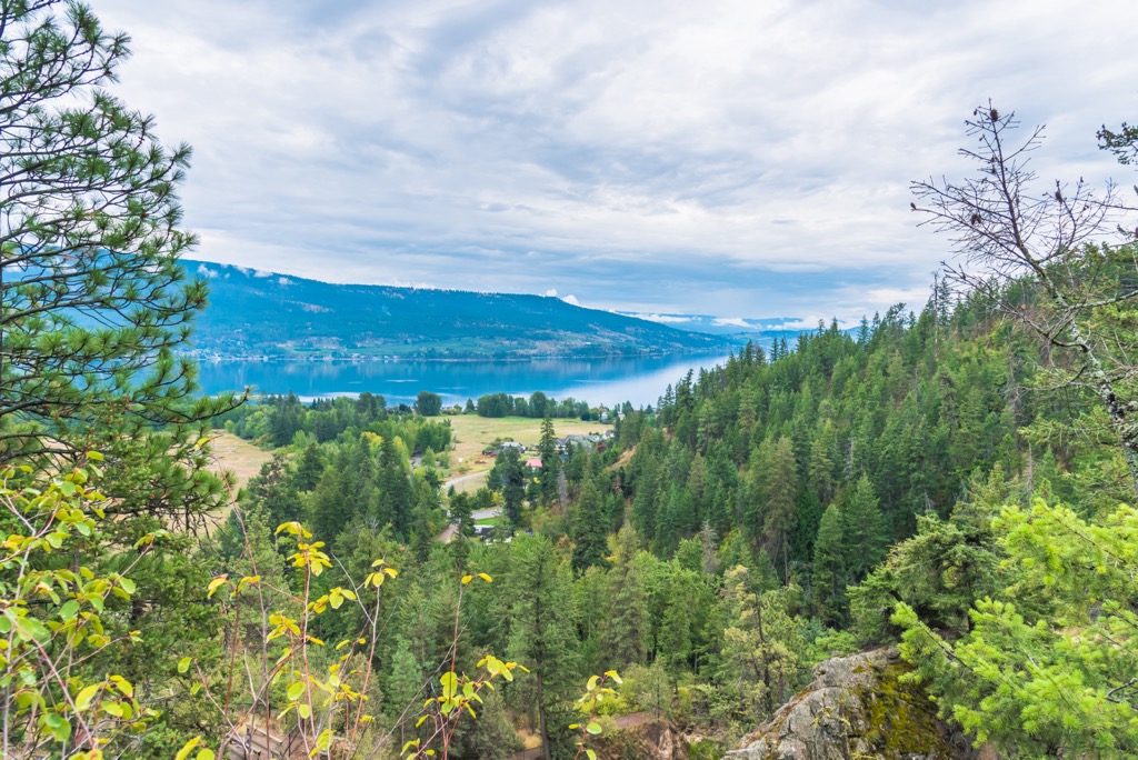
Fintry Provincial Park encompasses 360 hectares (889 acres) of the historic Fintry Estate, which is located on the shores of Okanagan Lake in central British Columbia, Canada. The park features a campsite, historic buildings, interpretive trails, and educational programs to help visitors understand the history of settlement in the Okanagan.
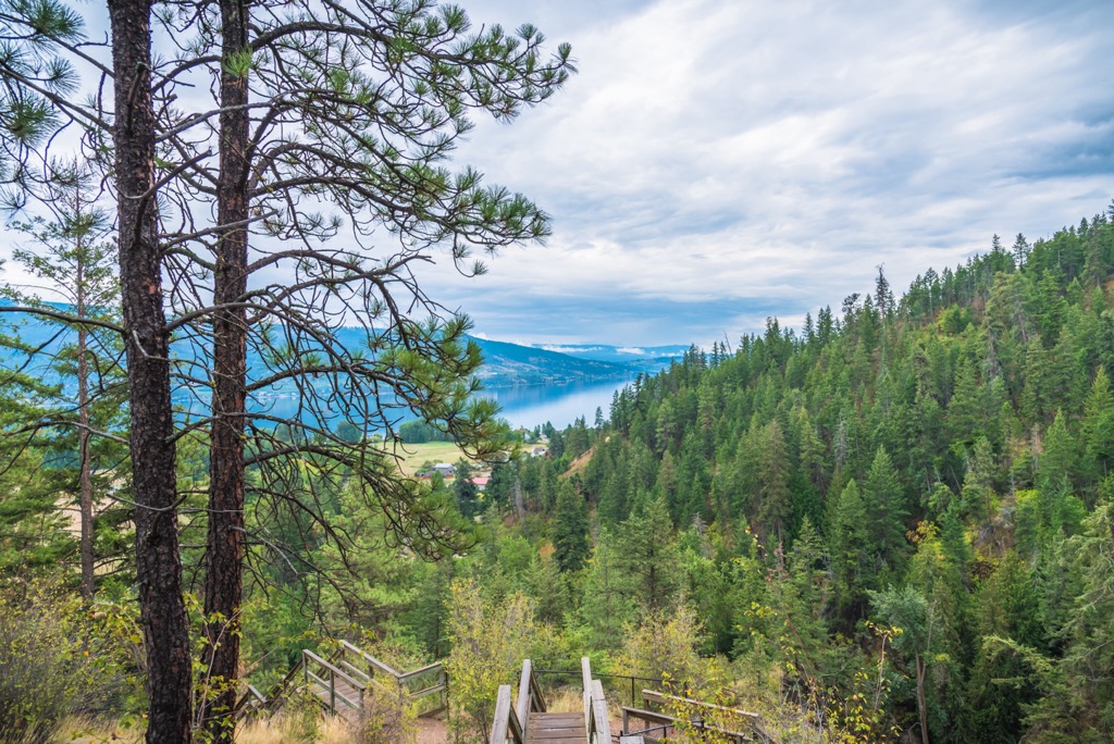
Located along the west side of Okanagan Lake, in British Columbia, Canada, Fintry Provincial Park is a protected area that holds unique historical and ecological value for the region. For a park that is only 360 hectares (889 acres) in size, Fintry manages to contain two distinct topographical areas as well as a number of significant historical sites.
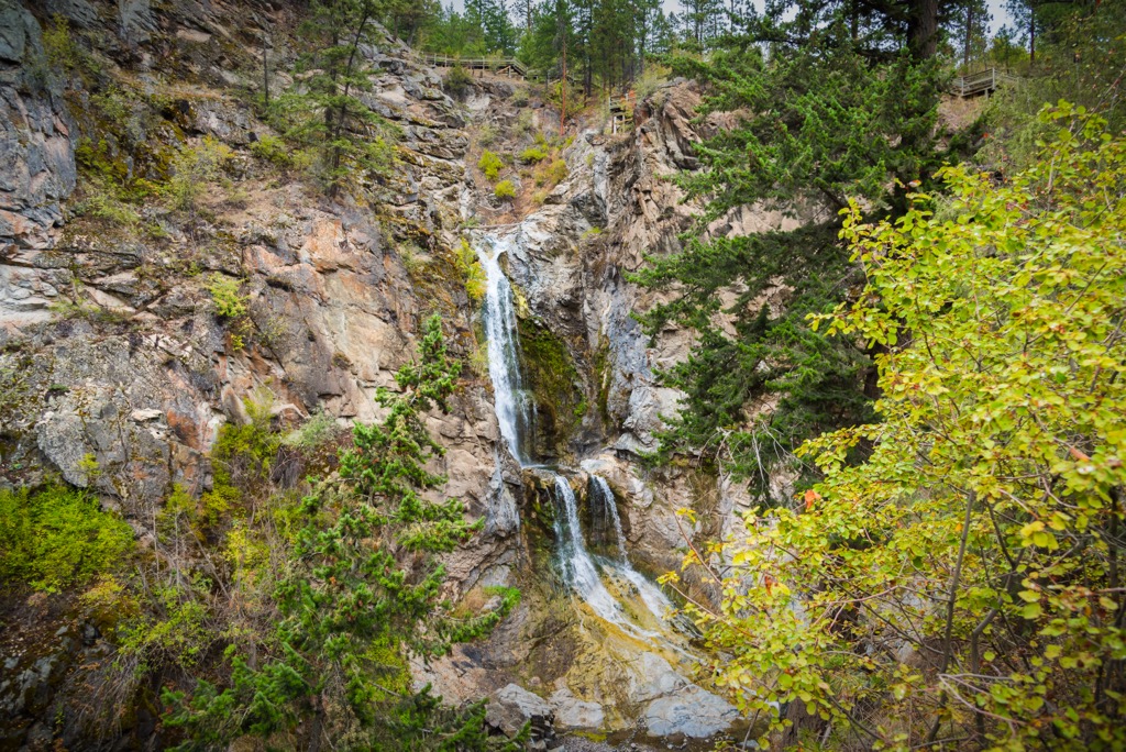
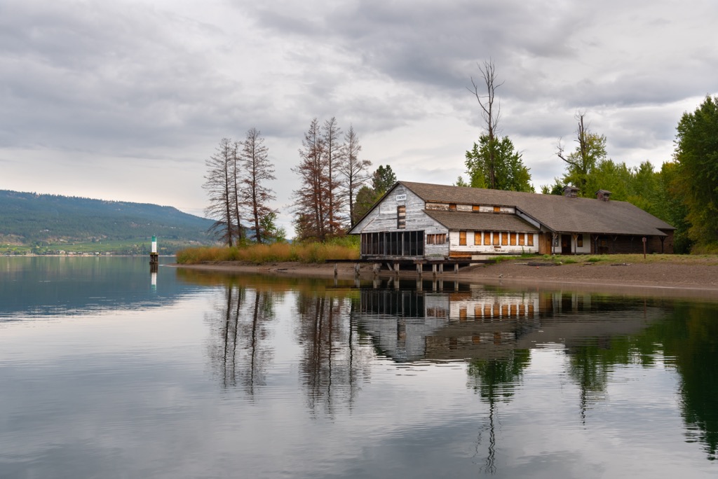
The park preserves the waterfront and the deep canyon of Okanagan Lake, through which Short Creek flows and creates waterfalls and a series of deep pools. Furthermore, the historical aspect of the park is represented through the Manor House, the octagonal barn, several other farm buildings, and the remnants of power generation and irrigation systems along Shorts Creek.
Fintry Provincial Park is one of the many parks in the Regional District of Central Okanagan, and it includes the Fintry Protected Area that’s located nearby. Other parks in the general area include:
The western side of Okanagan Lake, which is home to Fintry Provincial Park, is part of the Thompson Plateau. Meanwhile, the eastern side of the lake is geologically part of the Okanagan Highlands. The Okanagan Lake, which divides significant portions of the plateau and highlands, formed in a fault line.
The Okanagan fault runs from north to south along the center of the Okanagan Valley and is the reason why the lake is so deep and long. The Okanagan fault made its first significant appearance during the Eocene, about 55 million years ago. During this time, as the fault opened, there was significant volcanic activity. As a result, magma intruded the layers of rock, creating granite intrusions in the region.
During the Oligocene, the layers of rock that had accumulated in what’s now the Central Okanagan began to backslide. The younger layers of rock slid westward for upward of 100 km (60 mi), which exposed the older layers of rock. These older layers are now visible on the east side of Okanagan Lake and in the Okanagan Highland. A similar process occurred to the west, where the Rocky Mountain Trench opened between the Rockies and the Columbia Mountains.
The western side of the lake, which includes Fintry Provincial Park, is mainly composed of layers of sedimentary, volcanic, and plutonic rocks that slipped westward during the Oligocene. To the east of the lake, the bedrock is primarily composed of a mixture of metamorphic and plutonic rocks.
It was about 15,000 years ago that Lake Okanagan finally formed in its current size. At this time, glacial remnants remained at the bottom of the Okanagan Fault and were covered with hundreds of meters of glacial sediment and silt. As the ice finally melted, a massive kettle lake, known as Okanagan Lake, formed along the fault.
Furthermore, significant areas around Fintry Provincial Park are built upon the alluvial fans and deltas that glaciers laid down over 10,000 years ago. Vast deposits of silt and clay are seen in the cliffs that line the west side of Highway 97 in the Okanagan.
Fintry Provincial Park is considered to be quite exceptional because it contains tremendous historical and ecological significance in such a small area. Indeed, this 360-hectare (889-acre) park is home to many incredible ecological features.
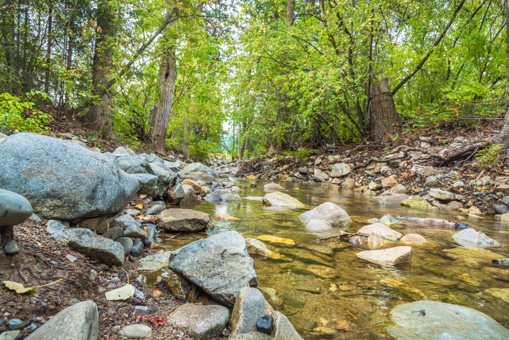
Among the most spectacular features of the park is the Shorts Creek Canyon, which has many scenic waterfalls and important ecosystems. Shorts Creek Canyon is also home to important spawning grounds for kokanee and essential rearing habitat that helps support rainbow and brook trout through their first two years of life.
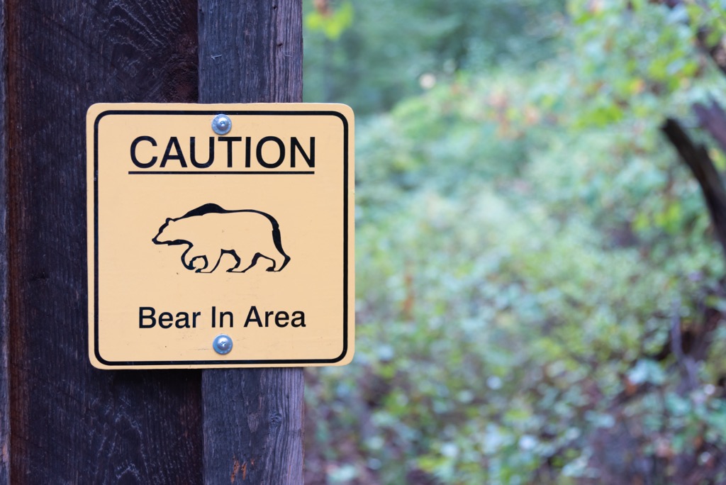
The canyon is also part of the historical range for California bighorn sheep, which would use the canyon's steep cliffs to escape predators. Additionally, the park has a very important winter range for deer, which is used extensively during severe winter conditions.
Most of the flora within Fintry Provincial Park is part of the Ponderosa Pine ecosection. This ecosection is home to some of the hottest and driest conditions in Canada.
Forests of ponderosa pine and Douglas fir surround the old orchard and hay fields of the Fintry estate. Along the beach, there are stands of endangered cottonwoods, and, if you look carefully, you may be able to find the rare Okanagan flame thrower plant.
California bighorn sheep inhabit the canyon and park, as do Townsend’s big-eared bats, and the western grebe. There is a known bald eagle’s nest in the park, too.
Some of the other animals that are known to pass through the region include black bears, grizzly bears, lynx, marten, coyotes, moose, white-tail deer, and mule deer. You can also see pileated woodpeckers, great-horned owls, northern goshawks, and ruffed grouse in the park.
The region that surrounds and includes Fintry Provincial Park is part of the traditional territory of the Syilx (Okanagan) First Nation.
The archeological sites in the region are still being studied; however, it is likely that a number of traditional trails crossed through the current park boundaries and that First Nations traditionally fished at the mouth of Shorts Creek. It is also likely that summer camps were set up on the delta so that First Nations could gather resources, fish, and trade.
Fur traders with the Hudson’s Bay Company were likely the first non-Indigenous people to encounter the First Nations of the Okanagan. In 1811, David Stuart traveled along a series of trails that took him from Fort Okanagan to Kamloops. This path would later be known as the Okanagan Brigade Trail, and it was used for another century by trappers and traders in the region.
The Fintry Estate is a good example of the agricultural and settlement history of the Okanagan. It was among the earliest settlements that were built in the early twentieth century by immigrants as self-sufficient pioneer communities.
The first European settler of the land was Thomas D. Shorts, a pioneer steamboat captain. Shorts played an important role in the maritime history of the Okanagan, as he had established a fleet of boats on Okanagan Lake.
In 1909, James Cameron Dunwaters purchased the property, and he eventually added many of the historic buildings that are still standing in the area to this day. Dunwaters named the Fintry Estate after an ancestral estate in Scotland. Furthermore, he erected the Manor House, the Octagonal Dairy Barn, the Packing House, the Gatekeepers House, and many of the other farm buildings that we see in the region.
The buildings on the estate were built from stone quarried from the area as well as from timber harvested in the nearby forests. It’s even known that Dunwaters kept Ayrshire cattle in his dairy barn. Furthermore, there is evidence along Shorts Creek of irrigation and power generation systems that were used for the settlement and estate.
The park area was purchased from private landowners in 1996 to formally establish the area as Fintry Provincial Park. The historic, recreational, and ecological values of the park make it an incredible destination in the Okanagan.
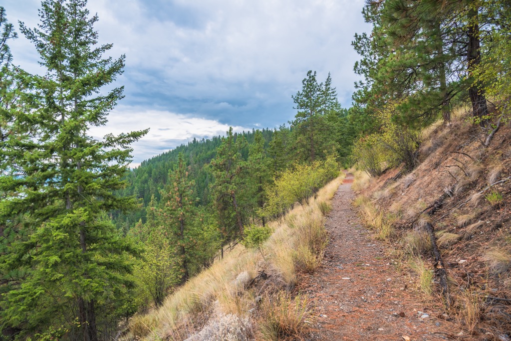
There are two major trails in Fintry Provincial Park. One of these trails brings you to some of the park’s historic features while the other leads to viewpoints of the waterfall. Here’s a look at some of the best hikes in Fintry Provincial Park that visitors can check out on their next trip to the region.
Starting from the Manor House, the trail around the historic sites of the delta takes about an hour for most people to complete.
This self-guided tour has an online brochure that describes each of the stops on the trail. On this hike, you’ll start at the Manor House and make your way through the gardens, to the pumphouse, the packinghouse, the octagonal barn, and to the rest of the historic buildings and sites in the park.
The Historic Delta shows the ingenuity of Dunwaters as he built up the Fintry Estate. Further signs of his ingenuity can be seen in Shorts Creek Canyon where he harnessed the speed of the water to provide his estate with power, running water, and irrigation. The water power from the creek was even used to operate his on-site sawmill.
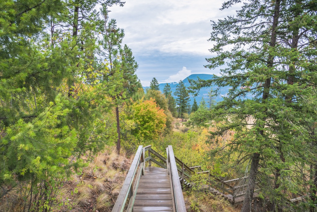
Starting from a gravel parking pad near the octagonal barn, the aptly named Shorts Creek Trail leads hikers to the waterfalls along Shorts Creek. This trail follows along narrow and steep cliffs, and it ultimately leads to a series of viewing platforms where visitors can take in one of the three falls of Shorts Creek.
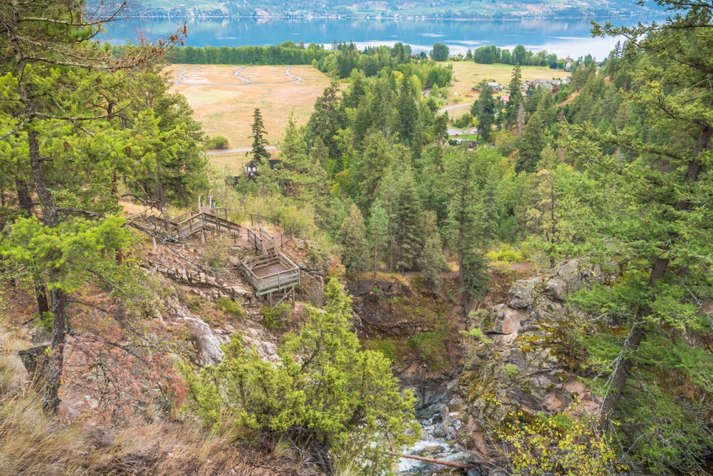
In addition to views of the stunning two-tiered cascade, this trail highlights remnants of the estate’s irrigation system and the chalet site, which was where Dunwaters had built a lodge for his gardener. This short hike offers stunning scenery and insight into the history of European settlement in the area.
Fintry Provincial Park is considered to be a destination park for many in the region. It is located along the shores of Okanagan Lake, and it offers many amenities for visitors, including a campground.
Visitors come to Fintry from across the province and country, as well as the nearby communities for a getaway adventure in southern British Columbia. The following are some of the nearby communities and cities that are worth checking out if you’re in the area.
The city of Kelowna, British Columbia, is situated on the shores of Okanagan Lake just to the south of Vernon in the Regional District of Central Okanagan. Kelowna is seen as the major service and transportation center for the Okanagan, and the de facto capital of the area.
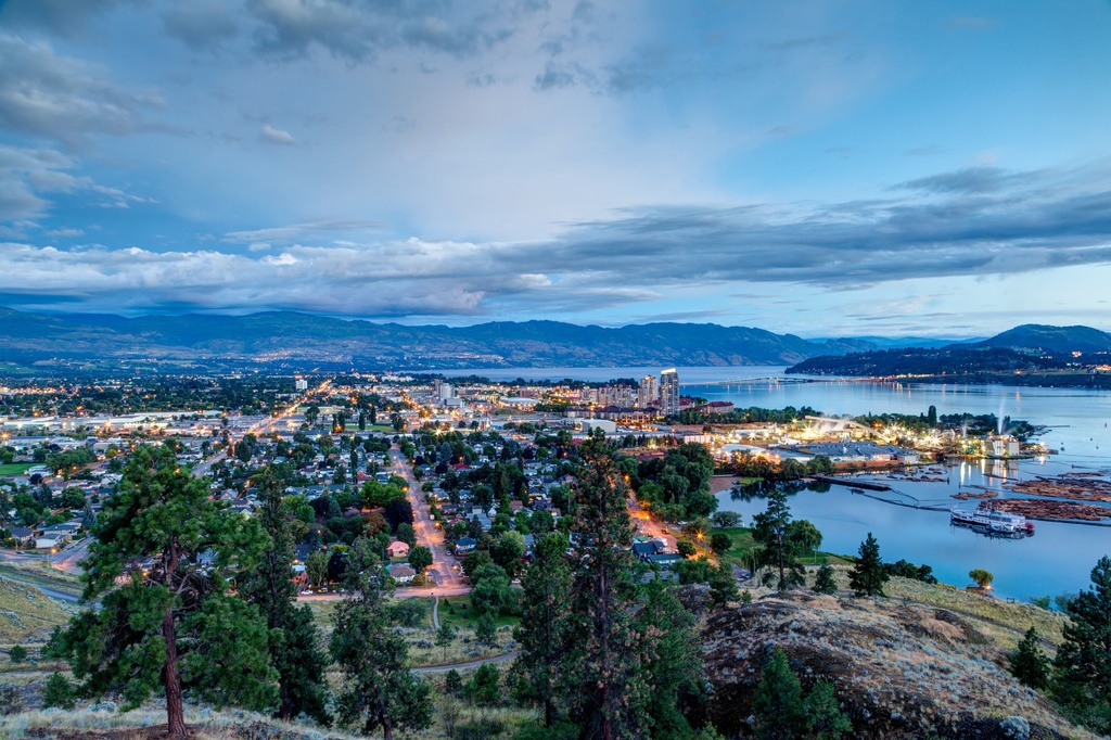
There are many lakeside accommodations in the city for visitors to choose from, as well as campgrounds, and hotels. Kelowna is home to golf courses, fantastic restaurants, orchards, farmer's markets, and many more activities. There are innumerable hiking opportunities around the city, too, many of which lead along the lake, across a ridge, or up a stream to a waterfall.
Some of the parks located near Kelowna that are wonderful for camping, hiking, or other outdoor activities include Okanagan Lakes Provincial Park, Okanagan Mountain Provincial Park, and Myra-Bellevue Provincial Park. Graystokes and Kalamalka Lake provincial parks are also located nearby and are highly recommended destinations.
The city of Vernon is located at the northern end of Okanagan Lake and Kalamalka Lake. It is the largest city in North Okanagan. The Greater Vernon Area also includes the district capital of Coldwater.
Compared to the nearby city of Kelowna, Vernon is a little smaller and a little more relaxed. However, it has all the amenities to make your stay enjoyable without the crowds that sometimes exist at popular locations in Kelowna.
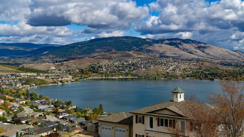
The city is located on the water, and it is surrounded by rolling hills that have ranchlands, farmland, vineyards, and orchards. There are guided and self-guided tours of the region’s vineyards available, too, as well as farmer’s markets to stroll through on the weekends when you’re not on the water or in the hills.
Some of the nearby parks that are worth visiting include Wrinkly Face Provincial Park, Cougar Canyon Ecological Reserve, and Kalamalka Lake Provincial Park. Most visitors to the city make their way down to the lakes where they can enjoy fishing, boating, swimming, or just strolling along the water.


