Scan the QR code and open PeakVisor on your phone
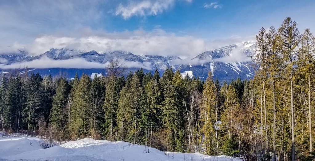
Monashee Provincial Park is a protected area located in the Monashee Mountains of central British Columbia, Canada. There are 9 peaks in the parks, the highest of which is Gates Peak at 2,772 m (9,094) in elevation and the most prominent of which is Mount Fosthall with 819 m (2,687 ft) of prominence.
Located in the Gold Range of the Monashee Mountains, Monashee Provincial Park is one of the many popular provincial parks in the Columbia Mountains of British Columbia, Canada. The park is located along the eastern border of the Regional District of North Okanagan, and it shares its border with the western border of the Regional District of Central Kootenay.
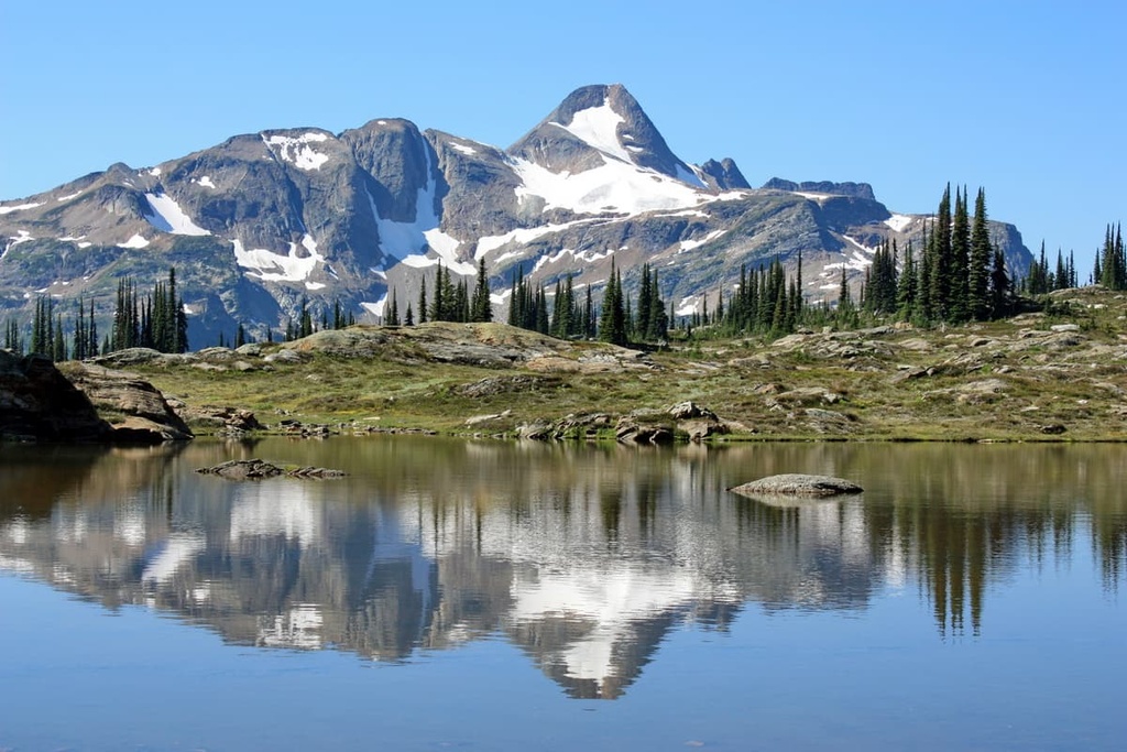
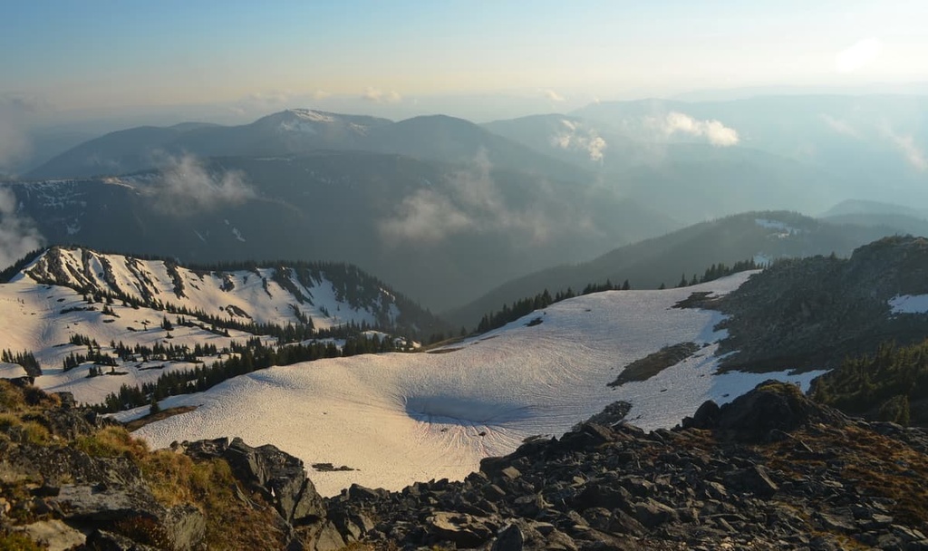
Bordered by the Shuswap River on the west and Upper Arrow Lake (which is part of the Columbia River) on the east, Monashee Provincial Park encompasses many peaks and several beautiful lakes. The rugged peaks of Mount Fosthall and Slate Mountain overlook Spectrum, Peters, and Margie Lakes.
Most of the recreational access to the park is via the Spectrum Creek Forest Service Road on the west side of the park. The forest service road also provides access to Rainbow Fall, which is a waterfall site incorporated as part of the park; however, it is situated about 6 km (3.6 mi) outside of the main park boundaries.
The greater part of the Monashee Mountains used to be referred to as the Gold Range; however, from the late nineteenth century, the Gold Range only referenced a narrow band of peaks on the west side. The range was named the Monashee Mountains by Donald McIntyre, a Scottish highlander who traveled the area in the 1880s and named the range for the Gaelic word monadhsith, which means “mountains of peace.”
Monashee Provincial Park is one of many parks in the region that cater to the conservation of the local ecosystems and the creation of wilderness recreational sites. Other parks that are located nearby include:
The Columbia Mountains were the first mountains of the Canadian Cordillera to form, followed by the Interior and Coast Mountains of British Columbia, and finally the Canadian Rockies. As part of the Columbia Mountains, the Monashee Mountains and the Gold Range formed between 185 million and 55 million years ago.
The rocks of Monashee Provincial Park are mostly sedimentary and metamorphic rocks of the Shuswap terrane. These sedimentary rocks formed along the ancient west coast of Canada when the Columbia Mountains were situated along the continental shelf and marine sediment accumulated to make thick layers.
As the supercontinent of Pangea broke apart and the continents and tectonic plates began to drift, North America collided with the Farallon plate, which was the underlying part of the Pacific Ocean. The collision of the plates created the force which folded, compressed, and stacked the layers of rocks to form the mountains that we see today
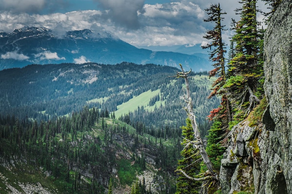
The history of the formation of the Monashee Mountains can be seen throughout the park as the severe folds expose many different layers of colour and composition. While it was the initial mountain building process that created the folds and bends in the layers of rock, the glaciers and ice sheets of the Pleistocene created much of the topography that we see today.
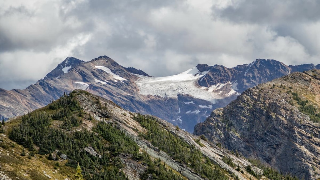
During the Pleistocene, only the peaks above 2,440 m (8,000 ft) escaped the intense erosion of the cordilleran ice sheet, as they stood above the ice as nunataks. Many peaks of the Gold Range, and Mount Fosthall were tall enough to escape the ice sheet; however, they were severely glaciated by cirque glaciers, which carved horns and cirques into the peaks. Several cirque glaciers remain in the Gold Range as remnants of the last glacial maximum.
The peaks and terrain in the park that are less than 2,130 m (7,000 ft) in elevation were severely overridden by the ice sheet, which rounded many of the features and created U-shaped and hanging valleys. As the glaciers retreated, morainal deposits of glacial till were left across the park.
The ecology of Monashee Provincial Park is represented by three ecological zones that correspond to the alpine, subalpine, and valley areas of the park.
The alpine is representative of the Interior Mountain Heather Alpine ecology, which has a high annual snowfall; however, the relatively warm temperatures in the region allow for a long growing season with a diversity of plant life. Mountain heathers are among the most common plants in the park, alongside mosses, lichens, wildflowers, and sedges.
The tree line of the park is typically forested with stands of subalpine fir that transition to a dense forest downslope where Engelmann spruce is the dominant tree. Along the Shuswap River, Vigue Creek, Spectrum Creek, and Bill Fraser Creek, there is also a band of the Interior Cedar Hemlock ecology.
The forests of the Interior Cedar Hemlock ecology contain some of the legendary tree giants, with western redcedar growing over 4 m (15 ft) in diameter and Douglas fir trees growing nearly 90 m (300 ft) tall. Along the rivers and creeks, the floodplains are also inhabited by stands of mountain alder, common horsetail, cottonwood, and red-osier dogwood.
Between 1962 and 1993, approximately 462 hectares (11,41 acres) of land were logged along the Shuswap River before the area was added to the park. However, 50 percent of the forests of Monashee Provincial Park are over 120 years old and 8 percent are over 250 years old.
Moose, mule deer, golden eagles, white-tailed ptarmigan, northern goshawk, pika, mountain goats, cougars, and black bears are all inhabitants of Monashee Provincial Park. Additionally, the park is home to threatened species such as grizzly bears, wolverines, and Townsend’s big eared bats, as well as the endangered mountain caribou.
The lakes and rivers of the park are full of a variety of fish; however, the waterfall along the Shuswap River prevents some species from swimming up to the park from the ocean. Bull trout, rainbow trout, Dolly Varden, kokanee, and sculpin are the main fish species found in Monashee Provincial Park.
As the glaciers made their final retreat from the Monashee Mountains about 10,000 years ago, humans started to arrive in the region. While there are no pre-contact archeological sites in Monashee Provincial Park, there are several locations along the valley corridors of Spectrum and Vigue Creek that were used well before the arrival of European trappers and traders as campsites by Indigenous peoples.
It is also likely that the original inhabitants of the region hunted the mountain caribou that inhabited the park, as it has been a staple of the First Nation’s diet for thousands of years. Additionally, the park supports vegetation that was typically gathered as part of the traditional “seasonal round,” which historically guided the collection of resources in the region.
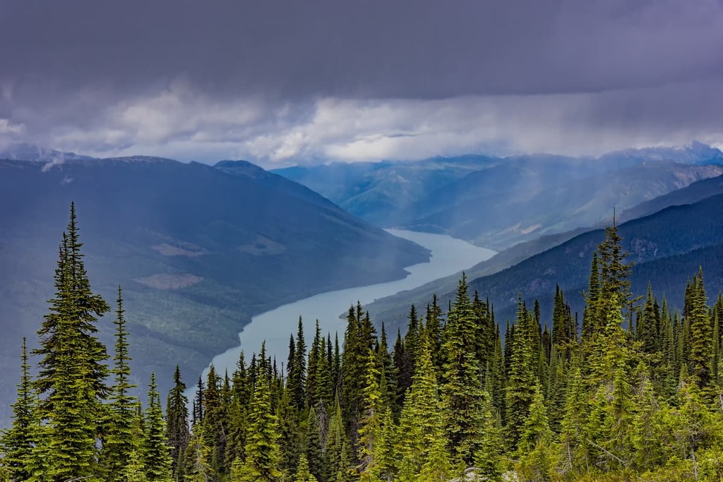
The park is located in the traditional territory of the Sinixt, Okanagan, Secwépemc, and the Ktunaxa. While the Ktunaxa are a distinct group, the others are related as members of the Interior Salish culture, and have long been known for their skill in harvesting salmon from the rivers. It is likely that many Indigenous peoples harvested salmon from the waters below the falls of the Shuswap River.
Nearby, at Sugar Lake, an archeological site was uncovered that showed evidence that the region had been occupied for the past 4,000 years. The Splatsin First Nation historically used Spectrum Lake, Cirque Lake, and Mount Fosthall, and they long maintained a trail system leading into what is now the park from Sugar Lake.
The rugged peaks, racing rivers, clear creeks, and stunning wilderness of Monashee Provincial Park hold many exciting and beautiful places to explore and discover. The following are some of the main trails and attractions in the park:
Located about 6 km (3.6 mi) outside of the borders of Monashee Provincial Park, Rainbow Falls is incorporated into the management area of the park and is a worthwhile stop while in the area.
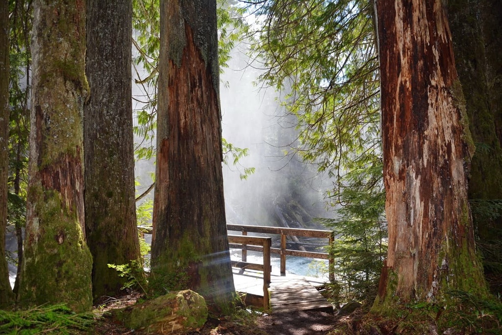
It is just a short walk to the falls from the parking lot. There are two boardwalks leading to the falls and two viewing platforms from which to view Spectrum Creek as it plummets into the river below.
The park has a day use and picnic area near the falls in addition to the trailhead for the Spectrum Lake Trail Corridor. This trail is a 40 m (150 ft) wide, 6 km (3.6 mi) corridor route that leads from the outlier Rainbow Falls into the main area of Monashee Provincial Park.
Monashee Provincial Park has several well-maintained hiking trails that lead to the backcountry campgrounds throughout the park. From the backcountry campgrounds, there are additional trails that lead further into the backcountry to some of the incredible destinations in the park. The following are the primary trails through the park:
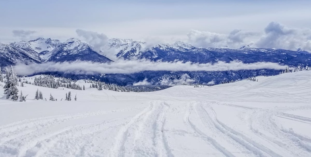
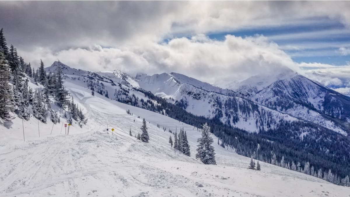
Thanks to the incredible backcountry slopes in the park, heliskiing has become a popular activity for many visitors to the region. Most of the heli-skiing tours take off from the commercial lodge that’s located outside of the park boundaries; however, many visitors choose to travel the park by ski touring. While most ski tours leave from the lodge, the main hiking trails into the park are good access points for the beginning of a ski tour.
Monashee Provincial Park has some opportunities for climbing, scrambling, and mountaineering.
The main destinations on the park for climbing and mountaineering are Mount Fosthall and Slate Mountain; however, there are many other cliffs and peaks in the parks that will pose a challenge to climbers looking for something off the beaten path.
As it is located near the between the Shuswap and Columbia Rivers, Monashee Provincial Park is in the middle of pristine recreational wilderness. It is surrounded by several cities which cater to outdoor recreation.
The following are the major cities near Monashee Park from which you can start your adventure into the park or find rest when you’ve made it out of the wilderness:
Located at the southern edge of the Columbia-Shuswap Regional District, Revelstoke is not technically situated in North Okanagan; however, visitors from the east will drive through it to get to North Okanagan and there are a lot of activities that make it a worthwhile rest stop.
Revelstoke is popular for its downhill skiing opportunities at Revelstoke Mountain Resort as well as its backcountry cat-skiing and heli-skiing opportunities. There are many trails to hike near the city, such as the Giant Cedars Boardwalk or the trails in Mount Revelstoke National Park. The Enchanted Forest and neighboring adventure park are also located close to the town, as is the 3 Valley Gap Ghost Town.
The roads leading to Revelstoke often follow the railway tracks and are surrounded by lush forests and steep mountains. There are many waterfalls to spot as well as wildlife to look out for when you’re in the town, too.
The city of Vernon is located at the north end of Okanagan Lake and Kalamalka Lake. It is the largest city on the North Okanagan. The Greater Vernon Area includes the district capital of Coldwater.
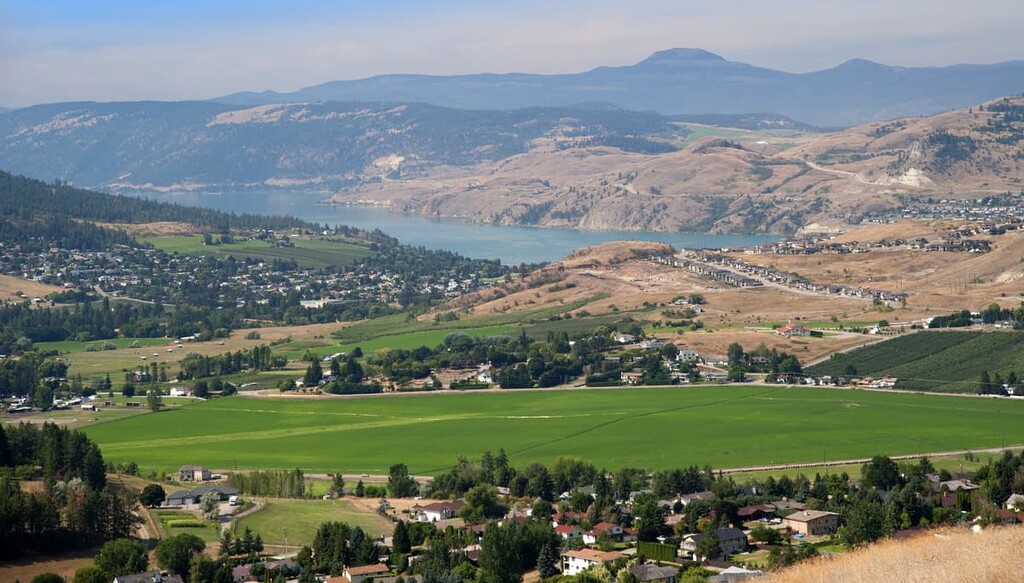
Vernon is a little smaller and a little more relaxed than the nearby city of Kelowna. However, it has all the amenities to make your stay enjoyable without the crowds that sometimes exist at popular locations in Kelowna.
The city is located along the lakes and surrounded by rolling hills that have ranching, farmland, vineyards, and orchards. There are guided and self-guided tours of the region’s vineyards, as well as farmer’s markets to stroll through on the weekends when you’re not on the water or in the hills.
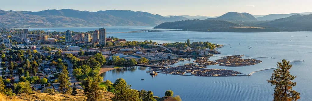
The city of Kelowna, British Columbia spans across Okanagan Lake and it is located just south of Vernon in the Regional District of Central Okanagan. Although Kelowna is located just outside of North Okanagan, it is one of the province’s major metropolitan areas and it offers good access to the North Okanagan region.
There are many lakeside accommodations in the city, as well as campgrounds, and hotels. Kelowna has golf courses, fantastic restaurants, orchards, farmers markets, and many more activities for visitors to enjoy. There are innumerable hiking opportunities around the city, too, many of which lead along the lake, a ridge, or up a stream to a waterfall.