
Scan the QR code and open PeakVisor on your phone
The Camelsfoot Range include 11 named peaks. The highest is Red Mountain at 2,442 m. Other notable peaks include Black Dome Mountain, Mount Birch and French Mountain.
The Camelsfoot Range is a collection of peaks located in south-central British Columbia, Canada alongside the Chilcotin Mountains and the Fraser Plateau. The range has 11 named peaks, the highest and most prominent of which is Red Mountain. The Camelsfoot Range is typically lower in elevation than the Chilcotin Mountains to the west, as its highest point, Red Mountain, is only 2,442 m (8,012 ft) tall.
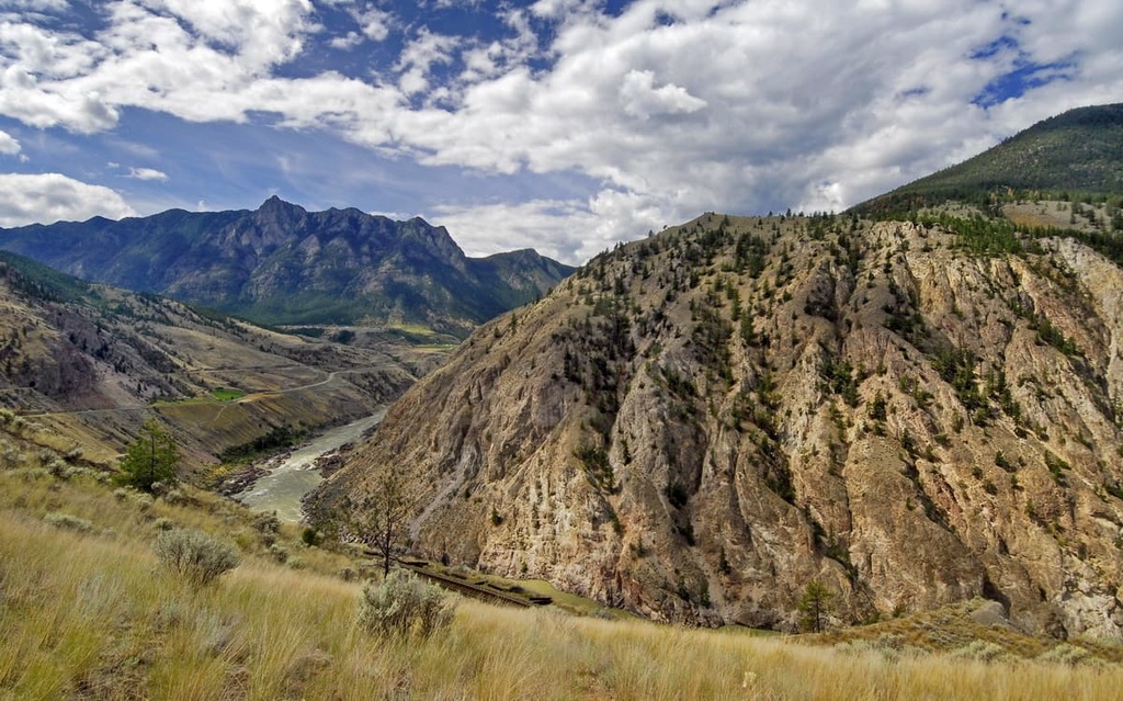
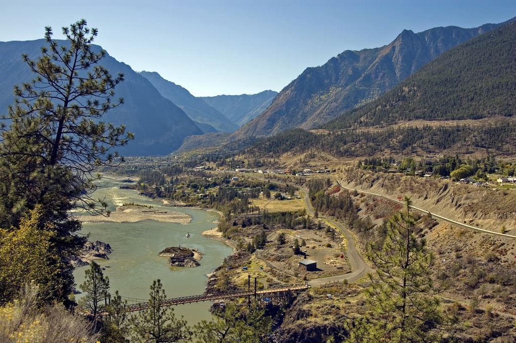
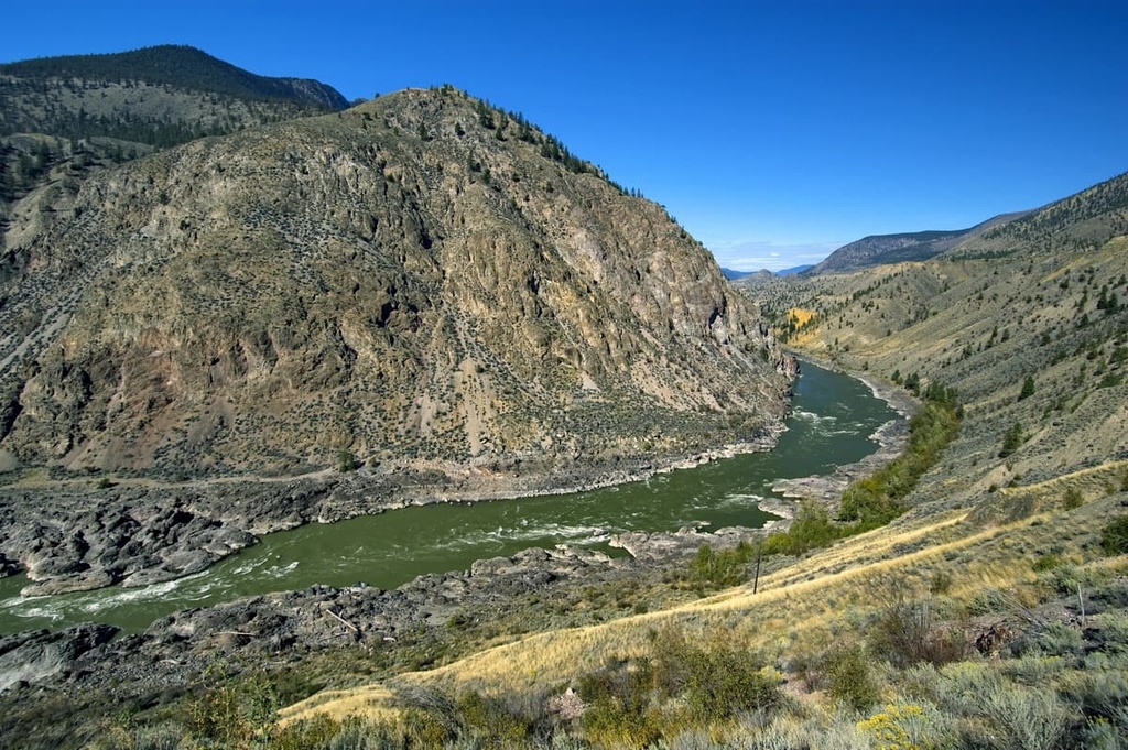
The Camelsfoot Range is situated in the south-central region of the Canadian province of British Columbia. It is nestled to the west of the Fraser River and is considered part of the greater Fraser Plateau.
Some parts of the range are located within a provincial park or protected area. Some of the parks found in the range include:
Additionally, the Camelsfoot Range is bordered by the Marble Range to the east, the Clear Range and the Lillooet Ranges to the south, and the Shulaps Range to the west.
While the Camelsfoot Range appears to be a part of the Pacific Ranges of the Canadian Coast Mountains, it is geologically part of the Fraser Plateau.
The Camelsfoot Range, Marble Range, and the Clear Range are all part of the Fraser Plateau, as are other noteworthy ranges. The Rainbow Range, Ilgachuz Range, and the Itcha Range are ranges created from late Miocene shield volcanoes.
As part of the Fraser Plateau, the Camelsfoot Range consists of layers of sedimentary rock that were overlain by later lava flows. The western front of the range is steep in the west but tends to become much more mellow in topography as you move toward the east.
The volcanic nature of many of the rocks in the Camelsfoot Range mean that there are sizable deposits of gold, copper, and other precious metals and minerals in the region. The range and general region have had many mines of the years, most of which were constructed and excavated during the mid to late nineteenth century.
During the Pleistocene, a cordilleran ice sheet covered western Canada and created much of the current topography in the Camelsfoot Range. The ice sheet was several kilometers thick and covered most of the range.
These glaciers eroded away and rounded most of the lower summits in the region. The few jagged peaks found in the range today would have been exposed when the region was otherwise covered by ice. At the time, they would’ve been referred to as nunataks, which is a peak that sticks out through an ice sheet, ice field, or glacier.

As they had previously been covered by the ice sheet, the mountains and valleys in the region are covered with significant layers of glacial drift. Some of the drift has created formations called moraines, kames, eskers, and drumlins.
Due to the elevation and the location of the Camelsfoot Range on the eastern edge of the Coast Mountains, bordering the interior plateaus, there is a wide variety of ecological zones in the range.
The highest peaks in the range are part of the cold alpine zone, Meanwhile, the slopes are covered with forests representative of the Engelmann spruce–subalpine fir, and sub-boreal pine-spruce ecologies.
The bottom slopes are representative of the montane spruce and the interior Douglas fir ecosystem, and the edge of the range even has part of the hot, arid bunchgrass ecology. With seven different ecosystems found in the Camelsfoot Range alone, there is a large diversity of flora and fauna in the area.
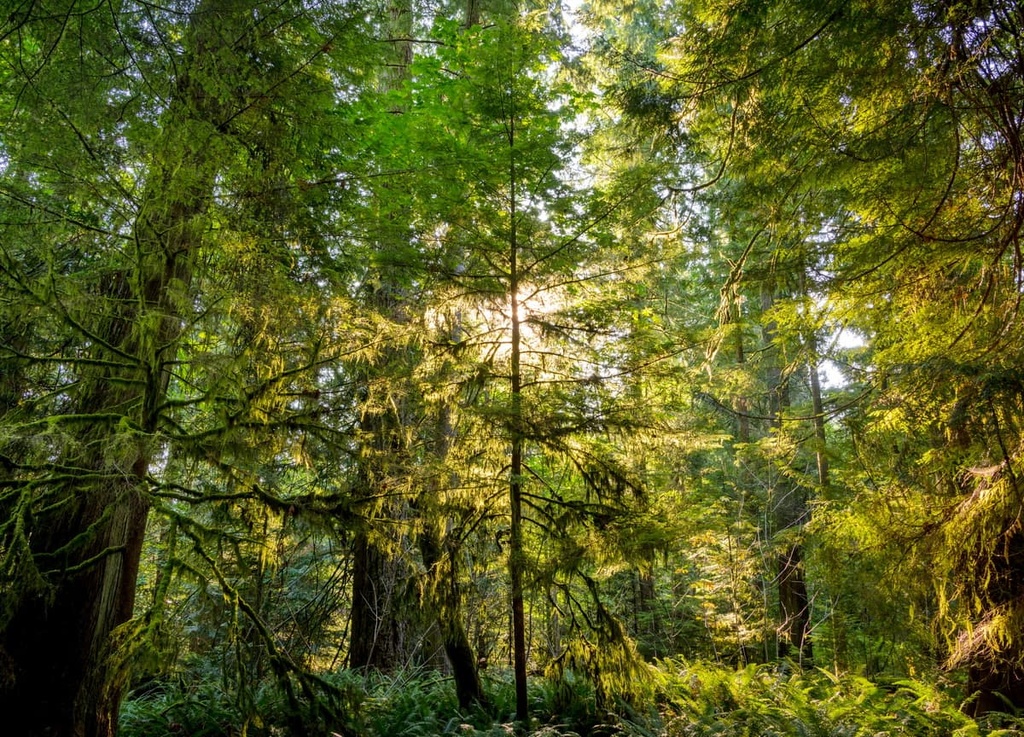
The forests consist of old-growth forests, high elevation aspen stands, a mosaic of dry and riparian forests, and krummholz along the tree line. Additionally, the range contains extensive alpine grasslands and riparian systems.
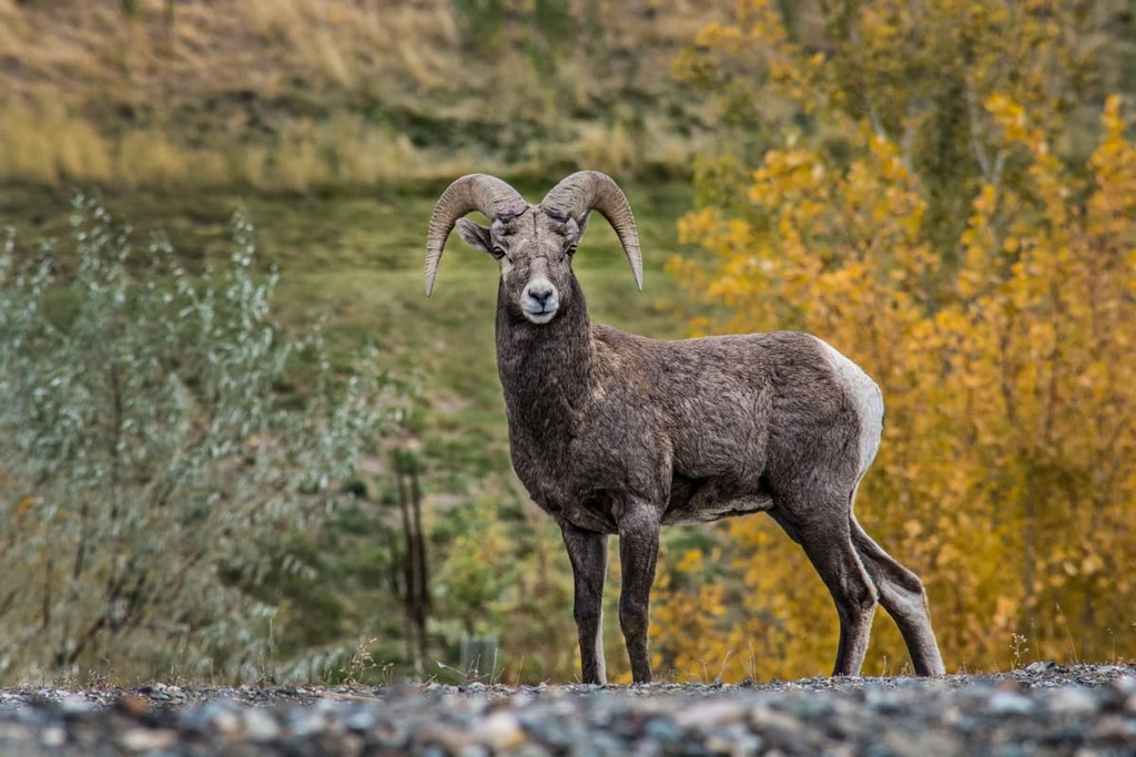
Among the various tree species in the range are stands of whitebark pine, which is a federally listed species at risk. Additionally, California bighorn sheep, which inhabit the range, are an at-risk species.
The range provides habitat and movement corridors for bighorn sheep, mountain goats, mule deer, and other ungulates. The range is also part of important grizzly bear habitat, which extends to South Chilcotin Mountains Provincial Park.
The Camelsfoot Range is part of the traditional territory of the Tŝilhqot’in, St’at’imc, and the Secwépemc First Nations. The area has been used traditionally by Indigenous people for hunting, gathering resources, and spiritual ceremonies.
The first inhabitants of the area likely arrived about 8,000 years ago. At the time, they primarily hunted the ancient megafauna that inhabited North America, such as mammoths, mastodons, and giant bison.
About 4,000 years ago, members of the Coastal Salish culture migrated and settled in the interior mountains and plateaus of what is now British Columbia. Whether it was through warfare or simply better technology, the Salish culture supplanted the previous cultures of the interior. By 2,000 years ago, they became very adept at harvesting salmon, which is still a traditional primary food source.
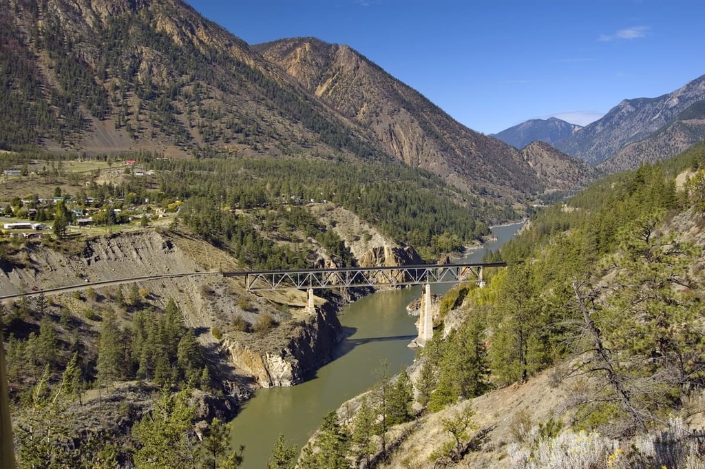
The Camelsfoot Range is home to many important archeological sites, most of which are found along the Fraser River. The Fraser River was a major thoroughfare throughout human history in the region as it provided access to many essential resources. One site along the river is thought to contain the remnants of over 200 pit houses, which may have been the largest settlement in the region.
The life that local First Nations had lived for thousands of years was disrupted with the arrival of non-Indigenous travelers and fur traders. David Thompson traveled through the region on his way to the Pacific Ocean in the early nineteenth century, which opened the area to European traders and prospectors.
Gold and other precious minerals were discovered in the range and the region in the mid nineteenth century. Miners scoured the hills, staking claims and building mines in their attempt to strike it rich. Most of the mines were exhausted and closed by the turn of the twentieth century.
The range is currently part of an extensive backcountry that is enjoyed by hikers, horse packers, and hunters. The rather subdued topography in the region makes for relatively easy travel through the area; however, there are no low elevation passes to cross the range, which can be an unexpected challenge.
Currently, the range is home to several parks and protected areas that are designed to preserve the pristine condition of the wilderness.
The Camelsfoot Range is located less than 200 km (120 mi) from millions of people; however, it is relatively unvisited and has no major developed recreational sites. However, the following are some of the areas that preserve the wilderness and have unofficial trails leading across its beautiful terrain.
Fred Antoine Provincial Park is an outdoor recreation area located in the Camelsfoot Range. It preserves two untouched watersheds and their old growth Douglas fir forests. The park is open for backcountry adventures, and during your travels, you may encounter some of the numerous cultural artifacts that exist in the region from local First Nations.
The park is also home to several rare and endangered wildlife species, such as the fisher, California bighorn sheep, rubber boa, and the peregrine falcon. Other animals you might spot include mountain goats, mule deer, grizzly bears, and perhaps the harlequin duck.
Edge Hills Provincial Park contains the unique and rare dry climate associated with the bunchgrass ecosystem. This area, which is located on the eastern slopes of the Camelsfoot Range, is among the northernmost representation of the bunchgrass ecosystem and its associated flora and fauna.
The park encompasses panoramic vistas of the Fraser River canyon. It also features forested slopes, grassy benchland meadows, and ravines. There are many unofficial and unmaintained trails in the park that were often created during the mining days of the nineteenth century as well as traditional travel routes of local First Nations.
Backcountry hiking and backpacking are permitted in the park, and there are many fascinating places to visit and spend time. While traveling, if you come across any artifacts or archeological sites, keep in mind that it is illegal to destroy or disturb them in any way.
Located in the upper elevations of the Camelsfoot Range, Yalakom Provincial Park protects the region’s old growth forests, high elevation aspen stands, and krummholz forests. While exploring some of the unofficial trails through the park, you may have the opportunity to see California bighorn sheep, mountain goats, or mule deer during their migration.
Furthermore, the park contains fascinating examples of the geological processes that created the mountains, such as the thick metamorphosed rock forming scarp and dip slope topography. The park is open for backcountry adventuring, and it permits random wilderness camping.
The Camelsfoot Range is located on the border of the Chilcotin Mountains and the Fraser Plateau. The range has incredible scenery, superb wildlife viewing opportunities, and a vast expanse of trackless backcountry through which to adventure.
The following are some of the communities and cities near the range from where you can start your adventures.
Vancouver’s first settlement grew from a makeshift site called Gastown at the edge of Hastings Mill, which was built by Gassy Jack in 1867. Marked by the Gastown steam clock, historic Gastown grew into the third-largest metropolis in Canada.
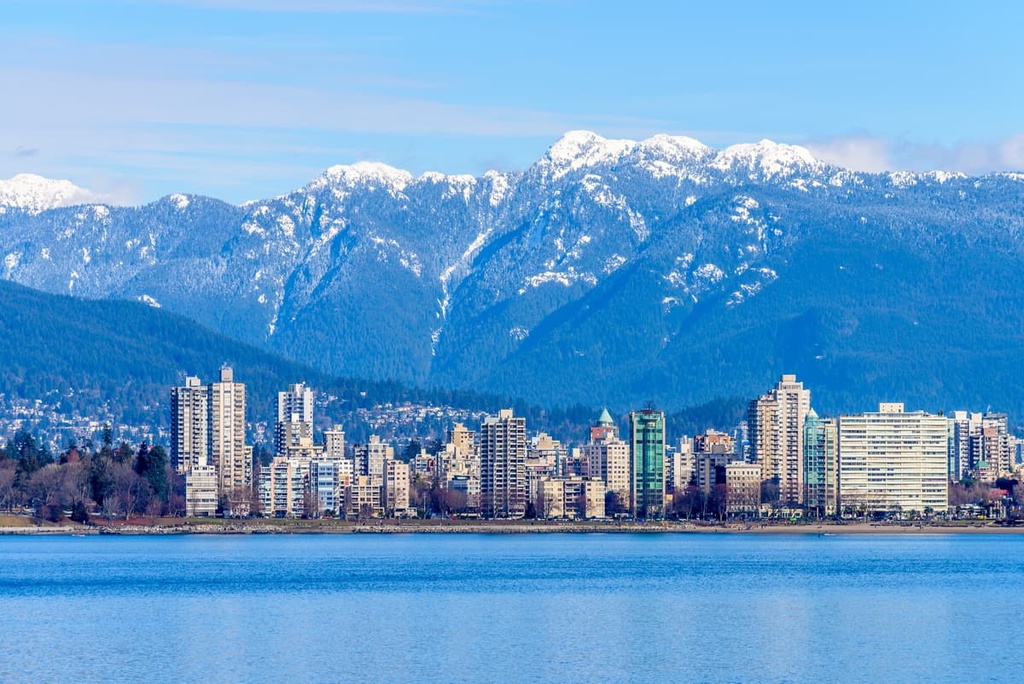
Surrounded by dense forests, the main economy of Vancouver still rests with logging and forestry; however, tourism and movie production are now both major industries in the city. The city has hosted major events such as the PNE, EXPO 86, and the 2010 Winter Olympics. It’s also the home of TED Talks and it has many stunning venues and sites to visit.
If you’d like to get out into nature but you don’t have time to leave the city, Stanley Park is one of North America’s largest urban parks. If you do have the time to venture outside the city, the following are some of the popular hikes around Vancouver: St. Marks Summit, Quarry Rock, Norvan Falls Trail, Pacific Spirit Regional Park, Burnaby Lake Park, and the infamous Grouse Grind.
Additionally, some of the amazing provincial parks that are easily accessible from the Lower Mainland include Golden Ears Provincial Park, Garibaldi Provincial Park, Mount Seymour Provincial Park, Indian Arm Provincial Park, Pinecone Lake – Burke Mountain Provincial Park, and Tantalus Provincial Park.
Over two million people visit Whistler every year, primarily for alpine skiing and snowboarding during the winter; however, downhill and mountain biking are also popular at the Whistler Blackcomb Resort. The town is located about 120 km (72 mi) from the densely populated Vancouver and the Lower Mainland. It is the primary ski hill for locals and international skiing destination.
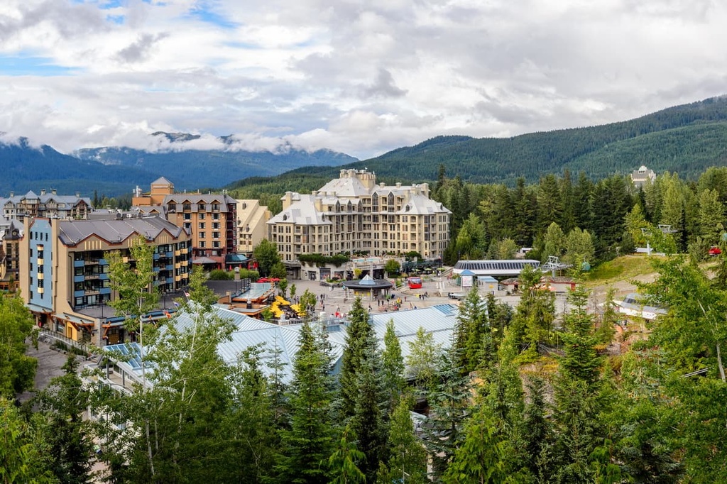
Resort skiing and cycling are popular activities in the town and there are also many great trails in the area to hike. Hikes to Garibaldi Lake, Black Tusk, Panorama Ridge, the Ancient Cedars Trail, and Cheakamus Lake are all great options if you have some free time during your visit.
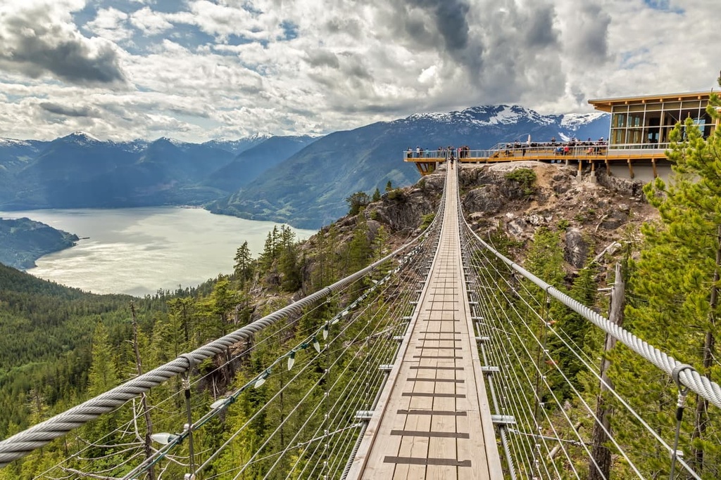
Squamish is to climbing as Whistler is to skiing. With nearly 2,000 recorded climbing routes in and around the town, climbers come from all over the world to perfect their craft in Squamish. The town is located at the end of the Howe Sound and is about 160 km (96 mi) from the south end of the Camelsfoot Range.
Some of the popular areas to climb in Squamish include the Stawamus Chief, which is a granite massif with over 300 climbing routes. Shannon Falls, Murrin Park, The Malamute, and the Smoke Bluffs provide an additional 1,500 routes in the town. There are also over 2,500 published bouldering problems that can be found using local guidebooks.
Additionally, you can also see one of the largest populations of bald eagles in North America from the nearby community of Breckendale. Squamish is also popular for windsurfing and kiteboarding, ultra trail running, visiting Shannon Falls, river-rafting on the Squamish and Elaho Rivers, snowmobiling, hiking, mountaineering, and backcountry skiing.


The highest peak in the Camelsfoot Range is Red Mountain, at 2,442 m.
The Camelsfoot Range have 11 named peaks.


