
Scan the QR code and open PeakVisor on your phone
The Shulaps Range include 6 named peaks. The highest is Big Dog Mountain at 2,859 m. Other notable peaks include Shulaps Peak, Rex Peak and Shulaps Range.
Named after the word for male mountain goat in the Tsh’ilqotin (Chilcotin) language, the Shulaps Range is a subrange of the Chilcotin Ranges in British Columbia, Canada. The range is located along the border of the Squamish-Lillooet Regional District and the Cariboo Regional District and has 6 named peaks. The tallest peak in the Shulaps Range is Shulaps Peak, which stands at 2,880 m (9,449 ft) in elevation.
Located in the Chilcotin Ranges of British Columbia, Canada, the Shulaps Range has five named peaks, the tallest of which is Shulaps Peak. Shulaps Peak rises 2,880 m (9,449 ft) above sea level.
The name for both the range and its highest peak comes from the Tsh’ilqotin (Chilcotin) word for a male mountain goat. The nearby Yalakom Provincial Park, which is located in the Camelsfoot Range, is named for the word for a female mountain goat in the Tsh’ilqotin (Chilcotin) language.
The Shulaps Range does not have any protected areas; however, the following parks and protected areas are located near and adjacent to the range:
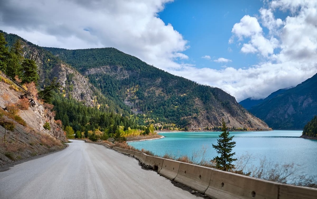
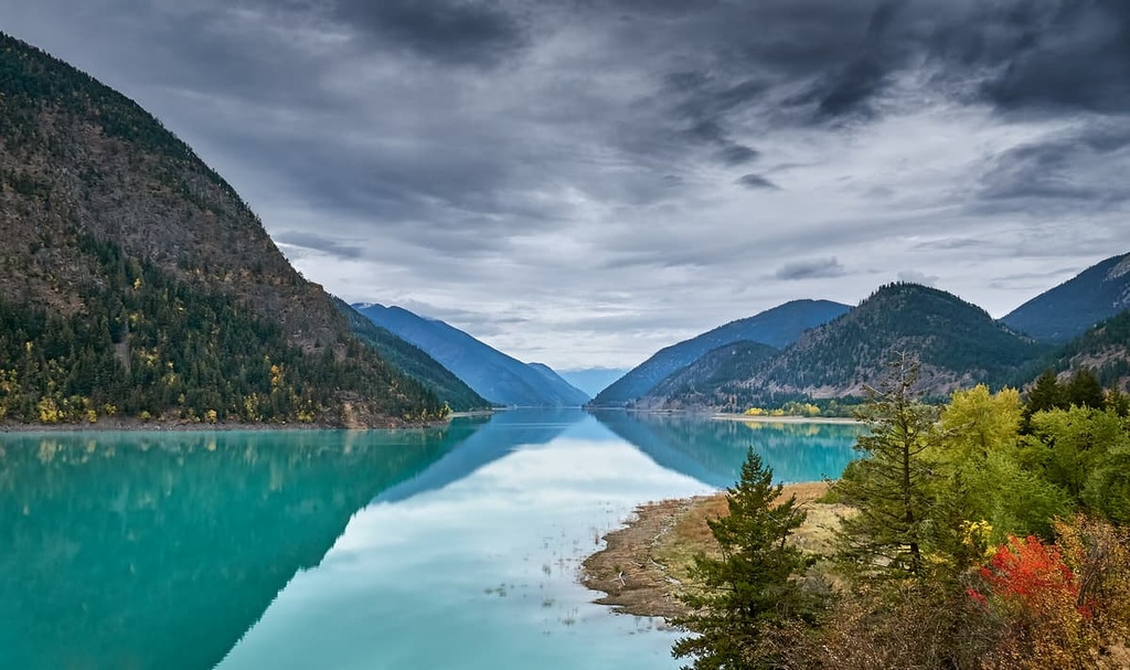
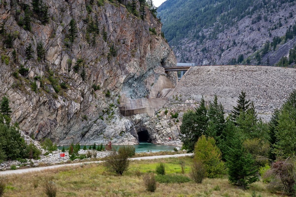
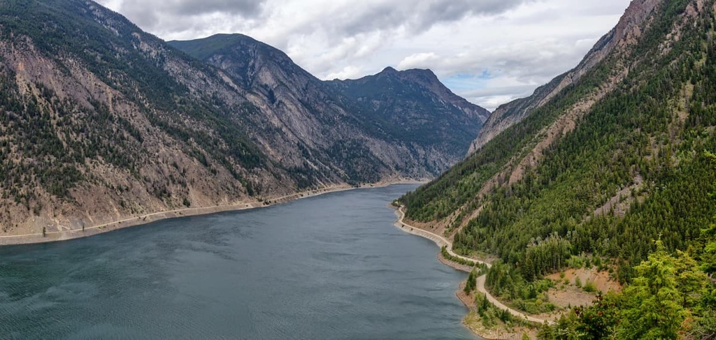
The Shulaps Range is about 60 km (36 mi) long and 8 km (5 mi) wide. It is bordered along its southern edge by Carpenter Lake and BC Highway 40. The Bendor Range is situated adjacent to the Shulaps Range, and it is also a subrange of the Chilcotin Ranges.
The Chilcotin Ranges are a subrange of the Pacific Ranges of the Canadian Coast Mountains. The Yalakomo River separates the Shulaps Range from the Camelsfoot Range in the east. However, the Camelsfoot Range is considered to be part of the Fraser Plateau and not part of the Chilcotin Ranges.
The Canadian Coast Mountains and the Pacific Ranges are typically underlain by granitic rock; however, the Chilcotin Ranges are generally underlain by non-granitic rocks. Alternatively, the Chilcotin Ranges are typically composed of layers of Mesozoic volcanic and sedimentary rocks.
In the western part of the Chilcotin Ranges, between the Fraser River and Taseko Lake, the layers of Paleozoic and Mesozoic volcanic and sedimentary rocks are intruded by small granitic rocks that are similar to the larger intrusions present in the rest of the Coast Mountains. The Shulaps Range, however, has an intrusion of peridotite which forms the tallest peaks of Shulaps Peak and Big Dog Mountain.
The Shulaps Range was traversed by many miners and prospectors during the nineteenth century where many found minor placer gold deposits; however, aside from an active gold claim on Big Dog Mountain, there were no significant gold discoveries in the region.
Additionally, there was a jade mine in the range where nephrite was mined. Before European settlers arrived and found the jade deposits, the nephrite was harvested by First Nations in the region because of its inherent beauty as well as its durability for tool making.
The Shulaps Range is located within the interior rain shadow, which is created by the height of the Coast Mountains. As the warm, moisture laden air blows inland from the Pacific Ocean, it cools and condenses as it makes its way over the mountains. As a result, much of the moisture in the air precipitates as rain and snow before it reaches the Shulaps Range.
This abundant rain creates the temperate rainforests along the coast; however, the interior side is significantly drier. The Shulaps Range is a high collection of dry peaks which are often free of snow by May. Even during the winter, dry winds blast the range and generally prevent any significant accumulation of snow.
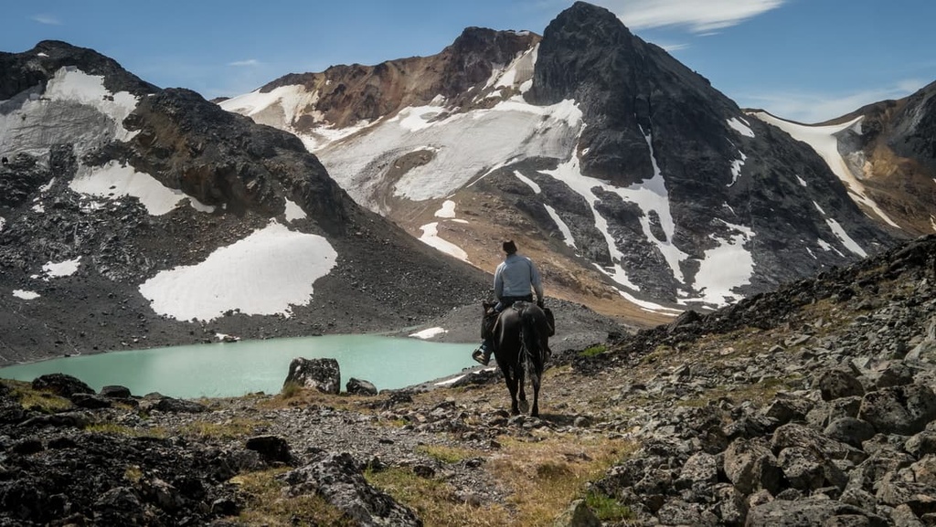
The alpine area of the Shulaps Range is particularly sensitive to disturbance. As a result, laws are in place that prevent motorized vehicles from traveling above 1,920 m (6,300 ft) in elevation in the range. Below the range’s rocky peaks, the alpine is filled with glaciers, heather, grasslands, and ridges that are covered in krummholz.
The range has an especially high concentration of mountain goats, California bighorn sheep, and hoary marmots. The deep canyons, alpine ridges, and forested valleys and slopes of the Shulaps Range are also home to grizzly bears, black bears, mule deer, wolverines, wolves, snowshoe hares, lynx, bobcats, and pica.
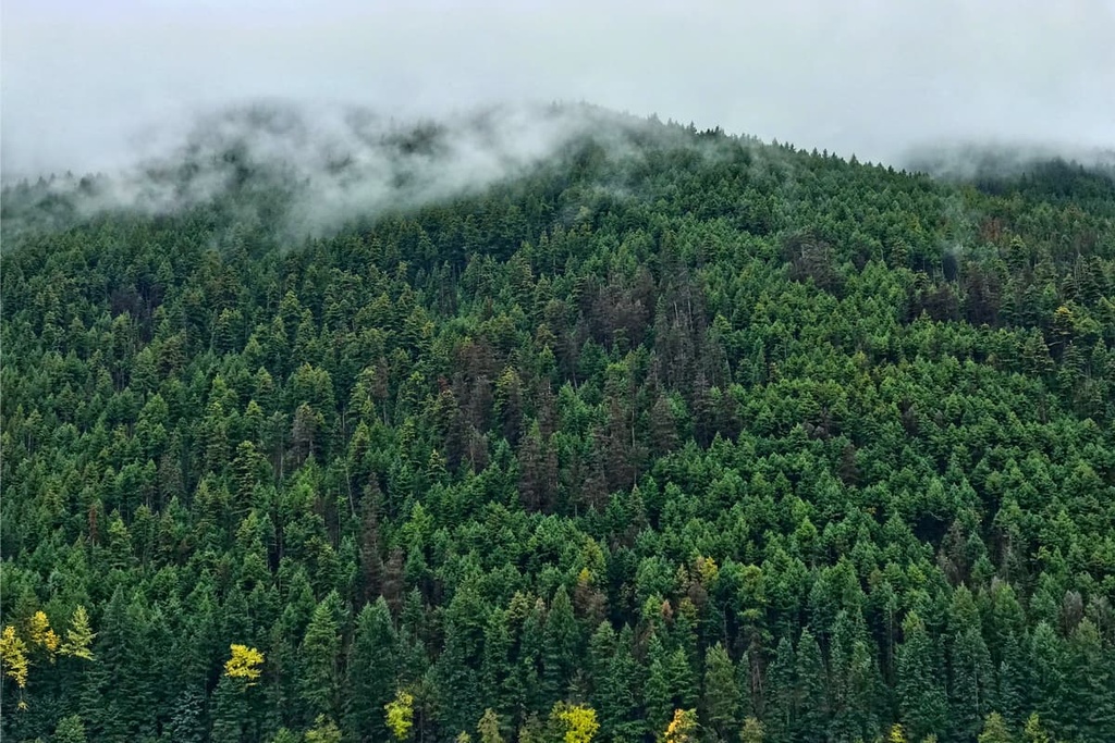
Subalpine fir typically dominates the treeline of the range and it mingles with Engelmann spruce at lower elevations. The lower slopes are filled with forests of lodgepole pine, Douglas fir, trembling aspen, and hybrid Engelmann-white spruce.
The lowest elevations and edges of the range transition from the Montane Spruce ecosystem to the dry Interior Douglas Fir ecosystem. Along the interior plateaus, the Interior Douglas Fir ecosystem is characterized by a matrix of grasslands and forests of Douglas fir and lodgepole pine. In the driest and hottest areas of the lowlands, Ponderosa pine grows in stands amidst the meadows of bunchgrass.
The Nlaka’pamux, Stl’atl’imx, and Secwepemc First Nations have utilized the resources of the forests and the rivers of the Shulaps Range for thousands of years. While there is evidence of human habitation dating back over 8,000 years in the region, it is speculated the ancestors of the modern First Nations arrived in and around the Shulaps Range about 4,000 years ago.
The First Nations of the region were able to adapt to the changing conditions over the millennia. Ultimately, their knowledge and skill of fishing and harvesting salmon is what helped the First Nations survive and flourish in the range.
One of the items of the regions that was historically prized and sought after by many First Nations is nephrite jade. When polished, nephrite, like most jades, is a stunning green gemstone; however, nephrite is also incredibly durable. Though it was difficult to shape, nephrite tools were far more durable than any other stone tool available to First Nations at the time.
In 1808, Simon Fraser met many First Nations as he traveled his way to the Pacific along the river that would now bears his name in English. After Simon Fraser made his way through the region, fur traders arrived about a decade later.
The fur trade was prosperous between 1820 and 1850 for many local First Nations. As the European traders searched for a better route through the Coast Mountains, they would buy furs and dried salmon from First Nations in the region. While the fur trade continued, gold fever overtook the Fraser River between 1858 and 1865 as thousands of miners traversed the Shulaps Range in their attempt to strike it rich.
There were many placer gold deposits discovered in the region; however, mining activity in the range mostly dried up after the late 1860s, with the exception of a single mine on Big Dog Mountain that’s still in operation. A few settlers also mined nephrite jade, but most were focused on finding gold deposits.
After the placer gold deposits were exhausted, many miners turned to homesteading, logging, ranching, and agriculture to continue living in the region. Eventually the railroad came, and hydroelectric dams were also constructed around the Shulaps Range.
The range is now home to many logging operations; however, the forestry companies are required to take stock of potential archeological sites within their range. As a result, many fascinating and culturally significant sites have been uncovered in the Shulaps Range.
Through the surveys, the remains of pithouse villages, seasonal camps, and culturally modified trees have been uncovered. Additionally, culturally important areas where ceremonies and burial took place have been found, as have pictographs and petroglyphs.
While there are no official trails or protected areas in the Shulaps Range, there is a long history of human of use and travel through the area. The ancestors of the First Nations that call the region home have historically traversed the ridges of the range as they traveled to and from other communities for social and commercial purposes.
In more recent years, commercial outdoor guides have created trails as they traverse the range with their clients for hunting and fishing expeditions. Additionally, conservationists have taken note of the stunning wilderness and have made proposals to preserve some of the land as parks and protected areas.
The Shulaps Range is yet to receive any level of protection from forestry and mining; however, there are still some incredible locations to visit in the range.
If you follow the old trails through the range, you can see the stunning emerald waters of Serpentine Lake. From Serpentine Lake, you can then ascend to the crystal clear waters of Wolf Lake, and then continue to summit Rex Peak or Shulaps Ridge.
The region’s forestry roads give a lot of access points to the Shulaps Range for hiking, backpacking, and other activities. At the base of the range, there is also a campsite at Tyaughton Creek and an easy hiking loop around Marshal Lake.
As part of the Chilcotin Ranges, the Shulaps Range features a beautiful and easily accessible wilderness. The following are some of the cities and towns that can serve as a great basecamp for your adventures in the region.
Located about 12 km (72 mi) away from Vancouver and about 130 km (78 mi) from the Shulaps Range, Whistler receives over two million visitors every year. Most visitors come to the city for alpine skiing and snowboarding during the winter months; however, downhill and mountain biking are also popular at the Whistler Blackcomb Resort during the summer.
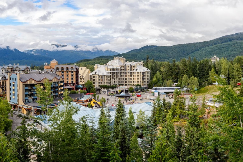
Some of Whistler’s most popular hikes include the Singing Pass Trail and the High Note Trail to the top of Whistler Mountain. Garibaldi Provincial Park, Callaghan Lake Provincial Park, and Clendinning Provincial Park are some other hiking areas near the community of Whistler that are also worth checking out if you’re in the region.
Located just to the south of the Shulaps Range, Lillooet is considered to be one of the oldest continuously inhabited locations in North America with a history that dates back several thousand years. Due to its dry climate, long growing season, and relatively mild winters, the area has been attractive to people for a long time.
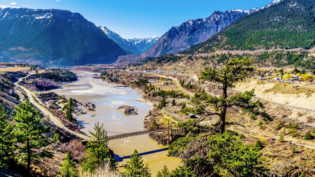
The community once had robust market gardens that provided orchard produce. During the summer, it is usually among the top contenders for the hottest place in Canada. The modern town came about during the Fraser Canyon Goldrush in the 1860s; however, the area has been inhabited by the St’at’imc Nation for countless generations before that.
Lillooet is located near the confluence of major rivers, and it is situated on the border between the mountains and the interior plateaus. The community is surrounded by stunning wilderness areas such as Stein Valley Nlaka’pamux Heritage Park, South Chilcotin Mountains Provincial Park, Churn Creek Protected Area, and Marble Range Provincial Park.
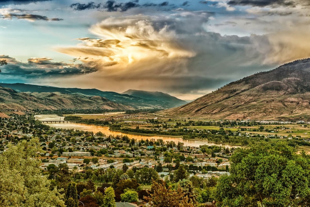
Located upon the Thompson Plateau, Kamloops is situated about 180 km (108 mi) to the east of the Shulaps Range. The city is considered the Tournament Capital of Canada as it hosts over 100 sporting events and tournaments annually, bringing in competitors from across the country and continent.
The dry and mild climate that make Kamloops such a great place for the many tournaments and festivals that it holds also means that hiking, skiing, and other adventuring in the region is typically quite warm and comfortable.
Some of the hiking areas located near Kamloops include the Kenna Cartwright Nature Park, Lac du Bois Grasslands Protected Area, Tunkwa Provincial Park, Bonaparte Provincial Park, and Greenstone Mountain Provincial Park.


The highest peak in the Shulaps Range is Big Dog Mountain, at 2,859 m.
The Shulaps Range have 6 named peaks.


