
Scan the QR code and open PeakVisor on your phone
The Bendor Range include 7 named peaks. The highest is Whitecap Mountain at 2,918 m. Other notable peaks include Mount Truax, Mount Bobb and Mount Williams.
The Bendor Range is one the eastern subranges of the Pacific Ranges within the Canadian Coast Mountains in British Columbia, Canada. There are 7 named mountains in the range, the highest and most prominent of which is the ultra-prominent Whitecap Mountain (2,918 m/9,573 ft).
As it is located on the east side of the Pacific Ranges of the Canadian Coast Mountains, the Bendor Range is often mistaken as being part of the Chilcotin Ranges. However, the Bridge River, in central British Columbia, Canada is the southern limit of the Chilcotin Ranges, and the Bendor Range is located to the south of the Bridge River.
Of the seven named peaks in the Bendor Range, Whitecap Mountain is the tallest and the most prominent. Whitecap Mountain stands at 2,918 m (9,537 ft) above sea level and it has 1,517 m (5,010 ft) of prominence.
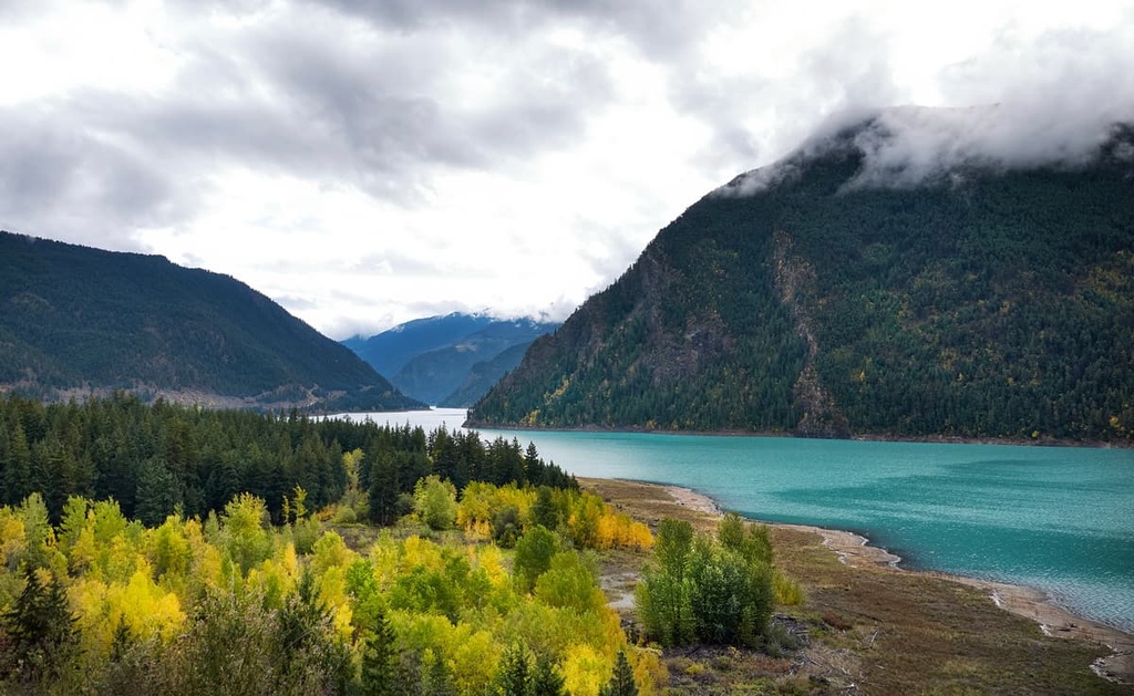
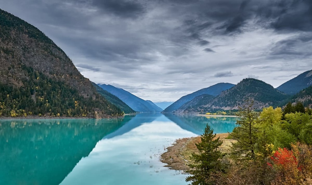
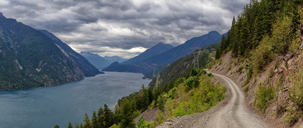
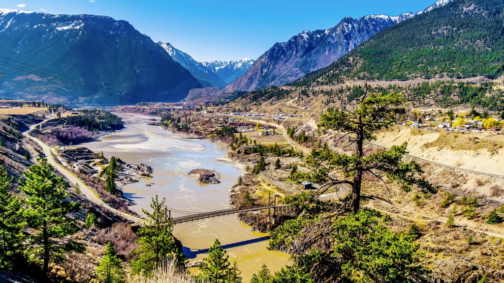
The Bendor Range is located among the beautiful wilderness and lakes of central British Columbia. The northern limit of the range is the Bridge River and Carpenter Lake. Meanwhile, Anderson and Seton lakes are both located along the eastern slopes of the Bendor Range. Cadwallader Creek is the southwestern limit of the Bendor Range.
There is little commercial timber available in the Bendor Range, much like the Shulaps Range to the north; however, the Bendor Range is home to many semi-abandoned mining towns on its western slopes.
While there are many beautiful areas in the region, there are no protected areas or provincial parks established in the Bendor Range. However, here are a few parks that are located near the range:
The Bendor Range contains all of the typical serrated ridges, cirques, and horned peaks of the Coast Mountains as well as a similar composition of Paleozoic aged layers of marine sediment and volcanic rocks.
The Paleozoic layers in the Bendor Range are primarily composed of chert, sandstone, argillites, and limestone, which were deposited as sediments in a wide, shallow sea bottom during the Permian.
At the same time that sediment was accumulating, sea-floor volcanic eruptions created layers and blocks of basaltic lava. This accumulation of rocks would later become the Bridge River Terrane.
The Bridge River Terrane also contains many batholiths, including the Bendor plutonic suite, which was created by Jurassic and Cretaceous intrusions. The granitic batholiths form the backbone of the Bendor Range and are also the major reason for the gold deposits in the range.
The volcanic events that led to the creation of the Bendor Range with its batholiths and plutonic suite were also responsible for the mineralization that created the gold deposits in the range. The Eocene erosion of the mountains likely created many of the original placer deposits in the region at the expense of the range’s lode deposits.
Major uplift of the Bendor Range occurred during the Laramide orogeny, though the most recent uplift of the range occurred during the Pliocene. The final uplift of the Bendor Range and the subsequent erosion likely concentrated placer deposits at lower elevations where prospectors first discovered the gold while traveling along the Bridge River.
While the significant uplift of the Coast Mountains occurred Along the Pacific coast, the Coast Mountains took the brunt of the tectonic collisions and are more compressed when compared to the eastern ranges of the Coast Mountains. The major topography of the Bendor Range was created during the Pliocene; however, the glaciers of the Pleistocene left their mark on the range.
The Pleistocene glaciers created the serrated ridges as well as the cirques and horned peaks that now define the range. These glaciers were also responsible for creating the Bridge River hanging valley as well as the significant amount of glacial drift along the valleys and creeks. Glacial rivers deposited thick layers of clay, sand, and gravel in the valleys, further diluting the placer gold, which ultimately made the placer gold in the range uneconomical to mine.
However, the western flanks of the Bendor Range are home to several semi-abandoned mining towns, including Bralorne. The mining towns were established to dig for the lode deposits that were discovered in the range.
At its peak production in the early twentieth century, Bralorne was the third richest mine in the world. The Bralorne mine is also one of Canada’s deepest mines, with shafts that start in the mountains over 1,050 (3,500 ft) above sea-level and descend more than 1,600 m (1 mile) below sea-level.
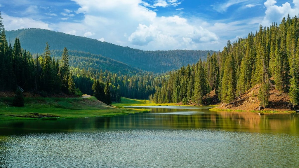
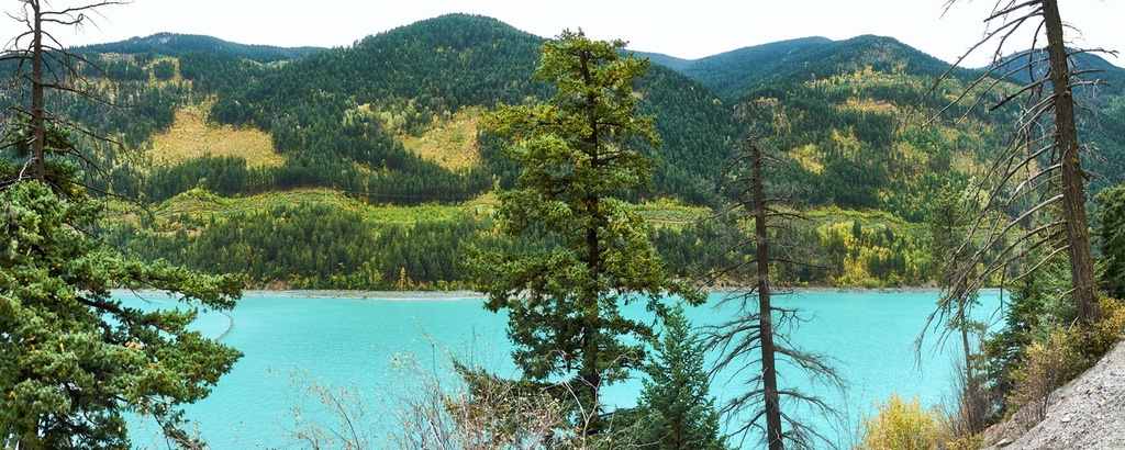
The Bendor Range is generally covered in forests of fir up until the treeline at 1,980 m (6,500 ft). Subalpine fir typically dominates the treeline of the range and it mingles with Engelmann spruce at lower elevations. The lower slopes are filled with forests of lodgepole pine, Douglas fir, trembling aspen, and hybrid Engelmann-white spruce.
The peaks are typically filled with alpine meadows filled with grasses and heather. The ridges are covered with krummholz that have been blasted by the dry winds.
The range is located within the interior rain shadow, which is created by the height of the Coast Mountains and the prevailing wind patterns. Throughout the region, warm, moisture laden air blows inland from the Pacific Ocean, and as it rises above the Coast Mountains, it cools and condenses. This condensation forces most of the moisture from the ocean to precipitate as rain and snow before it reaches the Bendor Range and the Fraser Plateau.
This rainshadow is one of the reasons why British Columbia’s interior has a dry climate while the coast is covered with a temperate rainforest. As it is located within the rainshadow, the Bendor Range has very little commercial grade timber and many of the forests have been untouched by major logging operations.
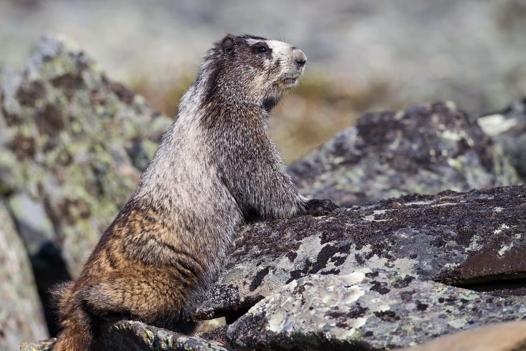
The forests and meadows of the range are home to many different wildlife species. For example, mountain goats, California bighorn sheep, and hoary marmots inhabit the alpine of the range. Meanwhile, the deep canyons, alpine ridges, and forested valleys in the Bendor Range are home to grizzly bears, black bears, mule deer, wolverines, wolves, snowshoe hares, lynx, bobcats, and picas.
The Canadian Coast Mountains, including the Bendor Range, have likely been home to humans for over 8,000 years. While the Bendor Range is the traditional territory of the Tsilhqot’in (Chilcotin) and St’át’imc (Lillooet) First Nations, these nations supplanted previous groups in interior British Columbia about 4,000 years ago.
The Lillooet are part of the Interior Salish, who originally migrated inland from the Pacific Coast. With their knowledge of coastal fishing practices, they were able to adapt and survive the changing hunting and climate conditions that likely were the downfall of the original inhabitants of the area.
Potlatches, the tradition of clan names, mythology, and creative expressions such as totem poles are cultural similarities between the Lillooet and their Coast Salish relatives. The Lillooet traditionally supplemented their salmon harvest by hunting bear, bighorn sheep, caribou, deer, and other small game.
The neighbors to the Lillooet, the Tsilhqotʼin (Chilcotin), lived much the same way; however, there were some strong cultural differences which likely caused much of the historic tension between the two First Nations. The Lillooet saw themselves as traders and would prefer to trade with neighbors for economic gain; however, the Chilcotin were historically seen as raiders by the Lillooet.
The Tsilhqotʼin are an Athabaskan-speaking people, who originally inhabited the northern reaches of British Columbia. The Tsilhqotʼin are the southernmost Athabaskan speaking nation and were neighbors with the Lillooet First Nation for many generations. During the Chilcotin–Lillooet War, the Tsilhqotʼin raided all 11 of the Lillooet bands, taking women and children as slaves.
The final battle of the war between the Tsilhqotʼin and Lillooet occurred in what is now called Graveyard Valley in South Chilcotin Mountains Provincial Park. The Lillooet were considered the victors of the war and a peace treaty between the nations was created in 1845.
While the Chilcotin–Lillooet War was ongoing, fur traders were attempting to make their living by trading furs with the local First Nations. The war between the two nations created significant difficulty for the traders in the area at the time.
After the Fraser Canyon gold rush began to wane in the 1860s, some miners settled into farming and ranching while others continued up the Bridge River hoping to strike it rich. The miners along the Bridge River only had minimal success discovering viable placer gold deposits; however, it was soon discovered that the western slopes of the Bendor Range had significant lode deposits.
The discovery of the lode deposits led to the creation of several mines in the Bendor Range, with Bralorne being the most productive of the regional mines. As it featured mine shafts that penetrated the Earth’s crust to more than 1,600 m (1 mile) below sea-level, Bralorne was the third richest mine in the world during its heyday.
The current mining towns are now relatively abandoned compared to their peak populations; however, there are still companies searching for the gold in the Bendor Range. Some mining interest in the region has resurfaced in recent years as some commercial geologists believe they have found the likely location of further gold deposits to the northeast of Bralorne.
While there are no provincial parks or other recreation areas located within the Bendor Range, there are still opportunities for some incredible adventures. The following are some of the best hiking routes in the Bendor Range for you to check out during your next visit to the region.
The trail to the summit of Bobb Mountain is a difficult 16 km (9 mi) one-way trek. With nearly 2.5 km (1.5 mi) of elevation gain, boulder fields to traverse, and some bushwhacking until you hit the alpine, the trail is considered to be a difficult hiking route by most locals.
However, the trail to the top of Bobb Mountain also gives you the opportunity to visit a hanging valley with eight lakes and to summit a relatively untrodden mountain in the interior of British Columbia. While difficult, the views and the adventure make the trail to the summit of Bobb Mountain worth the effort.
The trail through McGillivray Pass was once a route that prospectors, miners, and hunters used to head into Bridge River Country from the Fraser River. A railway was once proposed through the pass; however, nothing ever came of that plan. Currently the pass is home to several private ski cabins.
From McGillivray Pass, hikers can test themselves against Whitecap Mountain, the tallest mountain in the Bendor Range, which also happens to be an ultra-prominent mountain with over 1,500 m (5,000 ft) of prominence. The trek to the summit of Whitecap Mountain is over 35 kms (21 miles) long and will likely take several days to complete.
Travelers attempting the route should be comfortable in the mountains and be confident in their navigational skills. Other peaks that can be summited in the same area are Star Mountain, Mount McGillivray, Mount Piebiter, and Royal Peak.
While there are several smaller towns located near the Bendor Range, the following are some of the major communities and cities in the region where you can find food, supplies, and accommodation for your travels.
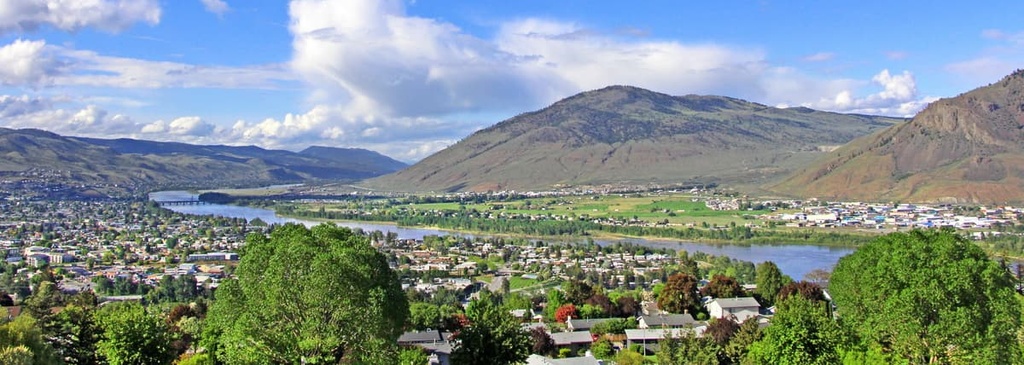
Located to the east of the Bendor Range, Lillooet is one of the oldest continuously inhabited locations in North America. Due to its dry climate, long growing season, and relatively mild winters, the area has a history that dates back several thousand years.
During the summer, it is usually among the top contenders for the hottest place in Canada and it used to be a major producer of orchard fruit. While the area has been inhabited by the St’at’imc Nation for countless generations, the modern town came about during the Fraser Canyon Goldrush in the 1860s.
Lillooet is located near the confluence of a few major rivers, and it is situated on the border between the mountains and the interior plateaus. The community is surrounded by a number of stunning wilderness areas, too, such as Stein Valley Nlaka’pamux Heritage Park, South Chilcotin Mountains Provincial Park, Churn Creek Protected Area, and Marble Range Provincial Park.
Located upon the Thompson Plateau, Kamloops is situated about 200 km (120 mi) to the east of the Bendor Range. Known as the Tournament Capital of Canada, Kamloops is visited by competitors from across the country and continent who come to participate in the more than 100 sporting events and tournaments that the city hosts each year.
As it is situated upon the Thompson Plateau, Kamloops is also located close to many great hiking and wilderness areas. Some of the hiking areas located near Kamloops include Kenna Cartwright Nature Park, Lac du Bois Grasslands Protected Area, Tunkwa Provincial Park, Bonaparte Provincial Park, and Greenstone Mountain Provincial Park.
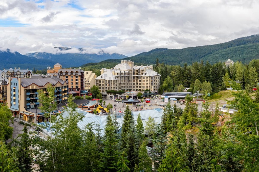
Located about 60 km (36 mi) south of the Bendor Range, Whistler is a world-famous mountain town. It is known as the major community that’s located near the Whistler-Blackcomb ski resort and for its part in hosting the 2010 Winter Olympics.
Whistler-Blackcomb is one of the largest ski resorts in North America, and it receives more than 2 million visitors every year. Most visitors come for the resort’s famous ski trails; however, more and more people are arriving during the summer months each year to experience the downhill mountain biking opportunities at the resort.
Some of Whistler’s most popular hikes include the Singing Pass Trail and the High Note Trail to the top of Whistler Mountain. Other hiking areas located nearby include Garibaldi Provincial Park, Clendinning Provincial Park, and Tantalus Provincial Park. The incredible climbing and bouldering routes around the town of Squamish are also located only a short drive away from Whistler.


The highest peak in the Bendor Range is Whitecap Mountain, at 2,918 m.
The Bendor Range have 7 named peaks.


