Scan the QR code and open PeakVisor on your phone
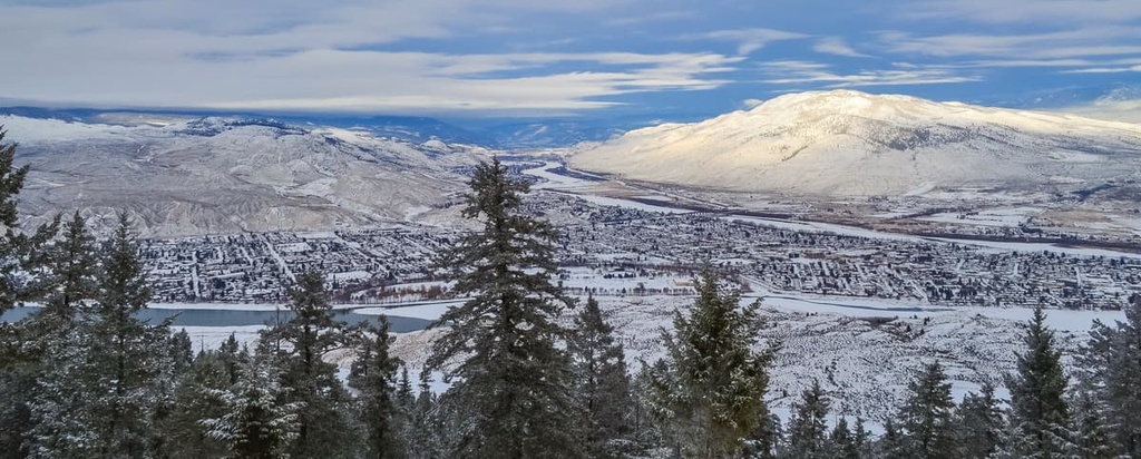
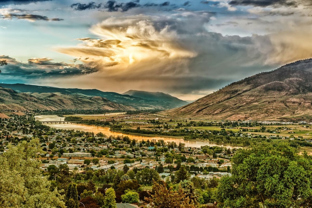
Kenna Cartwright Nature Park is a protected area located in the city of Kamloops, British Columbia, Canada. The park covers almost 800 ha (1,976 acres) of land overlooking the Thompson Valley. This makes it the largest municipal park in the province. Dufferin Hill (885 m/2,904 ft)is the only summit within the park. It overlooks the Thompson Valley, Kamloops Lake, and the confluence of the North and South Thompson Rivers.
Southern British Columbia, Canada contains many wilderness treasures, one of which is the Kenna Cartwright Nature Park in the city of Kamloops.
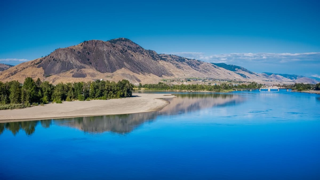
Located on the Thompson Plateau, the city of Kamloops is bordered by the North and South Thompson River, all of which are named for David Thompson, who has been described as the “greatest practical land geographer that the world has produced.”
The Kenna Cartwright Nature Park is named for a longtime city councilor and former mayor of Kamloops. Cartwright was a major proponent and supporter of parkland preservation.
In addition to parkland preservation, Kamloops has invested in significant infrastructure to position itself as the tournament capital of Canada. It earned this title because it hosts over 100 sports tournaments each year.
Kamloops is located about 355 km (213 mi) from the city of Vancouver and about 165 km (99 mi) from Kelowna. The city is easily accessible thanks to its regional airport . It can also be accessed by vehicle, as it is located at the junctions of the Trans-Canada Highway and Highway 5.
If you’re in Kamloops to attend a tournament or if you’re just passing through the city for other reasons, there are many natural areas and wilderness parks in the region that are worth checking out.
The following are some of the parks and natural areas near Kamloops:
Kenna Cartwright Nature Park is situated on the Thompson Plateau, which is part of the Interior Plateau of British Columbia. The Interior Plateau sits between the Columbia Mountains to the west and the Coast Mountains to the east.
On the west coast of North America, several mountain formation events occurred that created the Western Cordillera that exists to this day. The Sevier orogeny was the first event, and it started with the creation of the Columbia Mountains about 160 million years ago as oceanic and continental tectonic plates collided.
The Sevier orogeny continued for about 110 million years, as island arcs were accreted to the west coast of North America. As the coastal margin was compacted, additional mountain ranges were thrust up on the west coast. These were the Coast and Insular Mountains, the latter of which includes the Vancouver Island Ranges.
Before the Eocene, the plateaus in the region were actually a depression between the Coast and Columbia Mountains. The underlying rocks of the Nechako, Fraser, and Thompson Plateaus have volcanic intrusions that occurred during the Jurassic and Cretaceous; however, the major lava flows that leveled the plateaus started during the Eocene, about 50 million years ago.
The plateaus were part of a region where the tectonic activity of compression and relaxation created weak spots in the Earth’s crust. Subsequently, the lava erupted through these weak spots for millions of years to form the plateaus. The Thompson Plateau experienced volcanic activity throughout the Eocene, about 20 million years, after which the landscape began to settle.
These lava flows created generally flat plateaus, however, there are steep cliffs along the rivers. The current topography was formed from the most recent glacial maximum of the Pleistocene, which scoured the plateaus, eroding all the softer rocks and spreading a layer of glacial till across the region. Topographical relief on the plateau is mainly found as drumlins and eskers.

The ecology of Kenna Cartwright Nature Park is representative of the Bunchgrass and Ponderosa Pine ecosystems, which are the driest and hottest of British Columbia’s ecological zones. These grasslands are confined to the lowest elevations of the valley in the southern interior.
Bluebunch wheatgrass is the dominant grass in the area, though there is also plenty of sagebrush. Douglas fir and ponderosa pine grow in the grasslands; however, the hot, arid climate is typically too harsh for them at lower elevations. The trees and forests typically only grow in the hills where the climate is cooler.
Ponderosa pine forests are the driest forests in British Columbia. They are the predominant forest type on the slopes of Dufferin Hill. Douglas fir grows alongside the ponderosa pine, both of which have bark that resists burning during the frequent grass fires in the region. Where fire has claimed the forests, lodgepole pine is typically the first tree to grow.
The park is home to many wildlife species including burrowing owls, hawk owls, and the great grey owls. River otters may be seen playing or working in and around the Thompson River. There are also California bighorn sheep and black bears that may make their way into the park.
In the sky and trees in the park, you may also see one of the many warblers, sparrows, wrens, eagles, or bats that call the region home. Common bat species include the hoary bay and the big brown bat.

On the ground, you must watch for the many reptiles, such as racer snakes, gopher snakes, and spadefoot toads. Rattlesnakes are rare in the park; however, if you see one and give it respectful distance, you generally have nothing to worry about.
The lands of the Kenna Cartwright Nature Park, as well as Kamloops and the surrounding plateau, are the traditional territory of the Secwepemc, or Shuswap First Nation, who are part of the Interior Salish culture.
While there are no specific historic or cultural sites in the nature park, from the summit of Dufferin Hill, you are privileged to gaze upon a land that has been home to humans since time immemorial.
From the top of Dufferin Hill, you can look across the river at the remains of a 2,000-year-old winter village, or upon the places that have traditionally been used for villages, campsites, and hunting and fishing. At the confluence of the rivers below, you can imagine the fur traders pulling their canoes onto the shores for the first time.
You can look towards downtown Kamloops and see the old train station which welcomed settlers since the late 1800s. The land of Kenna Cartwright Nature Park was used for grazing leases. Here, massive tree stumps on the north side of the park attest to the logging that occurred during the 1920s.
Kenna Cartwright, for whom the nature park was named, was a city councilor and mayor of Kamloops during the 1980s and 1990s. She championed the idea that led Kamloops to becoming the Tournament Capital of Canada, and in doing so, helped revitalize the local economy.

She was the city’s first female mayor and only mayor to pass away in office. Cartwright died in 1991 after a battle with leukemia. Kenna Cartwright Nature Park was created in 1996 and named in her honor.
The Kenna Cartwright Nature Park in Kamloops, British Columbia is the province’s largest municipal park. It has over 40 km (24 mi) of trails winding around Dufferin Hill, through the bunchgrass and forests of ponderosa pine and Douglas Fir.
The following are some of the most popular trails in the park.
The 1.5 km (0.9mi) trail to the viewing platform adjacent to the ridge is an easy walk, with only 145 m (475 ft) of elevation gain. During the right season you’ll be welcomed by a carpet of wildflowers as you hike. At other times of the year, the landscape maintains its rugged, grassy beauty.
The trail can be hiked as an out-and-back adventure. Or you can follow one of the other trails from the viewing platform and create a loop around the park.
The popular Ridge Trail makes a 5.1 km (3 mi) loop across the front of Dufferin Hill and then along the ridge the viewing platform. There is only 218 m (715 ft) of elevation gain throughout the hike.
The trail offers views of Kamloops Lake, the North and South Thompson Rivers, and the city of Kamloops. You can also look upon the vast Thompson Plateau that extends in all directions.

Kenna Cartwright Nature Park is the largest municipal park in British Columbia. It was named in honor of the former mayor who worked to revitalize the city of Kamloops.
In addition to Kamloops, there are several other cities in the region that are worth checking out during your visit to the region.
Thanks to the work of Kenna Cartwright, Kamloops became the Tournament Capital of Canada as a strategy to revitalize their struggling economy through the 1980s and 1990s.
The nature park that was named in her honor covers 800 ha (1,976 acres) on the south side of the Thompson River. With over 40 km (24 mi) of hiking trails, the park serves as the crown jewel of Kamloops’ parks.
One of the main reasons so many people have the opportunity to visit Kamloops is because the city has built the infrastructure needed to host more tournaments than any other city in Canada. Annual tournaments for baseball, hockey, golf, rodeo, tennis, and many more sports are hosted in the city.
While in Kamloops, some of the wilderness areas to explore include, of course, Kenna Cartwright Nature Park; however, there are many more. Other parks and wilderness areas include Lac du Bois Grasslands Protected Area, Greenstone Mountain Provincial Park, and Mount Savona Provincial Park.
Salmon Arm is one of the communities on the shores of the Shuswap Lake. The city is located about 110 km (66 mi) east of the Kenna Cartwright Nature Park and is home to the longest freshwater wooden wharf in North America.
The city is now situated at the location of the head offices for the Columbia-Shuswap Regional District and is a popular summer tourist destination with its beaches, camping facilities, and houseboat rentals. Its inviting climate and proximity to Alberta make it a popular destination for Albertans to spend part of their summer vacation.

Some of the popular trails around Salmon Arm are the 1.3 km (0.8 mi) Syphon Falls Trail, the 6 km (3.6 mi) Raven Trail, and the 11 km (6.6 mi) South Canoe Trail System. Other places and trails to look for are Wild Rose Bay, Park Hill, the Salmon Arm Pier, and the trail up Mount Ida.
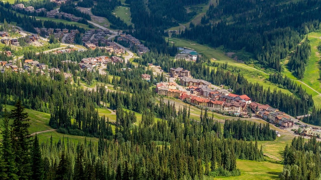
Sun Peaks is situated 56 km (33 mi) to the northeast of Kamloops and the Kenna Cartwright Nature Park. The mountain resort community caters to visitors who are skiing the slopes of Tod Mountain. Sun Peaks Resort first opened in 1961 with a single chairlift and the Burfield Lodge.
The skill hill and the resort were expanded over the following decades. There are many lifts available for quick access to the slopes, lodges, golf courses, and the resort village. The resort has a snowboard park, ice rinks, tennis courts, and multiple hotels. It is used for skiing and boarding in the winter and mountain biking in the summer.