
Scan the QR code and open PeakVisor on your phone
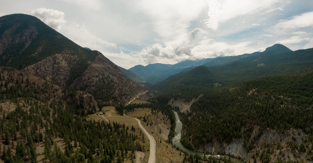
Situated along the Yalakom River, in the interior of British Columbia, Canada, Yalakom Provincial Park encompasses nearly 9,000 ha (22,240 ac) of old-growth forests and pristine grasslands, creeks, and mountains in the Yalakom Creek basin. Yalakom Mountain (2,433 m/7,928 ft) is the tallest and most prominent of the two mountains in the park.
Located along the west side of the Camelsfoot Range, of British Columbia, Canada, Yalakom Provincial Park was established in 2010 to preserve the mosaic of old-growth forests and riparian areas, alpine grasslands, stunning examples of the geological formation of the mountains, and important wildlife corridors.
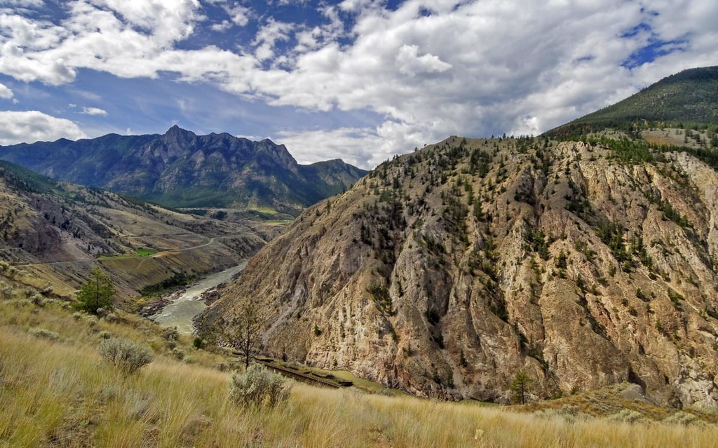
The park is in the Camelsfoot Range, which is one of the western ranges upon the Fraser Plateau. The Camelsfoot Range is often misrepresented as the eastern extent of the Chilcotin Ranges, which is part of the Pacific Ranges of the Coast Mountains. However, the Camelsfoot Range is geologically related to the plateau rather than the adjacent mountain range.
Yalakom Provincial Park is divided between the political boundaries of the Thompson-Nicola Regional District and the Squamish-Lillooet Regional District. Lillooet is about 60 km (36 mi) south of the park, and the primary access to the park is to follow Bridge River Road (Highway 40) and then drive up Yalakom Forest Service Road for about 30 km (18 mi).
One of the major features of the park is the representation of an extensive elevational sequence of biogeoclimatic zones. The park reaches from the valley of the Yalakom River to the heights of Yalakom Mountain and Nine Mile Ridge. Nine Mile Ridge is an impressive feature that dominates the northern boundary of the park, and it is indeed around 15 km (9 mi) long.
Yalakom Provincial Park is one of over a thousand parks and conservation areas in the province of British Columbia, and BC Parks works to have a reasonable representation of historic sites and each biogeoclimatic zone. The following are some of the other nearby parks and wilderness areas:
Situated along the western slopes of the Camelsfoot Range, Yalakom Provincial Park is geologically part of the Fraser Plateau. As part of the Fraser Plateau, the Camelsfoot Range consists of layers of sedimentary rock that were overlain by later lava flows.
The Marble Range and the Clear Range adjacent to the Camelsfoot Range are also all part of the Fraser Plateau. Other nearby ranges upon the Fraser Plateau are also the Rainbow Range, Ilgachuz Range, and the Itcha Range which were ranges created from late Miocene shield volcanoes.
While there are significant layers of sedimentary rock in the Camelsfoot Range, the volcanic origin of many of the rocks mean that there are sizable deposits of gold, copper, and other precious metals and minerals in the region. During the mid and late nineteenth century many mines were constructed and excavated in the range.
The topography of the park as we see it today was greatly influenced by the massive cordilleran ice sheet that covered the park in several kilometers of ice, during the Pleistocene. The ice sheet eroded away and rounded most of the lower summits in the region.
The few jagged peaks that are found across the Camelsfoot Range would have been exposed when the region was otherwise covered by ice. At the time, they would’ve been referred to as nunataks, which is a peak that sticks out through an ice sheet, ice field, or glacier.

Yalakom Provincial Park is in the rain shadow of the Canadian Coast Mountains which means that the region is considerably dryer than the nearby coast. The rain shadow is caused by the steep coastal mountains, and that as the warm, moisture laden air blows off the Pacific and cools off as it rises over the Coast Mountains.
The cooling of the air as it rises above the mountains, makes the air more dense such that the moisture precipitates along the western slopes. By the time the air has passed over the mountains, much of its moisture has precipitated and it leaves the eastern slopes with significantly less precipitation.
The rain shadow cast by the Coast Mountains creates a very dry summer climate where wildfires are frequent. However, the region is greatly affected by interior weather systems where dense Arctic air can flow into the region during the winter.
Most of the park is covered with forests of Engelmann spruce, lodgepole pine, and hybrid spruce. The lower valleys along the west side of the park also have some Douglas fir and whitebark pine, which is a blue-listed species in British Columbia.
The peaks and ridges are covered with barren and rocky alpine tundra. The cold and dry climate has created a relatively sparse landscape throughout the park where there is little understory vegetation and the alpine area is quite barren.
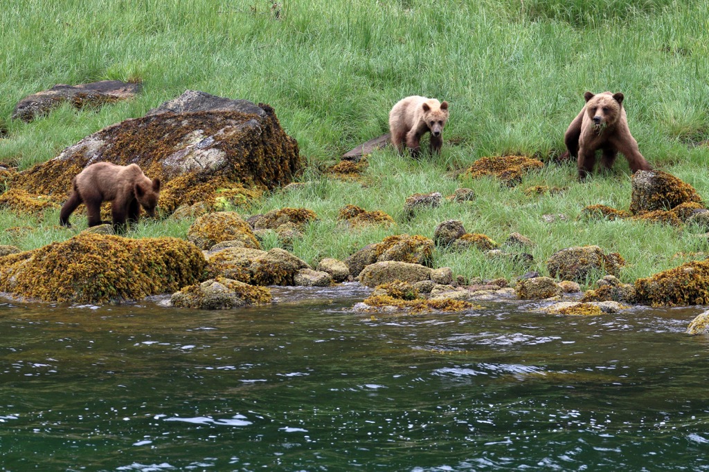
It is said that there are more grizzly bears than humans in Yalakom Provincial Park and the area is also known as a refuge for California bighorn sheep.
Fishers, peregrine falcons, grey wolves, cougars, harlequin ducks, and rubber boas are some of the rare species that are found in the park.
The park is especially important for the migration of mountain goats, grizzly bears, and mule deer. Yalakom is a migration hub between adjacent parks and habitats. Wildlife moves east through the park to the Fraser River, north to the Churn Creek Protected Area, and west to the South Chilcotin Mountains and Big Creek provincial parks.
The traditional territory of the St’at’imc Nation, Secwepemc Nation and Tsilhqot’in National Government encompass Yalakom Provincial Park. Yalakom is the anglicized version of the St’at’imc word yegálcken which means the bighorn sheep ewe. Sweláops is their word for the ram, which was given to the adjacent Shulaps Range, which is west of the Yalakom River.
The area has been used traditionally by Indigenous people for hunting, gathering resources, and spiritual ceremonies with the first inhabitants of the area likely arriving about 8,000 years ago. At the time, the indigenous primarily hunted the ancient megafauna, such as mammoths, mastodons, and giant bison that inhabited North America.
The modern First Nations that inhabit the region are likely descendants from members of the Salish culture who emigrated inland from the coast about 4,000 years ago. The resultant Interior Salish culture flourished when the other cultures struggled, making the Interior Salish culture the dominant culture in the interior of British Columbia.
It is speculated that their superior knowledge of fishing and harvesting fish from the rivers was a key factor that kept them fed while the large game animals were becoming scarcer. Along with their knowledge of fishing, the Interior Salish share many cultural attributes with their coastal cousins, such as the construction of longhouses and their traditional art style.
There is no mention of significant archeological sites in Yalakom Provincial Park; however, there are some significant village sites along the Fraser River and Bridge River. The rivers were a major thoroughfare in the region throughout human history as they provided access to many essential resources.
While relatively undisturbed by outsiders for thousands of years, The life of local First Nations was changed with the arrival of non-Indigenous travelers and fur traders. David Thompson was among the first Europeans to explore and travel through the region, as he made his way to the Pacific Ocean in the early nineteenth century.
Following on the heels of Simon Fraser and David Thompson were the fur traders and later the miners and settlers. Gold and other precious minerals were discovered in the Camelsfoot Range and adjacent mountains in the mid nineteenth century.
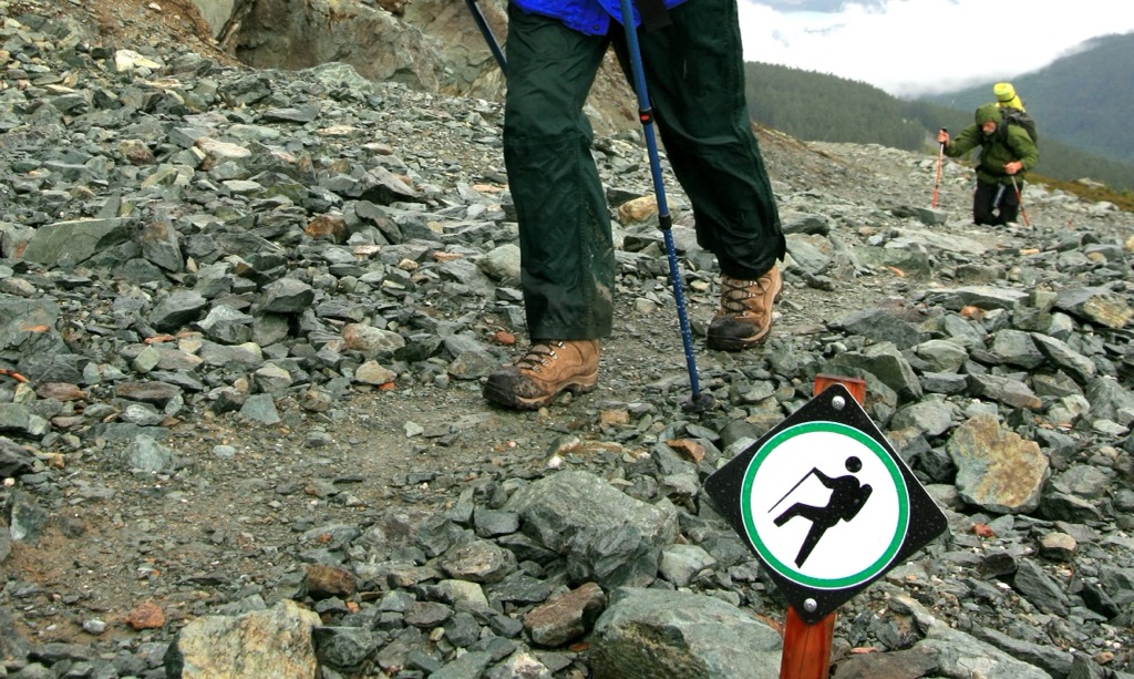
The range is currently part of an extensive backcountry that is enjoyed by hikers, horse packers, and hunters. In general, the region has subdued topography that makes for easy travel; however, it takes some effort to ascend from the valleys to the more easygoing ridges and alpine meadows.
Located in the upper elevations of the Camelsfoot Range, Yalakom Provincial Park protects the region’s old growth forests, high elevation aspen stands, and krummholz forests. It is difficult to access and requires some endurance to reach the higher elevations of the park.
While exploring some of the unofficial trails through the park, you may have the opportunity to see California bighorn sheep, mountain goats, or mule deer during their migration. Furthermore, the park contains fascinating examples of the geological processes that created the mountains, such as the thick metamorphosed rock forming scarp and dip slope topography.
The park is open for backcountry adventuring, and it permits random wilderness camping. One of the major trails in the park is the route up and across Nine Mile Ridge. The route is popular for hiking and mountain biking. Hikers and riders can make the trail an out-and-back or they can drop off the ridge and hike or bike out along a creek.
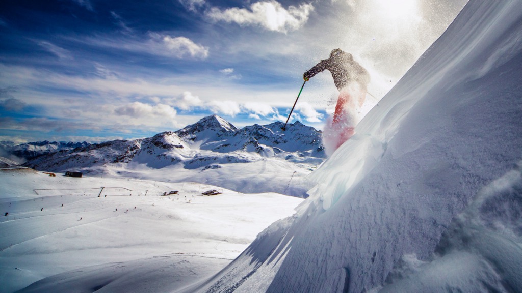
It takes some effort to traverse Yalakom Provincial Park; however, there are incredible opportunities waiting in the park for ski touring, hiking, trail riding, and mountain biking.
Yalakom Provincial Park is in the Camelsfoot Range, which is adjacent to the Chilcotin Ranges and on the west side of the Fraser Plateau. The park encompasses a range of incredible scenery, superb wildlife viewing opportunities, and a vast expanse of trackless backcountry through which to adventure.
The following are some of the communities and cities near the range from where you can start your adventures.
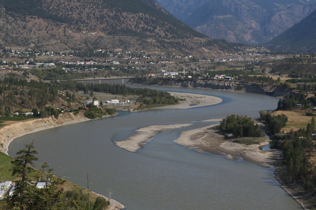
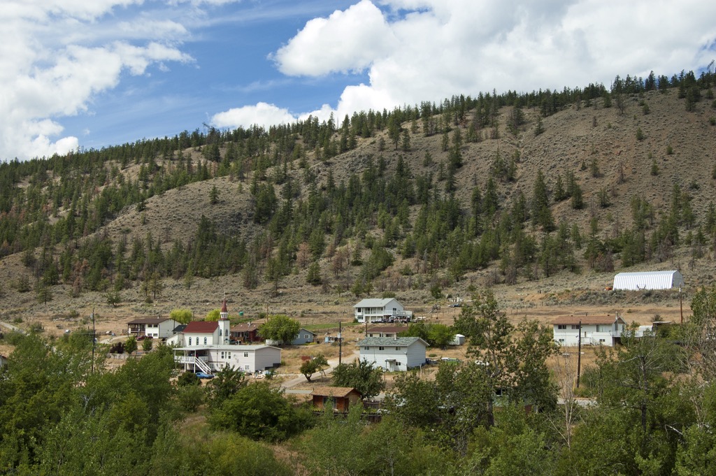
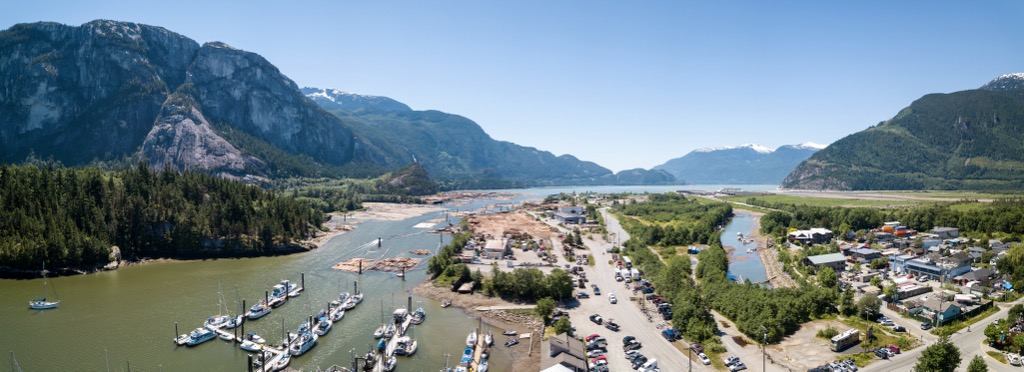
Lillooet is about 60 km (36 mi) south of Yalakom Provincial Park and is located on the traditional territory of the St’at’imc First Nation, who have lived in the area for thousands of years.
Miners and prospectors came to the valley in the 1860s during the Fraser Canyon gold rush and established the settlement that is now the city of Lillooet. However, the region around Lillooet is considered to be one of the oldest continuously inhabited areas in what’s now known as North America.
Lillooet is situated at the confluence of the Fraser and Bridge Rivers, where generations of indigenous families have fished in the rivers for sustenance. Surrounding Lillooet are some stunning wilderness areas such as Stein Valley Nlaka’pamux Heritage Park, South Chilcotin Mountains Provincial Park, Churn Creek Protected Area, and Marble Range Provincial Park.
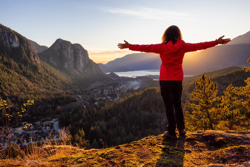
The resort community of Whistler is about 190 km (114 mi) southwest of Yalakom Provincial Park.
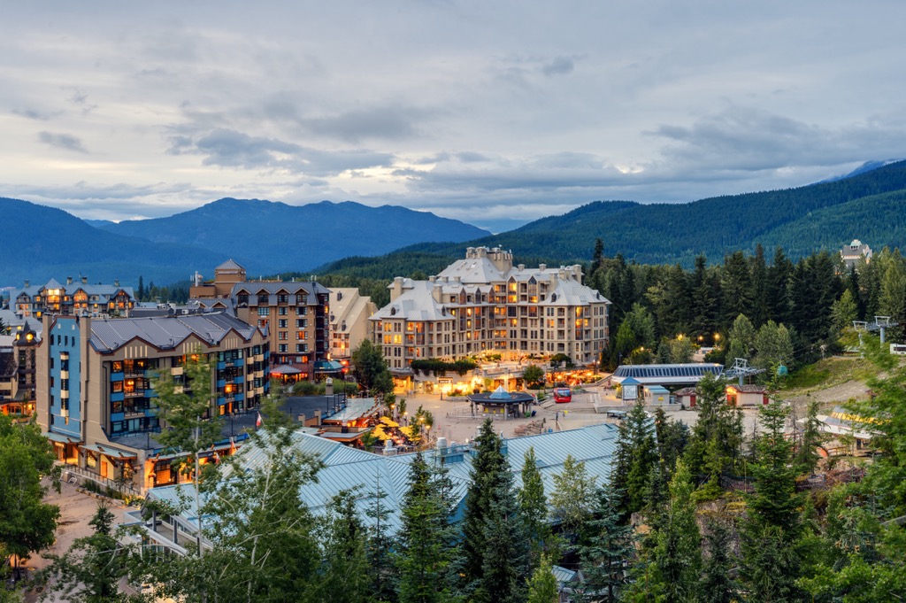
The community receives over two million annual visitors, primarily for alpine skiing and snowboarding during the winter. Downhill and mountain biking have also become incredibly popular at the Whistler Blackcomb Resort.
Resort skiing and cycling are popular activities in the town and there are also many great trails in the area to hike. Hikes to Garibaldi Lake, Black Tusk, Panorama Ridge, the Ancient Cedars Trail, and Cheakamus Lake are all great options if you have some free time during your visit.
During the winter visitors can ski to the ice cave in Blackcomb Glacier Provincial Park or do a ski tour through the Fitzsimmons and Spearhead Ranges. During the summer hikers can follow the Musical Bumps Trail or one of the other incredible trails in the area.
Squamish is a climbing mecca in the Canadian Coast Mountains and is about 250 km (150 mi) southwest of Yalakom Provincial Park. Climbers come from all over the world to practice their craft on the over 2,000 climbing routes in and around the town.
While there are incredible wilderness areas nearby for hiking and sightseeing, such as Breckendale Eagles Provincial Park, Tantalus Provincial Park, and Garibaldi Provincial Park, the climbing areas remain among the most popular places to visit while in Squamish.
Some of the popular areas to climb are the granite massif of Stawamus Chief Provincial Park, or the routes at Shannon Falls, Murrin Park, The Malamute, and the Smoke Bluffs. In addition to the published climbing routes, there are also over 2,500 published bouldering problems that can be found using local guidebooks.


