
Scan the QR code and open PeakVisor on your phone
Squamish-Lillooet Regional District is home to 478 named mountains. The highest is Lillooet Mountain at 2,941 m.
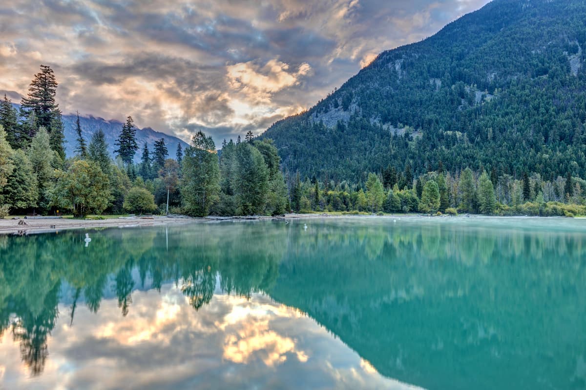
The Squamish-Lillooet Regional District is a regional district located within British Columbia, Canada. The district spans 16,353 square kilometers across southwestern BC. In the south of the district lies Britannia Beach along Howe Sound, and to the north lies Pavillion. The major cities within the district include Squamish, Whistler, and Lillooet with an estimated total population of 43,000. Within the Squamish-Lillooet Regional District lies the native land of the Squamish people and the St’at’imc people. There are 490 named mountains in Squamish-Lillooet Regional District. Lillooet Mountain is the highest point at 2,941 meters. The most prominent mountain is Wedge Mountain with 2,258 meters of prominence. With the southern portion of the regional district being located just north of Vancouver, the region is a popular destination for nearly every type of outdoor activity.
Throughout the regional district is a variety of animals. The mountains and forest are home to black bears, grizzly bears, mountain lions, mountain goats, and the elusive wolverine. Bald eagles frequent the area, especially during the winter months and the waterways of the district are full of trout, salmon and whitefish.
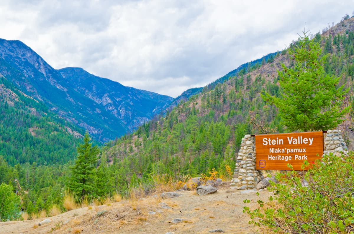
Stein Valley Nlaka’pamux Heritage Park: Stein Valley Nlaka’pamux Heritage Park spans 1,072 square kilometers across the regional district. The park was originally established by BC Parks and the Lytton First Nation back in 1995. The park helps protect both the cultural and ecological significance of the Stein River valley. The expansive park is home to some of the most diverse wildlife in all of the regional district. There are over 150 kilometers of backpacking trails throughout the park, along with cable crossings and a suspension bridge across the river.
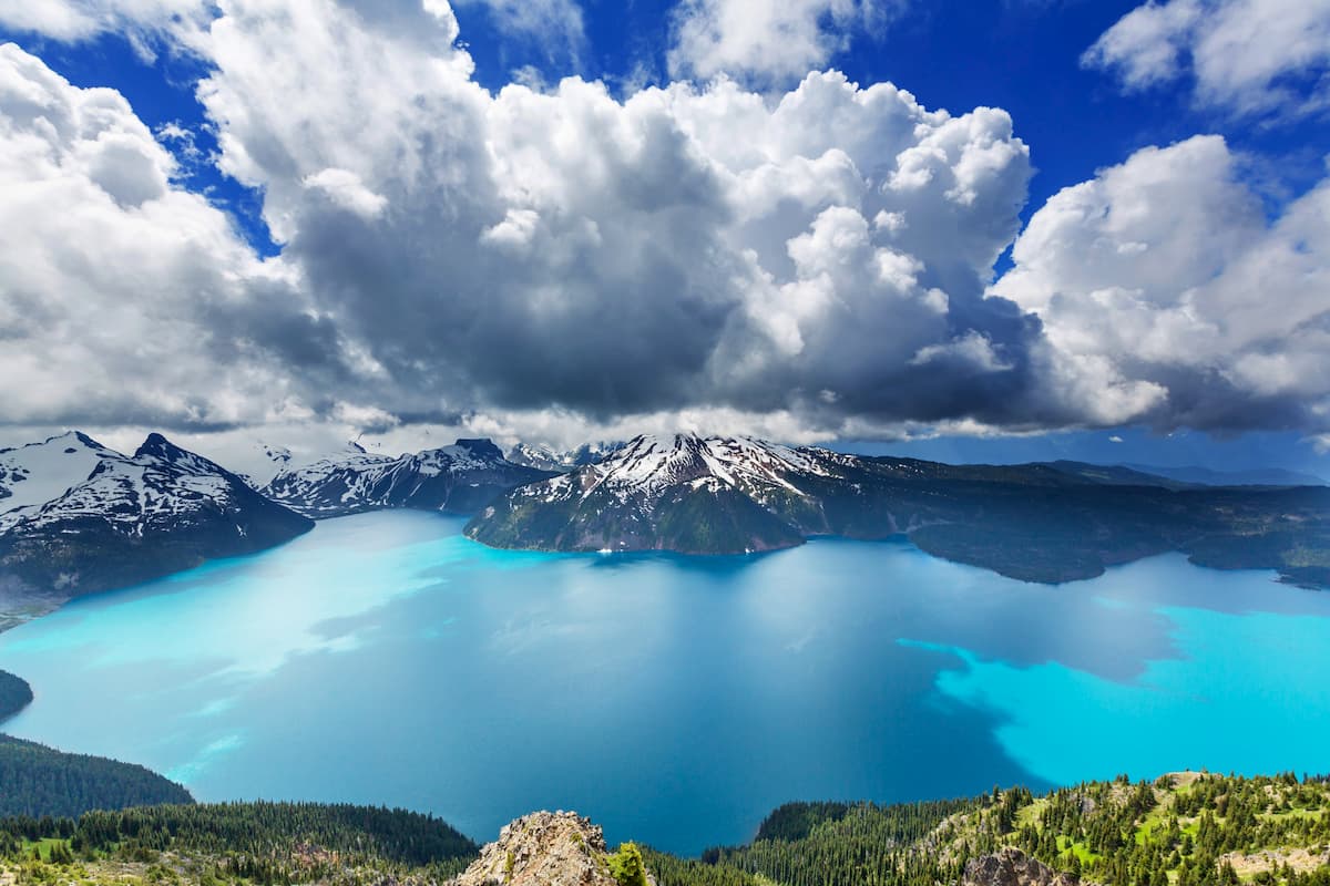
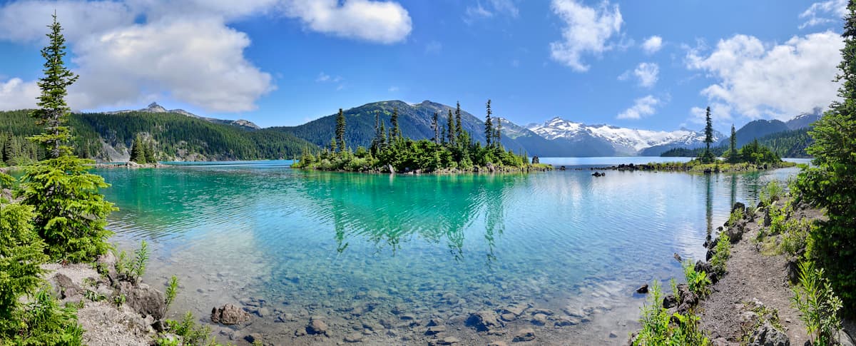
Garibaldi Provincial Park: The most iconic park in the district is Garibaldi Provincial Park. The park spans 1,950 square kilometers, encompassing much of the Garibaldi Range. The western region of the park can be easily accessed along the scenic Sea to Sky Highway. A majority of the park lies between the towns of Squamish and Whistler, both known for their abundance of outdoor activities. Notable hikes within the park include Elfin Lakes, Garibaldi Lake, the Garibaldi Neve, Black Tusk, and Wedgemount Lake. Both Golden Ears Provincial Park and Pinecone Burke Provincial Park lie to the south. In total the park boasts over 90 kilometers of trails through the rugged peaks, lush forests, open meadows, and alpine lakes.
Tantalus Provincial Park: The Tantalus Provincial Park protects the Tantalus Range. The range is a subrange of the Coast Mountains located in southwestern British Columbia, just west of Squamish. The park spans 113 square kilometers. The Lake Lovely Water Recreation Area within the park offers some of the most spectacular views of the iconic alpine lake. The park as a whole offers a variety of hiking trails, backcountry, rock climbing, and mountaineering during winter months.
Clendinning Provincial Park: Clendinning Provincial Park was established back in 1996 and covers 74,947 acres. There are 10 named mountains in Clendinning Provincial Park. The highest and the most prominent mountain is Elaho Mountain at 2,798 meters. There are 12 named glaciers within the park. The park is known for its diversity of landscapes. From old growth forests to tranquil meadows and steep cliffs covered in glaciers, granite slabs and icefalls. This park is quite remote and only those with the experience and gear should explore it.
Birkenhead Lake Provincial Park: This park spans 97 square kilometers within the regional district. Birkenhead Lake was first established in 1963 as a way to provide camping for those traveling from Whistler up to Lillooet.Popular trails in the park include Birkenhead Lake Trail, Goat Lookout Trail, and the Wilderness Trail.
Other parks within the regional district include: South Chilcotin Mountains Provincial Park, Mehat! Creek Provincial Park, and Upper Lillooet Provincial Park.
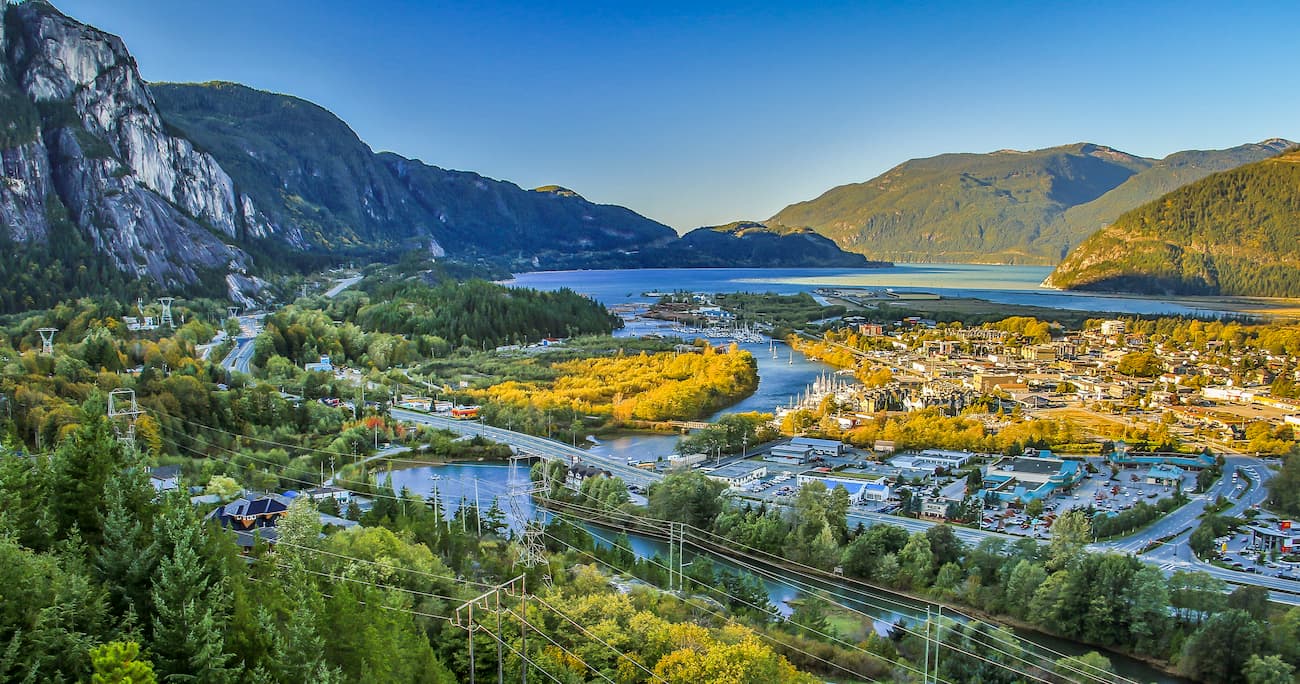
Squamish sits on the Howe Sound surrounded by mountains, just an hour north of Vancouver. The town is known for the Sea to Sky Gondola that provides views of the mountains, Howe Sound, and Shannon Falls. Squamish is often seen as an outdoor paradise with countless mountain biking, hiking, trail running, skiing, and watersports all nearby. Due to increased cost of living in both Vancouver and Whistler, the population of Squamish continues to grow.
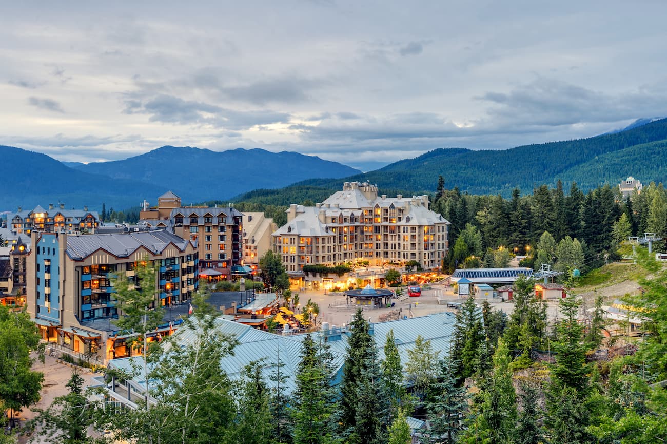
Located 90 minutes north of Vancouver, Whistler is a resort town located in the mountains. It is home to Whistler Blackcomb which is one of the largest ski resorts in North America. The town only has 13,000 residents but is busy year-round with tourists. Despite being known for the ski resort, the town is almost equally as popular in the summer months for hiking and mountain biking. Take the gondola to the top of the mountain and hike from there, or explore the numerous nearby glacier lakes.
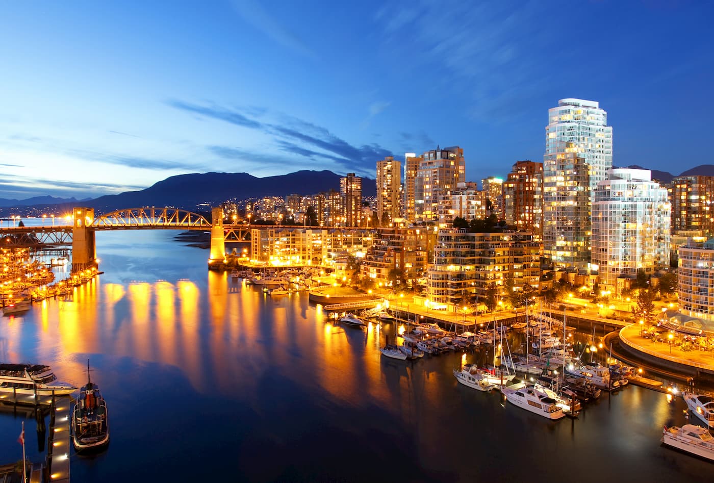
Vancouver is the third largest city in Canada and the largest city in the entire province. While the city population is 603,000, the Vancouver metro area has a population of over 2,500,000. The city is one of the most ethnically and linguistically diverse cities in Canada. The mild climate of the city, along with its abundant access to lakes, trails, and mountains, makes it a popular destination for outdoor recreation. The city is close to three ski resorts, and an abundance of hiking, running, and mountain biking trails.


ultra
glacier
swbc-high-peaks
gunn-scrambles
british-columbia-ultras
ultra
glacier
swbc-high-peaks
gunn-scrambles
british-columbia-ultras
ultra
glacier
gunn-scrambles
british-columbia-ultras
ultra
swbc-high-peaks
gunn-scrambles
british-columbia-ultras
Yes. Squamish-Lillooet Regional District has 478 named mountains. The highest is Lillooet Mountain at 2,941 m.
The highest mountain in Squamish-Lillooet Regional District is Lillooet Mountain, at 2,941 m.
Squamish-Lillooet Regional District has 478 named mountains.


