
Scan the QR code and open PeakVisor on your phone
Established in 1927, Garibaldi Provincial Park is a 753-square-mile wilderness area tucked within the heart of the Coast Mountains, just 43 miles north of Vancouver, British Columbia. The park encompasses hundreds of acres of craggy alpine summits, stunning coastal forest, and pristine alpine lakes, making it one of Vancouver’s most beloved outdoor recreation destinations.
Garibaldi Park sits within the northern portion of the Garibaldi Ranges, a subdivision of the Pacific Ranges of the Coast Mountains. This set of summits is characterized by its incredible high alpine terrain, expansive icefields, and lofty, snow-capped peaks.
In fact, the park’s inception was inspired, in part, by the sweeping views from the summit of Mount Garibaldi. Mount Garibaldi, a potentially active stratovolcano, was always an important cultural landmark for the local indigenous people of this territory, the Squamish. According to Squamish mythology, this illustrious summit, which was originally named Nch’kay to depict the muddy water of the cheeky River, served as a place of refuge from rapidly rising flood waters.
After Vancouver mountaineers reached its summit in 1907, several summer climbing camps were established. These climbing camps would ultimately spark preservation efforts in 1920 and would lead to the first ascents of several nearby summits, including The Black Tusk.
The Black Tusk, another notorious stratovolcano, sits in a meadow-ridge between Garibaldi and Cheakamus Lakes. Though The Black Tusk is not among the tallest in the region, its distinctive and recognizable pinnacle make it one of the best-known mountains in the Garibaldi Ranges.
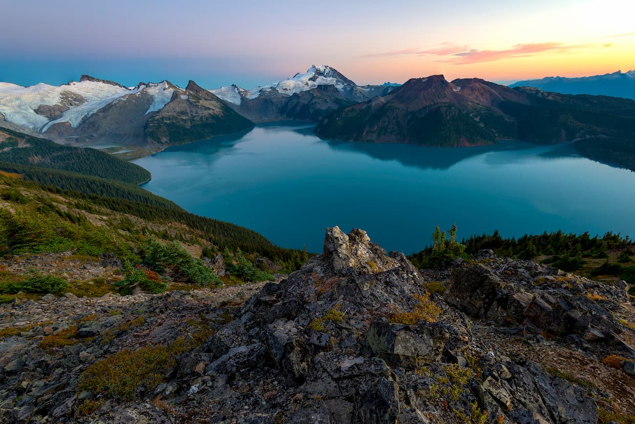
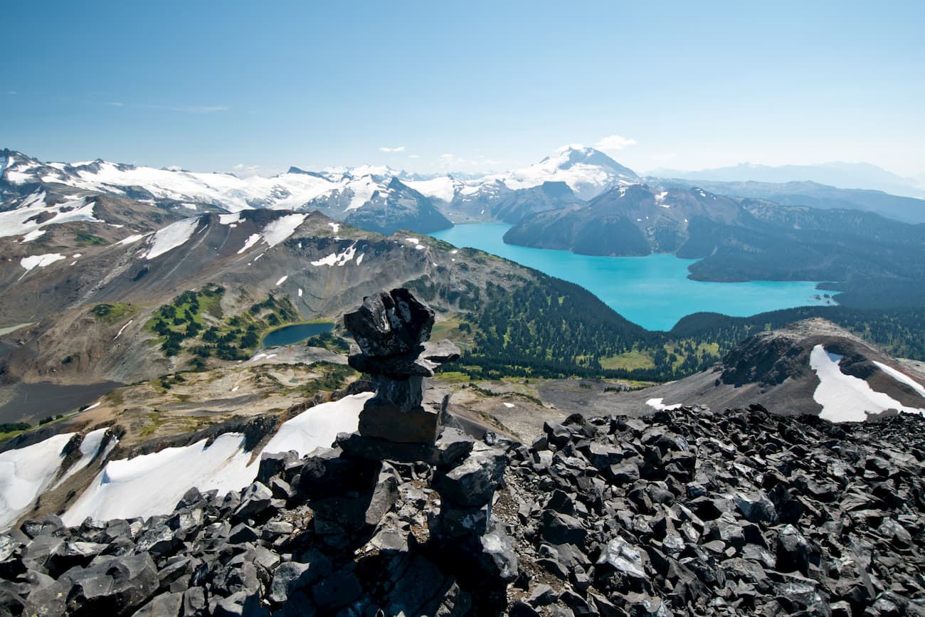
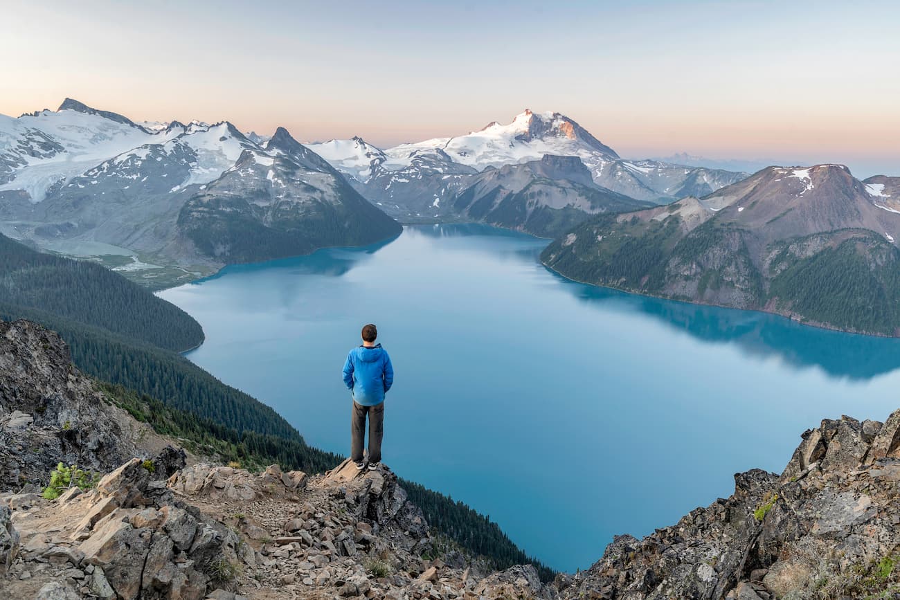
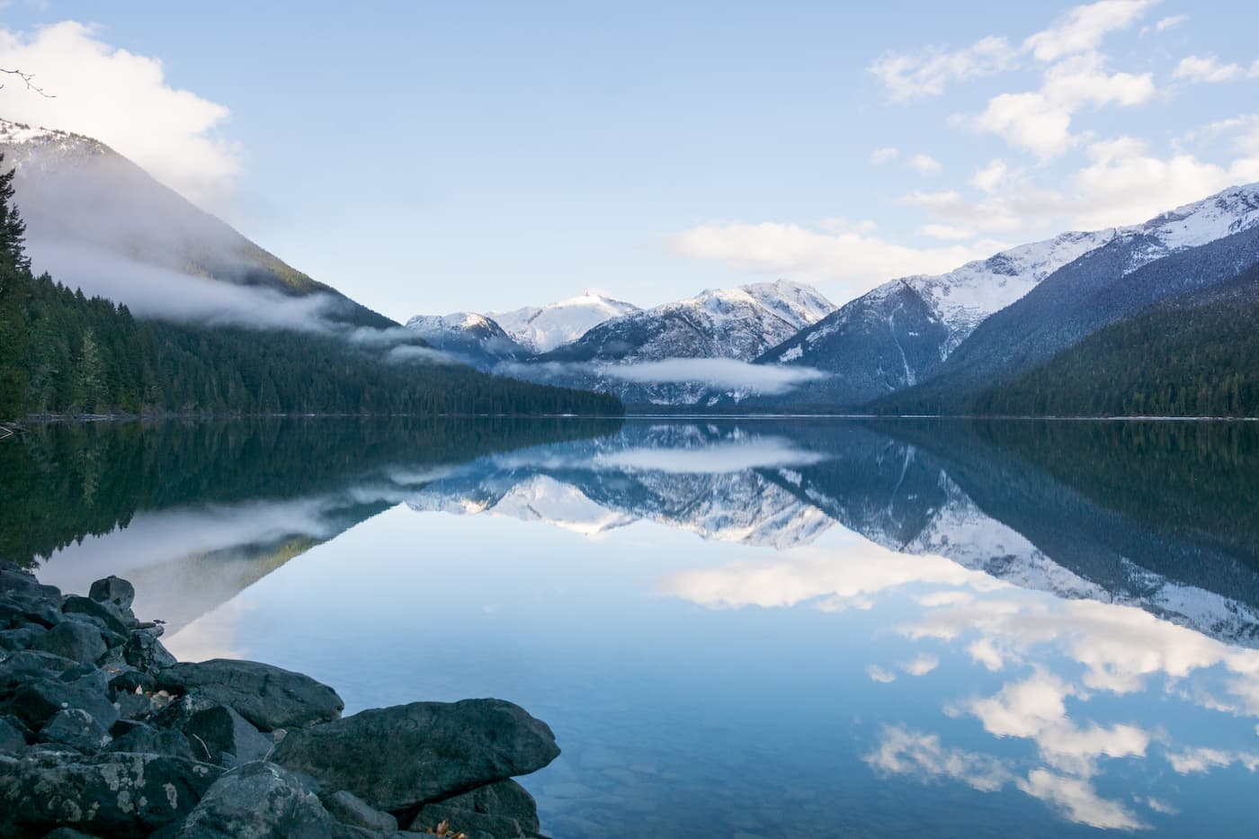
Today, Garibaldi Park contains over 100 named mountains and 150 glaciers. The highest peak in the park, Wedge Mountain, reaches over 9,500 feet in elevation. Evidence of the region’s continental and alpine glaciation, as well as volcanic activity, can be found scattered throughout the park’s most prominent features, including The Table, the Opal Cone, Garibaldi Lake, and Cheakamus Lake.
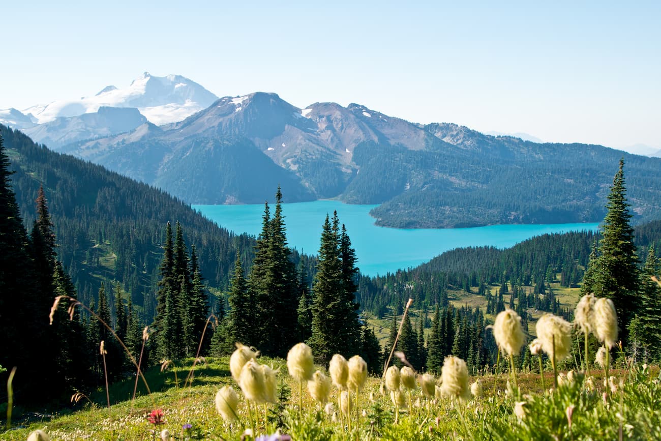
Garibaldi’s lower elevations are dominated by dense forest of Douglas-fir, western red cedar, and western-hemlock, while higher elevations contain yellow cedar, alpine fir, and white bark pine. The park also houses a variety of wildlife, including black bears, grizzly bears, deer, pika, and mountain goats.
Panorama is one of Garibaldi’s most notorious hiking trails. At 18.6-miles round trip, this footpath isn’t for the faint of heart. However, those willing to put in the effort will be rewarded with sweeping, panoramic views of Garibaldi Lake, Black Tusk, and the Helm Lake area. While Panorama Ridge can technically be tackled in a day, most hikers will opt to pitch a tent at Garibaldi Lake or Taylor Meadows and hike the ridge the following day.
The craggy black pinnacle of Black Tusk is impossible to miss, even from a distance. This Garibaldi icon is a popular bucket-list ascent for experienced hikers and offers some of the best views in British Columbia. Hikers can climb Black via the Rubble Creek Trailhead or the Helm Creek trail. Although it’s possible to hike to the summit and back in a single day, this would require climbing over 5,000 feet in elevation over the course of 18+ miles. Many hikers will camp at Helm Creek, Garibaldi Lake, or Taylor Meadows and enjoy the summit after a full night’s sleep.

If you’re not able to tackle one of Garibaldi’s long-distance trails, the trip to Cheakamus Lake is an excellent alternative. This 10-mile footpath leads to the stunning shoreline of Cheakamus Lake, a vibrant turquoise lake surrounded by snow-capped summits. You can pitch a tent along the shoreline or continue around the lake to a rocky outcrop with stunning views of the surrounding scenery.
Located just north of Vancouver, Squamish sits at the northern tip of the Howe Sound and is surrounded by stunning summits and alpine lakes. Though Squamish isn’t quite as large as its neighboring city of Vancouver, it offers a healthy variety of premium accommodations, amenities, and dining options. Squamish is just 35 minutes from Garibaldi’s most iconic hiking trails, making it the perfect destination for anyone looking to explore the park.
![]()
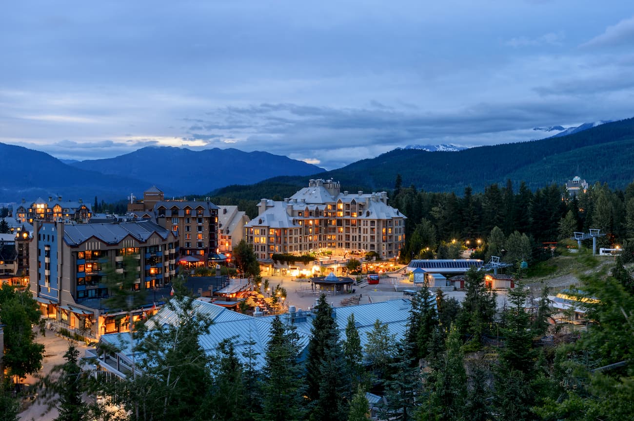
Whistler, a vibrant mountain town that is home to one of the largest and most popular ski resorts in North America, is just 30 minutes north of Garibaldi Provincial Park. Whistler Blackcomb offers over 8,100 acres of snow-covered slopes, 16 alpine bowls, 3 glaciers, and over 200 trails, ranging from novice to Olympic-level trails, to explore. While there’s no denying that Whistler is best-known for its epic backcountry skiing and snowboarding, this charming city also caters to avid hikers, backpackers, and sightseers. The city, which is bounded by Whistler Mount and and Blackcomb Mountain, offers an all-seasons Peak 2 Peak Gondola that allows visitors to easily access some of the most scenic hiking trails in the province.


ultra
glacier
swbc-high-peaks
gunn-scrambles
british-columbia-ultras
ultra
glacier
swbc-high-peaks
gunn-scrambles
british-columbia-ultras
glacier
volcano
cascade-volcanoes-pin
canada-sampler


