
Scan the QR code and open PeakVisor on your phone
The Fitzsimmons Range include 15 named peaks. The highest is Overlord Mountain at 2,625 m. Other notable peaks include Mount Benvolio, Mount Fitzsimmons and Cheakamus Mountain.
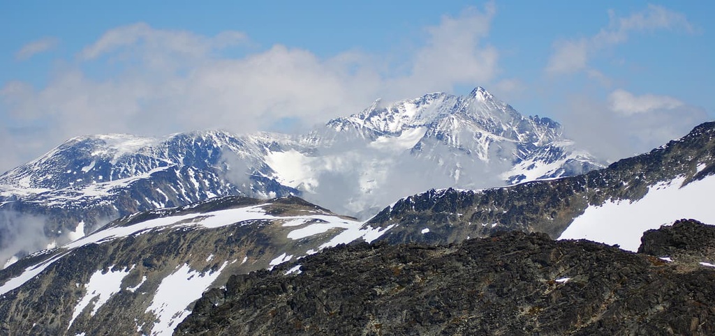
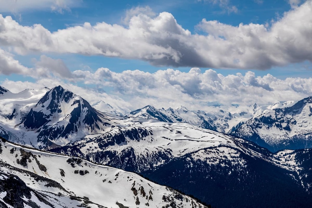
The Fitzsimmons Range is a chain of peaks located in the southwestern part of British Columbia, Canada. It is home to the famous resort town of Whistler. Overlord Mountain is the tallest of the 15 named peaks in the Fitzsimmons Range with an elevation of 2,625 m (8,612 ft). Meanwhile, Mount Whistler is the most prominent peak in the range with 464 m (1,522 ft) of prominence.
The Fitzsimmons Range is a subrange of the Garibaldi Ranges of southwestern British Columbia, Canada.
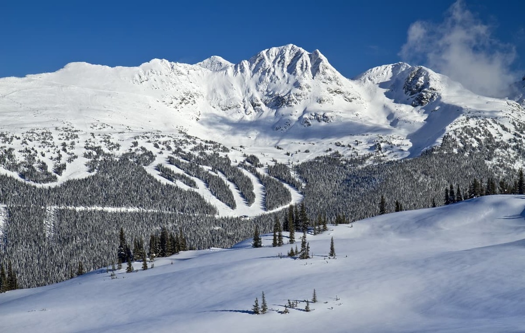
The most famous mountain in the Fitzsimmons Range is Mount Whistler, which is 2,181 m (7,156 ft) tall. Mount Whistler is also the most prominent peak in the range with 464 m (1,522 ft) of prominence. Aptly named, Mount Whistler overlooks the town of Whistler. Much of the range is associated with the Whistler Blackcomb Ski Resort or is part of Garibaldi Provincial Park.
The Garibaldi Range is a subrange of the Pacific Ranges, which itself is a subrange of the Canadian Coast Mountains. It is adjacent to the North Shore Mountains, Southern Fiord Ranges, and the Douglas Ranges. The subranges that surround the Fitzsimmons Range include the Spearhead Range, which is situated to the north, and the McBride Range, which is located to the southeast.
Aside from Mount Whistler, other popular peaks in the range include Oboe Summit, Piccolo Summit, and Flute Summit. All of these peaks are actually hillocks along the ridge that extends off of Mount Whistler. They were renamed when Mount Whistler was given its current English language name (it was formally called London Mountain).
Located within the Squamish-Lillooet Regional District at the opposite end of the range from Whistler is Mount Fitzsimmons, the namesake of the range and the location of the Fitzsimmons Glacier.
Mount Fitzsimmons is part of the Overlord Massif. Overlord Mountain is the tallest peak in the massif, which also includes Mount Benvolio and Refuse Pinnacle.
The Fitzsimmons Range lies within the municipal boundaries of the community of Whistler as well as the resort of Whistler and Garibaldi Provincial Park. Garibaldi Provincial Park is part of the BC Parks System, which is responsible for conservation efforts in over 800 provincial parks.
Other noteworthy parks that are located near the Fitzsimmons Range include:
The Fitzsimmons Range contains various volcanic rocks that were deposited on the seafloor over the past 250 million years. The sediment on the sea floor was compacted by the weight of the underwater lava flows. About 170 million years ago, these sediments were compressed, folded, and buckled, to form the mountain ranges that we see today.
The Fitzsimmons Range is part of the Pacific Ranges of the Canadian Coast Mountains. The tectonic action of the Pacific plates as they interacted with the North American plate is what was responsible for the creation of the faults, folds, volcanic activity, and the overall force that lifted the Coast Mountains.
The Coast Mountains run from north to south along the coast of British Columbia from the southwest corner of the province to Alaska. The Coast Mountains include the subranges of the Boundary Mountains in the north, the Kitimat Ranges along the central coast, and the Pacific Ranges along the southern coast of the province.
Geologically, the rocks found in the Fitzsimmons Range to the south of Singing Pass, which include Fissile Peak and Overlord Mountain, are older than the rocks that compose the “musical bumps” of Oboe, Piccolo, and Flute Summits. Additionally, the red color of the rock around Fissile is caused by iron oxidation and was once a hotspot for mineral prospecting.
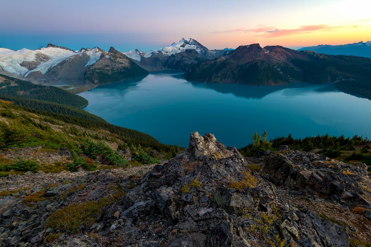
A unique geological feature in the area is a rock glacier that formed beneath an area adjacent to the Whistler-Blackcomb ski resort. The rock glacier is the result of rocks that tumbled off of Disease Ridge into the basin below where ice persists because the rocks insulate it from the sun.
As moisture seeps down among the rocks, the moisture freezes around the rocks, reducing their friction, allowing them to roll and “flow” as more rocks fall onto the pile. The rock glacier in the Fitzsimmons Range moves about 15 cm (6 inches) a year, which is typical of rock glaciers; however, rock glaciers further north, such as those in Yukon, may move as much as a meter a year.
The peaks in the western part of the range are typically gentler and more rounded than the glaciated and jagged peaks in the east. The persistent glaciers in the range suggest that the area was an epicenter for glacial activity during the Pleistocene. Additionally, the region’s jagged peaks may have stood above the cordilleran ice sheet as nunataks, while Whistler and the “musical bumps” were rounded by the ice sheet.
An interesting note is that the nearby Garibaldi Volcanic Belt, which includes Black Tusk, Mount Fee, and Mount Garibaldi, formed during the Pleistocene. Indeed, Mount Garibaldi likely erupted about 13,000 years ago, blowing through the kilometers-thick ice sheet that once covered western Canada.
The Fitzsimmons Range and the general region has a significant history of mining thanks to the richness of its mineral deposits. These minerals are likely due to the tectonic processes that created vast gold, silver, zinc, and iron deposits from the older volcanic rocks of the region.
There are four ecological zones represented in the Fitzsimmons Range, each of which is characterized by its dominant plant species.
The highest elevations of the range are part of the Alpine Tundra Zone. This zone includes communities of heather on otherwise barren peaks. The runoff from these glaciers often settles in low areas. Small communities of dwarf shrubs may start growing in this zone, too.
Most of the Fitzsimmons Range is part of the Alpine zone, and only the lower slopes and the lowest valleys have any significant forest cover. The lowest valleys in the range are part of the temperate rainforests of British Columbia, which is in turn part of the Coastal Western Hemlock Zone. This zone is dominated by red cedars, western hemlock, alder, and big leaf maple.
Rising up the slopes around the range’s ski hills are forests dominated by Engelmann spruce and subalpine fir. These are part of the Engelmann Spruce-Subalpine Fir Zone, which is typically much cooler than the rainforest valley bottoms.

The transition from the alpine to the subalpine is gradual. The tree line is a mosaic of meadows and scattered trees that become a dense forest at lower elevations. The subalpine is a relatively thin band of the Mountain Hemlock Zone that is dominated by forests of mountain hemlock and amabilis fir.
The Fitzsimmons Range has grizzly and black bears, elk, moose, cougars, deer, wolves, coyotes, foxes, and many more mammals. Mountain goats and bighorn sheep frequent the alpine areas of the range. Whistler Mountain was named for the whistling of the hoary marmot, which you could traditionally hear when hiking in the region.
In addition to the many mammals present in the range, there are several species of woodpeckers, owls, eagles, and hawks that inhabit the Fitzsimmons Range. However, the year-round popularity of the Whistler-Blackcomb Resort has likely diminished the populations of some of the wildlife in the range.
Human habitation of the Fitzsimmons Range and surrounding area began about 10,000 years ago, shortly after the melting of the Pleistocene ice sheet. Obsidian mines that were used by Indigenous peoples for the past 10,000 years have been uncovered in Garibaldi Provincial Park.
The range is the traditional territory of the Squamish, Lil’wat, and St’át’imc First Nations. It is possible that it was the ancestors of these contemporary First Nations that mined the obsidian in what is now Garibaldi Provincial Park in order to make razor-sharp blades and fine jewelry.
According to other theories, a different culture that first lived in these mountains was responsible for this mining activity. Either way, Garibaldi obsidian was long a valuable trading item. The obsidian in the region has been found in archeological sites in British Columbia and Washington.
The first recorded non-Indigenous visitors to the Fitzsimmons Range were William Downie and Joseph Mackay. The British colonial government commissioned the pair in 1858 to search for better coastal access to the booming gold mines of interior British Columbia. Downie was a “49er” (veteran of the California gold rush), and Mackay was a trapper for the Hudson’s Bay Company.
During the 1860s, thousands of people in the search for gold rushed into British Columbia. While most followed the Douglas Route up Lillooet Lake, others landed in Howe Sound and prospected in the creeks as they advanced through the mountains.
Of all the settlers and miners that settled in the area around the turn of the twentieth century, the first to make a claim on Whistler Mountain and mine copper was Jimmy Fitzsimmons. Fitzsimmons cut a trail between Blackcomb Mountain and Whistler Mountain to his cabin, which is located across from what is now known as the Singing Pass.
Fitzsimmons Range, Fitzsimmons Creek, Mount Fitzsimmons, and Fitzsimmons Glacier were all given their English language names after Jimmy Fitzsimmons. During his time, Whistler Mountain Singing Pass was called London Mountain and Avalanche Pass.
The resort community and world-famous ski resort and tourist area grew from very modest beginnings in the early twentieth century. The accessibility that came with the Pacific Great Eastern Railway in 1914, the spectacular setting, and the excellent fishing all made the Whistler area the popular tourist resort that it is today.
In 1965, London Mountain was renamed Whistler Mountain. This was actually a name that the locals had long used for the mountain because of the whistling sound of the hoary marmots that live on the mountain’s slopes. The same year, the first lifts were installed on the mountain and a lodge was built.
With Whistler Mountain open to skiers in 1966, a new era in Canadian skiing began. Over the following decades, the communities and resorts in the area grew rapidly. There’s now an eclectic history of many vibrant personalities that have lived and skied on Whistler.
The growth of Whistler is the main historical event of the past century; however, it’s worth noting that early settlers were frequently employed in mining and forestry. Mining in the area has since subsided as the provincial government focused more on allowing the expansion of the ski resort as opposed to developing mining claims.
In 2003, the culmination of many years’ work and a dream for the past 50 years came about as Whistler and Vancouver won the bid for the 2010 Olympics. While the area remains a popular tourist destination, the future growth of the area remains uncertain as locals look to conserving the natural beauty of the area over further growth and expansion of the resort.
The Fitzsimmons Range is home to one of the world’s premiere ski destinations. It features breathtaking landscapes, forests, rivers, lakes, and glaciers. The following are several of popular hiking trails and attractions in the Fitzsimmons Range:
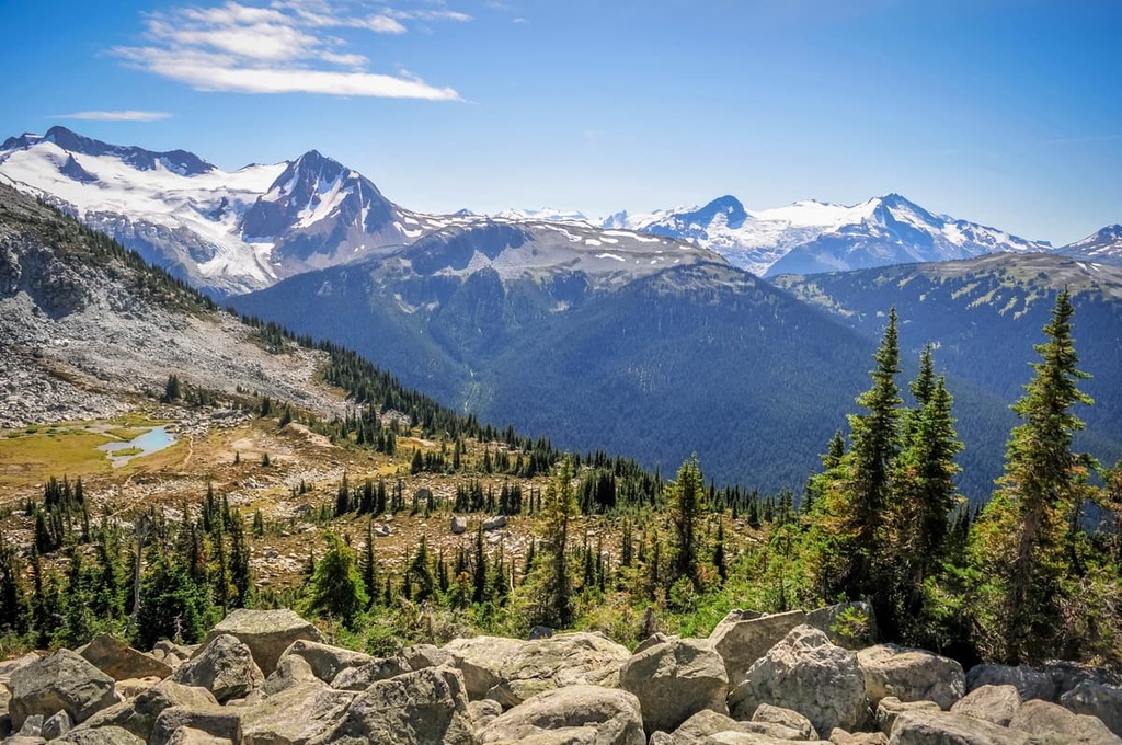
From Whistler Mountain, this trail leads 10.5 km (6.3 mi) past the “musical bumps” of Oboe, Flute, and Piccolo Summits and down Singing Pass to Russet Lake.
The trail offers incredible views of Fitzsimmons Creek. Along the way, hikers have the option to extend their adventure up Whirlwind Peak and attempt the summit of Overlord Mountain, which is the tallest mountain in the Fitzsimmons Range.
The Singing Pass Trail to Russet Lake from the town of Whistler is about 15 km (9 mi) long with nearly 1,500 m (4,920 ft) of elevation gain. The trail follows Fitzsimmons Creek up the valley and over Singing Pass into Garibaldi Provincial Park.
There are several ways to reach the summit of Whistler Mountain. From the Roundhouse Lodge, you can take the gondola to the summit or hike one of the trails.
The hiking trails to the summit include a route along Pika’s and Mathew’s Traverse, which is a 3.3 km (2 mi) grind to the top of Whistler. The other option is the 10 km (6 mi) High Note Trail, which also reaches Flute Summit and takes you near Piccolo Summit.
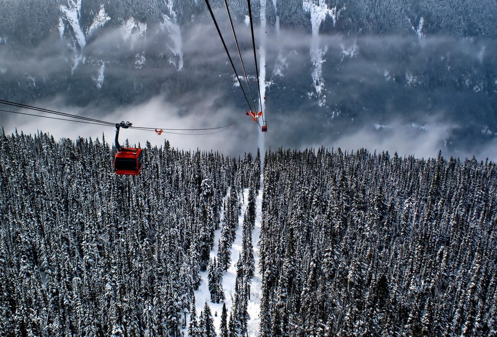
The ski resort on Whistler Blackcomb is one of the largest ski resorts in North America. It often surpasses 2 million visitors a year. Originally conceived as part of the bid for the 1968 Winter Olympics (the resort did not win an Olympic bid until 2010), the ski hill was built anyway, and it quickly grew in popularity.
The resort has 3,306 ha (8,171 acres) of ski area that cover the ridges of Whistler Mountain and Blackcomb Mountains. It is serviced by many gondolas and dozens of lifts. The resort has incredible winter facilities, and it is now a year-round destination that also offers world-class mountain bike terrain.
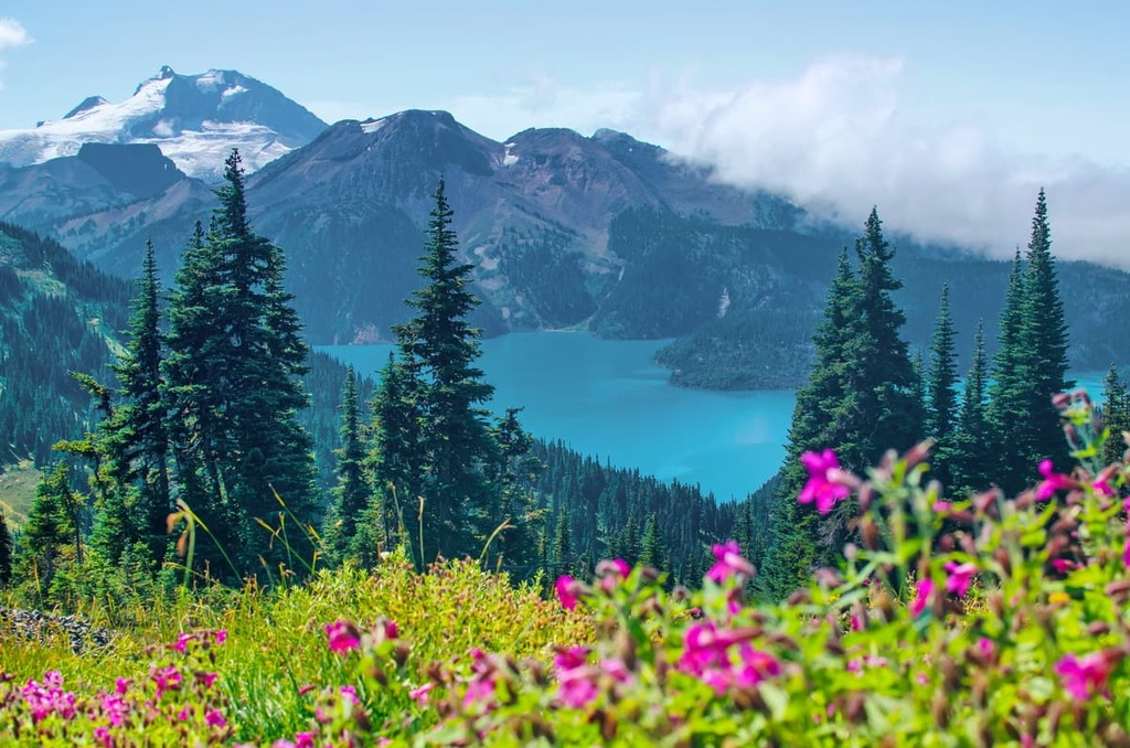
The Fitzsimmons Range is part of the northwest corner of Garibaldi Provincial Park, which is named for one of its most iconic peaks—Mount Garibaldi.
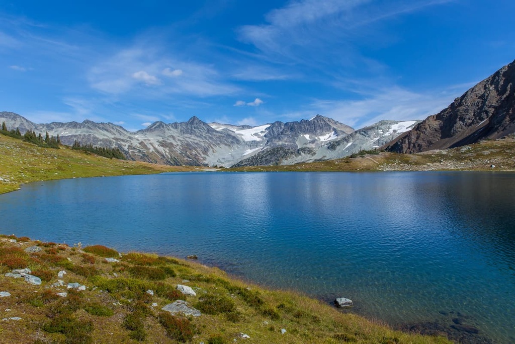
Mount Garibaldi is a volcano that erupted through the Pleistocene ice sheet about 13,000 years ago. The park has scenic vistas, abundant wildlife, rugged mountains, shimmering lakes and rivers, and 90 km (54 mi) of hiking trails.
Some of the top recommended hikes of the park include the Garibaldi Lake Trail, Panorama Ridge, Elfin Lakes, and Wedgemount Lake. Some of the most popular peaks to summit in the park include Mount Weart, Wedge Mountain, Mount Price, Mamquam Mountain, and Overlord Mountain.
Looking for a place to stay near the Fitzsimmons Range? Here are some of the best cities and towns to check out in the region:
Located about 120 km (72 mi) to the south of the Fitzsimmons Range and Whistler, Vancouver is located at the south end of the Pacific Ranges, along the Fraser River. Vancouver is the largest city in British Columbia, and it is often confused as the capital of the province, which is actually Victoria.
The city has many cultural attractions to check out, including libraries, museums, performing arts, art galleries, and a vibrant nightlife. There are also annual festivals, such as the Pacific National Exhibition.
In the city, there are many great paths to walk, especially in Stanley Park, which is one of North America’s largest urban parks. Outside of the city, some popular hikes around Vancouver to check out include St. Marks Summit, Quarry Rock, the Grouse Grind, Pacific Spirit Regional Park, Burnaby Lake Park, and the Norvan Falls Trail.
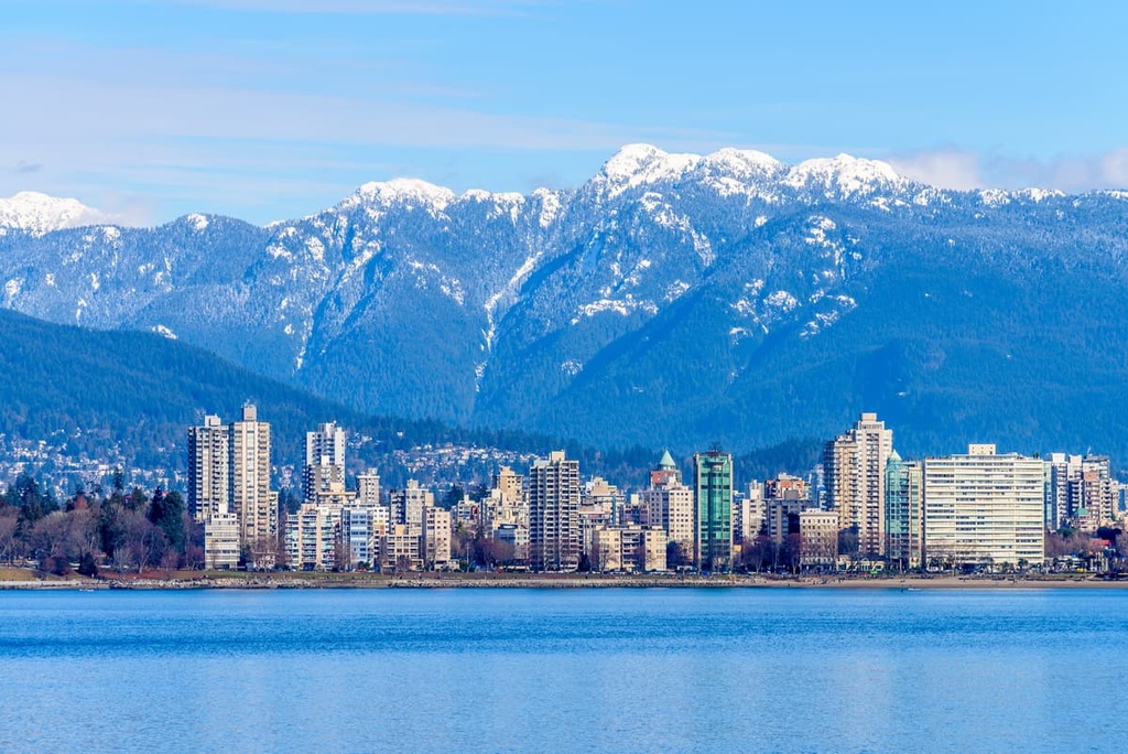
Additionally, some of the amazing provincial parks that are easily accessible from the Lower Mainland include Garibaldi Provincial Park, Pinecone Burke Provincial Park, Golden Ears Provincial Park, and Mount Seymour Provincial Park. All of these hikes offer incredible trails and backcountry experiences.
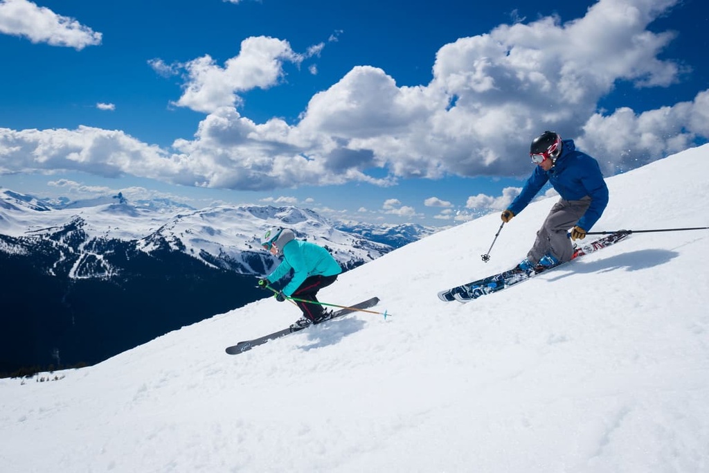
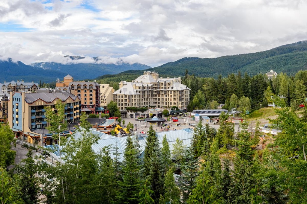
Whistler is a resort community that is situated on the northwest side of the Fitzsimmons Range, about 120 km (72 mi) away from Vancouver. Over two million people visit Whistler every year, primarily for alpine skiing and snowboarding during the winter; however, downhill and mountain biking are also popular at the Whistler Blackcomb Resort during the summer months.
During the winter, the town is filled with skis and snowboards, as visitors flock to one of the largest ski resorts in North America. During the summer, the town is still full of life; however, mountain bikes and hiking boots are on the trails, instead.
Some of Whistler’s popular hikes include the Singing Pass Trail and the High Note Trail to the top of Whistler Mountain. Additionally, one hike that you don’t want to miss is the short hike to the train wreck at the south end of town.
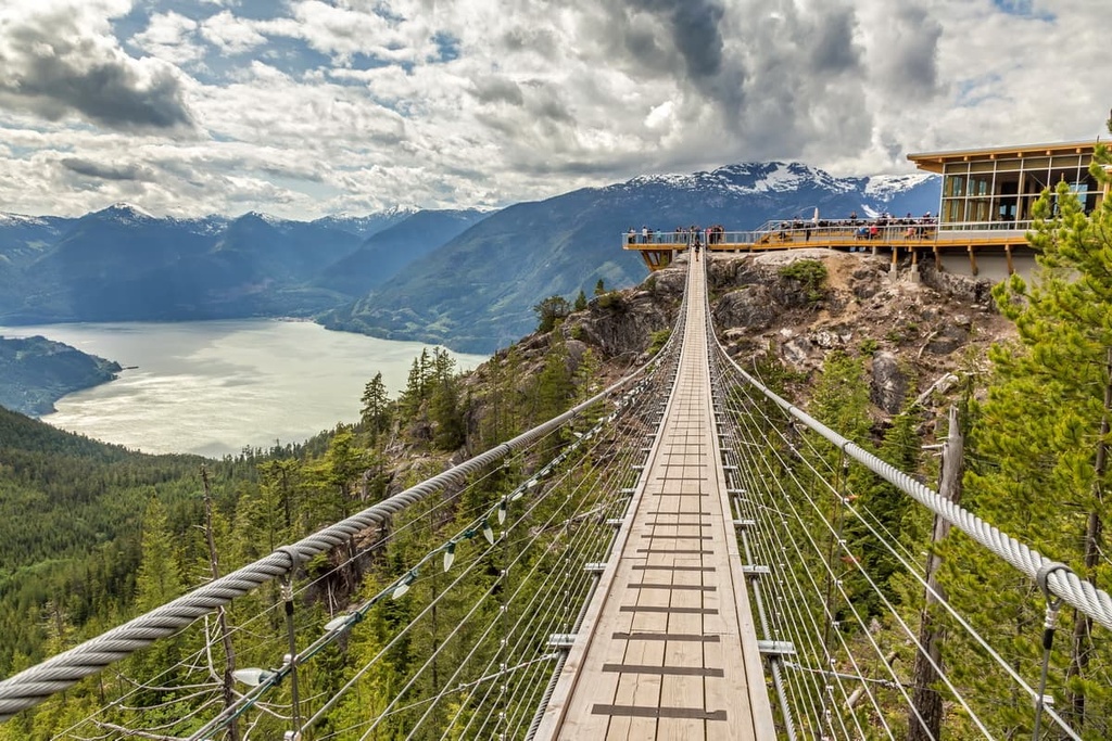
Situated at the north end of Howe Sound on the Sea to Sky Highway in British Columbia, Squamish is a town that’s just 60 km (36 mi) to the south of the Fitzsimmons Range. Like Whistler, Squamish is a popular destination for tourists in search of outdoor adventure and recreation.
However, while Whistler is known for the ski hills, Squamish is world renowned for its thousands of climbing and bouldering routes. Indeed, climbing is a very popular sport around Squamish and there are some well renowned climbing areas within the city limits.
Climbing attractions include the granite massif called the Stawamus Chief, with over 300 climbing routes, as well as Shannon Falls, Murrin Park, The Malamute, and the Smoke Bluffs, all of which contain an additional 1,500 routes. Additionally, the area is home to over 2,500 bouldering problems that are published in local guidebooks.
Squamish is also a popular destination for windsurfing and kiteboarding, ultra-trail running, visiting Shannon Falls, river-rafting on the Squamish and Elaho Rivers, snowmobiling, hiking, mountaineering, and backcountry skiing.


The highest peak in the Fitzsimmons Range is Overlord Mountain, at 2,625 m.
The Fitzsimmons Range have 15 named peaks.


