Scan the QR code and open PeakVisor on your phone
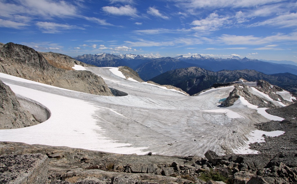
Sitting above the resort town of Whistler, in British Columbia, Canada, Blackcomb Glacier Provincial Park offers unique opportunities in the summer and winter. The glacier flows along the slopes of Blackcomb Peak and The Spearhead, which are the only peaks in the small park.
Blackcomb Glacier Provincial Park is adjacent to the northwest side of Garibaldi Provincial Park, in British Columbia, Canada. In 1990, 220 ha (540 acres) between Blackcomb Peak and The Spearhead were separated from Garibaldi Provincial to better protect the upper parts of Blackcomb Glacier.
The park provides opportunities for hiking in summer, and skiing and snowboarding in winter. In the winter, visitors may access the park via the gondolas and lifts at the Whistler Blackcom resort; however, there are no facilities at the park. Summer access to the glacier is available through the resort development, and then following a trail to the park.
The tallest peak in the park is The Spearhead (2,457 m/ 8,016 ft), which is the second tallest mountain in the Spearhead Range. Blackcomb Peak (2,436 m/ 7,922 ft) is the other peak in the park, and the one which lends its name to the glacier.

Blackcomb Glacier is in the Spearhead Range, which is a subrange of the Pacific Ranges. The Pacific Ranges are the southern ranges in the Coast Mountains, which line the west coast of Canada. The Fitzsimmons Range and Bastion Range are adjacent to the Spearhead Range, and all three are part of Garibaldi Provincial Park.
Blackcomb Glacier Provincial Park is part of BC Parks, which is responsible for about 1,000 parks and protected areas in the province. Some of the parks have vast trail networks and infrastructure while others are kept in near pristine condition. The following are some of the parks that are near Blackcomb Glacier Provincial Park.

Blackcomb Glacier Provincial Park is in the Spearhead Range, which is part of the Pacific Ranges of the Canadian Coast Mountains. The Canadian Coast Mountains are part of the Canadian Cordillera which spans from the Rockies, in the east, to the Insular Mountains which form many of the island belts off the coast of British Columbia.
The Canadian Cordillera started forming about 170 million years ago when oceanic tectonic plates collided with and subducted beneath the west coast of North America. As the oceanic plates subducted, their micro-continents and volcanic island arcs were scraped off and accreted to the west coast of Canada.
It was the force of the tectonic collision that created the mountains in western Canada. As the Coast Mountains were forming, magma intruded into the layers of sedimentary rock and slowly cooled to form granite and other granitic rocks, of which the Spearhead Range is composed.

Over the following millions of years, the softer layers of Cretaceous rock were eroded. The topography of the range today is due mainly to the most recent glaciation which occurred near the end of the Pleistocene. During the Pleistocene, the Cordilleran ice sheet covered much of Canada and was several kilometers thick in some places in the mountains and it scoured the mountains.
The ecology of Blackcomb Glacier Provincial Park is representative of the Coastal Mountain-heather Alpine zone. This alpine area, close to the coast, features a deep, warm snowpack that is ideal for skiing.
Blackcomb glacier dominates the park and where the glacier does not cover, it is typically rocky and barren. Where vegetation does grow in the park, it is typically communities of mountain heather.

Most of the park is relatively high in elevation and is part of the alpine zone. The lowest areas in the park and the subalpine area surrounding the park are forests of mountain hemlock, yellow cedar, and amabilis fir.
Grizzly and black bears, elk, moose, cougars, deer, wolves, coyotes, and foxes are common in the mountains surrounding the park; however, mountain goats and bighorn sheep are the only large mammals that you may see in the park. However, marmots abound in the area, and they typically make their homes among the alpine rocks. Indeed, Whistler is named for the sound that the marmots make.

There is no evidence of human habitation within Blackcomb Glacier Provincial Park; however, the surrounding mountains and region have been inhabited for about 10,000 years. One of the earliest evidence of people inhabiting the area are the obsidian mines in the adjacent Garibaldi Provincial Park that have been used for over 10,000 years.
The park is in the traditional territory of the Lil’wat, Squamish, and St’át’imc First Nations. Generations of indigenous families have been harvesting the region’s salmon for food and the cedar trees for buildings, clothing, and tools.
Starting around the 1860s, thousands of people rushed into British Columbia in search of gold. While most followed the Douglas Route up Lillooet Lake, others landed in Howe Sound and prospected in the creeks of the Fitzsimmons and Spearhead Range as they advanced through the mountains.
As prospectors made their way from the coast and through the mountains, the beauty of the area was duly noted. Settlers began arriving at the base of the Spearhead and Fitzsimmons Range by the beginning of the twentieth century and quickly recognized the potential for tourism to the area.
The community of Whistler and the adjacent ski resort started modestly in the beginning of the twentieth century. When a railway was built through the community, visitors flocked to the area to enjoy the spectacular setting and the excellent fishing.
It was 1965 when the first ski lifts were installed, in the area in 1965 in an attempt to attract the Olympic bid for 1968; however, the Olympics were finally hosted at Whistler Blackcomb in 2010.
Blackcomb Glacier Provincial Park was carved out of Garibaldi Provincial Park in 1990, to protect the upper portion of Blackcomb Glacier. Adjacent to the glacier, Blackcomb resort had constructed lifts that reached the edge and even into the park. The “Blackcomb Glacier” run is a popular run for advanced skiers which runs across the glacier.
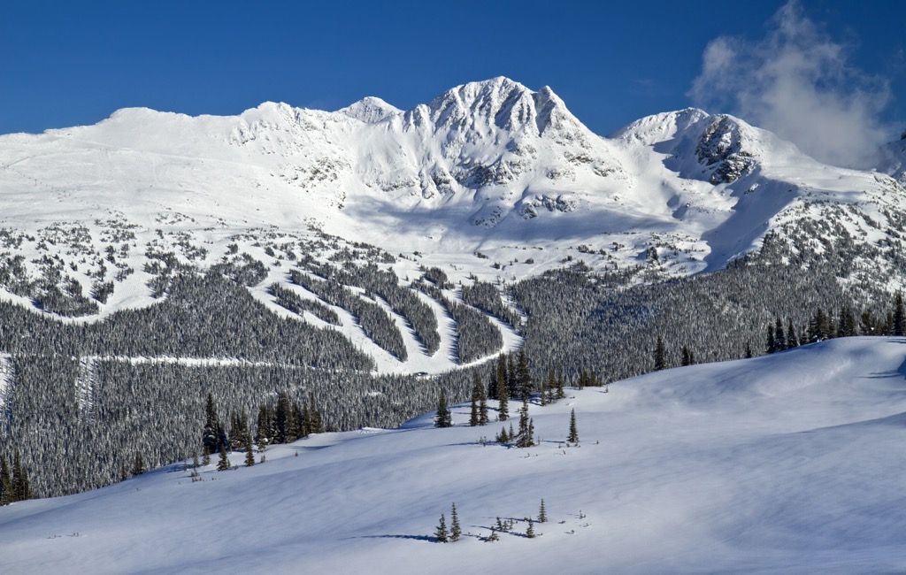
In 1997, the Whistler and Blackcomb Resorts amalgamated ownership to create a single resort. Combined, it is the largest ski area in North America with 33 square kilometers (8,171 acres) of terrain.
Millions of people visit Whistler Blackcomb every year and many test their skills against the Blackcomb Glacier. While on the glacier, many visitors will stop by the ice cave which is part way down the run.
Blackcomb Glacier Provincial Park is quite small; however, there are some great trails through the park and a nice ice cave to visit. The following are the major trails and attractions of the park.
Skiing likely brings more people to Blackcomb Glacier Provincial Park than any other activity. The lifts of Whistler Blackcomb resort make the glacier quite accessible and visitors get the opportunity to ski upon a glacier. Skiing upon Blackcomb Glacier is only available in the winter; however, the adjacent Horstman Glacier is open for summer skiing at Whistler Blackcomb.

The trip to the Blackcomb Glacier Ice Cave typically starts by ascending most of Blackcomb Peak via the chair lifts and then the t-bar which nearly reaches the top of the glacier. A 50 m (164 ft) hike brings visitors to the top of the Blackcomb Glacier run where the fun begins.
Markers designate the easiest path down the glacier and as they come closer together, the ice cave is nearby. Just above the ice cave on skiers right are some cliff signs that warn of the drop over the cave. While you can ski straight down to the cave, it is considered safer to loop around the boundary signs as the crevasses can be unpredictable from season to season.
A short hike takes you back up to the cave where you should anticipate spending a bit of time. There are usually people at the cave taking pictures and having a break. When you’re ready to leave, follow the route back down the mountain.

First completed in the 1960s, the Spearhead Traverse is a 40 km (24 mi) point-to-point trail that typically starts in the village of Whistler and ends on the Blackcomb Glacier. The route is considered quite difficult and strenuous, and it can be done hiking or ski touring.
Starting from Whistler, the route goes up the valleys and ascends the Fitzsimmons range just past Oboe Summit. The route then follows that range, passing beneath Fissile Peak and Overlord Mountain before traversing beneath Mount Fitzsimmons into the Spearhead Range.

The route rounds Mount Macbeth and then skirts Quiver Peak, Shudder Mountain, Tremor Mountain, Mount Pattison, and Decker Mountain before entering Blackcomb Glacier Provincial Park for the final leg. The trail ends by passing between Blackcomb Peak and The Spearhead, at which point visitors can take the gondola down, or ski the rest of the way, in the winter.
Whether hiking or skiing, the following are some communities near Blackcomb Glacier Provincial Park that will have accommodations and the services you need.
Whistler is the resort community situated at the base of Blackcomb Peak and it is the main resort community for the Whistler Blackcomb ski area. The community and resort hosted the downhill events of the 2010 Winter Olympics and currently receives over two million visitors every year.
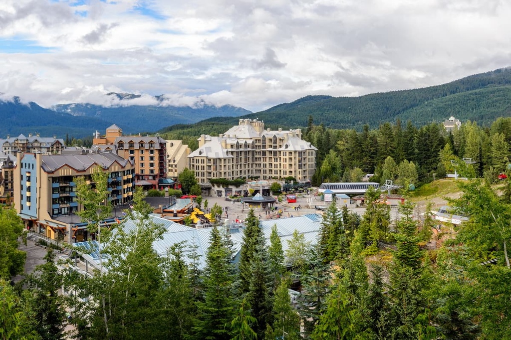
Most visitors come for alpine skiing and snowboarding during the winter; however, downhill and mountain biking are also popular at the Whistler Blackcomb Resort during the summer months.
Some of Whistler’s popular hikes include the Singing Pass Trail and the High Note Trail to the top of Whistler Mountain. Additionally, one hike that you don’t want to miss is the short hike to the train wreck at the south end of town.
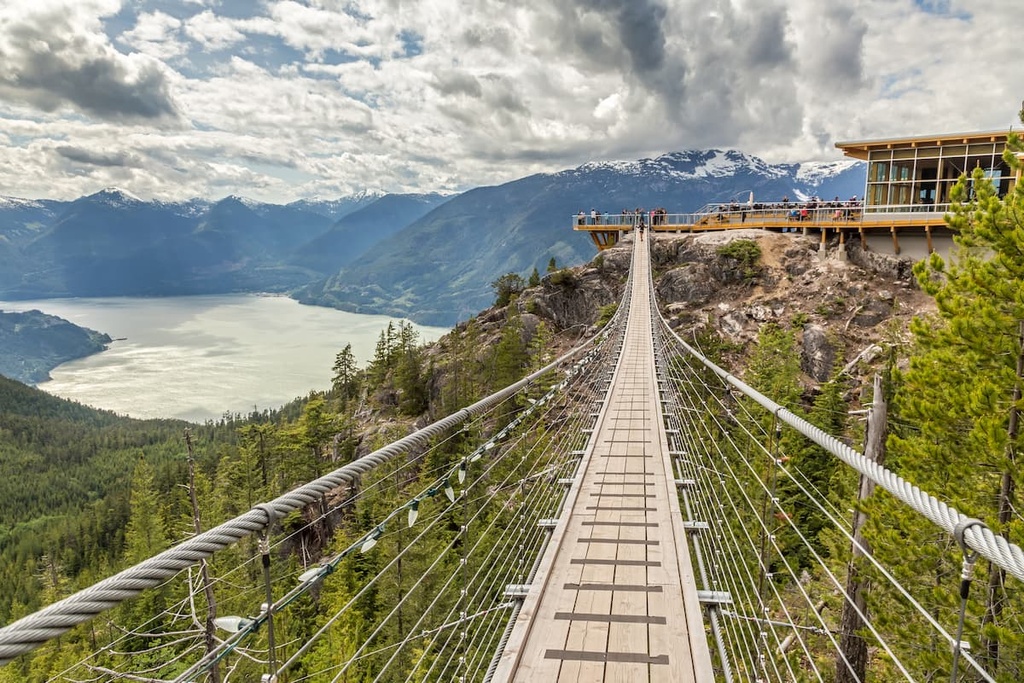
Squamish is a charming town situated at the north end of Howe Sound, about 60 km (26 mi) south of Blackcomb Glacier Provincial Park. The town is situated along the Sea to Sky Highway in British Columbia, which connects the Lower Mainland to the skiing on Whistler and Blackcomb Mountains.
Squamish is a popular destination for tourists in search of outdoor adventure and recreation, especially climbing and bouldering. Nearby Stawamus Chief has over 300 climbing routes and Shannon Falls, Murrin Park, The Malamute, and the Smoke Bluffs 1,500 more routes. The area is home to over 2,500 bouldering problems that are published in local guidebooks.
While climbing is likely the largest draw to Squamish, it is also a popular destination for windsurfing and kiteboarding, ultra-trail running, river-rafting, snowmobiling, hiking, mountaineering, and backcountry skiing. Tantalus Provincial Park, Brackendale Eagles Provincial Park, Alice Lake Provincial Park, and Garibaldi Provincial Park are some wilderness areas that are close and accessible from Squamish.