Scan the QR code and open PeakVisor on your phone
Marble Canyon Provincial Park is located in the northeastern corner of the Squamish-Lillooet Regional District of southern British Columbia, Canada. Located in the Canadian Coast Mountains, Marble Canyon encompasses the stunning Turquoise, Crown, and Pavilion Lakes, as well as a handful of rare geological occurrences in the Coast Mountains. The park’s only peak is Chimney Rock, which has an elevation of 1,725 m (5,695 ft)
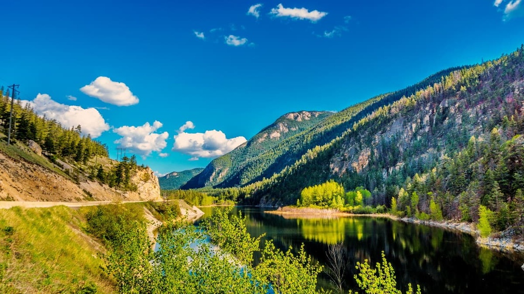
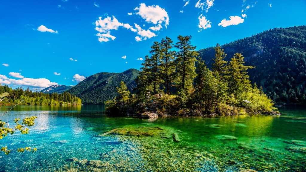
Located along Highway 99 near the west coast of Canada in British Columbia, Marble Canyon Provincial Park’s main attractions are the three stunning lakes and the region’s unique geology.
The park is home to a campground located between Turquoise and Crown Lakes. Meanwhile, Pavilion Lake is located at the northern end of the park and was part of a sector that was only added to the protected area in 2001.
The only peak in the park is Chimney Rock, which stands 1,725 m (5,695 ft) in elevation with a prominence of 198 m (650 ft); however, the park boasts a stunning 1,000 m (3,280 ft) tall limestone cliff that dominates the canyon. These white, chalk-faced, limestone cliffs are rare within the Coast Mountains and are only found in large concentrations in Marble Canyon, which is located in the Pacific Ranges.
While the park is located within the Squamish-Lillooet Regional District, it is situated along the border with the Thompson-Nicola Regional District. Each of the regional districts have unique features that have been preserved for conservation and recreation through the development of parks and protected areas.
The following are some of the other parks and protected areas located near Marble Canyon Provincial Park that are worth checking out during your next visit:
The Canadian Coast Mountains originally formed as a volcanic island arc off the west coast of North America. As the Farallon plate, which was the tectonic plate under the Pacific Ocean at the time, was subducting beneath North America, the buoyant islands were too large to be subducted and were skimmed off the plate and pushed against the continent.
By the time the island arcs collided with North America, they were already ancient, as they had started forming during the Paleozoic and probably came together during the Carboniferous Period about 300 million years ago. While the island groups are known as the Wrangell and Chilliwack groups, other islands of distinct composition were integrated into the greater Insular Islands.
The subduction of the Farallon plate caused it to feed the volcanic Coast Range Arc with molten rock. Plutons of magma burned upwards through the recently accreted Insular Belt, injecting massive amounts of granitic stock into the ancient Insular terrane.
At the surface, new volcanoes reached high above the sea along the continental margin. While the volcanoes of the Coast Mountains have long since eroded, The Coast Range Volcanic Arc intruded molten granite rocks that created the massive batholith that now forms the backbone of the Coast Mountains.
The injection of magma metamorphosed many of the surrounding rocks and, in many cases, it turned marine sediment into schist. Additionally, older plutons were subsequently deformed by later intrusions turning them into gneiss.
While all this geological activity was taking place, the islands that form Marble Canyon were broken apart and separated. The white, chalk-faced, limestone cliffs of Marble Canyon Provincial Park are distinct from the surrounding granitic mountains and were part of a unique island chain that formed in the Pacific and merged into the Insular Belt.

Another section of the island chain that created the 1,000-meter (3,280-ft) tall limestone canyon walls of Marble Canyon has been discovered in the northwest corner of British Columbia. The limestone mountains in that area created weathered peaks that appear like a crumbling castle wall. However, these mountains are aesthetically more like the peaks of the Rocky Mountains as opposed to the surrounding Coast Mountains.
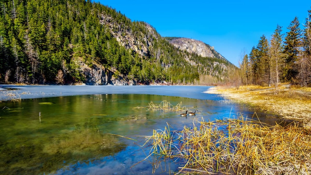
While the ecology of Marble Canyon Provincial Park is classified as part of the Interior Douglas Fir ecosystem, we would be remiss if we didn’t first mention the ancient life forms that have left their mark in the park. In fact, along the bottom of Pavilion Lake, paleontologists have uncovered freshwater stromatolite fossils
The stromatolites are coral-like structures that are the fossilized remains of micro-organisms that are considered to be similar to some of the oldest known lifeforms on earth. Freshwater stromatolite fossils are rare, and Pavilion Lake is one of the few places in the world to have them.
Since the formation of the stromatolite fossils, the region has undergone immense ecological changes. As the surrounding mountains formed, the region was raised out of the sea and was part of a tropical region that featured a flourishing coastal ecology; however, the continued rising of the mountains drained the ancient sea and soon, the region was covered with massive glaciers and an ice sheet.
As the ice melted, grasslands and savanna like conditions first prevailed and then trees started growing, creating dense forests. Since it is located on the eastern side of the Coast Mountains, Marble Canyon Provincial Park is situated in the range’s rain shadow. As a result, the park is significantly drier than the rainforests of the west coast and is more like the dry interior plateaus.

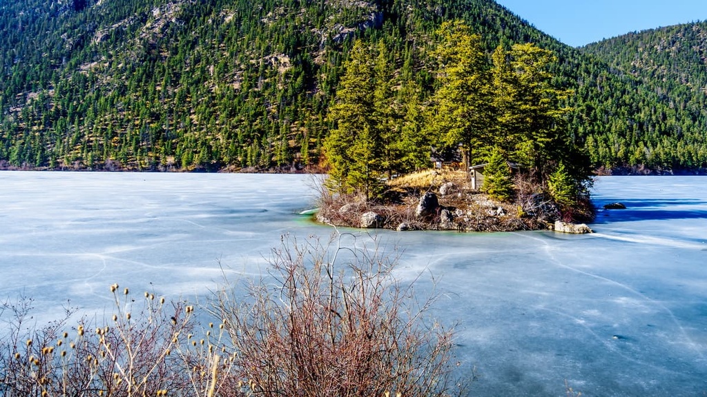
The park contains a diversity of habitats that include marshy shorelines along Turquoise Lake and rocky shorelines around Crown Lake. The shoreline along Pavilion Lake is mostly trees and shrubs. The park contains pockets of old growth Douglas fir and large Ponderosa pine.
The broken rocky slopes of the park are covered with grasses, junipers, and Douglas firs. The open understory is a prime wintering zone for many ungulates, including mule and white-tailed deer, moose, and elk. The park is too small to contain the full range of large mammals; however, black bears are known to frequent the area.
The lakes in the park are particularly popular for fishing, and they contain an abundance of rainbow trout. Additionally, Marble Canyon Provincial Park is appreciated by bird watchers thanks to the large variety of birds that frequent the lakes, marches, and the surrounding cliffs of the park.
While the region around the park has been inhabited for about the past 8,000 years, it has only been in the past 3,000 to 4,000 years that the Interior Salish culture arrived in the area. Before the people of the Salish culture arrived from the west coast, the eastern side of the Coast Mountains and the Thompson Plateau were home to different Indigenous cultures.
It was likely through superior technology and survival adaptations that the Salish culture thrived in the region’s inland environment when the previous Indigenous population could not.
The Salish’s skill harvesting salmon was likely one of the major factors that allowed the culture to flourish. This is because, at the time of the Salish incursion into the interior of British Columbia, large game for hunting was becoming increasingly scarce. This fishing knowledge helped the Interior Salish procure a predictable and sufficient food source, which let them thrive in the region.

The ancestors of the region’s many First Nations traditionally inhabited the shores of the many lakes in the area as they went about their seasonal rounds. During these seasonal rounds, many First Nations traditionally traveled through the region while hunting and harvesting food, medicinal and ceremonial plants, and other resources.
The region in and around Marble Canyon Provincial Park is the traditional territory of the Interior Salish. More specifically, the Ts'kw'aylaxw First Nation have lived in the area since time immemorial and they have a spiritual connection to Pavilion Lake. The park contains pictographs and archeological sites that are evidence of the long First Nations history and use of the area.
Marble Canyon Provincial Park is a relatively small park; however, it is packed with attractions that draw visitors from across the region and even the world. With opportunities for swimming, hiking, climbing, scuba diving, canoeing, and fishing, there is no shortage of adventure in the park.
Here’s a quick overview of some of the best hikes and attractions in Marble Canyon.
The freshwater stromatolite formations along the bottom of Pavilion Lake draw recreational divers and scientists from around the world. Diving in the lake gives visitors the opportunity to see the rare coral-like fossilized remains of micro-organisms that are similar to the first known life forms on Earth.
The delicate nature of the stromatolites in the park has prompted local officials to suspend mooring buoys in the center of the three recognized recreational diving areas in the region. To prevent damage to these rare formations, recreational divers can only dive within the outlined Natural Environment Zones.
Marble Canyon Provincial Park is considered to have some of the best and most easily accessible icefalls in the region. Dozens of routes have been opened up by local climbers and the area is still hailed as an area of relatively undiscovered beauty.
While the highway follows the main canyon, a maze of canyons run off on both sides of the main canyon with many discovered and still uncharted routes to climb. Chimney Rock dominates the skyline with its jagged, castellated ridges and peak and offers many routes for climbers. Marble Canyon Provincial Park offers tremendous opportunities for climbing year-round on rock or ice.
Located on the far side of Turquoise Lake, the trail to Marble Canyon Falls is a relatively simple 1.6 km (1 mi) hike with minimal change in elevation. Within the small park, the falls are the main hiking attraction, and they provide a stunning view for such a mild hike.
Located at the eastern edge of the Coast Mountains, along the border of the Thompson Plateau, Marble Canyon Provincial Park is located in an area of spectacular wilderness. The following are some of the major cities and communities that serve as great starting points for visits to the park.
Whistler is a resort community located along the Sea to Sky Highway in the Fitzsimmons Range of the Canadian Coast Mountains. Known across the world for its part in the 2010 Vancouver Winter Olympics, the ski hills of Whistler Blackcomb receive over two million visitors every year.
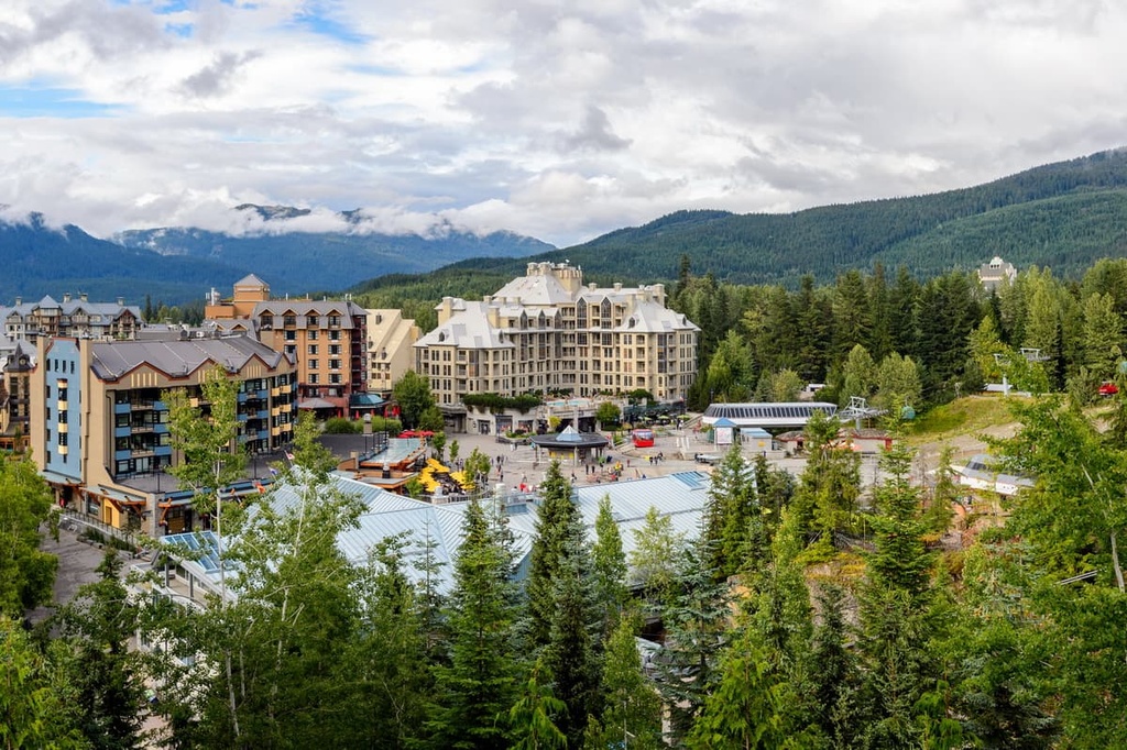
Most visitors come for alpine skiing and snowboarding during the winter; however, downhill and mountain biking are also popular activities at the Whistler Blackcomb Resort during the summer months.
Marble Canyon Provincial Park is located about 178 km (107 mi) west of Whistler. However, the city still offers great accommodations for visitors traveling to the park.
Whistler is also home to many incredible adventure opportunities that make it a great destination in its own right. Some of the best adventures that you can set out on near Whistler include the Singing Pass Trail and the High Note Trail to the top of Whistler Mountain or the short hike to the train wreck at the south end of town.
Squamish is a popular destination for windsurfing and kiteboarding, ultra-trail running, visiting Shannon Falls, river-rafting on the Squamish and Elaho Rivers, snowmobiling, hiking, mountaineering, and backcountry skiing. However, climbing is probably the activity that draws most of the tourists to the town.
The community of Squamish is a charming town situated at the north end of Howe Sound. It is located about 235 km (141 mi) from Marble Canyon Provincial Park. The town is situated along the Sea to Sky Highway in British Columbia, which connects the Lower Mainland to the skiing on Whistler and Blackcomb Mountains and to the plateaus of Interior British Columbia.
Like Whistler, Squamish is a popular destination for tourists in search of outdoor adventure and recreation. However, while Whistler is known for its ski hills, Squamish is world renowned for its thousands of climbing and bouldering routes.
While there are new climbing routes opening in Marble Canyon Provincial Park, Squamish has been a mecca for climbers for decades. Thanks to the granite massif called the Stawamus Chief along with Shannon Falls, Murrin Park, The Malamute, and the Smoke Bluffs, there are over 1,800 climbing routes and over 2,500 published bouldering problems in the area around Squamish.
One of the main reasons why so many people visit Kamloops is because the city has built the infrastructure needed to host more sports tournaments than any other city in Canada. Dozens of tournaments for baseball, hockey, golf, rodeo, tennis, and many more sports are hosted in the city each year.
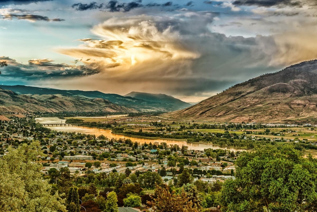
Thanks to the work of Kenna Cartwright, Kamloops became the Tournament Capital of Canada as part of a strategy to revitalize the city’s economy during the 1980s and 1990s. The nature park that was named in her honor covers 800 ha (1,976 acres) on the south side of the Thompson River. With over 40 km (24 mi) of hiking trails, the park serves as the crown jewel of Kamloops’ parks system.
Marble Canyon Provincial Park is located only about 120 km (72 mi) west of Kamloops. However, there are many other fantastic wilderness areas to check out if you're staying in the city. Some of the other areas to explore around Kamloops include Lac du Bois Grasslands Protected Area, Greenstone Mountain Provincial Park, and Mount Savona Provincial Park.