Scan the QR code and open PeakVisor on your phone
Fred Antoine Provincial Park includes the watersheds of Fred Creek and Antoine Creek in the Camelsfoot Range of southern British Columbia, Canada. North of the town of Lillooet, the park encompasses 8,230 ha (20,236 acres) of steep, rugged terrain, and dry forests. Mount Duncan (2,185 m/7,169 ft) is the tallest of the park’s three peaks.
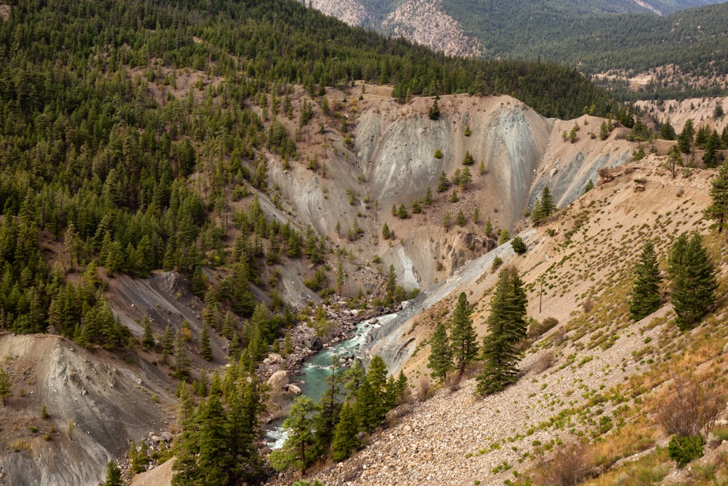
Fred Antoine Provincial Park is in southern British Columbia, Canada. The park covers 8,230 ha (20,236 acres) of dry forests and steep, rugged terrain rising to the peaks of Mount Duncan, Slok Hill, and Mount Bishop. The many branches of Antoine Creek create a rugged landscape with many steep ridges.
The park’s mountains are part of the Camelsfoot Range which may be considered the eastern edge of the Coast Mountains’ Chilcotin Ranges or the western edge of the Fraser Plateau. The park contains the complete watershed Antoine Creek and the upper elevations of Fred Creek which flow into the Bridge River.
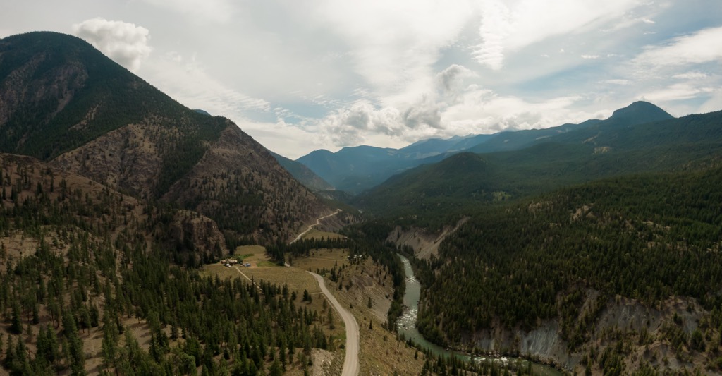
Zoned entirely for wilderness recreation, park visitors can hike, backpack, camp, or trail ride in the pristine wilderness of Fred Antoine Provincial Park. Primary access to the park is by following Highway 40 about 25 km (15 mi) north of Lillooet.
Fred Antoine Provincial Park is one of the many parks in the region that preserve the integrity of these wilderness areas. The following are some of the other parks that are nearby.
Fred Antoine Provincial Park is in the Camelsfoot Range, which is on the western edge of the Fraser Plateau. The Camelsfoot Range is often added geographically to the Chilcotin Ranges, which are in the Coast Mountains; however, geologically, the Camelsfoot Range is part of the Fraser Plateau.
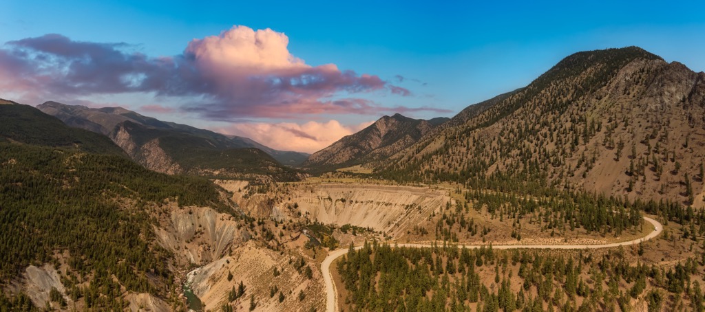
The division between the Fraser Plateau and the Coast Mountains is along the Fraser River fault line. The Camelsfoot Range is geologically related to the adjacent Marble Range and Clear Range. The west side of Fred Antoine Provincial Park is quite steep and deeply incised by the creeks while the eastern end of the park is a more gradual slope toward the Fraser Plateau.
The oldest rocks in the park were formed as part of the Bridge River terrane and are located along the fault line on the west side of the park. The Bridge River terrane started forming about 350 million years ago in the Pacific Ocean and was one of the many crustal fragments which originated elsewhere and was subsequently incorporated into North America.
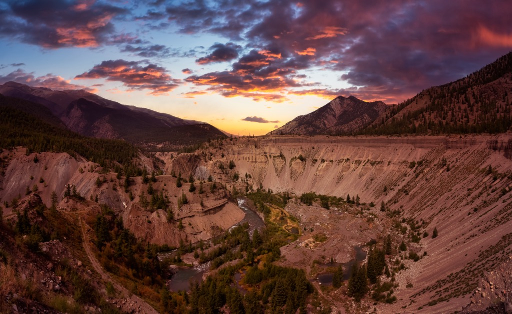
Most of the rocks that form the peaks of Fred Antoine Provincial Park are made of sandstone, siltstone, shale, chert, and basalt. There are also some formations of marine sediments that formed layers of limestone.
In general, moving from west to east, the age of the exposed rocks go from oldest to youngest. The west side of the park is the Bridge River terrane, and the east side of the park is dominated by Cretaceous aged sandstone, siltstone, shale, and conglomerate. There are many fossil beds that have been discovered in Fred Antoine Provincial Park and the eastern side of the Camelsfoot Range.
Fred Antoine Provincial Park is in the rain shadow of the Canadian Coast Mountains; however, the region is greatly affected by interior weather systems. Especially during the winter, dense Arctic air can flow into the region.
The forests of the lower elevations of the park are filled with Douglas fir, lodgepole pine, and some stands of ponderosa pine. The rain shadow cast by the Coast Mountains creates a very dry summer climate where wildfires are frequent.
The upper slopes are affected by the northern arctic air, making the winters in Fred Antoine Provincial Park quite cold. Engelmann spruce, lodgepole pine, and hybrid spruce are common on the upper slopes. Whitebark pine, a blue-listed species in British Columbia is also found in the park.
Extensive alpine tundra dominates the rugged peaks and the high alpine meadows of the park. The cold winter winds rip and twist the trees along the treeline into stunted and twisted forms. Known as krummholz, the gnarly trees often look like sculpted bonsai.
Some of the rare animals that inhabit Fred Antoine Provincial Park are California bighorn sheep, grizzly bears, fishers, peregrine falcons, and rubber boas. Other animals that live in this area of the Camelsfoot Range are mountain goats, mule deer, grey wolves, cougars, and harlequin ducks.
The grizzly bears of the park are part of the threatened South Chilcotin Grizzly Bear Population Unit, and the park is part of their critical habitat. Furthermore, the park provides important migration corridors for mountain goats and critical winter and spring range for the mule deer population.
The St’at’imc are the First Nation who have traditionally inhabited the territory in and around Fred Antoine Provincial Park. The St’at’imc are an Interior Salish people that are located around the Fraser Canyon and Pacific Ranges of the Coast Mountains.
The St’at’imc culture shares many features that are typical of the First Nations along the coast of British Columbia. The potlatch ceremony, clan names, mythology, totem poles and other forms of art, are all traditions that came from their Coast Salish ancestors.
The fertile valleys and abundant rivers around the community of Lillooet have been inhabited for thousands of years by the St’at’imc First Nation. The people would live in long plank houses or earth lodges during the winter and bark or mat covered lodges while they traveled during the summer.
Salmon and other fish were important aspects of their local economy and sustenance and they also hunted and trapped bear, sheep, caribou, deer, and other small mammals. They followed a seasonal round, where they traveled to hunting and spawning grounds as well as locations where fruits and other resources could be gathered while in season.
While the St’at’imc appeared to have preferred trading with their neighbors as opposed to warfare, during the early eighteenth century, a war with the neighboring Tsilhqot’in threatened their survival as a nation.
During the war, the Tsilhqot’in raided all 11 of the St’at’imc bands, taking women and children as slaves. A great battle was fought between the two nations, west of Fred Antoine Provincial Park, in Graveyard Valley in South Chilcotin Mountains Provincial Park, which was Tsilhqot’in territory.
The St’at’imc warchief of the battle, Chief In-Kick-Tee (Hunter Jack), led his people to victory in the battle at Graveyard Valley. The area is still revered by the local First Nations. A peace treaty was signed between the two nations in 1845.
Regarding the specific history of Fred Antoine Provincial Park, there are several cultural and archeological sites in the park that relate to the history of the St’at’imc. While forestry and mining developments ring the park, the park was established to preserve the natural environment for the inspiration, use, and enjoyment of the public.
The wilderness of Fred Antoine Provincial Park is rugged, and the terrain is steep. The three peaks in the park, which are Mount Duncan, Slok Hill, and Mount Bishop have no established trails and very few people attempt to climb to their peaks.
The rugged and steep terrain keep most visitors away; however, there are some wonderful locations to be explored. Within the park are several archeological sites which have been discovered and they contain artifacts and other indications of ancient habitation.
Furthermore, the east side of the park has sites where fossils have been discovered and intrepid adventurers may encounter more sites while trekking. If you happen to encounter a cultural or other ancient site, cultural artifacts or fossils should never be moved and their locations should be reported to BC Parks.
While Fred Antoine Provincial Park is only 25 km (15 mi) north of Lillooet, the steep and rugged terrain of the Fred Creek and Antoine Creek watersheds are difficult to navigate and deter most visitors. For those that desire to trek pristine wilderness and hike among old growth Douglas fir forests, the following communities can provide supplies and accommodation.
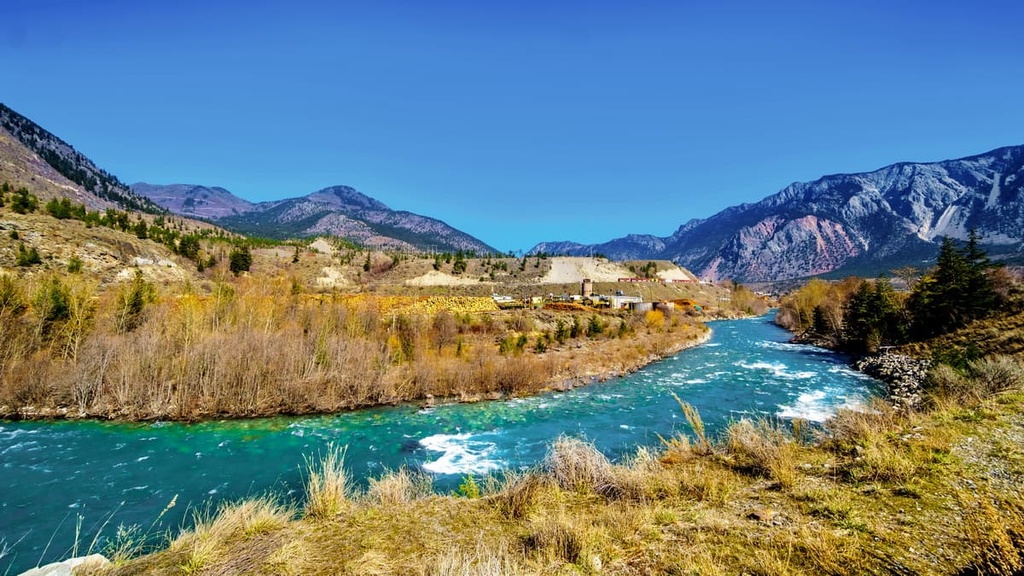
Lillooet is 25 km (15 mi) south of Fred Antoine Provincial Park and during the summer, Lillooet is often one of the hottest places in Canada. The community is located on the traditional territory of the St’at’imc First Nation, who have lived in the area for thousands of years.
The region around Lillooet is also considered to be one of the oldest continuously inhabited areas in what’s now known as North America. Miners and prospectors came to the valley in the 1860s during the Fraser Canyon gold rush and established the settlement that is now the city of Lillooet.
Lillooet is surrounded with incredible wilderness recreation areas such as Stein Valley Nlaka’pamux Heritage Park, South Chilcotin Mountains Provincial Park, Churn Creek Protected Area, and Marble Range Provincial Park.
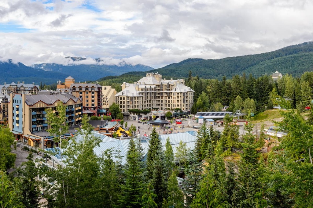
Whistler is a resort community located along the Sea to Sky Highway, 150 km (90 mi) southwest of Fred Antoine Provincial Park. The resort of Whistler Blackcomb receives over two million visitors every year.
Most visitors come for alpine skiing and snowboarding during the winter; however, downhill and mountain biking are also popular activities at the Whistler Blackcomb Resort during the summer months.
Some of the best adventures that you can set out on near Whistler include the Singing Pass Trail and the High Note Trail to the top of Whistler Mountain or the short hike to the train wreck at the south end of town.
Other nearby places to explore are the Fitzsimmons and Spearhead Ranges that are adjacent to the community. Garibaldi Provincial Park, Blackcomb Glacier Provincial Park, and Callaghan Lake Provincial Park are other wilderness areas that are close to Whistler.
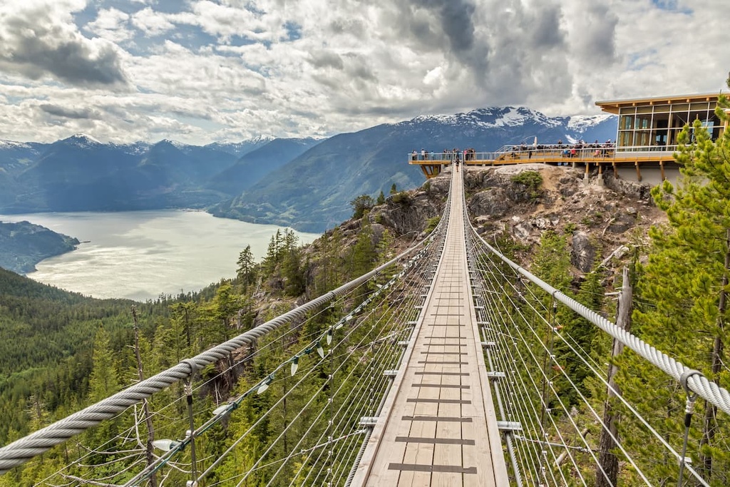
Squamish is about 200 km (120 mi) southwest of Fred Antoine Provincial Park. Climbing and bouldering bring many tourists to the community; however, there are many more activities to enjoy.
Windsurfing and kiteboarding, ultra-trail running, visiting Shannon Falls, river-rafting on the Squamish and Elaho Rivers, snowmobiling, hiking, mountaineering, and backcountry skiing are also activities to enjoy while in Squamish.
The town is situated along the Sea to Sky Highway in British Columbia, which connects the Lower Mainland to the skiing on Whistler and Blackcomb Mountains and to the plateaus of Interior British Columbia.