Scan the QR code and open PeakVisor on your phone
Named for the Tsilhqot’in (Chilcotin), one of the most prominent First Nations in the region, the Chilcotin Ranges are a subrange of the Pacific Ranges, which are themselves a subrange of the Canadian Coast Mountains. The ranges are located in the western part of British Columbia, Canada. The tallest mountains in the ranges are Mount Tatlow and Taseko Mountain, which stand 3,051 m (10,010 ft) and 3,060 m (10,039 ft) tall, respectively.
The Chilcotin Ranges are a subrange of the Pacific Ranges of the Canadian Coast Mountains in the western part of the Canadian province of British Columbia. The ranges are located along the border between the Squamish-Lillooet Regional District and the Cariboo Regional District.
As there are several potential subranges in the region, there is some debate as to which ranges are actually part of the Chilcotin Ranges.
Most sources agree that the Shulaps Range is part of the Chilcotin Ranges, though the rest of the subranges are up for debate. Other subranges that have been previously included as part of the Chilcotin Ranges are the Dickson Range, Leckie Range, Potato Range, and the Camelsfoot Range.
Geological and physiographical reports suggest that the Camelsfoot Range, which is located in the eastern part of the region, is part of the Fraser Plateau and that the Yalakom River is the dividing line between these two physiographic areas.
Furthermore, provincial reports mention the northwestern boundary of the Chilcotin Ranges as Tatlayoko Lake. If this is the case, then the Potato Range would be part of the Chilcotin Ranges.
The final disputed ranges in the region are the Dickson and Leckie ranges, which are located adjacent to one another on the north side of the Bridge River. Most literature on the matter states that the Bridge River is the southern boundary of the Chilcotin Ranges, which would make both the Dickson and Leckie ranges part of the Chilcotin Ranges.
Therefore, based upon their geological and physiographical similarities, the ranges that should likely be included as part of the Chilcotin Ranges are the Shulaps Range, Dickson Range, Leckie Range, and the Potato Range. Major boundaries for the Chilcotin Ranges include the Yalakom and Bridge rivers to the east and south, respectively, and Tatlayoko Lake to the east.
The Chilcotin Ranges are home to a unique diversity of landscapes that have been preserved through several provincial parks in the region. The major parks in the region that are located in the Chilcotin Ranges include:
The Chilcotin Ranges are a geological anomaly among the Pacific Ranges and the Canadian Coast Mountains. These geological differences are the major reason why the Chilcotin Ranges are actually considered to be a major subdivision of the Pacific Ranges.
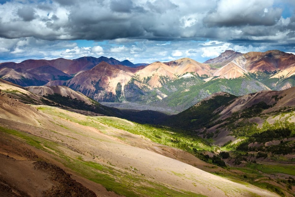
In general, the Pacific Ranges have a core of batholiths and granitic intrusions, whereas the Chilcotin Ranges are generally underlain by non-granitic rocks. Instead, the Chilcotin Ranges are typically composed of layers of volcanic and sedimentary rocks.
In the western part of the Chilcotin Ranges, between Taseko Lake and Tatlayoko Lake, there are layers of Mesozoic volcanic and sedimentary rocks. Small granitic stocks intrude the Paleozoic and Mesozoic sedimentary and volcanic rocks that underlie the eastern Chilcotin Ranges in these areas. Furthermore, Big Dog Mountain and Shulaps Peak are the highest points of a Triassic intrusion of peridotite that exists in the range.
As far as precious minerals and metals go, the Chilcotin Ranges are home to gold and a form of jade called nephrite. Minor placer gold deposits in the region were discovered in the nineteenth century and there is still an active gold claim on Big Dog Mountain.
Before European settlers arrived and found the jade deposits, the nephrite was traditionally harvested by First Nations in the region because of its inherent beauty as well as its durability for tool making.
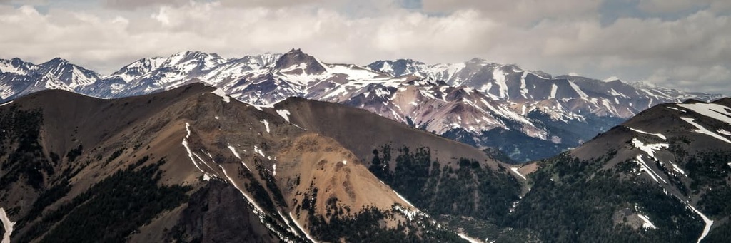
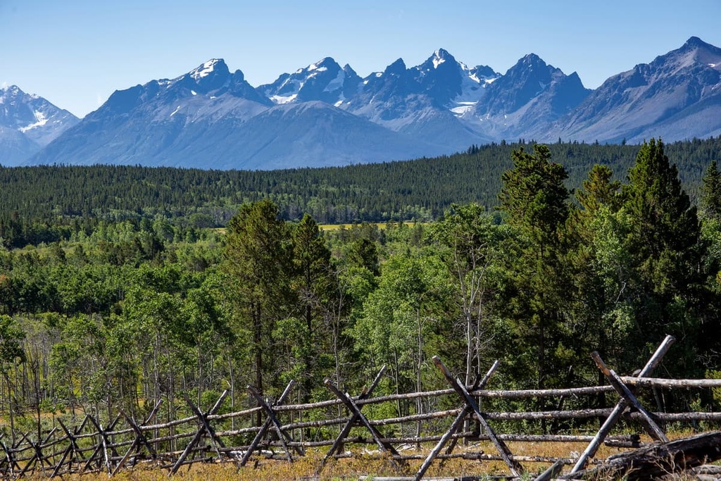
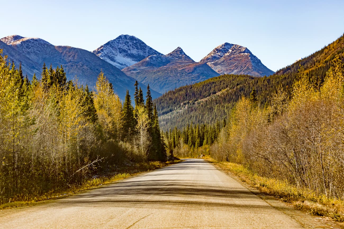
The Chilcotin Ranges grow progressively taller as you move toward the western granitic mountains of the Pacific Ranges. The high peaks of the ranges are typically serrated and scalloped with alpine glaciers while the lower summits were rounded over by the Pleistocene ice sheet that once covered much of the continent.
River valleys in the region were also heavily modified by glaciation, however, the uplands of the Chilcotin Ranges are typically undissected by rivers.
Ecologically, the Chilcotin Ranges are located within the interior rain shadow, which formed as a result of the height and prominence of the Coast Mountains to the west.
The reason for this rain shadow is fairly straightforward: as warm, moisture-laden air blows inland from the Pacific Ocean, it cools and condenses as it makes its way over the mountains. As a result, much of the moisture in the air precipitates as rain and snow before it reaches the Chilcotin Ranges.
This abundant rain generally falls to the west of the Chilcotin Ranges, which is why we see massive temperate rainforests located along the coast of British Columbia; however, the interior side of the Coast Mountains is significantly drier.
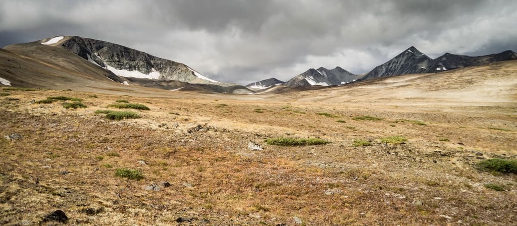
Therefore, the Chilcotin Ranges are a collection of high, dry peaks that are often free of snow by May each year. Dry winds blast the ranges all year long, and these winds generally prevent any significant accumulation of snow.
The dry alpine area of the Chilcotin Ranges is particularly sensitive to disturbance, and as a result, only non-motorized travel, such as hiking, cycling, and horseback riding are permitted in these regions. Local laws prevent motorized vehicles from traveling above 1,920 m (6,300 ft) in elevation in the range so as not to inadvertently destroy these sensitive ecosystems.
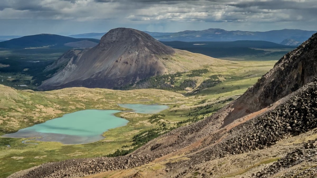
There are some glaciers located among the Chilcotin Ranges; however, they are not as large as the glaciers found in the rest of the Coast Mountains or the Rocky Mountains, which are both located to the east. The Chilcotin alpine is filled with rocky peaks that transition to meadows of heather, grass, and wildflowers. Meanwhile, ridges in the region are covered with wind-blasted krummholz.
The Chilcotin Ranges experience an average annual precipitation of 100 cm (40 inches) or less, which is why the region can only support moderately dense forests with relatively sparse undergrowth. However, the relatively open forests in the ranges have created an ecosystem where it’s easier for animals to travel and migrate.
The cold-tolerant subalpine fir dominates the treeline of the range; however, the longer-living Engelmann spruce takes over the canopy at lower elevations, leaving subalpine fir as the main undergrowth species. The lowest slopes of the range are filled with forests of lodgepole pine, Douglas fir, trembling aspen, and hybrid Engelmann-white spruce.
The lowest elevations and edges of the Chilcotin Ranges transition from the Montane Spruce ecosystem to the dry Interior Douglas Fir ecosystem. Along the Fraser Plateau, the Interior Douglas Fir ecosystem is characterized by a matrix of grasslands and forests of Douglas fir and lodgepole pine. In the driest and hottest areas of the lowland section of the ranges, ponderosa pine grows in stands amidst meadows of bunchgrass.
Finally, in the rocky alpine, the Chilcotin Ranges are home to an especially high concentration of mountain goats, California bighorn sheep, and hoary marmots. Grizzly bears, black bears, mule deer, wolverines, wolves, snowshoe hares, lynx, bobcats, and picas all live in and upon the deep canyons, alpine ridges, and forested valleys and slopes of the Chilcotin Ranges.
The Chilcotin Ranges were named for the Tsilhqot’in First Nation, who are the southernmost Athabaskan-speaking First Nation. The territory of the Tsilhqot’in encompasses everything from the Similkameen region in what is now southern British Columbia to the Pacific Coast in the west and the Rocky Mountains in the east.
The Chilcotin Ranges were traditionally part of the southern territory of the Tsilhqot’in; however, the ranges were also part of the territory of the neighboring Nlaka’pamux, Stl’atl’imx, and Secwepemc First Nations. First Nations have utilized the resources of the forests and the rivers of the Chilcotin Ranges for thousands of years.
Evidence suggests that people began inhabiting the eastern Coast Mountains and Interior Plateaus over 8,000 years ago. However, it is believed the ancestors of the modern First Nations arrived in and around the Chilcotin Ranges about 4,000 years ago.
It was about 4,000 years ago that Salish nations from the coast ventured and settled in the interior of British Columbia. It seems certain that the Salish had superior technology compared to the First Nations that had been living in the interior at the time of their arrival; however, there is still some speculation as to how the Salish became the dominant First Nations of interior British Columbia.
One theory suggests that the Interior Salish simply had better technology and knowledge of fishing, both of which allowed them to adapt to changing climatic conditions as they were able to focus on fisheries for their major food source as opposed to game that needed to be hunted. Other theories suggest that the Salish used warfare to gain control of the region over other First Nations.
During this time, the Tsilhqot’in were also part of an ancient trade network that controlled the distribution of obsidian in the region. The main source of obsidian in the region is located near Mount Edziza, which is currently part of Mount Edziza Provincial Park.
Additionally, the Chilcotin Mountains are a source of nephrite jade, which was historically prized and sought after by many First Nations. When polished, nephrite, like most jades, is a stunning green gemstone; however, nephrite is also incredibly durable. Though it was difficult to shape, nephrite tools were far more durable than any other stone tool available to First Nations in the region at the time.
Archeological evidence from this time includes the remains of pit house villages, seasonal camps, and culturally modified trees. Indeed, the region is peppered with culturally important areas where ceremonies and burials took place for many generations. In fact, pictographs and petroglyphs have also been uncovered in the ranges.
Simon Fraser was among the first Europeans to travel near the Chilcotin Ranges when, in 1808, he traveled his way to the Pacific along the river that would come to bear his name in English. That said, the Tsilhqot’in had encountered European and American ships many decades earlier along the Pacific Coast as these ships came to the region to trade sea otter pelts.
About a decade after Simon Fraser traveled through the region, European fur traders started to arrive in full force. Between 1820 and 1850, the fur trade was prosperous for many local First Nations. European traders would buy furs and dried salmon from First Nations in the region as they searched for a better route through the Coast Mountains.
While the fur trade continued, gold fever overtook the Fraser River between 1858 and 1865 as thousands of miners traversed the Chilcotin Ranges in the hopes of striking it rich. While there was significant activity early on with mining placer deposits, mining activity in the range dried up after the late 1860s, with the exception of a single mine on Big Dog Mountain that’s still in operation to this day.
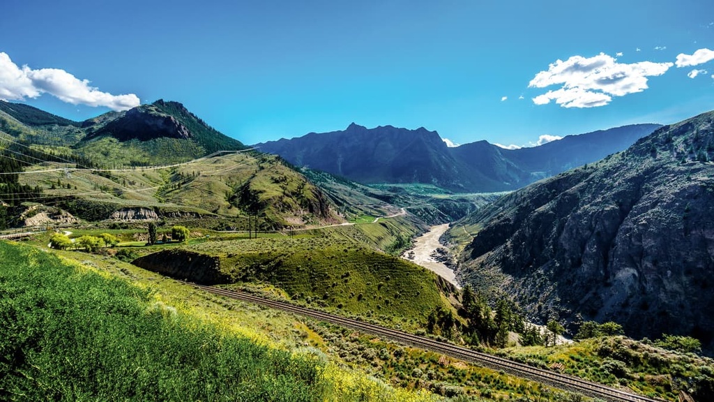
With the exhaustion of the placer deposits in the Chilcotin Ranges, many miners turned to homesteading, logging, ranching, and agriculture in order to continue living in the region. Eventually, the railroad came to the region, and hydroelectric dams were constructed along the Bridge River.
Parts of the range are home to logging operations; however, most of the Chilcotin Ranges have relatively poor timber stock compared to nearby areas. Significant portions of the range have been preserved as provincial parks where hikers and hunters can traverse traditional First Nations trade routes and more recently established mining trails as they make their way through the mountains.
The Chilcotin Ranges are a unique range of dry mountains with relatively sparse forests. These conditions have created great opportunities for comfortable travel through the region. The following are some of the best hikes in the Chilcotin Ranges to check out during your next trip to the area.
There are over 200 km (120 mi) of trails that traverse the ridges and broad valleys of South Chilcotin Mountains Provincial Park. While there are opportunities for wildlife viewing, fishing, and skiing in the region, most visitors come to the park to experience the backcountry through hiking, mountain biking, and horseback riding.
Some of the most popular trails in the park are the Gun Creek Trail, the High Trail, Tyaughton Creek Trail, and Deer Pass Trail. There are also opportunities to view and scramble Mount Sheba, Mount Solomon, Mount Cunningham, and Castle Peak, which are all located within the park.
Big Creek Provincial Park is a northern extension of South Chilcotin Mountains Provincial Park. Access to the hiking of Big Creek Provincial Park is typically via plane or by hiking through South Chilcotin Mountains Provincial Park.
The park features gently rolling terrain and open forests that make it relatively easy to travel through on foot. Some of the major trails in the park include the Elbow and Lorna Pass Trail Loop and the Graveyard Cabin via the Relay Creek Trail.
When combined with the trails of South Chilcotin Mountains Provincial Park, it is relatively easy to hike for days or weeks in Big Creek Provincial Park, making it a great destination for people interested in exploring the stunning backcountry of the Chilcotin Ranges.
The western Chilcotin Ranges contain part of the beautiful Ts’ilʔos Provincial Park. There are opportunities for short day hikes and extended wilderness backpacking excursions in the park. In addition to hiking, visitors can also enjoy mountain biking, fishing, canoeing, swimming, winter sports, and climbing; however, the climbing areas in the park are difficult to access.
One of the most popular excursions in the park is the multi-day hike along the Tchaikazan Valley and over Spectrum Pass to the Dorothy Lake/Yohetta Valley. Travelers should plan to take four to six days to complete this beautiful hike, and there is also an option to take a side trip along Rainbow Creek Valley down to Chilko Lake.
Another popular trail in the park is the hike to the summit of Tullin Mountain. This day hike departs from the campground at the north end of Chilko Lake and it gives hikers an excellent view of both the park as a whole and Chilko Lake.
The Chilcotin Ranges are located on the eastern side of the Pacific Ranges near the Fraser Plateau. These ranges feature many incredible parks and opportunities for backcountry travel.
The following are some of the major cities and communities located near the Chilcotin Ranges that can serve as good starting points for adventures in the region.
Located about 12 km (72 mi) away from Vancouver and about 100 km (60 mi) from the Chilcotin Ranges, the town of Whistler is a popular tourist destination that receives over two million visitors every year.
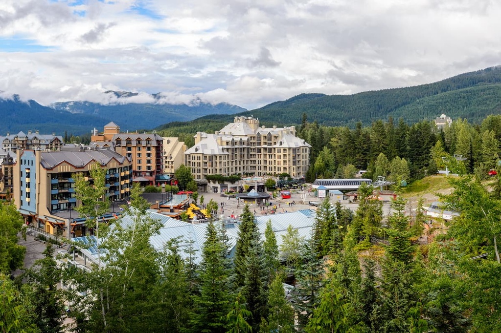
While most visitors to Whistler come to the city to ski at the famous Whistler Blackcomb Resort, downhill and mountain biking have also become hugely popular in town during the summer months.
As far as adventure activities go, Whistler is located close to Garibaldi Provincial Park, Callaghan Lake Provincial Park, and Clendinning Provincial Park, so there’s something for everyone to love near this incredible town. Additionally, there are many hiking opportunities located right outside of the community, such as the Singing Pass Trail and the High Note Trail to the top of Whistler Mountain.
Located just to the south of the Chilcotin Ranges, Lillooet is one of the oldest continuously inhabited locations in North America. Due to its dry climate, long growing season, and relatively mild winters, the area has been attractive to people looking for a nice place to live for thousands of years.
The modern town of Lillooet came about during the Fraser Canyon Goldrush in the 1860s; however, the area has been inhabited by members of the St’at’imc Nation for countless generations. Interestingly, as it usually contends for the title of the hottest location in Canada, Lillooet once had robust market gardens that provided orchard produce.
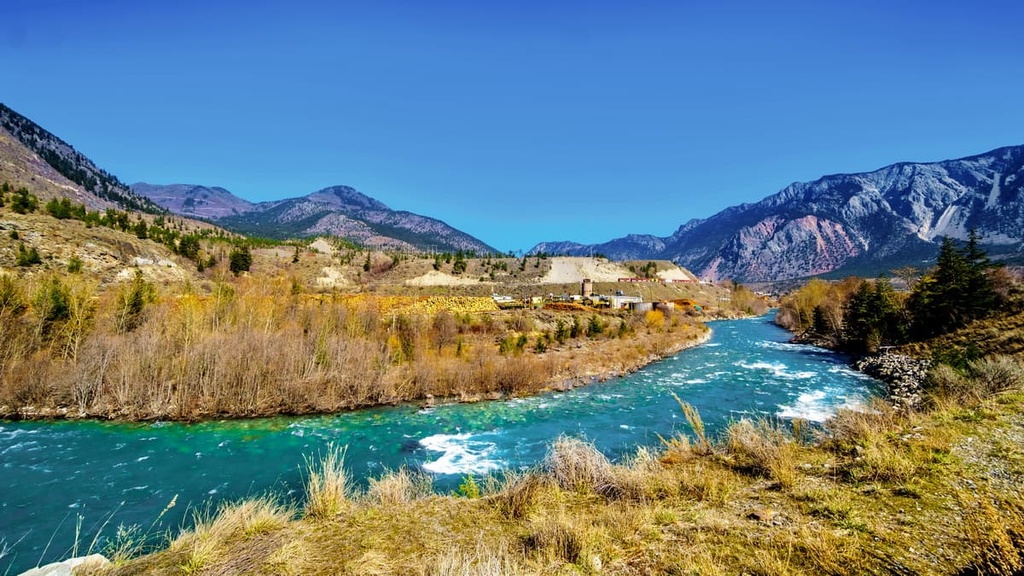
The community is surrounded by stunning wilderness areas such as Stein Valley Nlaka’pamux Heritage Park, South Chilcotin Mountains Provincial Park, Churn Creek Protected Area, and Marble Range Provincial Park.
There are many scenic hiking opportunities located near the town, too as Lillooet is situated near the confluence of a number of major rivers. Lillooet is also located on the border between the mountains and the interior plateaus, so it’s a great central destination for anyone looking to travel throughout southwestern British Columbia.
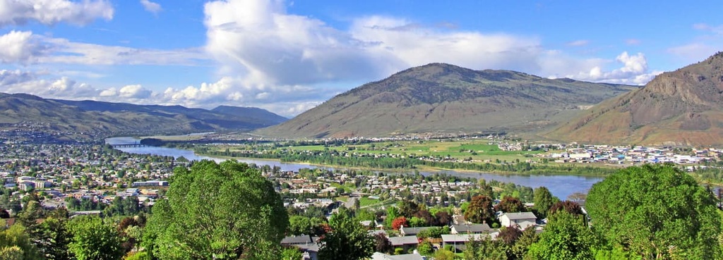
Located on the Thompson Plateau about 180 km (108 mi) to the east of the Chilcotin Ranges, Kamloops is a community of around 90,000 people that’s became a popular tourist destination in recent years.
Kamloops is particularly well known among the cities around the Chilcotin Ranges because it hosts a large number of sporting tournaments each year. As a result, it is often called the “Tournament Capital of Canada” and thousands of people flock to the city annually to enjoy its world-class sporting facilities.
In addition to its many tournaments, Kamloops is famous for its excellent array of nearby hiking and outdoor recreation areas. Some of the many hiking areas located near the city include Bonaparte Provincial Park, Kenna Cartwright Nature Park, Lac du Bois Grasslands Protected Area, Tunkwa Provincial Park, and Greenstone Mountain Provincial Park.