
Scan the QR code and open PeakVisor on your phone
Cariboo Regional District is home to 531 named mountains. The highest is Mount Waddington at 4,014 m.
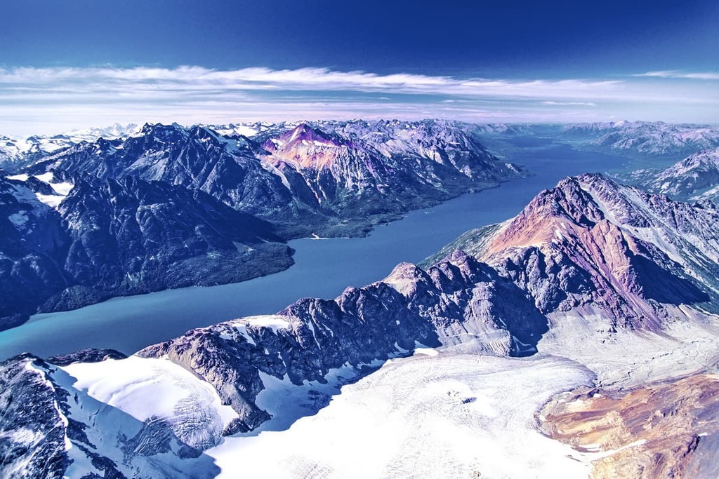
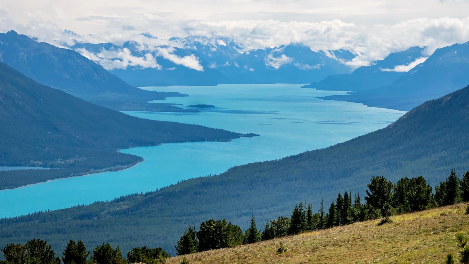
The Cariboo Regional District is an administrative region located in the central part of British Columbia, Canada, covering a portion of the Interior Plateau. The region is a vast wilderness filled with raging rivers, alpine peaks, dense forests, and warm grasslands. There are 531 named peaks in the Cariboo Regional District, the tallest and most prominent of which is Mount Waddington with 4,014 m (13,169 ft) of elevation and 3,290 m (10,794 ft) of prominence.
Located in central British Columbia, Canada, the Cariboo Regional District envelopes part of the Nechako Plateau, Fraser Plateau, Cariboo Mountains, and the Quesnel Highland. The Thompson-Nicola Regional District is located to the south of Cariboo Regional District while the Regional District of Bulkley-Nechako is situated to the north.
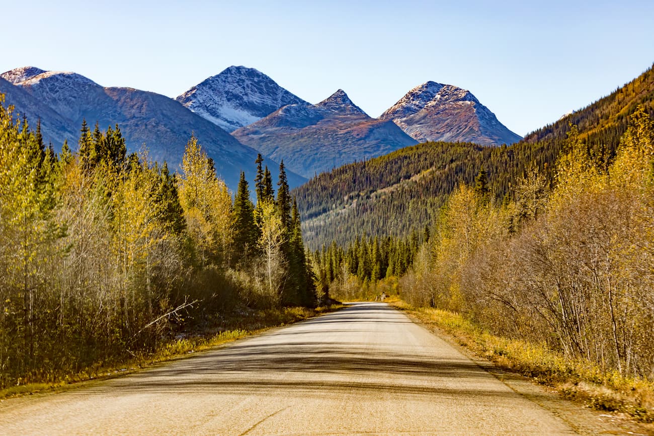
Highway 97 is the main north-south highway that runs through the region. In fact, the regional district’s three primary communities—Quesnel, Williams Lake, and 100 Mile House—are located along the highway. Meanwhile, Highway 20 is the primary east-west highway in the region. It runs westward from Williams Lake.
The regional district covers a large portion of the rugged Fraser Plateau, which was first visited by Europeans in the late eighteenth century, though it has been inhabited by First Nations for over 8,000 years.
Some of the most beautiful views, delicate ecosystems, and worthwhile recreational areas of the Cariboo Regional District are found in its provincial parks. The following are some of the parks and protected areas in the region, many of which have beautiful mountains to climb and wildernesses to explore.
The Cariboo Regional District has parts of two main geological areas: the interior plateaus and the Columbia Mountains. The underlying rocks of the interior plateaus and the Columbia Mountains are Paleozoic and Mesozoic sedimentary and volcanic rocks that were accreted to the west coast of Canada starting about 180 million years ago.
About 180 million years ago the supercontinent of Pangea was broken apart and the continents were moving across the Earth’s surface as a result of plate tectonics. Rifts in the middle of the Pacific Ocean pushed certain oceanic plates eastward, while Laurentia, the ancient North American continent, was being pushed to the west.
Oceanic plates are denser than the continental plates, so when oceanic and continental plates collide, the oceanic plate subducts below the continent. During the subduction, volcanic island arcs and microcontinents that had formed upon the oceanic plates often accrete, or become stuck to the edge of the continent, creating a new continental coastline.
As oceanic plates from the Pacific subducted beneath the west coast of North America, volcanic arcs accreted to the coast. Over time, the accretion of exotic terranes formed nearly the entire province of British Columbia along the west coast of Canada. The tectonic collision, in addition to adding exotic terranes, also pushed the continental margin inland, buckling it to form mountain ranges.
The Columbia Mountains were the first mountains to be formed on the west coast of what is now British Columbia. The mountain building event that created the range, called the Sevier orogeny, lasted from around 160 to 50 million years ago. During this time, the Columbia Mountains formed and the underlying terranes of the Interior Plateau accreted to the coast. Afterward, the Coast and Insular Ranges formed, too.
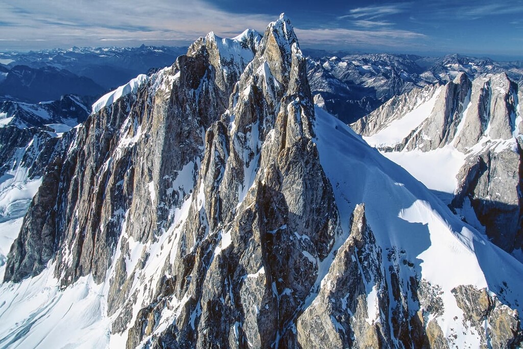
The Columbia Mountains are composed of Proterozoic and Cambrian sedimentary rocks, principally quartzite, with significant granitic intrusions. The underlying rocks largely influence the current topography of the mountain ranges.
Where the peaks in the region are composed of the quartzite layers, there are often sharp peaks and continuous ridges. Meanwhile, the mountains in the region that are underlain with granite tend to be larger, with rounded peaks and irregular ridges radiating from a central peak.
The flat plateaus of the interior were created from lava flows that covered the interior as far back as about 60 million years ago. However, the Fraser Plateau was created from the lava that erupted only 5 million years ago while the Nechako Plateau started forming about 60 million years ago.
The plateaus and mountains in the region were also heavily glaciated during the Pleistocene. Intense cirque glaciation in the Cariboo Mountains created the sharp peaks and steep valleys of the range. In particular, the northern slopes were typically affected the most by late-stage glaciation, creating a pattern of steep northern aspects in the range.
The ice sheet scoured the plateaus creating the gentle topography by eroding elevated peaks and filling in depressions with the glacial till, to create a relatively flat surface. As the final glaciers melted from the plateaus they created the drumlins and eskers that give the plateau most of its topographical relief.
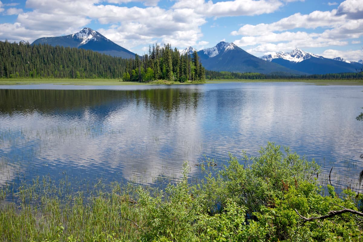
Like the geology of the Cariboo Regional District, there are two significant ecozones which correspond with the topographical differences of the plateaus and the mountains. The plateaus are located in the rain shadow of the coast mountains and are dominated by the dry Interior Douglas Fir and Bunchgrass ecozones.

The Cariboo Mountains are part of the interior temperate rainforest. They contain montane ecosystems of dense forests at lower elevations which gradually transition to cold-tolerant trees, and end with the barren alpine zone.
The Fraser and Nechako Plateaus are located in the rain shadow of the Coast Mountains, so they are the driest regions in the province. Most of the plateau is covered with forests of Douglas fir, though lodgepole pine are usually the first trees to repopulate an area after a forest fire.
While the plateaus are among the driest and warmest areas in the region, the plateau river valleys tend to be even warmer and drier, such that it’s too hot and arid for trees to grow. The river valleys upon the plateau are filled with drought-resistant grasses, such as bunchgrass and sagebrush.
The valleys of the mountainous areas in the Cariboo Regional District are filled with the inland temperate rainforests. These rainforests are dominated by western hemlock and western red cedar. The valley floors also have hybrid spruce and subalpine fir. Meanwhile, the transition areas between the mountains and the plateaus will also have Douglas fir and lodgepole pine.

As the elevation increases in the region, the climate becomes cooler, so the cedar and hemlock fade out and the forests transition to predominantly Engelmann spruce and subalpine fir, which are more tolerant to the cold. Toward the alpine, at the tree line, subalpine fir tends to be the dominant tree species. As one moves higher up in elevation, the forest thins until the only trees are the ragged krummholz.
The alpine of the Cariboo Mountains receives significant snowfall. The sparse vegetation cover here is typically sedge and heather, which grow in protected areas around the summit.
The alpine is inhabited by bighorn sheep, mountain goats, marmots, and the Columbian ground squirrels. Meanwhile, the subalpine has caribou, elk, grizzly and black bears, mule and white-tailed deer, moose, cougars, and wolves.
Unless they hibernate, most of the animals in the regional district migrate to lower elevations of the plateaus where there is less snow during the winter. Some notable exceptions to this rule are mountain goats which will find steep, south facing rocky outcrops and cliffs. Additionally, caribou are known to eat lichen from trees during the winter, and long-legged moose have no issue moving through the snow.

The Cariboo Regional District is the traditional territory of Dene and Interior Salish First Nations. There is archeological evidence and cultural knowledge that Indigenous groups have inhabited the Cariboo Regional District for at least the past 7,000 years. Humans have also been known to live on the plateau for at least the last 4,000 years.

Around 4,000 years ago, the use of winter pit houses and longhouses in communities became common in the area, too. The hunting and gathering lifestyle continued until European traders and settlers arrived on the plateau.
Alexander Mackenzie was the first recorded European to meet the First Nations of what is now the Cariboo Regional District when he arrived in the area in 1793. By the end of the eighteenth century, many First Nations in the region transitioned from a lifestyle consisting of seasonal migration and sustenance living to communities that were more based on fur trapping, trading with European settlers, and agriculture.
Nowadays, the primary industries in the relatively sparsely populated Cariboo Regional District are mining, agriculture, and forestry.
The remote wilderness of Cariboo Regional District is home to incredible scenery, historic and cultural sites, and many natural wonders. The following are some of the best hiking areas in the Cariboo Regional District.
Bowron Lake Provincial Park is famous for its 116 km (70 mi) canoe circuit that includes ten lakes, numerous waterways, and connecting portages. Depending on your skill and experience level, this trip can take 6–10 days to complete. If you don’t have a week to paddle, the west side of the circuit can be completed in 2–4 days or you can stay at the park campground and take day trips into the wilderness.
Cariboo Mountains Provincial Park is a diamond in the rough. This infrequently visited park is located between Bowron Lakes Provincial Park and Wells Gray Provincial Park, forming a continuous protected area in the Cariboo Mountains of over 7,600 square kilometers (2,934 square miles) of land. Cariboo Mountains Provincial Park encompasses 1,134 square kilometers (437 square miles) of that total land area.
The park has mountain peaks, hanging alpine valleys, tarn lakes, extensive meadows, large wetlands, and ancient forests of red cedar and hemlock. The diverse habitats in Cariboo Mountains Provincial Park support a diverse wildlife, and wildlife viewing is popular in this pristine wilderness area.
Adjacent to Matthew River Falls is the vehicle access camping at Ghost Lake Recreation Site for those that want to take day trips into the remote wilderness of the park. For the adventurous, the park is full of fresh backcountry adventures where you can blaze a trail to the tarn lakes, alpine meadows, and the majestic peaks.
Located on the west side of Cariboo Regional District, Tweedsmuir Provincial Park is a stunning wilderness area. It is home to a number of historic grease trails that the Nuxalk and Carrier First Nations traditionally used to facilitate their trade of furs and obsidian for eulachon grease.
Other trails include the day hikes to Kettle Pond or the Valley Loop to Burnt Bridge. Some of the popular backpacking trails are Rainbow, Octopus Lake, Crystal Lake, Hunlen Falls, and Ptarmigan Lake.

The Mackenzie Heritage Trails is a 300 km (180 mi) regional hiking trail from Quesnel to Tweedsmuir Provincial Park. The excursion takes 20–30 days and has about 1,800 m (5,900 ft) of elevation gain as it follows Mackenzie’s historic route. The popular 80 km (48 mi) scenic section through the Rainbow Range only takes 5–7 days to complete.
Other popular activities in the park include canoeing, horseback trail riding, snowmobiling, and fishing. You can find trout, coho salmon, and chinook salmon in the Bella Coola and Atnarko Rivers, or cutthroat trout, rainbow trout, dolly varden, and whitefish in the lakes.
The Cariboo Regional District was traversed by countless men seeking their fortunes during the nineteenth century Cariboo gold rush. While the goldrush has since ended, the region is home to pristine wilderness with countless opportunities for relaxation or adventure. The following are the largest municipalities in the region,
Located along Highway 97 in central British Columbia, Quesnel is the largest municipality in the Cariboo Regional District. Quesnel is surrounded by pristine wilderness, which draws in numerous tourists each year who want to hike, canoe, hunt, and climb in the region.

Quesnel is located near Wells Gray Provincial Park, Barkerville Provincial Park, and Bowron Lake Provincial Park. The Riverfront Trail, Hogsback Trail, and the Wonderland Trails Loop are some of the fun and easy hikes near the town.
Williams Lake was established at the crossroads of two major trails to the Cariboo goldfields. It is now the second largest city in the district, after Quesnel. The community is located at the junction of the modern Highways 97 and 20, and it is surrounded by rugged and beautiful wilderness.
The Williams Lake Rodeo is held annually on the Canada Day long weekend and is the second largest professional rodeo in Canada, after the Calgary Stampede. The city is located among the beautiful wilderness of the Fraser Plateau and there are many opportunities for outdoor recreation.

Some of the best trails of the area include the Jenna Trail, Moose Drop Loop, Williams Lake River Valley Trail, Russet Bluff to Billy Goat Loop, and the Williams Lake River Valley Recreation Site Loop Trail.
Besides hiking, some of the popular activities in the area are OHV use, horseback trail riding, fishing, canoeing, and backpacking.
The municipality of 100 Mile House was named for the fact that it is located at the 100-mile (160 km) mark of the Old Cariboo Road from Lillooet to the Cariboo goldfields.
The area has hundreds of lakes that are popular for boating and fishing. There are also vast tracts of wilderness that provide exceptional opportunities for hiking, cross country skiing, and OHV use.

Some of the popular hiking trails around 100 Mile House are Bridge Creek Falls, 100 Mile Marsh, 108 Mile Lake and Sepa Lake Loop, and the Walker Valley Greenway. Some of the provincial parks that are located nearby include Schoolhouse Lake Provincial Park and Wells Gray Provincial Park.


.jpg)
ultra
glacier
4000ers-canada
11ers-bc
fred-beckey-great-peaks
canada-sampler
british-columbia-ultras
ultra
glacier
4000ers-canada
11ers-bc
fred-beckey-great-peaks
canada-sampler
british-columbia-ultras
Yes. Cariboo Regional District has 531 named mountains. The highest is Mount Waddington at 4,014 m.
The highest mountain in Cariboo Regional District is Mount Waddington, at 4,014 m.
Cariboo Regional District has 531 named mountains.


