
Scan the QR code and open PeakVisor on your phone
Located in the Coast Mountains of British Columbia, Canada, the Dean River Conservancy protects fragile habitats and serves as an important link between the Pacific Coast and the Interior Mountains. The conservancy is centered upon the Dean River. It is home to 7 named peaks, the highest and most prominent of which is Kalone Peak (2,530 m/8,301 ft).
Situated along the eastern slopes of the Coast Mountains in British Columbia, Canada, the Dean River Conservancy is a protected area in the Kitimat Ranges. The conservancy covers 56,096 ha (138,616 acres) of land along the Dean River, and it encompasses seven named mountains.
The tallest and most prominent peak in the conservancy is Kalone Peak, which is 2,530 m (8,301 ft) in elevation and has 1,396 m (4,580 ft) of prominence. The conservancy protects the vital ecological link that the Dean River provides as a connection between the coast and the Interior Mountains of British Columbia.
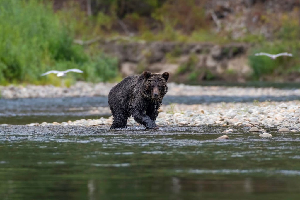
The Dean River is one of the few Central Coast rivers that cuts through the coastal mountains. As a result, it provides a corridor for grizzly bears to travel from the interior to the coast for seasonal fishing opportunities. The Dean River Conservancy also helps connect the ecosystems of Tweedsmuir Provincial Park and the Jump Across Conservancy.
Some of the other parks and conservancies that are located adjacent to and near the Dean River Conservancy include:
The mountains of the Dean River Conservancy are part of the Kitimat Ranges, which are a subrange of the Canadian Coast Mountains. The Kitimat Ranges are granitic mountains that stretch from the Nass River to the Burke Channel and the Bella Coola River.
The Dean River is one of the few rivers that traverses the range. Its valley serves as a travel corridor for wildlife between the Interior Mountains and plateaus of British Columbia to the Pacific Coast.
During the Mesozoic, there were several continental collisions that resulted in the creation of much of the land that’s now part of British Columbia, including the land that is part of the Kitimat Ranges and the Dean River Conservancy.
The formation of the Coast Mountains and the Kitimat Ranges occurred during the Sevier orogeny. This mountain-building event took place after the development of the neighboring Columbia Mountains, and before the Rocky Mountains, which are the westernmost ranges in the Canadian Cordillera.
The Sevier orogeny was a mountain-building event that was caused by the subduction of several tectonic plates beneath the North American continent. As the plates that underlay the Pacific Ocean subducted below the North American continent, volcanic island arcs and microcontinents were scraped from their oceanic plate and welded onto the continental margin of North America.
The subduction of these tectonic plates also created a volcanic zone along the continental margin. Many volcanoes were created throughout the Coast Mountains during this time. Additionally, there were massive intrusions of magma in the region during this period that helped to create the granitic stock of the Kitimat Ranges.
Significant portions of the Kitimat Ranges were first created as igneous intrusions, which means that magma rose from the Earth’s core towards the surface but didn’t erupt as a volcano along the continental margin. The magma slowly cooled as pockets in the sedimentary layers. This created granitic and dioritic rocks, which eventually formed the granite batholiths that currently extend from southwestern British Columbia to Yukon and Alaska.
The Kitimat Ranges were generally covered by the cordilleran ice sheet that dominated the region during the Pleistocene. The overriding ice sheet rounded over many of the summits in the ranges, as only the highest peaks projected above the ice sheet during this time. These high mountains eventually formed horn-shaped peaks that were created by alpine and cirque glaciation.
These ice sheets and glaciers carved out the wide U-shaped river valleys that exist in the region, such as the valley that the Dean River flows through. Glacial till covers the valley floor in the conservancy, and in some locations, you can even see glacial erratics and other formations of glacial debris.
The ecology of the Dean River Conservancy is divided into three sections: Coastal Mountain-heather in the alpine, Mountain Hemlock in the subalpine, and Coastal Western Hemlock in the lower valleys.
The alpine zone in the conservancy experiences cold winters, which, when combined with the region’s short, cool growing season, create conditions that are unfavorable to most trees and many plants. Barren rock and heath-covered meadows dominate the alpine in the Dean River Conservancy. The most prominent alpine vegetation in the conservancy includes stands of krummholz trees, dwarf shrubs, heaths, herbs, mosses, and lichen.
The subalpine in the conservancy is typically a thin band of mountain hemlock–dominated forests. White-tailed ptarmigans, wolverines, and marmots are the typical animals that are found along the tree line, which separates the alpine from the subalpine. Golden eagles also make their nests high in the mountains in the conservancy.
The Mountain Hemlock zone of the conservancy typically starts as thin parkland stands that are interspersed with sedge and mountain heather communities. These sedge and mountain heather communities eventually become dense forests at lower elevations. The typical trees encountered in the higher elevation forests of the conservancy include mountain hemlock, amabilis fir, and yellow cedar.
The lowest elevations of the Dean River Conservancy are dominated by the legendary giant trees of British Columbia. The forests are filled with Douglas fir, which can reach upwards of 100 m (327 ft) in height. There are also western red cedars and Sitka spruces in the conservancy that can grow to be over 4 m (13 ft) in diameter.
The most prevalent trees in the forests of the Coastal Western Hemlock Zone are western hemlock and Pacific silver fir, which are interspersed with Douglas fir, red cedar, and Sitka spruce.
Many bird species inhabit the conservancy’s forests as these forests provide access to food sources such as insects, small animals, and conifer seeds. The great horned owl, great gray owl, Clark’s nutcracker, and several woodpecker species are commonly seen in the forests of the conservancy.
Black bears, grizzly bears, Roosevelt elk, and deer are some of the main inhabitants of the conservancy. In particular, the Dean River serves as an important corridor for the seasonal grizzly bear migration, which brings many of the region’s bears to the coast for the prime fishing season.
The Dean River Conservancy is part of the traditional territory of the Nuxalk First Nation. Known collectively as the Nuxalkmc, the First Nation is composed of several lineages that represent the ancestral villages of their territory.
Before European contact, the Nuxalk population was estimated to have been around 35,000 people, according to oral histories. By 1780, the estimated population of the First Nation was about 1,400 people. The 1862 Pacific Northwest smallpox epidemic reduced the population of the Nuxalk First Nation to approximately 300 members.
In the early twentieth century, the Nuxalk were relocated or forcibly moved from across their traditional territory to a settlement in the Bella Coola Valley. While originally classified as part of the Coast Salish traditions and culture, anthropological and cultural evidence makes it clear that the Nuxalk are distinct from their Salish neighbors.
Traditionally, the Nuxalk had a society that was based around hunting, fishing, and gathering. Fishing for salmon and eulachon (“candlefish”) in the Bella Coola River has been historically important to the First Nation. Currently, the communities surrounding the Dean River Conservancy are primarily dependent upon forestry and commercial fishing for employment.
The most popular activities in the Dean River Conservancy are fishing, hunting, and backpacking.
Many outfitters in the region offer visitors the help of experienced guides so that they can enjoy the hunting and fishing opportunities in the conservancy. Backpacking is one of the few ways to experience the park on your own terms; however, there are other options for adventure in the park, too.
The Dean River Conservancy and the surrounding mountains are prime terrain for heli-skiing and ski touring. Ski touring allows visitors to access terrain that is located within and close to sensitive habitat areas in the conservancy during the winter months.
Additionally, during the summer, heli-hiking and heli-biking offer unique ways to visit the remote coastal mountains of the conservancy.
Looking for a place to stay near the Dean River Conservancy? Here are some of the best towns and lodges to check out before your next trip to the region.
The Lower Dean River Lodge has been hosting guests for over 60 years, though the current lodge was rebuilt in recent years after a major flood in 2012 literally swept the building off the ground. The lodge itself is a luxury wilderness resort located along the Dean River in the Dean River Conservancy. It is accessible via helicopter from Bella Coola and Anahim Lake.
While the lodge has historically focused primarily on chartered fishing tours on the Dean River, the owners of the lodge are always looking for new ways to help people enjoy the wonders of the conservancy. The owners of the lodge are exploring new activities to help guests get outside such as through heli-hiking, heli-biking, and heli-skiing adventures.
A stay at the lodge is likely the easiest way to experience the backcountry wilderness of the Dean River Conservancy. Visitors to the lodge can enjoy the region's stunning scenery, luxury accommodations, and amazing outdoor activities.
The community of Bella Coola is located about 25 km (15 mi) to the south of the Dean River Conservancy. The small community of Bella Coola is situated on the site where Alexander Mackenzie finished his transcontinental journey in 1793. Furthermore, Bella Coola is home to the main heliport where you can catch a helicopter that can shuttle you into the Dean River Conservancy.
From the community of Bella Coola, there are endless opportunities for fishing, hiking, river rafting, wildlife tours, flightseeing, ocean cruising, heli-hiking, swimming, and much more. Bella Coola is situated in the heart of the Great Bear Rainforest, so the community’s stunning wilderness scenery and wildlife viewing will not disappoint.
Located about 75 km (45 mi) to the southwest of Dean River Conservancy, Bella Bella is a small Heiltsuk Nation community located on Campbell Island. Also known as Waglisla, which means “river on the beach” in the Heiltsuk language, the modern community of Bella Bella was founded at the turn of the twentieth century.
The Heiltsuk have lived in the area for countless generations, harvesting what they needed from the ocean and the wilderness to survive. The remote community is the capital of the Heiltsuk territory and has a population of nearly 1,500 people.
With the shuttering of local canneries and a lack of demand for coastal shipping in recent years, Bella Bella began to shrink in size. However, with the start of regular ferry services from Vancouver Island and the mainland, as well as the opening of a regional airport that provides flights to remote communities and areas along the coast, Bella Bella has been reinvigorated over the past decade.
From Bella Bella, adventurers can travel to Eucott Bay Hot Springs or the Fiordland Conservancy. The Eucott Bay Hot Springs are among the largest and best-known hot springs located along the coast. Meanwhile, the nearby Fiordland Conservancy offers incredible opportunities for paddling, fishing, and sightseeing.


