Scan the QR code and open PeakVisor on your phone
The Dickson Range is the southernmost range of the Chilcotin Ranges of the Canadian Coast Mountains in British Columbia, Canada. Dickson Peak is a pyramidal mountain that is the tallest and the most prominent mountain in the range at 2,814 m (9,232 ft) in elevation and with 835 m (2,740 ft) of prominence.
Located in southwestern British Columbia, Canada, the Dickson Range is a subrange of the Chilcotin Ranges. The Chilcotin Ranges form a unique group of mountains within the Pacific Ranges of the Canadian Coast Mountains.
The Dickson Range is one of several subranges in the Chilcotin Ranges, which also includes the Leckie Range and the Shulaps Range. While the Camelsfoot Range is often considered part of the Chilcotin Ranges, it is geologically similar to the adjacent Fraser Plateau and is actually part of the https://peakvisor.com/range/british-columbia-interior.html.
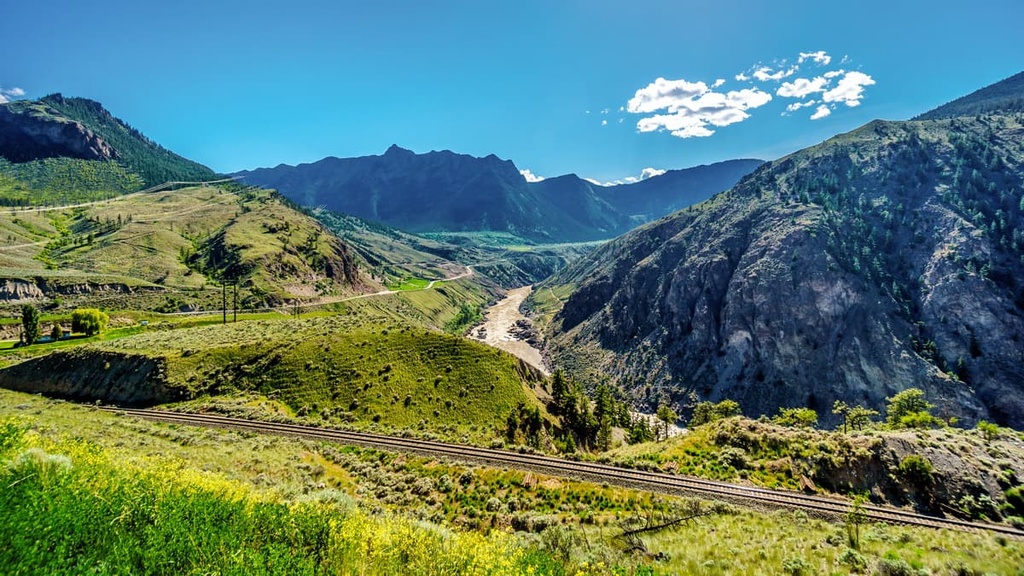
Downton and Gunn Lake are the southern limit of the Dickson Range while Leckie Creek and the Leckie Range are located along the northern border of the Dickson Range. The major route to access the Dickson Range is the Slim Creek FSR via the communities of Gold Bridge and Gun Lake.
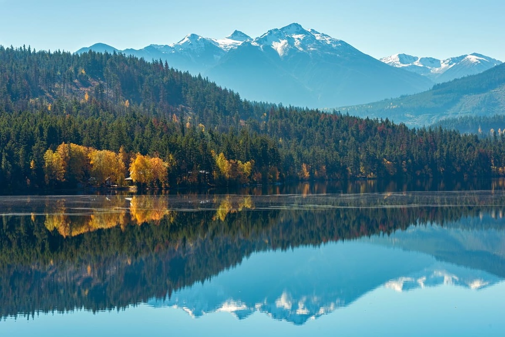
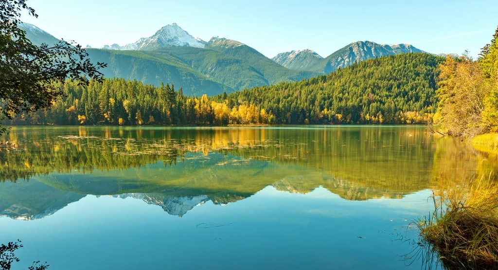
Bridge River Delta Provincial Park and part of South Chilcotin Mountains Provincial Park are both situated in the Dickson Range. The following provincial parks are also located near the range:
The Dickson Range and the Chilcotin Ranges are geologically distinct from the rest of the Pacific Ranges. In general, the Pacific Ranges are essentially granitic in composition and they contain the highest peaks of the Coast Mountains. The Chilcotin Ranges are an anomaly within the Pacific Ranges as they are mostly Mesozoic sedimentary and volcanic in origin.
Additionally, many of the peaks of the Pacific Ranges projected through the Pleistocene ice sheet as nunataks that were then eroded by cirque and alpine glaciers. The peaks of the Chilcotin Ranges also decline in elevation from the precipitous granite peaks of the Pacific Ranges until the mountains abruptly meet with the Fraser Plateau.
The Dickson Range is situated on the lee side of the Coast Mountains, which gives them a drier climate compared to the rest of the Coast Mountains. The range’s topography and its location between the wet coastal and dry interior climates create a diversity of environmental conditions, which in turn results in a diversity of vegetation and associated wildlife.
While the range largely represents the Engelmann Spruce–Subalpine Fir ecosystem, there are also areas representative of the Montane Spruce, Sub-Boreal Pine Spruce, and Interior Douglas-fir ecologies. The vegetation in the region includes everything from lush alpine and subalpine meadows, areas of aspen and mixed forest, scattered stands of whitebark pine, and both large marshes and spruce bogs.
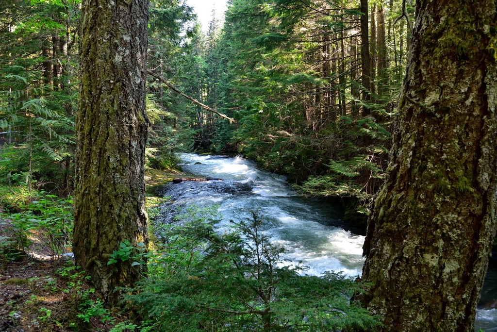
The forests of the Dickson Range are not as dense as the forests in adjacent Pacific Ranges and there is minimal understory in the forests. This allows for relatively easy travel for animals and people.
Some of the animals that inhabit the Dickson Range are the fisher, grizzly bear, California bighorn sheep, wolverine, gyrfalcon, northern goshawk, mountain goat, cougar, fox, and black bear.
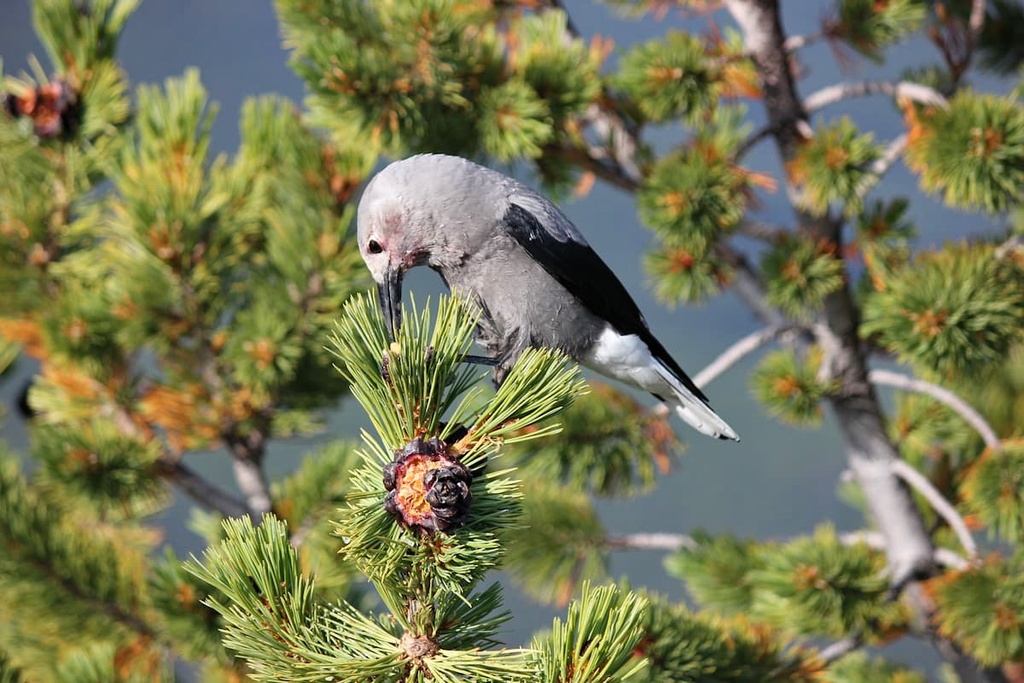
The seeds of the whitebark pine provide also an important food source for several species. This includes Clark’s nutcrackers and grizzly bears who appreciate these high-energy foods.
The Dickson Range is situated within the traditional territories of the St’at’imc, Tsilhqot'in and Secwepemc First Nations. During the early nineteenth century, a major war was fought between the St’at’imc and the Tsilhqot'in, which ended with a final battle at nearby Graveyard Valley. Here, the St’at’imc defeated the Tsilhqot’in, and the two First Nations agreed to a peace treaty.
First Nations have used the range for thousands of years for hunting and for gathering food and medicinal plants. There are no major routes through the range as it was always easier to bypass the range via Bridge River or Slim Creek. However, it is likely that some areas of the ranges have been used for spiritual and sacred purposes as well as hunting and gathering.
Since European settlement began in the area in the eighteenth century, horses have been in use for ranching, guide outfitting, hunting and tourism. There are no official trails in the range; however, the Dickson Range has become a popular location for heliskiing.

The major informal trails near the Dickson Range are located along Slim Creek and Bridge River, which lay to either side of the range. The trail along Slim Creek is a popular route to take if you access the vast wilderness area of South Chilcotin Mountains Provincial Park.
Dickson Peak and Mount Penrose are likely the two most popular summits in the range; however, there are no official trails to the top of either peak.
Most of the other peaks in the Dickson Range are relatively easy to climb; however, like Dickson Peak and Mount Penrose, there are no official trails to the summits. As a result, climbing any of these peaks requires both extensive research and backcountry navigational skills.
In addition to hiking the relatively unvisited mountains of the Dickson Range, there are unique opportunities for exploration at Bridge River Delta Provincial Park as well as Gunn Lake. Around Gunn Lake there are several short hiking trails and many trails for mountain biking that you can check out.
The following communities and cities are all located near the stunning wilderness of the Dickson Range, and they each offer supplies, lodging, and food.
Lillooet is located just to the east of the Dickson Range and, during the summer, it is often one of the hottest places in Canada. The region around Lillooet is also considered to be one of the oldest continuously inhabited areas in what’s now known as North America.
The community is located on the traditional territory of the St’at’imc First Nation, who have lived in the area for thousands of years. Miners and prospectors came to the valley in the 1860s during the Fraser Canyon gold rush and established the settlement that is now the city of Lillooet.
Located near the Fraser and Bridge Rivers, Lillooet is surrounded with incredible wilderness recreation areas. Some of the popular areas for hiking near Lillooet include Stein Valley Nlaka’pamux Heritage Park, South Chilcotin Mountains Provincial Park, Churn Creek Protected Area, and Marble Range Provincial Park.
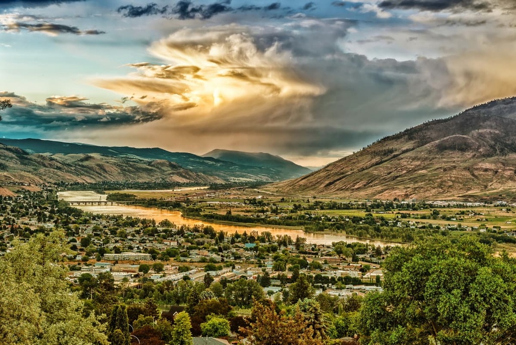
The city of Kamloops is situated on the Thompson Plateau, about 200 km (120 mi) to the east of the Dickson Range and the Chilcotin Ranges. The mild climate draws visitors to the city all year long. Many visitors to Kamloops come to participate in one of the many annual tournaments that the city hosts and to visit its surrounding wilderness and recreational areas.
The dry, elevated plateaus surrounding Kamloops are home to many interesting and unique wilderness and recreational areas. Some of the places to visit near Kamloops include Kenna Cartwright Nature Park, Lac du Bois Grasslands Protected Area, Tunkwa Provincial Park, Bonaparte Provincial Park, and Greenstone Mountain Provincial Park.