
Scan the QR code and open PeakVisor on your phone
Upper Lillooet Provincial Park has 1 named peak. The highest is Polychrome Ridge at 2,396 m.
Upper Lillooet Provincial Park is a remote wilderness park that’s located about 150 km (90 mi) to the northwest of Vancouver in British Columbia, Canada. The park’s single named mountain, Polychrome Ridge (2,396 m/7,861 ft) overlooks old-growth forests, glaciers, alpine ridges, and wetland habitat.
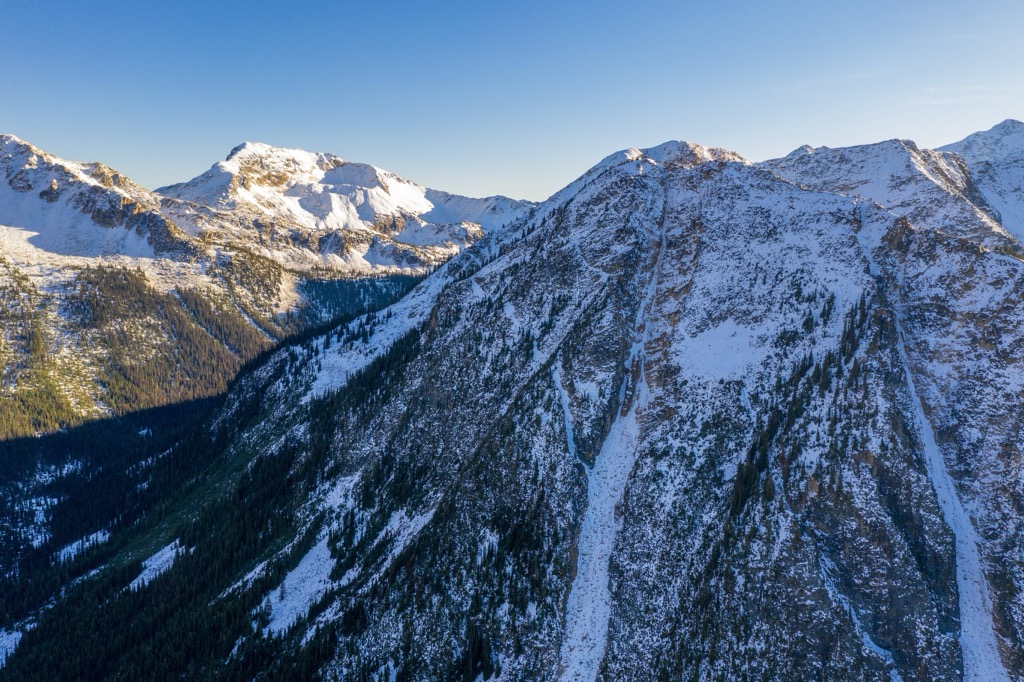
Situated in the Pacific Ranges of the Canadian Coast Mountains of British Columbia, Canada, Upper Lillooet Provincial Park is a protected area that encompasses nearly 200 square kilometers (77 sq. mi) of unlogged watershed. The park includes glaciers, wetlands, alpine ridges, and old-growth forests.
The single named peak of the park is Polychrome Ridge, which has an elevation of 2,396 m (7,861 ft) and a prominence of 422 m (1,385 ft). The park is a remote backcountry wilderness area with no official trails. Its only road access is via a 70 km (42 mi) drive along the Upper Lillooet Forest Service Road, which ends at the park’s boundary.
Upper Lillooet Provincial Park is not considered a general destination park. This is because the park is difficult to access and because it lacks many of the facilities that most visitors look for in hiking destinations, such as marked trails. As a result, the park is best suited to experienced hikers who want to experience the remote backcountry on a backpacking expedition.
Alternatively, the following nearby parks are better suited to frontcountry tourists looking for a day hike or a wilderness experience in an area with some maintained facilities:
Some of the other remote wilderness parks located nearby that also have limited accessibility and facilities like Upper Lillooet Provincial Park include:
Polychrome Ridge is the single named peak in Upper Lillooet Provincial Park, and it is part of the Pacific Ranges of the Canadian Coast Mountains. The geology of the park consists primarily of volcanic and sedimentary rocks that are of Jurassic age and older.
The area that is now British Columbia was previously located to the west of the continental margin of North America. In fact, the region was once covered by the ocean and shallow seas.
Many of the sedimentary layers in the park were created by the deposition of marine sediments during this time. Other sedimentary layers found in the region are the result of eroded sediments from the continent that were ultimately deposited into the sea.
The volcanic rocks of the Coast Mountains formed in two different ways. Some of the volcanic rocks in the region are the result of volcanic islands that were accreted to the edge of the continent as oceanic plates subducted below it.
The remainder of the volcanic rocks in the region are the result of the volcanic activity that often accompanies this sort of plate subduction. A subduction event typically creates a weak area in the crust where magma can push through, and in some cases, allow lava to erupt onto the surface.

In fact, the Coast Mountains contain a massive granite backbone that is referred to as the Coast Intrusions. The Coast Intrusions are the granitic rocks that resulted from a massive magma intrusion into the crust during this period of subduction.
As the magma slowly cooled beneath the surface, it created granitic batholiths. The layers of rock that covered the batholiths were subsequently eroded to expose the granitic peaks of the Coast Mountains.
Following the formation of the Coast Mountains, they were consistently battered by the erosive forces of wind and water. During the Pleistocene, the formation and movement of the massive continental ice sheets and glaciers created the topography of the Coast Mountains and eroded away the layers that covered Polychrome Ridge in Upper Lillooet Provincial Park.
There are several glaciers that are located in and around Upper Lillooet Provincial Park, including the Lillooet Glacier, Job Glacier, Mosaic Glacier, and the Manatee Glacier. These glaciers are the remnants of the massive ice sheet that once scoured the mountains of the region and rounded the top of Polychrome Ridge.
The park is home to many glacial features, such as moraines, eskers, kames, and drumlins. Many areas of the park, especially the valley bottoms, have a veneer of glacial debris. The glaciers of the park are the source of water for the Upper Lillooet watershed, and the park helps to preserve the watershed’s pristine wilderness.
Furthermore, the area is part of the Garibaldi Volcanic Belt. Some of the most recent volcanic activity in the Coast Mountains occurred near the park, too. About 2,400 years ago, an eruption and block/ash flows blocked the Lillooet River. Some of the remnants of this event include pumice deposits and hot springs that are located just outside the park.
Upper Lillooet Provincial Park is ecologically valuable as it is one of the few intact watersheds in the Pacific Ranges. Furthermore, the sheer size of the park is valuable in its own right, as it is home to only one of five unlogged watersheds in the eastern Pacific Ranges that is over 50 square kilometers (19 square miles) in area.
The park has representations of ecosystems that include Coastal Mountain-heather Alpine, a subalpine that consists of the Mountain Hemlock zone, and lower slopes and valleys that are filled with old-growth forests of the Coastal Western Hemlock zone.
Glaciers flow from the highest points of the park, creating a landscape that is generally void of flora and fauna. The Coastal Mountain-heather Alpine consists of rocky ground that transitions to alpine meadows filled with grasses, sedges, and especially mountain heather. There are several bird species that nest in alpine areas in the park, too, such as the white-tailed ptarmigan, however, there are few animals that inhabit the alpine all year-round.
Mountain goats and smaller mammals, such as marmots, pika, and ground squirrels inhabit the alpine areas of the park. Grizzly bears, black bears, black-tailed deer, wolves, moose, and wolverines all inhabit the lower slopes and valleys of the park.
The abundant rainfall in the Pacific Ranges has created the dense cedar and hemlock forests of the region. The upper slopes are filled with forests of mountain hemlock, amabilis fir, and yellow cedar, which transition to forests filled with western hemlock, red cedar, Douglas fir, amabilis fir, and numerous deciduous tree species.
Of special note are the riparian areas that consist of wetlands and areas adjacent to the many creeks of the watershed. The park contains a relatively rare community of plants that consists of cottonwood, willow, and thimbleberry. Additionally, smooth willowherb, which is rare in the area, has been discovered in the park.
Upper Lillooet Provincial Park is located within the traditional territory of the Líl̓wat Nation, who have lived in the region for thousands of years. They are of Interior Salish origin and their ancestors supplanted the previous inhabitants of interior British Columbia over three thousand years ago.
The traditional lifestyle of the Líl̓wat and other Interior Salish cultures included a heavy dependency on fishing for their sustenance that was supplemented by foraging and hunting large and small game. The Interior Salish are culturally related to the coastal Salish cultures, from where they likely originated before they explored and expanded inland.
Due to the close relation to the coastal Salish cultures, Many Salish First Nations share similar traditions and skills, such as elaborate wood carvings, weaving, and their use of cedar. It is suspected that the Interior Salish’s knowledge of fishing is what enabled them to survive changing climatic conditions in the interior of British Columbia when other First Nations did not.
The first recorded exploration of the area occurred in 1893 when Stanley Smith set out to determine the fate of two surveyors who had disappeared in 1892. The final fate of the two surveyors is unknown, as only the hat of one of them was discovered in the Squamish Valley.
The area was designated as a park in 1997 for the protection and conservation of the region’s old-growth forests and wildlife values, though it was never intended to be a major hiking and recreation destination.
Nevertheless, even though the park is not managed as a major tourist destination, there are incredible opportunities for remote, wilderness-oriented recreation available in the region for experienced outdoor adventurers.
Upper Lillooet Provincial Park was never intended to be and is not advertised as a destination park. The value of the park primarily remains with its ability to preserve old-growth forests and the diversity of the wildlife. However, while it is difficult to access, the pristine wilderness of the park is a great place for highly experienced hikers to seek out remote backcountry experiences.
There are logging roads that lead to the edge of the park, but there are no official roads or trails in the park itself. Helicopters are typically used to bring visitors to the park’s alpine areas for hiking and backcountry skiing.
Furthermore, there are only remnants of human existence in the park. While hiking in the park, you may end up following one of the old horse trails that once brought backcountry recreationalists into the area. Or, you may come across the remnants of the stone hut on Polychrome Ridge, though there are no maintained facilities in the park itself.
The remote wilderness of Upper Lillooet Provincial Park is the perfect place to find wilderness solitude and enjoy backcountry recreation. The following are some of the closest major cities and communities to the park.
Vancouver is a major city that’s situated at the southern end of the Pacific Ranges along the Fraser River. It is located about 150 km (90 mi) to the south of Upper Lillooet Provincial Park.
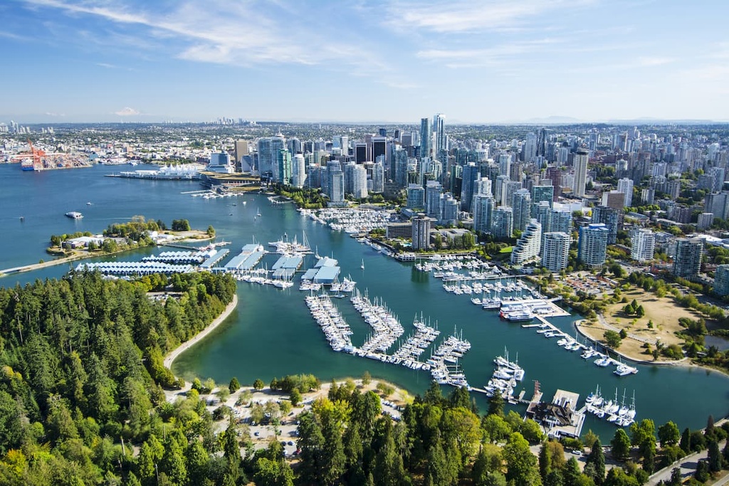
As the largest city in British Columbia, Vancouver has many cultural attractions for visitors to check out, including libraries, museums, performing arts, art galleries, and a vibrant nightlife. There are also annual festivals in the city, such as the Pacific National Exhibition.
Garibaldi Provincial Park, Pinecone Burke Provincial Park, Golden Ears Provincial Park, and Mount Seymour Provincial Park are some of the incredible wilderness areas that are located near Vancouver. These parks offer many opportunities for hiking and backcountry recreation, such as backpacking or backcountry skiing in the winter.
In addition to the region’s many nearby provincial parks, the city has many great paths for visitors to walk, especially in Stanley Park. Some other popular treks that are located near the city include the trails to St. Marks Summit, Quarry Rock, Norvan Falls the Grouse Grind, and the hikes in both Pacific Spirit Regional Park and Burnaby Lake Park.
Whistler is a resort community that is situated in the Fitzsimmons Range, about 70 km (42 mi) to the southeast of Upper Lillooet Provincial Park. It is the main resort community for the Whistler Blackcomb ski area.
During the winter, the town is filled with skis and snowboards, as visitors flock to one of the largest ski resorts in North America. During the summer, the town is still full of life; however, you’ll find mountain bikes and hiking boots on the trails, instead of skis and snowboards.
Some of Whistler’s popular hikes include the Singing Pass Trail and the High Note Trail to the top of Whistler Mountain. Additionally, one popular Whistler-area hike that you don’t want to miss is the short hike to the train wreck at the south end of town.
Whistler receives over two million visitors every year. Most visitors to the town come for alpine skiing and snowboarding during the winter; however, downhill and mountain biking are also popular at the Whistler Blackcomb Resort during the summer months.
Squamish is a charming town situated at the northern end of Howe Sound, about 100 km (60 mi) to the south of Upper Lillooet Provincial Park. It is located along the Sea to Sky Highway in British Columbia, which connects the Lower Mainland to the ski resort on Whistler and Blackcomb mountains. While it is located near world-class skiing, most of Squamish’s visitors come for the climbing opportunities.
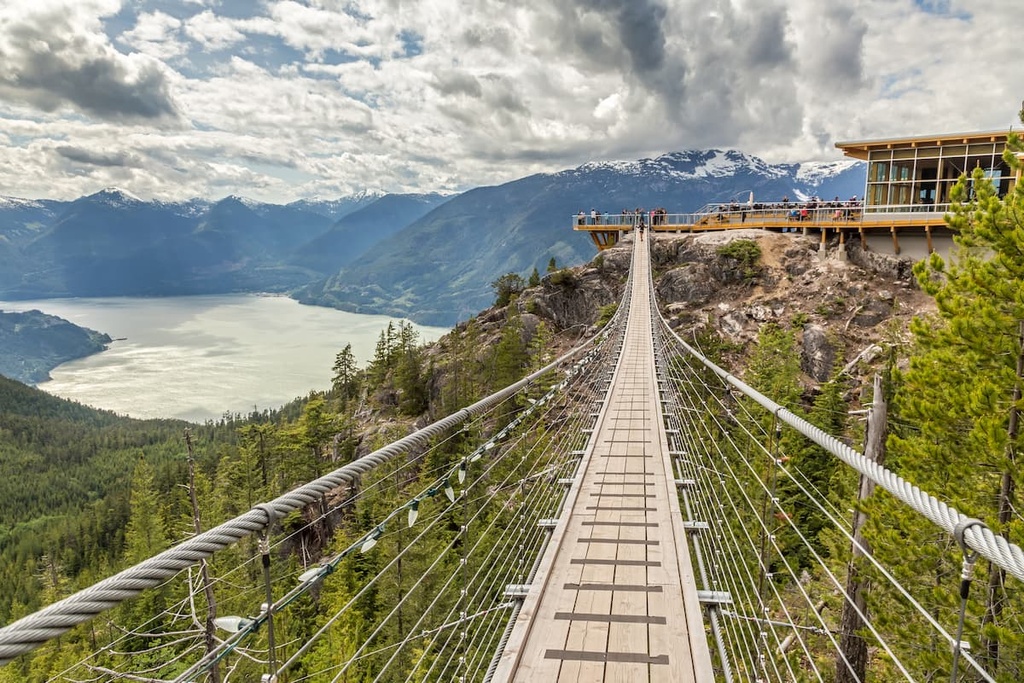
Like Whistler, Squamish is a popular destination for tourists in search of outdoor adventure and recreation. While Whistler is known for its ski hills, Squamish is world-renowned for its thousands of climbing and bouldering routes.
Stawamus Chief is one of the more popular attractions in the area, as it has over 300 climbing routes on its granite face. Shannon Falls, Murrin Park, The Malamute, and the Smoke Bluffs, all host an additional 1,500 routes. Additionally, the area is home to over 2,500 bouldering problems that are published in local guidebooks.
Squamish is also a popular destination for windsurfing and kiteboarding, ultra-trail running, visiting Shannon Falls, river-rafting on the Squamish and Elaho Rivers, snowmobiling, hiking, mountaineering, and backcountry skiing.


The highest peak in Upper Lillooet Provincial Park is Polychrome Ridge, at 2,396 m.
Notable peaks in Upper Lillooet Provincial Park include Polychrome Ridge.


