Scan the QR code and open PeakVisor on your phone
Sustut Provincial Park is located within the watersheds of the upper Skeena and upper Omineca Rivers in northern British Columbia, Canada. The remote wilderness park contains scenic vistas, undisturbed wilderness, and the mountainous terrain of the Connelly and Hogem Ranges. It is also home to an active fumarole, The Thumb, which is the tallest of the 4 named peaks in the park at 1,848 m (6,063 ft) in elevation.
The remote northern wilderness of British Columbia, Canada is home to many incredible natural features and areas. In particular, there are many volcanic features in northern British Columbia.
Sustut Provincial Park is home to one of these very important volcanic features: an active fumarole called The Thumb. The Thumb is the park’s tallest peak and the basaltic escarpment is a fumarole that emits volcanic gasses and vapors.
Access to the remote wilderness park is mainly via plane as there are no drivable overland routes into the park. Sustut Provincial Park is one of the many remote wilderness parks and protected areas in the region. Some of the other parks in the region include:
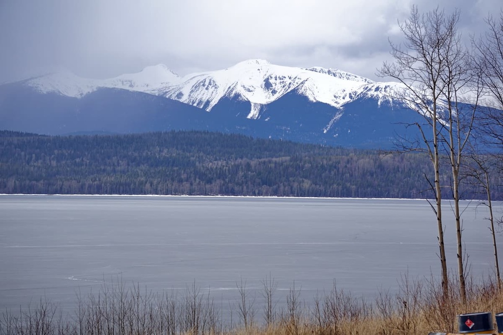
Sustut Provincial Park is located on the Nechako Plateau in the interior of British Columbia. The Nechako Plateau is the northernmost of the three plateaus in the interior system, which also includes the Fraser and Thompson plateaus.
The surface of the Nechako Plateau typically lays between 1,200 (4,000 ft) and 1,500 (5,000 ft) in elevation and it has fairly minimal relief. The plateau is an expanse of rolling country that is almost completely undissected except where major rivers like the Fraser cut their way across the region.
The Hazelton Mountains are located on the western side of the plateau while the Skeena and Omineca Mountains are located to the north. The Fraser Basin and Fraser Plateau also border the southern end of the Nechako Plateau.
Tertiary lava flows created the flat and gently dipping terrain of the plateau by overlaying the older layers of volcanic and sedimentary rocks. The surface is also underlain by Jurassic and Cretaceous aged granitic intrusions.
During the Pleistocene, the cordilleran ice sheet scoured the plateau, obscuring the bedrock with a massive amount of glacial till across the surface. The surface of the plateau was scoured by the ice and drumlins were left in the wake of the glaciers, both of which indicate the direction the glaciers were traveling at the time of their retreat.
Other notable features that you can find on the plateau include eskers and meltwater channels. Eskers are sinuous ridges of glacial debris that were left behind by subglacial rivers. The meltwater channels and other glacial features are best observed from the air or ground as maps tend not to show the contour lines that display low relief features.
A significant geological feature in the park is the Big Kettle Fumarole. The cone is about 2.4 m (8 ft) high and there is a 1.5 m (5 ft) by 1.5 m (5 ft) depression in the top. Carbon dioxide also emanates from the bottom of the fumarole as evidenced by the tiny bubbles and the remains of animals that have succumbed to CO2 asphyxiation.
The wilderness of Sustut Provincial Park is a prime example of the complex, old-growth forests, and wetlands of the Engelmann Spruce–Subalpine Fir ecological zone. The Engelmann Spruce–Subalpine Fir zone occupies the upper elevations of most of British Columbia.
The climate in this zone is typically snowy and cold for over half the year and deep snowpacks are common. The subalpine parkland often contains snowfields that persist late into the summer months when the average temperature is only 10 degrees Celsius (50 degrees Fahrenheit).
The basaltic cliffs of the park are prime mountain goat habitat and the vast wilderness of the park is also home to caribou, grizzly and black bear, and stone sheep. Steelhead trout, bull trout and Dolly Varden are found in the Asitka and Sustut rivers, which contain important salmonid habitats.
The subalpine areas of the park are typically a parkland-like mosaic of isolated stands of trees and alpine grasslands. Subalpine fir tends to dominate the treeline; however, since spruce tend to live longer than fir, the forest canopy is usually dominated by Engelmann spruce.
Mountain heather dominates the alpine, forming vast communities alongside the persistent snowpack. Additionally, krummholz is formed by the driving wind along the treeline. The bushy clumps of conifers in the park put up leaders that are ravaged from exposure to the driving wind and ice crystals. This eventually creates sculpted trees that are aesthetically akin to alpine bonsais.
The Gitxsan First Nation, Carrier-Sekani Tribal Council (Takla Lake First Nation), and Tsay Keh Dene Nation all consider the land within Sustut Provincial Park to be part of their traditional territory. While the region has been inhabited for thousands of years, there are no recorded archeological sites within the boundaries of the park.
However, the Gitxsan First Nation have traditional names for many of the features in the park in Gitxsanimaax and are working with officials to have traditional names recognized. Furthermore, while there are no recorded archeological sites in the park, First Nations in the area have long been familiar with the territory and likely used it for hunting and gathering resources.
In August of 1913, British Columbia land surveyor Frank Swannell and his team documented their visit to Big Kettle Fumarole in the Sustut Provincial Park. First Nations in the area have long known of the fumarole and the deadly consequences of venturing too close to it. In his report, Swannell notes that the Sekani (Tse’khene) had mentioned how birds flying overhead near the fumarole are mysteriously killed in mid-air.
The park currently remains a vast tract of pristine wilderness. The park’s remote location has made it difficult to access; however, there are many beautiful areas in the park that are worth the effort to visit.
The primary role of Sustut Provincial Park is to preserve a large tract of relatively undisturbed wilderness. The park contains significant habitats for caribou, mountain goats, grizzly bears, and black bears. Furthermore, the park contains regionally significant volcanic features including The Thumb and the Big Kettle fumarole.
Most visitors to the park come for guided hunting and fishing excursions; however, there is a growing interest in additional backcountry pursuits in the park.
Backcountry hiking to the volcanic features is one of the many popular adventures that visitors enjoy in the park. There are some trails throughout the park that are maintained by the various outfitters as well as an historic trail that was used by the RCMP and miners during the Yukon gold rush.
The river offers opportunities for whitewater rafting and kayaking as well as fishing. The pristine wilderness is also home to many animals, so it offers the opportunity to view wildlife in their habitat.
The vast wilderness around Sustut Provincial Park and the Nechako Plateau is relatively uninterrupted by towns and cities. The following are some of the communities and cities located closest to the park where lodging and other services can be found.
Located on the east side of the Hazleton Mountains along Highway 16, Smithers has a population of over 5,000 people and is the major service hub for the Bulkley Valley. The town is about 200 km (120 mi) to the south of Sustut Provincial Park and is one of the last major communities that you’ll pass by before entering the vast wilderness of northern British Columbia.
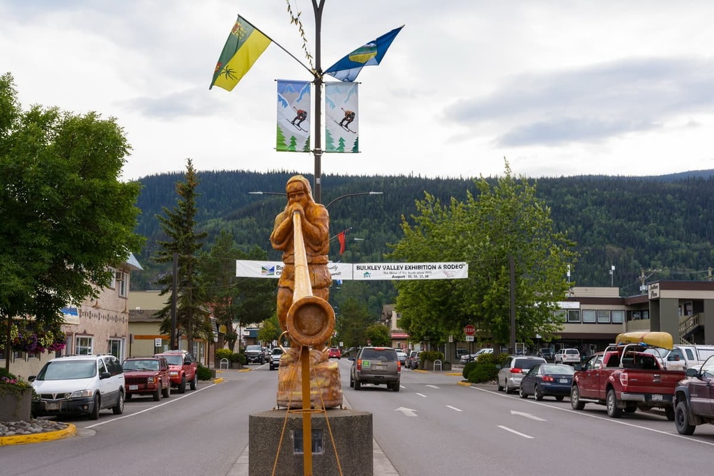
Some of the top local hikes around Smithers are the Crater Lake Trail, Malkow Lookout Trail, Silvern Lake Trail, and Call Lake Trail. Additionally, you can check out some of the mountain trails in the area, which include the Harvey Mountain Trail and the trail to Hudson Mountain.
Some of the popular hiking areas around town include Babine Mountain Provincial Park and Seven SIsters Provincial Park.
Takla Landing is a small community located on the eastern side of Takla Lake. It is home to the main community and headquarters of the Takla Lake First Nation and is situated about 120 km (72 mi) to the south of Sustut Provincial Park.
The community of Takla Landing is home to approximately 250 residents, most of whom are citizens of the First Nation. During the Omineca Gold Rush in the late 1860s, the community was used as a popular steamboat landing site for prospectors who hoped to make it to the gold strikes along the Omineca River.
For many decades, the community of Takla Landing was fairly isolated from the rest of British Columbia due to the ruggedness of the surrounding terrain. A number of unpaved roads now connect the community to Fort St. James and Germansen Landing.
Takla Landing is located near Omineca Provincial Park and Babine River Corridor Provincial Park; however, the community is also a launching point to the nearby Mount Blanchet Provincial Park, which is only accessible by boat.
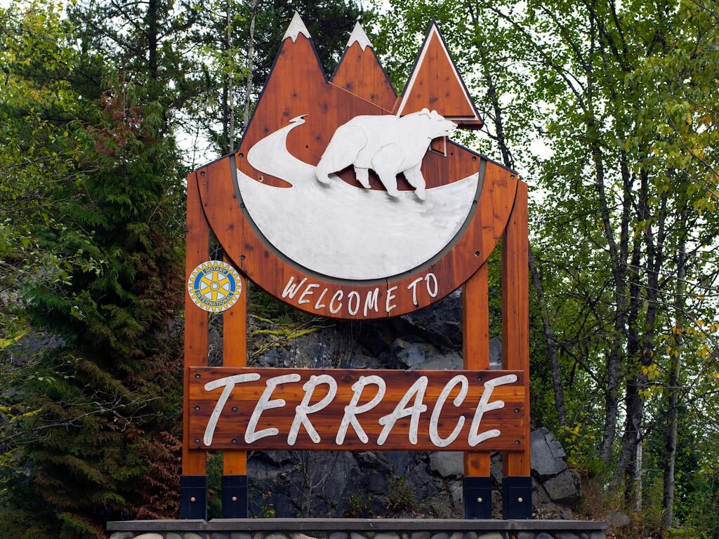
Terrace is located about 250 km (150 mi) away from the remote Sustut Provincial Park. Terrace is situated at the junction of Highway 16 and Highway 37, and it is home to the Northwest Regional Airport as well as a railway station serviced by Via Rail’s passenger trains.
There are countless areas to explore near Terrace and many outdoor activities, such as fishing, hiking, mountain biking, climbing, and hunting, to enjoy. In fact, locals often spend the autumn searching for wild mushrooms and the summer picking berries.
Some of the popular wilderness areas located near Terrace include Seven Sisters Provincial Park, Gitnadoiks River Provincial Park, and Nisga’a Memorial Lava Bed Provincial Park.