Scan the QR code and open PeakVisor on your phone
Seven Sisters Provincial Park and Protected Area is an outdoor recreation destination located in the Regional District of Kitimat-Stikine in central British Columbia, Canada. Of the 11 named peaks in the park, Weeskinisht Peak is the tallest and most prominent. Weekskinisht Peak is 2,747 m (9,012 ft) tall with 1,861 m (6,106 ft) of prominence, making it one of British Columbia’s ultra-prominent mountains.
Located about 200 km (120 mi) from the west coast of Canada in the Province of British Columbia, Seven Sisters Provincial Park and Protected Area is an outdoor recreation destination that covers nearly 400 square kilometers (154 square miles) of wilderness.
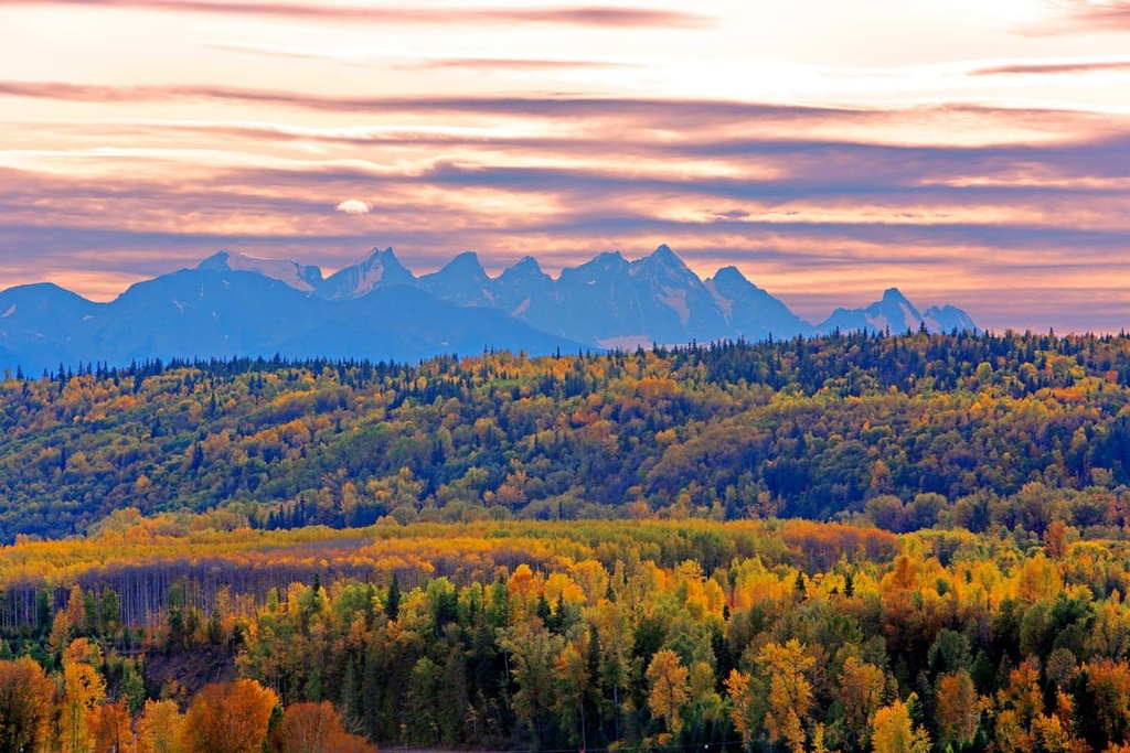
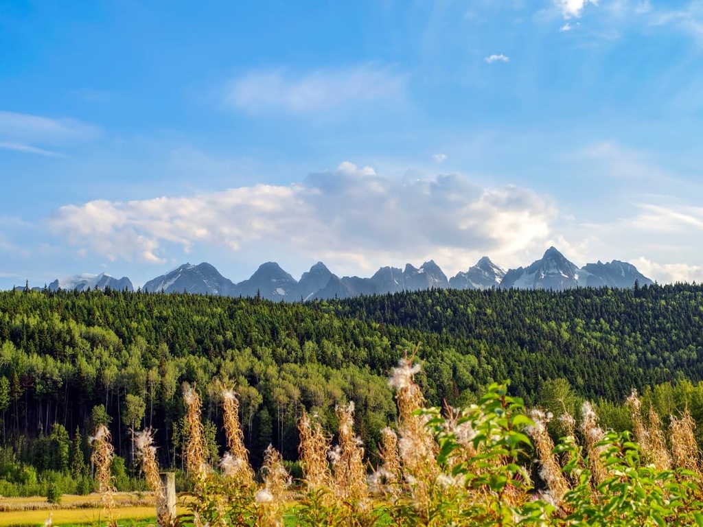
The namesake and highlight of the park are the spectacular set of peaks called the Seven Sisters that are visible from the Yellowhead Highway (Highway 16) between Terrace and Hazelton.
The park is located in the Regional District of Kitimat-Stikine and, as part of the British Columbia Parks system, is one of over 800 provincial parks and protected areas in the province. Some of the other provincial parks in the regional district include:
Seven Sisters Provincial Park includes part of the Nass Ranges of the Hazelton Mountains. The Hazelton Mountains are topographically similar to the adjacent Kitimat Ranges of the Canadian Coast Mountains; however, they are geologically related to the Nechako Plateau, which is located to the east.
The Coast Mountains are primarily composed of intrusive igneous and foliated metamorphic rocks, whereas the Hazleton Mountains have a different geological composition altogether. Extrusive rocks are the dominant rock type in the range, but there are small areas that have intrusive igneous rocks and folded layers of sedimentary rocks.
The Hazleton Mountain formed as part of the Sevier orogeny, which was caused by the collision of North America with oceanic tectonic plates about 160 to 50 million years ago.
During the event, oceanic plates subducted under the west coast of Canada. This caused volcanic island arcs to raft into the coastal margin. The island arcs were then accreted to the west coast, making the continent larger in the process. This also compressed the landmass on the west coast, causing the uplift of the Columbia, Interior, and Coast Mountains.
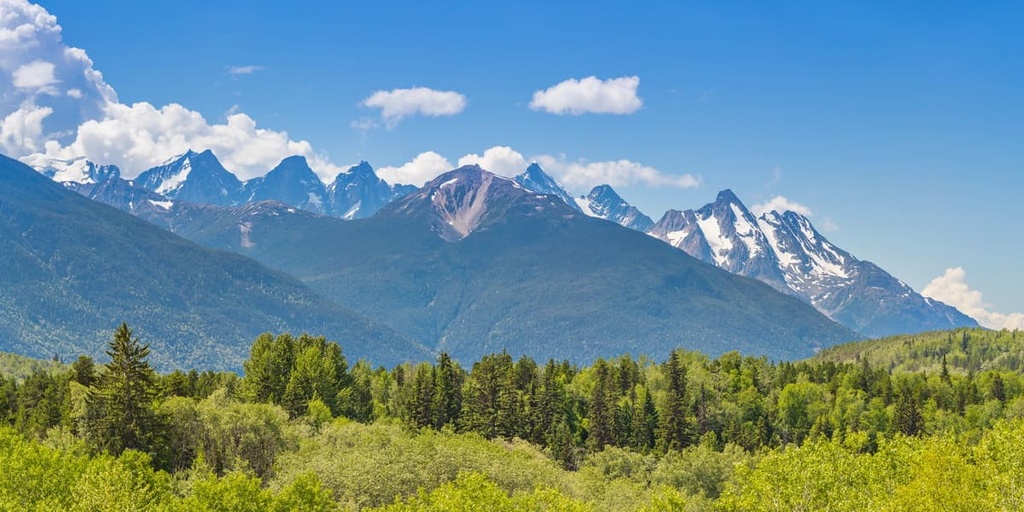
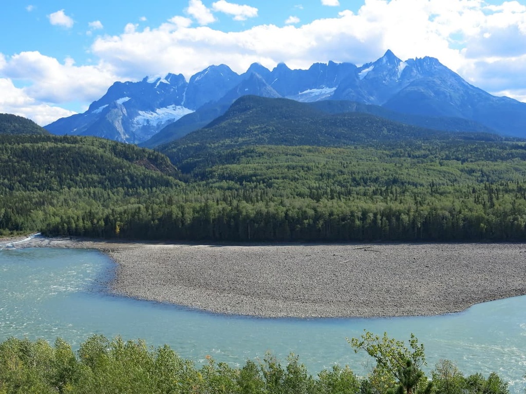
The major subranges of the Hazelton Mountains are the Kispiox, Nass, Bulkley, and the Tahtsa Ranges. Seven Sisters Provincial Park primarily contains the Nass Ranges. Typically, the Nass Ranges have serrated peaks around 2,130 m (7,000 ft) in elevation. These peaks are most evident in the park as part of the series of peaks called the Seven Sisters.
The higher elevations in the region were not consistently covered by ice sheets during the glacial maximums of the Pleistocene. This is why the tallest peaks in the park have remained jagged and serrate. However, the peaks in the region below 1,830 m (6,000 ft) were significantly rounded by glaciers as the ice sheets certainly covered and scoured everything below that elevation.
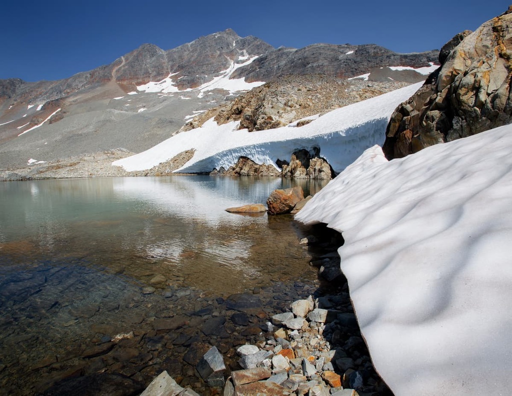
The ecology of Seven Sisters Provincial Park has a distinct alpine zone that transitions into a narrow subalpine band. It eventually transitions into a temperate west coast rainforest in the valleys.
In the alpine, the peaks of the park are typically barren and rocky. Meanwhile, meadows of sedge and heather along with stands of stunted trees dominate the tree line.
Mountain goats and bighorn sheep inhabit the steep cliffs and rocky outcrops of the region. They prefer southern facing cliffs during the winter because they are typically free of snow. Marmots and ground squirrels make their homes under the rocks of the alpine and forage upon the heath, which grows across the lower elevations of the alpine.
The subalpine in the park is a narrow band of forests of mountain hemlock and amabilis fir that transitions to forests of western red cedar, western hemlock, and Douglas fir on drier slopes. There are many significant mammal species that live in this part of the park, including grizzly bears, black bears, moose, caribou, elk, cougars, and coyotes.
Golden eagles prefer to nest in south-facing areas where they can prey upon large alpine rodents, such as the hoary marmot and the Columbian ground squirrel. Woodpeckers are found in the old-growth forests of the region because they prefer the richly infested standing-dead trees. Meanwhile, other birds, such as the gray jay, red crossbill, white-winged crossbill, and the pine siskin, prefer conifer forests.
The area that is now part of Seven Sisters Provincial Park is the traditional territory of the Gitxsan, or the “people of the river mist.” Archaeological evidence suggests that the region has been continuously inhabited by humans for the past 10,000 years.
The Gitxsan speak a language that is part of the Tsimshianic language group. Other First Nations whose language belong to this group include the Nisga’a, who traditionally live to the north, and the Tsimshian, who traditionally live to the west, along the coast. Often, the Gitxsan are referred to as Interior Tsimshian; however, they are a distinct First Nation.
While the Gitxsan share language commonalities with their neighbours to the west, they share a joint political and cultural community with their eastern neighbours. The Wet’suwet’en, an Athapaskan people, traditionally reside to the east and share a long and deep relationship with the Gitxsan First Nation.
The Indigenous communities of the region traditionally had an abundance of resources to subsist on.
Salmon has traditionally been an important food resource for most of the Indigenous communities and nations along the west coast of what is now British Columbia, as were cedar trees. Salmon were caught and dried for winter food stores while parts of cedar trees were harvested to make baskets, tools, and ceremonial regalia.
The abundant resources of the west coast allowed for large communities and structured societies to develop. Before European contact, this area of British Columbia had the highest density of Indigenous communities to the north of Mexico. Unfortunately, smallpox and measles epidemics killed an estimated 90% of Indigenous people in the region.
While there is no major industry in Seven Sisters Provincial Park, the region is rich in forestry and mineral resources. Due to the volatility of commodity prices, tourism has become a major industry in the region since the turn of the century. Seven Sister Park was established in the year 2000.
Because it is located along the Yellowhead Highway, Seven Sisters Provincial Park is much more accessible than many of the other parks and protected areas in the area.
While paddling, cycling, horseback riding, and fishing are all possible in the region, hiking and backpacking are the main activities in the park. Backcountry wilderness camping is permitted throughout the park and there are minor facilities available along some of the park’s trails.
The following are the major trails of Seven Sisters Provincial Park:
The Oliver Creek Trail is 17 km (10.2 mi) long, and it climbs 1500 m (4,920 ft). The trail passes through spectacular forests and it ends in a spectacular alpine basin. It is an ideal trail for overnight backpacking trips as it provides access to alpine hiking and the Seven Sisters peaks.
The Watson Lakes Trail is an easy 3 km (1.8 mi) hike with minimal elevation gain on a scenic, well-maintained path. It passes by three small lakes with picnic sites and fishing.
The scenic lakeside picnic/camping site on the path is only 1 km (0.6mi) down the 3 km (1.8 mi) trail, which makes it an easy and ideal destination for families and novice hikers.
The Cedarvale Trail is a moderate 3 km (1.8 mi) hike through beautiful forest scenery that features a cedar grove. The route proceeds past the treeline to spectacular scenery at the foot of a moraine.
Further travel beyond this point requires backcountry experience as route finding, bushwhacking, and glacier travel are required; however, determined hikers can proceed further down the trail and even cross over to the Whiskey Creek Trail.
The Whiskey Creek Trail is a 7.2 km (4.3 mi) trail that leads to the upper reaches of Whiskey Creek, which is located below a headwall and a glacier.
The trail starts out relatively level and passes through pleasant mature forest before a difficult creek crossing at Whiskey Creek. Then, the trail makes a steep ascent through the forest to the headwall. The trail provides access for the prime mountaineering destinations in the park.
The Coyote Creek Trail is a 13 km (7.8 mi) long path that is used by mountaineers and summer skiers to access the alpine areas of the park. The trail is rocky and brushy, and while OHVs can access the portion of the trail that is outside of the park, OHVs are not permitted within the park and must be left at the boundary.
Seven Sisters Provincial Park is situated in the beautiful Regional District of Kitimat-Stikine. Much of the park is easily accessible from Highway 16, making it a popular destination for locals. The following are some of the major cities and towns located near Seven Sisters Provincial Park:
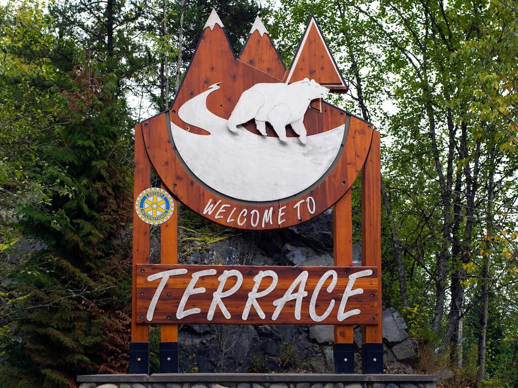
Terrace is a city located on the west side of the Hazleton Mountains. It is the primary community within the Regional District of Kitimat-Stikine. Terrace is located at the junction of Highway 16 and Highway 37, about 50 km (30 mi) from Seven Sisters Provincial Park.
Fishing, hiking, mountain biking, climbing, and hunting are among the many activities to enjoy in and around Terrace. In fact, locals often spend the autumn searching for wild mushrooms and the summer picking berries.
Some of the most popular hikes around Terrace are Ferry Island, Gunsight Lake, Terrace Mountain, Sleeping Beauty Trail, and Wesach Falls. Wesach Mountain is one of the top local peaks to bag. The alpine areas of Seven Sisters Provincial Park are located less than an hour to the north.
Located on the east side of the Hazleton Mountains along Highway 16, Smithers is a city that has a population of over 5,000 people. It is the major service hub for the Bulkley Valley. The town is situated about 150 km (90 mi) to the east of Seven Sisters Provincial Park and is surrounded by beautiful forests and mountains.
Some of the top local hikes around Smithers are the Crater Lake Trail, Malkow Lookout Trail, Silvern Lake Trail, and the Call Lake Trail. The most popular mountain trails in the region are the Harvey Mountain Trail and the trail to Hudson Mountain.
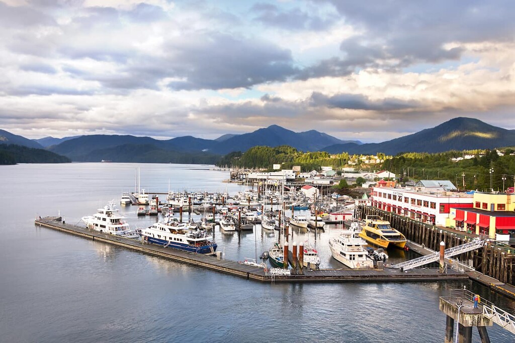
Prince Rupert is the transportation hub of British Columbia’s north coast. It is located about 200 km (120 mi) from Seven Sisters Provincial Park. The area has been inhabited for the last 5,000 years by multiple First Nations.
Tours can be arranged from Prince Rupert to Khutzeymateen Grizzly Bear Sanctuary, which features one of the densest populations of grizzlies in North America. Prince Rupert is the starting point for many wildlife viewing trips, including expeditions to see grizzly bears, salmon, eagles, and whales.
If you’d like to explore the region’s wilderness on foot, some of the most popular hikes around Prince Rupert include the Butze Rapids Trail, Tall Trees Trail, and the trail to Wantage Falls. You can also hike Mount Hays via the Kiwanis Trail.