Scan the QR code and open PeakVisor on your phone
Swan Lake/Kispiox River Provincial Park is located along the western edge of the Skeena Mountains in the Regional District of Kitimat-Stikine of British Columbia, Canada, and it preserves ancient forests and important wetlands. The park covers 622 sq. km (240 sq. mi) of wetlands, lakes, rivers, forests, and a handful of stunning mountains, the tallest of which is Mount Kologet.
Swan Lake/Kispiox River Provincial Park is situated along the eastern edge of the Kitimat-Stikine Regional District of British Columbia, Canada. This northern wilderness park is also nestled along the western edge of the Skeena Mountains and is accessible via local roads that branch out from Highway 37.
Originally established as the Swan Lake Wilderness Area in 1991, the park was expanded to include the upper Kispiox River in 1996 and was reclassified as a provincial park. The park features chain lakes that are popular with canoeists as well as ancient forests, rivers, and swamps that are virtually unmodified and undisturbed from their natural state.
The park extends from the western slopes of the Skeena Mountains and includes Mount Kologet which is 1,950 m (6,398 ft) tall and has 1,315 m (4,314 ft) of prominence. Mount Kologet is the only named mountain in the park; however, there are many other ridges and peaks in the park to explore.
Aside from Swan Lake/Kispiox River Provincial Park, there are several other parks in the region that help conserve the pristine wilderness and natural diversity.
Some of the other major parks in the area include Babine Mountains Provincial Park and Seven Sisters Provincial Park. Smaller nearby parks include Driftwood Canyon Provincial Park, Ross Lake Provincial Park, and Seeley Lake Provincial Park.
A geological formation called the Bowser Basin dominates the region surrounding Swan Lake/Kispiox River Provincial Park. The rocks of the Bowser Basin consist of siltstone, greywacke, shale, conglomerate, and coal. They record the orogenic interaction between volcanic and oceanic rocks in the region.
The Skeena Mountains, in general, are a distinct unit of Jurassic and Cretaceous sedimentary rocks. Typically, limestones and rocks of direct volcanic origin are absent in the region, as are igneous intrusions; however, Swan Lake/Kispiox River Provincial Park is located on the western edge of the Skeena Mountains and includes formations that are more typical of the eastern Boundary Ranges of the granitic Coast Mountains.
Greywacke is among the most durable rocks that formed the Skeena Mountains, and as such, most of the peaks in the range feature greywacke outcroppings. The valleys and saddles of the mountains are also characterized by tight folds while the massifs are commonly gently contorted.
The serrate peaks and ridges of the park and the Skeena Mountains were formed by intense alpine glaciation. Furthermore, the Pleistocene ice sheet almost entirely covered the Skeena Mountains, rounding off ridges and summits that were below 1,830 m (6,000 ft) in elevation.
The ice sheet also created the distinct lakes that are now located on the western end of Swan Lake/Kispiox River Provincial Park. This parallel and linearly aligned cluster of lakes, which includes Swan Lake, Brown Bear Lake, Stephens Lake, and Axnegrelga Lake, is evidence of the effect of glaciers in the region. However, such landscapes are more typical of the Canadian Shield than the mountainous British Columbia.
The flora and fauna of Swan Lake/Kispiox River Provincial Park live in a diverse array of habitats. The western side of the park is dominated by the chain lakes and their associated swamps and wetlands, while, toward the east, the park rises up from the submontane to the alpine zone.
The location of Swan Lake/Kispiox River Provincial Park represents the transitional area between the Coastal Rainforests and the Interior. The park is one of the only locations in northern British Columbia that features Interior rainforests.
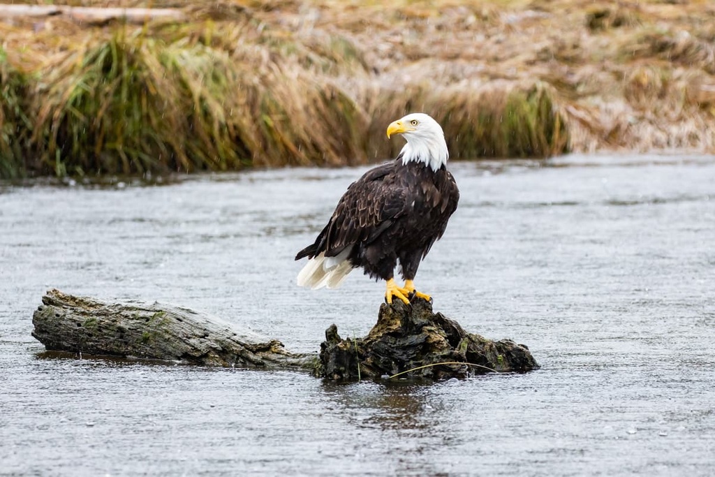
The waters and wetlands of the park are important for the residential water supply, and they also contain important spawning grounds for salmon and steelhead. The park is also occupied by several rare and endangered species, including bald eagles, bull trout, wolverines, grizzly bears, fishers, Swainson’s hawks, and trumpeter swans.
Some of the forests in the park are “antique forests,” which means that the forests are older than the oldest trees and have not been affected by any significant natural disturbances.
The forests contain a variety of long-lived trees, such as western red-cedars and Douglas firs. Additional tree species in the park include Engelmann spruce and subalpine fir upon the slopes, as well as western hemlocks and lodgepole pines.
The Gitanyow and Gitxsan First Nations consider the land that is now called Swan Lake/Kispiox River Provincial Park to be part of their traditional territory. The area has been traditionally used for fishing, hunting, and the collection of herbs for medicinal and ceremonial uses.
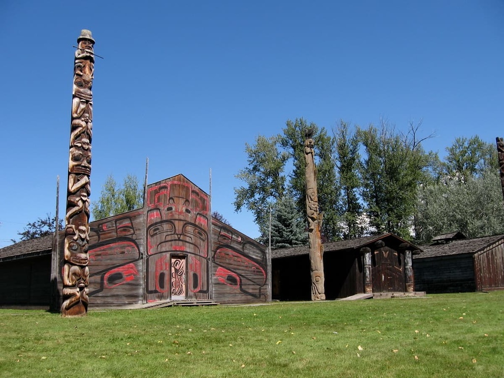
Although no formal archeological sites have been identified in the park, First Nations in the region report that there are sites of ancient Indigenous villages in the park boundaries. The park has also been identified as the location and source of multiple Indigenous legends.
Current traditional and recreational uses of the park include hunting, trapping, fishing, and the gathering of medicinal and ceremonial herbs.
Over the past many hundreds of years, First Nations have used the area, creating a network of rustic trails that run in the park and extend beyond its borders. The trails were likely used for communication and access into the region for fishing and hunting.
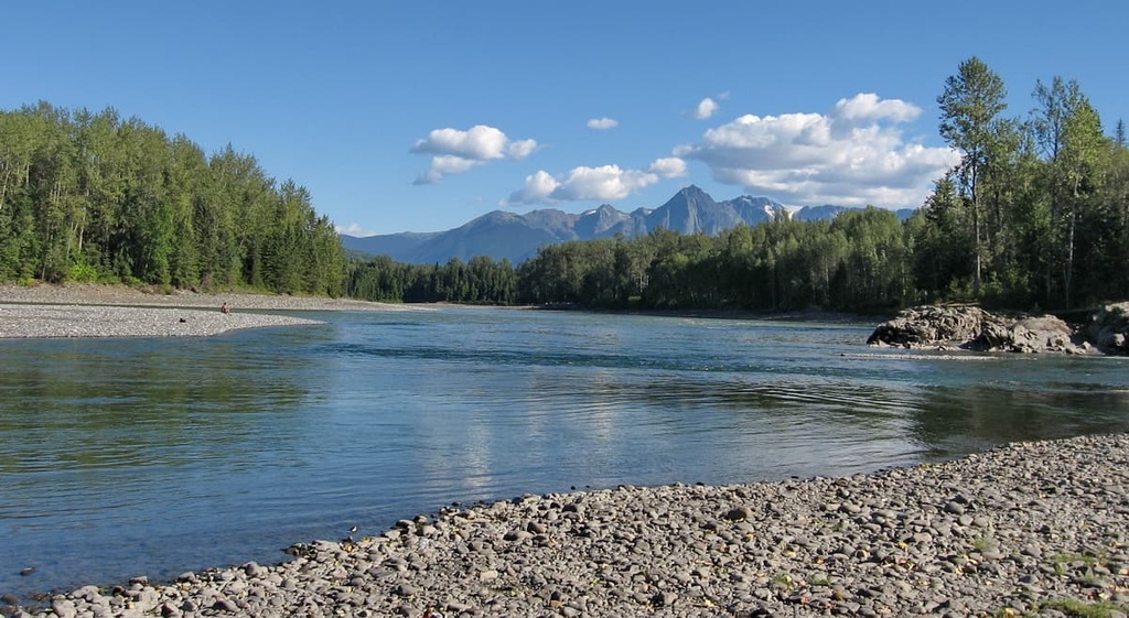
Swan Lake/Kispiox River Provincial Park contains a diverse collection of landscapes that aren’t common in northern British Columbia. Some of the main attractions of the park include canoeing the chain lakes, which are unusual in this part of the country, and fishing in some of the more accessible lakes.
A typical canoe trip in the park typically consists of paddling across Brown Bear Lake to the portage trail that connects it to Swan Lake. The shores of the lakes contain many suitable camping sites as do some of the islands in the middle of Swan Lake.
It is possible to also canoe across Club Lake; however, the waterways between Club and Stephens Lake are impassable and must be portaged if you want to continue towards the Kispiox River.
There are no official hiking trails in the park; however, First Nation use over the past several hundred years has created trails to several of the lakes that are suitable fishing destinations. There is a rustic trail to Hodder and Footsore Lake, which are both located at the southern end of the park. Other rustic trails cross the park, too, and they are typically used and created by hunters and trappers.
One of the main delights of visiting Swan Lake/Kispiox River Provincial Park is the opportunity to venture where few people go even though you’re still able to access the park by road. The park is considered too remote for many commercial ventures; however, the road access makes it easy enough for outdoor enthusiasts to make their way to the area for backcountry adventures.
Besides canoeing and fishing, there are other potential activities in the park. Other activities to try are swimming, wildlife viewing, hiking, backcountry camping, mountaineering, and backcountry skiing.
Swan Lake/Kispiox River Provincial Park is located in the remote wilderness of the Kitimat-Stikine Regional District in northern British Columbia. The following are some of the closest cities and towns to the park that offer much-needed services while traveling around the northern wilderness.
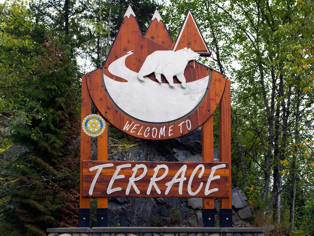
Terrace is a city located on the western side of the Hazleton Mountains. It is situated about 175 km (105 mi) to the southwest of Swan Lake/Kispiox River Provincial Park. Located at the junction of Highway 16 and Highway 37, it is the primary community within the Regional District of Kitimat-Stikine.
Searching for wild mushrooms in the fall and picking berries in the summer are two of the ways that the residents of Terrace get to enjoy their wilderness backyard. Other activities in the area include fishing, hiking, mountain biking, climbing, and hunting.
Some of the most popular hikes around Terrace include the trails to Ferry Island, Gunsight Lake, Terrace Mountain, Sleeping Beauty Trail, and Wesach Falls. Wesach Mountain is also one of the top local peaks to bag.
Additionally, the alpine areas of Seven Sisters Provincial Park are located less than an hour to the north and Gitnadoiks River Provincial Park is about the same distance to the southwest of Terrace.
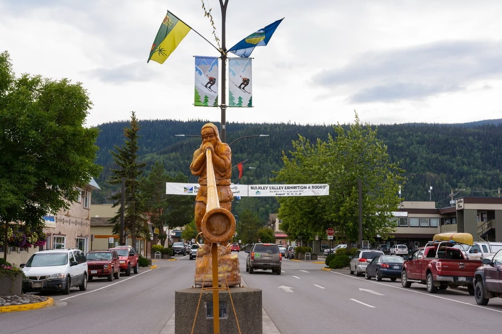
Smithers is situated about 150 km (90 mi) to the south of Swan Lake/Kispiox River Provincial Park near Babine Mountains Provincial Park. With a population of over 5,000 people, it is a major service hub for the Bulkley Valley.
As it is surrounded by beautiful forests and mountains, Smither has many fantastic local hikes and wilderness areas for visitors to enjoy. Some of the best hikes around Smithers include the Crater Lake Trail, Malkow Lookout Trail, Silvern Lake Trail, and the Call Lake Trail. Additionally, the Harvey Mountain Trail and the trail to Hudson Mountain are among the most popular mountain trails located near Smithers.