Scan the QR code and open PeakVisor on your phone
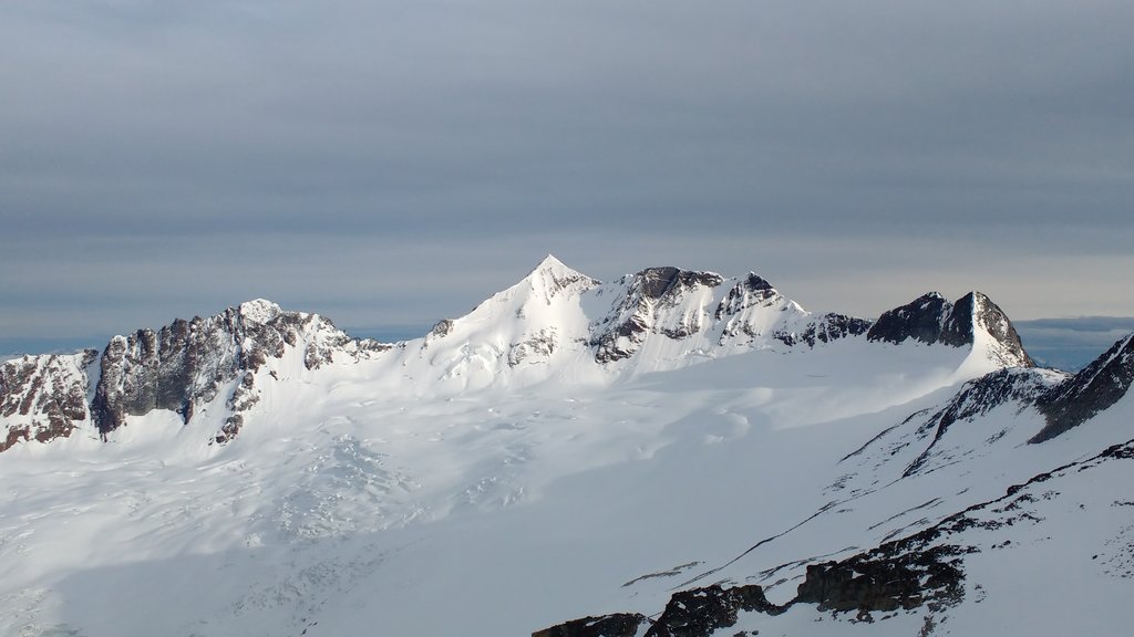
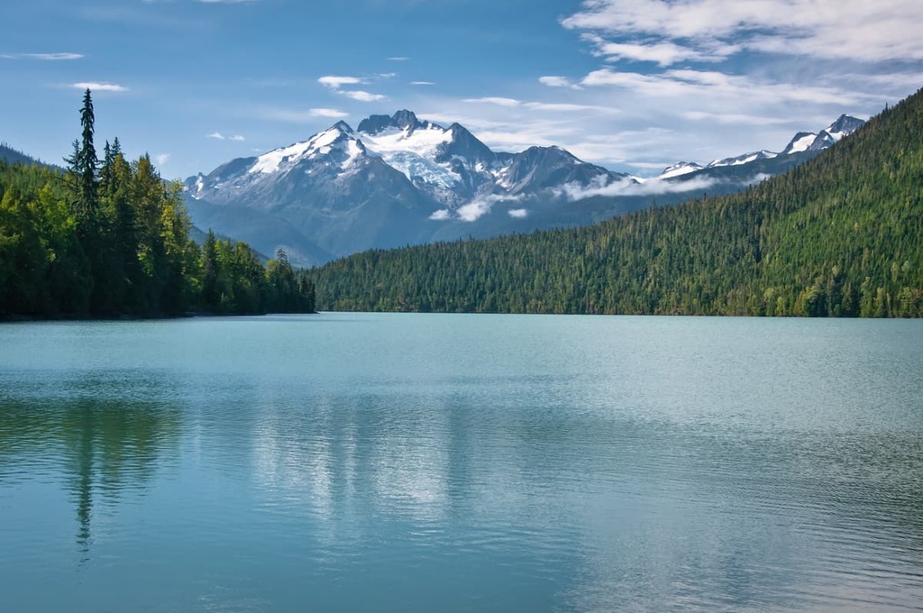
Nisga’a Memorial Lava Beds Provincial Park is a protected area located near the western coast of central British Columbia, Canada in the Hazelton Mountains to the east of the Canadian Coast Mountains. There are 4 named peaks within the park, the highest and most prominent of which is Mount Priestly (2,358 m/7,740 ft).
Located to the east of the Canadian Coast Mountains in central British Columbia, Canada, Nisga’a Memorial Lava Bed Provincial Park (Anhluut'ukwsim Lax̲mihl Angwinga'asankswhl Nisg̲a'a) is a unique location that allows people to visit the youngest volcanic landscape in Canada. It also gives visitors a chance to learn about the First Nations who have inhabited the region for generations.
The park is located within the Nass Ranges of the Hazelton Mountains. The Hazelton Mountains may appear to be part of the Canadian Coast Mountains; however, they are classified as geologically distinct. The Hazelton Mountains also include the Kispiox Range, Bulkley Ranges, and the Tahtsa Ranges.
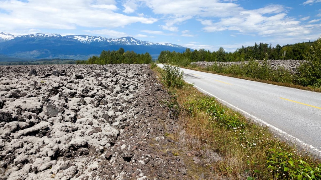
Nisga’a Memorial Lava Bed Provincial Park is part of the Regional District of Kitimat-Stikine. As a result, some of the major communities located near the park are Terrace, Smithers, and Prince Rupert. The Nisga'a Highway is the primary access point to the park and to the communities of the Nisga’a Nation.
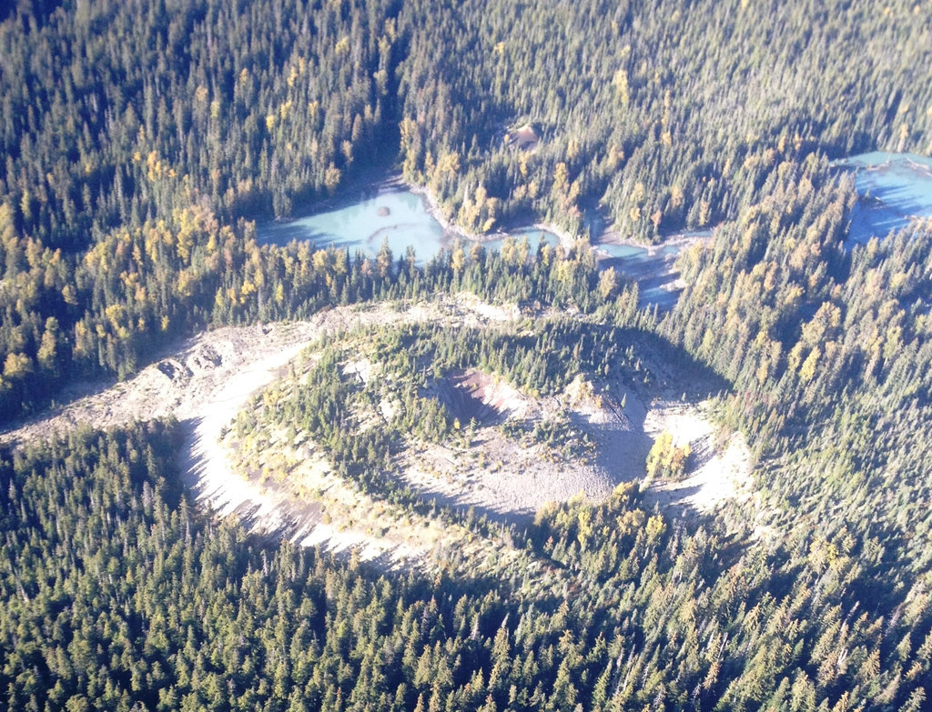
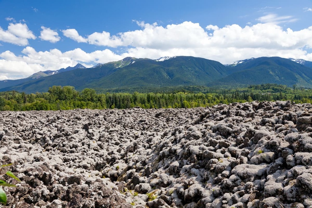
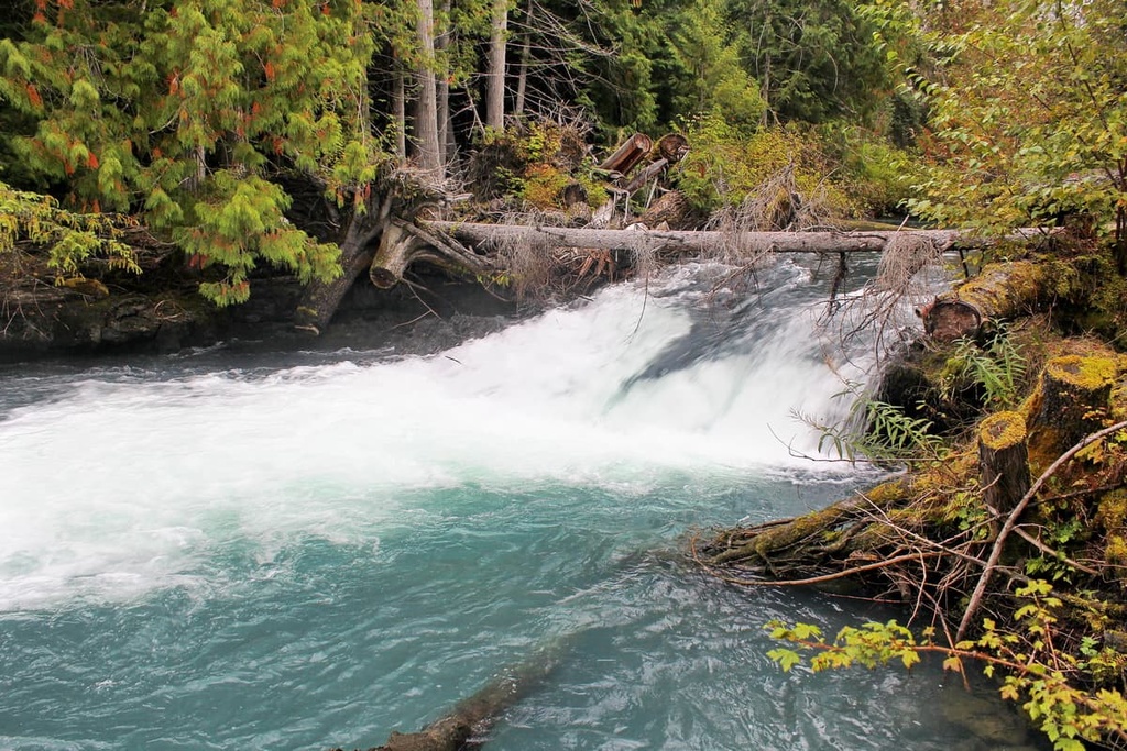
One of the primary features of Nisga’a Memorial Lava Bed Provincial Park is the Nisga’a alkali basalt flow. Estimated to have last erupted in the seventeenth or eighteenth century, the region;s volcanoes produced a large volume of lava when they were last active
The lava flowed from the volcanic cone down Crater Creek to the Tseax River where a lava dam was created, which greatly enlarged the area of Lava Lake. From here, the lava continued to flow, moving the river and finally spilling out over the Nass River floodplain.
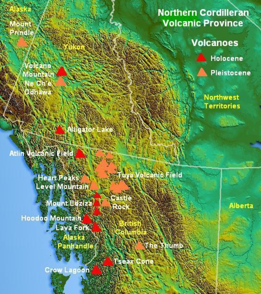
The Tseax Cone is part of the Northern Cordilleran Volcanic Province and is therefore part of the Pacific Ring of Fire. The volcanic activity of the Tseax Cone is caused by a rifting or tearing apart of two sections of the North American Plate. As the Pacific Plate slides to the north along the Queen Charlotte Fault, the movement of this plate causes rifting along the edges of the continent.
There are several features that are well represented within the park that show what kind of lava erupted and how it moved. The lava from the Tseax Cone was made of basalt and is typically gray, black, or dark brown in color.
Pāhoehoe is an interesting, rope-like lava formation which is found at the volcano. A paāoehoe flow typically advances in bursts that continuously break forward from a cooled node.
Additionally, there are a number of lava tubes in the region. These tubes form when lava cools on the surface and forms a crust that insulates the liquid lava below. Eventually, this liquid lava can create large tunnel-like structures, like what’s seen in parts of Nisga'a to this day.
Nisga’a Memorial Lava Bed Provincial Park is located along the interior side of the coastal wet belt. The park’s high levels of rainfall are a result of the warm, moisture laden air that rises over the coastal mountains from the Pacific. Although significant rainfall occurs along the coast, substantial amounts of precipitation still manage to fall to the east of the Coast Mountains.
Large areas of the park are covered in the lava flows where the vegetation is delicate. Within the lava flow, lichens, mosses, shrubs, heather, and grasses are the common pioneer species that emerge from the fertile pockets amidst the ravaged landscape.
The valley forests in the region contain the largest variety of coniferous species in the province, as they are part of the Interior Cedar-Hemlock ecosystem. Western red cedar and western hemlock are the typical climax trees of these valleys. Douglas fir and lodgepole pine also grow in the area alongside spruces and subalpine fir.
Subalpine fir and white-Engelmann spruce hybrids typically cover the slopes and higher elevations in the region. Additionally, subalpine fir generally dominates around the tree line. Above the treeline, the rocky landscape is filled with heathers, grasses, sedges, and a wide variety of wildflowers.
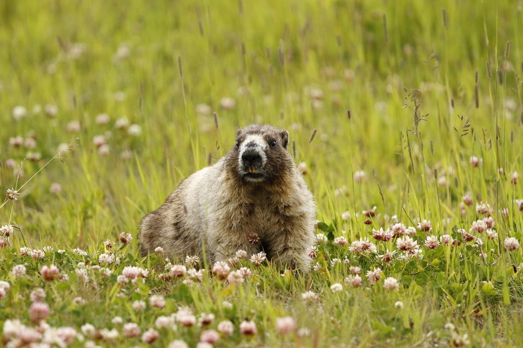
The park’s landscape remains largely inhospitable; however, moose inhabit the slopes and wetlands in the region, while mountain goats and marmots inhabit the alpine areas. Bears and many other species also live in the area and there is an abundance of birds that inhabit and migrate through the park.
The Nisga’a Memorial Lava Beds Provincial Park is located within the traditional territory of the Nisga’a First Nation. The Nisga’a and their ancestors have lived in the region since time immemorial.
The Nisga’a Nation is divided into four tribes: G̱anada (Raven), Gisḵ’aast (Killer Whale), Lax̱gibuu (Wolf), and Lax̱sgiik (Eagle). The four tribes are further divided into houses and clans, which are groups of houses with similar ancestry.
Traditionally, the Nisga’a harvest food year-round from the beach and the sea, including shellfish, seaweed, fish, and sea lion. Additionally, the Nisga’a traditionally hunt mountain goats, marmots, and birds in the forests.
Pre-European contact, the NIsga’a traditionally live in long, dugout cedar houses that often held several extended families. Softened cedar bark was used to fashion skirts, capes, and hats for clothing, in addition to blankets to keep people warm. Cedar armor, helmets, and loincloths were donned during warfare.
During the fourteenth century and then the eighteenth century, the Tseax Cone erupted. The events of the eighteenth-century eruption are told in the oral histories and legends of the Nisga’a people.
A Nisga’a legend of the eruption tells of two children who were torturing salmon, when they were happened upon by an elder who warned them their deed would upset the Creator. The ground began to shake, and a scout was sent to investigate. Smoke and flames were seen, and the scout ran to warn the people.
Some people fled up the mountain while others canoeed to the far side of the river, to be caught in the lava flow. As the people watched the lava flow over their villages, Gwaxts’agat, a powerful being, emerged to block the advancing lava. Gwaxts’agat blew against the lava with his great nose, finally cooling and stopping the flow. After stopping the lava, Gwaxts’agat retreated into the mountain where it still remains.
It is estimated that more than 2,000 people died from this most recent eruption, many of which likely perished from the hot, suffocating gasses of the volano’s pyroclastic flow. The Tseax Cone eruption is arguably the greatest geophysical disaster in the recent history of what’s now Canada.
Anhluut’ukwsim Laxmihl Angwinga’asanskwhl Nisga’a (Nisga’a Memorial Lava Bed Park) was established in 1992 in order to conserve nearly 18,000 hectares of unique landscapes and history. The park was the first to be jointly managed by a First Nation and BC Parks. This has provided the Nisga’a with a powerful opportunity to share their history and their culture with visitors.
Nisga’a Memorial Lava Bed Provincial Park is more than a volcanic landscape. In addition to the stunning wilderness and landscape, the park is filled with the culture of the Nisga’a Nation. The following are some of the major trails and attractions visitors can enjoy while in the park:
The park has five short interpretive trails that provide access to some of the park’s special features. The Crater Creek, Beaupre Falls, Tree Mould Trail, Vetter Creek, and Fish Wheel Trail lead visitors through the beautiful landscape while helping them recognize the significance of the area and its features.
From the interpretive trails, you’ll be able to view various lava formations, lava tubes, lava casts, and waterfalls. The trails are short enough that most visitors can walk the majority of them within a day.
The Tseax Lava Cone is both a delicate ecosystem and a culturally significant area for the Nisga’a First Nation. The trail to the lava cone is only accessible via guided tour. The trail is considered a moderate hike and the tour lasts about four hours. Reservations are recommended as drop-in scheduling is limited.
On the tour, you will have the opportunity to visit the lava cone and view the stunning wilderness. Additionally, your tour guide can provide you with extensive information about the volcano, the area, the history of the Nisga’a, and Nisga’a culture.
Located about 500 m (0.3 mi) to the east of Ansegagen Creek, the Aiyansh Hot Springs are a unique destination situated along the edge of the provincial park.
The hot springs have changing rooms, ramps, and a boardwalk to make them easily accessible. Kept warm by the same geological activity that forced the eruption of the Tseax Cone, the hot springs are a welcome treat after a day of hiking or driving.
Nisga’a Memorial Lava Bed Provincial Park is located in a remote part of central British Columbia where the coast is rugged and the forests are dense. The following are some of the main communities that are situated near the park.
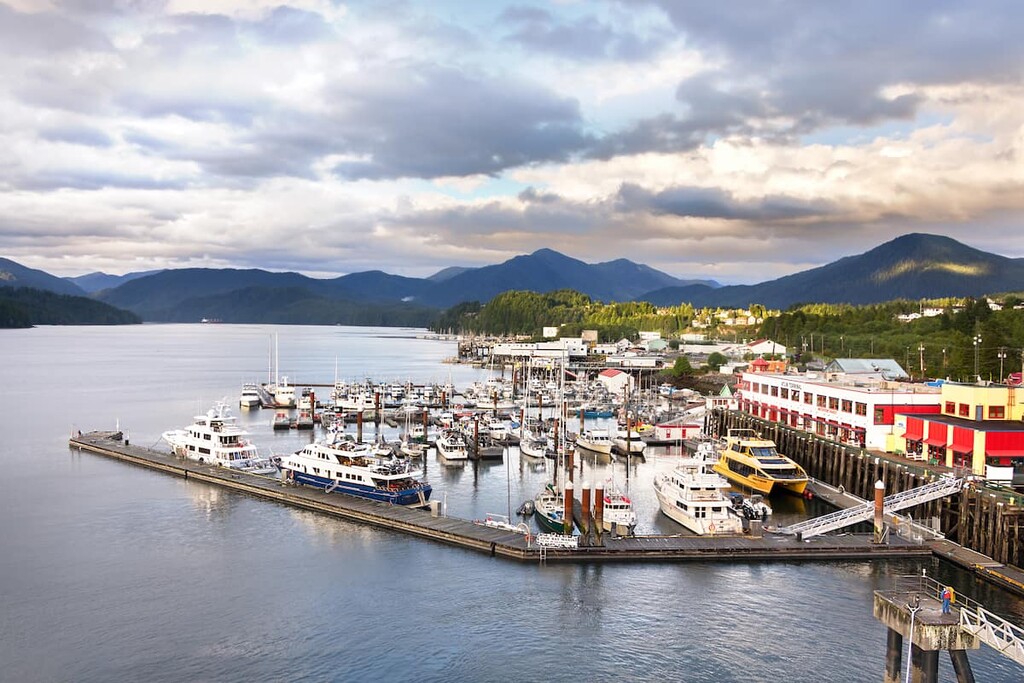
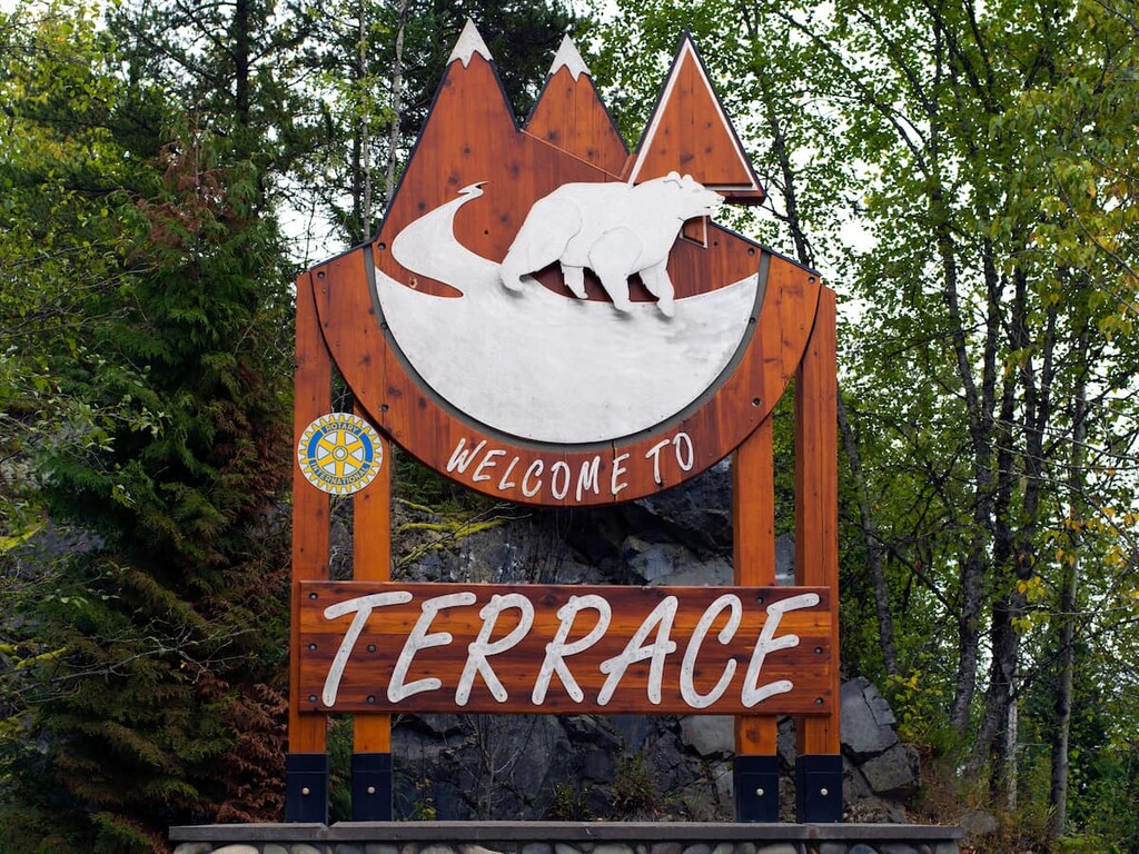
Terrace is located on the west side of the Hazleton Mountains and is situated about 80 km (48 mi) to the south of Nisga’a Memorial Lava Bed Provincial Park. As the primary community in the Regional District of Kitimat-Stikine, it has most of the major services that visitors may require.
The wilderness surrounding Terrace is known for its fishing, hiking, mountain biking, climbing, and hunting. In fact, locals often spend the autumn searching for wild mushrooms and the summer picking berries.
Some of the most popular hikes around Terrace are Ferry Island, Gunsight Lake, Terrace Mountain, Sleeping Beauty Trail, and Wesach Falls. Wesach Mountain is one of the top local peaks to bag.
The recreation areas of Seven Sisters Provincial Park, Kleanza Creek Provincial Park, Lakelse Lake Provincial Park, and Sleeping Beauty Mountain Provincial Park are also only a short drive away from town.
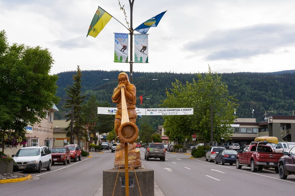
Located on the east side of the Hazleton Mountains along Highway 16, Smithers is a city that has a population of over 5,000 people and is the major service hub for the Bulkley Valley. Located about 280 km (168 mi) to the east of Nisga’a Memorial Lava Bed Provincial Park, the town is surrounded by beautiful forests and mountains.
Some of the top hikes around Smithers include the Crater Lake Trail, Malkow Lookout Trail, Silvern Lake Trail, and the Call Lake Trail. The most popular mountain trails in the region are the Harvey Mountain Trail and the trail to Hudson Mountain.
For additional adventures, you can also check out the Seven Sisters Provincial Park, Babine Mountains Provincial Park, Nadine Mountain Provincial Park, and the Morice River Ecological Reserve, all of which are located only a short distance away and offer various backcountry opportunities and peaks to climb.
Prince Rupert is the transportation hub of British Columbia’s north coast, and it is located about 240 km (144 mi) to the west of Nisga’a Memorial Lava Beds Provincial Park. Like the park, the community has a long history of occupation by First Nations, with evidence of human settlement dating back over 5,000 years.
Some popular attractions to check out while in the city include the tours to Khutzeymateen Grizzly Bear Sanctuary, which features one of the densest populations of grizzlies in North America. Prince Rupert is also the starting point for many wildlife viewing trips, including expeditions to see grizzly bears, salmon, eagles, and whales.
Some of the most popular hikes around Prince Rupert include the Butze Rapids Trail, Tall Trees Trail, and the trail to Wantage Falls. You can also hike Mount Hays via the Kiwanis Trail. Additionally, the Gamble Creek Ecological Reserve, Diana Lake Provincial Park, and Gitnadoiks River Provincial Park are all located only a short distance away from the city.