Scan the QR code and open PeakVisor on your phone
The Kitasoo Spirit Bear Conservancy is located on Princess Royal Island at the southern end of British Columbia, Canada in the Regional District of Kitimat-Stikine. The conservancy is home to the highest concentration of Kermode bears (spirit bears) in the world as well as 10 named peaks. The tallest and most prominent peak in the conservancy is Mount Parry (1,058 m/3,471 ft). Another remarkable peak in the area is Kitasu Hill, which is a basaltic cinder cone located on Swindle Island.
Located along the central coast of British Columbia, Canada, the Kitasoo Spirit Bear Conservancy is centered on Princess Royal Island, which is located at the south end of the Regional District of Kitimat-Stikine.
It encompasses the area from Laredo Sound and Laredo Channel up the Laredo Inlet to Canoona Lake. It also includes the surrounding mountains that extend to the Princess Royal Channel on the east side of Princess Royal Island.
The Kitasoo Spirit Bear Conservancy protects the forested valleys, mountains, and coastal areas on the island that are home to the world’s largest concentration of spirit bears. Mount Parry is the tallest of the peaks in the conservancy, with an elevation and prominence of 1,058 m (3,471 ft).
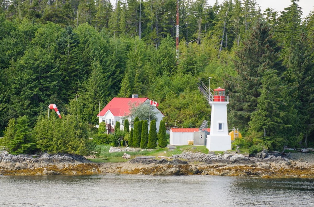
The eastern edge of the conservancy borders the Inside Passage, which is a popular marine route. As a result, the park is easily accessible by boat. Additionally, the village of Klemtu on Swindle Island is accessible via BC Ferries’ Discovery Coast Passage route from Port Hardy.
The Kitasoo Spirit Bear Conservancy is one of many conservancies in the region. Other conservancies and parks that are nearby include:
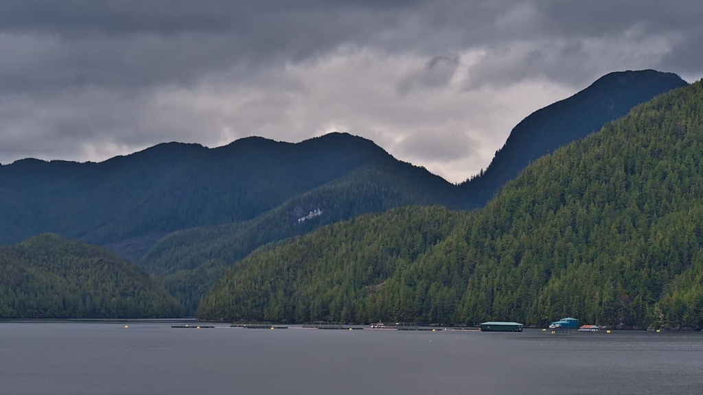
The geology of the Kitasoo Spirit Bear Conservancy is divided into two sections. The easternmost area of the park is part of the Hecate Lowland, while the western side of the park is dominated by the Kitimat Ranges.
The Hecate Lowland is part of the greater Hecate Depression, which is the lowland area between the Coast and Insular Mountains. The Hecate Lowland is found along the mainland coast from Prince Rupert to Vancouver, and it also includes some of the offshore islands.
These lowlands are representative of a late Tertiary erosion surface that truncates granite and older rocks. The bare bedrock of the lowlands show the sculpting effects of the region’s Pleistocene glacial erosion. Sea-level cirques show the historic extent of the glaciers during the Pleistocene.
The lowlands of Kitasoo Spirit Bear Conservancy rise toward the east until they meet the Kitimat Ranges of the Coast Mountains on the east side of Princess Royal Island. The Kitimat Ranges rise from the Hecate Depression and include the granitic mountains along the coastal archipelago as well as the mainland from the Nass River to the Bella Coola River.
In general, the Kitimat Ranges rise from sea level to reach elevations between 1,830 m (6,000 ft) and 2,440 m (8,000 m). The mountains are largely eroded and they feature the granitic rock of the Coast Intrusions as well as bold, monolithic granitic mountains that are similar to the mountains of Yosemite National Park.
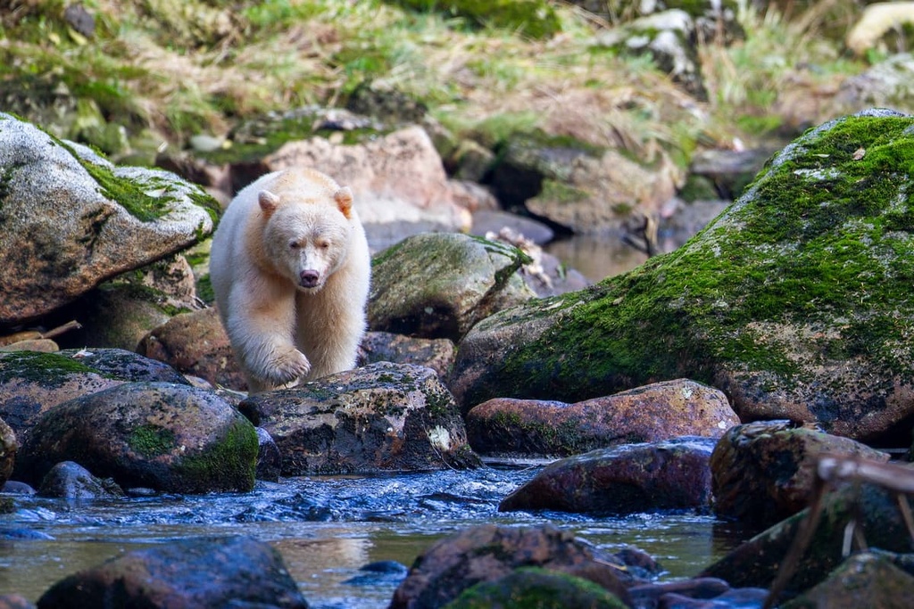
The Kitasoo Spirit Bear Conservancy encompasses a vast marine area as well as part of a terrestrial ecosystem called the Great Bear Rainforest. The primary ecological feature of the conservancy is the presence of the spirit bear, which is also called the Kermode bear.
The spirit bear (Ursus americanus kermodei) is a white-furred subspecies of the American black bear that inhabits the central and north coast regions of British Columbia. It is estimated that there are over 400 fully white spirit bears in existence, with nearly a quarter of those living within or near the Kitasoo Spirit Bear Conservancy.
The conservancy is dominated by old growth temperate rainforest with pockets of second growth trees that are the result of hand logging activities at the beginning of the twentieth century. There are many bogs upon the lowlands where the peatlands form a mosaic of blanket bog, bog woodland, and scrub forest on the flat terrain.
The rainforests in the conservancy are dominated by western hemlock, western redcedar, amabilis fir, and Sitka spruce, the latter of which is especially prevalent in coastal areas. Mountain hemlock, yellow cedar, and amabilis fir are common at the higher elevations in the Kitimat Ranges of the conservancy.
Marbled murrelets, a red-listed species in British Columbia are found in Laredo Inlet as is an abundance of bald eagles. Colonies of puffins, murres, and cormorants all inhabit the windswept outer islands of the conservancy, too. Oystercatchers, pigeon guillemots, phalaropes, and rhinoceros auklets also inhabit the conservancy.
Orcas, humpback whales, Stellar sea lions, sea otters, elephant seals, and porpoises can be seen in the waters surrounding the Kitasoo Nature Conservancy. As far as land mammals go, the area is home to a significant population of grey wolves, as well as black bears, mountain goats, deer, ravens, and foxes.
The Kitasoo Spirit Bear Conservancy is in the traditional territories of the Kitasoo/Xai’xais, Heiltsuk, and Gitga’at First Nations. The area of the conservancy has been and is still used to supply food for the First Nations as well as provide social, ceremonial, cultural, and economic value to local residents.
The conservancy encompasses an area that includes several ancient village sites, seasonal camp sites, and other cultural sites. The Laredo Inlet is the heartland of the Kitasoo First Nation, and the area has been used for berry picking, fishing, bark stripping, gathering of medicinal plants, and other sustenance activities.
There are several documented sites of archeological and cultural importance in the park. The Kitasoo/Xaixais claim that there are many undocumented cultural sites across the conservancy. The local First Nations lived relatively undisturbed for thousands of years, until the end of the eighteenth century.
Between May and August of 1788, First Nations made contact with Captain Charles Duncan and traded sea otter skins with him for other goods. Duncan traded between Princess Royal Island and Queen Charlotte Island, and, while on this trading mission, he gave Princess Royal Island its English name after his sailboat, the Princess Royal.
At the end of the nineteenth century many First Nations citizens were forced to live in centralized villages and reservations, which meant that they were moved out of the borders of the Kitasoo Spirit Bear Conservancy. Over the following century, minor logging operations cut some of the old growth forests; however, most of the forest was left intact.
In 2006, the Kitasoo Spirit Bear Conservancy was officially established to aid in the protection of the old growth forests and the spirit bears that reside on Princess Royal Island. The conservancy has since become a destination for wildlife viewing, as many visitors hope to spot one of the area’s majestic white bears.
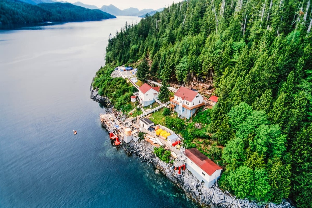
Visitors can get to the Kitasoo Spirit Bear Conservancy via the BC Ferries route from the village of Klemtu or by private boat and kayak. Many people are drawn to the region’s pocket beaches where beachcombing and relaxing are popular activities while others hike the trails on Swindle Island.
One of the popular destinations on Swindle Island, which is located at the southern end of the conservancy, is Kitasu Hill. Kitasu Hill is a relatively young basaltic cinder cone that rises a couple hundred meters above sea level.
Most visitors come to the conservancy to try and spot one of the famous Kermode bears. While looking for the elusive white bears, visitors are often treated to views of incredible sea life as well as the many birds which inhabit the area.
While visiting the conservancy, visitors may stay in their boats in one of the protected anchorages of Kitasoo Bay, Surf Inlet, and Laredo Inlet. If arriving via kayak or ferry, visitors can camp throughout the conservancy and enjoy the spectacular scenery.
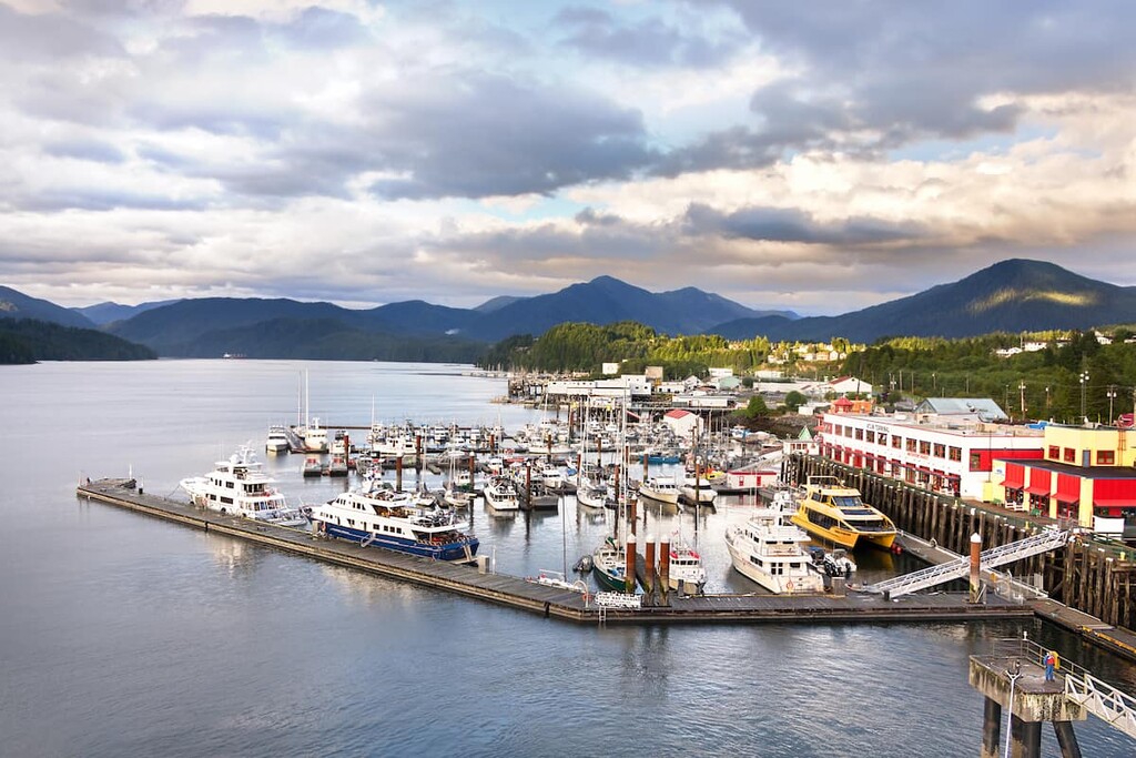
The central coast of British Columbia is a relatively remote and uninhabited area of the province. The following are some of the communities that have been built along the rugged central coast near Kitasoo Spirit Bear Conservancy that you can check out during your travels.
Also known as Waglisla, Bella Bella is the home of the Heiltsuk First Nation and is located on Campbell Island, about 40 km (24 mi) southeast of Princess Royal Island and the Kitasoo Spirit Bear Conservancy.
Bella Bella is the largest community on the Central Coast of the Queen Charlotte Strait, and it serves as a jumping point for many adventures along the rugged coast of central British Columbia.
The community has ferry service from Port Hardy on Vancouver Island and airport with flights to the village of Klemtu, which is the closest community to the Kitasoo Spirit Bear Conservancy. Bella Bella is also located adjacent to the incredible wilderness areas of the Fiordland Conservancy, Hakai Protected Area, and the many islands along the central coast.
First Nations have lived in the Kitimat area for countless generations; however, the current community was constructed in the 1950s when Alcan was invited to work on a hydroelectric project to power their aluminum smelting plant.
Kitimat is located alongside tidal waters at the head of the Kitimat Arm of the Douglas Channel, about 100 km (60 mi) to the northeast of Kitasoo Spirit Bear Conservancy. The town has over 8,000 residents who benefit from the thoughtful city planning of Clarence Stein, who created a beautiful and functional town for the residents who were initially mostly employed by Alcan.
Thanks to its many trails that lead up mountains, along creeks, along rivers, through valleys, or along the ocean shore, Kitimat is home to endless incredible wilderness treasures for visitors to experience. Some of the popular hiking areas located near Kitimat include Gitnadoiks Provincial Park, Huchsduwachsdu Nuyem Jees / Kitlope Heritage Conservancy, and Seven Sisters Provincial Park.