
Scan the QR code and open PeakVisor on your phone
Situated about 100 km (60 mi) off the coast of British Columbia, Canada, Gwaii Haanas National Park Reserve and Haida Heritage Site is important for its protection of the environment and cultural sites of the Haida First Nation. In the Haida language, Gwaii Haanas means “islands of beauty” and visitors will have the opportunity to immerse themselves in the incredible environment and culture of the park.
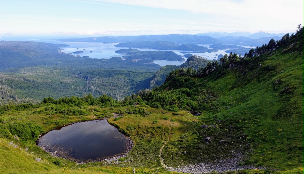
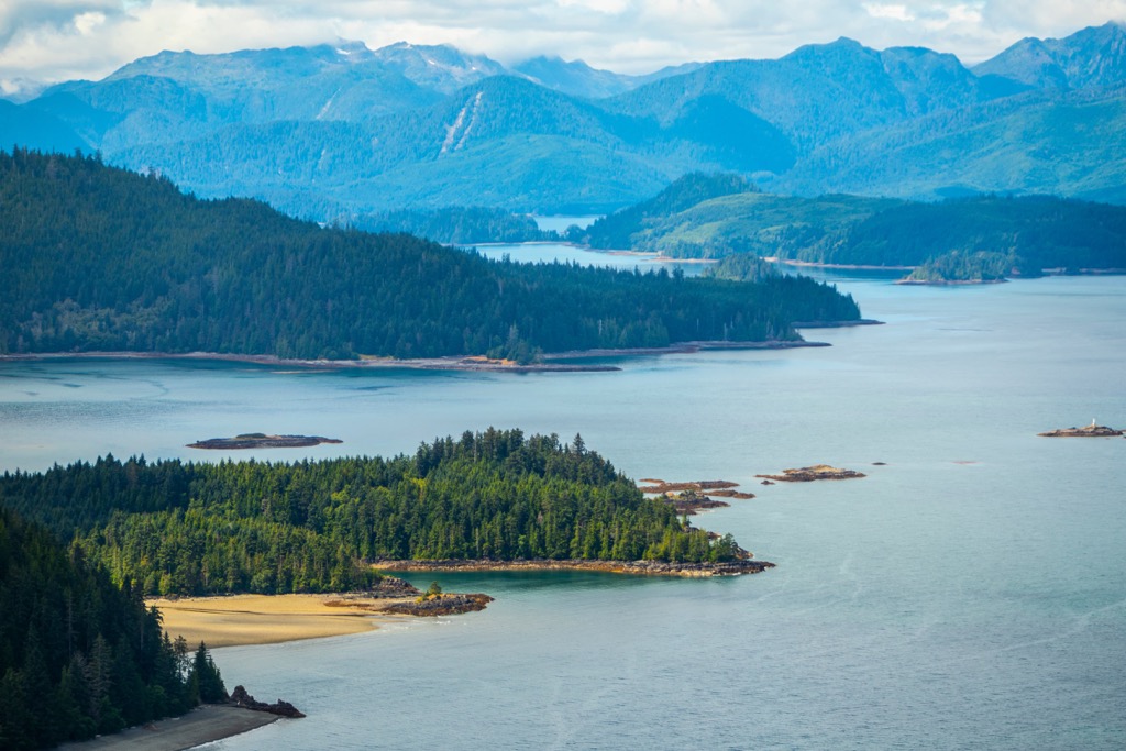
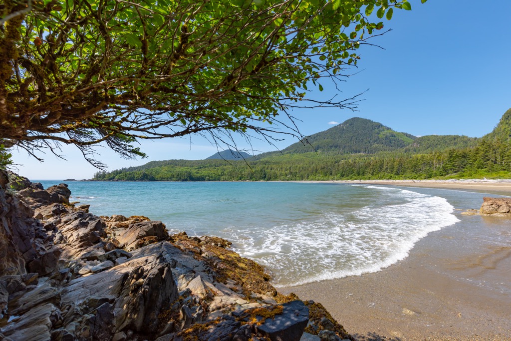
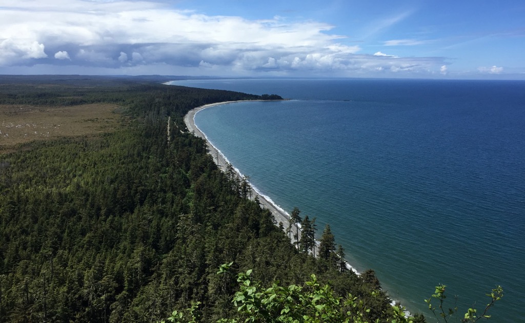
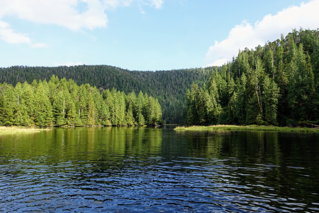
The reserve covers nearly 1,500 square kilometers (580 square miles) of land, including 138 islands, over 43 named peaks in the San Christoval Mountains, and many islets, fjords, freshwater lakes, and hot springs. Whether visiting during a day trip, or spending a week, visitors will have an experience of a lifetime.
Gwaii Haanas Park reserve and Haida Heritage site is the southern archipelago of Haida Gwaii, situated about 100 km (60 mi) off the coast of northern British Columbia, Canada. The reserve and heritage sites encompass 138 of the 150 or so islands that make up Haida Gwaii.
The national park reserve and heritage site are only accessible by float plane and boat. There are no facilities in the parks and all visitors must have a permit to enter and stay. Visitors can come as part of commercial tours or as their own, independent group.
To minimize impact on natural and cultural features, the number of visitors at any one time and annually is strictly controlled within the park. The park staff balance the number of visitors arriving as part of a commercial tour or arriving independently and neither are given preference when applying for a permit.
Most adventures with the Gwaii Haanas National Park Reserve and Haida Heritage Site start in the communities of Skidegate, which is home to the Parks Canada administration offices for the park and is also home to the Haida Heritage Centre. Visitors may also arrive for their adventures in the park through the regional airport in the community of Sandspit.
Gwaii Haanas National Park Reserve and Haida Heritage Site is the largest conservation area in Haida Gwaii, and it encompasses about 15% of the entire land mass of the archipelago. Indeed, when including the surrounding marine area which is protected as the Gwaii Haanas National Marine Conservation Area reserve, it is the only place in the world that is protected from the seafloor to the mountain peaks.
The following are some of the other parks and conservation areas in Haida Gwaii:
Due to the large temperate rainforests, the diversity of wildlife, the picturesque marine areas, and the incredible cultural heritage, Gwaii Haanas is a very popular tourist destination. While there is so much to experience, visitors should first ensure they have the proper permits before booking travel to the islands.
Haida Gwaii, which used to be called The Queen Charlotte Islands, are part of the chain of mountains off the coast of British Columbia. Known as the Insular Mountains, the two main ranges are the Queen Charlotte Mountains of Haida Gwaii and the Vancouver Island Ranges on Vancouver Island.
Haida Gwaii has four subranges upon the archipelago’s two major islands, Graham Island in the north and Moresby Island in the south. The Cameron Range, Crease Range, and the McKay Range are found upon Graham Island, and the San Christoval Range is the 50 km (30 mi) long backbone of Moresby Island.
The islands of the archipelago, surrounding Moresby Island, are outlier peaks of the partially submerged San Christoval Range Located at the north end of the park, and rising to 1,112 m (3,648 ft), Mount de la Touche is the tallest and most prominent mountain in the park.
The islands of Haida Gwaii and the mountains of Gwaii Haanas were formed when a chain of islands collided with the continental margin millions of years ago. The islands’ fossil record shows that much of Gwaii Haanas was once part of a rich marine environment that existed over 350 million years ago. Limestone is one of the common sedimentary rocks that are formed in a marine environment.
Around 230 million years ago, the growing island chain was affected by major volcanic upheavals that created massive basalt formations. Basalt is a dark, fine-grained rock formed from the rapid cooling of low-viscosity lava, such as when volcanoes erupt underwater. Further volcanic activity created more volcanic and sedimentary formations, including pillow lavas which are round, bulging masses of basalt.
Rifting in the seafloor pushed the oceanic plates and North America together, and the less buoyant oceanic plate subducted beneath the western edge of North America. Tectonic activity compressed and raised the seafloor from the seabed to form the mountains, many of which are well above sea level.
The islands are on the western continental margin of the North American continental plate, where it is still colliding with the oceanic plates. There are active faults along the west coast of Haida Gwaii that are part of ongoing tectonic activity. Gwaii Haanas’ and Haida Gwaii are the most tectonically active areas in Canada, and as such, geological events continue to affect the archipelago.
During the Pleistocene, glaciers grew upon the island and coalesced with the cordilleran ice sheet that reached from the mainland. During the most recent glacial maximums, which occurred between 100,000 and 10,000 years ago, Haida Gwaii was connected to the mainland by a low-lying plain between Haida Gwaii and where the community of Prince Rupert now sits.
During the Pleistocene, the volume of water trapped as continental ice lowered the sea level significantly, and as such, many of the coastal regions were exposed. The glaciers formed among the mountain peaks and grew towards the ocean, creating characteristic U-shaped valleys. As the sea level rose, the valleys along the coast flooded and became the characteristic fjords of the west coast.
While most of North America was covered in ice throughout the Pleistocene, there were isolated areas that remained ice-free for at least some of the most recent glacial maximums. One such area is the Refugium Range on Vancouver Island, and there were also pockets on Haida Gwaii which also remained unglaciated. The unglaciated areas create unique ecosystems by having allowed fungal, plant, and animal species to survive, which were otherwise destroyed by the glaciation.
About 57,000 years ago, Haida Gwaii was likely covered by tundra and meadows where herds of animals grazed. The presence of coprophilous (dung-loving) spores were excavated from fossil layers in Naikoon Provincial Park which indicates that mammoth, bison, caribou, or mastodons likely inhabited Haida Gwaii for a time.
As the Pleistocene was ending and the glaciers were receding, Haida Gwaii was likely free of ice thousands of years before the rest of British Columbia’s coast. The evolving ecosystems of Haida Gwaii were several thousand years ahead of the mainland and other coastal islands along the west coast. The tundra transformed to meadows and eventually the forests started growing.
Being ice-free before the rest of the coast combined with the glacial refugium on Haida Gwaii (places that remained free of ice during a glacial maximum) created a unique biocultural zone where Haida Gwaii has many unique, and endemic animals and plants.
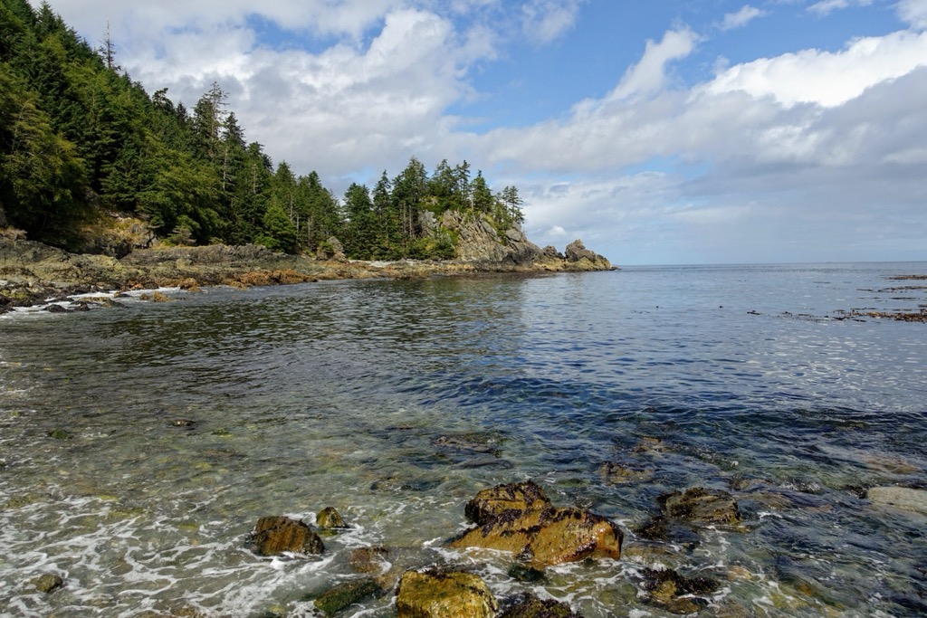
The climate of Gwaii Haanas is wet and mild, which is characteristic of the coastal mountainous areas. Frequent winds and precipitation along the west coast of Haida Gwaii has limited the development of communities to the east side, which has fairer weather. Indeed, Haida Gwaii has the wettest climate in Canada, with the west coast receiving 4,200 mm of rain during the year.
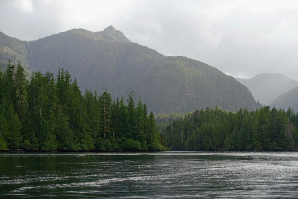
The wet and mild climate is responsible for the super productive forests that dominate the islands. The lower elevations are dominated by forests of Sitka spruce, western red cedar, western hemlock, and shore pine. Due to the wet environment, there were rarely large-scale forest-destroying disturbances, like fires. As such, the forests of Haida Gwaii were ancient, and new trees only had the opportunity to grow when canopy trees fell.
Up the slopes of Gwaii Haanas are forests of hemlock and yellow cedar, while the subalpine is characterized as having mountain hemlock forests, parkland, alpine meadows, and heaths. The alpine area of Haida Gwaii and Gwaii Haanas is representative of the Coastal Mountain-heather Alpine Zone, which is known to have large communities of heather covering the peaks.
The alpine has a covering of evergreen dwarf shrubs, especially white and yellow mountain heather, and partridgefoot. Any of the alpine meadows are very lush, with a variety of grasses, sedges, and forbs. Rocky outcrops, boulder fields, talus slopes, and avalanche tracks are home to many of the rare vascular plant species of Haida Gwaii.
Black bear, pine marten, river otter, Haida ermine, dusky shrew, silver haired bat, California myotis, Keen’s myotis, little brown bat, and deer mouse are among the few native mammal species on Haida Gwaii. Another indigenous species to the island, the Dawson caribou, has become extinct, when in 1908 the last three known specimens were killed.
Haida Gwaii is sometimes referred to as “the Galapagos of the north” because in similar fashion to the Galapagos Islands, isolation has created many endemic animal subspecies. The pine marten, Haida ermine, and Keen’s mouse are among the 39 known endemic subspecies on the islands. Additionally, the Haida Gwaii black bear has adapted to have a larger and stronger jaw than mainland relatives, which has adapted to crush shellfish.
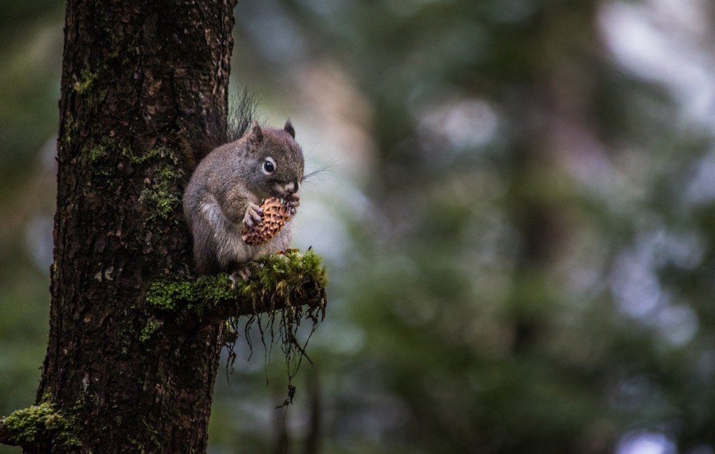
Sitka black-tailed deer, rocky mountain elk, European red deer, raccoon, red squirrel, muskrat, beaver, and several rat species are among the animals that were introduced to the islands. Of note are the black-tailed deer, which can cause significant destruction to the understory of the forests. Indeed, there is a noticeable difference between the density of the understory of the forests with deer versus the isolated forests of small islands without any deer.
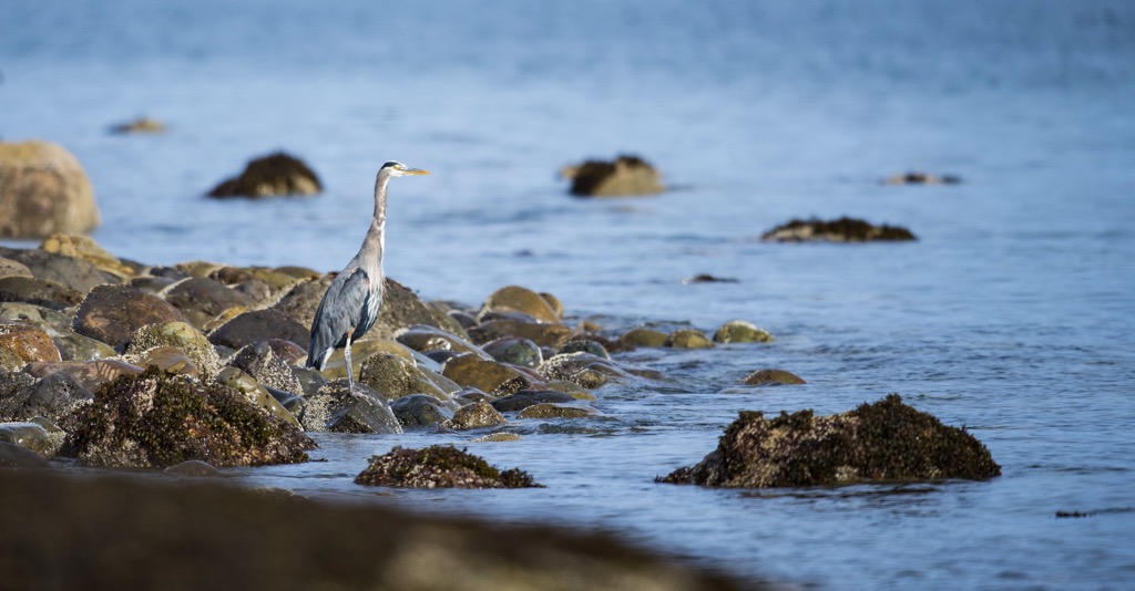
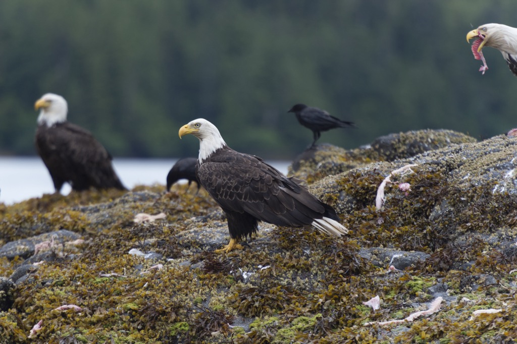
Gwaii Haanas is visited by over 200 bird species for feeding, breeding, resting and nesting. From May to August, Gwaii Haanas is inhabited by about 750,000 nesting seabirds, including sandpipers, geese, murrelets, petrels, cormorants, gulls, auklets and puffins, as well as relatively high concentrations of bald eagles and peregrine falcons.
Some other bird species that you may see are the endemic pine grosbeak, sooty song sparrow, northern saw-whet owl, Queen Charlotte hairy woodpecker and Steller’s jay subspecies. While introduced birds include, the ring-necked pheasant, house sparrow, and European starling.
Due to the introduction of small predators, like rats and raccoons, many burrow-nesters such as the Leach's storm-petrel, fork-tailed storm-petrel,ancient murrelet, tufted puffin, horned puffin, rhinoceros auklet, and Cassin's auklet suffer reduced populations.
The rich waters surrounding Gwaii Haanas host at least 23 of marine mammals, including whales, dolphins, and the largest colony of Steller's sea lions on Canada's west coast. While sea otters were once abundant around the island, they were extirpated by the twentieth century. However, there have been recent sightings of couples and individuals in Gwaii Haanas.
Further extirpation in the region saw a decimation of the local populations of basking sharks between 1955 and 1969. During that time, the commercial salmon fisheries deemed basking sharks a nuisance and so the Coast Guard and the Department of Fisheries and Oceans were part of the eradication program that saw the drastic decline in their population. Basking sharks have been seen in the waters of Gwaii Haanas, taking refuge while their population recovers.
Visitors to the archipelago may have encounters with grey whales, sei whales, humpback whales, fin whales, blue whales, and minke whales. Harbour porpoises, Dall’s porpoises, and Pacific white-sided dolphins inhabit the region and Orca pods are the apex predators in the seas around Gwaii Haanas.
Another interesting note on the endemic subspecies on Haida Gwaii pertains to a number of stickleback subspecies that have been identified. Evolutionary scientists have come to study the unique stickleback subspecies that have adapted to the conditions of each specific lake where they are found.
At the end of the Pleistocene, the ice sheet was melting and the west coast of North America started to be exposed. At this time, starting about 16,000 years ago, plants started to grow upon the mountains and the broad, coastal plain that was exposed due to the low sea level. It is likely that bison, mastodons, mammoths, and caribou grazed upon the coastal plains between the Insular Mountains and the mainland.
By about 13,000 years ago, people had migrated along the coast and began to inhabit what are now the islands of Haida Gwaii. It is unknown exactly when the first inhabitants migrated to Haida Gwaii or from which direction they came from; however, there is more certainty that the Haida are descendant from these original inhabitants.
Over the past 13,000 years and possibly more, the Haida have developed their own distinct language and a complex social class system. Haida Gwaii is the traditional territory of the Haida and from their uninterrupted habitation of the islands, the Haida claim inherent communal rights to their traditional, ancestral, customary, and unceded territory.
In more recent years, the Haida have begun to claim the inherent rights to sovereignty, self-governance, and the jurisdiction over their territory. Some of the recent advances for the Haida include the renaming of their traditional territory from the colonial “Queen Charlotte Islands”, to Haida Gwaii and the Gwaii Haanas Agreement to cooperatively manage Gwaii Haanas National Park Reserve and Haida Heritage Site.
The Haida became skilled seafarers, fishermen, craftsmen, and traders throughout their 13,000 years inhabiting the Haida Gwaii. The Haida created a unique artistic style to represent themselves, the world around them, and their beliefs. Many of their beautiful totem poles and artwork are displayed across the world.
Juan Perez from Spain was the first European to document Haida Gwaii, in 1774; however they remained unclaimed and unnamed (by Europeans) until the British claimed them in 1787. It was Captain George Dixon who claimed the islands and named them after his ship, the Queen Charlotte.
The first relationship between Europeans and the Haida pertained to the trade of sea otter pelts. However, overhunting soon collapsed the sea otter population and the Europeans also spread diseases like smallpox and tuberculosis during the trading.
Diseases likely claimed over 90% of the Haida population, decimating them from over 7,000 to under 700. Combined with pressures from involuntary assimilation, the majority of the remaining Haida were forced to move to a new colonial government, and missionaries forced the Haida to leave many of their villages and move to Old Massett and Skidegate Mission.
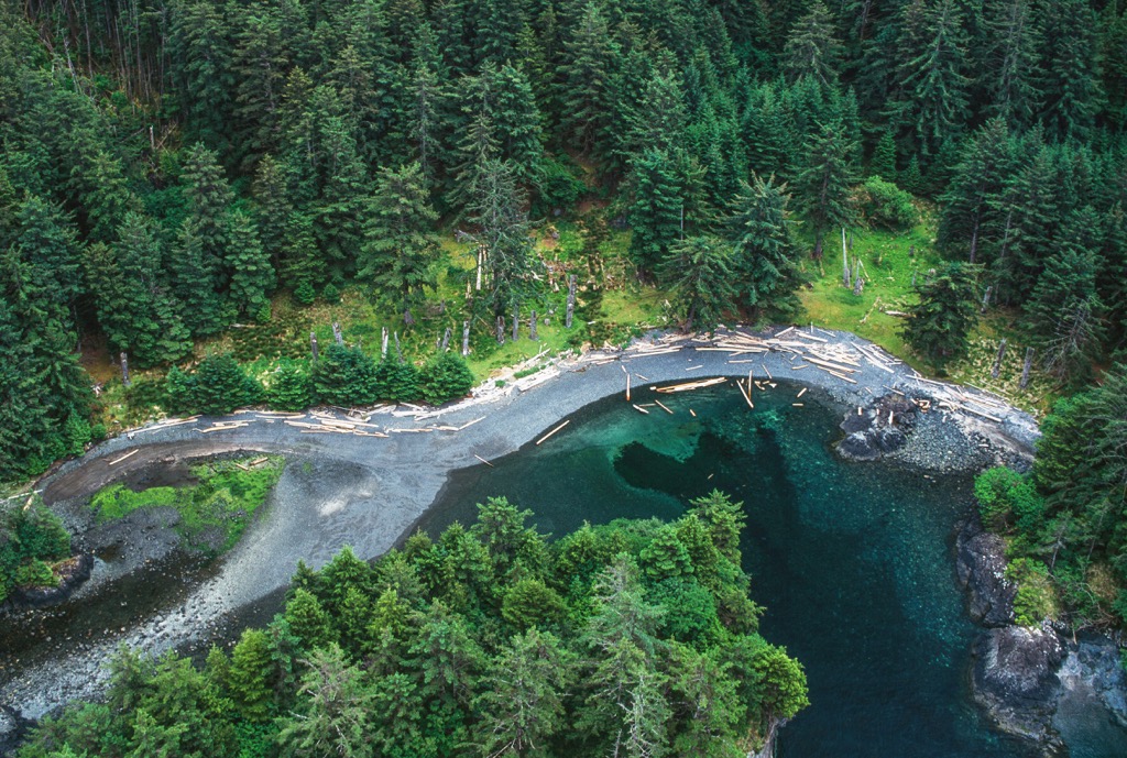
Settlement of the islands was encouraged after the first World War, to fend off US expansionism. After the second World War, logging and commercial fishing began in earnest upon their unsustainable rise. In particular, the logging industry rapidly destroyed the island’s ancient forests, and threatened the ecological integrity of the islands.
It took immense pressure on the provincial and federal government to stop the logging industry from their continued destruction of sensitive and pristine ecosystems. The cooperatively managed Gwaii Haanas National Park Reserve and Haida Heritage Site was the result of years of effort to preserve the environment and significant cultural sites of the Haida people.
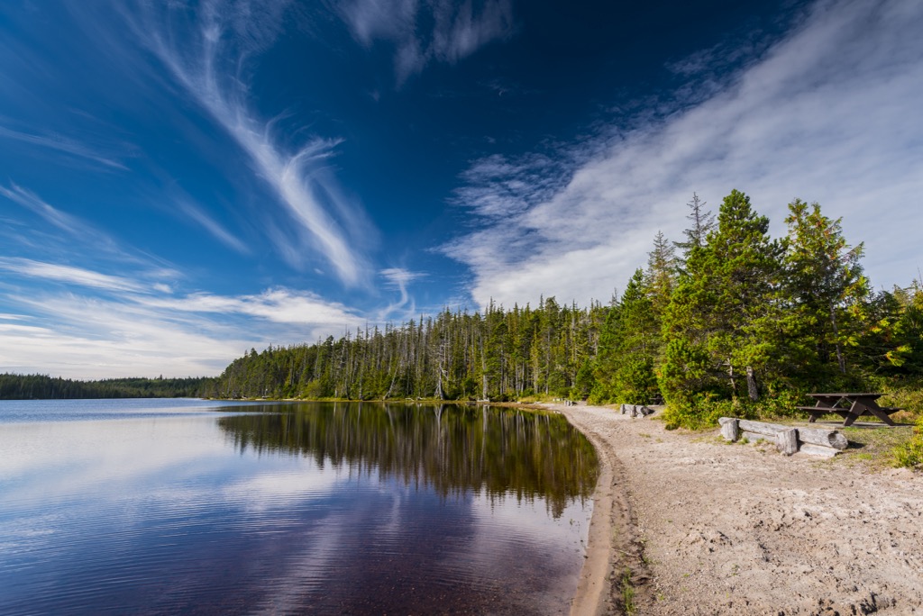
Gwaii Haanas is a beautiful and unique island archipelago at the south end of Haida Gwaii. There are no facilities in the national park reserve and guest numbers are strictly managed to prevent damage to the sensitive ecosystems. The following are some of the major activities and attractions while visiting Gwaii Haanas.
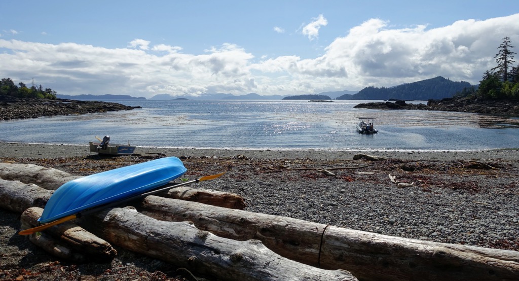
Kayaking along the coast and through the islands of the Archipelago is one of the most intimate ways to experience the wonders of Gwaii Haanas. Visitors can explore the archipelago through a guided tour or on their own.
Gwaii Haanas visitors can paddle kayaks though the waters and catch a glimpse of killer whales, Pacific white-sided dolphins, and Steller sea lions. Visitors may also be treated to a sighting of migrating humpbacks and grey whales as they flick their tails and feed upon the marine bounty of Gwaii Haanas.
Visitors can soak in sun warmed tidal pools or search out the hot springs. The sky is full of stars in the evening and you can fall asleep to the sound of waves lapping against the shore.
Effigies of bears, eagles, ravens, and thunderbirds greet the visitors that come to gaze upon the centuries-old totem poles lining the beach at SGang Gwaay, a UNESCO World Heritage Site. SGang Gwaay is one of the many cultural sites in the park where visitors can walk among the ruins of ancient Haida villages.
T’aanuu Llnagaay (Tanu), K’uuna Llnagaay (Skedans), SGang Gwaay (Anthony Island), Gandll K’in Gwaay.yaay (Hotspring Island), and Hlk'yah GawGa (Windy Bay) are the five major sacred island sites in the park. The sites are cared for by Watchmen, the on-site guardians, who can point out the log remains of the enormous, multi-tiered longhouses and share their traditional knowledge and culture.
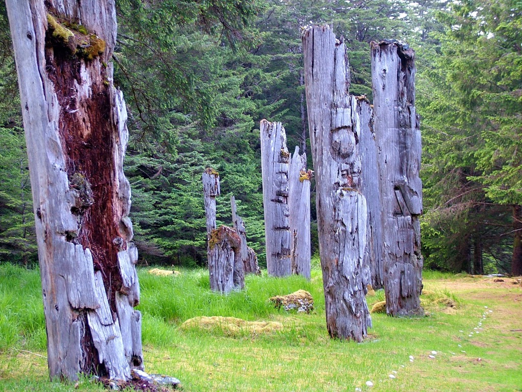
While exploring the park visitors may come upon culturally significant sites throughout the rainforest. Some of the common cultural sites that may be found are bark-stripped cedar trees and the remains of partially carved canoes.
There are many tour operators that offer trips to explore Gwaii Haanas and view the incredible marine wildlife. You will likely be treated to views of the humpback whales, dolphins, and sea lions. Puffins will be seen flinging over the water, and looking into the shallows you may be treated to the otherworldly giant sea stars and anemones as they glow neon in the shallows.
The guided tours are a wonderful way to experience the majesty of the islands without having to know how to navigate upon the water and camp in isolated areas. Since there are no roads, stores, and very few navigational aids, if you have any doubt in your ability to navigate or be self-sufficient, tours are the best way to experience Gwaii Haanas.
Ferries, planes, and charter boats are the only way to reach Haida Gwaii, and boats and float planes are the only way to explore the remote and beautiful archipelago of Gwaii Haanas. The following are some of the largest communities on Haida Gwaii where most Gwaii Haanas adventures will start.
Located on the shores of Rooney Bay on Graham Island, Skidegate is one of the major Haida communities. It is about 80 km (48 mi) north of Gwaii Haanas and accessible by ferry from Prince Rupert on the mainland or Alliford Bay on Moresby Island.
Skidegate was named after the chief of the village in the early nineteenth century. For years it was commonly referred to as Skidegate Mission, which referred to the United Church Mission that was located there at the turn of the twentieth century.
Some of the popular activities in the community include fishing, boating, camping, beachcombing, hiking, kayaking, sightseeing, and wildlife viewing. Skidegate is along the island’s major highway and visitors to the community can also travel to Naikoon Provincial Park, on the northeast corner of Graham Island.
Located on the northeast coast of Moresby Island, Sandspit is the location of Haida Gwaii’s major regional airport. There is regular service to and from Prince Rupert, and Vancouver at the Sandspit airport and Sandspit is considered the Gateway to Gwaii Haanas.
The first settlers of Sandspit established farms and ranches upon the grassy plains of the area. The first major industries were a dogfish oilery in 1910 and a fish cannery in 1913. Transportation and logging are the major industries for the community; however, there has certainly been a shift to have a focus on increased sustainable tourism.
Guided tours and individuals regularly depart from Sandspit to visit the amazing sites of Gwaii Haanas. Whether on a sailboat, a powerboat, or kayaking, there are services and accommodations in Sandspit that can help you prepare for your adventure.


