
Scan the QR code and open PeakVisor on your phone
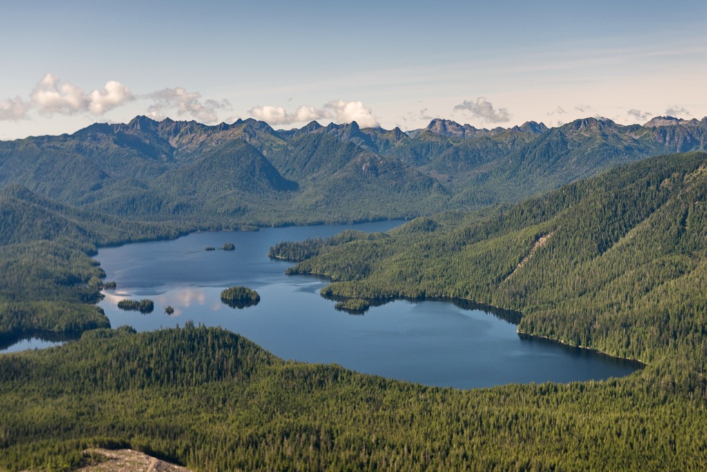
Yaaguun Suu is one of the many protected areas in the Haida Gwaii archipelago in British Columbia, Canada. Encompassing nearly 8,000 hectares (20,000 acres), Yaguun Suu protects Yakoun Lake and nearly all of its tributaries, coastal rainforests, and 6 peaks within the Queen Charlotte Mountains. Mount Stapleton (1,074 m/3,524 ft) is the tallest and most prominent peak in the park.
Located on the southwest corner of Graham Island in the Haida Gwaii archipelago of British Columbia, Canada, Yaaguun Suu Heritage Site / Conservancy was established to protect the cultural importance of the area and the wilderness. The park is home to old-growth forests and high value salmon areas that have been important to the Haida for thousands of years.
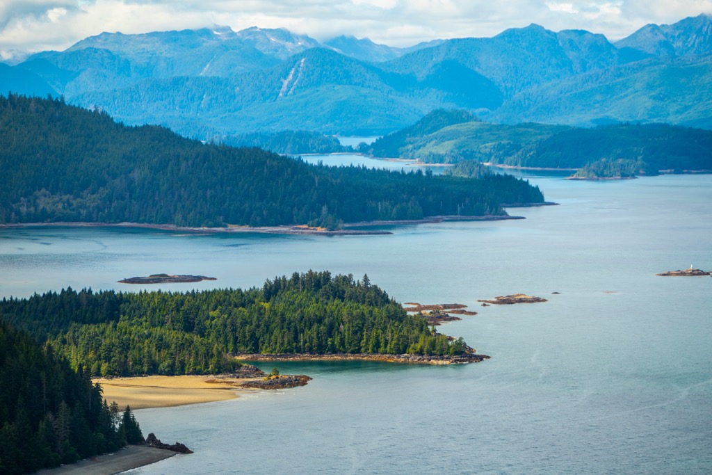
Situated in the southwest corner of Graham Island, the park covers nearly 8,000 hectares (20,000 acres) of traditional Haida territory. The park is about 2 km (1.2 miles) from the west coast of Haida Gwaii at Shields Bay and 25 km (15 miles) northwest of the community of Daajing Giids.
As a Heritage Site and Conservancy, Yaaguun Suu is co-managed by the Haida nation and BC Parks. The park was created to protect important cultural areas of the Haida nation as well as the conservation of the wilderness surrounding Yakoun Lake.
Yaaguun Suu is part of an archipelago-wide system of protected areas that conserves about half of the land of Haida Gwaii. In addition to Yaaguun Suu, the protected areas on Haida Gwaii include:
Traditionally Yakoun Lake and the area of Yaaguun Suu was accessible overland via traditional Haida trails. The park is currently accessible via forest service roads from Daajing Giids and Port Clements. Access to the lake is still only possible on foot, and there is a trail from a small parking area at the end of a spur road just north of the park.
The events that formed Haida Gwaii took millions of years and there were many volcanic events that took place to create the archipelago. The basement rock of Haida Gwaii and the main underlying rock of Yaaguun Suu is the Wrangellia terrane.
The Wrangellia terrane started forming as a volcanic island arc hundred of millions ago in the Pacific Ocean, as it was opening after Pangea started breaking up. Undersea volcanoes created the base of Wrangellia, and around 200 million years ago, a volcanic event, lasting 5 million years pushed the terrane well above sea level.
Wrangellia includes rocks from many time periods and different types of deposition. There are Paleozoic limestones overlain by Triassic Karmutsen basalts. Then there was the addition of more limestone in the Triassic and then the Jurassic limestone and volcaniclastic rock. Finally Jurassic plutons invaded the island arc and early Cretaceous lithic rocks were added to the mix.
It was during the Cretaceous that Wrangellia, which was sliding east on the Farallon plate collided with the westward moving North America. Since oceanic plates are denser than continents, the Farallon plate subducted beneath the continent to melt; however, the Wrangellia island arc was sufficiently buoyant to escape the subduction and was accreted to the edge of the continent.
The Wrangellia terrane accounts for many of the islands off the coast of British Columbia, including Vancouver Island, as well as some connections with the mainland.
For practical purposes, Yaaguun Suu is generally dominated by undivided volcanic rocks, except the mid-western portion near the appropriately named Sandstone Creek, which show older mudstone, siltstone, shale and sandstone.
For further investigation, the rock and fossils preserved on Haida Gwaii record a nearly complete uninterrupted span of geological time from the Late Triassic through Late Cretaceous. Astute hobby paleontologists may enjoy their time examining the rocks of the island.
Conserving the pristine quality of the Yaaguun Suu wilderness is as important as preserving the ability for the Haida to continue practicing their traditional lifestyles with resources from the park. The beautiful wilderness area is in the productive wet belt of the west coast , where the forests are extremely productive and produce massive trees.
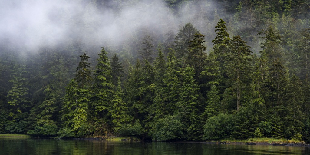
The forests in and around Yaaguun Suu are some of the most productive Sitka spruce forests on Haida Gwaii. The forests of this park represent important plant communities, such as those between yellow cedar, mountain hemlock, and hellebore; and the presence of salal in the red cedar and Sitka spruce forests.
Notable flora which has been discovered in the park is a red listed species, the Queen Charlotte aven, which has two occurrence records for the area.
There are many important fish bearing streams in the Yaaguun Suu Heritage Site/Conservancy which were used anciently and now. The streams are known to contain Sockeye Salmon, Chinook Salmon, Coho Salmon, Chum Salmon, Pink Salmon, Steelhead, Dolly Varden and Cutthroat Trout. In particular, the Yakoun River is a major salmon-bearing stream on.
Yakoun Lake also hosts a variety of fish for anglers, such as Coastrange Sculpin, Coho Salmon, Cutthroat Trout, Dolly Varden, Pacific Lamprey, Pink Salmon, Prickly Sculpin, Sockeye Salmon, Steelhead and 3-spine Stickleback. The lake is an average of about 35 m (115 ft) with a max depth of about 91 m (300 ft), with significant salmonid stocks and the exceptional fish habitat is well supported by the surrounding old growth forests.
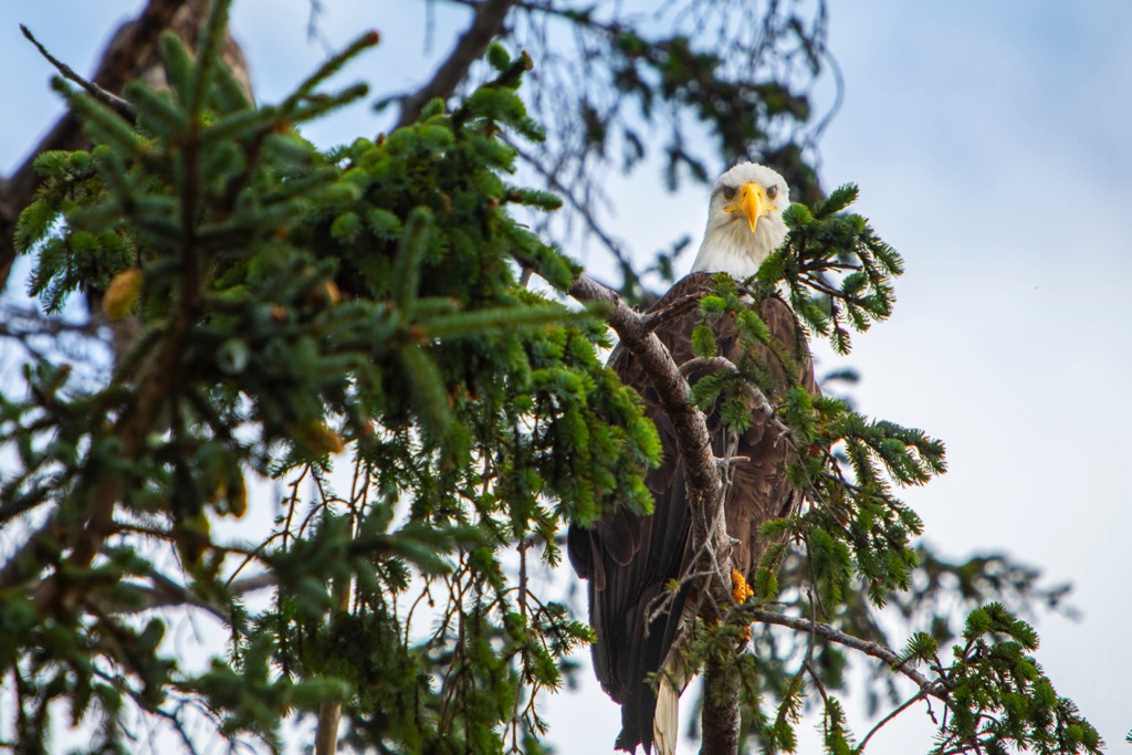
Northern Goshawks and Marbled Murrelets are among the species that make their homes in Yaaguun Suu; however, there is concern that introduced species threaten the local ecosystems. Introduced mammals, such as Black-tailed Deer threaten the balanced ecosystem, as does bull thistle, which is an invasive plant that is occurring in this area.
The archaeological evidence suggests that Yaaguun Suu has been occupied for at least 10,000 years. Oral history of the Haida indicates that they have inhabited the area for an even longer time, possibly 14,000 to 19,000 years ago.
The oral traditions of the Haida and archaeological findings agree that the Haida ancestors lived alongside glaciers and were present when the first tree, a lodgepole pine, grew on Haida Gwaii. Around 7,500 years ago the Haida culture transformed to incorporate the red cedar which now grew on the island and it was referred to as a coastal “tree of life.
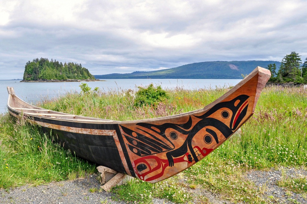
The Haida became very adept at using the cedar trees to construct their homes, boats, and massive monuments. Their style of art and construction became widespread and reached other coastal and inland nations.
Traditional uses of Yaaguun Suu include harvesting cedar trees for monuments, cedar bark harvesting, harvesting medicinal plants, hunting, fishing, trapping, and food gathering. There are many culturally important sites within the park that include a traditional seasonal camp at Yakoun Bay and at least 13 monumental cedars that have been documented.
While the wilderness around Yaaguun Suu remained relatively intact, the arrival of European and Asian traders fundamentally changed the Haida, as they no longer had their relative isolation to protect and insulate them.
The first recorded contact with the Haida was by Juan Perez, a Spanish explorer in July 1774. Unfortunately due to the weather, the Spanish sailors were never able to set foot on Haida Gwaii, they were able to trade with the locals, who paddled to the ship in their canoes. The Haida conducted regular trade with Spanish, British, American, and Russian fur traders and whalers.
The Haida did quite well for themselves with the sea otter trade which was initiated by British Captain George Dixon in 1787. The Haida were at the center of the lucrative China sea otter trade until the middle of the nineteenth century.
During the mid and late nineteenth century there were instances where smallpox made its way to the island archipelago of Haida Gwaii. The disease was rampant across the islands, leaving many villages unpopulated. The pre-epidemic population of Haida Gwaii was estimated at 6,607 people, which was reduced to 829 in 1881.
Further hits to Haida culture include the 1885 Potlatch Ban, which destroyed internal financial relationships and interrupted their cultural heritage. Furthermore, as the islands were “Christianized”, many of their cultural works, such as totem poles were destroyed or shipped off to museums. Finally, children from Haida Gwaii were shipped to residential schools as far away as Alberta, which significantly undermined the Haida’s self-knowledge and culture.
After the discovery of the archipelago and its official relation to the Dominion of Canada and the British Empire, it was named the Queen Charlotte Islands. In 2009, British Columbia officially changed the name of the archipelago to Haida Gwaii and there is continued legislation to instill the rights of the indigenous people within their territory.
Part of the mandate for the Haida Nation is to protect the land and water of their traditional territory. To this end, nearly 70% of the archipelago maintains a protected status, including Yaaguun Suu Heritage Site and Conservancy. Groups associated with the park have made an effort to make trails and recreation areas in the park to facilitate recreational and traditional use of the wilderness and waterways.
While Yaaguun Suu may appear isolated, the rivers, creeks, and Yakoun Lake were part of important traditional fishing grounds. As such there are some traditional Haida trails that are within and cross the park that link the area to other important areas.
One of the traditional trails connect Yakoun Lake to Shields Bay overland through the Sandstone Creek watershed Other traditional trails connect Yakoun Lake overland to Long Inlet, overland via Delta Creek and ridgetop to Kagan Bay, over the lake to the Yakoun River.
When visiting Yaaguun Suu it is possible to traverse the ancient trails and see the areas that have been inhabited for over 10,000 years. The traditional trails are not necessarily maintained as official trails; however, research and asking around will likely lead you to know where the trails are.
Furthermore, local groups have made the effort to create and maintain trails around parts of Yakoun Lake to facilitate visitors. There is good fishing in the lake and the creeks and rivers of the park, and there is a sandy beach at one end of the lake that makes it an enjoyable place to swim.
Haida Gwaii is a beautiful archipelago steeped in history and culture. The following are some of the communities that you might visit while visiting Yaaguun Suu.
Previously known as the village of Queen Charlotte, Daajing Giids had its ancestral name restored in 2022. The village was founded in 1891 and became the archipelago’s first registered townsite in 1908, when the archipelago’s first sawmill began operating.
As with the original name of the archipelago, the village was named Queen Charlotte, after Captain George Dixon’s two-hundred ton ship which he sailed along the coast on his trading mission.
The inhabitants of the town were originally working resource based jobs; however, there has been a strong shift for the people to work in tourism-oriented employment. While tourism is certainly growing on the island, the local governments are striving to manage tourism in a way that doesn't interfere with conservation and cultural ideals.
Daajing Giids is the closest community to Yaaguun Suu and is also one of the popular starting points for excursions south into Gwaii Haanas National Park Reserve and Haida Heritage Site. Naikoon Provincial Park is also a popular place to visit while on Haida Gwaii, particularly because it is accessible via roads.
Skidegate is one of the major Haida communities and is Located on the shores of Rooney Bay on Graham Island. It is just east of Daajing Giids and about 80 km (48 mi) north of Gwaii Haanas. The community is one of the entry points for Haida Gwaii with ferries arriving from Prince Rupert on the mainland or Alliford Bay on Moresby Island.
Originally named for a village chief from the early nineteenth century, it was commonly referred to as Skidegate Mission. The United Church Mission was built in the community at the turn of the twentieth century.
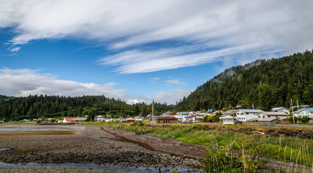
Skidegate is along the island’s major highway and visitors to the community can also travel by road to Naikoon Provincial Park, on the northeast corner of Graham Island. Other places to visit are Yaaguun Suu and Gwaii Haanas.
While in town, some of the popular activities are fishing, boating, camping, beachcombing, hiking, kayaking, sightseeing, and wildlife viewing. There are local tour guides that can facilitate trips through the archipelago and interpret the many heritage sites that you can visit.


