
Scan the QR code and open PeakVisor on your phone
Vladimir J. Krajina (Port Chanal) Ecological Reserve is a protected area on the west coast of Graham Island in the Haida Gwaii archipelago of British Columbia, Canada. Mount Hobbs (246 m/ 807 ft) is the tallest named mountain in the reserve.
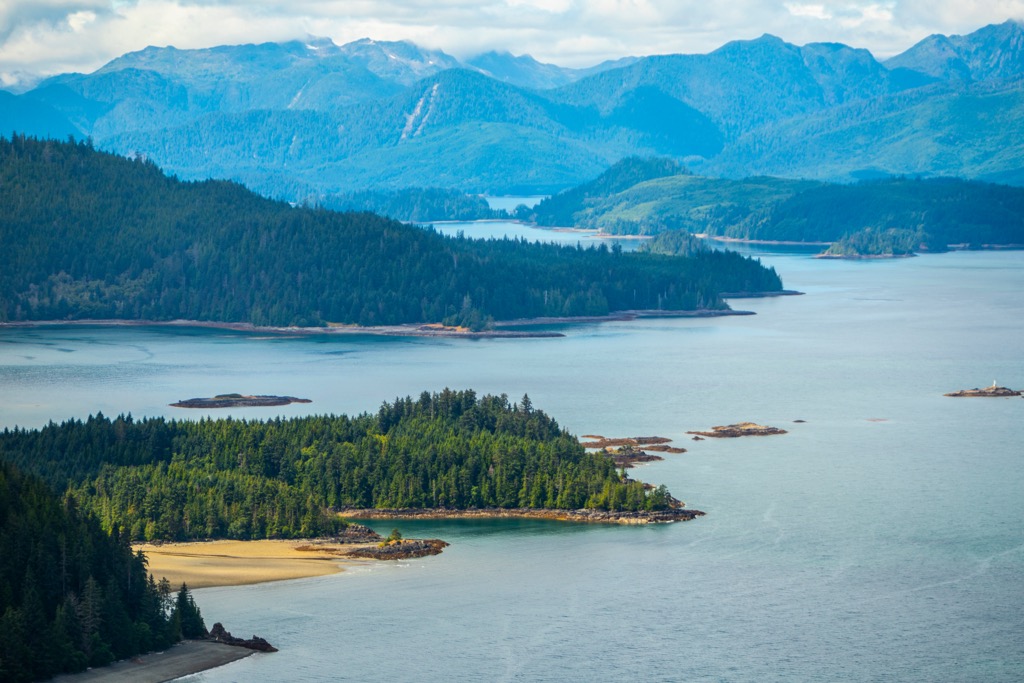
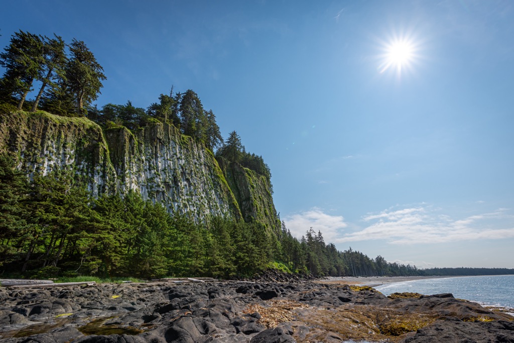
Vladimir J. Krajina Ecological Reserve is located on the west coast of Graham Island, the largest island of the Haida Gwaii archipelago in British Columbia, Canada. Within the traditional territory of the Haida, the reserve protects nearly 100 square kilometers (38 square miles) of pristine wilderness and shoreline.
The reserve is located on the west slope of the Queen Charlotte Mountains, with mountainous terrain reaching 825 m (2,730 ft). Centered on Port Chanal, the ecological reserve protects 60 km (36 mi) of shoreline, two large islands, as well as the surrounding headlands and steep cliffs.
The Vladimir J. Krajina (Port Chanal) Ecological Reserve was one of the first ecological reserves to be created in the province of British Columbia. There are over 150 ecological reserves across the province and in Haida Gwaii, nearly 70% of the land is under some sort of environmental protection. The following are some of the nearby protected areas:
The Haida Gwaii archipelago is part of the Insular Mountains which are the westernmost mountain range of the Canadian Cordillera. Most of the Insular Mountains are submerged under the ocean and their peaks form the thousands of islands along the west coast of Canada.
The Vancouver Islands Ranges and the Queen Charlotte Mountains are the two major ranges in the Insular Mountains. The Vancouver Island Ranges dominate Vancouver Island and the Queen Charlotte Mountains dominate Haida Gwaii.
The Queen Charlotte Mountains are the backbone of the Haida Gwaii archipelago and run down the west side of Graham Island and through the center of Moresby Island. The Cameron Range, one of the four subranges of the Queen Charlotte Islands, is the group of peaks and ridges on the northside of Port Chanal, in the Vladimir J. Krajina (Port Chanal) Ecological Reserve.
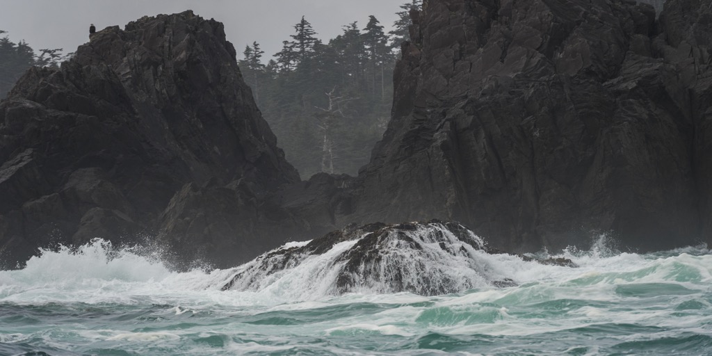
The Insular Mountains formed around 100 million years ago when a chain of volcanic islands collided with ancient British Columbia. Being primarily of volcanic origin, the rocky shores and cliffs of the ecological reserve are primarily made of pillow lavas and turbidites.
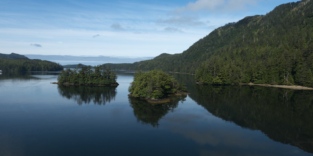
During the Pleistocene, glaciers formed in the peaks and carved out valleys which later flooded to become the fjords along the west coast of Graham Island. About 18,000 years ago, the continental shelf was a broad coastal plain and much more of the Insular Mountains were exposed. As the world’s glaciers melted, the sea level rose and covered the base of the Insular Mountains.
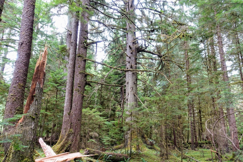
The ecological reserve is covered with the great temperate rainforest that is also present upon the other islands and coastal areas of British Columbia. Massive red cedar, western hemlock, and Sitka spruce dominate the shore.
This ecological reserve is said to have one of BC’s most spectacular forests, a Sitka spruce stand near Port Chanal.
This relatively small area on the west coast of Graham Island contains pristine wilderness from the shore to the alpine peaks and ridges. Ancient, un-logged forests of western hemlock, red cedar, and Sitka spruce dominate the lowest elevations. With increased elevation, mountain hemlock and yellow cedar become more apparent in the forests.
The forests taper off with increased elevation up the slopes of the Queen Charlotte Mountains and the highest elevations of the ecological reserve are part of the alpine tundra zone. The alpine area of the reserve is dominated by communities of mountain heather and lichen.
The ecological reserve is home to over 40 rare plant species, including net-veined willow, northern butterweed, whorled lousewort, spike-oat, and Queen Charlotte false rue anemone. Indeed, this ecological reserve is the only known location in British Columbia to have northern butterweed.
Furthermore, the ecological reserve was the location of two previously undiscovered species of sphagnum moss, and it is home to several other species, such as the Queen Charlotte isopyrum, that are endemic to Haida Gwaii.
In addition to the incredible plant life that is in the ecological reserve, there are many unique and rare wildlife species present as well. Ancient murrelets and Cassin’s auklets have large nesting colonies in Vladimir J. Krajina Ecological Reserve, and other endangered resident bird species include the peregrine falcon, hairy woodpecker, Steller's jay, and the Haida Gwaii sub-species of the northern saw-whet owl.
Some of the other notable wildlife includes nesting of fork-tailed petrels, peregrine falcons, bald eagles, black oystercatchers, and pigeon guillemots. Additionally, regarding marine life, there are four salmon species that spawn in the ecological reserve and there is also a Steller sea lion haul out along the shore of the ecological reserve.
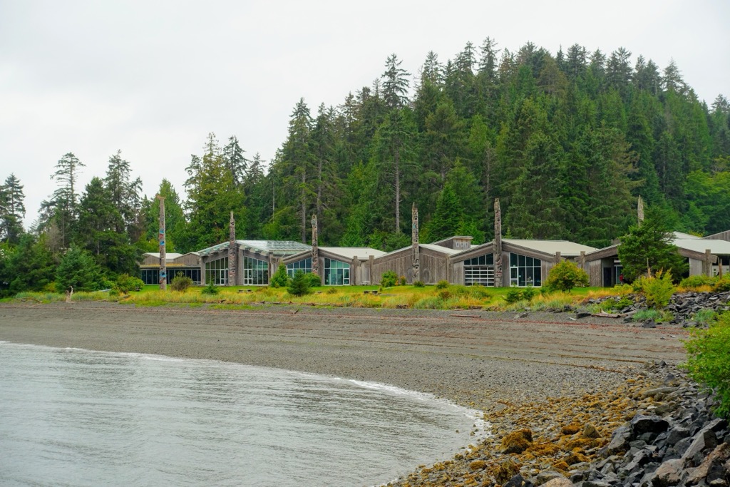
Archaeological evidence supports that Haida Gwaii has been inhabited for 10,000 years and the oral traditions of the Haida suggest an even longer history upon the islands.
The Vladimir J. Krajina Ecological Reserve was established based on its virtually undisturbed wilderness; however, there is evidence that the Haida have used the area. There is a First Nations sustenance fishing area at the mouth of Mercer Creek and there is a significant archeological site within the reserve.
While logging tenures existed adjacent to the Vladimir J. Krajina Ecological Reserve, Vladimir J. Krajina and others were working to preserve the wilderness around Port Chanal. Aside from traditional use from the Haida, the ecological reserve has remained essentially untouched.
Due to his life and dedication to the establishment of ecological reserves and his contributions to science, Ecological Reserve Number 45 at Port Chanal was renamed to honor Vladimir J. Krajina.
Dr. Vladimir J. Krajina was born in 1905, in Czechoslovakia and was interested in the diversity of flora and fauna from a very young age. Dr. Krajina was a skilled botanist in the early twentieth century and he rose to become the Head of the Department of Plant Sociology and Botany at Charles University in Prague.
However, from the onset of World War II, Dr. Krajina put his keen observation skills to help the Allied resistance. He was a leader of the Unified Czech Resistance and was later a member of parliament; however, his anti-totalitarian views would put him at odds with the communist party in 1947, when Czechoslovakia lost its independence.
The details of his escape from the country to Vancouver, Canada via Great Britain only describe that he passed through “ski slopes with one suitcase full of clothes, the other full of papers.” Once he arrived in Vancouver, he started working at the University of British Columbia from where he mapped the ecology of the province to ultimately create the system of biogeoclimatic zones.
Dr. Krajina traversed the province and recognized the ecological nuances and the importance of preserving wilderness areas in pristine condition. He successfully lobbied the government to create the British Columbia Reserves Act in 1971, which allowed the creation of ecological reserves.
Ecological reserves are different from all other classifications of protected areas in that they are not meant as recreational areas or to preserve archaeological or historical areas, nor are they an area for wildlife management.
The mandate of Dr. Krajina was emphasized in that ecological reserves are for scientific research and educational purposes. The ecological reserves are benchmarks to measure changes, banks of genetic material, and a place to preserve rare, unique, and endangered plants or animals in their natural surroundings.
Ecological reserves are not created for recreational purposes; however, the Vladimir J. Krajina Ecological Reserve is open to the public. Access to the ecological reserve is only permitted by boat or by foot without special authorization.
Most visitors to the ecological reserve are satisfied with kayaking along the beautiful coast, admiring the Steller sea lions, and the many colonies of birds upon the islands in the ecological reserve and cliffs of Port Chanal. Paddlers can also view the shipwreck upon the shores of Hippa Island.
Camping is not permitted; however, visitors are welcome to hike along the beaches or along the cliffs. There are no maintained trails in the ecological reserve, nor are there any facilities. There are archaeological sites within the ecological reserve and while visitors are welcome, care must be taken to not disturb the sites.
Vladimir J. Krajina Ecological Reserve is an incredible place that has stunning forests and an abundance of fascinating plants and wildlife. Furthermore, there are archaeological sites in the ecological reserve that are important to understanding the history of the Haida people. Care must be taken to continue to preserve the integrity of the ecological reserve as well as its cultural sites.
The following are some of the communities closest to Vladimir J. Krajina Ecological Reserve on the beautiful island archipelago of Haida Gwaii.
The village of Daajing Giids was founded in 1891 and when the first saw mill began operation in the town in 1908, it became the archipelago’s first registered townsite. The village was previously known as Queen Charlotte, Daajing Giids had its ancestral name restored in 2022.
With the opening of the sawmill, the inhabitants of the town were originally working resource-based jobs. However, in the more recent years, there has been a strong shift for the people to work in tourism-oriented employment.
The locals recognize that they have an incredible part of the word to live in and they love sharing it with visitors. However, while tourism is certainly growing on the island, the local governments are striving to manage tourism in a way that doesn't interfere with conservation and cultural ideals.
Daajing Giids is about 60 km (36 mi) southeast of Vladimir J. Krajina Ecological Reserve, however, there is no direct road access to the ecological reserve.
The community is also one of the starting points for excursions south into Gwaii Haanas National Park Reserve and Haida Heritage Site. Yaaguun Suu is a nearby Heritage Site and Conservancy with hiking trails and Yakoun Lake to swim in and Naikoon Provincial Park is also a popular place to visit while on Haida Gwaii, particularly because it is accessible via roads.
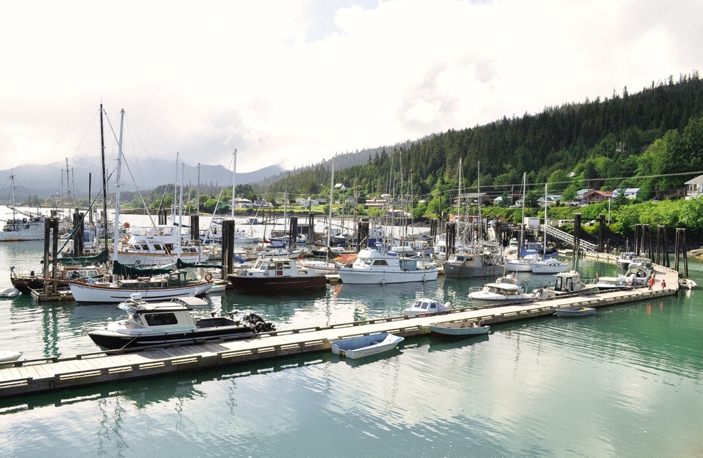
Located on the shores of Rooney Bay on Graham Island, Skidegate is one of the major Haida communities. It is just east of Daajing Giids and is one of the entry points for Haida Gwaii with ferries arriving from Prince Rupert on the mainland or Alliford Bay on Moresby Island.
The village was named for a local chief from the early nineteenth century and was commonly called the Skidegate Mission due to the church that was constructed in the community. The United Church Mission was built in the community at the turn of the twentieth century.
Some of the popular activities from the town are fishing, boating, camping, beachcombing, hiking, kayaking, sightseeing, and wildlife viewing. Local tour guides can be found who can facilitate trips through the archipelago and interpret the many heritage sites that you can visit.
Some of the places worth visiting while on Haida Gwaii are Naikoon Provincial Park, on the northeast corner of Graham Island, Yaaguun Suu and Gwaii Haanas. Naikoon Provincial Park and Yaguun Suu are particularly popular because roads lead into or at least near the park.
Sandspit is on the northeast tip of Moresby Island and has Haida Gwaii’s major regional airport. The airport has regular service to and from Prince Rupert and Vancouver at the Sandspit airport making it one of the most visited communities on Haida Gwaii.
Transportation and logging are the major industries for the community and many locals participate in the tourism industry as well. The first settlers in the area came for the grassy plain upon which they established farms and ranches. At the beginning of the twentieth century the major industries in the community included a dogfish oilery and a fish cannery.
Sandspit is considered the Gateway to Gwaii Haanas and guided tours and individuals regularly depart from Sandspit to visit the amazing sites of the parks. Sandspit has all the amenities and services that visitors need to have a memorable adventure in beautiful Haida Gwaii.


