Scan the QR code and open PeakVisor on your phone
Duu Guusd Heritage Site/Conservancy is a protected area on Graham Island in the Haida Gwaii archipelago of British Columbia, Canada. There are 60 named mountains in the heritage site/conservancy. The highest and the most prominent point is Queen Charlotte Mountains (832 m/2730 ft).
Duu Guusd Heritage Site/Conservancy protects both terrestrial and marine territory in the northwest corner of Graham Island—the largest island within the Haida Gwaii archipelago on the northwest coast of British Columbia.
The terrestrial area of the heritage site/conservancy covers 1,436 sq. km (554 sq. mi) from the Naden Harbour along Dixon Entrance to Langara Island, contouring along the Pacific Ocean coastline southward to Rennell Sound. A further 842 sq. km (325 sq. mi) of marine habitat are also part of the heritage site/conservancy.
Graham Island and the rest of the Haida Gwaii archipelago is part of the larger North Coast Regional District. With a population of less than 4,000 and far from any major population centers, Graham Island is remote and off of the typical tourist routes. Duu Guusd is even more secluded. the Rennell Sound region at the southern end of the conservancy is the only area accessible by car.
Notable peaks in the heritage site/conservancy include Ironside Mountain, Pivot Mountain, and Fortier Hill.
The islands of Haida Gwaii are formed from the Insular Mountains, a range mostly submerged under the ocean. These islands—along with thousands of other islands throughout coastal British Columbia—are in fact the peaks of this aqueous mountain range.
A collection of volcanic islands called the Insular Islands collided with the west coast of North America about 100 million years ago. The resulting geological uplift created the Insular Mountains, formed primarily from turbidites and pillow lavas.
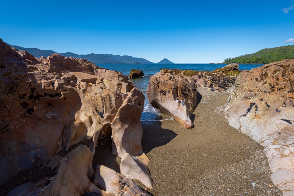
Duu Guusd has some remarkably well preserved rocks and fossils from byegone geological eras, offering a nearly uninterrupted look at geological history in the region from the Late Triaassic through to the Late Cretaceous.
More recently, extensive glaciation during the Pleistocene left behind a rugged eroded landscape of coastal fjords, lush inland valleys, and low peaks that now define Graham Island and the Duu Guusd region.
The heritage site/conservancy plays a critical role in protecting the unique ecology of Haida Gwaii. It is the only protected area that substantially covers all three of the archipelago’s terrestrial eco-sections—Windward Queen Charlotte Mountains, Queen Charlotte Lowlands, and Skidegate Plateau. Western Hemlock dominates at lower elevations, giving way to mountain heather further into the alpine.
The alpine meadows, old-growth forests, wetlands, sheltered inlets, and pristine shorelines found through these eco-sections are critical habitats for dozens of protected and endangered species. Protected plant species include northern goldenrod, black-tipped groundsel, creeping willow, Queen Charlotte avens, Queen Charlotte false rue-anemone, Taylor’s saxifrage, whorled lousewort, Queen Charlotte twinflower violet, dune bentgrass, alp lily, and dotted saxifrage.
There are over 70 known peregrine falcon nesting sites in Duu Guusd. The heritage site/conservancy is also home to northern saw-whet owls, northern goshawks, marbled murrelets, ancient murrelets, and Cassin's auklets.
Duu Guusd also covers 18 estuaries and some of the most biodiverse marine habitats on Haida Gwaii. Nearly 20% of the entire archipelago’s fish-bearing freshwater is within the heritage site/conservancy.
The estuaries are rich with kelp forests and eelgrass beds, fed by streams that serve as spawning grounds for coho salmon, chum salmon, pink salmon, sockeye salmon, Dolly Varden trout, steelhead trout, rainbow trout, and cutthroat trout.
Although the remoteness of Du Guusd helps in preserving its biological integrity, invasive species, including raccoons, Norway rats, and black-tailed deer pose a threat to native flora and fauna.
Duu Guusd has been home to the Haida people for at least 10,000 years, according to archeological studies. The rich oral traditions of the Haida suggest a history with this landscape that stretches back even further.
Many families throughout Haida Gwaii trace their ancestry back to Duu Guusd. The area is referenced in many origin myths and stories. Dozens of archaeological sites have found an impressive abundance of cultural items, including burial sites, modified trees, smokehouses, canoes, and tools.
The Haida Nation and the Province of British Columbia have a title dispute over the entire archipelago. The land remains unceded by the Haida Nation. The creation of Duu Guusd was in part the result of a reconciliation effort. The Haida Nation wished to see the region protected from ongoing logging that threatened their physical and spiritual lifeways.
After decades of political conflict, Duu Guusd finally earned protected status—designated a heritage site by the Haida Nation and as a conservancy by British Columbia. The Nation and province now work in concert to manage the region.
The management plan acknowledges both the ecological significance and the cultural importance of the region to the Haida Nation. Traditional use within the park includes tree bark harvesting, medicinal plant cultivation, fishing, hunting, and totem erection.
Outdoor recreation and tourism have been slow to develop in Duu Guusd due to its remote location. But those willing to make the journey will find that it is a world-class outdoor destination. Highlights include:
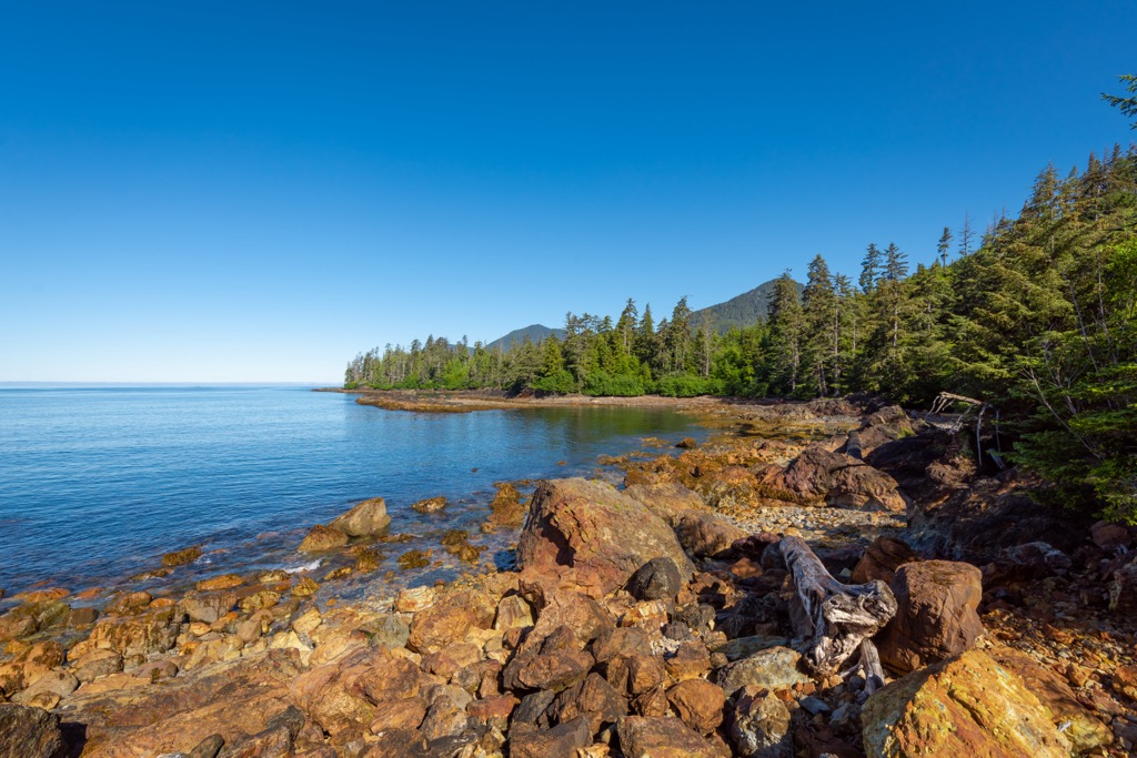
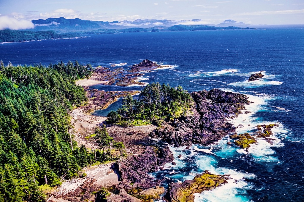
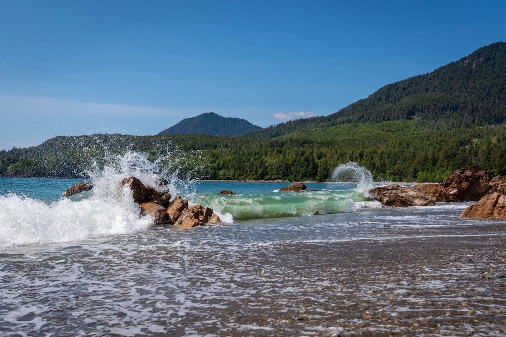
Diving: The coast of Graham Island, with its epic kelp forests, unique sea geology, and abundant marine life, is a diving paradise. The coastal road in the Rennell Sound region offers access to dozens of excellent shore dives. Many more are accessible by boat.
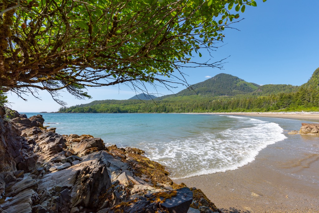
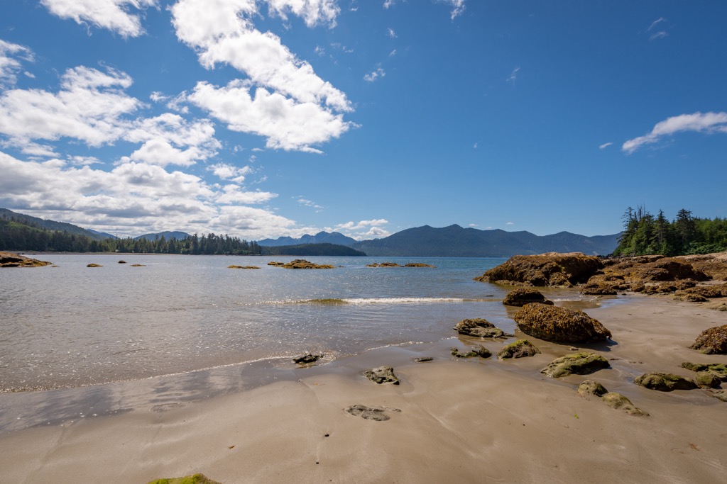
Beachcombing: Although formal trails are limited in the heritage site/conservancy, opportunities for exploring beaches are near endless. Five Mile Beach, Gregory Beach, and Bonanza Beach are all worthy of a day spent beachcombing and spotting marine wildlife.
Sea Kayaking: Launching from the Rennell Sound area, you can travel the wild, roadless expanses of Duu Guusd by water. Sea kayakers can camp throughout protected inlets, explore unique sea stacks and beaches, and spot whales, sea lions, seals, and countless shore birds.
Access to Duu Guusd by foot is limited mostly to the Rennell Sound area and requires a high clearance vehicle. Elsewhere, road access is non-existent.
However, there are still some hikes within Duu Guusd that are not to be missed on your visit to Graham Island.
The Riley Creek trail is a 10 km (6 mi) out-and-back hike through majestic old-growth forest to a secluded beach. Be mindful of the tides here: come prepared with a tide table to ensure you do not get stranded at high tide while exploring the beach.
Bonanza Beach is the highlight of the Rennell Sound area. A short, well-maintained trail leads from the parking lot to the sandy, sprawling beach. Walk-in camping is permitted here and at nearby Gregory Beach. Plan to spend the night watching the sunset beyond the Pacific from an idyllic hideaway at the edge of the world.
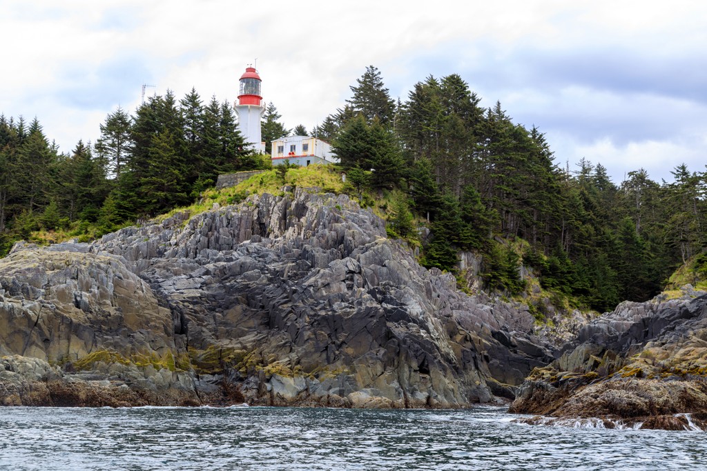
Located on a bluff on the northwest edge of Langara Island, the Langara Point Lighthouse is one of only two active lighthouses on Haida Gwaii. Trails around the complex lead through old-growth spruce forests to breathtaking ocean views.
Access to Langara Point is by boat or helicopter. Excursions here are offered by fishing lodges on the island. Guests can tour the lighthouse buildings and are often invited by the resident light keepers to stay for coffee or tea.
Planning a trip out to explore Duu Guusd Heritage Site/Conservancy? Here are some of the best towns to visit in the region.
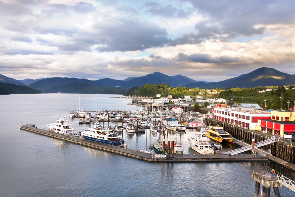
Located on the coast of mainland British Columbia, the port city of Prince Rupert is the gateway to some of the most inspiring wilderness areas in the country. The Khutzeymateen Grizzly Sanctuary is nearby. Bear sightings are a near certainty.
The town relies heavily on commercial fishing. The rich marine waters in this remote region of the province are replete with salmon, halibut, humpback whales, and countless other marine mammals. The BC Ferries route from Prince Rupert to Skidegate Landing on Graham Island is the best way to get to Duu Guusd by vehicle.
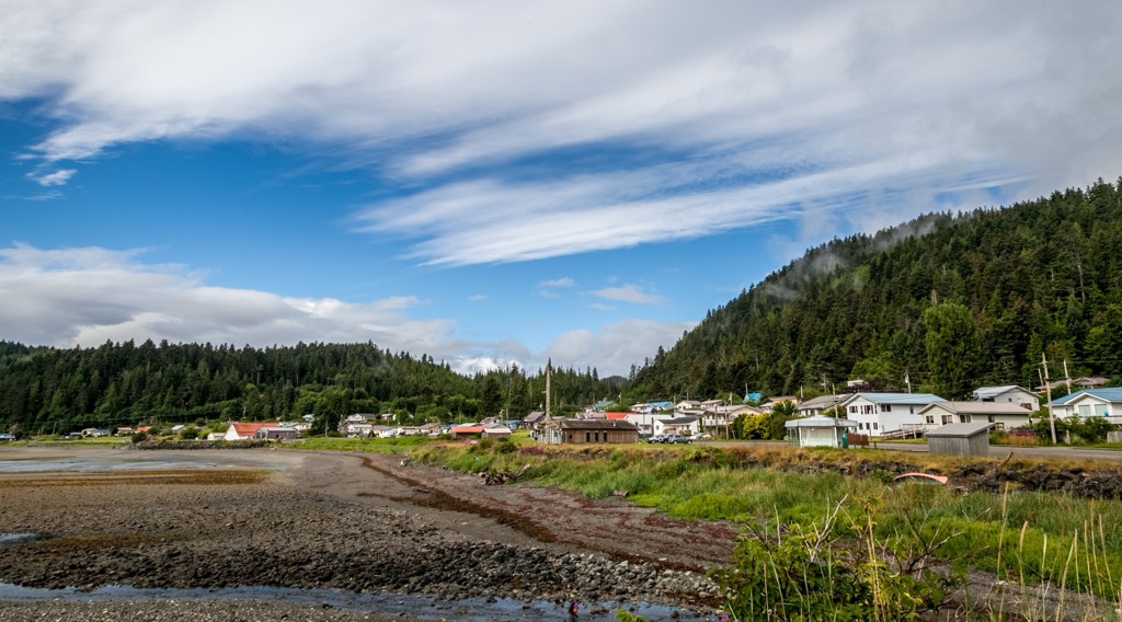
Formerly known as Queen Charlotte, the town of Daajing Giids is one of the larger settlements on Graham Island with a population of around 1,000. Only 9 km from the Skidegate ferry terminal, Daajing Giids is often where tourists get their bearings before exploring Duu Guusd.
The town is only 36 km (22 mi) south of the Rennell Sound region of Duu Guusd. The Daajing Giids Visitor Information Centre provides travellers with information on road conditions and amenities. There are two campgrounds in town along with a number of rustic guest houses and lodges, like the Chateau Norm and Premier Creek Lodging.
Just a few minutes from Daajing Giids is its sister town of Skidegate. Explore the rich history of the Haida people here with visits to the Haida Gwaii Museum, the Haida Heritage Centre, and Skidegate’s many galleries and studios. Wood carvings by the legendary Haida artist Bill Reid can also be found throughout the town.
Visitors to Skidegate can stay at JAGS, a family-owned guesthouse and coffee shop.