Scan the QR code and open PeakVisor on your phone
The North Coast Regional District of British Columbia, Canada includes the islands of Haida Gwaii and the islands and the coastal lands adjacent to the Skeena River on the mainland. There are over 332 mountains in the regional district, of which Redcap Mountain is the tallest at 1,953 m (6,407 ft) in elevation and with 721 m (2,365 ft) of prominence.
Located on the northern coast of British Columbia Canada, the North Coast Regional District encompasses the islands of Haida Gwaii as well as islands and the area adjacent to the Skeena River in the mainland.
Note that Haida Gwaii was referred to as the Queen Charlotte Islands before 2010. Prior to 2016, the regional district was named the Skeena-Queen Charlotte Regional District.
Highway 16 is the primary highway across the district, with airports and a ferry service that connect to Graham Island of Haida Gwaii. Prince Rupert is the regional capital; however, members of the Haida First Nations account for nearly half the population of Haida Gwaii and run their own government in their territory.
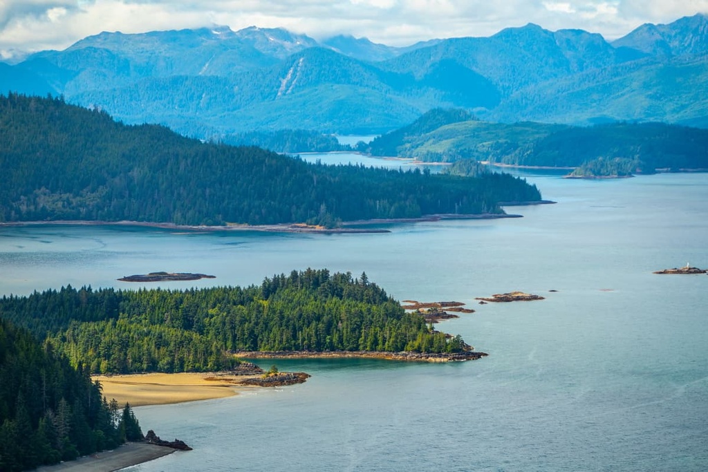
Haida Gwaii is composed of two main islands, Graham Island in the north and Moresby Island in the south. It also contains an archipelago of about 400 smaller islands. There are around 20,000 people who inhabit the nearly 20,000 square kilometer (7,751 square mile) region, with nearly 13,000 people residing in Prince Rupert alone.
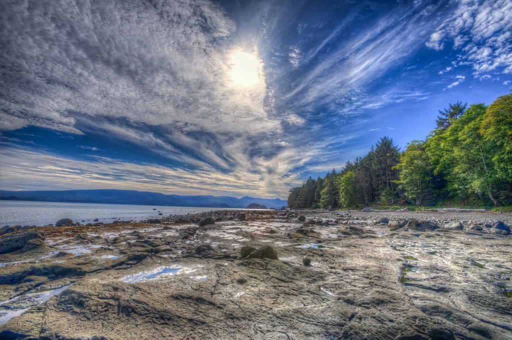
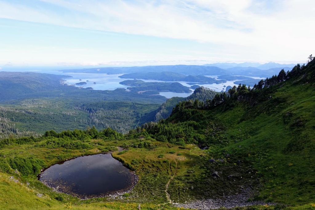
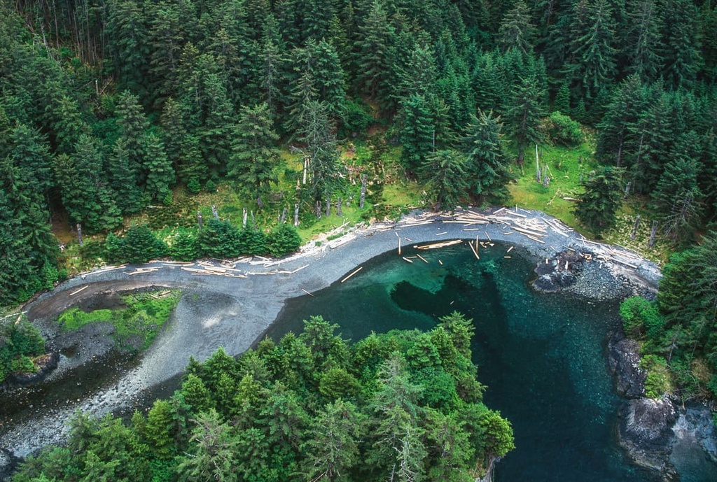
Most of the region is rugged coastal wilderness that’s only accessible by private plane charters or by boat. The region is home to many stunning coastal provincial parks that were created to preserve the cultural history and fragile natural landscapes. The following are some of the mainland and coastal island’s parks and protected areas:
Haida Gwaii has a human history that dates back 13,000 years. As such, there are many culturally and environmentally important areas on the islands. The following are some of the protected areas of Haida Gwaii:
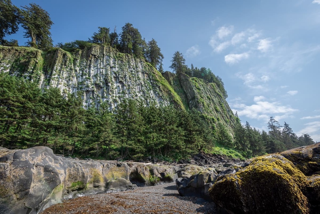
The North Coast Regional District’s geology is mainly part of the Insular Mountains, which is a mountain range that’s partially submerged under the ocean. The islands of Haida Gwaii and the islands along the coast of British Columbia, including the Vancouver Island Ranges, are the peaks of this submerged range.
The Insular Mountains formed when an ancient volcanic island arc, called the Insular Islands, collided against the west coast of North America about 100 million years ago. The primary rocks of the Insular Mountains are turbidites and pillow lavas.
During the Pleistocene, the entire range was encased in an ice sheet, where glaciers formed at the peaks and carved their way to the Pacific Ocean, creating valleys with tall, steep walls.
It’s believed that the range was fully exposed during the last glacial maximum, about 18,000 years ago. However, as the water levels increased, the glacial valleys flooded, transforming them into the rugged fjords of the west coast.
The North Coast Regional District has three primary ecological zones: the Coastal Mountain Heather Alpine, the Mountain Hemlock Zone, and the Coastal Western Hemlock Zone.
The Coastal Mountain Heather Alpine has a warm, deep, maritime snowpack. The alpine zone is only found on the mainland part of the North Coast Regional District, as the peaks of the coastal islands and Haida Gwaii are not tall enough to support an alpine zone.
The alpine peaks in the region are generally devoid of trees. As such, most summits in the regional district are barren and rocky. However, there are extensive alpine meadows filled with communities of mountain heather. Except for this heather, the snowy and windy conditions are typically unfavorable to trees and other plants.
While nearly all wildlife in the area migrates away from the alpine regions of the North Coast Regional District during the winter, Roosevelt elk, black tailed deer, and mule deer forage in the krummholz and meadows during the summer. Golden eagles, white-tailed ptarmigans, wolverines, and hoary marmots are also present during the summer months.
The Mountain Hemlock zone is a high-elevation subalpine zone located along the Pacific coast. It covers the peaks of the tallest mountains on Haida Gwaii.
The coastal climate in this zone ensures a high amount of annual precipitation in the range. Meanwhile, winters are long and cold, creating a short summer growing season. This ecological zone represents a thin band below the alpine zone of the coastal mountains in the Kitimat Ranges.
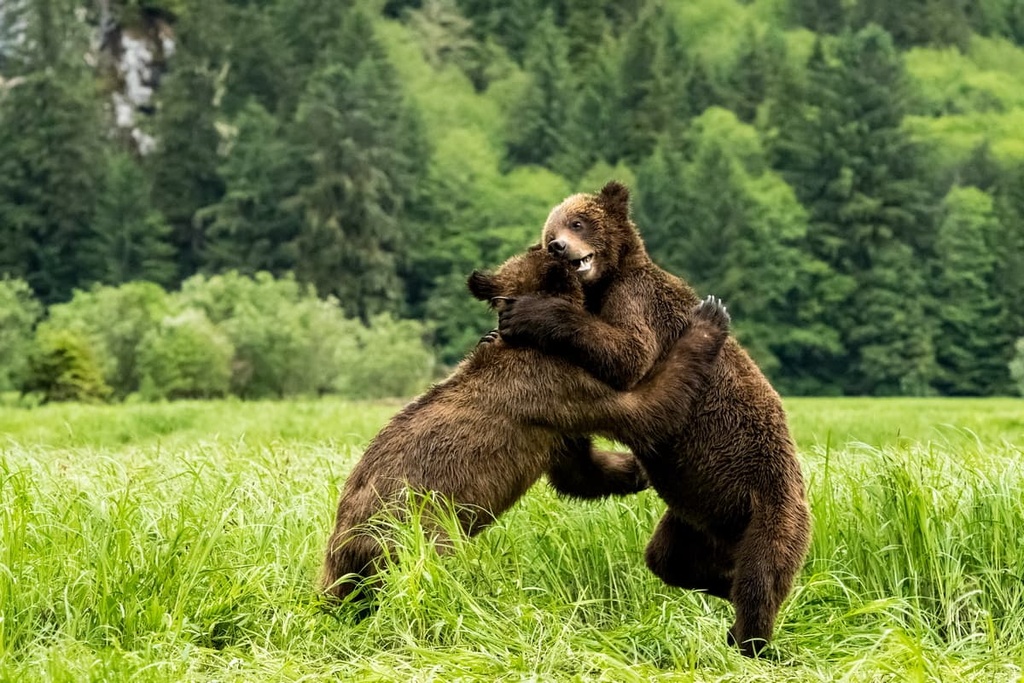
The subalpine forests are filled with mountain hemlock, amabilis fir, and yellow cedar. Black bears, grizzly bears, Roosevelt elk, and black tailed deer are common inhabitants of the zone. Mountain goats in the area prefer open rocky outcroppings during the summer, though they winter on the steep, south facing slopes of the zone where sunshine is more prevalent.
Many bird species prefer the mature forests of this zone because they provide good access to insects, small animals, and conifer seeds. The great horned owl, great grey owl, Clark’s nutcracker, and several woodpecker species are common to the forests of this ecological zone.
Some animals prefer open parkland and meadows, instead. This includes species such as the willow ptarmigan, blue grouse, and the Vancouver Island marmot.
The Coastal Western Hemlock Zone is found at the lowest elevations of the North Coast Regional District. It is the primary ecology covering Haida Gwaii and the coastal islands.
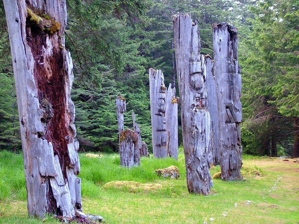
The Coastal Western Hemlock Zone is home to the legendary giant trees of British Columbia, where Douglas fir can reach upwards of 100 m (327 ft) in height and both the western redcedar and Sitka spruce can grow to 4 m (13 ft) in diameter.
The coastal forests are the most productive forests in British Columbia, with the dominant tree species being western hemlock and Pacific silver fir. Coastal margins, wetlands, estuaries, and extensive upland forests fill in the ecological mosaic of the region.
This zone has the greatest diversity of wildlife habitat of any ecological zone in British Columbia. There are many species of colony-nesting coastal birds that are unique to the region. Additionally, tufted puffins, ancient murrelets, Cassin’s auklets, and rhinoceros auklets nest on the rocky islands that are part of the Coastal Western Hemlock Zone.
The continued human habitation of the North Coast Regional District is among the longest in Canada, with evidence of occupation from over 13,000 years ago. Archaeologists believe that Haida Gwaii was a possible Pacific coastal route for migration from Beringia to the southern parts of North America.
As the glaciers melted at the end of the Pleistocene, the sea level was still low. During this time, the coastal margin and the Insular Mountains, including Haida Gwaii and the Vancouver Island Ranges, were fully exposed.
Additionally, toward the end of the Pleistocene, these mountain rangers were still connected. Even the Hecate Strait, between Haida Gwaii and the mainland, was a broad coastal plain that allowed for overland travel.
Oral traditions of the Haida recount the travels of their ancestors from what is now known as Alaska in search of new territory. Underwater archaeologists have discovered stone structures on the seafloor in the Hecate Strait that are estimated to be 13,700 years old. These are among the oldest signs of human habitation in what is now called Canada.
On Haida Gwaii, the Haida culture emerged and was enriched by the abundance of resources in the nearby land and sea. The Haida were noted seafarers, having occupied more than 100 villages throughout the islands and trading with mainland neighbors and people as far away as California.
This abundance of resources allowed the Haida to develop a unique cultural heritage. The villages were traditionally filled with well-constructed cedar longhouses and local artisans created totem poles. It wasn’t until 1774, however, that the Haida first made contact with Europeans whose ships were cruising the Pacific trading furs.
During the late eighteenth and into the nineteenth century, US sailors dominated the maritime fur trade in the islands of Haida Gwaii. At the time, these islands were considered to be part of Oregon Country. It was only in 1846 that the islands officially became part of the British colonies, and later part of Canada.
The first name that settlers of European descent gave to the archipelago was the ‘Queen Charlotte Islands.’ However, after petitions to the Canadian government, the name was changed in 2010 to Haida Gwaii. The Skeena-Queen Charlotte Regional District was subsequently renamed in 2016 to the North Coast Regional District to align with the renaming of the islands.
The North Coast Regional District encompasses the rugged west coast of northern British Columbia. Here, there are dense forests, deep fjords, and rocky coastlines both on the mainland and on Haida Gwaii. The following are some of the notable hiking areas and trails in the region.
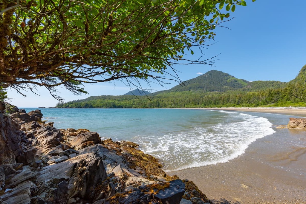
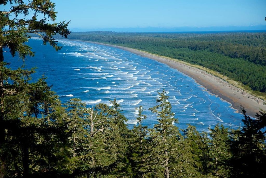
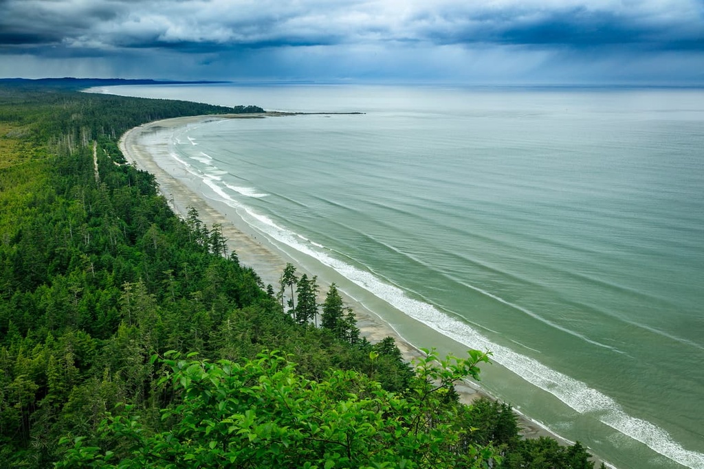
Naikoon Provincial Park, on the east coast of Haida Gwaii, is the most accessible wilderness park on the islands. Within the 700 square kilometers (270 square miles) of protected lands, there are rainforests, wetlands, sand dunes, and 100 km (60 mi) of beaches. The following are some of the popular trails in Naikoon Provincial Park:
The Secret Cove Trail on Moresby Island leads to a hidden cove with an amazing beach. The trail is short, which allows for more time enjoying the wilderness. It also offers incredible beach and ocean views.
Golden spruces (technically a genetic mutation in a Sitka spruce) are revered by many First Nations in the Pacific Northwest. One particular golden spruce, Kiidk'yaas, was located on the banks of the Yakoun River and was considered sacred to the Haida.
Unfortunately, Kiidk'yaas was felled in 1997 by Grant Hadwin, who claimed that he did so in protest against the logging industry. Hadwin disappeared soon after the incident and his fate remains unknown.
However, visitors can still visit the site of Kiidk'yaas. This short trail brings you to the riverbank across from where Kiidk'yaas once stood and it offers fantastic views of the surrounding forest.
Mount Moresby is located on Moresby Island, the southern of the two big islands of Haida Gwaii. The mountain is the tallest peak in the archipelago.
There is no official trail to the summit; however, there are cairns marking the way. The hike is strenuous and can take upwards of 10 hours to complete.
The North Shore Regional District is filled with rugged coastlines, dense forests, and significant cultural history. The following are some of the cities and villages of the North Coast Regional District that are significant for travelers to the area.
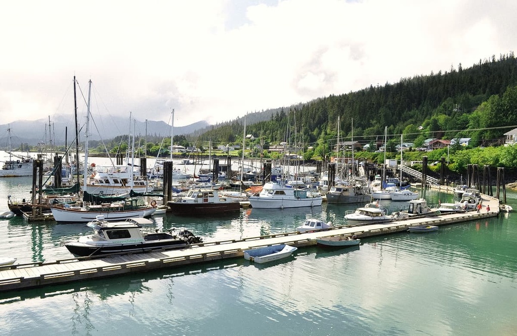
Located on Kaien Island, Prince Rupert is the transportation hub of British Columbia’s north coast. The area has been inhabited for the last 5,000 years by First Nations; however, the contemporary city of Prince Rupert was first established with a post office in 1906 and was the western terminus for railways.
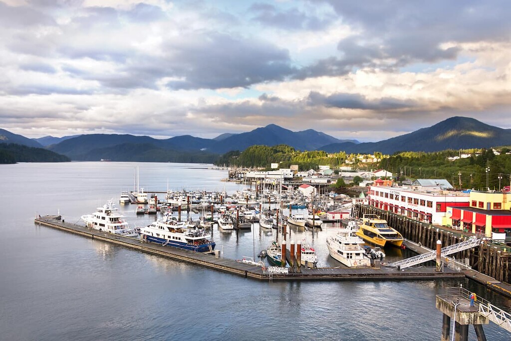
The city is the starting point for many wildlife viewing trips including expeditions to see grizzly bears, salmon, eagles, and whales. Tours can be arranged from Prince Rupert to Khutzeymateen Grizzly Bear Sanctuary which features one of the densest populations of grizzlies in North America.
With a variety of trails to choose from, some of the most popular hikes around Prince Rupert include the Butze Rapids Trail, Tall Trees Trail, and the trail to Wantage Falls. You can also hike Mount Hays via the Kiwanis Trail.
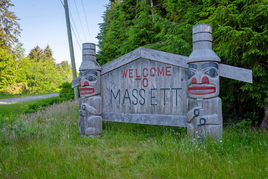
Located at the north end of Graham Island of Haida Gwaii, the village of Masset is the western terminus for Highway 16. It is also served by the Masset Airport. The village of Masset was possibly the location of the first meeting between the Haida and Europeans in the eighteenth century.
Located just to the east of the village is Naikoon Provincial Park with its stunning ancient forests and 100 km (60 mi) of beaches. Some of the popular hiking destinations in the area are the Blow Hole, the sand dunes of East Beach, the Pesuta shipwreck, and the Cape Fife Cabin.
The village of Queen Charlotte is located on the southern shore of Graham Island of Haida Gwaii, near the ferry terminal of Skidegate Landing. The village is home to one of the two hospitals on the islands and the village has services and accommodations for tourists arriving on the islands for their adventures.
While in the village of Queen Charlotte, you can employ local tour guides for fishing trips, wildlife viewing outings, and dive charters, or you can strike out on your own.
The alpine meadows of Sleeping Beauty Mountain and the summit of Mount Genevieve are strenuous but attainable destinations. You could also travel to the stunning beaches of Rennel Sound to hike, fish, beachcomb, or to kayak along the rugged coast and crescent beaches.