Get PeakVisor App
Sign In
Search by GPS coordinates
- Latitude
- ° ' ''
- Longitude
- ° ' ''
- Units of Length

Yes
Cancel
❤ Wishlist ×
Choose
Delete
Naikoon Provincial Park is a protected area on northeast corner of Graham Island in the Haida Gwaii archipelago of British Columbia, Canada. Argonaut Hill and Tow Hill are the tallest points in the park, standing both 130 m (427 ft) tall; however, Tow Hill is more prominent with 115 m (377 ft) of prominence.
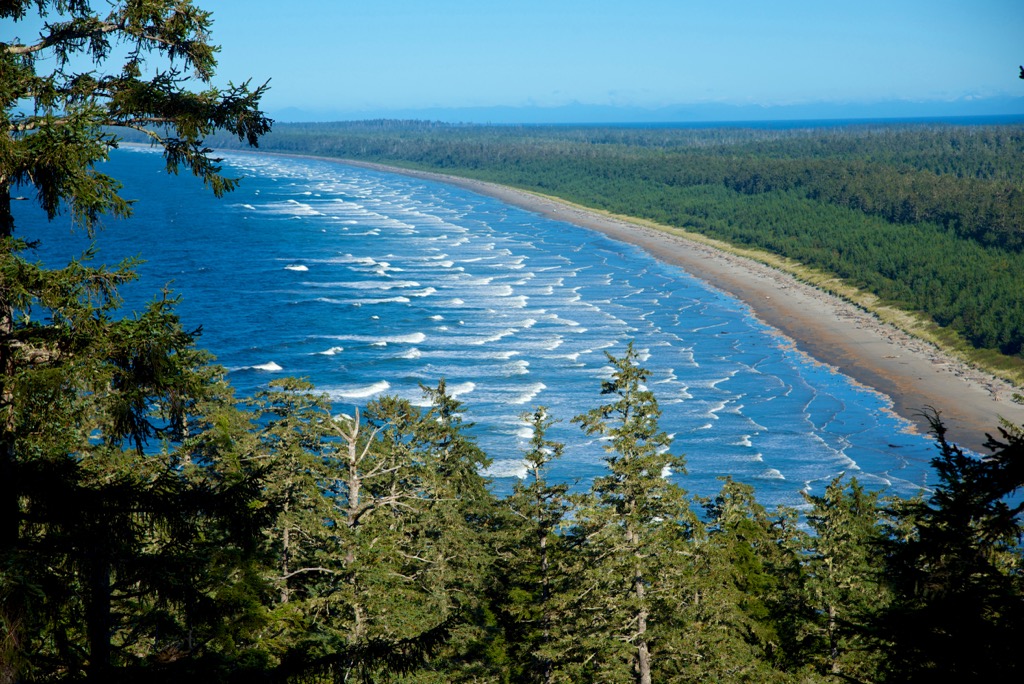
Covering the northeast coast of Graham Island in the Haida Gwaii Archipelago of British Columbia, Canada, Naikoon Provincial Park protects the wilderness and the cultural heritage of the Haida. Graham Island is the largest island within the Haida Gwaii archipelago on the northwest coast of the province.
Visitors can reach Haida Gwaii by air, through regularly scheduled flights from Vancouver and Prince Rupert, and by BC Ferries between Prince Rupert and Skidegate. Highway 16 is the major highway on Graham Island and it runs along the west side of Naikoon Provincial Park, providing access at Tlell, Mater Lake, and northeast of Masset.
There are no roads into the interior of the park; however, there are two developed, vehicle accessible camping sites for families and groups, as well as wilderness camping opportunities and the opportunity to stay in a Haida longhouse-style cabin near the beach. There are no reservations for any of the camping and it is all available on a first come basis.
The park headquarters is located in the community of Tlell ,which is about a 45 minute drive north of Daajing Giids. Speaking with the conservation officers at the park headquarters can give you insight into the culture, history, and physical features of the park.
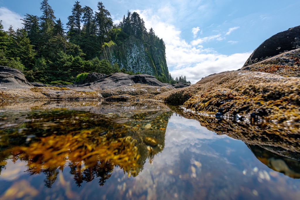
Naikoon Provincial Park is one of two provincial parks on Haida Gwaii, the other being the nearby, and much smaller Pure Lake Provincial Park. While there are only two provincial parks, nearly 70% of the archipelago is part of a conserved area.
The southern end of the archipelago is dominated by Gwaii Haanas National Park Reserve, and there are many smaller ecological reserves that are meant to protect very specific ecological features. Rose Spit and Tow Hill ecological reserves are encompassed by Naikoon Provincial Park.
The remainder of the conservation areas of Haida Gwaii are conservancies, which are protected areas that have a co-management between BC Parks and the local First Nations. The following are some of the other conservations areas near Naikoon Provincial Park that haven’t been mentioned already:
The islands of Haida Gwaii are part of the Insular Mountains, which also includes the Vancouver Islands Ranges. Most of the range is submerged and many of the islands along the coast of British Columbia are the peaks of this vast underwater mountain range.
About 100 million years ago a collection of volcanic islands called the Insular Islands collided with the west coast as their tectonic plate was subducted beneath the North American plate. The collision created the geological uplift of the Insular Mountains; however, this tectonic collision was also responsible for the formation of the Canadian Rockies and the uplift of the other interior ranges such as the Coast Mountains and the Columbia Mountains.
The Insular Islands and therefore the Insular Mountains are formed primarily from turbidites and pillow lavas. Indeed, Haida Gwaii and Vancouver Island contain some of the most recently active fault lines in Canada, which includes some relatively recent volcanic activity.
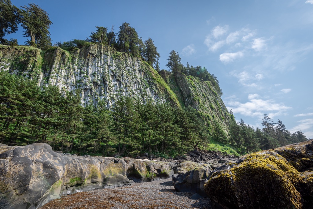
About 2 million years ago, molten lava was forced through a crack in the Earth’s crust and reached the surface at the location of Tow Hill. The molten rock, known as basalt, quickly cooled into long, geometrically shaped columns as a volcanic plug in Tow Hill.
During the Pleistocene, Haida Gwaii, including Tow Hill was covered by an ice sheet. As the glacier moved north, into the ocean it heavily eroded the northern slope of Tow Hill and exposed the basalt columns which now stand as an impressive sea cliff.
Furthermore, erosion created the popular “blowhole” attractions along the coast of the park. Waves cut through the layers of sandstone and shale along the coast of the island exposing the planes of sediment deposition. As the sea level continued to fall, cavities were formed from the erosion of the softer rocks and the wave pressure formed surge channels in the remaining cracks to create the “blowhole”.
The northeast corner of Graham Island is topographically unique in the Haida Gwaii archipelago in that it is a rare example of lowland and flat terrain. There are areas of poor drainage that give rise to unique ecosystems, such as the bog at the Argonaut plain. However, most of Naikoon Provincial Park is covered with the forests of British Columbia’s rainforest.
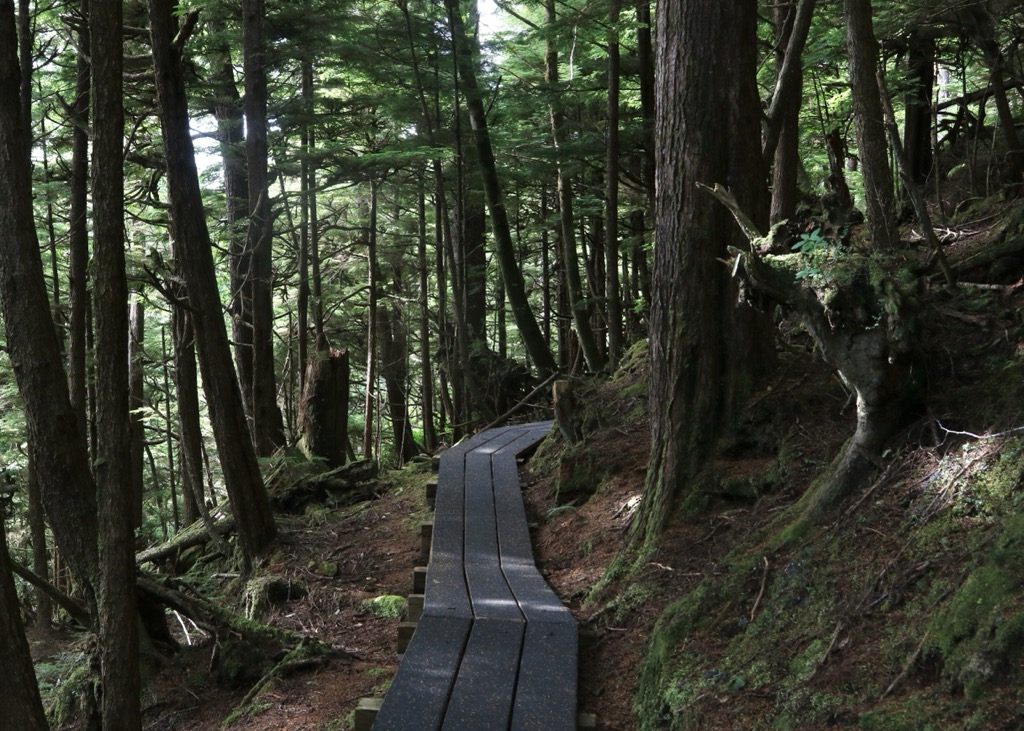
The climate of the archipelago is typically quite wet which promotes the growth of vast, dense forests across the coast of the province. Most of the forests are filled with western red cedar, western hemlock, amabilis fir, and Sitka spruce. The highest elevations of Argonaut and Tow hill may have stands of mountain hemlock.
Understory vegetation that may be found are Alaskan blueberry, oval-leaved blueberry, red huckleberry, and false azalea. Some of the herbs you may encounter are five-leaved bramble, cordilleran bunchberry, deer fern, spiny wood fern, queen’s cup, false lily-of-the-valley, and rosy twistedstalk.
The forest floor is typically covered with feather mosses and leafy liverworts. Typical mosses are lanky moss, step moss, and flat moss, along with cedar-shake liverwort.
The wildlife in the park is a mixture of native and introduced species. The native species of the park include black bear, river otter, marten, and several other mammals whose ancestors crossed the salt waters. Dolphins, harbour porpoises, and hair seals can be seen regularly while northern fur seals and California grey whales can be seen when they migrate north during late spring.
The bird species of Naikoon Provincial Park are similar to those of the mainland; however, many species have not crossed the Hecate Strait and others have developed interesting subspecies. The Hairy woodpecker, saw-whet owl, and Steller’s have formed a sub-species on Haida Gwaii.
Furthermore, a sub-species of pine grosbeak is only found on Haida Gwaii and Vancouver Island while a sub-species of song sparrow is only on Haida Gwaii and the Alaskan Islands.
Some of the introduced species include Sitka blacktail deer which were introduced in the early twentieth century, which have thrived in the absence of predators and presence of abundant forage. Muskrat, beaver, raccoon, red squirrels were introduced along with cattle.
There are small herds of wild cattle upon the island that are the remnants of domestic stock from the early days of settlement which have been seen along the east coast.
Rose Spit is a particularly great place to go birdwatching while at Naikoon Provincial Park. It is a place where sandhill cranes gather after nesting in the bogs. Also, the currents bring lots of food to the surface and beach, which attracts many different shore birds, and many sea birds that are rarely seen from the shore.
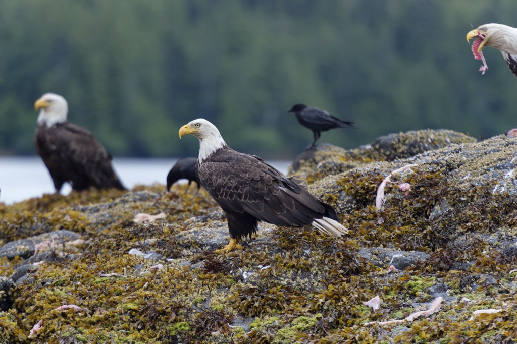
In Haida mythology, the Raven is one of the most powerful figures and their creation story begins with him being lonely. One day, Raven was lonely and was wandering down the beach that is now known as Rose Spit in Naikoon Provincial Park.
As he wandered, he heard noises coming from a clamshell and upon inspection of the shell he saw many little creatures hiding within. The Raven convinced the people to come out from under the shell and join the new world, and those became the Haida people.
In western Canada it was rather common that indigenous cultures would rise and fall, only to be supplanted by another group through climatic changes or warfare. The Haida are one of the exceptions where they can trace their ancestry to the first people that inhabited the archipelago of Haida Gwaii after the glaciers melted and Canada became habitable again.
Naikoon Provincial Park is the birthplace of the Haida people, and it is the ancestral home of the Gwak'rala'chala people who are one of the many tribes of the Haida.
Archeological evidence on and around the islands suggest that the Haida people have inhabited the islands for at least 10,000 years. The oral traditions of the Haida suggest that the Haida have an even longer history with their islands.
Currently, the Haida Nation desires to protect their ancestral lands from ongoing logging that threatens their physical and spiritual lifeways. While in Naikoon Provincial Park, visitors can reflect on the culture of the Haida.
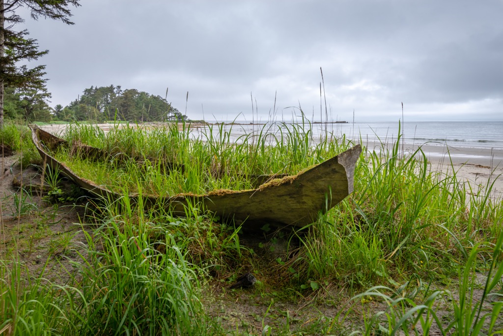
The Haida are famous across the world, primarily from many of their art pieces, which carry their unique style, that were stolen and displayed in museums and other collections. They are famous for their intricately carved totem poles, their 20 m (65 ft) dugout canoes that they plied across rugged waters into history.
Their advanced culture created argillite statues, intricately designed woven baskets, and hats made from woven spruce roots. Their belongings represented their prestige and wealth, and their potlatch ceremonies were surely an event to behold.
Spanish explorers are credited with the European discovery of Haida Gwaii. It was Juan Perez’s crew, sailing for the Spanish Viceroy of California, who first saw Haida Gwaii in 1774.
In the early twentieth century, after Haida Gwaii was considered part of Canada and British Columbia, the provincial government encouraged settlers to farm Haida Gwaii. Many settlers chose the vast lowlands of Graham Island, where Naikoon Provincial Park now sits.
The settlers would grow vegetables, raise cattle, and take gold from the sand beaches; however, poor conditions including the environment, access, and the political turmoil of the Great War led many to abandon their homesteads before the 1930s depression era.
However, there are still important village sites, food gathering sites, and other sites of cultural and spiritual significance to the Haida in the park. Pacific razor clams are one of the many foods traditionally harvested from the park.
During the summer, villages would be emptied as their people were out on the beaches harvesting food. Indeed, a razor clam fishery and cannery were opened at Hiellen River in 1923 which employed many Haida people.
Today visitors can enjoy the rich wildlife and wilderness of the park by visiting one of the developed campgrounds or hiking through the backcountry of the park. While there are no interpretive programs at the park, visitors can learn more about the history of the region and people by visiting sites such as Tow Hill, Blowhole, and Rose Spit viewpoints and reading the interpretive signs.
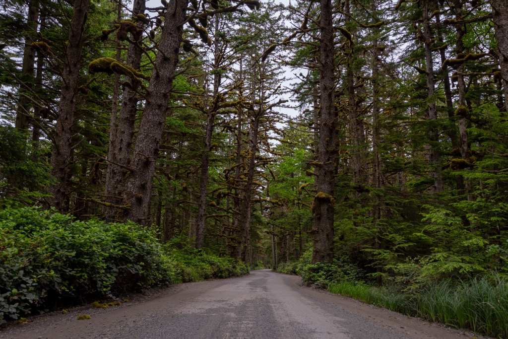
Another way to learn the history of the park and the people is to politely engage with the locals of Haida Gwaii. While there are no ranger stations in the park, the Park Conservation Officers are located nearby and are willing to speak with visitors at their headquarters in Tlell.
Naikoon Provincial Park is one of the most accessible wilderness areas on Haida Gwaii; however, it is still a remote wilderness area with few facilities. The following are some of the must see places and some of the top hiking trails in the park.
Tow Hill Ecological Reserve is located at the north end of the park and includes the geologically fascinating Tow Hill and the “blowholes” attraction. The Ecological Reserve is encompassed by Naikoon Provincial Park and there are some short hiking trails to the top of Tow Hill and out to the “blowholes”.
The trails can be hiked separately or as a loop. Both trails are about 1 km (0.6 mi) from the trailhead to the destination and the trail is mostly along a boardwalk and stairs. On clear days visitors may see as far as the Alaskan coast.

Rose Spit is the northeast corner of Graham Island and is considered to be the birthplace of the Haida people. One of the ways to view and experience Rose Spit is to hike the 21 km (13 mi) trail from Tow Hill Ecological Reserve to the spit, along the north coast.
Camping is not permitted within either of the ecological reserves; however, backpackers can set up camp in the areas that are designated as Naikoon Provincial Park.
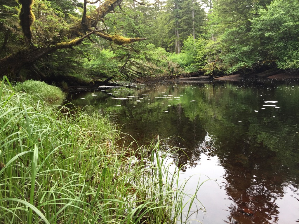
Departing from the Agate Beach Campground which is adjacent to Tow Hill Ecological Reserve, visitors can hike about 10 km (6 mi) to Cape Fife and the East Beach. There is a shelter for hikers that is available on a first come basis. This is a remote wilderness area that allows hikers to be immersed in the incredible wilderness of Haida Gwaii and spend some time upon the ancient beach.
This hike starts from the south end of the park and follows a trail through the forest, along the Tlell River, and along the East Beach until you make it to the Pesuta shipwreck. The trail is about 12 km (8 mi) round trip along fairly flat terrain and it gives you ocean views from the island and the opportunity to see a shipwreck up close.

The East Beach Trail extends along the entire east coast of Naikoon Provincial Park. The trail is over 70 km (42 mi) long with about 1,000 m (3,200 ft) of elevation change throughout the course of the hike. It is a challenging and remote route that generally takes several days to complete.
The typical trail route hooks up with the Cape Fife Trail between East Beach and Agate Beach Campground; however, ambitious hikers can add to their journey by hiking up Rose Spit and then follow the North Beach to Agate Beach Campground.
It is generally recommended to hike the trail from south to north, starting from Misty Meadows Campground and ending at Agate Beach Campground. Hiking this direction ensures the prevailing winds are typically at your back, making the hike a little more comfortable.
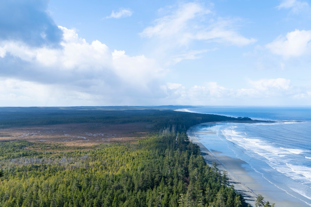
There are only about 4,000 people living throughout the Haida Gwaii Archipelago. If you are planning a trip to Naikoon Provincial Park, here are some of the best towns to visit in the region.
Prince Rupert is a port city located on the coast of British Columbia. It is the gateway to some inspiring wilderness areas such as the Khutzymateen Grizzly Bear Sanctuary and Gitnadoiks River Provincial Park.
There are many tourist and guiding services available to take visitors wildlife viewing and along the coast to discover secret coves, beaches, and wonderful wilderness to explore. The BC Ferries route from Prince Rupert to Skidegate Landing is the best way to get to Haida Gwaii with a vehicle.
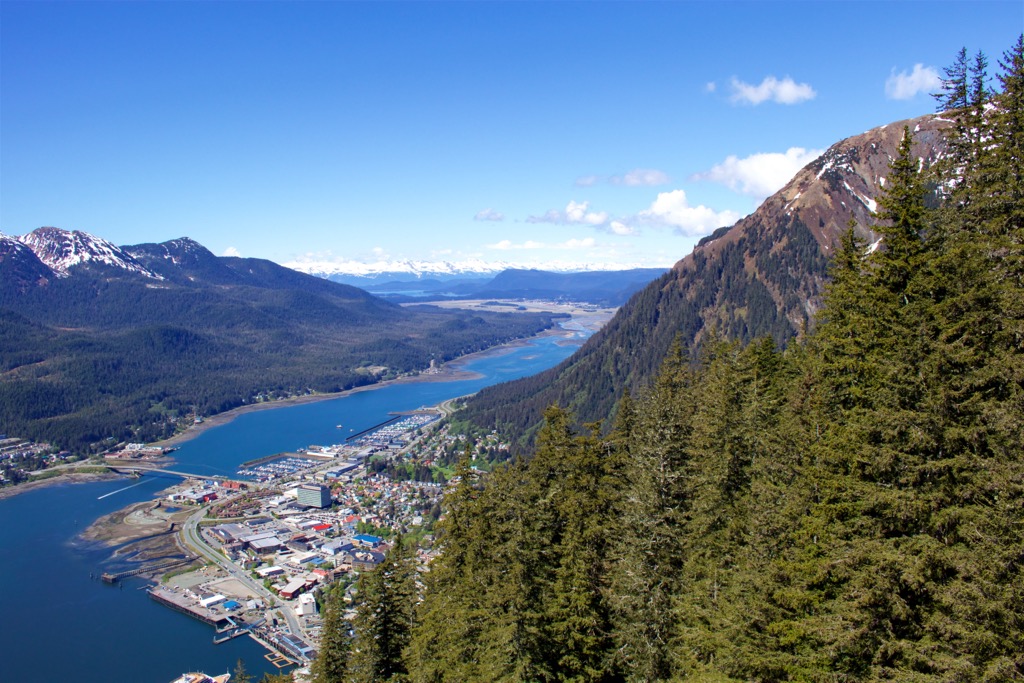
While the town is reliant upon commercial fishing and logging for their economy, tourism is also growing as more people want to experience these rugged wilderness areas in a sustainable way.
Skidegate Landing is where the BC Ferries terminal lies and is likely to be the first place you visit if you came by car and Skidegate is the community located just north of the ferry terminal. Skidegate is about 40 km (24 mi) south of Tlell and the southern end of Naikoon Provincial Park and over 100 km (60 mi) from the north end of the park.
The community offers wonderful opportunities to explore the rich history of the Haida people here with visits to the Haida Gwaii Museum and the Haida Heritage Centre. As you travel around town, you’ll also likely notice some of the many wood carvings by the renown Haida artist Bill Reid.
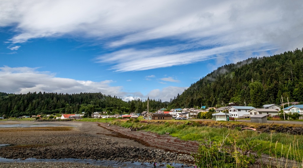
Daajing Giids is one of the larger settlements on Graham Island, and it was also one of the first. Originally named Queen Charlotte, the name was changed to a Haida name as part of the reconciliation process. The community has a population of around 1,000 and is where visitors can pick up anything they might be missing for their wilderness trip.
There are two vehicle accessible campgrounds at Naikoon Provincial Park and many opportunities for wilderness camping. Misty Meadows Campground is located near the community of Tlell at the south end of the park and Agate Beach Campground is along the north shore of the park, adjacent to Tow Hill Ecological Reserve.
The campgrounds are first come and no reservations are accepted; however, if you find they are full, there are other wonderful places around the island to visit. Furthermore, if you’re willing to hike through the wilderness, there are several cabins throughout the park that are for visitors to use.
Explore Naikoon Provincial Park with the PeakVisor 3D Map and identify its summits.


