
Scan the QR code and open PeakVisor on your phone
Daawuuxusda Heritage Site/Conservancy is located on the west coast of Haida Gwaii in British Columbia, Canada. The Heritage Site and Conservancy is co-managed by the Haida Nation and BC Parks to protect the shared interests of the area’s cultural and environmental value. The rugged Pacific coastline of Daawuuxusda consists of many channels, fjords, and inlets. The protected area includes a substantial marine area and rises to the summit of Mount La Pérouse (1,116 m/ 3,661 ft) in the Queen Charlotte Mountains.
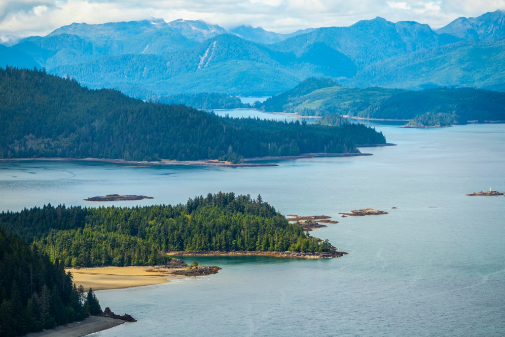
Located on the rugged Pacific Coast of Haida Gwaii in British Columbia, Canada, Daawuuxusda Heritage Site and Conservancy protects important Haida cultural areas and helps conserve the ecological integrity of the region.
Haida Gwaii is an archipelago that is located off the northern coast of British Columbia, and is home to the Haida Nation. Graham Island is the largest of the archipelago’s islands and Moresby Island is the second largest. The Queen Charlotte Mountains form the backbone of the archipelago, and the islands of the archipelago are the tops of part of the submerged Insular Mountains.
Daawuuxusda extends from the southern shores of Rennel Sound on Graham Island to Tasu Sound on Moresby Island. The terrestrial component of the park protects over 700 square kilometers (270 square miles) of rugged Pacific coastline and the Queen Charlotte Mountains while the marine component of the conservancy protects over 450 square kilometers (170 square miles) of the ocean and foreshore.
The conservancy encompasses many channels, fjords, inlets, islands, and part of the Queen Charlotte Mountains. Mount La Pérouse (1,116 m/ 3,661 ft) is the tallest of the twenty named summits that are encompassed within the conservancy.

Access to Daawuuxusda is limited and visitors usually arrive by air or sea because foot and vehicle access is difficult. There are a few rugged logging roads that lead into Skidegate Channel, Kootenay Inlet, and Peel Inlet; however, these roads are rugged and are eroding with little or no maintenance being conducted.
Gwaii Haanas National Park Reserve and Heritage Site is located south of Daawuuxusda and Duu Guusd Heritage Site and Conservancy is located to the north. Along with the Vladimir J. Krajina (Port Chanal) Ecological Reserve, these protected areas have contiguous marine boundaries along the west coast of the archipelago that form an important interconnected ecological complex.
Around half of the terrestrial area of Haida Gwaii is protected as a park or a conservancy. The following are some of the other protected areas near Daawuuxusda:
Haida Gwaii is an archipelago located off the coast of British Columbia and includes a diverse range of geological features and processes which have shaped the landscape. The islands are home to sedimentary, volcanic, and plutonic rock formations which have formed over hundreds of millions of years.
Haida Gwaii is a remnant of an island arc, known as the Insular Islands, which collided with the North America continental margin about 100 million years ago. The Insular Islands formed upon an oceanic tectonic plate, called the Farallon plate, which collided with the North American plate as the continent was moving westward.

The collision caused the dense oceanic plate to slide beneath the more buoyant continent, in a process called subduction. During the subduction, there was volcanic activity along the subduction zone and the islands upon the Farallon plate were skimmed off and stuck to the edge of the continent in a process called accretion.
Most of British Columbia is created from exotic terranes which were accreted to the west coast over the course of millions of years and created the Canadian Cordillera. The southern ranges of Canadian Cordillera started with the Columbia Mountains, followed by the Interior Mountains, and then the Coast Mountains.
The accretion of the Insular Islands and the formation of the Insular Mountains along the west coast coincided with the formation of the Rocky Mountains, which are the easternmost ranges of the Canadian Cordillera.
During the Pleistocene the Insular Mountains were a vast mountain range which rose high above the continental shelf. However, as the ice sheets melted and sea levels rose, the Insular Mountains were flooded. The islands of Haida Gwaii and the Vancouver Island Ranges are the tallest peaks of the submerged Insular Mountains.
The eastern side of Haida Gwaii, especially Graham Island, is composed mainly of sedimentary rocks; however, Daawuuxusda, and the west coast are composed mostly of Triassic and Jurassic aged volcanic rocks. From Rennel Sound in the north to Gudal Bay are intrusive rocks and then primarily undivided volcanic rocks to the north side of Skidegate Channel.
The volcanic rocks of Daawuuxusda are primarily composed of basalt and andesite, which are dark-colored rocks that are rich in iron and magnesium. While some of the volcanic rocks on the islands are hundreds of millions of years old, others are relatively young, with some of the rocks only dating back to the early Tertiary period, which ended around 65 million years ago.
One of the effects of the late-stage volcanism which occurred during the accretion of the Insular Islands was the formation of large plutonic rocks throughout the Queen Charlotte Mountains. These plutonic rocks are primarily granitic in nature and are found throughout the islands and specifically in Daawuuxusda, Southwest of the Chaatl Narrows is the Chaatl Inlet pluton formation.
Near Ells Point, along the steep cliffs of the south shore, visitors can view the distinct columnar basalt “pipe-organ” structures. Furthermore, the rocks of Daawuuxusda contain a nearly complete and uninterrupted fossil and rock record from the Late Triassic through the Late Cretaceous.
The Queen Charlotte Mountains are the mountainous backbone of Haida Gwaii and primarily rise along the west coast and are the mountains of Daawuuxusda. The mountains and terrain have been shaped by tectonic uplift, volcanism, erosion, and glaciation.

The ice sheet and glaciers of the Pleistocene played a major role in shaping the terrain of Daawuuxusda. During the last glacial maximum, which ended around 10,000 years ago, much of the archipelago was covered by glaciers that carved out deep valleys, many of which became the rugged west coast fjords of Haida Gwaii as the sea level rose.
In general, the geology of Haida Gwaii is complex and characterized by a rich geological history that has shaped the landscape over millions of years. From the volcanic rocks of the western islands to the granitic plutons that underlie much of the archipelago, the geology of Haida Gwaii is one of the things that create the intense natural beauty of Haida Gwaii.
Western Haida Gwaii is home to a diverse range of ecosystems and Daawuuxusda includes coastal rainforests, intertidal zones, and marine habitats. Daawuuxusda includes 70,319 hectares (173,762 acres) of terrestrial environment and 45,782 hectares (113,129 acres) of marine habitat.
These dense temperate rainforests, rugged coastline, and the intertidal zone are very similar to Vancouver Island and the coast of British Columbia; additionally, the isolation of Haida Gwaii has created circumstances where unique plants and animals have developed. An example are the rare endemic plants that occupy the limestone outcrops on Mount La Perouse.

The coastal rainforests of western Haida Gwaii are some of the most productive and biologically diverse ecosystems on the planet. These forests are dominated by towering conifer trees such as Sitka spruce, western hemlock, and western red cedar, which can grow up to 90 meters tall.
The forests of Skidegate Channel, Kootenay Inlet, and Peel Inlet were historically logged; however, now that the area is under conservation even the access roads are eroding, and the forests are returning to their natural state. Despite historical logging along the coast of Daawuuxusda, 96% of the forests are mature or old growth forests.
The dense canopy of the rainforest provides habitat for a variety of animals, including birds, mammals, and insects.
One of the most iconic species of the Haida Gwaii rainforest is the black bear. These animals are important seed dispersers and play a crucial role in maintaining the health of the forest ecosystem. Other mammalian species found in the rainforest include Roosevelt elk, cougar, and wolf. Raccoons, Columbian black-tail deer, and Norway rats are all introduced species to the island.
The rats and the raccoons can cause problems for the sea birds and will often devastate nesting seabird populations. There are eleven large nesting colonies along the coast of Daawuuxusda and nearly 30 known peregrine falcon nesting sites which host several breeding pairs of falcons.
The area provides important foraging and nesting habitat for the ancient murrelet, Cassin’s auklet, tufted puffin, horned puffin, marbled murrelet, peregrine falcon, pelagic cormorant, and potentially northern goshawk.
The intertidal zone along the western coast of Haida Gwaii is a unique and biodiverse habitat that is rich in marine life. This zone is characterized by the shifting tide, which creates a range of microhabitats that are home to a variety of species. Barnacles, mussels, and sea stars are common inhabitants of the intertidal zone, while kelp forests and eelgrass beds provide habitat for fish and invertebrates.
Daawuuxusda contains nine estuaries that are home to important eelgrass and surfgrass habitat. Indeed, the area northwest of Kindaken rock is recognized as a unique marine habitat.

The marine and intertidal habitats are vital to the health of the region’s fish stock. Chum salmon, pink salmon, sockeye salmon, dolly varden, cutthroat trout, rainbow trout, and steelhead are found in the waters in and around Daawuuxusda.
The waters around the archipelago are also home to a variety of whale and dolphin species, including humpback whales, orcas, and Pacific white-sided dolphins. Daawuuxusda also provides an important habitat for Steller’s sea lions.
The ecology of Daawuuxusda is complex and interconnected with the rest of Haida Gwaii. The area is rich in natural beauty and resources. While the region's rich biodiversity is under threat from a range of threats, the local Haida people and the provincial government are striving to preserve these unique and important ecosystems.
The natural history and ecology of Haida Gwaii and Daawuuxusda are closely tied to the cultural heritage of the region. The Haida people, who have lived in the region for thousands of years and the modern Haida are believed to be descended from the original inhabitants of the islands, who arrived at the end of the ice age.
The Haida people have a deep spiritual and cultural connection to the land and sea. Their traditional knowledge and practices have sustained themselves for thousands of years while maintaining the delicate balance between human activity and the natural world.
Their stories tell of their origin on Rose Spit in Naikoon Provincial Park, and from the day that the Raven coaxed the Haida from the clam shell, they spread across the archipelago. It is believed that the original Haida were nomadic hunters and gatherers. During their time migrating along the coast, they also became very adept at fishing.

Archeological evidence suggests that around 5,000 years ago, the Haida turned to gathering shellfish as opposed to hunting and fishing as their primary source of food. The meat of the shellfish was likely skewered on sticks and smoked so it could be stored for winter or for travel.
While shellfish became an integral part of their diet, the Haida continued to hunt fish for salmon, halibut, lingcod, sockeye and coho, and gather from the abundant berries and greens upon the islands. The relative ease with which the Haida could provide for their basic needs allowed them the time to create a rich and vibrant culture and society that included elaborate art, music, and storytelling traditions.
Many Haida families trace their ancestry to Daawuuxusda, which is home to many Haida cultural sites. Within Daawuuxusda are many recorded archeological and cultural sites.
The recorded sites include at least seven village sites or seasonal camps, culturally modified trees, a ceremonial rock feature, a pictograph, cultural material, shell middens, human remains, a mortuary pole, fish bones inside a cave, a cultural depression, a historical log cabin, and house posts. There are likely many other significant areas that are yet undiscovered or unrevealed by the Haida people.
The early 18th century brought European explorers to the region and the Haida people were soon introduced to the fur trade where sea otter pelts were prized. The introduction of European trading partners had a significant impact on Haida society, as it led to the introduction of European diseases and disrupted traditional trading relationships.
In the late 19th and early 20th centuries, the arrival of European settlers led to further changes in Haida society. The establishment of the Canadian government in the region led to the imposition of colonial policies and the loss of traditional Haida lands. The co-management of Haida Gwaii’s heritage sites and conservancies is part of the process of recognizing the Haida people’s claim upon their traditional lands.
Despite these challenges, the Haida people have maintained their cultural traditions and continue to play an important role in the region. The management of Daawuuxusda allows for traditional use of the area, including monumental cedar and cedar bark harvesting, the harvesting of seaweed and medicinal plants, hunting, fishing, trapping, and food gathering.
Daawuuxusda also provides a setting where the Haida can physically express their culture, such as through creating totem poles and the establishment of traditional style infrastructure. The area was once home to thousands of people and traces of their culture can be found across the wilderness and landscape.
The remote and rugged nature of Daawuuxusda limits the number of visitors to the park; however, those that make the journey are sure to be impressed.
Boating is the main way visitors will access the remote west coast of Haida Gwaii to explore Daawuuxusda; however, it should be noted that the weather and oceanic conditions of the west coast make traveling the region challenging.
There are several overland routes that follow old logging roads. These roads are typically not maintained and may be challenging to navigate with a vehicle; however, they do provide another option for exploring the area.

The coastline is rugged and stunningly beautiful. There are some good anchorages throughout the conservancy and there are opportunities for camping within many of the protected inlets. However, it should be noted that many of the ideal campsites overlap with old villages or archeological sites, and the cultural integrity of the area should be preserved.
Traveling and exploring the cultural sites is one of the options, as well, there are many geological features to view, such as the basalt columns near Ell’s Point. Furthermore, traveling around the area to admire the local flora and fauna is certainly worthwhile.
Haida Gwaii has many wonderful places to explore, with Daawuuxusda Heritage Site/Conservancy being one of the parks along the west side of the archipelago. The following are the major communities of Haida Gwaii, where visitors can find lodging, meals, guiding and tour services, and be immersed in the culture and natural environment of Haida Gwaii.
Located on the southern edge of Haida Gwaii, and with nearly 1000 inhabitants, Skidegate is one of the two largest communities on Haida Gwaii. Situated near Skidegate Landing, where the ferry port resides, Skidegate is a wonderful place to encounter Haida culture and get set for your island adventure.
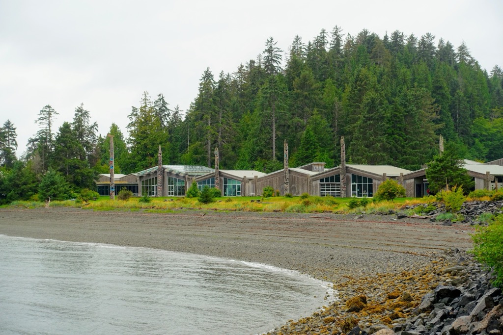
While in Skidegate there are many opportunities to discover Haida culture, such as by visiting the Haida Heritage Centre at Kaay Llnagaay which is a world-renowned museum that showcases the history, art, and traditions of the Haida people. Visitors can check out the totem poles, longhouses, and other exhibits that offer a glimpse into the rich and vibrant culture of this Indigenous community.
Furthermore, Skidegate is home to many talented Haida artists and craftspeople, and their creations can be found in shops, galleries, and their studios. These artists are a crucial cultural component of the Haida, and their works can help us gain a better understanding of their people’s history and culture.
Skidegate has many wonderful restaurants to sample local cuisine; however, the beauty of Skidegate is that it is also a great basecamp for exploring other parts of Haida Gwaii! Naikoon Provincial Park is north of the community and features the Pesuta Shipwreck Trail, and to the west is the Yaaguun Suu Heritage Site and Conservancy. These are certainly the most accessible parks on the island.
However, with the help of local operators or personal boats, visitors can explore the incredible territory of the Haida people. Gwaii Haanas National Park Reserve and Heritage Site encompasses the southern end of the archipelago, and Daawuuxusda and Duu Guusd lay along the west coast and are best accessed and explored by boat.
Daajing Giids is a small community located on the southern shore of Graham Island of Haida Gwaii and is only about 15 km (9 mi) east of Daawuuxusda. Founded in 1891, Daajing Giids was the first townsite registered on the islands and was called Queen Charlotte until 2022.
There are many worthwhile activities to do while staying in Daajing Giids, such as sampling the local cuisine of fresh caught seafood, admiring the many totem poles that are in the community, and learning about the local ecology.
Daajing Giids is located near the Tlell River and estuary where visitors can watch for and learn about the salmon, birds, and other marine life at the nearby Tlell River Interpretive Centre. There are also great walking trails along the river.
Other nearby hiking areas include Naikoon Provincial Park which boasts a variety of trails that wind through old-growth forests, sand dunes, and along the beach. The north side of the park is home to the Tow Hill Trail which offers a challenging climb up a volcanic plug, with stunning views of the surrounding landscape from the top.
Whether you're a seasoned hiker or a casual adventurer, there is no shortage of stunning scenery and outdoor exploration to be found near Daajing Giids.


