
Scan the QR code and open PeakVisor on your phone
Misty Fjords National Monument Wilderness has 38 named peaks. The highest is Mount John Jay at 2,226 m. Other notable peaks include Mount Wilson, Mount Willibert and Mount Lewis Cass.
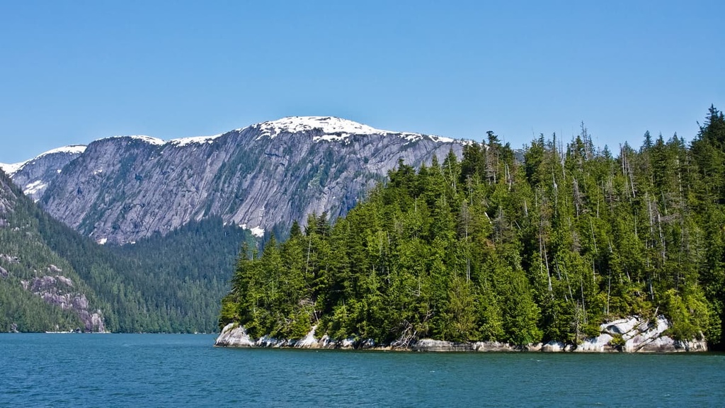
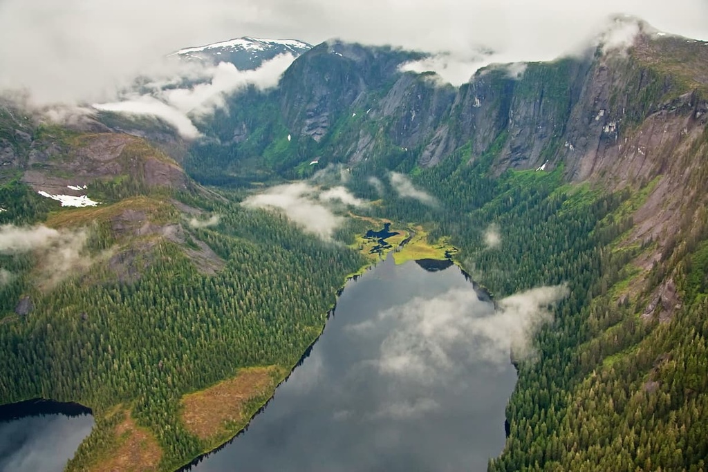
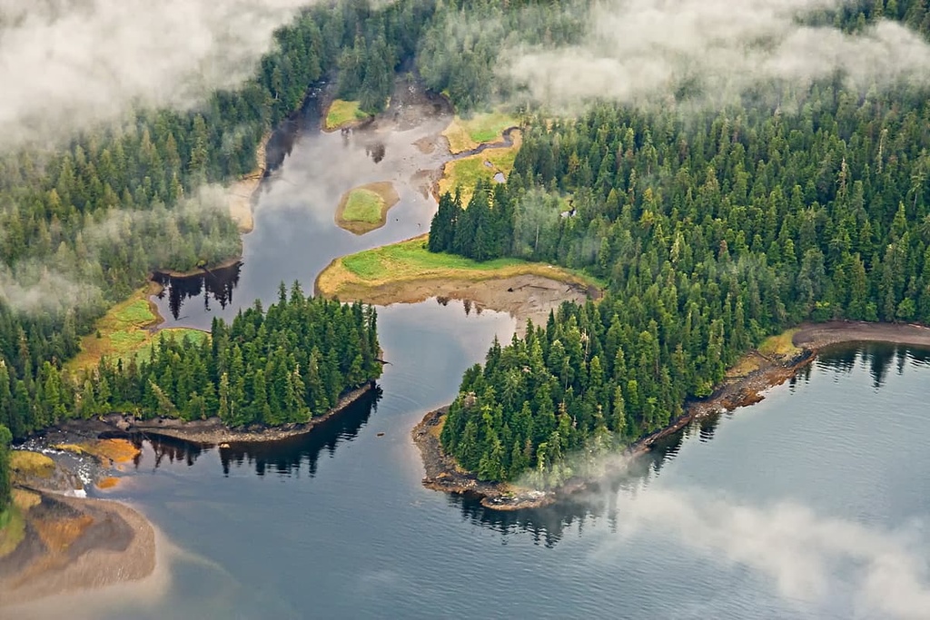
The Misty Fjords National Monument Wilderness protects 2,142,243 acres (866,935 ha) of lush coastal rainforest, deep fjords, and glacier-carved valleys at the southern tip of the US state of Alaska. There are 38 named mountains in the wilderness, the highest of which is Mount John Jay (7,303 ft/2,225 m) and the most prominent of which is Mount Reid (4,518ft/1,377 m).
The Misty Fjords National Monument Wilderness is the largest wilderness area in the Tongass National Forest, which extends approximately 500 miles (805 km) from the Dixon Entrance to Yakutat in southeastern Alaska.
The wilderness lies roughly 40 miles (64 km) to the east of the city of Ketchikan in an area known as the Ketchikan Gateway. For the most part, the park’s boundaries follow the Alaska-Canada border, which, in turn, is shaped by the Boundary Ranges of the Coast Mountains.
At its northeast corner, however, the wilderness is separated from the Canadian province of British Columbia by the Prince of Wales-Hyder Census Area. To the east, the park’s boundary is shaped by the Portland Canal, a principal inlet of the coast of British Columbia that stretches from Pearse Island in British Columbia the communities of to Stewart, British Columbia and Hyder, Alaska.
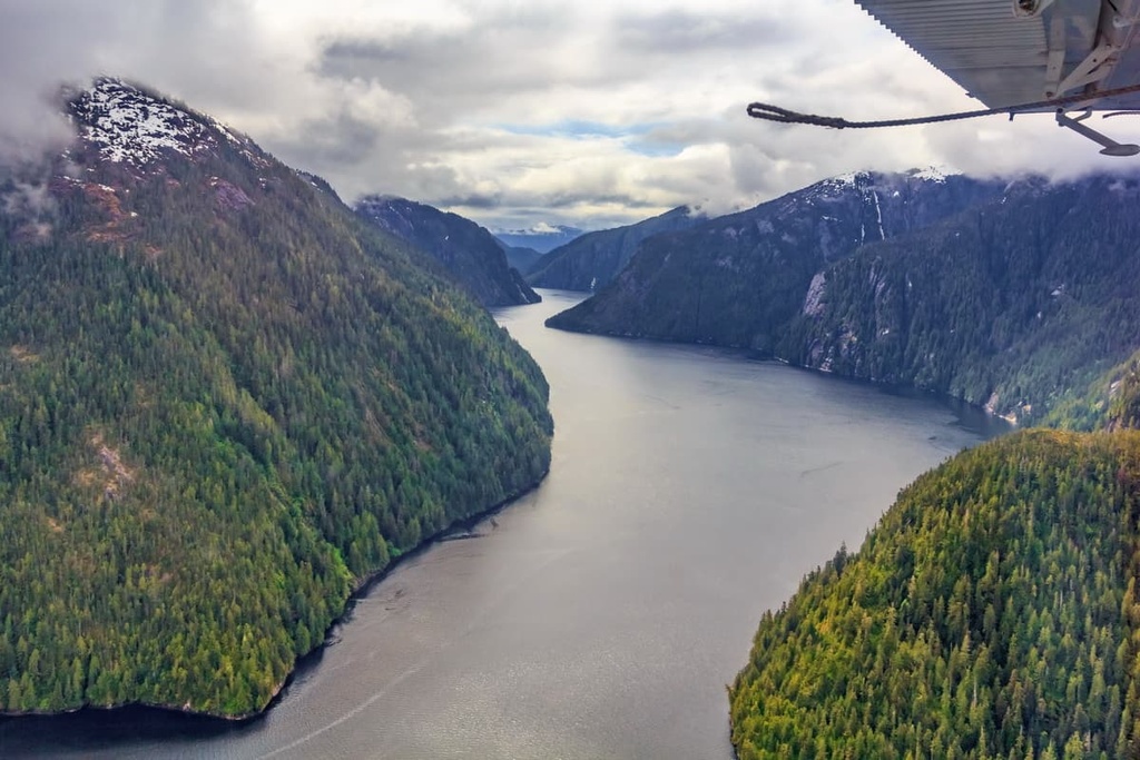
The Behm Canal, a 100-mile-long (161 km) waterway, cuts through the Misty Fjords National Monument Wilderness, separating mainland Alaska from Revillagigedo Island. The Misty Fjords National Monument Wilderness protects a portion of Revillagigedo Island, as well as several small islands in the Alaska panhandle, including Kanagunut Island, Sitkin Island, Tongass Island, Smeaton Island, and Winstanley Island.
Two Canadian Provincial Parks border the Misty Fjords National Monument Wilderness to the north: Border Lake Provincial Park and Lava Forks Provincial Park. In addition to the Misty Fjords National Monument Wilderness, the Tongass National Forest also contains the following wilderness areas:
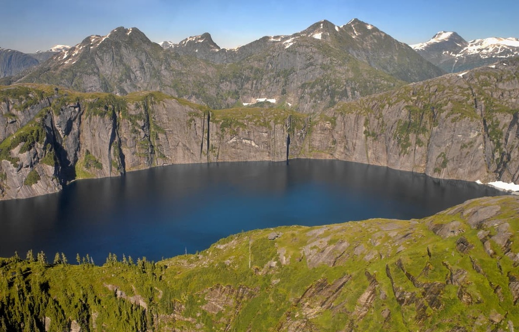
Often referred to as the ‘Yosemite of the north,’ Misty Fjords National Monument Wilderness is characterized by 50- to 70-million-year-old granite crags, glacial valleys, deep fjords, and sharp intervalley ridges that were shaped by volcanism, faulting, and glaciation.
The Behm Canal, which travels through the heart of the park, separates two terranes—the Coastal Mountain Batholith and the Taku terrane on Revillagigedo Island. Roughly 120 million years ago, the land now occupied by the park began its collision with North America, resulting in folding and faulting of local rock strata.
Rock forced upward was eroded and fragmented, while rock forced downward encountered extreme heat and pressure, altering its mineral composition. Today, remnants of these events can be found along the southwestern shore of Behm Canal, which contains the Taku terrane’s oldest rocks—greenstones, marbles, and schists—and along the Rudyerd Bay.
The park’s more ‘modern’ geologic history began during the last glacial maximum, when southeastern Alaska was covered by a thick sheet of ice. Roughly 17,000 years ago, during the most recent glaciation, the retreating ice carved out long, deep fjords and shaped many of the park’s impressive cliffs and summits.
One of the most impressive geologic features in the area is the New Eddystone Rock, a 237-foot basalt pillar located in the Behm Canal between the Revillagigedo Island and the entrance of Misty Fjords National Monument Wilderness. This impressive spire is believed to be the remnants of a volcanic system that extruded through the rock at the bottom of Behm Canal.
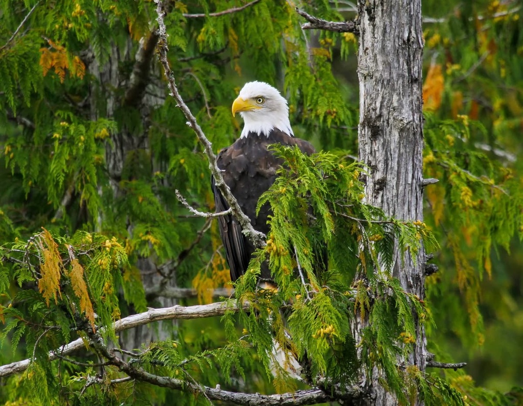
Wildlife in the Misty Fjords National Monument Wilderness is abundant. Brown and black bears, mountain goats, black-tailed deer, moose, and martens, are among the most frequently spotted mammals in the park, though a small population of wolves and wolverines are also known to roam the area.
Five Pacific species of salmon share the park’s expansive network of waterways with river otters, sea lions, harbor seals, orcas, and dall porpoises. Seabirds and waterfowl, including marbled murrelet, red-throated loon, surf scoter, and white-winged Scoter, are also inhabitants of the wilderness area.
The Misty Fjords National Monument Wilderness is blanketed by a vast coastal rainforest. At the forest floor stands of Sitka spruce, western hemlock, and cedar give way to muskegs dominated by sphagnum moss. Here, U-shaped valleys also rise abruptly to sheer ridges blanketed by alpine heaths and grasses.
The area that is now called southeastern Alaska has been the home of the Tlingit and Haida people for more than 10,000 years.
Historically, the Tlingit people occupied almost all of what is now called the Alexander Archipelago, including an area that extended from the Portland Canal along the present border between Alaska and British Columbia.
Meanwhile, the Haida traditionally occupied Haida Gwaii, an archipelago just off the coast of British Columbia, Canada, as well as the southernmost end of Prince of Wales Island.
The Tsetsaut people, an Athabaskan-speaking group, also traditionally occupied a territory around the head of the Portland Canal. Unfortunately, by the nineteenth century, the Tribe had been decimated by attacks and disease brought by early European colonizers.
The area now occupied by the Misty Fjords National Monument Wilderness was first visited by Europeans in 1793, when George Vancouver, a British officer of the Royal Navy, traveled up Behm Canal. At the time, it’s estimated that 2,000 Tlingit and Tsetsaut Athabaskans lived in the area.
By the time the US had purchased Alaska from Russia in 1867, nearly half of the Tlingit living in the region had been killed by disease. Throughout the eighteenth and mid-nineteenth century, Euro-Americans increasingly traveled to the area to fish, trap, harvest timber, and search for mineral deposits.
It wasn’t until the late 1800s that some of the nation’s most prominent conservationists, naturalists, and scientists sparked interest in preserving southeast Alaska. After decades of preservation efforts, in 1978, the Misty Fjords National Monument was created.
In 1980, the Alaska National Interest Lands Conservation Act was passed, which designated nearly the entire monument as wilderness.
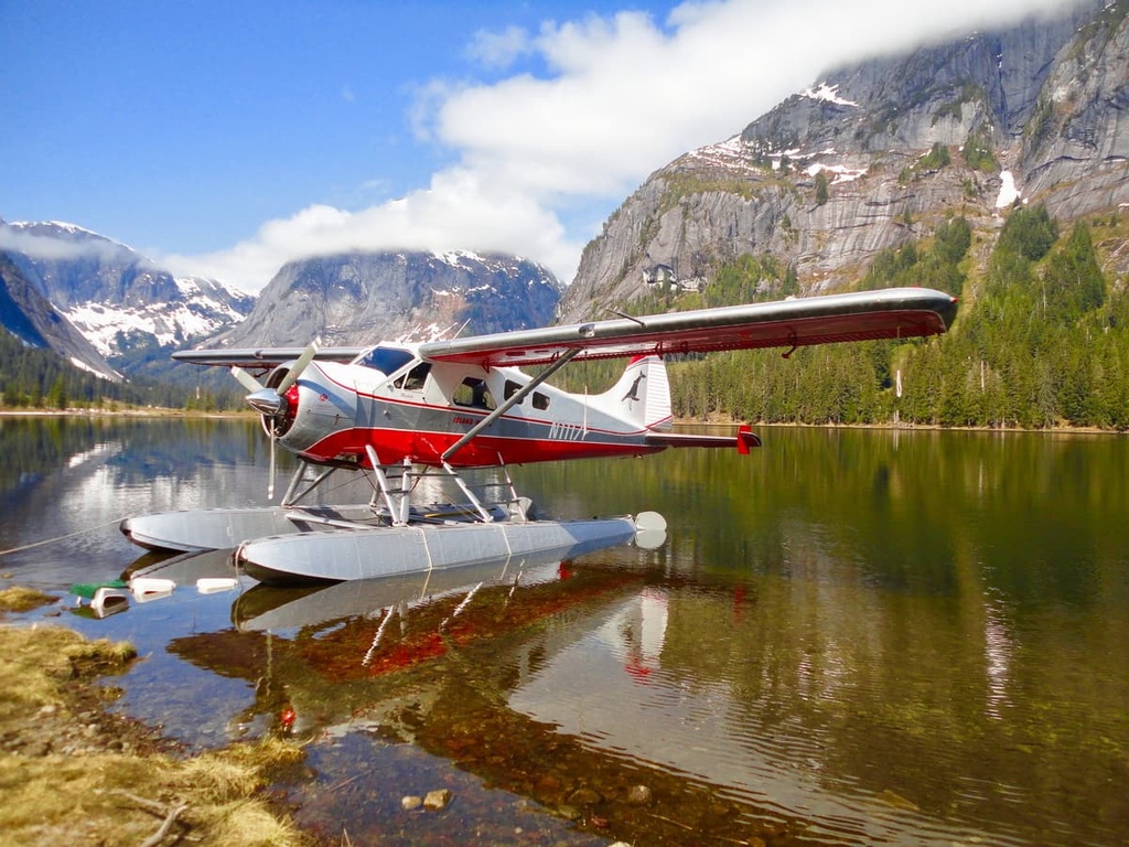
The Misty Fjords National Monument Wilderness is a remote, road-less wilderness that can only be reached by air or sea. These are some of the most popular attractions in the Misty Fjords National Monument Wilderness:
The Misty Fjords National Monument Wilderness is a remote, undeveloped area. There are technically 10 trails in the wilderness that provide a total of 20 miles of hiking opportunities. However, many of the trails are infrequently maintained and following them can be difficult.
As such, anyone venturing on a hike into the wilderness needs to be prepared for complete self-sufficiency in the mountains. All hikers should come prepared with the appropriate skills and confidence to be able to navigate off-trail and in foul weather.
Although there are many cabins in the wilderness, most are designed for boat or float plane access. Therefore, if you plan on backpacking in the wilderness, be sure to pack a tent, stove, and extra food, just in case your trip back to Ketchikan gets delayed by bad sea or air conditions.
The most popular way to experience the Misty Fjords National Monument Wilderness is via a flightseeing tour or day cruise from nearby Ketchikan. Many of these excursions boast aerial or waterfront views of the park’s most incredible natural features, including Rudyerd Bay, Punchbowl Cove, and Walker Cove.
There are 11 public recreation cabins located within the Misty Fjords National Monument
Wilderness. These cabins include:
Though the cabins are rustic, they are an excellent jumping-off point for exploring various bays, lakes, inlets, and trails in the area. Many of them also offer basic amenities, including a wood or oil burning stove, single and/or double bunks, a cooking counter or table, and cupboard space to store food.
All cabins in the area require advanced reservations. Be sure to review available amenities prior to making a reservation.
If you’re traveling to the Misty Fjords National Monument Wilderness, these are a few of the nearby cities to check out:
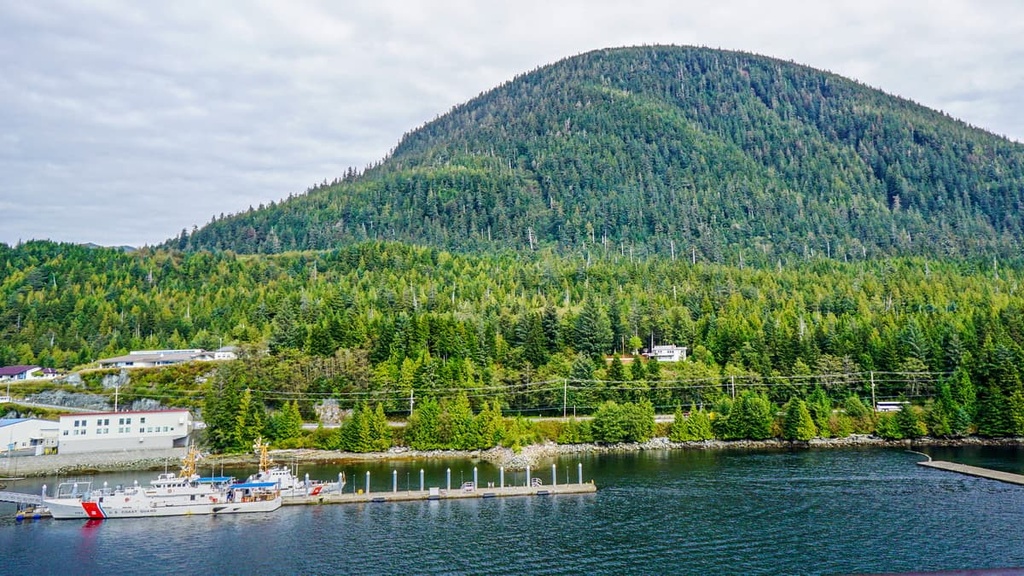
Located at the southernmost entrance to Alaska’s Inside Passage, Ketchikan serves as the gateway to the Misty Fjords National Monument Wilderness.
Ketchikan is rich in Alaska Native culture and is well-known for its arts, attractions, and sightseeing tours. A variety of accommodations are available in Ketchikan, including bed and breakfasts, hostels, hotels, motels, lodges, and resorts.
Ketchikan can be accessed by plane from several major cities, including Seattle, Anchorage, and Juneau, as well as many Inside Passage communities. The Alaska Marine Highway ferry also connects Ketchikan to Bellingham, Washington, and other nearby communities.
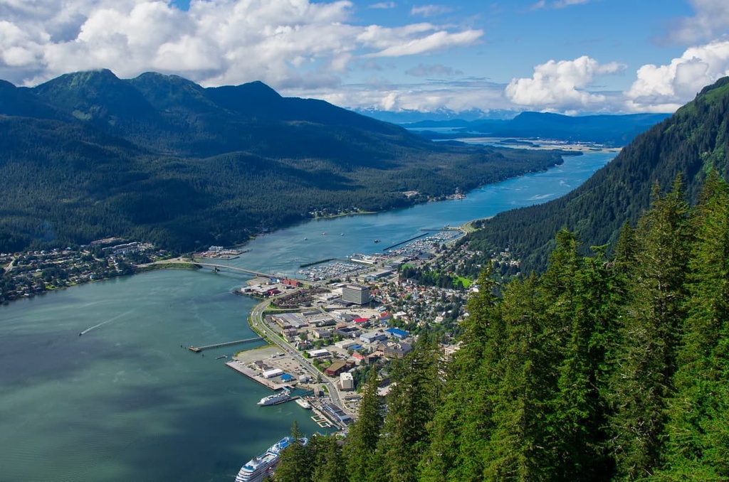
Juneau, the capital of Alaska, is a popular starting point for visitors looking to explore the Alaska panhandle.
Several outfitters in the city coordinate sightseeing tours, private plane excursions, and boat expeditions to nearby parks and natural attractions, including Misty Fjords National Monument Wilderness, Admiralty Island National Monument, Mendenhall Glacier, the Juneau Icefield, and Glacier Bay National Park.
Like Ketchikan, Juneau is accessible via the Alaska Marine Highway. The city also hosts an international airport so it’s a great starting point if you’re coming from further afield.


The highest peak in Misty Fjords National Monument Wilderness is Mount John Jay, at 2,226 m.
Notable peaks in Misty Fjords National Monument Wilderness include Mount John Jay, Mount Wilson, Mount Willibert, Mount Lewis Cass and Mount Upshur.


