
Scan the QR code and open PeakVisor on your phone
West Chichagof-Yakobi Wilderness has 31 named peaks. The highest is Mount Raatikainen at 1,097 m. Other notable peaks include Mount Lydonia, Hirst Mountain and Apex Mountain.
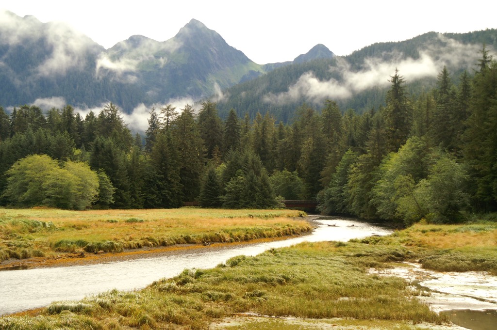
The West Chichagof-Yakobi Wilderness stretches across 265,286 acres (107,357 hectares) of temperate rainforest, muskeg, tidal pools and small lagoons in southeast Alaska, USA. Accessible only by float plane or boat, the wilderness area is often explored by kayak and then on foot by self-sufficient backcountry recreators. Of the 31 named mountains in the wilderness area, the tallest peak is Mount Raatikainen with a height of 3,599 ft (1,097 m) and a prominence of 3,396 ft (1,035 m).
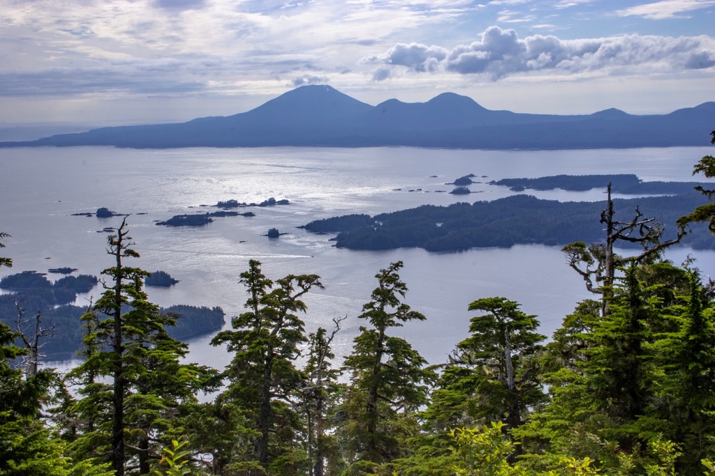
Established in 1980, the West Chichagof-Yakobi Wilderness covers 265,286 acres (107,357 hectares) of Yakobi and Chichagof islands in the Alexander Archipelago in southeast Alaska. These islands are part of the expansive Tongass National Forest, the nation’s largest national forest. The wilderness lies just south of Glacier Bay National Park, west of the state capital Juneau by 70 mi (115 km), and 55 mi (90 km) north of the charming town of Sitka.
The small town of Hoonah is situated 35 mi (55 km) to the east, and the wilderness can be accessed across an inlet from the village of Pelican. Due to its remote nature, the only ways to reach this incredible wilderness area are by float plane, motorboat, and paddle boat.
The open ocean brings large swells and strong winds to the exposed western boundary. Visitors planning their approach from this side should be familiar with the water and weather conditions, and experienced in open water navigation.
Throughout the wilderness area, recreators will find four public recreation cabins and one geothermal hot spring to soak in. Visitors should take care to practice “leave no trace” practices while exploring the many peaks, forests, tide pools, and hidden lagoons. The wilderness is managed by Sitka and Hoonah Ranger Districts.
Intense glacial advances and retreats approximately 14,000 to 10,000 years ago carved out the mountainous islands of southeast Alaska. Glaciers left behind numerous bays, steep valleys, and jagged coastline that distinguish this landscape today. Besides glaciation, the region has also been influenced by plate tectonics, sea level rise and fall, and volcanic activity.
The West Chichagof-Yakobi Wilderness contains multiple rocks that can be grouped roughly into four stratigraphic belts that are progressively younger towards the southwest. Rock types across the belts range from schist, gneiss, and marble to greenstone, sandstones, and phyllite. Gold and silver ore deposits were mined until the 1940s. Although not a huge source, nickel, copper, and cobalt deposits have also been discovered and mined in the region.
The islands fall near the Fairweather-Queen Charlotte Fault System where the eastern boundary of the Pacific Plate and the western boundary of the North American plate converge. This results in periodic seismic activity in the region which mainly occurs as larger, spaced out events rather than more frequent smaller earthquakes. The most recent earthquake within the West Chichagof-Yakobi Wilderness was in 1927.
The lush temperate rainforest of southeast Alaska receives between 24 to 220 in (60 to 550 cm) of rain per year and temperatures remain cool and regulated along the coast. The average summer temperature is 45 to 65 Fahrenheit (7 to 18 Celsius) and winters tend to stay fairly mild.
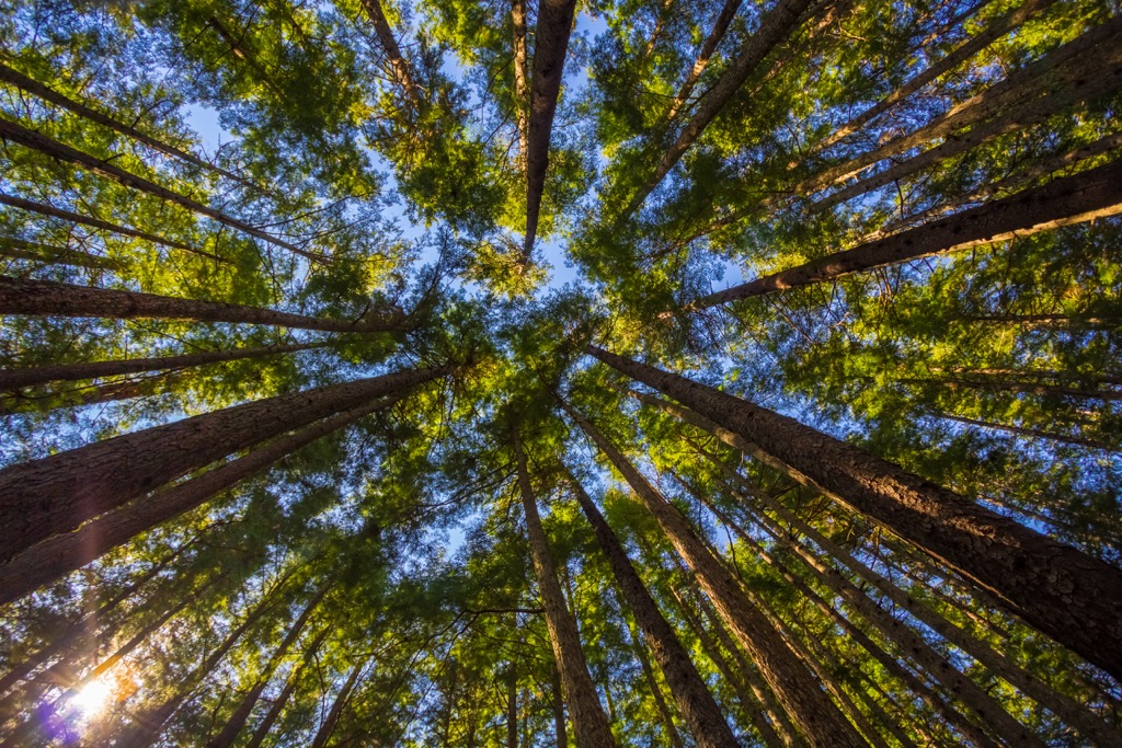
Like much of southeast Alaska, the West Chichagof-Yakobi Wilderness boasts a rich landscape of bays, lagoons, muskeg, mossy forest, tide pools, and forested peaks often shrouded in clouds. Roughly one third of the wilderness is dominated by western hemlock and Sitka spruce and summertime sees an abundance of wild berries, many of them edible.
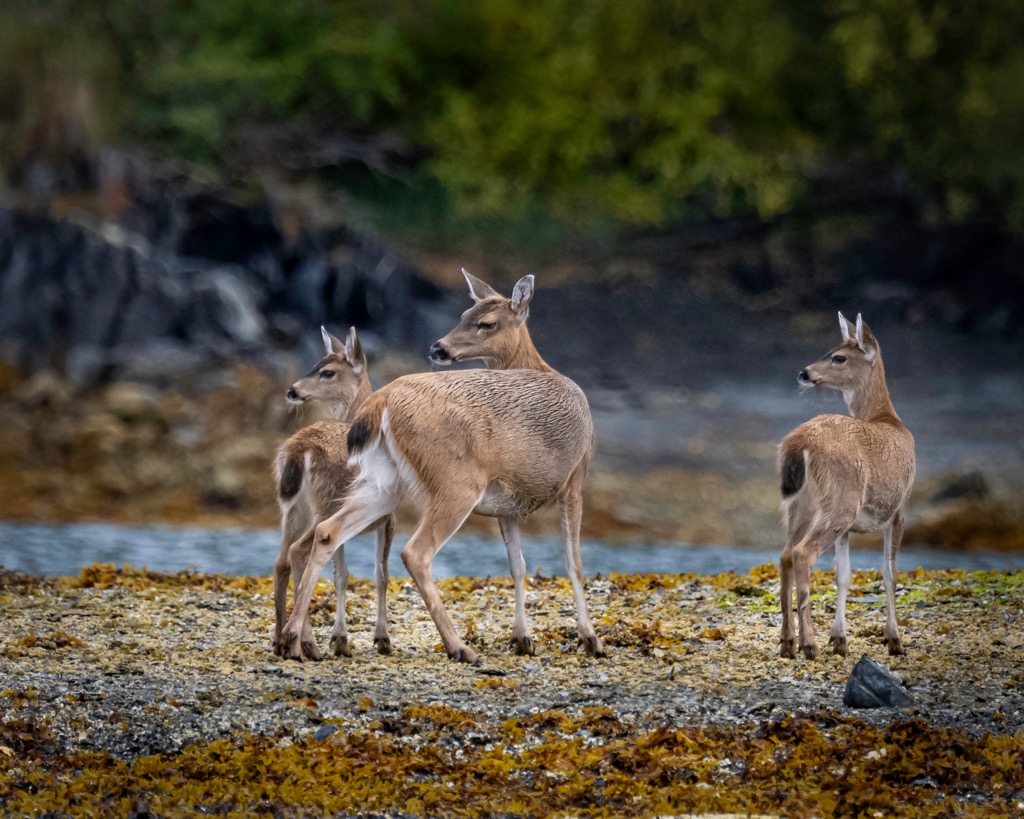
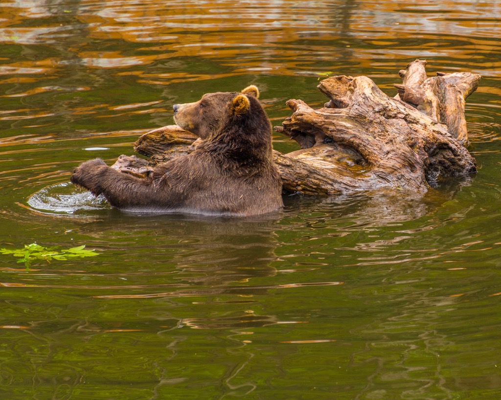
Such a rich environment supports an impressive host of animal life. Salmon return to the rivers to spawn in the summer, drawing grizzlies to the river banks, and seals, sea lions, and bald eagles to the bays. A variety of whales pass along the open ocean and larger bays, and sea otters are often seen bobbing. Black-tail deer frequent the forest and tide pools support diverse life such as anemones, sea-stars, chitons, crabs, and nudibranchs.
Recreators should be aware that there is a large grizzly population in the wilderness area and know safe practices for recreating in bear country such as carrying bear spray and safe food storage.
The Tlingit and Haida people have stewarded the land for the past 11,000 years. For centuries they moved freely through the region as hunter-gatherers and maintained extensive connections with tribes in neighboring regions. There is a close tie between the Tlingit, Haida, and Tsimshian tribes throughout southeast Alaska and western Canada.
The first Russian explorers arrived in 1741. In following decades, the Russians began to aggressively take over the region, reshaping trade routes and establishing a base. In 1802, the Tlingit chief in Sitka successfully staged a resistance and temporarily pushed the Russians from their post.
The US government purchased Alaska from Russia in 1867 and proceeded with forced assimilation programs, established mining and logging projects, and brought disease such as smallpox that killed nearly half the Tlingit population. Gold and silver mining in the West Chichagof-Yakobi Wilderness produced almost a million ounces of gold and silver.
The establishment of the Alaska Native Claims Settlement Act in 1971 created Native-managed corporations to return land to Native communities, differing from the reservation model implemented in much of the lower 48. This act resulted in 44 million acres (17.8 million hectares) of land being transferred to Alaska Native regional and village corporations.
The West Chichagof-Yakobi Wilderness attained its protection in 1980 after local teachers banded together and created a citizens proposal to preserve the area from development.
As a wilderness area with minimal development, visitors can explore responsibly using backcountry navigation skills. Many people come to the wilderness by kayak, navigating the many waterways and inlets, and hiking up into the forest. The tallest peaks are Mount Raatikainen (3,599 ft/1,097 m), Mount Lydonia (3,261 ft/994 m), and Hirst Mountain (3,241 ft/988 m).
Boats or float planes can be chartered to reach the wilderness. Kayakers arriving on their own should be aware of the variable conditions along the exposed western coast facing the open ocean.
It is best to visit in summer but be aware that spawning salmon bring grizzlies to river banks in higher concentrations. Besides that, the islands offer acres of beautiful nature to explore and visitors will not be bored.
Sitka, a charming town to the south, offers a host of exciting options for exploring the outdoors and the town’s rich cultural history. Juneau, found to the northeast, is Alaska’s capital and allows visitors to experience the splendor of nature and a vibrant, small-city community.
With around 9,000 full-time inhabitants, Sitka’s community stretches with the seasons as the long days of summer welcome tourists, fishermen, seasonal workers, and interns to the town. Nestled between mountains and water, visitors only have to walk a few minutes to reach the forest edge or the coast along Sitka Sound.
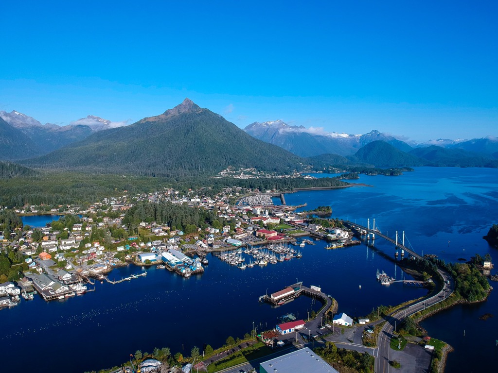
Popular activities include fishing, going out on the water with marine wildlife watching tours, visiting the Tlingit Cultural Center or Sheldon Jackson Museum, and exploring the mossy forests of the Tongass National Forest. The local airport connects the island town to Juneau, other small towns around southeast Alaska, and Seattle.
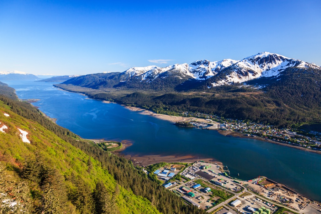
The state capital is home to 32,000 people and its airport connects to Seattle, small towns in southeast Alaska, and mainland Alaska. Juneau’s downtown takes in views of steep sided mountains, thick forest, and expansive waterways. Mendenhall Glacier is easily accessible, only 12 mi (20 km) from the city, and offers stunning views and hiking trails.
Other ways to take in the environment include going on wildlife viewing tours for bears, sea mammals, and mountain goats; fishing; visiting the museums and cultural centers in town; or during winter, enjoying downhill, heli, or cross country skiing.


The highest peak in West Chichagof-Yakobi Wilderness is Mount Raatikainen, at 1,097 m.
Notable peaks in West Chichagof-Yakobi Wilderness include Mount Raatikainen, Mount Lydonia, Hirst Mountain, Apex Mountain and Pinnacle Peak.


