Scan the QR code and open PeakVisor on your phone
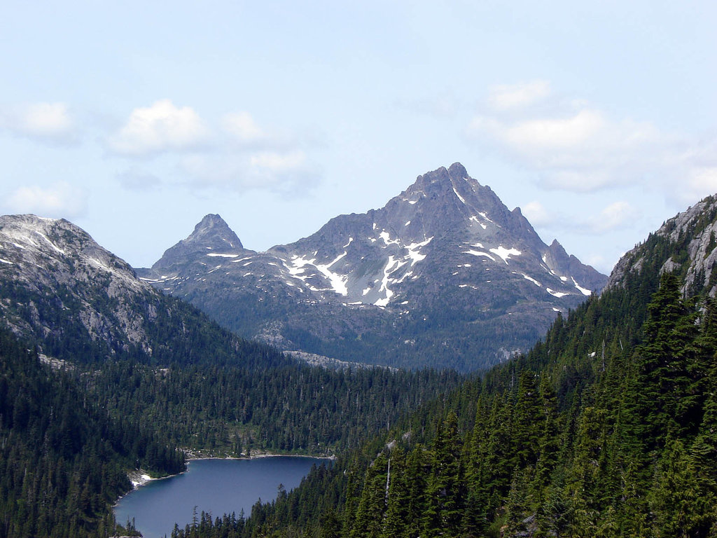
The west coast of Vancouver Island in British Columbia, Canada is home to rugged wilderness and stunning landscapes. Clayoquot Plateau Provincial Park is a protected area located upon a high elevation plateau that contains several small lakes, a karst/cave system, and 2 named peaks. Steamboat Mountain and the Limestone Twins stand above the karst topography of the plateau at elevations of 1,477m (4,846 ft) and 1,375 m (4,511 ft), respectively.
Clayoquot Plateau Provincial Park is a protected area located on Vancouver Island, in British Columbia, Canada.
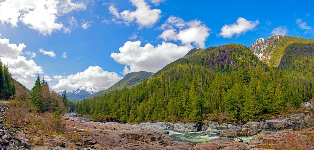
The park is located next to the Kennedy River and Highway 4 in the Alberni-Clayoquot Regional District. Encompassing 31 sq. km (12 sq. mi) of land, the park and its high elevation plateau contain several small lakes, sinkholes, fragile karst features, old-growth forests, and many rare plant species.
From the summit of the plateau, there are spectacular views of the Clayoquot Sound. Meanwhile, from the summit of the park’s peaks, you can view the karst topography of the plateau. The park is home to 2 peaks, the tallest and most prominent of which is Steamboat Mountain (1,477 m /4,846 ft).
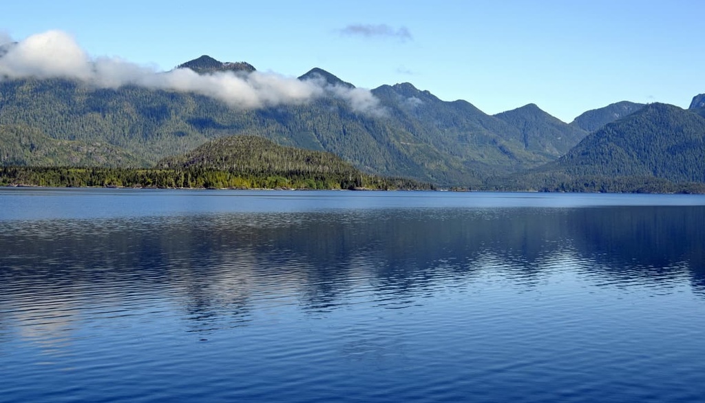
The park is situated on the west coast of Vancouver Island, which is known for its rugged and wild coastlines. The following are some of the other popular parks and destinations along the west coast of Vancouver Island near Clayoquot Plateau Provincial Park:
Vancouver Island has a complex geological history that dates back nearly 400 million years. This history began with the eruption of volcanoes on the floor of the Pacific Ocean. As rifts occurred in the oceanic crust, volcanoes spewed massive amounts of lava onto the sea floor, cerating the Wrangellia terrane in the process.
After the initial eruptions covered the sea floor with a layer of lava, marine sediments were deposited upon the lava for the next 130 million year. About 250 million years ago, volcanoes erupted again, covering the area with a massive layer of flood basalt. This basalt was up to 6 km (3.6 mi) thick.
At this point, the majority of the Wrangellia terrane had formed and it was now rafting upon its tectonic plate toward a collision with the west coast of North America. About 100 million years ago, as the oceanic tectonic plate was slipping under the North American plate, the Wrangellia terrane began colliding with the coastal margin, eventually forming a new coastal margin.
The west coast of Canada is primarily made of the Wrangellia terrane, with the addition of a couple smaller terranes that accreted to Vancouver Island millions of years later.
Wrangellia was compressed and folded during its collision with North America until it buckled and formed the mountains along the coastal margin, including the Vancouver Island Ranges, Haida Gwaii, and the Alaskan Panhandle.
Since Wrangellia formed in stages, the underlying rock formations are quite complex across the terrane. Additionally, magma continued to intrude into Wrangellia during the Tertiary, which started about 66 million years ago.
The rocks of Clayoquot Plateau Provincial Park are primarily limestones with igneous intrusions that occurred during the Paleogene. The limestone was eroded to form a magnificent karst topography that includes caves, sinkholes, ridges, towers, and fissures upon the plateau. The primary purpose of Clayoquot Plateau Provincial Park is to preserve the high elevation karst formations on the plateau.
The Clayoquot Plateau Provincial Park was originally proposed as an ecological reserve because it was seen as the best example of self-contained and undisturbed coastal-karst ecosystem.
The park contains a cross section of ecosystems from the lowlands to the alpine that contain a large number of disjunct plant occurrences, unusual combinations of plants, and pristine old-growth forests.
Within the park, 29 rare plant species have been discovered. These include alpine anemone, corrupt spleenwort, smooth willowherb, sand-dwelling wallflower, western hedysarum, and Olympic mountain aster. These plants have only a few known occurrences throughout the entire province of British Columbia.
The ecological zones are primarily dependent upon elevation. They include the Mountain-heather Alpine zone which is followed by a thin band of the Mountain Hemlock zone along the treeline.
The Alpine is covered with dense communities of mountain heather and dwarf shrubs. It transitions through a parkland-like mosaic of meadows and separated stands of trees that may include yellow cedar and mountain hemlock.
The slopes and lowlands of the region are dominated by the Coastal Western Hemlock zone, which is best known for its temperate rainforests full of giant Sitka spruce, western red cedar, and Douglas fir. The old growth forests in the park contain trees that are hundreds of years old and that reach heights of over 60 m (195 ft) tall.
There is archaeological and cultural evidence that humans hunted on the Clayoquot Plateau at least 2,600 years ago. Evidence of human habitation from the general region of Clayoquot Plateau Provincial Park suggests that people have lived in the area for at least the past 4,000 years.
Clayoquot Plateau Provincial Park is in the traditional territory of the Nuu-chah-nulth First Nations. It is likely that some of the initial inhabitants of Clayoquot Sound were the ancestors of the modern Nuu-chah-nulth First Nations.
While the Nuu-chah-nulth were known for their seamanship and their whale hunting prowess, they also spent time hunting animals on land, such as black-tailed deer, black bear, marten, and the Vancouver Island Marmot.
The Nuu-chah-nulth First Nations traditionally harvests animals during the summer and autumn to fill their winter stores. They also collect pelts, which were used for clothing such as robes, and blankets. Recorded sites where the First Nations have harvested Vancouver Island marmots since time immemorial include Mariner Mountain, Limestone Mountain, and Golden Hinde.
Two of these harvest sites are located in Strathcona Provincial Park. They are the only known archaeological sites within the park. These abundant coastal resources were the likely reason that First Nations didn’t typically establish permanent communities in the middle of Vancouver Island.
Indeed remains of 13 Vancouver Island marmots were uncovered in one of the karst caves within the Clayoquot Plateau. However, unlike some of the other marmot harvesting and processing sites that were discovered, the Clayoquot Plateau site appears to have been the result of a single event that occurred about 2,600 years ago.
Despite the pressures of the forestry industry around the park, Clayoquot Plateau Provincial Park was established in 1995 in order to preserve some of the region’s old-growth forests.

There are no official trails in Clayoquot Plateau Provincial Park. Access to the plateau is considered to be quite difficult as it requires a strenuous hike through tough forest and brush; however, the prospect of rare plants, karst formations, and an incredible view may make it a worthwhile endeavor.
Some of the major activities on the plateau include:
The west coast of Vancouver Island is very remote and it has a rugged natural beauty that is fantastic to see and experience. There are massive old growth forests, incredible hiking trails, and amazing scenery and landscapes to enjoy.
The following are some of the main destinations near Clayoquot Plateau Provincial Park to check out during your visit:
Port Alberni is the gateway to the west coast of Vancouver Island. Named after Don Pedro de Alberni, who commanded Fort San Miguel at Nootka Sound from 1790 to 1792, the city is in the traditional territory of the Nuu-chah-nulth Tribal Council and many of the place names in the area are Nuu-chah-nulth in origin.
Port Alberni is a good jumping off point for many outdoor activities, such as ocean and freshwater fishing, hiking, kayaking, and mountain biking. There are several hiking trails in Port Alberni and over a hundred in the surrounding valley and mountains.

Some of the popular hikes in the area include the Horne Lake Trail, Log Train Trail, and the Inlet Trail. Mount Arrowsmith is nearby, too, if you want to hike the Saddle Trail, or you can climb to the summit.
Tofino is a popular destination for outdoor recreationists and tourists arriving from across the continent and the world to view the wildlife and adventure in the wilderness of the west coast. The town is located on the rugged west coast of Vancouver Island at the end of Highway 4, about 85 km (51 mi) to the west of Clayoquot Plateau Provincial Park.
While the community is a year-round tourist destination, most of the tourists come during the summer for backpacking the West Coast Trail, surfing on Long Beach. In addition to surfers and backpackers, the community is popular for people just wanting a break from the city, hikers, mountain bikers, whale watchers, bird watchers, and anybody that wants to enjoy nature.
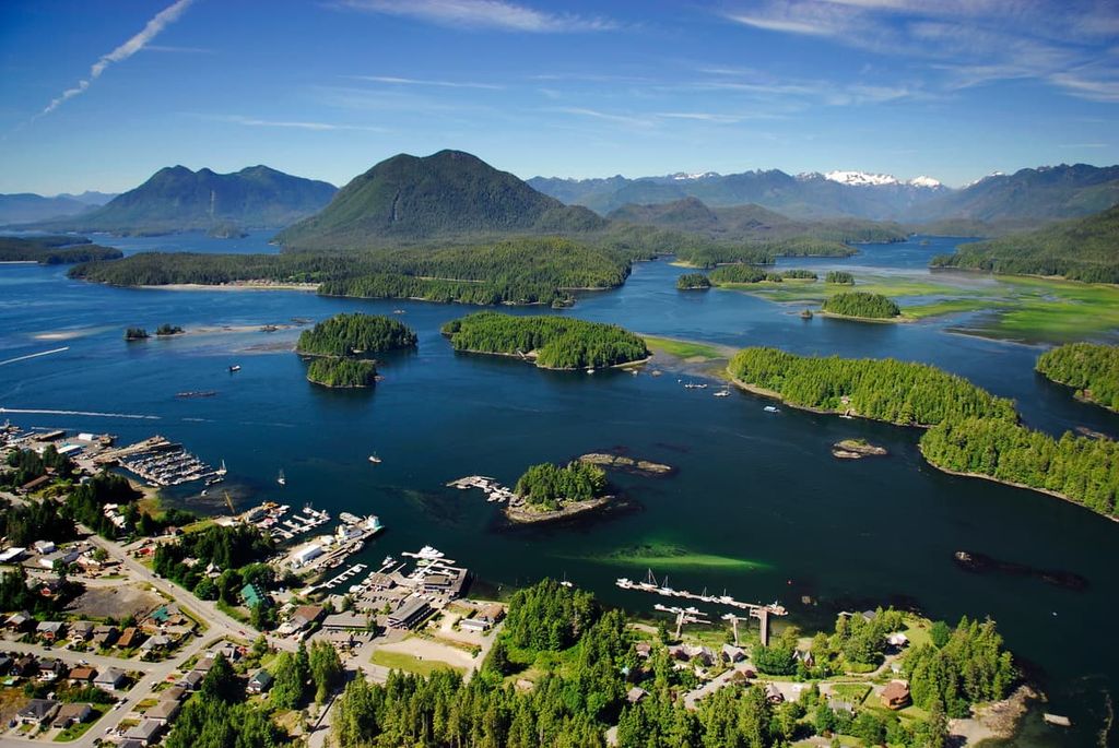
Some of the major parks and wilderness areas around Tofino include Pacific Rim National Park Reserve, Clayoquot Arm Provincial Park, and Kennedy Lake Provincial Park. From Tofino, you may also be able to arrange access to Vargas Island Provincial Park, Flores Island Provincial Park, or Maquinna Marine Provincial Park.
Ucluelet is situated on the west coast of Vancouver Island, and, like Tofino, it has become a year-round tourist destination. The Long Beach and the Broken Group Islands zones of the Pacific Rim National Park Reserve are located on either side of the community. There are also many other trails and attractions in the region, such as the popular Wild Pacific Trail.
Kennedy Lake Provincial Park is located just to the north of Ucluelet, which has the largest freshwater lake on Vancouver Island. Kennedy Lake Provincial Park also has a boat launch and it allows power boats for water skiing or touring. The consistent winds in the region also make it a good place for wind and kite surfing.