
Scan the QR code and open PeakVisor on your phone
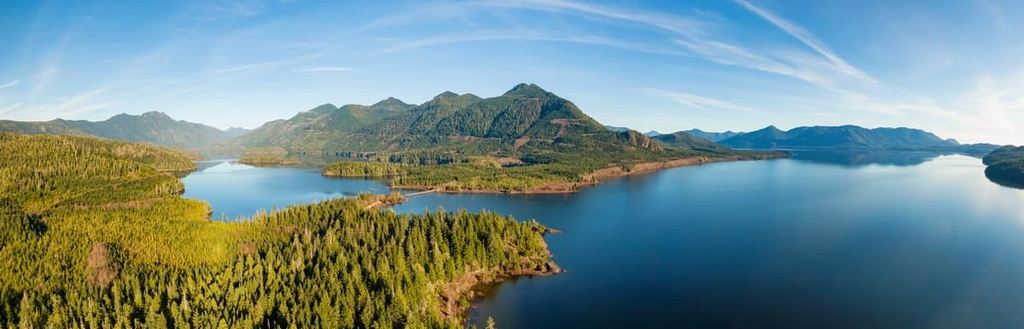
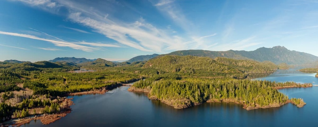
Clayoquot Arm Provincial Park is a protected area located on the west side of Vancouver Island of British Columbia in Canada. The park is typically accessed by boat through Kennedy Lake, which is the largest body of freshwater on Vancouver Island. Towering high above the lake and the park’s beautiful beaches, the Clayoquot Arm’s single summit is Muriel Ridge, which is 1,165 m (3,822 ft) tall and has 526 m (1,726 ft) of prominence.
Situated on the shores of the largest body of freshwater on Vancouver Island, Clayoquot Arm Provincial Park is a remote wilderness park in the Alberni-Clayoquot Regional District of British Columbia, Canada.
The Alberni-Clayoquot Regional District extends as far north as the famous Nootka Sound, where Captain James Cook first made landfall on Vancouver Island in the late eighteenth century
Clayoquot Arm Provincial Park is located along the north shore of the Clayoquot Arm of Kennedy Lake. It contains a single summit, Muriel Ridge, that overlooks the lake and has an elevation of 1,165 m (3,822 ft).
Some of the other parks in the region include:
The main access to Clayoquot Arm Provincial Park is via boat from Kennedy Lake Provincial Park. The boat launch on Kennedy Lake is accessible from Highway 4, which connects the west coast cities of Tofino and Ucluelet with the rest of the island.
The major geologic formation of the Alberni-Clayoquot Regional District and the Clayoquot Arm Provincial Park is the Vancouver Island Ranges ,which are part of an ancient terrane called Wrangellia.
The Wrangellia Terrane is primarily composed of volcanic flood basalts that erupted about 250 million years ago; however, there are volcanic and sedimentary layers as old as 350 million years.
Additionally, the Wrangellia Terrane became part of the west coast of Canada starting about 160 million years ago when it was accreted to the continental margin as its underlying tectonic plate subducted beneath North America. The rocks that make up Muriel Ridge in Clayoquot Arm Provincial Park are mainly metamorphic complexes of the Wrangellia Terrane.
During the Pleistocene, glaciers and ice sheets covered the island to an elevation between 1,000 m (3,280 ft) and 1,500 m (4,920 ft). In other areas of the island, some of the peaks are monadnocks, which stood above the ice sheets. However, Muriel Ridge was overridden by the ice and was heavily eroded by the region’s glaciers.
Throughout this period, many glaciers formed in the mountains in the middle of the island in what is now Strathcona Provincial Park and stretched out to the west coast. These glaciers created long U-shaped valleys that stretched from the mountains to the west coast of the island before they receded at the end of the Pleistocene.
These glacial valleys account for the formation of many of Vancouver Island’s finger lakes. Indeed, glaciation is likely the reason why the Clayoquot Arm of Kennedy Lake looks the way that it does today.
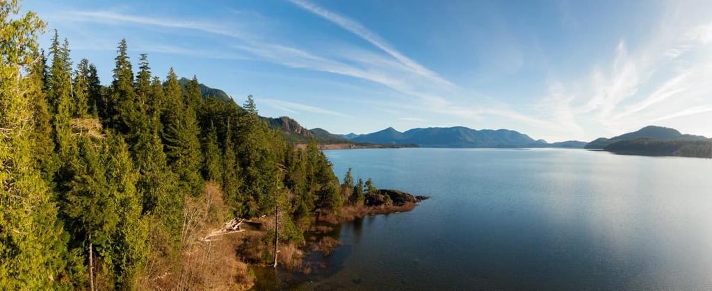
Clayoquot Arm Provincial Park encompasses the Clayoquot Arm of Kennedy Lake, upper and lower Clayoquot River, as well as Clayoquot Lake. The park contains many tributaries of the Clayoquot River as well as the forested slopes of Muriel Ridge, and the foreshore of the lake.
The park is home to old growth Sitka spruce forests, western red cedar forests, sandy beaches, riparian habitats, waterfalls, islets, and the river and lake valley. The park also contains a large number of habitats that provide homes for a variety of wildlife, fish, bird, reptile, and amphibian species.
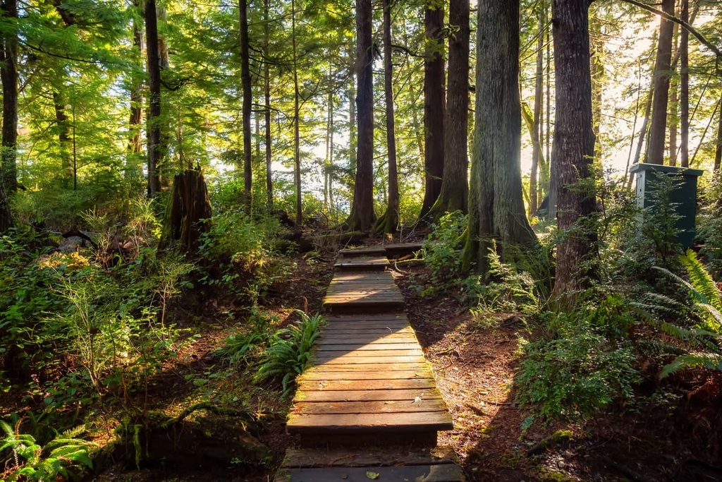
The park is part of the Coastal Western Hemlock zone, which covers the majority of Vancouver Island. It is filled with forests of western hemlock, red cedar, and Douglas fir. The park is also home to old growth Sitka spruce, which have adapted to live in an area that’s sprayed regularly with sea water.
Furthermore, the region’s lakes and rivers are filled with a variety of fish, including sockeye salmon, chinook, chum, coho, cutthroat trout, steelhead, Dolly Varden char, peamouth chub, prickly sculpin, river lamprey, and threespine stickleback. Within the Clayoquot Arm, the sockeye salmon exhibit an unusual phenomenon where they spawn up to 20 meters (65 ft) below the surface.
The tidal influence upon the lower Kennedy River allows harbor seals and sea lions to enter Kennedy Lake and travel as far as Clayoquot Lake, which are both brackish and offer salmon feeding opportunities. Other notable wildlife in the park includes gray wolves, cougars, river otters, marten, and mule deer.
Bald eagles also soar over the lake, while great blue herons stand sentinel along the shore. The forests in the park are filled with western screech owls and northern pygmy owls, while osprey, Barrow’s goldeneye, harlequin ducks, trumpeter swans, and marbled murrelets inhabit their niche in the ecosystem of the park.
The Nuu-chah-nulth First Nations have lived on the west coast of what is now Vancouver Island for thousands of years. Indeed, the land that is now Clayoquot Arm Provincial Park is part of their traditional territory. There are many places within the park that are culturally important to the Nuu-chah-nulth First Nations.
While Clayoquot Arm Provincial Park does have archaeological sites, there are also natural areas that are considered culturally significant to the Nuu-chah-nulth.
Locations may be considered culturally significant because they are considered sacred, or because they provide important resources. Waterfalls, caves, prayer pools, and ancient trees may all be considered sacred to the Nuu-chah-nulth.
Some of the culturally significant areas of Clayoquot Arm Provincial Park include the waterfalls and the Clayoquot River valley. The river valley has traditionally been used as a training area for Nuu-chah-nulth seeking spiritual power.
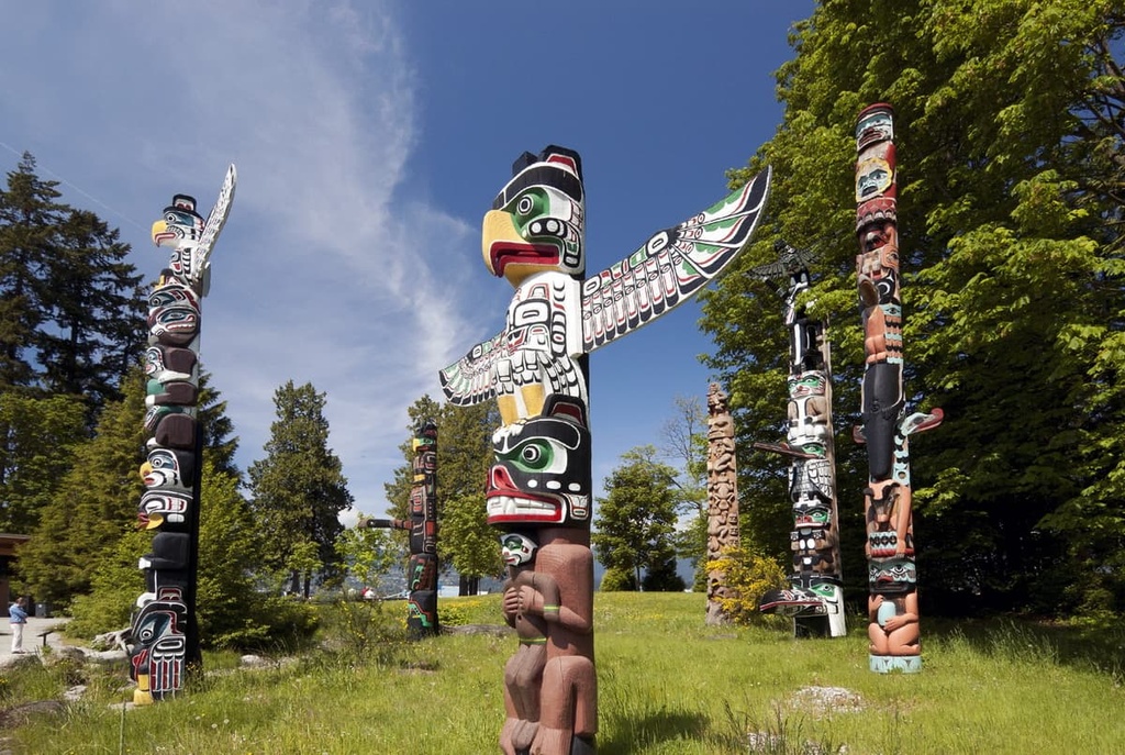
Some of the historical sites in the park contain evidence of ancient camps and tool making. There are also a number of culturally modified trees in the region. Culturally modified trees in Clayoquot Arm Provincial Park are usually red cedars, from which planks or strips of bark were removed for construction or crafting purposes.
While there has been pressure on the surrounding area from logging companies, the park was established early enough to save some of the spectacular old growth forests of Vancouver Island. There are no facilities in the park; however, visitors are permitted to camp throughout the region.
Clayoquot Arm Provincial Park offers opportunities for canoeing, kayaking, fishing, hunting, swimming, waterskiing, wildlife viewing, and windsurfing. While there are no official trails in the park, ambitious hikers can likely find a way to summit Muriel Ridge or to explore along the Clayoquot River and visit the Clayoquot Valley.
Most visits to Clayoquot Arm Provincial Park involve paddling the scenic coastline of the Kennedy Lake and camping along its beautiful shores. While on the shoreline, there are opportunities to relax on the sandy beaches or explore the uninhabited islets.
The park is filled with a variety of wildlife, such that caution should be taken while exploring along the shore or in the forests so that you minimize the risk of a bear encounter. Black bears inhabit the park so be sure to store your food properly and practice proper bear safety precautions.
Power boats are permitted on the lake. As such, water skiing and boating are popular activities. There are strong winds that commonly pick up in the afternoon, which can be hazardous and difficult for recreational paddlers; however, the consistent winds make Kennedy Lake an ideal destination for windsurfing and kite surfing.
The west coast of Vancouver Island has a rugged beauty that’s worth seeing and experiencing. The following are some of the main destinations near Clayoquot Arm Provincial Park where you can enjoy the rugged coastline, pristine wilderness areas, and the many recreational opportunities:
Located at the head of the Alberni Inlet, Port Alberni is a city situated on tidal waters on the west coast of Vancouver Island, British Columbia. The city is home to one of BC’s first sawmills, so forestry has long been the primary employer in the region.
Port Alberni is still economically dependent upon logging and milling; however, the people are expanding their environmental focus to draw in and capitalize on tourism to the area. Port Alberni is a good jumping off point for many outdoor activities.

Marine and freshwater fishing, hiking, kayaking, and mountain biking are all activities that can be easily enjoyed from the community. There are several hiking trails in Port Alberni and over a hundred in the surrounding valley and mountains.
The Horne Lake Trail, Log Train Trail, and the Inlet Trail are all popular trails in the area, too. Mount Arrowsmith is also located nearby, so you can hike the Saddle Trail or climb to the summit. Port Alberni is the gateway to the wild and rugged west coast of Vancouver Island and, as such, there are many activities to enjoy during your stay.
Situated at the edge of Clayoquot Sound, Tofino is a year-round tourist destination that has beaches, surfing, wildlife viewing, fishing, hiking, paddling, and so much more. While the population swells significantly in the summer, the winter storms coming off the Pacific Ocean are a sight to behold and an incredible event to experience.
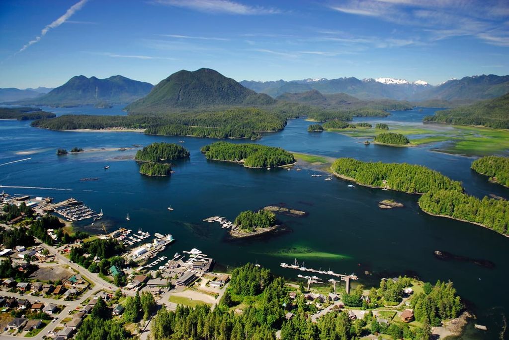
The area has long attracted surfers and backpackers to the popular Pacific Rim National Park Reserve areas of Long Beach and the West Coast Trail. Additionally there are opportunities for day hiking, mountain biking, whale watching, and bird watching in the town.
Ucluelet, like Tofino, has become a year-round tourist destination for many of the same reasons as Tofino. The beauty of the wilderness and seascape are incredible attractions as well as all the recreational opportunities.
Surfing, fishing, camping, hiking, kayaking, swimming, and beach combing are all popular activities in Ucluelet. While the summer months are generally the most popular for people who want to enjoy warm weather activities on the beach; autumn offers the opportunity to experience the salmon run while the winter months bring in the beach-pounding winter storms.
Any time of year, the Wild Pacific Trail is a nice trail to hike. It’s a regional trail that begins near the mouth of the Ucluelet Inlet and travels along the Pacific coastline through Big Beach Park. The path is well maintained and there are stunning coastal views to enjoy along the way.


