
Scan the QR code and open PeakVisor on your phone
The Hankin Range is one of the many subranges of the Vancouver Island Ranges in British Columbia, Canada. As it is surrounded by riparian areas and filled with the flora and fauna of the Pacific temperate rainforests, the Hankin Range is an incredible area for any outdoor adventure. There are 3 named peaks in the range, Mount Hoy (1,417 m/4,649 ft) and Mount Kinman (1,305 m/4,281 ft).
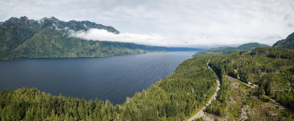
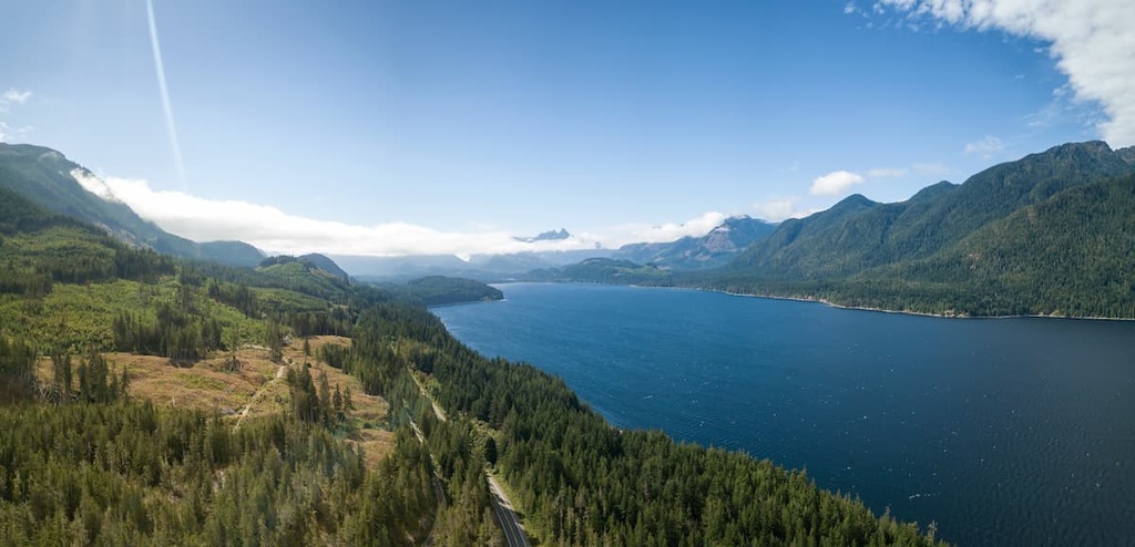
The Hankin Range is a subrange of the Vancouver Island Ranges, which are located on Vancouver Island in British Columbia, Canada. It is situated at the northern end of the Vancouver Island Ranges between the Karmutzen Range and the Bonanza Range.
The primary access to the range is via Highway 19, which leads to a series of forestry service roads. Logging roads are prevalent across the range, and they offer relatively easy access to the trails that lead to the summits of Mount Hoy and Mount Kinman. Of the two peaks in the range, Mount Hoy is the tallest with an elevation of 1,417 m (4,649 ft) above sea level.
There are no protected areas within the Hankin Range; however, there are many nearby parks and recreation areas that help preserve the region’s wilderness. Some of the many parks that are located around the Hankin Range that are worth checking out include:
The Hankin Range is one of the 18 subranges of the Vancouver Island Ranges, which are, in turn, part of the Insular Mountains. The Insular Mountains include the Vancouver Island Ranges, which are the peaks that form the archipelago of Haida Gwaii, as well as some of the coastal mountains in southern British Columbia and the Alaskan panhandle.
The northern end of Vancouver Island is underlain by a roughly 6 km (3.6 mi) thick sequence of marine and terrestrial basalts and sediments. These layers are primarily part of the Triassic and Jurassic aged Vancouver and Bonanza groups.
These layers of rock in northern Vancouver Island have been intruded by the Island Plutonic Suite. The magma intrusions of the Island Plutonic Suite created granitic batholiths, including the Nimpkish Batholith, which dominates the area. The intrusions in the Nimpkish Lake area are primarily pale gray granodiorite and tonalite.
The intense heat of these intrusions metamorphosed rocks of the surrounding layers to create fine-grained marbles and skarn. Some of the skarn deposits contain deposits of minerals and metals, such as gold, copper, silver, and zinc.
The bedrock of Vancouver Island is part of the Wrangellia terrane, which started forming as a volcanic island arc in the Pacific Ocean about 300 million years ago. It was about 105 million years ago that, while riding upon the Farallon plate, the Wrangellia terrane accreted to the western continental margin of North America.
During and after the accretion of Wrangellia to the west coast of North America, the terrane underwent intense pressure and heat, which caused the terrane to fold, buckle, and crumble. The north end of Vancouver Island was subsequently subjected to intense periods of uplift and erosion.
This period of pre-Pleistocene uplift and erosion created an extremely rugged topography across the northern and central ranges of the island. The mountains of the nearby Strathcona Provincial Park, Schoen Lake Provincial Park, and Nimpkish Lake Provincial Park are examples of the rugged topography that was created during the initial uplift of the Insular Mountains.
During the Pleistocene, the ridges and peaks of the Hankin Range were smoothed over as a result of the many glacial maximums that occurred over the course of this roughly two million year-long period.
Throughout the Pleistocene, several major glacial events covered Vancouver Island in over 1,200 m (4,000 ft) of ice. Additionally, smaller alpine glaciers created cirques and glacial valleys that are still seen in the range to this day.
Since it is located near the northern end of the Vancouver Island Ranges, the Hankin Range is subjected to the intense annual rainfall that is typical of the Pacific Coast. As a result, the range primarily features landscapes that are common in the Pacific temperate rainforest ecosystem.
The relatively low elevation of the Hankin Range doesn’t support a true alpine ecosystem. Therefore, Mountain Hemlock forests extend as high as the range’s summits. At lower elevations, these Mountain Hemlock forests transition into forests that are typical of the Western Hemlock – Cedar zone.
These forests typically have thick stands of Douglas fir, red cedar, pine, and western hemlock; however, significant tracts of the range were logged during the second half of the twentieth century, so many of the range’s forests are only 25- to 35-year-old second growth. Underbrush consisting of salal, salmonberry, and ferns is also abundant in the second-growth forests and along the old logging roads in the Hankin Range.
There are many different species of birds that prefer the open canopy of the younger forests in the Hankin Range. Meanwhile, other animals prefer the protection that the range’s old-growth forests provide. As far as wildlife goes, black bears, black-tailed deer, and Vancouver Island gray wolves all inhabit the Hankin Range.
The Hankin Range is part of the traditional territory of the 'Namgis First Nation, who are a Kwakwa̱ka̱ʼwakw people that have lived in the region since time immemorial.
The inventory of archaeological sites in the Hankin Range is currently unknown; however, the adjacent Karmutzen Range contains the remains of a former 'Namgis village. Furthermore, it is likely that the Hankin Range was traditionally used for fishing, hunting, and the gathering of resources, so there’s a high probability that there are cultural artifacts that have yet to be uncovered within the range.
Additionally, Nimpkish Lake is located along the path of a grease trail, a traditional trade route, that traverses much of Vancouver Island. The phrase ‘grease trail’ is a reference to eulachon oil, which is an oil that has long been processed from small fish in the region.
Eulachon oil was historically traded by coastal First Nations to inland First Nations for obsidian, copper, furs, and other items. As such, it was an important commodity to the First Nations of the coast. This grease trail, in particular, leads across the island to Kyuquot Sound by way of the Tahsish River, Atluck Lake, and Nimpkish Lake.
Currently, there are no communities that live in the Hankin Range; however, the range has productive forests that have been logged for many decades.
Furthermore, during the mid-twentieth century, mineralogical and mining reports showed localized deposits of gold, copper, zinc, and silver within the Hankin Range. However, ever since the original claim was worked in the 1930s, no major mining has occurred in the range.
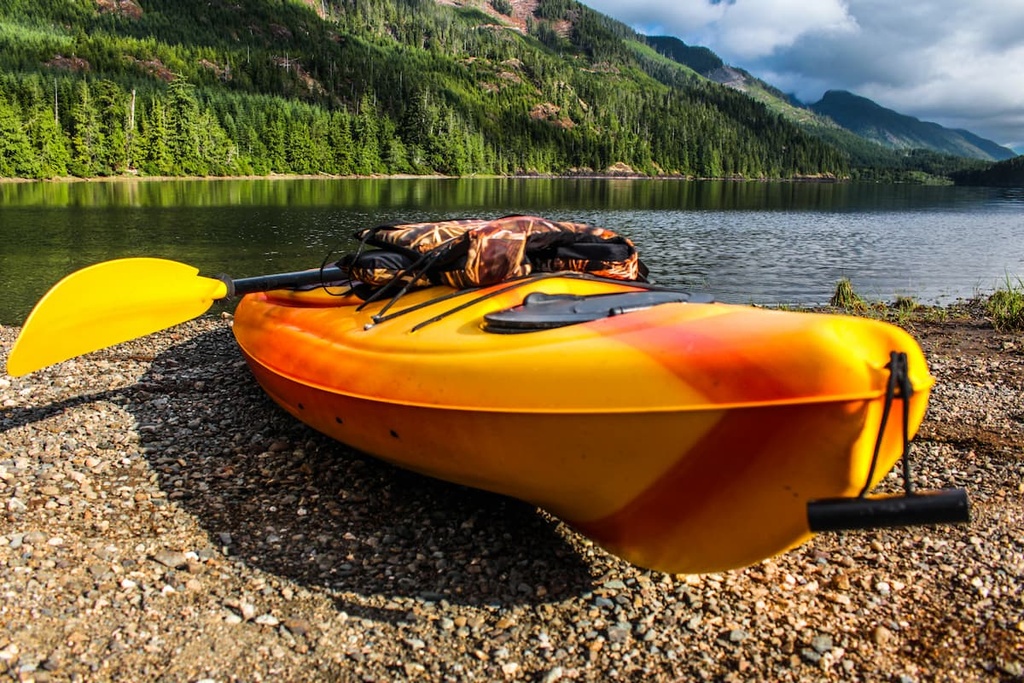
As it is located between Nimpkish and Bonanza lakes, there are many recreational opportunities for visitors to enjoy in the Hankin Range.
Although there are no official hiking trails in the range, there are many logging roads that allow visitors to access Mount Hoy and Mount Kinman. But any visitors traveling to the range must follow local laws and regulations regarding the use of the region’s logging roads.
Furthermore, there are several recreation sites situated around the perimeter of the range. Many of these recreation sites offer trails, campgrounds, and other activities, so they’re a nice alternative to hiking in the Hankin Range if you’d prefer to stay on maintained trails. Some of the many recreation sites in the region include the Kinman Creek Recreation Site, Bonanza Lake Recreation Site, and Ida Lake Recreation Site.
The Hankin Range is one of the northernmost ranges of the Vancouver Island Ranges, and it is located in a fairly remote part of the island. The following are some of the main cities located near the range that offer accommodations and services for visitors.
Often considered the gateway to the north end of Vancouver Island, Campbell River is a community nestled along the east coast of Vancouver Island, about 160 km (96 mi) to the south of the Hankin Range. Campbell River has many great places to stay, fantastic places to eat, and some incredible beaches for relaxation.

The community of Campbell River is also located close to some great recreational and hiking areas, such as Strathcona Provincial Park, Schoen Lake Provincial Park, and Mount Arrowsmith Massif Regional Park, Some of the popular local hikes around the town include the Campbell River Lookout Trail, the trail to Mount Menzies, and the Quinsam River Hatchery Trail.
Furthermore, Elk Falls Provincial Park is a protected area located nearly adjacent to the city that boasts some great hiking trails. Many of the park’s trails lead to overlooks above the beautiful Elk Falls. As there are several vantage points available to view the falls, including a suspension bridge over the river itself, Elk Falls is a wonderful destination for anyone looking for an easy hike while in town.
Located about 10 km (6 mi) to the east of the Hankin Range, Port McNeill is home to the regional offices of the Regional District of Mount Waddington. Port McNeill is situated along the eastern coast of Vancouver Island and it is typically considered to be the gateway to the scenic islands of the Broughton Archipelago.
Thanks to its regular ferry service to Alert Bay on Cormorant Island and Sointula on Malcolm Island, the town offers many options for wilderness and coastal adventures. The nearby Broughton Archipelago is home to many excellent destinations for visitors to enjoy, including Broughton Archipelago Marine Provincial Park and Conservancy, Cormorant Channel Marine Provincial Park, and Qwiquallaaq/Boat Bay Conservancy.

In addition to the beautiful seaways of the Broughton Archipelago, there are several places worth visiting on Vancouver Island during any trip to Port McNeill. For example, from Port McNeill, you can check out Nimpkish Lake Provincial Park, Little Huson Caves Regional Park, and the beautiful Cape Scott Provincial Park.


